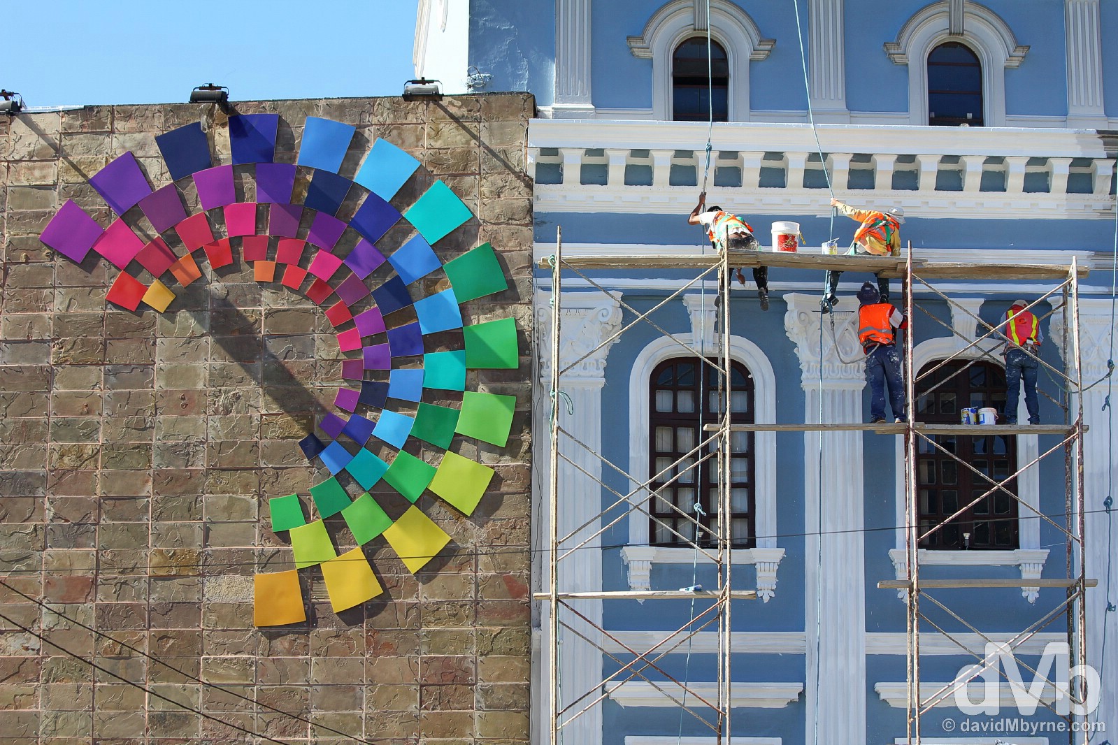
Ecuador
The Equator, The Galapagos, The Rainforest, The Avenue Of Volcanoes, & Some Of South America’s Best Colonial Architecture
Rainforest lodge, Napo Province, Ecuador. July 12, 2015
Ecuador (July 2-28 2015)
I had just crossed the border from Colombia into northern Ecuador, had just began the first of the many southbound bus trips I’d take on Ecuador’s E35 over the coming weeks. I was en route to the Ecuadorian capital of Quito, a 5 to 6 hour bus ride away from the border. Out of the blue someone in officialdom boarded the bus and, among his routine observational chores, started handing out a flyer promoting the range of things to do and see in the country. Everyone was welcome to one – they were professionally printed in many different languages – but the intended recipients were the obvious foreigners on board of which there was only one – me. I thought that was neat, rare promotion by a state tourism body while conducting a routine a police check, something definitely not uncommon in South America. That goes some way to understanding how important tourism is to the Ecuadorian economy and how seriously the authorities take in promoting it. And although Ecuador is one of the smallest countries on the continent there’s a lot to promote – Inca ruins, hot springs, waterfalls, awesome colonial architecture, the Andes and the so-called Andean ‘Avenue of Volcanoes’, the equator, the Amazon rain forest, Pacific Coast beaches, whale watching, & of course the famed Galapagos Islands. On my travels I sampled all Ecuador had to offer meaning it was to be one of my favourite South American countries. What follows is, presented in chronological order, a look at almost a month of travel through the country.
Read all postings from the Ecuadorian road in chronological order or jump to specific postings using the following links.
ARRIVAL – Border Crossing From Colombia
THE CAPITAL & THE EQUATOR – Quito & La Mitad del Mundo/The Middle of the World
THE ANDEAN AVENUE OF VOLCANOES – Iliniza Norte Volcano
HOT SPRINGS & WATERFALLS – Banos & La Ruta de las Cascadas/The Waterfalls Road
THE AMAZON RAIN FOREST – The Rain Forest – Cotococha Amazon Lodge
CENTRAL ECUADOR HIGHLIGHTS & INCA RUINS – Alausi || El Nariz del Diablo – The Devil’s Nose Train || Ingapirca (Inca ruins)
THE GALAPAGOS ISLANDS – The Galapagos Islands
BACKPACKER BEACH – Montanita
WHALE WATCHING – Puerto Lopez
Postings From The Ecuadorian Road (In Chronological Order)
BORDER CROSSING
Date || July 2, 2015
Location || Quito, Ecuador ( )
)
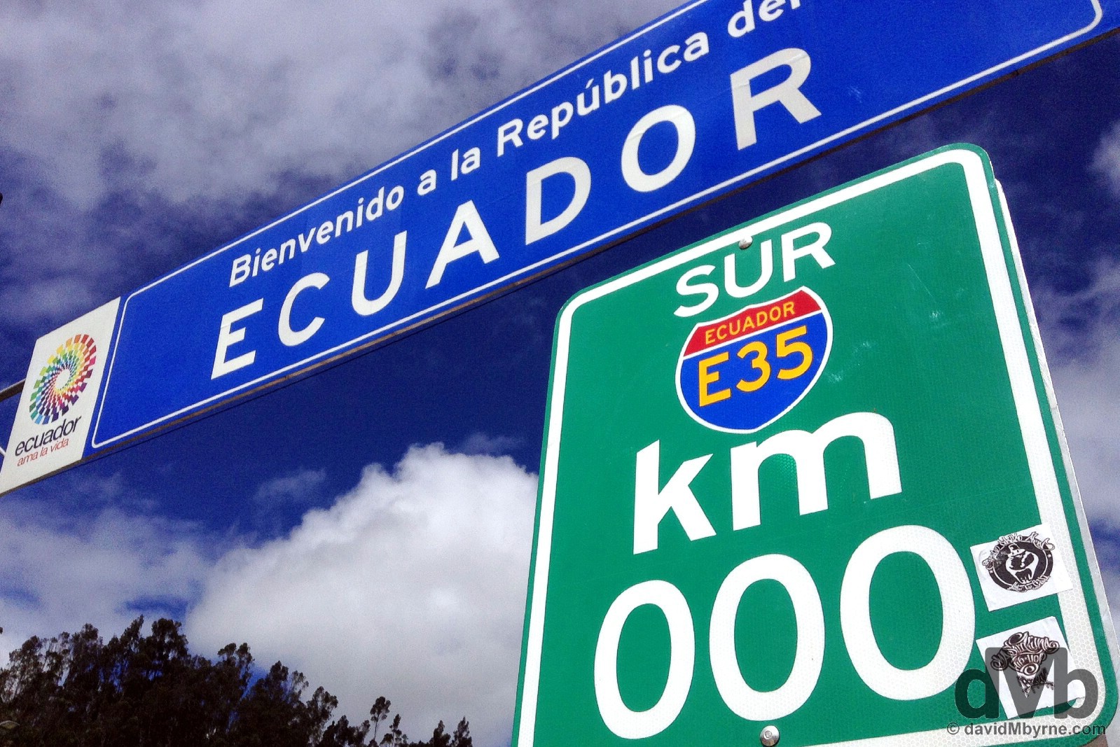
I crossed the Colombia / Ecuador border today by walking across the Rumichaca Bridge marking the boundary between the two countries, taking a picture of the southern 0 km marker of the Ecuadorian section of the wider Pan-Americana Highway as I went. As you do.
Entering Ecuador at the Rumichaca Bridge border crossing with Colombia. July 2, 2105.
It was all very straight forward getting stamped out of Columbia and into Ecuador, my 25th country for 2015 (and it’s barely July). Then it was back on a bus for another long South American bus trip, the latest in a string of long day & night bus journeys over the last few days in getting here to Quito, the Ecuadorian capital and the second highest capital city on the world. I’ve been moving a lot of late (I haven’t spent 2 nights in the same location since first arriving in South America back on June 21st) so I’m looking forward to dropping down a gear or two here in Ecuador as I delve into what it has to offer, which is a lot – Inca ruins, hot springs, colonial architecture, the Andean ‘Avenue of Volcanoes’, the Amazonia rain forest, Pacific Coast beaches, &, of course, the famed Galapagos islands. All to come over the coming weeks. Boo ya.
QUITO & THE EQUATOR (LA MITAD DEL MUNDO/THE MIDDLE OF THE WORLD)
Date || July 3, 2015
Location || Quito, Ecuador ()
I had a quick scoot around the historic UNESCO-listed old town of Quito earlier this morning. It was/is a glorious day here, not a cloud in sight, not even a wispy, far-off one. And on days like this the city of Quito really shines; what a beautiful, photogenic place it is.
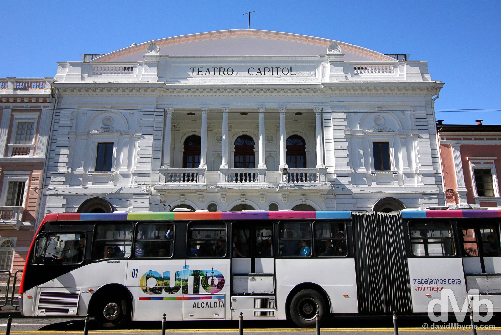
Teatro Capital, Avenida Gran Colombia, Quito Ecuador. July 3, 2105.
The Pope visits Quito in 2 days’ time. Posters and banners are everywhere highlighting the visit. It’s a big deal – the first South American pontiff to visit the continent – and Quito seems to be making an effort to spruce itself up ahead of his arrival; whites are getting whiter, streets & footpaths/sidewalks are being hosed down, and flowerbeds are being tended to. Avenida 10 de Agosto, Quito, Ecuador. July 3, 2015.

Plaza del Teatro in Quito, Ecuador. July 3, 2015.
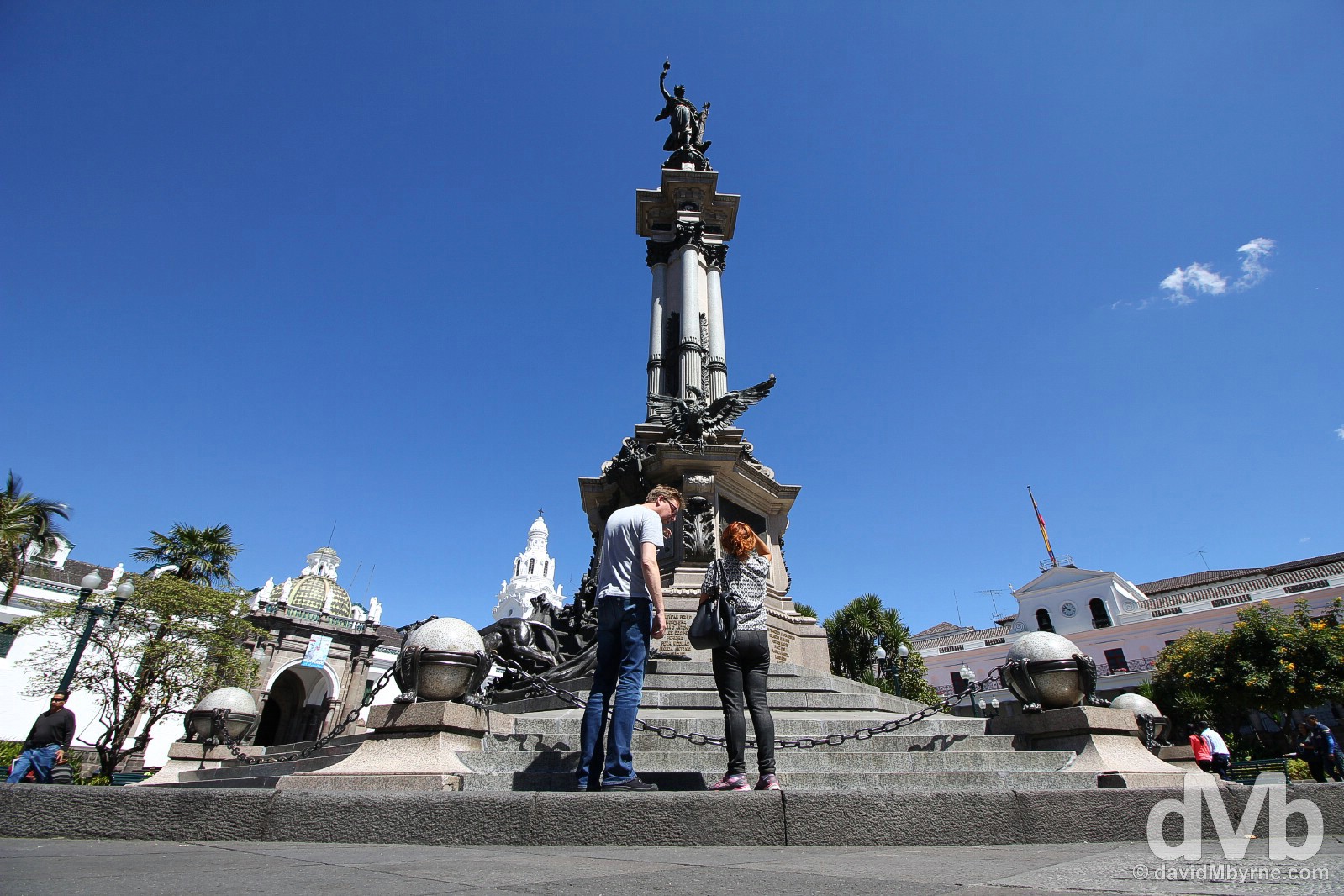
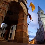
Plaza de la Independencia, one of the three main squares in the UNESCO-listed old town of Quito, Ecuador. July 4, 2015.
Date || July 4, 2015
Location || Quito, Ecuador ()
It was yet another gorgeous day today here in Quito. Pat, my bestie from home who has joined up with me for a few weeks of Ecuador adventures, spent most of it in a cafe on the edge of the vast, cobbled Plaza San Francisco, another one of the three main squares in Quito’s UNESCO-listed old town.
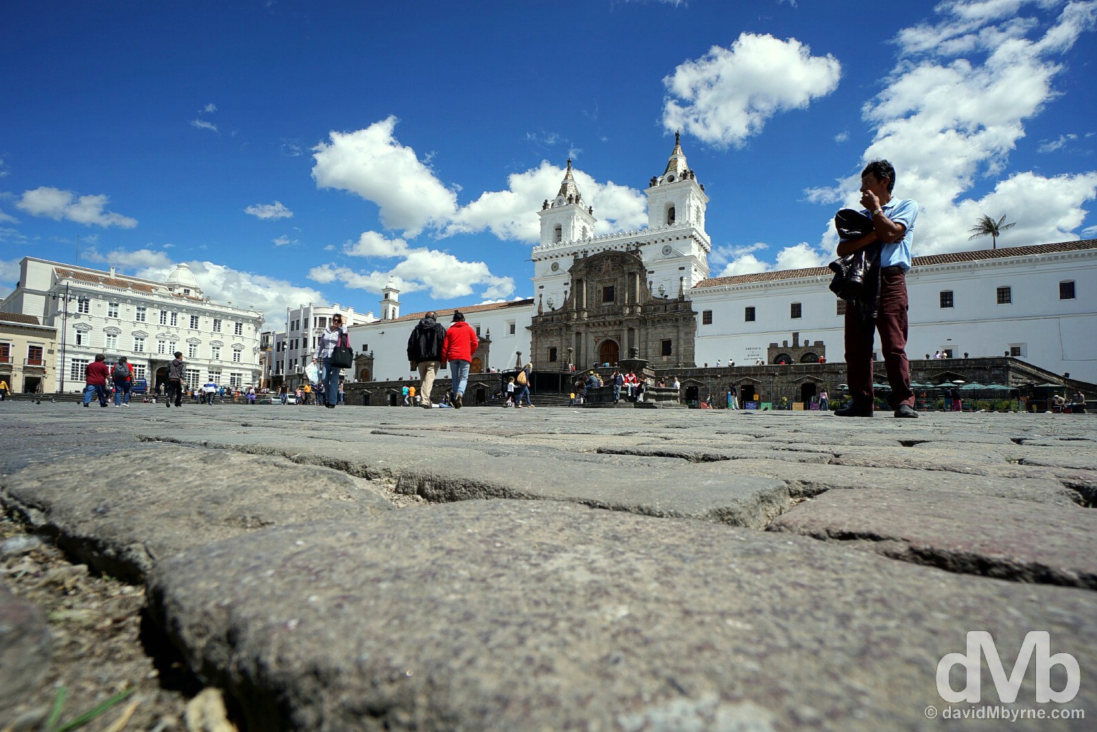
The dominant feature of Plaza San Francisco is the massive facade of the Iglesia y Monasterio de San Francisco. Built between 1536 and 1580, it’s part of the largest religious complex in South America. Plaza San Francisco, Quito, Ecuador. July 4, 2015.
Over coffees (no beer, yet), Pat & I drafted up a rough itinerary for our time exploring the country. Lots to look forward to including a rather ambitious plan to scale not one but 2 5000+ metre volcanoes. Oh yes, we’ve high hopes for Ecuador. A few more captures from today in Quito.
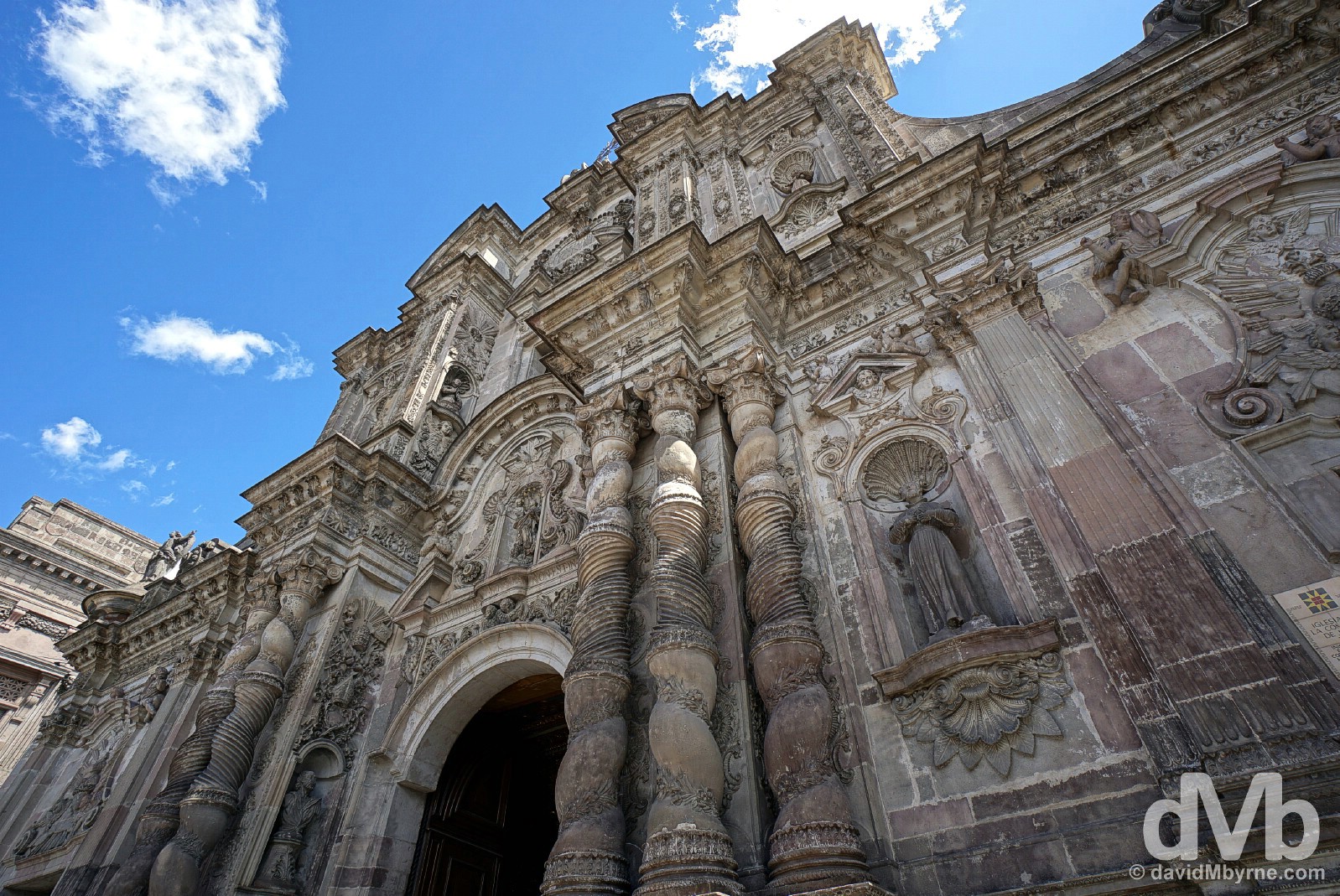
The facade of the baroque La Compania Church, construction on which stared in 1605 and was completed only 160 years later in 1765. Quito, Ecuador. July 4, 2015.
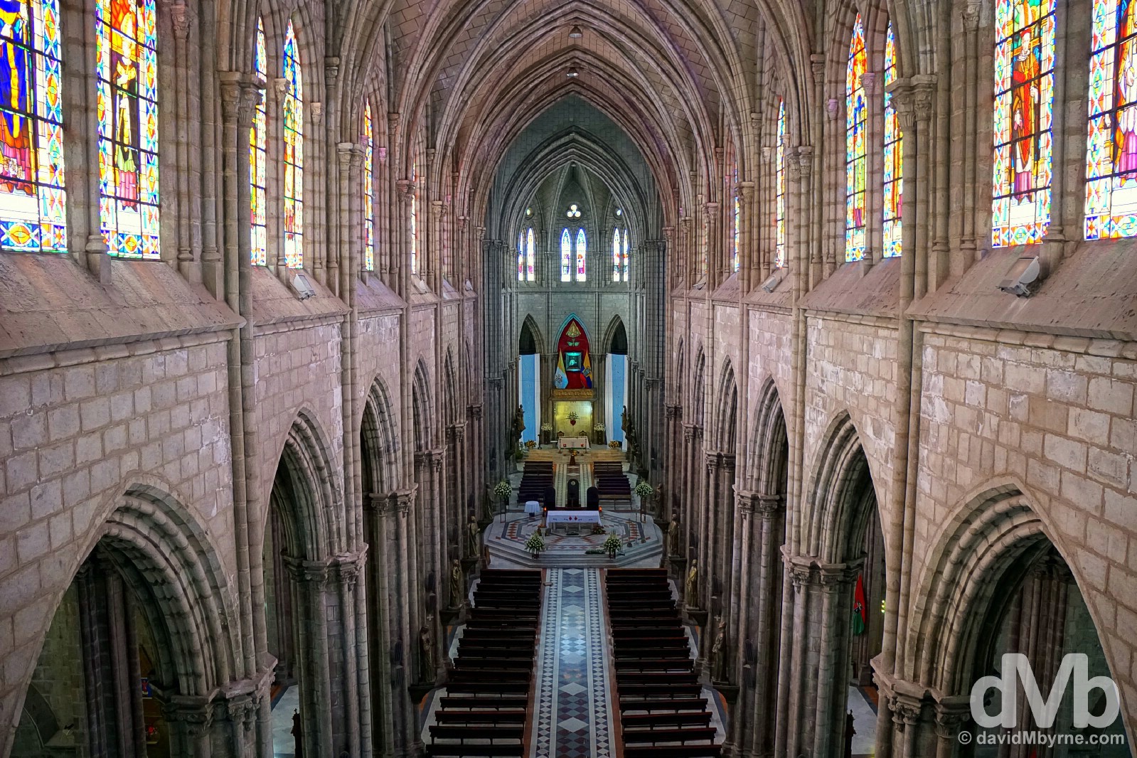
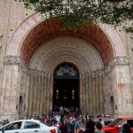
Probably my highlight of Quito was the this, the interior of the city’s 1890 Gothic Basilica del Voto Nacional. Housing 24 chapels & a basement crypt with the remains of many a former Ecuadorian head of state, it’s the only church in Ecuador to be blessed by a Pope – Pope John Paul II blessed it in 1985. Quito, Ecuador. July 4, 2015.
Date || July 5, 2015
Location || Quito, Ecuador ()
It was our last day in Quito today. We briefly left the city to be the cynics we are at the so-called Middle of the World, before returning to get high, cold & somewhat breathless while overlooking the Ecuadorian capital.
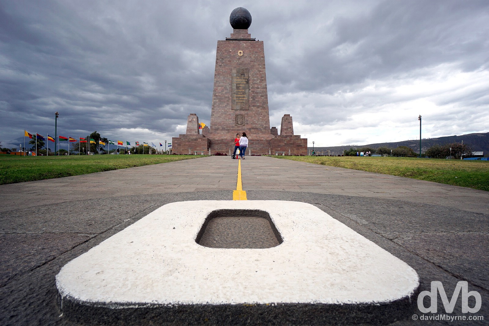
O is for Oeste (West) at La Mitad del Mundo, The Middle of the World, a complex of tourist shops, cafes & museums some 20 kilometres north of Quito that is billed as the location for the equator, the line that divides the earth’s northern & southern hemispheres. The exact location of the equator, from which Ecuador takes its name, was first ascertained by a Frenchman, Charles-Marie de la Condamine, way back in the mid 1700’s. In 1936 a monument to the achievement was raised across the line, marked here in yellow (southern hemisphere to the right, northern hemisphere to the left), only to be replaced by the present 30 metre-tall concrete monolith, replete with large metal globe, in 1979. All of this was before the advent of modern-day GPS equipment which has since determined the precise location of the equator to be some 240 metre away, equivalent to 7 seconds of a degree off. Whoops. But hey, let’s not let a little fact like that get in the way of a very busy tourist attraction. La Mitad del Mundo (The Middle of the World), Ecuador. July 5, 2015.
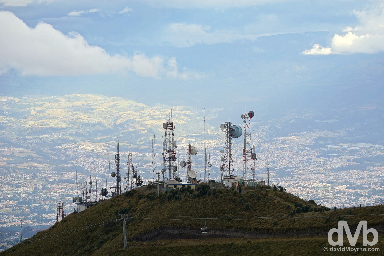
Returning to Quito, we took the Teleferiqo, a cable car system opened in 2005, to the 4050 metre-high, antenna-infested summit of Cruz Loma on the slopes of Volcan (Volcano) Pichincha overlooking Quito where the views of the city were rather nice. Quito, Ecuador. July 5, 2015.
Getting Even Higher
We were cold & somewhat breathless on 4050 metre-high Cruz Loma; the altitude gain of some 1200 metres from downtown Quito was noticeable. And that got us wondering. Tomorrow we’ll be leaving the city for good. We won’t be going very far; 70 kilometres or so south to the little village of El Chaupi from where we’ll begin our assault on our first 5000+ metre volcano, the 5125-metre-high volcano Ilniza Norte which, & all going to plan, will be a warm-up for the main event a few days later, the 5897 metre-high Cotopaxi volcano, Ecuador’s second highest peak. The highest either of us has ever been on terra firma was when we stood together, freezing & breathless, on the 5050 metre-high Lalung La Pass in Tibet back in March 2008. We were driven there so needless to say, and as said before, we’ve high ambitions for this coming week in Ecuador.
THE AVENUE OF VOLCANOES / ILINIZA NORTE
Date || July 7, 2015
Location || El Chaupi, Ecuador ()
Ecuador’s central sierra, just south of the capital Quito, is where the country is at its spectacular alpine best. Eight of the country’s ten highest peaks are found here in a north-south chain of Andes peaks dubbed the ‘Avenue of Volcanoes’. Pat & I wanted to get high among all that Andean splendor and so today we dragged ourselves out of bed at 5 a.m. to attempt to go higher than we ever have before.
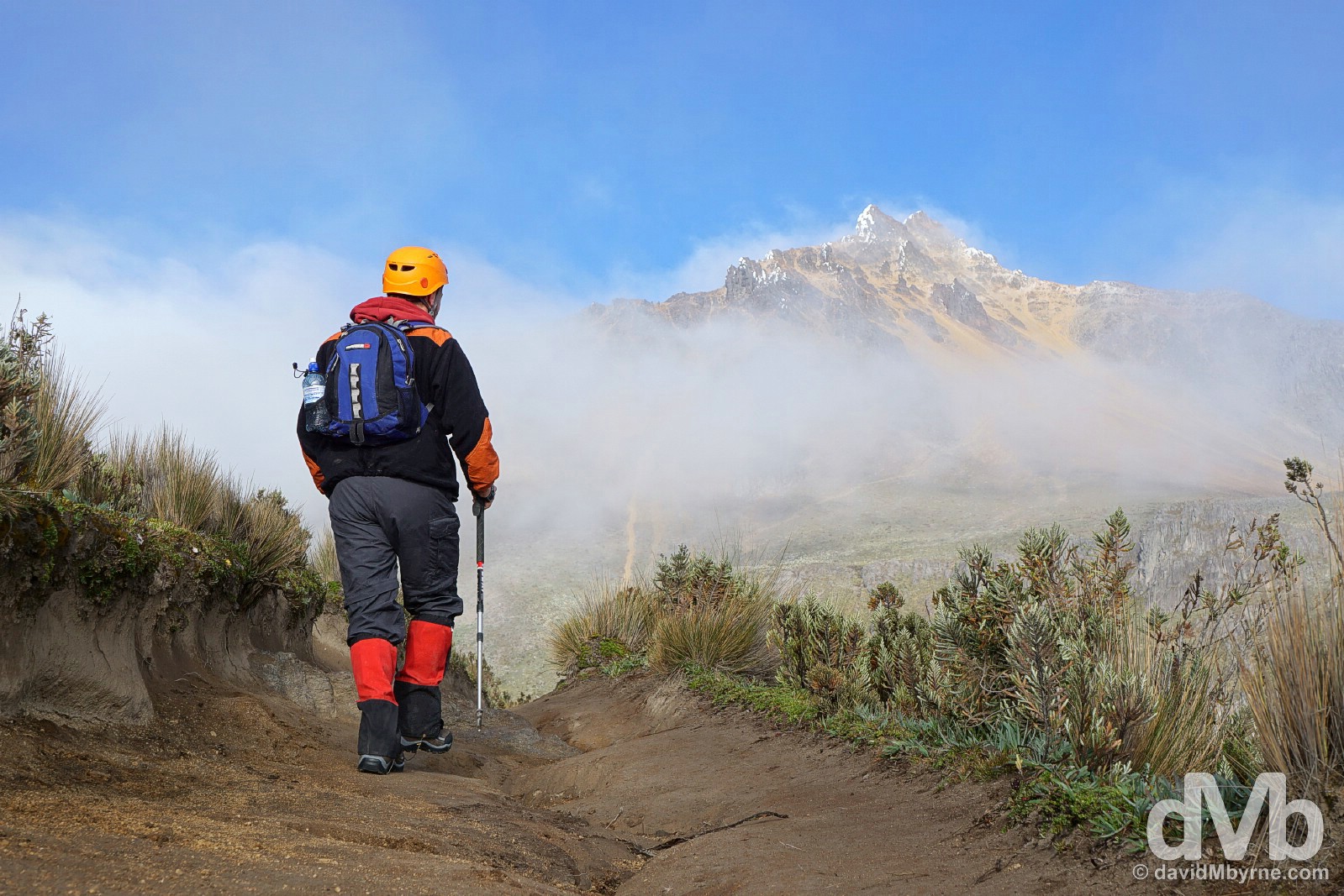
7:30 a.m., forty-five minutes in, and about the only time of the day we saw any bit of blue sky, conveniently located over the summit we were plodding towards. Soon after this picture was taken we were enveloped in clouds, clouds that would stay with us for the rest of the day – we got high, higher than we’d ever been before on terra firma, but all we were treated to were views of white nothingness in all directions. Heading for the summit of Iliniza Norte (seen in the distance) in Reserva Ecologica Los Ilinizas, Ecuador. July 7, 2015.
Iliniza Norte
Topping out at 5,125 metres, Iliniza Norte is Ecuador’s eight highest peak. We chose it, as most do, as a warm-up for the nearby 5,897-metre-high Cotopaxi, Ecuador’s second highest peak & the country’s most popular climb. Iliniza Norte turned out to be a hell of a ‘warm-up’, especially considering neither of us had ever before walked as high. Starting at an elevation of 3950 metres, it took us 2 hours to reach the small cabin refuge at 4700 metres, followed by another two hours of clambering over rocks & ice to reach the 5125-metre-high summit. It was precarious at times, especially when our guide roped us up.
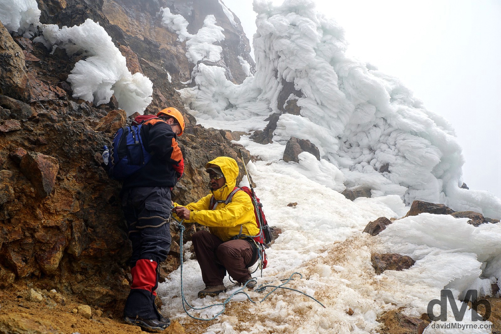
Roping up for the unnervingly named Paso de Muerte (Death Pass), a region of slippery rocky ridges and steep inclines about 60 minutes shy of the summit. Iliniza Norte in Reserva Ecologica Los Ilinizas, Ecuador. July 7, 2015.
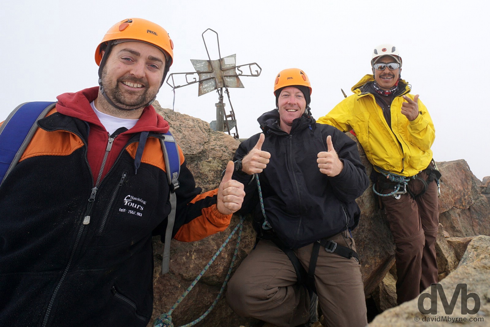
We huffed & we puffed. We were breathless, experienced lightheadedness & suffered mild high-altitude headaches. We slipped a few times, we got dirty & wet. But we made it, and all told it wasn’t that difficult. With our guide & the rather crude cross marking the compact 5125-metre-high summit of Iliniza Norte, Reserva Ecologica Los Ilinizas, Ecuador. July 7, 2015.
So, Cotopaxi next then? ‘No chance’, says Pat. ‘One 5000+ metre Ecuadorian peak is enough. I’ve young kids who depend on me.’ ‘Fair enough lad, I hear ya.’ So we’re off to Banos tomorrow instead, a hot springs town some 140 kilometres down the Pan-American from our location here in the village of El Chaupi, a place where very little is open and even less stirs. With a bit of luck we’ll at least get a glimpse of Cotopaxi before leaving. At this stage we’ll be happy with that; Cotopaxi’s perfectly conical, 5897 metre-high form sits right across the valley from us here in El Chaupi but, and even though we’ve been here 2 days now, we’ve yet to see it. Those clouds again.
BANOS & LA RUTA DE LAS CASCADAS (WATERFALL ROAD)
Date || July 10, 2015
Location || Banos, Ecuador ()
Today was the day we were supposed to leave Banos, Ecuador’s laid-back spa resort town. That was the original plan. But we’re staying put one more day as Pat’s feeling a bit delicate, a bit under the weather, mirroring the miserable, wet & dank conditions we woke to this morning. Banos was a much more inviting place the last few days.
Waterfalls & spa resorts. That’s Banos, Ecuador. July 9, 2015.
Banos
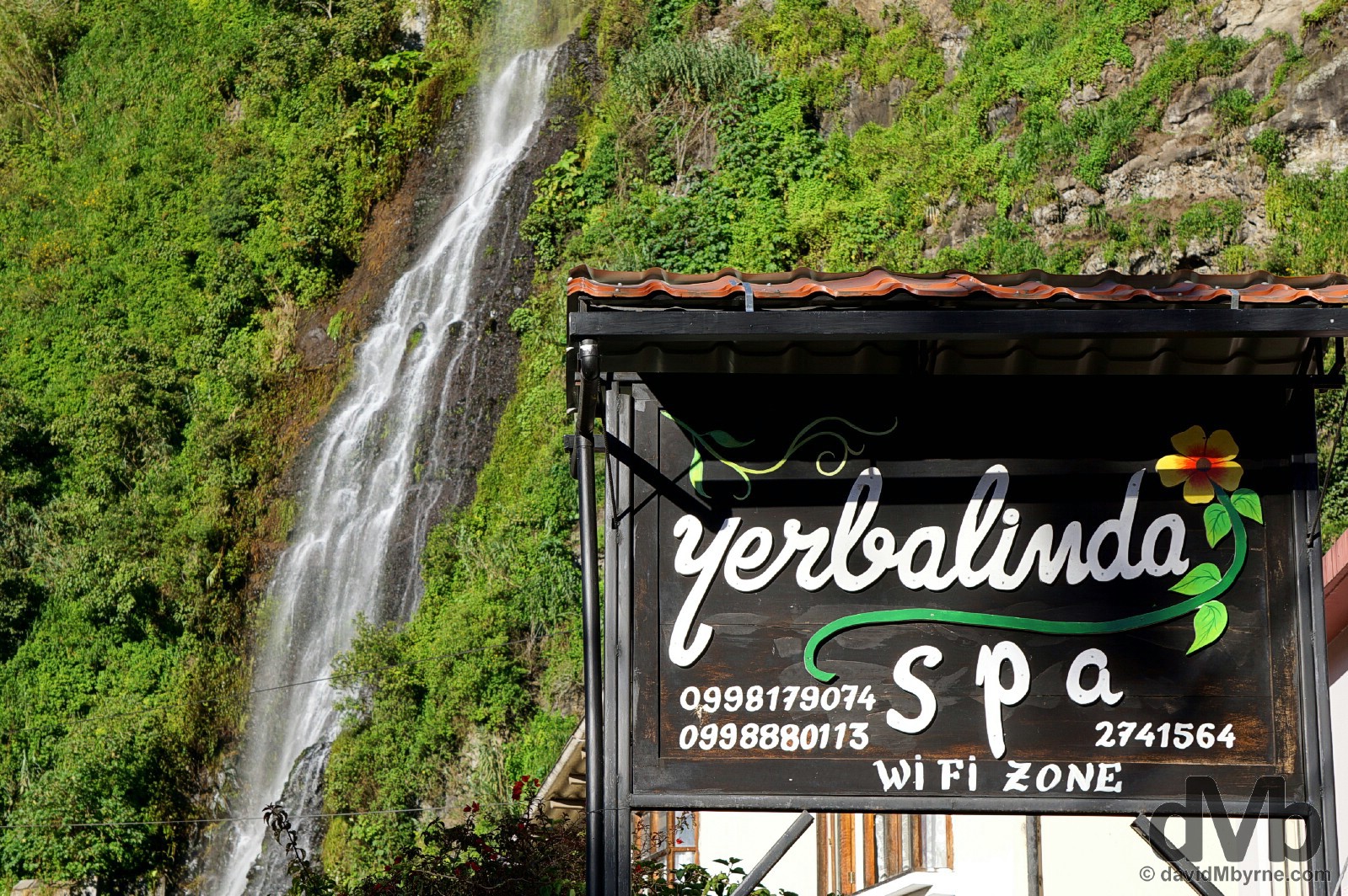
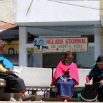
Ecuador’s hugely popular spa resort town, Banos, meaning bath in Spanish, is a laid-back place that was founded by the Dominicans in 1553 as a staging post between the central sierra & the Amazonian Oriente – it is known as the Gateway to the Amazon as it is the last settlement of any size located in the mountains before reaching the jungle of Ecuador’s Amazon River basin further east, our next stop (whenever we get there). The town has a population of some 15,000, people who live in the shadow of Volcan Tungurahua, a 5023 metre-high volcano that rumbles frequently – a spurt of activity in 1999 saw the town & surrounds forcibly evacuated leaving 20,000 people homeless for over 4 months. The town is situated in a narrow opening of the Pastaza Valley and is enclosed by soaring green, waterfall-infused hills. It’s quite the location & sitting as it does at an altitude of only 1820 metres means the town’s mild climate is the perfect place to nurse tired limbs & warm up after some Ecuadorian high-altitude exploits. That’s why we came here, that and the fact that it’s conveniently en route to the jungle.
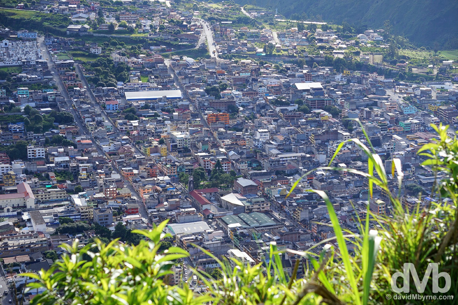
Banos, Ecuador as as seen from the Bellavista lookout overlooking the town. July 9, 2015.
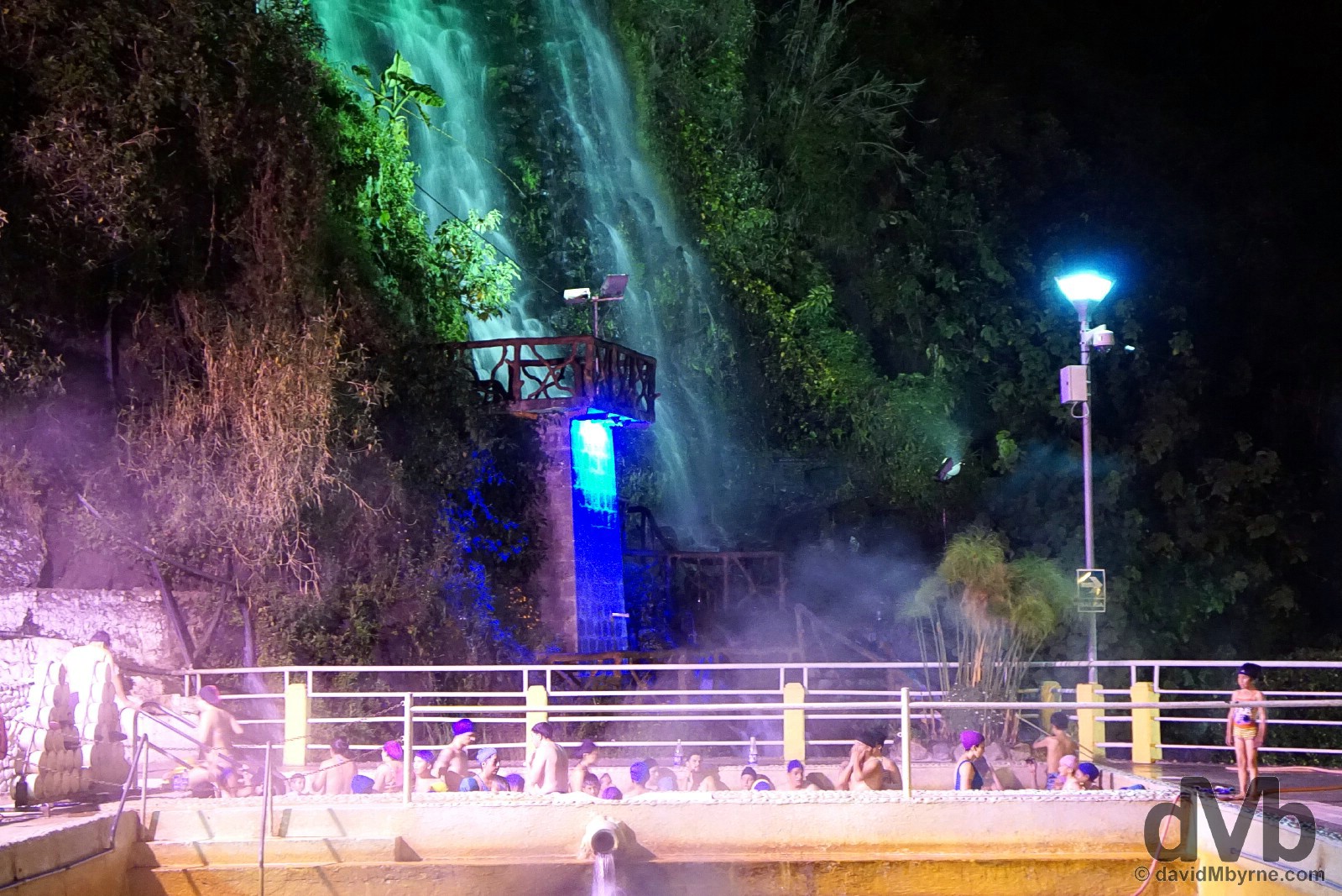
Night bathing at the Piscinas de la Virgen near the base of the town’s distinctive Virgen waterfall, 1 of some 60 waterfalls in the Banos region. There are more than a few public baths in town and this one in particular, where you play havoc with your body by alternating between uncomfortably hot & unbearably cold pools, has welcomed me as a $3 paying guest for the last two nights – it’s a short walk from our posada (guesthouse) near the base of the Virgen falls. Banos, Ecuador. July 9, 2015.
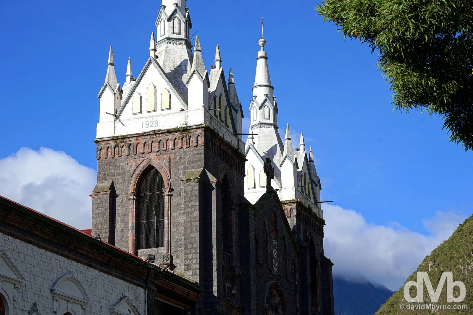
Aside from walks in the surrounding hills and dips in the town’s thermal pools, there’s not a whole lot to the town of Banos itself. It does, however, boast a nice leafy central park and a rather striking, if somewhat dirty looking cathedral (from the outside, it’s interior is gorgeous), the Basilic de Nuestra Senora del Rosario de Agua Santa, that overlooks the town’s other civic space, Parque de la Basilica. Banos, Ecuador. July 9, 2015.
La Ruta de las Cascadas
The road east out of Banos follows the winding, steep-sided Pastaza Valley, one that is laden with waterfalls. Dubbed the La Ruta de las Cascadas (the Route of Waterfalls), we hopped on a few public buses yesterday and paid a visit to two of the route’s star watery attractions, the Manto de la Novia (Bride’s Veil) waterfall & the Pailon del Diablo (Devil’s Cauldron).
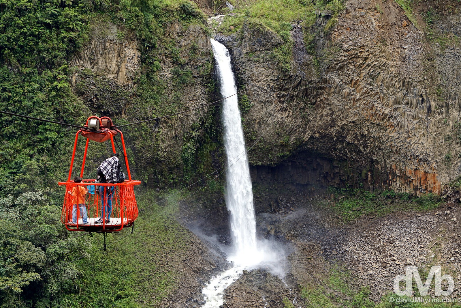
There are numerous options for crossing from one side of the deep Pastaza Valley to the other but the rickety 500-metre cable car near the Manto de la Novia (Bride’s Veil) waterfall is one of the nearest to Banos (it’s 10 kilometres est of the town) and thus one of the most popular. July 9, 2015.
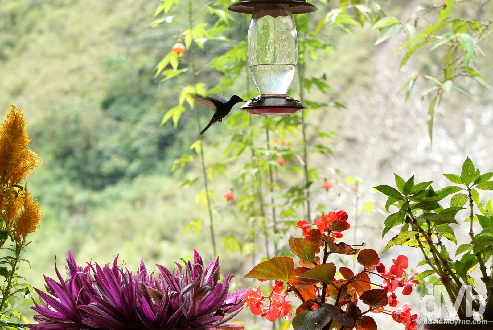
Belying the thunderous sound of the nearby Manto de la Novia (Bride’s Veil) waterfall, it was a pretty peaceful setting while having a coffee in a rustic cafe on the Pastaza Valley floor. There were a few hummingbirds keeping us company and watching them dance in the air as they so effortlessly do pushed the relaxation factor into overdrive. Near the base of the Manto de la Novia (Bride’s Veil) waterfall in Pastaza Valley, Ecuador. July 9, 2015.
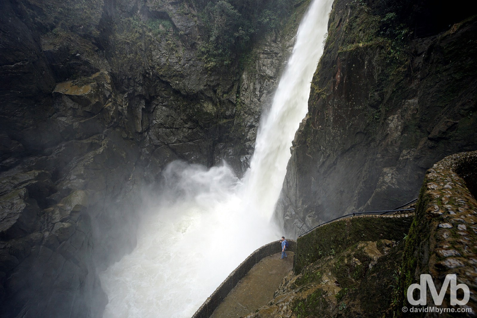
Pat getting nicely wet at the base of the Pailon del Diablo (Devil’s Cauldron), a brute of a falls where a section of the Pastaza Valley’s Rio Verde thunders down a tight gorge. Pailon del Diablo (Devil’s Cauldron), Pastaza Valley, Ecuador. July 9, 2015.
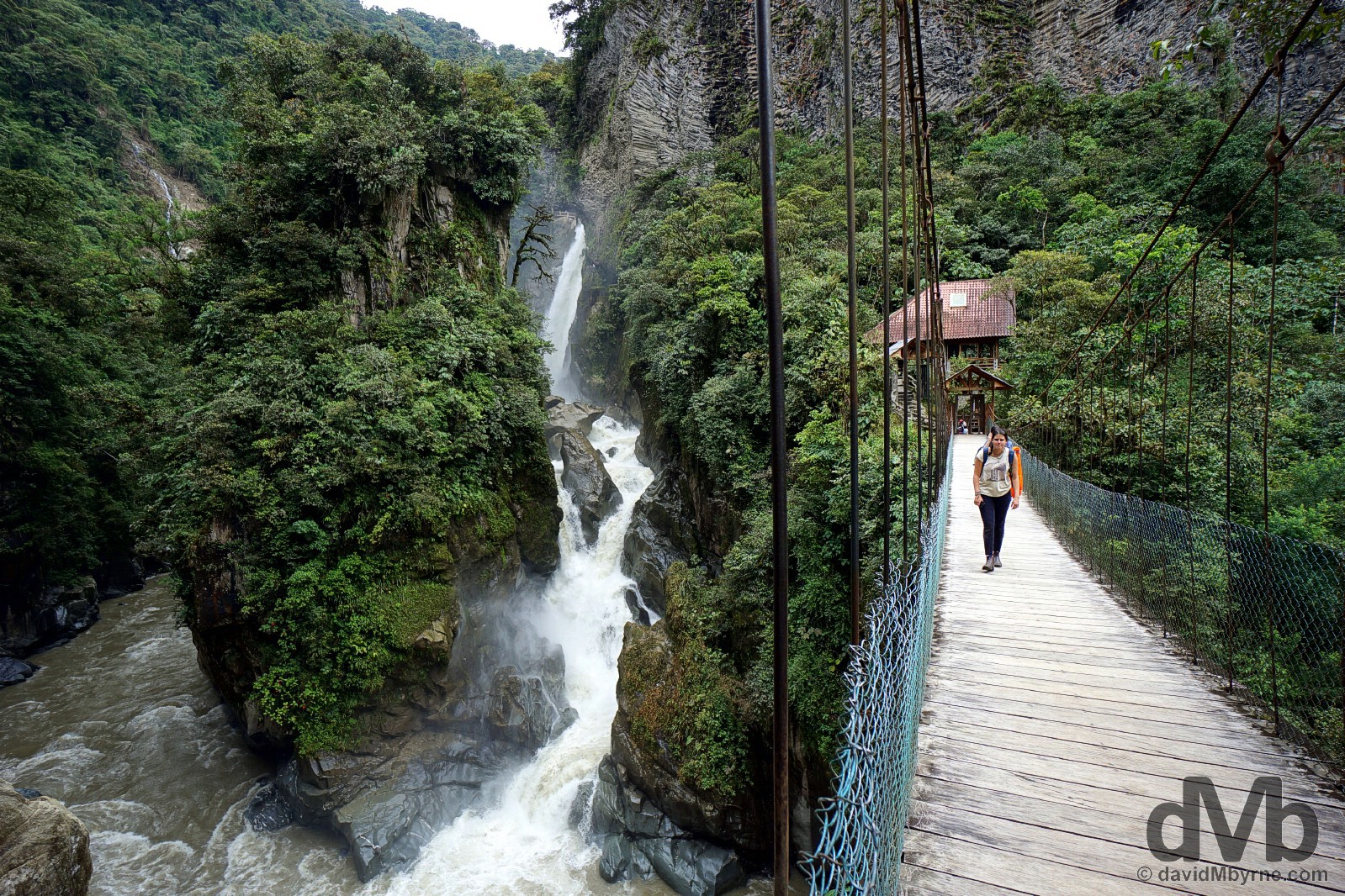
Pailon del Diablo (Devil’s Cauldron), Pastaza Valley, Ecuador. July 9, 2015.
Delayed Jungle Departure
Pat wasn’t good yesterday. He’s better today but regardless, we’re staying put for una noche más (one more night) here in a wet & miserable Banos. We’ll head east tomorrow, passed the waterfalls we viewed yesterday & into the Ecuadorian Amazon for a few nights in a jungle lodge, a few days of seclusion, canoe transportation, tribal villages, & creepy crawlies. We’ve picked out a nice lodge, or so it seems. One by the river. It boasts no electricity, no WiFi – it’s the jungle, you see – but it does have a bar. We made sure of that. Some things are more important than others.
THE AMAZON RAIN FOREST
Date || July 13, 2015
Location || Cotococha Amazon Lodge, Napo Province, Ecuador ()
It rained a lot in the Ecuadorian rain forest. It has stopped today & the sun is out, conveniently the day we’re bidding adieu to the greenness surrounding us & the eco vibe we’ve bought into over the last few days. The rain didn’t bother us over the last few days. Not much. Somehow it just seems right to experience rain, even lots of rain, while in the rain forest. It may dampen things a bit and the extra moisture mixed with the ever-present humidity makes taking pictures a challenge. But it – the rain – does nothing to diminish the soothing tropical rain forest hum of birds & insects and it only adds to the distinctive tropical rain forest odour, that rich smell of steaming foliage.
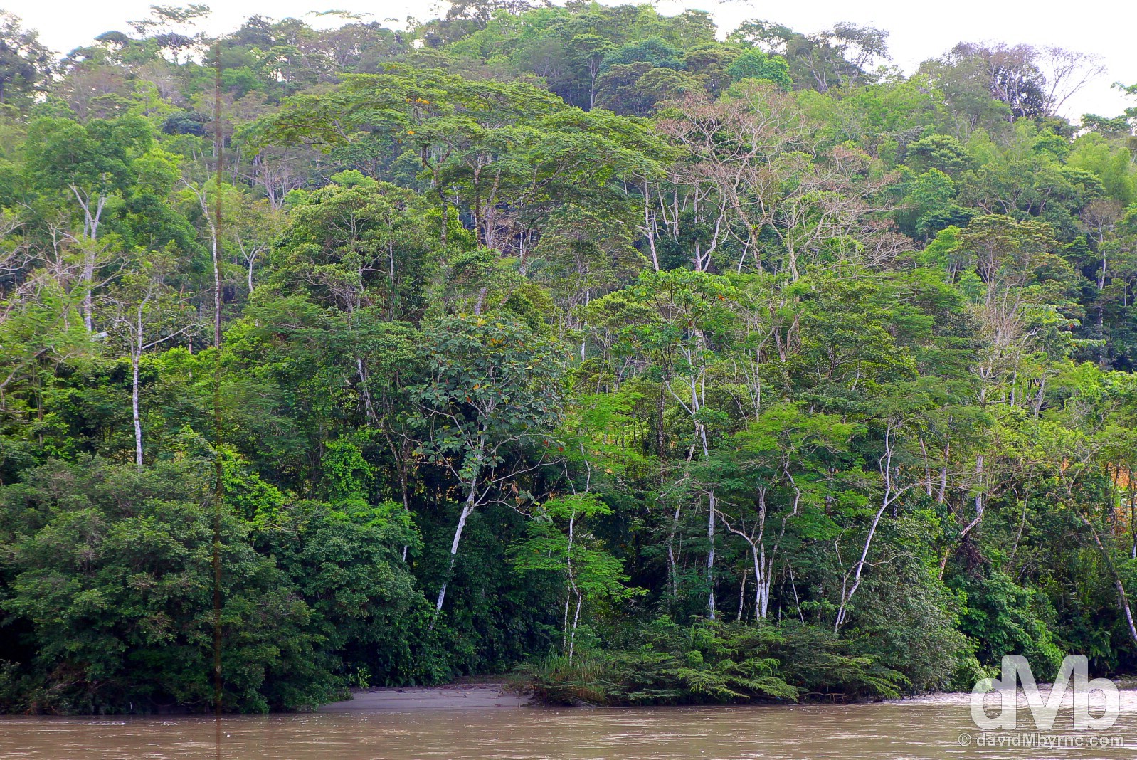
A section of the Ecuadorian rain forest by the Napo River, Napo Province. July 13, 2015.
The Ecuadorian Oriente
The Ecuadorian Oriente, which is pretty much the whole eastern half of the country, is a vast, sparsely populated (mostly) jungle wilderness. It’s one of the country’s most captivating destinations & spending a few days of estrangement from the real world while feeling all Tarzan like in the tropical rain forest of the Ecuadorian Amazon is an Ecuadorian must-do. Needless to say it is a very relaxing place to be.
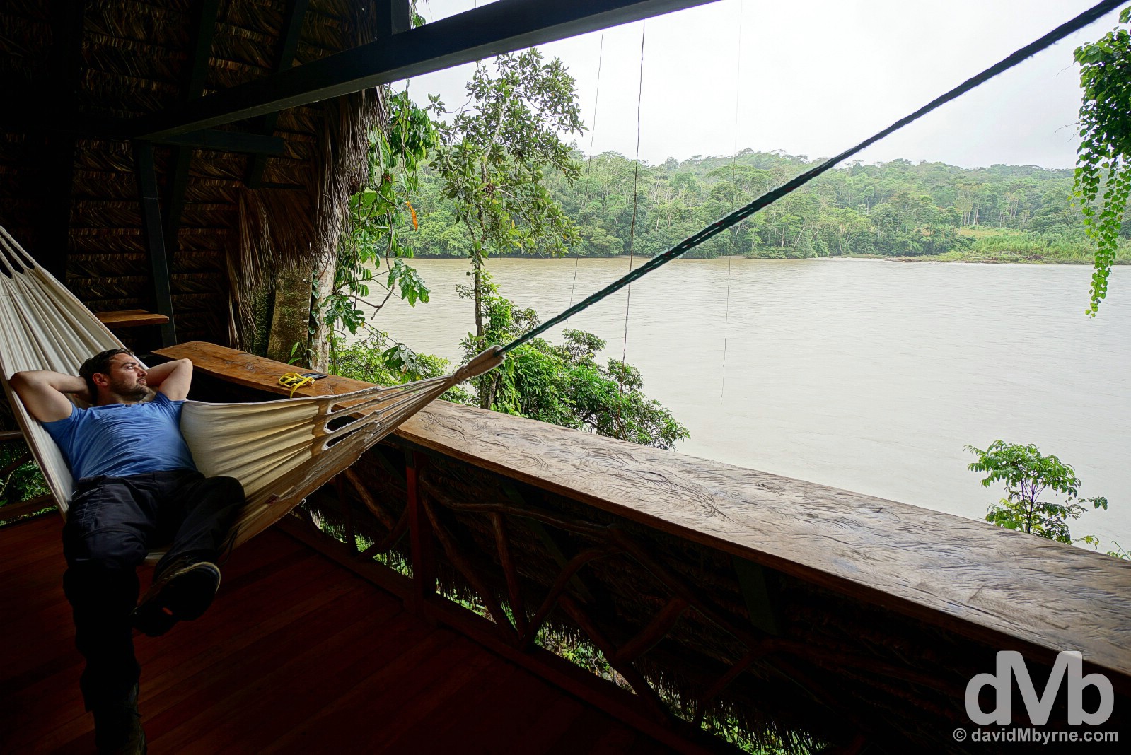
Pat relaxing in a hammock overlooking the Napo River from Lodge 13 of Cotococha Amazon Lodge, Napo Province, Ecuador. July 12, 2015.
Cotococha Amazon Lodge, home in the Ecuadorian jungle. July 11, 2015.
Cotococha Amazon Lodge
Located within a protected area along the banks of the mighty Napo River, Cotococha Amazon Lodge boasts 17 spacious, riverside cabins built in traditional Kichwa (a local indigenous tribe) style. The lodge accommodations are ecological and intentionally designed to put you in harmony with nature; there are no glass windows, just insect screens, & there is no electricity, just oil lamps to light the plush lodge interiors when the sun goes down and the jungle around you really starts to sing.
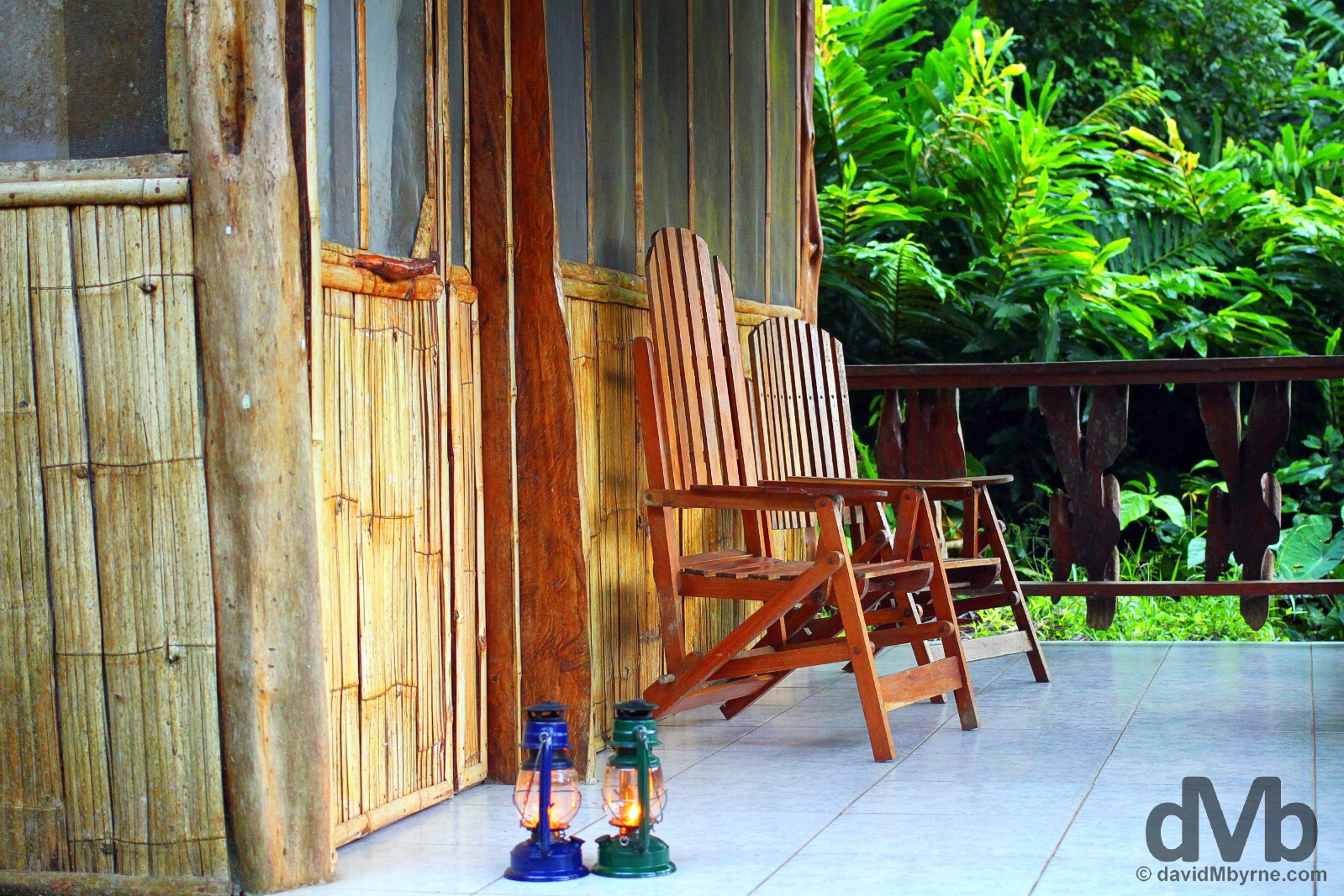
Night lights. Oil lamps outside a lodge of the Cotococha Amazon Lodge, Napo Province, Ecuador. July 12, 2015.
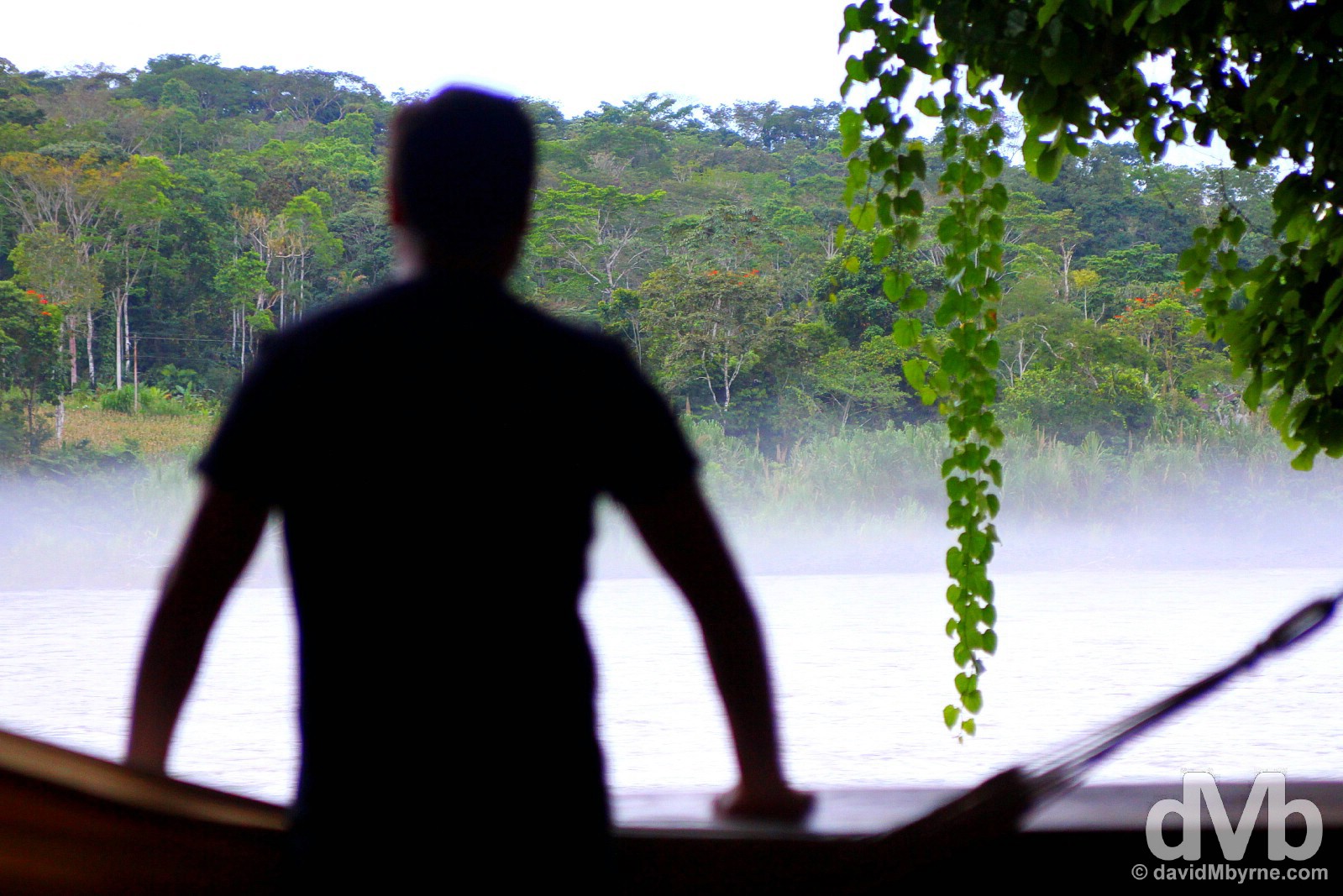
There are many options for jungle lodge accommodation in the Ecuadorian Amazon but we like to think we chose well with the Cotococha Amazon Lodge. Three beautifully presented meals a day, mostly traditional dishes prepared using locally sourced organic ingredients, meant we didn’t starve and an on-site bar meant we were rarely thirsty. And when we weren’t on the lodge grounds we were being whisked along the Napo River, a tributary of the 6400-kilometre-long Amazon River, in a motorized canoe to visit a rather unique animal reserve & to get wet & dirty as we hiked, in wellies, deep into the jungle to search out some of the residents that call this unique environment home.
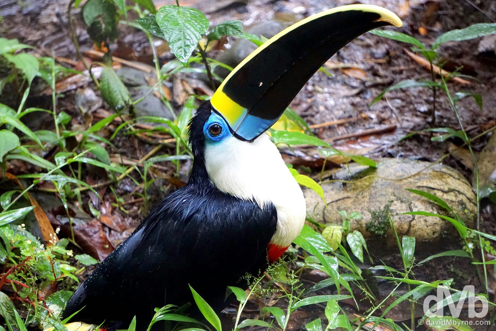
A Toucan in the AmaZOOnico Animal Reserve, a volunteer-staffed reserve where animals rescued from illegal trade can recover before being released back into their natural habitat (if at all possible). The toucan was my highlight of the visit here, a bird I’d never before seen in person. Of the 40+ species of toucan, over half are found in Ecuador. Amazingly beautiful birds. AmaZOOnico Reserve, Napo Province, Ecuador. July 12, 2015.
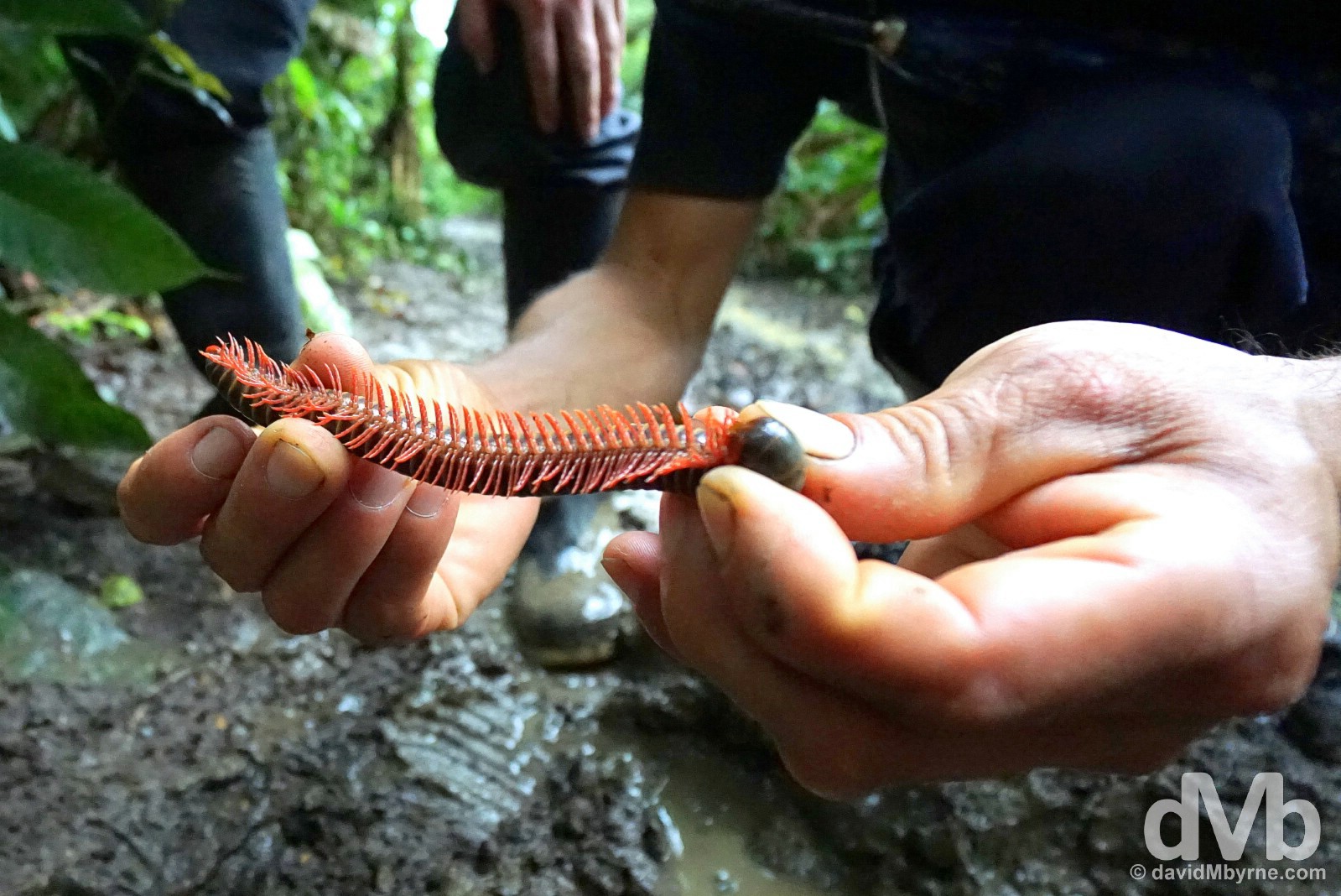
Having seen a toucan in the reserve, we also saw one resting in the canopy of the rain forest as we were led through its mucky interior, a cornucopia of rain forest flora & fauna, by our guide, seen here showing us a small millipede – seemingly they grow a lot bigger. In the rain forest of Ecuador, Napo Province. July 12, 2015.
Pat, this time out of the hammock, admiring the rain forest & Napo River view from lodge 13 of the Cotococha Amazon Lodge, Napo Province, Ecuador. July 12, 2015.
ALAUSI, NARIZ DEL DIABLO (DEVIL'S NOSE) & INGAPIRCA
Date || July 13, 2015
Location || Alausi, Ecuador ()
It was a long day of bus travel today – 4 different buses over 8 hours of travel – as we swung out of the jungle and back to normality. We’re in a small town called Alausi, a convenient base for exploring Ingapirca, Ecuador’s best-preserved Inca ruins, & the starting point of the El Nariz del Diablo (The Devil’s Nose), touted as Ecuador’s definitive train journey. That’s why we’re here and that’s what will occupy us over the coming days. But really at this stage of our Ecuadorian proceedings it’s a case of getting Alausi out of the way so we can continue on to Guayaquil, Ecuador’s largest city, from where we fly to the Galapagos Islands. We do that the day after tomorrow and it goes without saying we’re both immensely looking forward to.
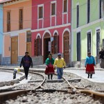
Alausi
-
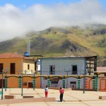
- Alausi, Ecuador. July 14, 2015.
-
- Avenida 5 de Junio, Alausi, Ecuador. July 14, 2015.
-
- Alausi, Ecuador. July 14, 2015.
El Nariz del Diablo – The Devil’s Nose
Ecuador’s definitive train journey & billed as one of the world’s best, a dramatic 12-km switchback descent from Alausi to Sibambe through a section of the Andes, zigzagging down an 800-metre sheer rock face over the so-called Devil’s Nose on ‘the most difficult railway int he world’.
-
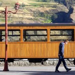
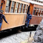
- On the platform of the train station in Alausi, Ecuador. July 15, 2015.
-

- El Nariz del Diablo, the Devil’s Nose train, Sibambe, Ecuador. July 15, 2015.
-
- Riding El Nariz del Diablo, the Devil’s Nose, train from Alausi to Sibambe, Ecuador. July 15, 2015.
-
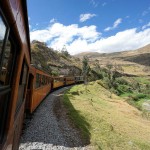
- Riding El Nariz del Diablo, the Devil’s Nose, train from Alausi to Sibambe, Ecuador. July 15, 2015.
Ingapirca
Ecuador’s only & best preserved Inca ruins displaying typically exquisite Inca stonemasonry techniques.
-
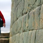
- Analysing the brickwork of the Temple of the Sun in Ingapirca, Ecuador. July 14, 2015.
-
- Temple of the Sun, Ingapirca, Ecuador. July 14, 2015.
-
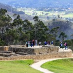
- Ingapirca, Ecuador. July 14, 2015.
-
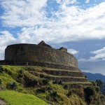
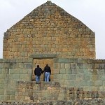
- The Temple of the Sun, a.k.a. the Elipse or Castle of Ingapirca, in Ingapirca, Ecuador. July 14, 2015.
THE GALAPAGOS ISLANDS
Galapagos Islands
Even before departing the South American mainland for the Galapagos Islands, an archipelago of volcanic islands straddling the equator off the Ecuadorian mainland, you get a sense that the location is just a tad different, a break from the norm. And by the norm I mean anything you’ve ever likely to have experienced before. Access to Darwin’s natural laboratory of evolution, famed for its unrivaled array of wondrous endemic birds, mammals, reptiles & plants, requires not only the purchase of a TCT (Tarjeta de Control de Transito Turista, a Traffic Control Card) but also the payment of a US$100 Parque Nacional Galapagos conservation fee. This outlay coupled with baggage screening to ensure you’re not carrying, inadvertently of otherwise, any alien pests & seeds hints that you’re about to embark on a trip to somewhere rather special. And rather special it is.
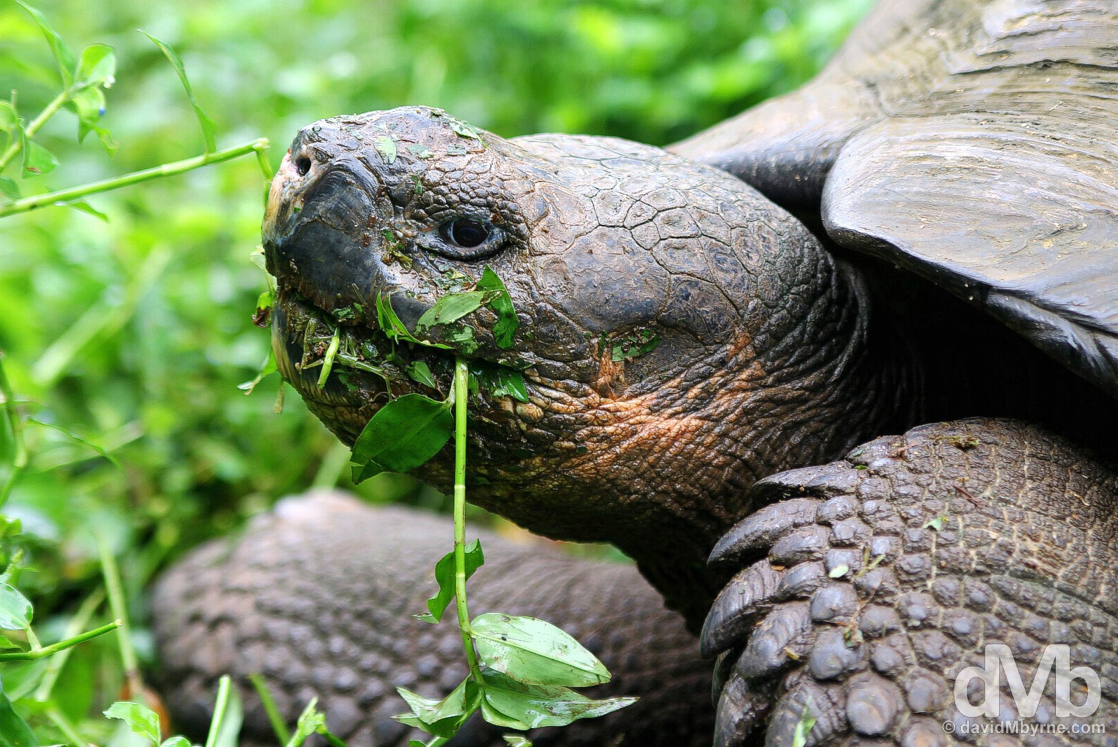
A Giant Tortoise feeding at Rancho Primicias on Isla Santa Cruz, Galapagos Islands, Ecuador. July 17, 2015.
– Ecuador Ministry of Tourism
I spent 5+ days on Galapagos, independently visiting a few of the many islands to get a look at some of their unique inhabitants: I ogled at iconic, almost cartoonish like birds, the fabled giant tortoise, & demonic-looking iguanas; I cruised in calm waters to unique habitats & fought off seasickness bouncing between island settlements via small interisland water taxis; I explored & stumbled through pitch-dark, damp lava tubes; I walked & chased nimble crabs on picture-perfect beaches; and I trekked to volcanic craters & through wonderful volcanic topography. It was quite the ride. Click here for a day-by-day recap of my visit.
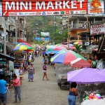
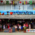
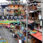
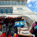
Montanita
A surfers favourite & Ecuador’s very own Khao San Road, a chilled-out, every-hour-is-happy-hour backpacker & drifter town crammed with straw-roofed, bamboo-walled hostels, bars & cafes. Seemingly clothing is optional.
-

- On the beach in Montanita, Ecuador. July 23, 2015.
-

- A stall in Montanita, Ecuador. July 23, 2015.
-
- Montanita, Ecuador. July 23, 2015.
-
- No shoes. Montanita, Ecuador. July 23, 2015.
-
- I Love Montanita, Ecuador. July 23, 2015.
-
- Montanita, Ecuador. July 23, 2015.
-
- Montanita, Ecuador. July 23, 2015.
Puerto Lopez
Humpback whales breaching in the coastal waters off Puerto Lopez. The best location on mainland Ecuador for summer whale-watching and conveniently located near, not to mention a welcomed reprieve from, Montanita.
-
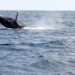
- A humpback whale breaches the surface while whale watching off Puerto Lopez, Ecuador. July 24, 2015.
-

- Whale watching off Puerto Lopez, Ecuador. July 24, 2015.
-

- For sale in the fish market in Puerto Lopez, Ecuador. July 24, 2015.
-

- Whale watching off Puerto Lopez, Ecuador. July 24, 2015.
Cuenca
My penultimate stop in Ecuador is the country’s third largest city, one full of beautiful architecture, cobbled streets & leafy plazas, is probably its prettiest.
-
- City Hall & the IglesIa de San Alfonso in Cuenca, Ecuador. July 26, 2015.
-
- Cuenca, southern Ecuador. July 26, 2015.
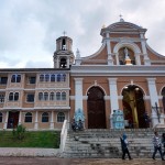
-
- Exiting the Catedral Nueva on Parque Calderon in Cuenca, southern Ecuador. July 26, 2015.
-
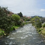
- The Rio Tomebamba in Cuenca, southern Ecuador. July 26, 2015.
-
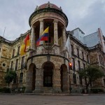
- City Hall in Cuenca, Ecuador. July 26, 2015.
Loja
A university town with a rich tradition in the arts (it’s known as the Music & Cultural Capital of Ecuador), Loja is my last stop in the country as I continue to ride the Pan-American south towards Peru.
-

- Loja, southern Ecuador. July 27, 2015.
-
- Iglesia San Sebastian overlooking Plaza Independencia in Loja, southern Ecuador. July 27, 2015.
-

- Loja, southern Ecuador. July 27, 2015.
-
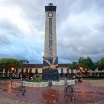
- Plaza Independencia in Loja, southern Ecuador. July 27, 2015.
Trackbacks/Pingbacks