Friendship Highway, Tibet
An 800 km Scenic Route Traversing The Tibetan Plateau, a.k.a. The Roof of the World
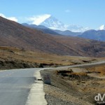
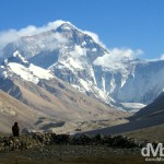
The north face of Mt. Everest as seen from the Rongbuk Valley, Tibet. March 2, 2008
The Friendship Highway (also known as the China Nepal Highway) is an 800 kilometre (500 mile) scenic route connecting Lhasa, the capital of Tibet, the autonomous region of the People’s Republic of China, with the Chinese/Nepalese border at the Sino-Nepal Friendship Bridge between Zhangmu, Tibet and Kodari, Nepal. The only international highway in Tibet, it includes the westernmost part of the 5,470 kilometre (3,400 mile) China National Highway 318, connecting Shanghai to Zhangmu. The Highway is renowned for its scenic beauty – the route crosses the Tibetan Plateau, aka The Roof of the World, the world’s highest (average elevation of 4,500 metres) & largest plateau, traversing three 5,000+ metre passes in the process, before dropping to 1,750 metres at the Friendship Bridge, some 120 kilometres (75 miles) shy of Kathmandu, the Nepalese capital.
I was fortunate enough to travel the Friendship Highway over a 4 day period in late February & early March of 2008, only 2 weeks before the 2008 Tibetan unrest closed the region to foreign travellers (I was in northern India at the time). That 4 day period, which was part of a larger overland adventure that I embarked upon with Pat, a very good friend of mine, still to this day ranks as one of my very fondest travel experiences. I kept a digital diary of those 4 days, in an attempt to immortalise the experience. This is it.
Pre-Friendship Highway || February 28, 2008
Location || Lhasa, Tibet ( )
)
Altitude || 3,650 metres (11,975 ft)
We’ve Been Good Boys
Our time in Lhasa has come to an end and we are leaving here in the morning to begin our 5 day overland trip on the Friendship Highway that connects Lhasa to the border with Nepal. We are hoping that the last 4 days that we have spent here have sufficiently acclimatised us for what lies ahead. We have been good boys and have tried to follow the Avoiding Altitude Sickness information we have with us – we have rested, we have eaten well, we have started taking aspirin (which is seemingly good for the blood at high altitudes) and we have – get this – drank only in moderation (although, whoops, last night we let our guard down a little). We’re probably making too much out of this whole altitude sickness thing but hey, neither of us wants to get sick on the upcoming trip, and run the risk of ruining the trip for ourselves and our fellow travellers. Yes, we’re doing what we can to help the cause. So you see, we have been good boys.
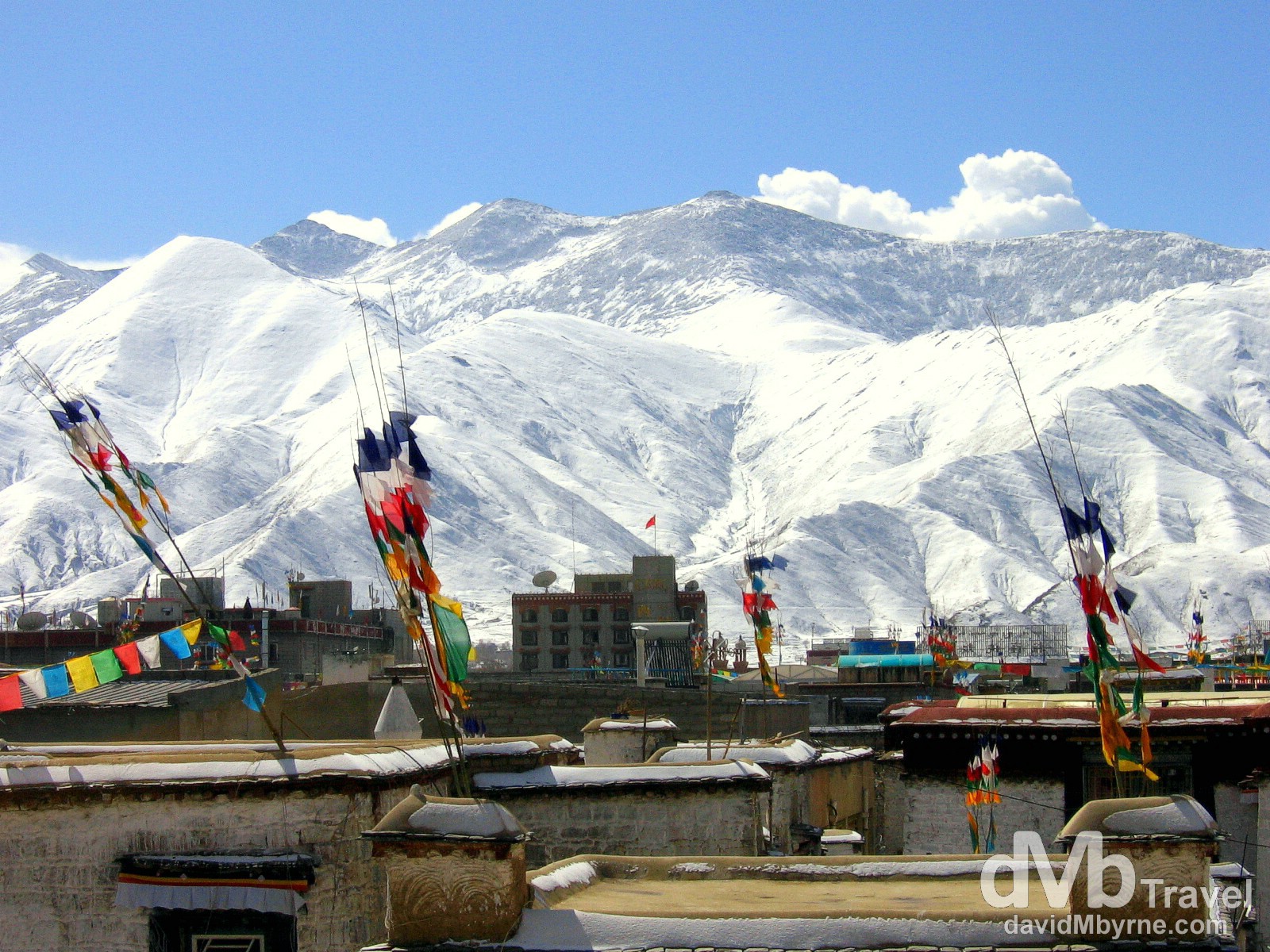
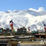
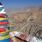
The view of the surrounding Himalaya Mountains from the rooftop of the Jokhang Temple. Lhasa, The Roof Of The World, is the capital of Tibet, officially an autonomous region of China. Located in the Himalayas high on the Tibetan Plateau, there’s an intoxicating lure to the location few other places on earth can match. Maybe it’s the sheer isolation. Maybe it’s the fact that it was closed off to the west for most of its existence. Maybe it’s the religious monuments that turned the whole region into the Buddhist kingdom it is today, a kingdom that so intoxicated early western travellers, the mythical Shangri-la locked away in its mountain fortress in the Himalayas. Lhasa, Tibet. February 27, 2008
Winding Down
We have spent the last few days in the city generally taking it easy & staying out of trouble. We have stared pilgrims (pilgrims who have stared right back at us), we’ve dodged beggars (beggars who didn’t want to dodge us) and we’ve visited both the Jokhang Temple and the Polata Place, using the roofs of both locations as viewing platforms from where we took in the full splendour of the peaks surrounding the city. The jaw-dropping scenery on show here has certainly whetted our appetite for what lies ahead on the Friendship Highway, a route renowned for its scenic wonders, something you’d expect given the fact that it traverses the Himalayas, the mountain range extending 1500 miles on the border between India and Tibet.
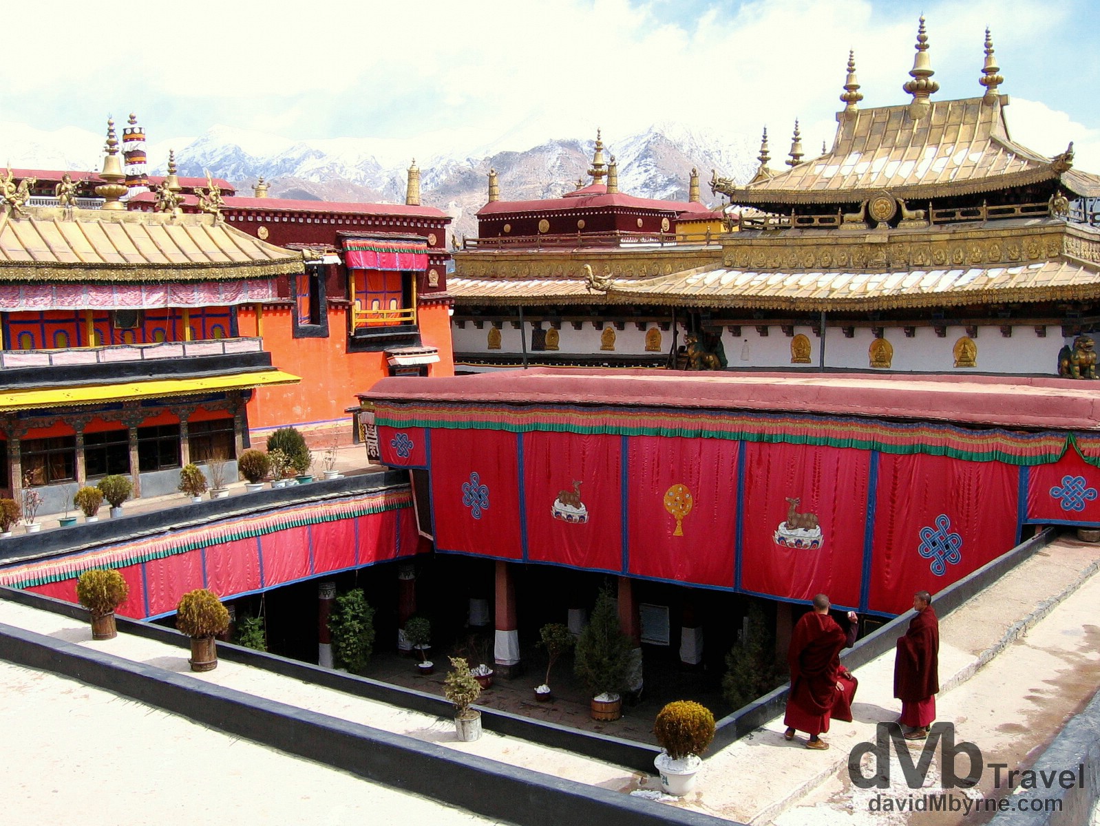
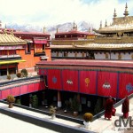
Young Buddhist Monks on the roof of the Jokhang Temple, the holiest temple in the Tibetan Buddhist world and, along with the Potala Palace, one of the two central city landmarks (both are UNESCO World Heritage-listed). Lhasa is an object of devout pilgrimage for Tibetan Buddhists and this temple is abuzz with a constant crowd of pilgrims from all over China prostrating themselves in front of the temple doors at all hours of the day. Lhasa, Tibet. February 27, 2008.
– UNESCO
Trip Buddies
We’ll be sharing our Friendship Highway jeep with a French couple, Guigui & Oliver, & a lone Japanese traveller who goes by the name Ricky. Collectively the 5 of us have spent the last few days negotiating (term loosely used) an itinerary and a fair price with the owner of a Toyota Land Cruiser, one we’re sure we’ll be comfortable in, bags and all. We’re happy with most things about the trip – the price (RMB 3,500, about €350 split 5 ways), the jeep, the driver and most importantly the itinerary which, as we prepare to embark on the trip tomorrow, reads as follows:
• Day 1: Friday February 29, 2008
Leave Lhasa (3,650 m / 11,975 ft) for Gyantse (3,950 m / 13,000 ft), stopping off to view Yamdrok-tso lake (4,488 m / 14,800 ft) from the Kamba-la pass (4,794 m / 15,800 ft). Overnight in Gyantse.
• Day 2: Saturday March 1, 2008
Leave Gyantse for Shigatse (3,900 m / 12,900 ft). Overnight in Shigatse.
• Day 3: Sunday March 2, 2008
Leave Shigatse for Everest Base Camp (EBC) area passing the Gyatso-la pass (5,220 m / 17,200 ft), the highest pass of the trip. Overnight at a guesthouse near the Rongphu Monastery (4,980 m / 16,400 ft).
• Day 4: Monday March 3, 2008
Trek 7 kilometres to EBC (5,150m / 17,000 ft) for sunrise. Mid-morning leave for Tingri (4,390 m / 14,500 ft). Overnight in Tingri.
• Day 5: Tuesday March 4, 2008
Leave Tingri for Zhangmu (2,300 m / 7,590 ft), on the Tibet-Nepal boarder. After clearing boarder formalities find onward transport to Kathmandu.
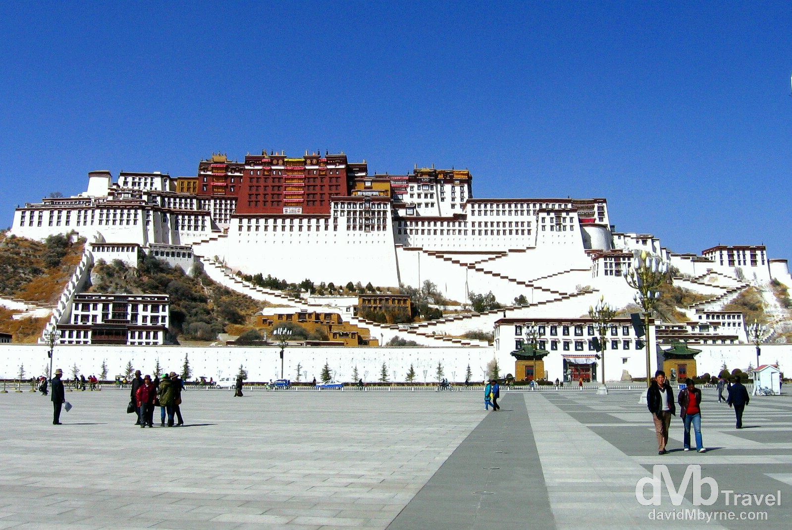
The Potala Palace as seen from People’s Park, Lhasa. The Potala Palace is the enduring landmark of Lhasa, the symbol of Tibet in the west and one of the most astonishing buildings in the world. The 110-metre-tall palace is perched 130 metres above the city atop Marpo Ri (Red Mountain) in the centre of the Lhasa Valley. Rising thirteen dramatic storeys and consisting of over a thousand rooms, the palace complex, comprising the White and Red Palaces with their ancillary buildings, took a workforce of at least seven thousand builders and fifteen hundred artists and craftsmen nearly fifty years to complete (1645-1693). The building measures 400 metres east-west and 350 metres north-south, with sloping stone walls averaging 3 metres thick – the walls are 5 meters (more than 16 ft) thick at the base where copper was poured to help proof the palace against earthquakes. The Potala was built for several purposes – it has served as administrative centre, seat of government, monastery, fortress and the home of all the Dalai Lamas up until the 14th Dalai Lama who fled to India following the failed anti-Chinese uprising of 1959. It’s widely regarded that today the palace is only a shadow of its former self; it has been forcibly converted into a museum by the Chinese but excited and awestruck pilgrims from all over ethnic Tibet still make their way here to give offerings at each of the palaces altars. We did visit the palace but unfortunately pictures were not allowed, a restriction that was strictly enforced by the palace monks. We saw a lot of Buddha’s in a lot of different chapels within the dark cavernous interior and also saw a few tombs of past Dalai Lamas, chief Lama (Buddhist priest) and once rulers of Tibet. Indeed, the three-storey, 3700 kg gold tomb of the Fifth Dalai Lama was mighty impressive and the highlight of the visit. But overall we were a tad disappointed by the visit – it was expensive (€10), the access to the rooftop wasn’t what we expected it to be and the restriction on taking pictures, even of the far-off mountains from the roof, was frustrating. Small rants I guess. Lhasa, Tibet. February 25, 2008.
– UNESCO commenting on the Historic Ensemble of the Potala Palace, Lhasa
So there you have it. We’ll start this little adventure within an adventure in the morning & because we’re being good boys we’ll be looking after ourselves tonight by avoiding the temptations of Lhasa beer, hoping to have ourselves in tip-top shape for the 8:30 a.m. departure. I’ll be trying to update our progress as we go but I’ll assume here and now that where we’re going won’t be offering internet access. And besides, we’ll probably be looking for heating and hot water before looking for internet access.
Days 1 & 2 Route Information || Lhasa to Shigatse
From Lhasa, the Friendship Highway follows the Kyi Chu river for about 60 kilometres up to the confluence with the Yarlung Tsangpo River (Brahmaputra) at Chushul. The main route continues along the Yarlung valley up to Shigatse, Tibet’s second-largest city and formerly the home of the Panchen Lamas. A subsidiary branch crosses the Yarlung Tsangpo at Chushul and crosses the 4,800-metre high Gampa La, passes along turquoise Yamdrok Yutso lake before crossing the 5,045-metre high Karo La at the foot of Noijin Kangsang, and following downstream the Nyang Chu valley through Gyantse up to Shigatse.
The Freeze, Part I
“Where’s the heater?” I asked the nice, obliging lady showing me around a few of the cheaper rooms in the Jianzang Hotel, the hotel my guidebook claims is the best one in town.
“No heating,” was the reply I dreaded to hear but kind of expected. Shiver.
Pat, having sent me in to scope out the rooms, was sitting out in the jeep, nice and warm. It was the same jeep that had taken 6 hours to get us here to Gyantse from Lhasa, on this, the first day of our 5-day Friendship Highway trip to Nepal.
“We’re in for a long night, Lad”, I told him. After explaining the grim reality of the situation we both agreed we’d probably make it through the night if we wore most of what we had in our bag, most of our not-suited-for-Tibet-in-late-February clothes. So that’s what we’re doing. As I type it’s 9:20 p.m. on days 1 and I’m in bed under two duvets with my socks, pants, t-shirt and fleece on trying to keep my fingers warm enough to get through this entry. It’s not easy so I hope you appreciate the effort.
Day 1 Recap
If I was to quickly recap today I would say we left Lhasa later than planned at 11.a.m (delays), drove up, and up, and up, and up, eventually reaching the the Kamba-la pass on the top of some mountain from where we were accosted by Yak-leading locals for pictures as we tried to take in the view of Yamdrok-tso lake some distance (300 metres actually) below us. Views were sublime.
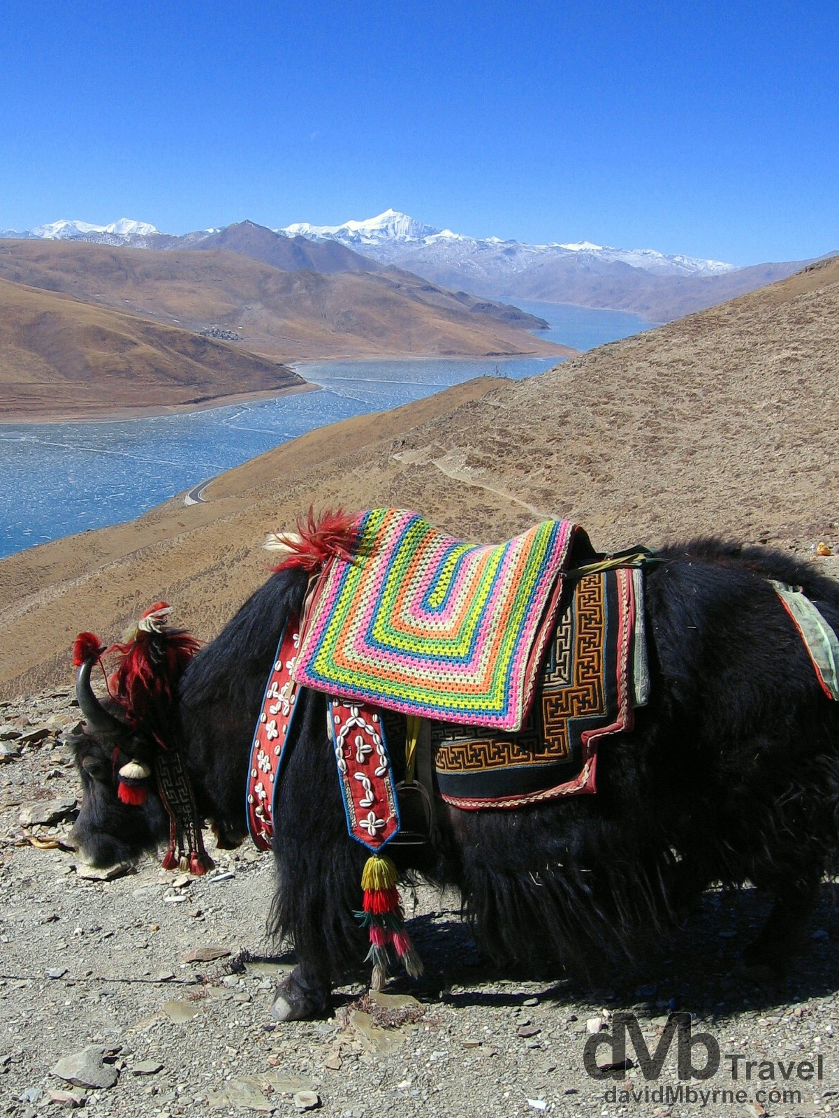
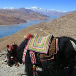
Day 1 || 12:17 || A yak on the Kamba-la pass (4,794 m / 15,800 ft) of the Friendship Highway overlooking a frozen Yamdrok-tso lake. The peak in the distance is Mt. Nojin-Kangtsang (7,191 m / 23,730 ft). That is according to my guidebook – our driver isn’t much good in this regard as he can’t speak a word of English. This was our first real look at snow-capped peaks having driven from Lhasa through arid, dusty and rocky plains to get to the pass. And it was here I was accosted for RMB 5 by a local after being accused of taking a picture of her dog. Not guilty. On the Kamba-la Pass of the Friendship Highway, Tibet. February 29, 2008.
Yak Dependent
From the Kamba-la Pass we drove to a small Tibetan village where we found a restaurant (more like a local’s front room, one that provided quite the authentic Tibetan experience) for a lunch of rice, potatoes & steak. Yak steak of course. And with the room heated by a central stove fuelled by dried yak dung it really hit home how important the long haired beasts are to the Tibetans. After lunch it was back on the road for a two-hour drive to our present location of Gyantse, passing through dry, arid and almost otherworldly environments with some amazing scenery as we went.
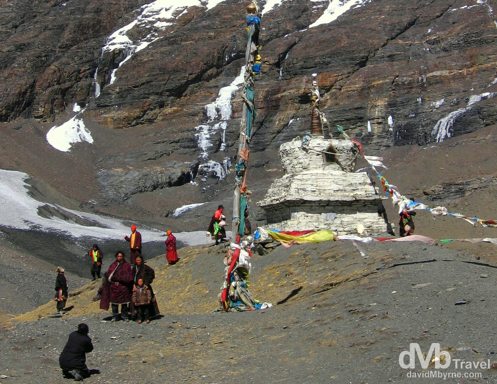
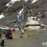
Day 1 || 14:55 || A family portrait in front of a stupa, a dome-shaped shrine erected by Buddhists, at the foot of a peak on the Friendship Highway. A Roadside marker here told us the elevation was 5,020 metres (16,470 ft). On the Friendship Highway between Lhasa & Gyantse, Tibet. February 29, 2008.
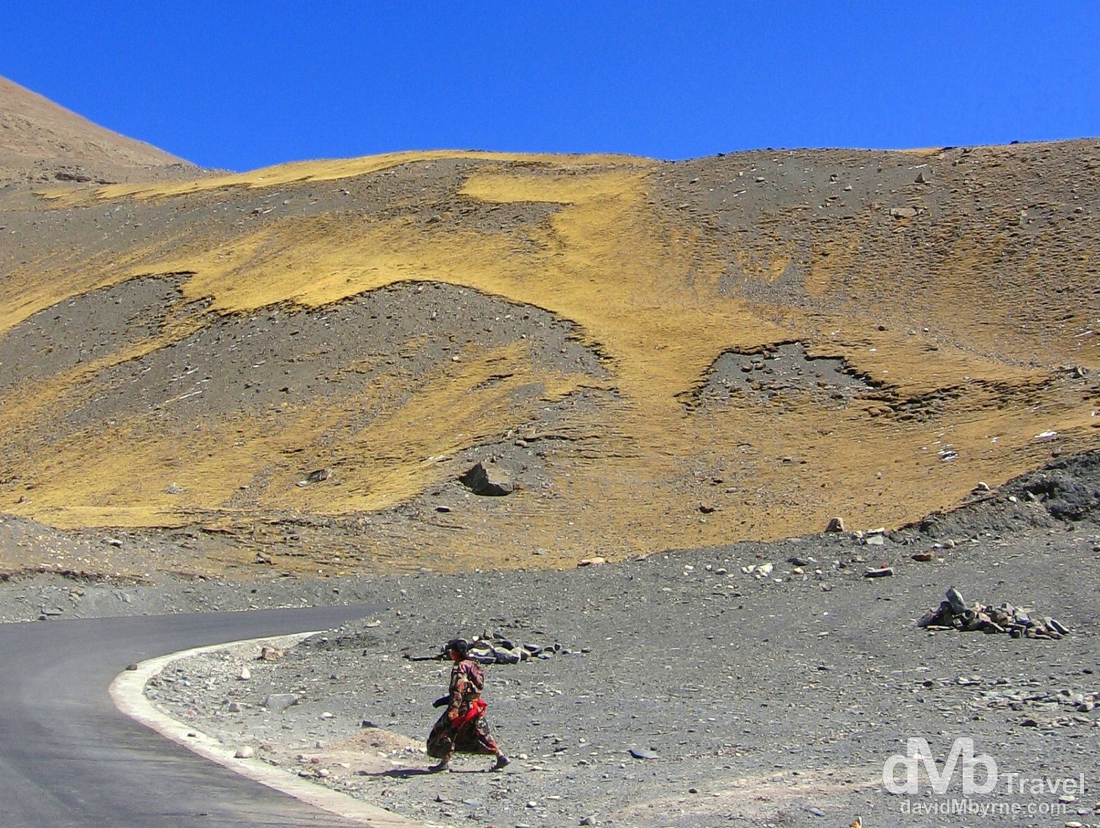
Day 1 || 14:57 || On the Friendship Highway from Lhasa to Gyantse, Tibet. February 29, 2008.
Gyantse
When we arrived in Gyantse, Tibet’s fourth largest town, we visited the Pelkhor Chode Monastery where the monks were a little overly concerned about us taking pictures inside the monastery temple, going so far as to frisk us for hidden cameras at the entrance (assuming we let them of course, which we didn’t). We took offense to their stance, especially after paying €4 into the monastery complex minutes earlier, and the whole episode left a bad taste in our mouths. By that stage we weren’t that keen to see the inside of yet another temple anyway so we sat outside in the sun instead commenting on how many rabid-looking stray dogs there were in the grounds of the monastery sunning themselves just like us. It certainly is a dogs life, here in Gyantse at least.
Tomorrow || Day 2
Tomorrow, Day 2, is a handy day. We’ll take another look around Gyantse – I’ll be honest, as of now it doesn’t seem to offer much but I’ll reserve judgement proper until tomorrow. We’ll then be back on the road again en route Shigatse, Tibet’s second largest town. Shigatse is only an hour away, an hour nearer EBC (Everest base camp). One thing I know we’ll be doing when we get to Shigatse is splashing out (€10+) and looking for a hotel with heating, knowing it’s unlikely we’ll get it at EBC. Not that that bothers us; for some reason staying in a hotel / guesthouse at EBC without heating seems tolerable.
The Freeze, part II
We’re just trying to settle in for the night and Pat, who looks every bit the burglar he isn’t with his black beanie on, has just piped up from under his two duvets.
“Here Dave, how much was the room with heating?”
“RMB 170 (€17) Lad, why?”
“Ummm, and how much was this room?”
“RMB 60 (€6). Why?”
“So by saving RMB 110 (€11), RMB 55 each, we’ll probably freeze to death in some hole of a town in southern Tibet. What would our families think of that?”
“I dunno lad, I never considered that. But c’mon. It’s not that bad. Think good thoughts. Sweet dreams.”
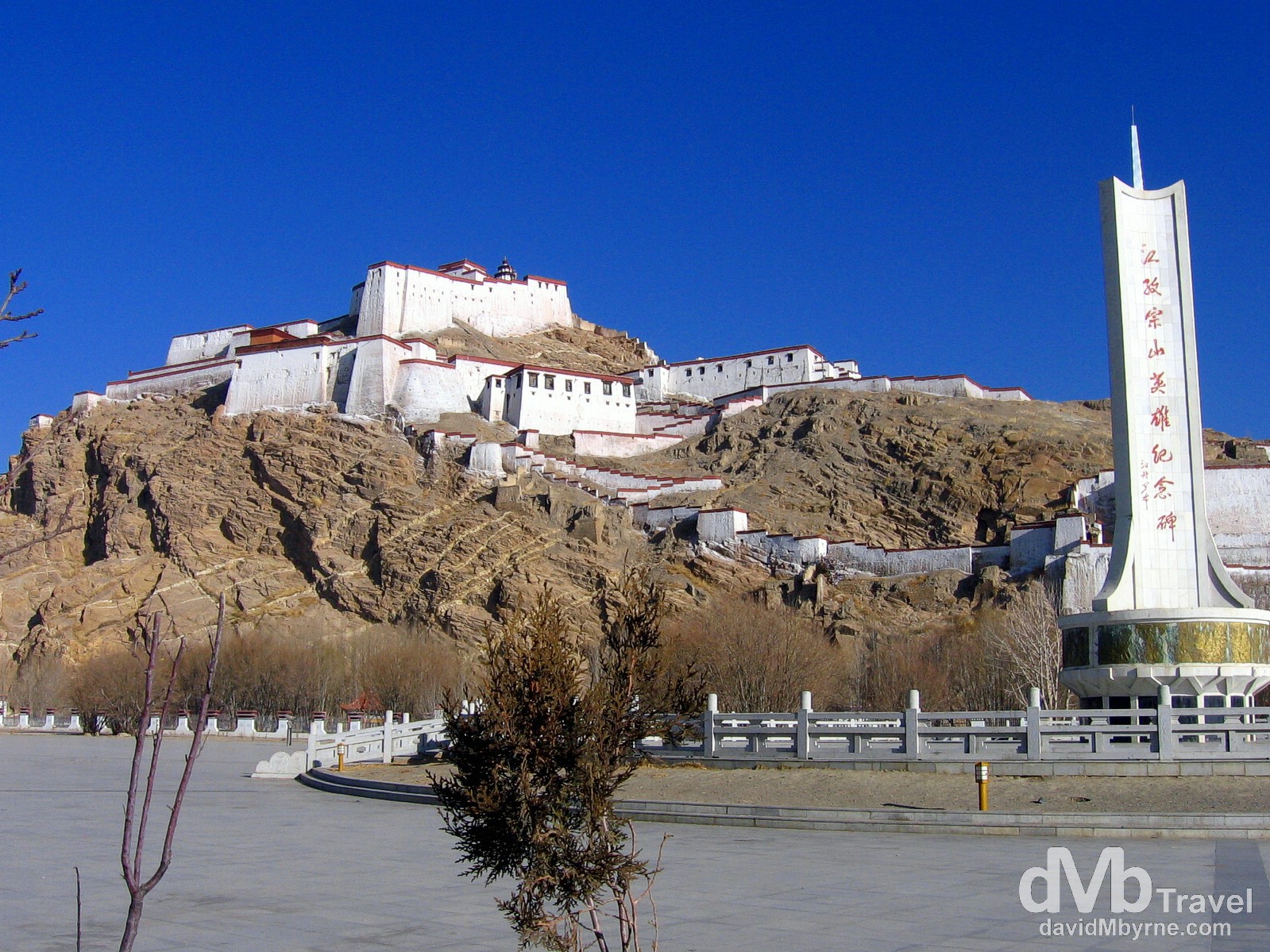
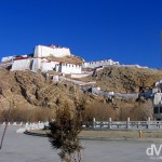
Day 2 || 10:07 || The anti-British Heroes Monument (right) & Dzong, the Old Fort in Gyantse (![]() ), Tibet. March 1, 2008.
), Tibet. March 1, 2008.
Gyantse || The Redemption
Before we left Gyantse earlier this morning for our present location of Shigatse we paid a visit to Dzong, Gyantse’s Old Fort. It looks impressive from ground level from where it hints at offering nice views. Of course it’s only after you make the effort to get to the fort’s highest point that it becomes apparent just how good the views it affords are. And who knows, when you do make it all the way to the top you might even be in agreement with us that hey, Gyantse isn’t all that bad after all, at least not from 400 ft up where the the views of the town and the surrounding valley are truly amazing, especially on a crystal-clear day like today.
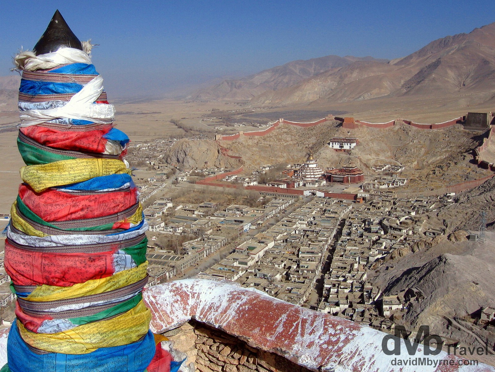
Day 2 || 11:04 || The fort was built to guard the Nyang-chu valley (seen here) that the town of Gyantse is strategically located in, a town referred to as the “Hero City” because of the resistance of 500 Tibetan soldiers to a British invasion in 1904. The aforementioned 500 soldiers were, after holding out for several weeks, finally overcome by the superior equipment of the British – many of them jumped to their deaths from the fort walls. In the distance can be seen the Pelkhor Chode Monastery where we were frisked my monks the day previous. The view from atop Dzong, the Old Fort in Gyantse, Tibet. March 1, 2008
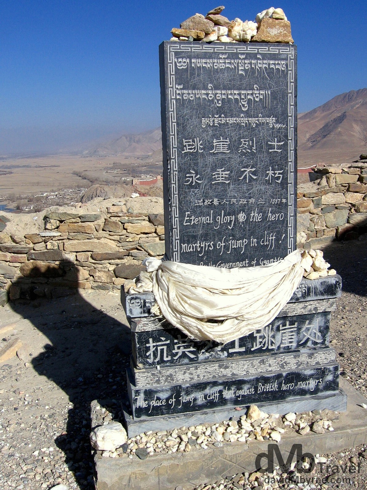
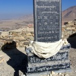
Day 2 || 10:52 || The Martyrs Monument atop Dzong, the Old Fort in Gyantse. We liked the text on here – ‘Eternal glory to the hero martyrs of jump in cliff’ & ‘The place of jump in cliff that against British hero martyrs’ You get the idea. Dzong, the Old Fort in Gyantse, Tibet. March 1, 2008.
Shigatse || One Hour
One hour. That’s all we spent in the jeep today getting from Gyantse to Shigatse, Tibet’s second largest town (I’m disagreeing with our guidebook which classes it as a city) & the former home of the Panchen Lamas. Something tells me the next few days won’t be so agreeable to our asses (as in buttocks, not pompous fool or hardy & sure-footed animal smaller and with longer ears than the horse) but for now we’re wallowing in the warmth of our heated Shigatse hotel room having just let ourselves down by falling off the wagon. Yep, having gotten to Shigatse a few hours ago we quickly realised that there was nothing to do here, nothing to do that is assuming you don’t want to go looking at more monasteries and if, unlike us, you haven’t had your fill of Buddha statues, frisking monks and rabid-looking stray dogs. So with nothing to do we did what we do best – we went drinking. Don’t think badly of us. As I said previously maybe we’re taking this whole altitude sickness prevention thing too seriously anyway. That and the fact that Shigatse seems to be the sort of place that drives people to drink. It started off innocently enough. Having checked into our €12-a-night hotel room we had the shower we didn’t have in our Gyantse icebox hotel earlier in the day before we went out to have a look around and see what Shigatse has to offer. Not much as it turned out. We wandered here, we wandered there and before we knew it we were sitting on the side of a road drinking the daemon beer. That proved to be quite the spectacle for the passing locals, who we doubt see many foreigners at all, never mind foreigners who sit by the side of the road sipping beers. We had fun too, and so did a few locals, & that’s all that matters.
We’re now back in the hotel room, disgusted with ourselves, and we’re probably going to have dinner in a few minutes in the hotel restaurant. Actually, we are going to have dinner in a few minutes in the hotel restaurant. The only uncertainty is will we have dinner with or without beer? Considering tomorrow is a big day, EBC day, and we’ll be spending a long time in the jeep getting there, then it might be sensible on our part to be sensible.
Seen Today On The Streets Of Shigatse
Try these for size: goat carcasses; people sitting on the side of the road attached to intravenous drips (no sign of a hospital); pool tables on street corners; souvenirs made out of human skulls (it’s “OK” we were told by the lady manning the stall, “Nepalese people, no Tibetan”); and not forgetting the two westerners drinking Snow beers, getting sunburn and watching the world go by.
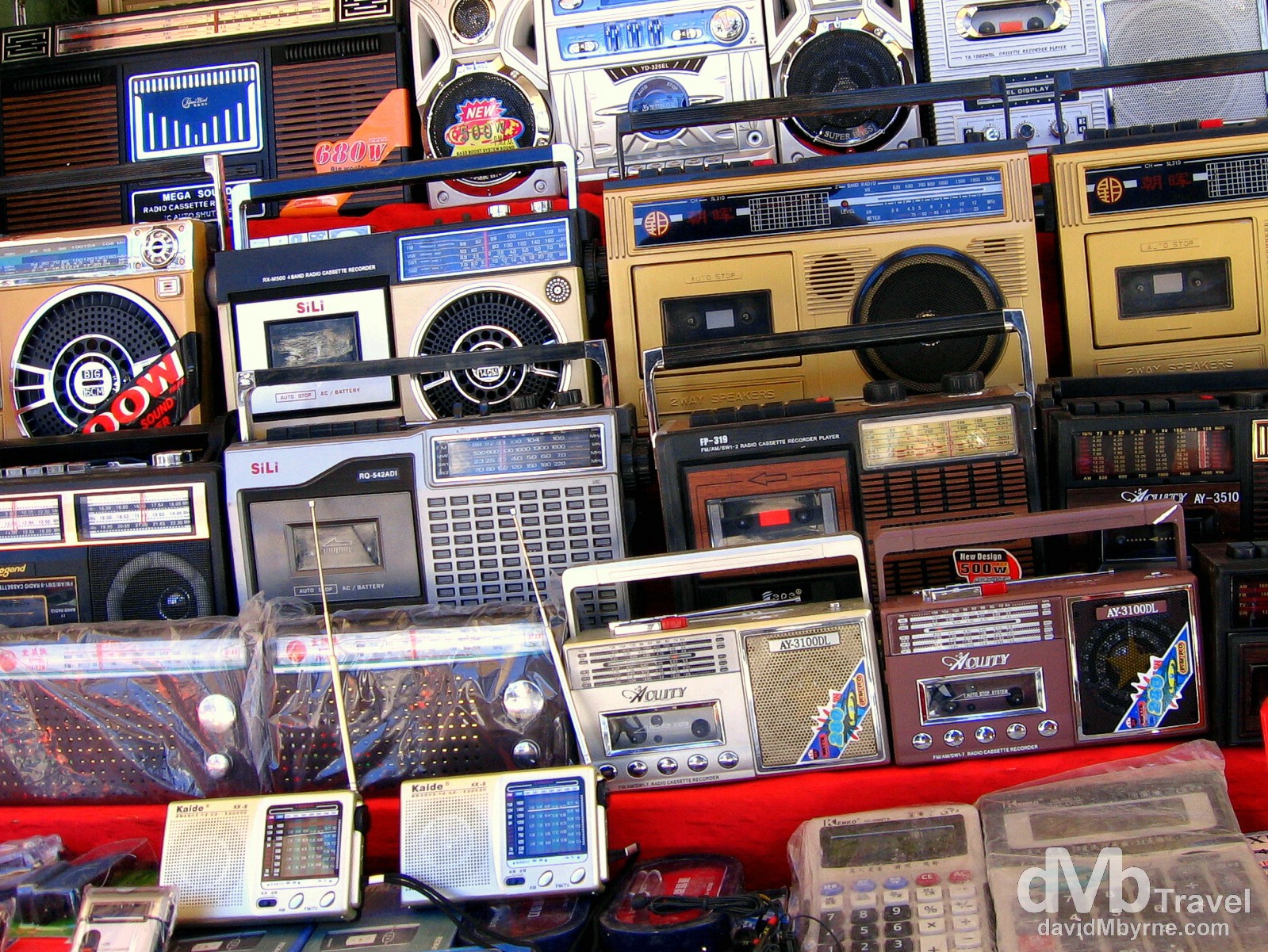
Day 2 || 15:43 || Hi-Tech. For Sale on the streets of Shingtse, Tibet. March 1, 2008.
Day 3 Route Information || Shigatse to Tingri/Rongbuk Valley
From Shigatse, continuing west parallel to the Yarlung Tsangpo valley, the road passes Lhatse and forks just beyond at Chapu, where China National Highway 219 continues west and upriver, finally crossing the Brahmaputra/Indus divide near sacred Mount Kailash and Lake Manasarovar, then on to Ali in Gar County.
From Chapu near Lhatse, the Friendship Highway maintains the Hwy 318 route number and turns southwest and crosses the main Brahmaputra-Ganges divide at Gyatso La (5,260m), the highest pass on the road. Descending 1,000 meters onto alluvial plains of the Bum-Chu, also known as the Arun river in Nepal, the highway passes near Shelkar (New Tingri) then through Old Tingri, both gateways to Rongbuk Monastery and the north side of Mount Everest.
Day 3 Recap
Day 3. Today had potential. It was supposed to be the day we spent the night in Rongbuk Valley near EBC (Everest base camp). We’re supposed to be there right now. But we’re not. Instead we’re in another disheveled Tibetan Friendship Highway town, this latest one called Tingri, somewhere we’re not supposed to be until tomorrow. But now that we are here we find ourselves trying to keep warm as we grumble over our chocolate & instant noodles, cursing the Chinese & lamenting about that should have been. It ended bad but it wasn’t all disappointment & letdown today. Quite the contrary – it was actually great, beyond great, up to a point. Enter the Chinese.
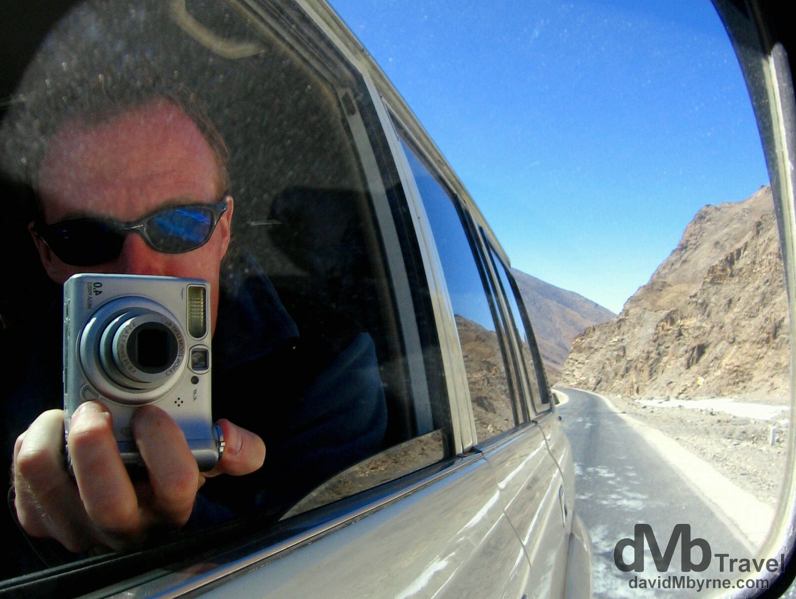
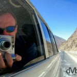
Day 3 || 12:45 || As I said, things on this day started out well. And the weather was great too. We rotate seats in the Toyota Land Cruiser jeep/4×4 daily and today, the day the itinerary said we’d drive from Shigatse & up the Rongbuk Valley in full view of Mount Everest, just happened to be my day to enjoy the best seat in the house, the lone front seat, perfect front seat reflection selfie territory. I couldn’t resist. On the Friendship Highway, Tibet. March 2, 2008.
Gyatso La Pass
Not long after taking my selfie we reached the Friendship Highway’s Gyatso La Pass, not only the highest point of the day but also of the whole trip, not to mention the highest I’ve ever been on planet earth. It was one hell of a (cold) buzz, albeit only for the few minutes to subjected ourselves to the elements.
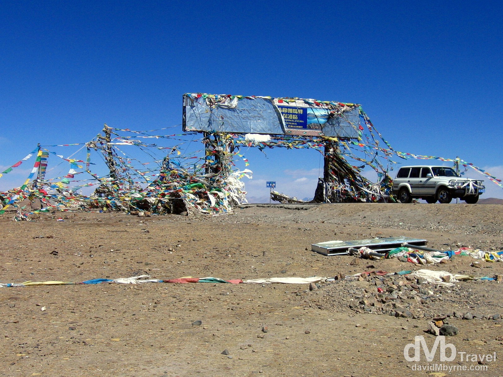
Day 3 || 13:04 || Our Toyota Land Cruiser on the 5,260 metre (17,257 ft) Gyatso La Pass, the highest point on The Friendship Highway. Easily the highest point I’ve ever been on the earth’s surface, the Gyatso La Pass has, according to dangerousroads.org, ‘a well-deserved reputation for being dangerous because of unpredictable snowstorms and blizzards.’ At this altitude I would imagine so. We didn’t hang around here too long; the wind was almost bowling us over & as one might expect it was bitterly cold. Plus, the views weren’t that great, surprising really. But just standing out in the thin air knowing you were on the highest point of the Friendship Highway was one hell of a (cold) buzz. Gyatso La Pass on the Friendship Highway, Tibet. March 2, 2008.
Our First View Of Everest
The hits just kept on coming. And the next one was to be a big one. Shortly after leaving the Gyatso La Pass we got our first look at a distant Mount Everest, the first time we laid eyes on the world’s highest peak (yes, it’s the ‘preposterous triangular lump’ in the distance).
– George Mallory, explorer, commenting on Mt. Everest
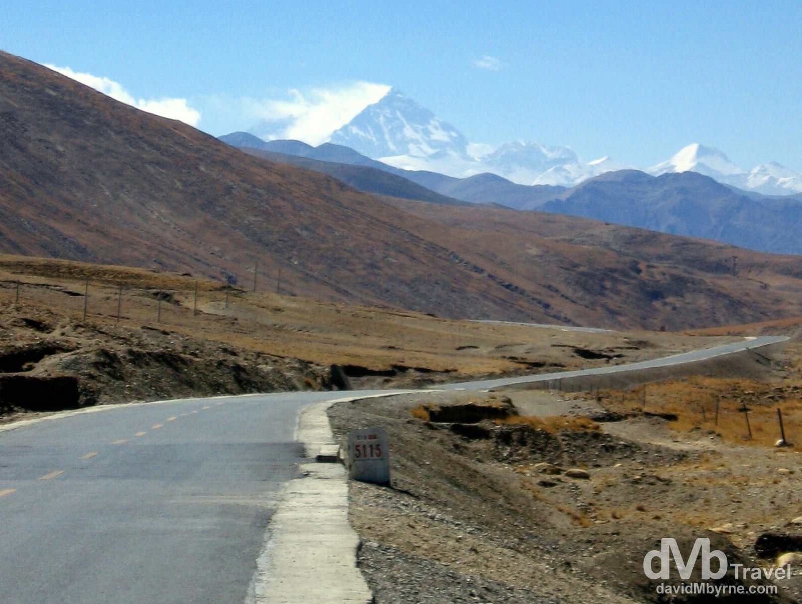
Day 3 || 13:36 || We kept going, didn’t pull over; this image was captured from the front seat of the moving jeep hence its blurriness. The marker here tells us we are a mere 5,115 kilometres from Shanghai on China’s east coast – The Friendship Highway is the westernmost part of the 5,470 kilometre (3,400 mile) China National Highway 318 connecting Shanghai to Zhangmu, the border town with Nepal marking the end of the Friendship Highway proper. We passed the huge, black granite 5,000 kilometre marker earlier in the morning, at 11:34 a.m. to be precise, almost exactly 2 hours previous. We did stop there and did take pictures, none of which were very good. On The Friendship Highway, Tibet. March 2, 2008.
Zhufeng Road & The Pang La Pass
Time for a lineup, a unrivalled alpine lineup as seen from yet another lofty mountain pass, this one the Zhufeng Road’s Pang La Pass.
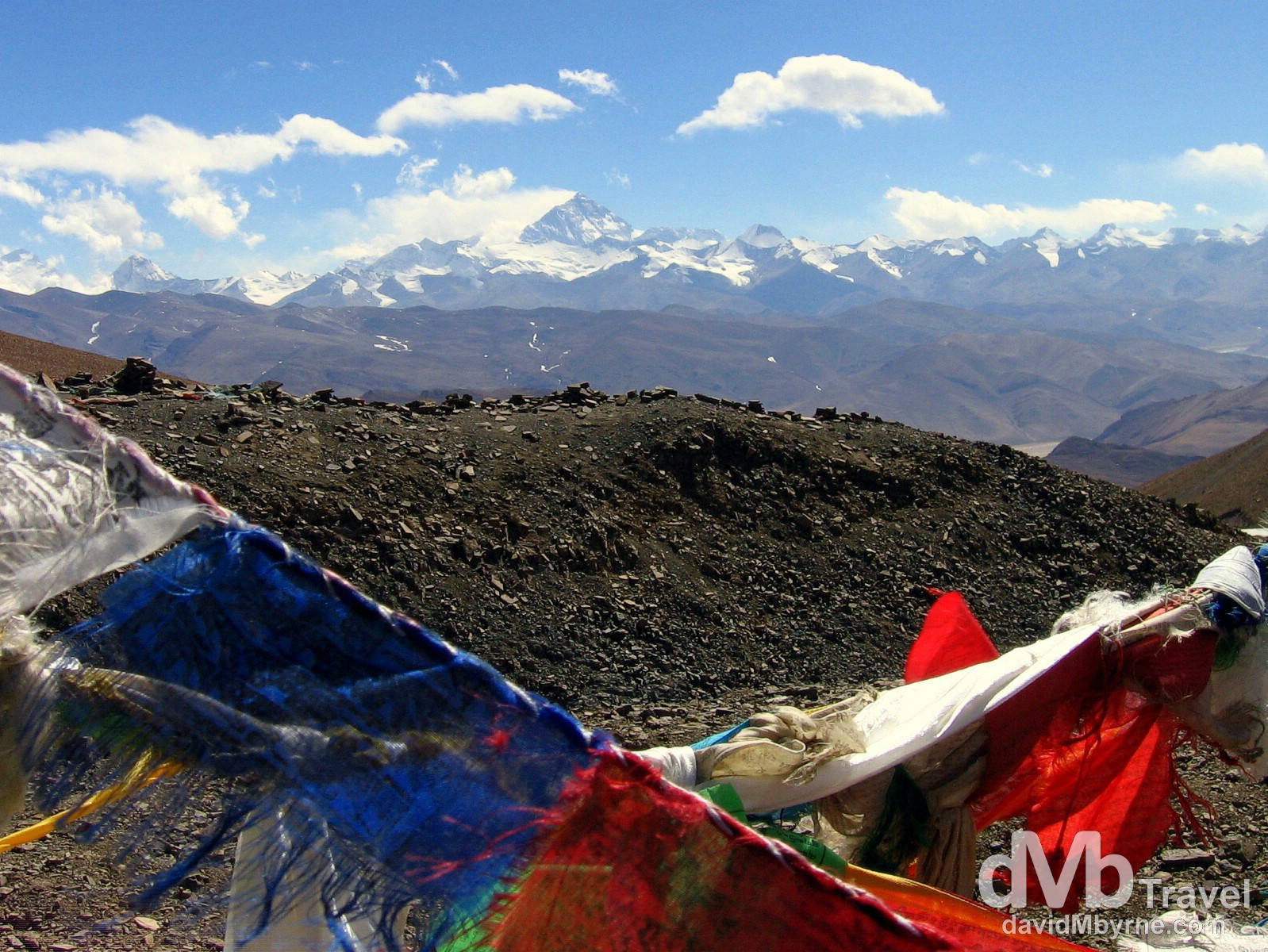
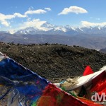
Day 3 || 15:54 || The glory of the Everest region as seen beyond a sea of prayer flags at the Pang La Pass. The 5,205 metre (17.076 ft) Pang la Pass is the highest point on Zhufeng Road, a 90 kilometre gravel & sand road connected to the (paved) Friendship Highway which marks the Tibetan approach to the Rongbuk Valley (& Monastery) & Everest Base Camp (EBC). Having turned off the paved Friendship Highway onto this dirt road, we spent close to three hours bouncing along it – with a total of 64 switchbacks, it’s a long, bumpy, windy, dusty but spellbinding trip and the going is slow. Some 20 kilometres off the Friendship Highway one reaches here, the Pang la Pass, from where the full glory of the Everest region is laid out before you. A picture on the rear of the National Park entrance ticket we had paid €18 for earlier in the day helped us identify the individual peaks we were gazing at from the pass. They include no less than 4 of the world’s 14 so-called eight-thousanders, peaks reaching over 8,000 metres in height: Cho Oyu (8,153 m || 26,904 ft); Lhotse (8,501 m || 28,053 ft); Makalu (8,463 m || 27,927ft); & of course Everest (8,848 m || 29,028 ft) which is, needless to say, the triangular peak sitting rather appropriately in the dead centre of the image. On the Pang La Pass, Rongbuk Valley, Everest Region, Tibet. March 2, 2008.
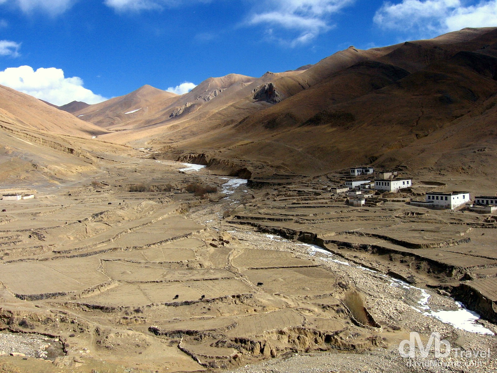
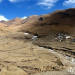
Day 3 || 16:35 || One of the many small, remote villages found along the bumpy 90 kilometre Zhufeng Road connecting the Friendship Highway to the Rongbuk Valley. Make no mistake – living anywhere out here has got to equate to an oh so bleak existence. Yurgya Hamlet, Everest region, Tibet. March 2, 2008.
– dangerousroads.org commenting on Zhufeng Road & The Pang La Pass
A few more captures from the trip along the unforgiving Zhufeng Road.
- A section of the Zhufeng Road connecting the Friendship Highway to the Rongbuk Valley, Tibet. March 2, 2008.
- Yurgya Hamlet as seen from the Zhufeng Road en route to the Rongbuk Valley, Tibet. March 2, 2008.
Rongbuk || The Arrival
We departed Shigatse earlier today at 11 a.m. & we arrived in the Rongbuk Valley (which Everest, in all its glory, sits in) at 6 p.m. having spent the best part of 7 hours inside our hired Toyota Land Cruiser jeep, 4 of those hours hours on the nicely paved Friendship Highway traversing the highest pass of the trip & getting our first views of Everest, & 3 hours bouncing around the inside of the jeep as it slowly made its way up the windy, 90 kilometre Zhufeng Road that links the valley to the Friendship Highway proper. Everything up to that point had been great. Better than great. And it got even better when we were greeted by the Chinese military personnel who patrol the Everest area with a big “Welcome to Everest” cheer as we got out of the jeep, gazing in awe up the valley at the north face of Everest as we did. Geographically we were at the end of the road, outside the only guesthouse in the valley, right beside the Rongbuk Monastery, the highest monastery in the world, and some 7 kilometres down the valley from Everest Base Camp (EBC).
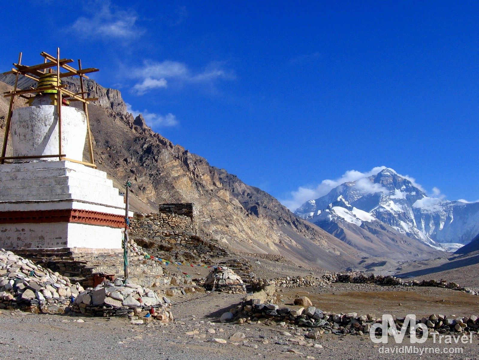
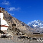
Day 3 || 18:24 || A stupa of the Rongbuk Monastery in view of the north face of Mount Everest. The Rongbuk Monastery is, at 4,980 metres (16,430 ft), the highest monastery in the world. Prior to the creation of the dirt road we had just driven up explorers such as George Mallory and Sandy Irvine had to walk for five weeks from Darjeeling, in the Indian foothills of the Himalaya, to reach this location. The monastery was founded in 1902 by the Nyingma Lama although a hardy community of nuns had used meditation huts on the site for hundreds of years before this. The chapels themselves were of limited interest but the position of the monastery, perched on the side of the Rongbuk Valley leading straight towards the north face of Everest, is stunning. According to my guidebook just to sit outside and watch the play of light on the face of the mountain is the experience of a lifetime. Rongbuk Valley, Everest region, Tibet. March 2, 2008.
– John Noel, British explorer, commenting on the Rongbuk Monastery
When Good Days Turn Bad
Seven kilometres. Having come this far we were only 7 kilometres from EBC and even having spent 7 tiring hours inside a 4×4 jeep we were as pumped as could be. We were eager to stash our bags, settle into the guesthouse and take a look around the monastery and valley and so just after receiving our greeting we began to unload our luggage. We did so until we were told to produce our passport for yet another check, just like all the other checkpoints we’d passed through earlier in the day en route to our present location. It was then that everything stopped going to plan.
“You not staying here. You don’t have correct permission,” was the official line they spun us.
“Correct permission! What?”
According to the military guy raining on our parade the person we hired the jeep from in Lhasa, the guy who was supposed to arrange the permits to enable us to have the “correct permission”, didn’t do what he was supposed to do. So we found ourselves standing in the Rongbuk valley, in full view of the north face of Mount Everest, arguing our case with two Chinese military personnel who were having none of it. Pat was a model of calmness during the negotiations. I wasn’t.
“We just doing our job,” they kept reminding us. (They seemed to know which lines to utter in order to scupper our plans, & which line – singular – to utter to justify their decisions, but nothing beyond that. Hence it became quickly obvious that attempting to rebutting them was a pointless endeavour).
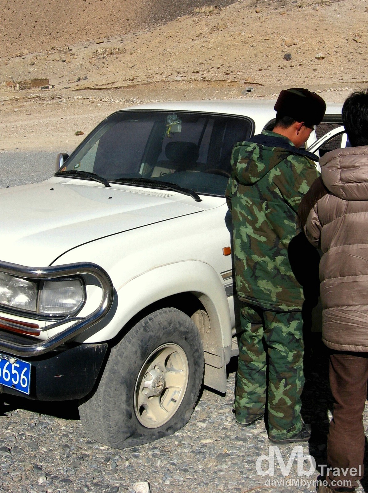
Day 3 || 18:13 || Deflated tyre (& ambitions). Checking our ‘permission’. The results weren’t good. Rongbuk Valley, Everest region, Tibet. March 2, 2008.
It was somehow communicated to us that we were granted 30 minutes to take pictures after which we’d have to pile back into the jeep and head back down the 90 kilometre dirt road to the Friendship Highway. Adding another 3+ hours of driving, 3+ hours of nighttime driving on the dirt road we’d just driven up, wasn’t in anyway appealing, least of all to our driver who spent the 30 minutes we’d been granted to take pictures changing the jeep tire, it obviously having succumbed to the conditions of Zhufeng Road en route to the Rongbuk Valley.
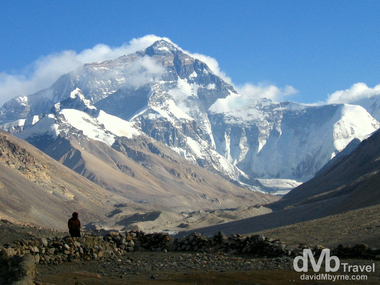
Day 3 || 18:34 || A lone, distant figure stands silhouetted in the Rongbuk Valley in full view of the north face of Mount Everest. Tibetan Everest Base Camp is some 7 kilometres up the valley from this point, a distance we had planned on trekking early on day 4 of our Friendship Highway trip. Planned. Past tense. Rongbuk Valley, Everest region, Tibet. March 2, 2008.
The Reluctant Retreat
Nighttime quickly fell as we reluctantly left the Rongbuk Valley which made the 90 kilometre drive back to the Friendship Highway that bit slower and that bit more dangerous. There was a strange mood in the jeep – we were well aware that the jeep was using the only spare tire we had and were also fully aware that a breakdown of any kind would have put us in a rather grim predicament. Seventy kilometres into the trip we stopped on the Pang La Pass, the same pass we had stopped at earlier in the day to gaze and marvel at the Everest region spread out in front of us. This time, however, we stopped to give our driver a rest. Of course we couldn’t see anything that the jeep lights weren’t illuminating, except for the stars in the sky which made for a wonderful spectacle.
We set off again, bouncing the remaining 20 kilometres to the paved Friendship Highway where we all drew a collective sigh of relief. And so three hours after leaving the Rongbuk Valley we limped into the dusty courtyard of the Amdo Hotel here in Tingri, 24 hours earlier than initially planned. It was 10 p.m. and it had been a long, long day of sitting in a jeep, showing our passports at numerous Chinese military checkpoints and gazing at mountains from high-altitude passes. The cold Gyantse hotel room from two nights previous was still fresh in our memory as we were shown earlier the €6 room that was to be our accommodation for the night. The room is small, it is dingy, it is dirty, and it’s not 7 kilometres from Everest Base Camp. But at 10 p.m. it was pretty much our only option – we doubt there are many better accommodation options in this one-horse looking town anyway. Of course the room has no heating and being at 4,390 metres (14,500 ft) means it is also cold. Very cold. As I type (23:15) we’re hoping the combination of our exhaustion and layers of clothing will, again, get us through the night.
“Here lad, where are the sleeping pills you bought in Lhasa?”
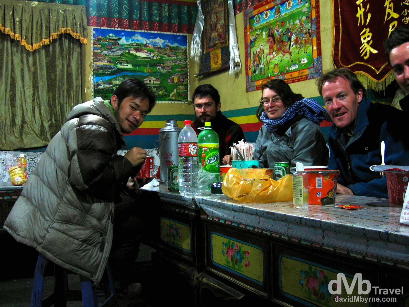
Day 3 || 22:27 || Beaten. Pat didn’t quite make the cut for this picture of our group (L-R: Ricky, Oliver, Guigui, yours truly & Pat) feasting on the supplies (instant noodles, chocolate etc.) that we had purchased to get us through the night and following morning at the guesthouse in the Rongbuk Valley. Being in Tingri 24 hours earlier than planned means shortening our Friendship Highway trip from 5 to 4 days. As a group we have discussed ways in which we could possibly get back to EBC in the coming days but we quickly reached a consensus that it’s not possible based on the logistics of what needs to be done. We’re chalking it down as a disappointment, a major disappointment, but we’re still grateful we got as close to Everest as we did. 7 kilometres. So close yet so far. Amdo Hotel, Tingri (![]() ), Tibet. March 2, 2008.
), Tibet. March 2, 2008.
Day 4 Route Information || Tingri to Zhangmu/Kodari
Continuing southwest, the highway climbs over Lalung La (5,050 m / 16,570 ft) and crosses shortly after the Tong La (also known as Thong La, Yakri Shung La or Yakrushong La) (5,150 m / 16,900ft), which marks the water divide between the Bum-Chu / Arun and the (Matsang Tsangpo / Sun Kosi) rivers. The Friendship Highway then descends along the Matsang Tsangpo through Nyalam, then more steeply through a canyon to Zhangmu. The road ends at the Friendship Bridge on the China-Nepal border at a mere 1,750 m / 5,740ft elevation. The continuation of the road between the border town of Kodari to Kathmandu is named Arniko Rajmarg.
Day 4 Recap
We made it through the night. Again I credit layers and the human will for survival. However, my watch wasn’t so lucky. I woke this morning to find it dead. 9:05 a.m. on March 3, 2008, was when it died. That was mere minutes after I checked it having been raised from our slumber by a chorus of stray dogs patrolling Tingri’s main/only street. Maybe its time was up (no pun intended) or maybe, & as was more likely the case, it was the cold in the room that killed my timepiece, the same cold that froze my contact lens solution to a block and depleted the power in my digital camera batteries. Burr.
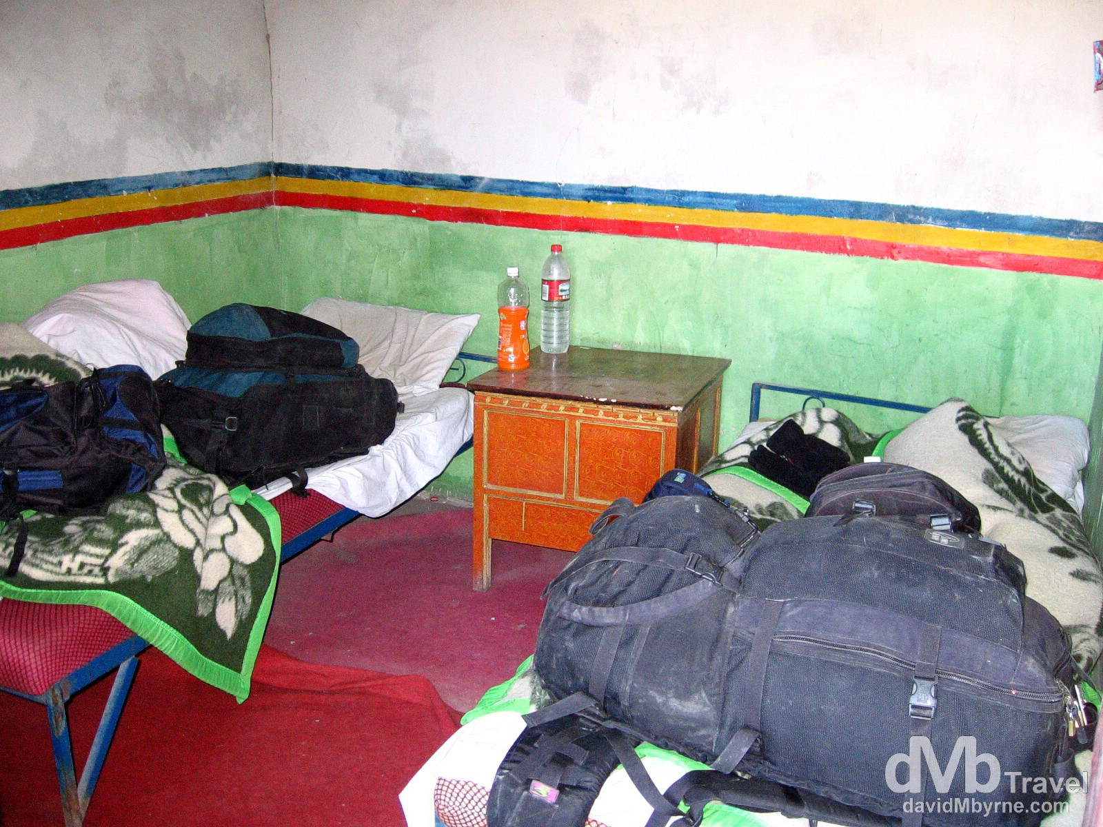
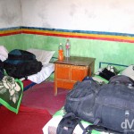
Day 4 || 09:32 || Home away from home. Our Amdo Hotel room. It looked bad in the dark of night and even worse in the light of day. That said, we slept surprisingly well. Exhaustion will do that I guess. Tingri (![]() ), Tibet. March 3, 2008.
), Tibet. March 3, 2008.
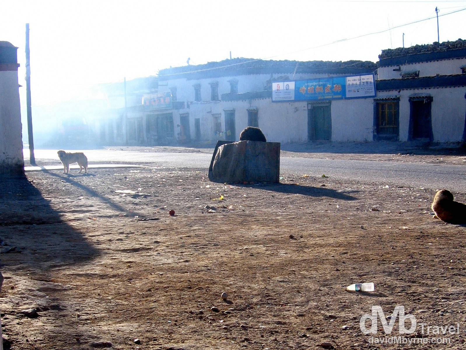
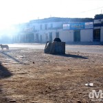
Day 4 || 09:40 || Early morning in Tingri, home to few people & many, many stray dogs. Tingri, Tibet. March 3, 2008.
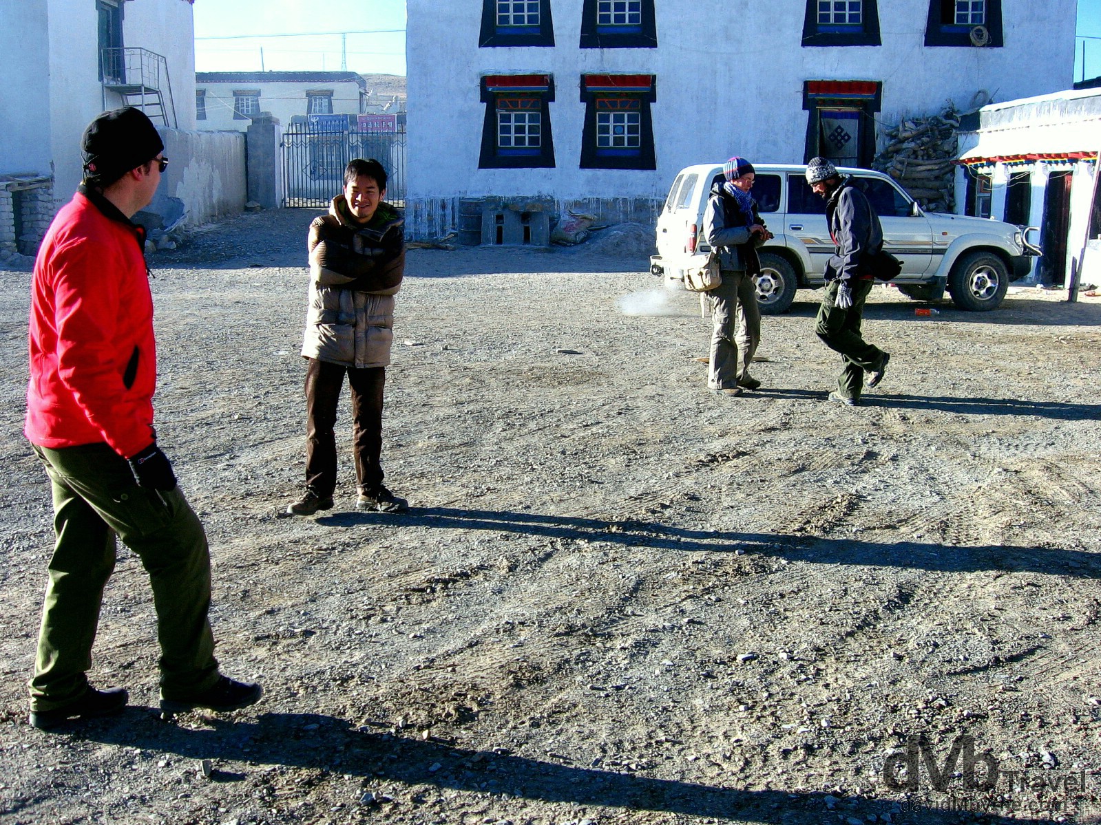
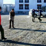
Day 4 || 09:50 || Trying to keep warm pre-departure in the courtyard of the Amdo Hotel, Tingri, Tibet. March 3, 2008.
Nepal Bound
Having endured the night we endured we weren’t too fond of hanging around Tingri, as nondescript a town as I have ever seen. Deeming the jeep the warmest place we could probably be, we passed on breakfast and by 10 a.m. we were back on the road, this time for the last time, heading for border with Nepal. Five to six hours we were told the trip would take. Five and one-half hours is what took & we felt every minute of those 5 1/2 hours. The Chinese haven’t yet gotten around to paving the final stretch of the Friendship Highway from Tingri to Zhangmu on the Tibet-Nepal border. So, and once again, we spent the day bouncing around the inside of a no-spare-tire Toyota Land Cruiser feeling like crumbs in a biscuit tin. But discomfort aside the trip was, of course, a splendid spectacle.
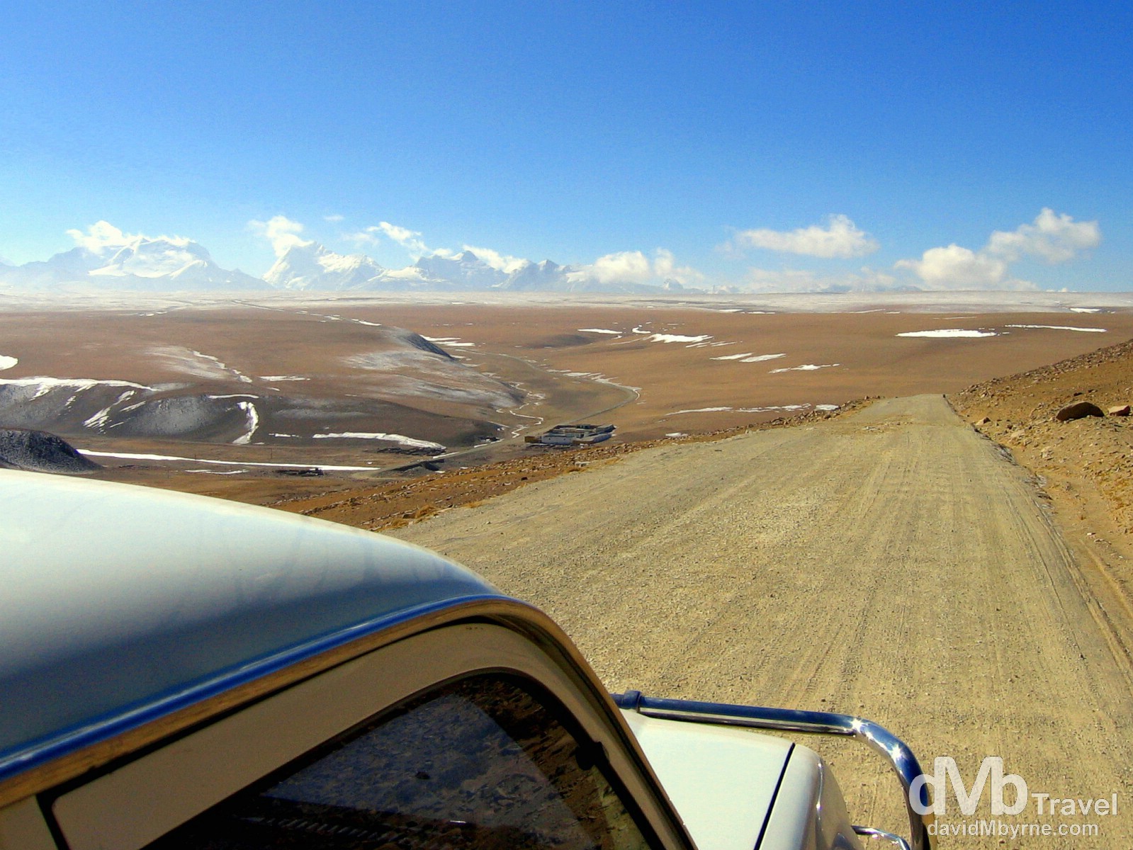
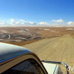
Day 4 || 11:44 || Almost 2 hours into our 5 1/2 hours of Day 4 jeep travel and we are approaching the end/edge of the Tibetan Plateau & the end of the stunning Himalayan vistas. But as it turned out we’d left the best vista for last. The Friendship Highway, Tibet. March 3, 2008.
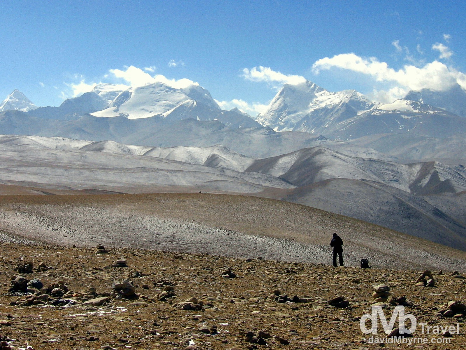
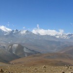
Day 4 || 12:06 || Not long after taking the previous picture we arrived at the 5,050-metre (16,650 ft) Lalung La Pass. We spent quite a while here savouring the scene in front of us, all the while in agreement that yes, the vista afforded by this pass was the best vista of the whole trip. The distant Himalayas from the Lalung Pass, Friendship Highway, Tibet. March 3, 2008.

Day 4 || 12:06 || Himalayan vista on the 5,050-metre (16,650 ft) Lalung La Pass on the Friendship Highway en route to Zhangmu, Tibet. March 3, 2008
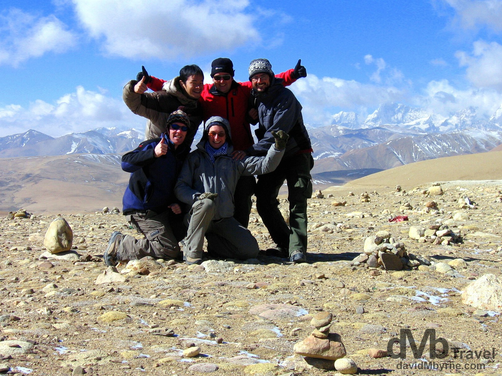
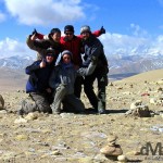
Day 4 || 12:09 || Trip buddies. Guigui, Oliver, Ricky, Pat & I on the 5,050-metre (16,650 ft) Lalung La Pass on the Friendship Highway en route to Zhangmu, Tibet. March 3, 2008
The Descent || 5,050 metres (16,650 ft) to 1,750 metres (5,740 ft)
From the Lalung La Pass it was downhill the whole way to Zhangmu, the border town with Nepal & the end of the Friendship Highway proper. As we descended from the Tibetan Plateau the scenery changed dramatically & we quickly said goodbye to the bright, sunny, dry weather and the barren, rocky, dusty landscape we’d become accustomed to over the past 3 days. We entered a massive, damp, humid gorge alive with vegetation (trees and stuff) and as soon as we did it clouded over and snowed heavily, making the twisty and dramatic mud & gravel road we were traveling on that much more twisty and that much more dramatic. It was a precarious section of the trip to say the least, clinging as we were to the side of a cliff as we descended further and further into the wet gorge, one we couldn’t see the bottom of. We spent the couple of hours alone on one 33-kilometre stretch of cliff-hugging road trying as we descended to peer out of the jeep into the abyss below. As we did we couldn’t help but wonder exactly how far down the valley floor was and that if today – March 3, 2008 – was indeed the day we were all going to die. Any thoughts of enjoying what lay ahead on this trip were put on hold until we successfully navigated the “precipice” (Pat’s word) we found ourselves in.
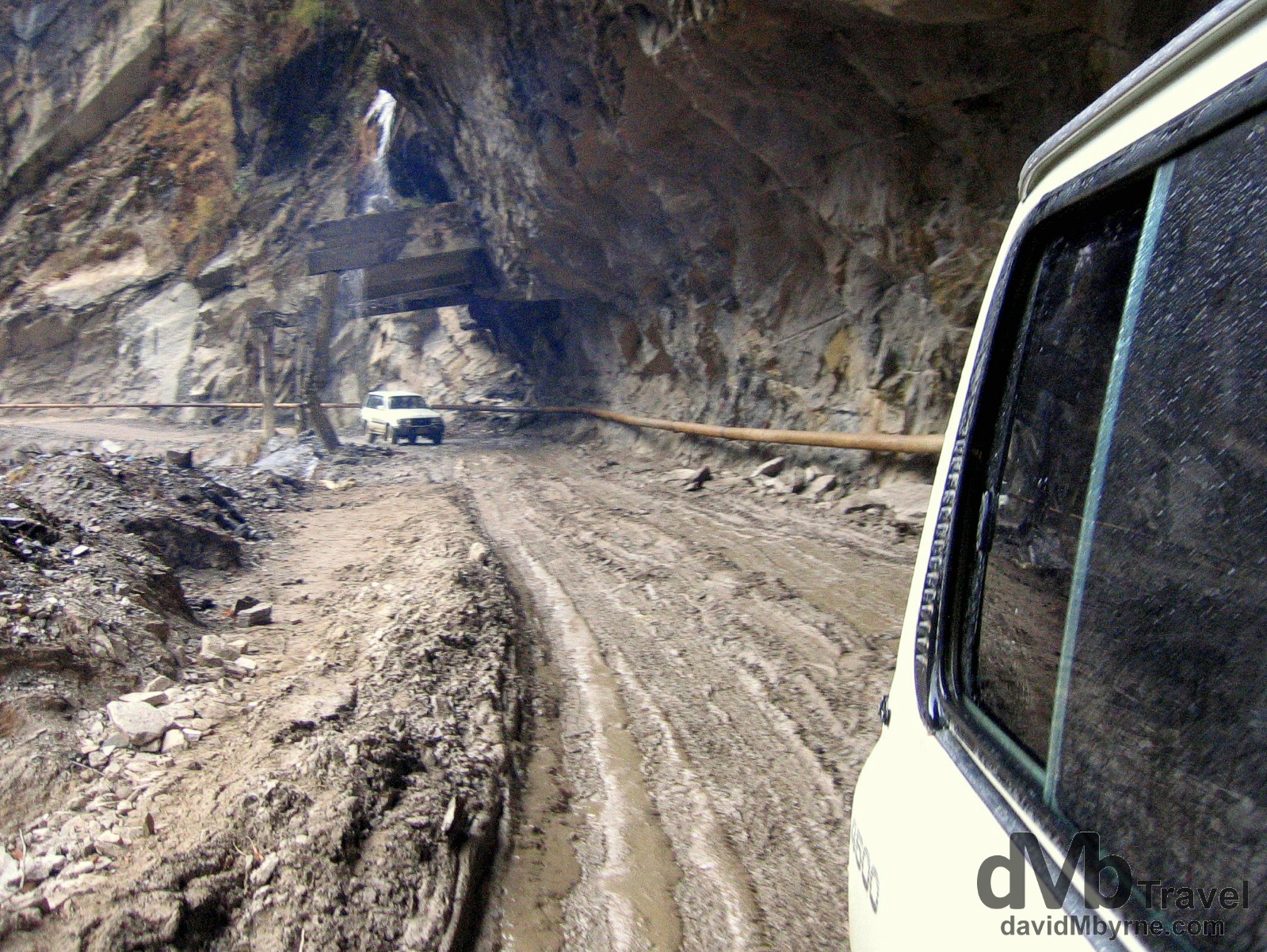
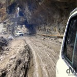
Day 4 || 14:31 || A part of the road near the end of the Friendship Highway approaching the Tibetan town of Zhangmu on the border with Nepal. March 3, 2008.
Zhangmu || The End/Start Of The Friendship Highway
We eventually made it to Zhangmu, a Chinese-Tibetan-Nepalese hybrid border town that clings gamely to the side of the gorge we had finally descended to the bottom of. It was raining & visibility was poor but from what we could see of Zhangmu it looked like a shambolic collection of tin shacks, construction sites, wooden huts, shops, brothels (we assume) & border-related offices. According to our guidebook the town is a “great place with a Wild-West-comes-to-Asia atmosphere”. Wild West indeed. We didn’t think it was such a “great place” & having come this far on this day we were keen to keep going, as quickly as possible, for Nepal. So shortly after saying goodbye to our driver (we commiserated with him for having to make the return trip to Lhasa) we hired a car to take us the remaining 8 kilometres to the China-Nepal border proper, another 8 kilometres of dramatic, cliff-hugging road, the end of which is marked by the so-called Friendship Bridge, the actual border crossing between China/Tibet and Nepal.
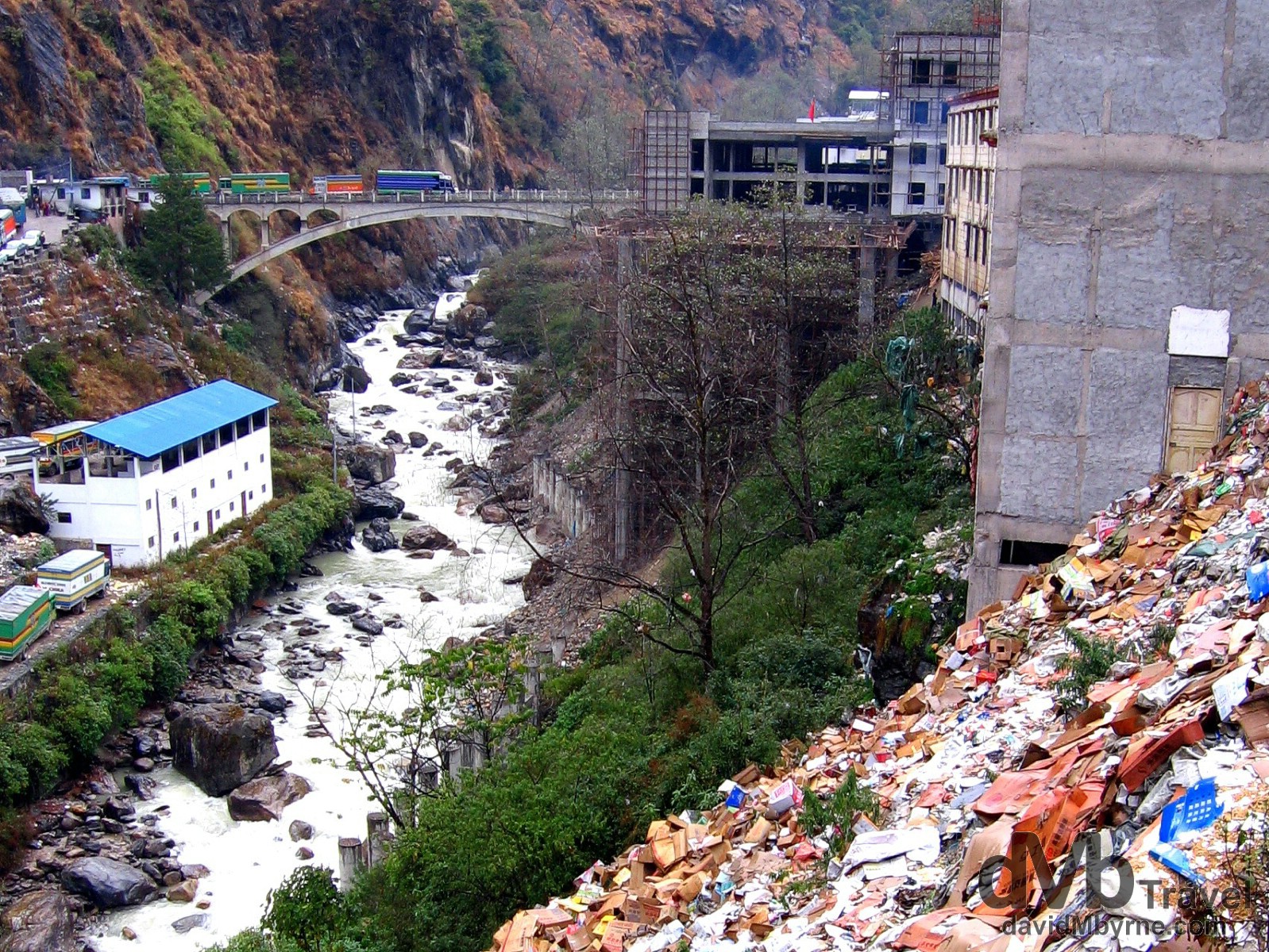
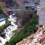
Day 4 || 14:36 || This picture was taken from the Tibetan/Chinese side of the border with the Nepalese border town of Kodari on the left bank of the gorge. In the distance is the so-called Friendship Bridge separating the two countries, the bridge we crossed on foot a few minutes after capturing this picture. From here it’s 120 kilometres (75 miles) to Kathmandu, the capital of Nepal. Oh and yes, that is rubbish in the foreground. Lots of it. At the Zhangum/Kodari China/Nepal border crossing in Tibet. March 3, 2008.
It was as busy, lawless and chaotic an area as one would expect any international border crossing in this part of the world to be. But it was also surprisingly hassle free for us 5 westerners and shortly after walking across the Friendship Bridge we were in Kodari, Nepal, and organising onward transport for the 4 hour drive to Kathmandu. I remember Pat proclaiming as we crossed the bridge that we were now “Nepal’s problem,” an utterance that for some reason comforted us both.
Day 4 Observations
• Breathing Easier
We began breathing easier once we got to the Chinese-Nepal border. Not because the danger of falling off the edge of a cliff into an bottomless gorge had subsided but because of the drop in altitude. It was pretty dramatic – 3,000 metres (10,000 ft) in the space of a few hours. It’s nice to know that with each breath we’re now getting our regular intake of oxygen (to supplement our regular intake of carbon monoxide).
• Counting Our Blessings
We’re glad, so glad, we weren’t born in Tibet. If the 4 day trip through Tibet has taught us anything, it’s how appreciative we are of the fact that we were born into a western society. Seeing the hardships of everyday life in Tibet really makes one crave for the so-called luxuries of home. Heating and hot water come to mind straight away but the poor Tibetans go without so much we take for granted – infrastructure, democracy, freedom of speech etc. Because of all the hardships they endure Pat reckons the Tibetans are “a broken race.”
• A Happier Lot
The Nepalese are a happy, more laid-back lot than the Tibetans (in much the same way we commented on observing the Tibetans being a happier lot than the Chinese). Maybe it’s because they realise, not to mention appreciate, that they are not Tibetans (or Indians for that matter). Dealing with the border officials – two young, jovial guys in casual clothes in a room immediately off the Friendship Bridge – was like dealing with a member of your own family and organising onward jeep transport to Kathmandu was not the exercise in negotiating it would have been in Tibet (or China). It made the long uncomfortable trip from the border to Kathmandu that bit more bearable. As did the jeep driver who tried to educate us on the ways of life in Nepal, his limited grasp of the English language aside. He told us that Nepal has “many, many rice” in response to a question on the numerous paddy fields we passed en route to Kathmandu. He wasn’t the only Nepali to make us smile on the drive to Kathmandu. At one of the military checks we passed through (yes, they have them here too) the boyish-looking soldier smiled at me in the back of the jeep before proclaiming “Welcome! Happy journey!”
• Colourful
In keeping with their happier demeanor, the Nepalese also seem to like to colour things, especially buses and trucks, the colours & hand-painted designs of which would lighten any mood.
• Lefties
This is more like it. Familiarity breeds comfort. The Nepalese drive on the left, which is the right (as in correct, not as in the opposite of left) side of the road.
• The Beer Index
It looks like things are cheaper in Nepal than in China and that prompted Pat to ask me in the jeep to Kathmandu how much I thought a beer will cost here in Nepal.
“Dunno lad, but we’ll soon be finding out.”
The cost of a beer is our gauge as to how cheap/expensive a country is. It works well and is as good a method as any, even better than the McDonald’s index we find. After all, (most) everywhere has beer but not everyplace, mercifully, has McDonald’s.
• GMT +5.75
Nepal is 5.75 hrs ahead of GMT. That’s a weird time zone, especially having come from China with its GMT +8 hrs time zone. Rumour has it Nepal chose that time zone to firmly distinguish itself as a separate country from India, its southern neighbour, which is GMT +5.50 hrs.
• Much Ado About Nothing
Just like the Y2K bug all those years ago, we needn’t have worried about altitude sickness during our Friendship Highway adventure. Granted we only peered at Everest, not scale it. But regardless, none of us suffered so much as a headache over the last 4 days.
The Friendship Highway || The Gallery
- The view of the surrounding Himalaya Mountains from the rooftop of the Jokhang Temple, Lhasa, Tibet. February 27th 2008.
- Young Buddhist Monks on the roof of the Jokhang Temple. Lhasa, Tibet. February 27th 2008.
- The Potala Palace as seen from People’s Park, Lhasa, Tibet. February 25th, 2008.
- A yak on the Kamba-la pass (15,800ft, 4,794m) of the Friendship Highway overlooking a frozen Yamdrok-tso lake, Tibet. February 29th 2008.
- A family portrait in front of a stupa, a dome-shaped shrine erected by Buddhists, at the foot of a peak on the Friendship Highway, Tibet. February 29th 2008.
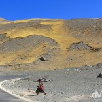
- On the Friendship Highway from Lhasa to Gyantse, Tibet. February 29th, 2008.
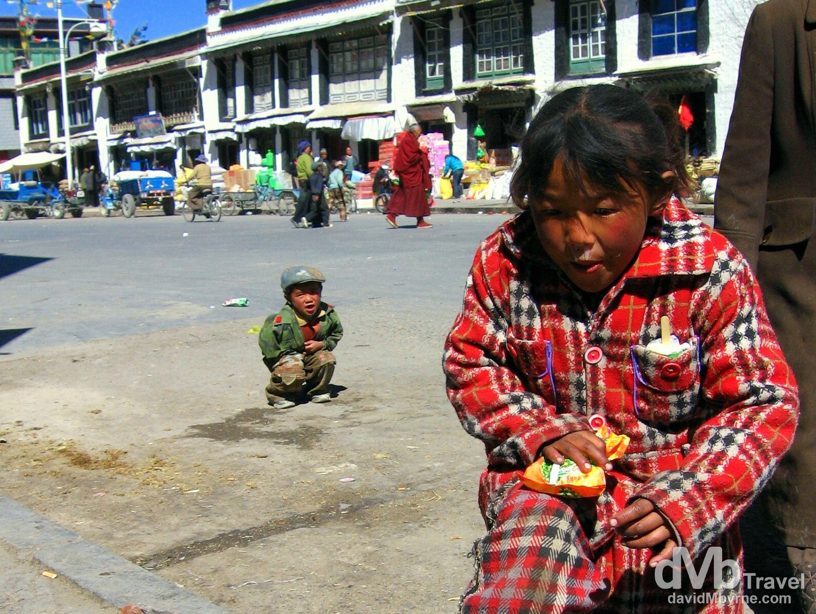
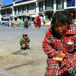
- Children on the streets of Shingtse, Tibet. March 1st, 2008.
- The Martyrs Monument atop Dzong, the Old Fort in Gyantse, Tibet, March 1st, 2008.
- Dzong, the Old Fort in Gyantse, Tibet. March 1st, 2008.
- For Sale on the streets of Shingtse, Tibet. March 1st, 2008.
- The view from atop Gyantse Old fort, Gyantse, Tibet. The fort was built to guard the Nyang-chu valley (seen here) that the town of Gyantse is strategically located in. The town is often referred to as the “Hero City” because of the resistance of 500 Tibetan soldiers to a British invasion in 1904. March 1st 2008
- Front seat reflection selfie on the Friendship Highway, Tibet. March 2, 2008.
- The 5,260-metre (17,257 ft) Gyatso La Pass, the highest point on The Friendship Highway connecting Lhasa, Tibet to the border with Nepal. March 2nd, 2008.
- First look at Everest from the 5115 kilometre marker (distance from Shanghai) on The Friendship Highway, Tibet. March 2nd, 2008.
- The glory of the Everest region as seen amidst prayer flags atop the Pang La pass, Tibet. The Rongbuk valley, which marks the approach to Everest Base Camp, is connected to the Friendship Highway via a long, bumpy & windy 90 kilometre dirt road. Some 20 kilometres off the highway one reaches the Pang la Pass from where the full glory of the Everest region is laid out before you & from where this picture was taken, showing 4 of the world’s 14 8,000+ metre peaks: Cho Oyu (8,153 m / 26,904 ft); Lhotse (8,501 m / 28,053 ft); Makalu (8,463 m / 27,927ft); & of course Everest (8,848 m / 29,028 ft), the triangular peak in the centre of the image. Pang La pass, Tibet. March 2nd 2008.
- Yurgya Hamlet on the bumpy road to Rongbuk Valley, Everest region, Tibet. March 2nd, 2008.
- A section of the Zhufeng Road connecting the Friendship Highway to the Rongbuk Valley, Tibet. March 2, 2008.
- Yurgya Hamlet as seen from the Zhufeng Road en route to the Rongbuk Valley, Tibet. March 2, 2008.
- A stupa of the Rongbuk Monastery in view of the north face of Mt. Everest. Tibet, China. March 2nd 2008
- A lone figure stands silhouetted in the Rongbuk Valley in view of the north face of Mount Everest, Everest region, Tibet. March 2nd, 2008.
- Amdo Hotel room, Tingri, Tibet. March 3rd, 2008.
- Early morning in Tingri on the Friendship Highway in Tibet. March 3rd, 2008.
- Trying to keep warm pre-departure in the courtyard of the Amdo Hotel, Tingri, Tibet. March 3rd, 2008.
- Approaching the end of the Tibetan Plateau en route to the border with Nepal. The Friendship Highway, Tibet. March 3rd, 2008.
- On the 5,050-metre (16,650 ft) Lalung La Pass on the Friendship Highway from Tingri to Zhangmu, Tibet. March 3rd 2008
- Himalayan vista on the 5,050-metre (16,650 ft) Lalung La Pass on the Friendship Highway, Tibet. March 3rd, 2008.
- A part of the road near the end of the Friendship Highway approaching the Tibetan town of Zhangmu on the border with Nepal. March 3rd 2008
- The Friendship Bridge at the Zhangum, China (right) / Kodari, Nepal (left) border crossing. March 3rd 2008

