Sterling Highway, Alaska
Driving The Picturesque 350 kilometre Route From Homer To Anchorage Through Alaska’s Kenai Peninsula
Buried. Abandoned in the village of Ninilchik off the Sterling Highway, Kenai Peninsula, Alaska. March 18, 2013
The drive from Homer to Anchorage on Alaska’s Kenai Peninsula is a long one – some 350 kilometres (220 miles), 150 kilometres (90 miles) longer then the drive I did on my first day in Alaska, the All-American Seward Highway from Anchorage to Seward. 230 of those aforementioned 350 kilometres is made up of the Sterling Highway, the rest the Seward Highway. I’ve just completed the drive from Homer and while it yielded few surprises (I was, after all, retracing my steps back to Anchorage) it did offer up ample photo opportunities. Here’s some of what I captured today on the drive.
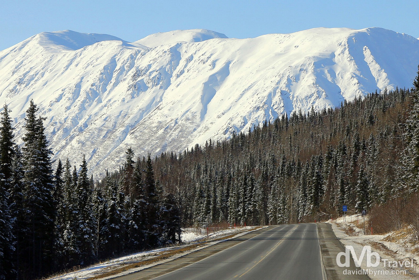
Driving the Sterling Highway, Kenai Peninsula, Alaska, USA. March 18, 2013.
Sterling Highway Interactive Route Map
Mount Redoubt from Anchor Point
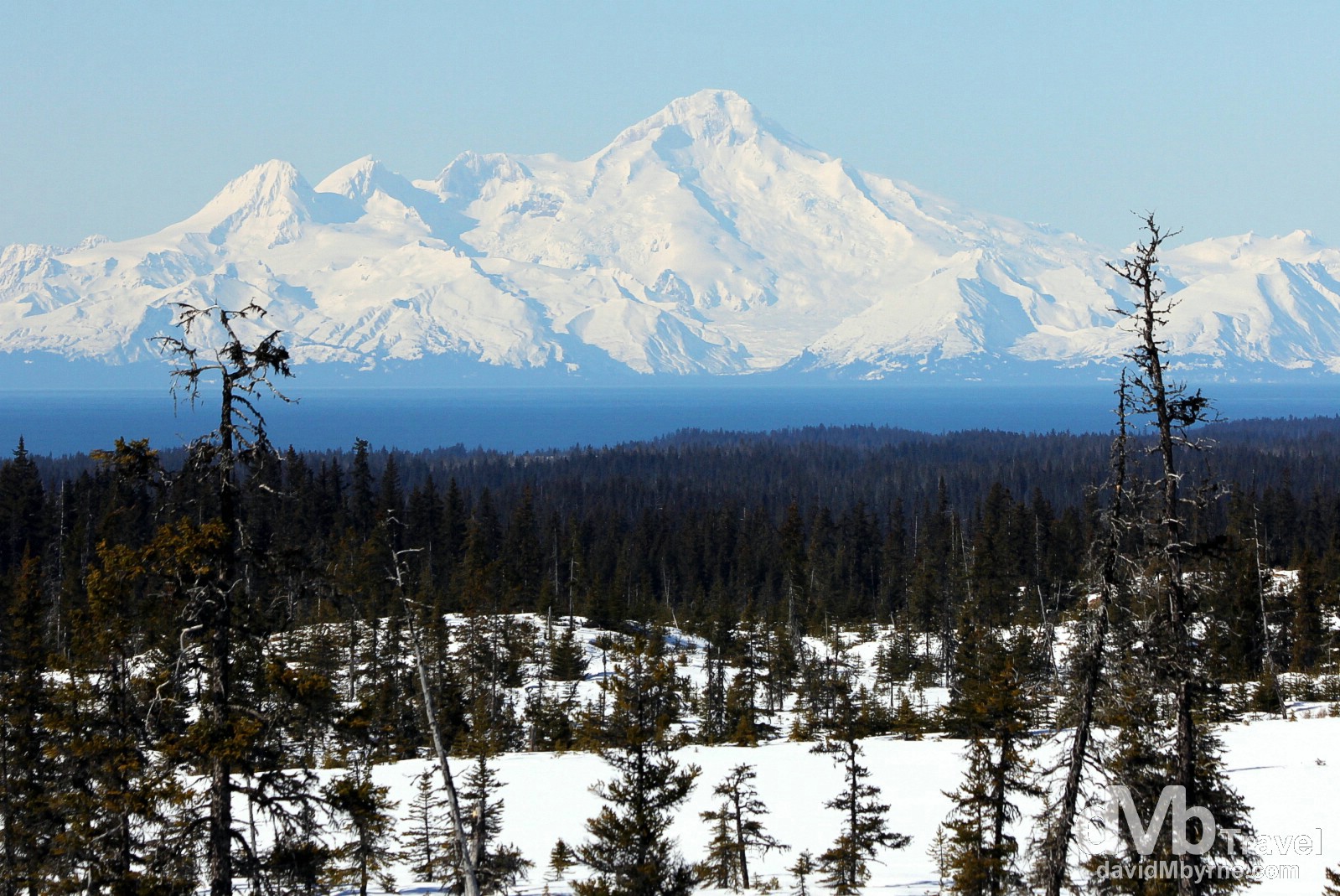
Mount Redoubt as seen from the Sterling Highway near Anchor Point. At 3,100 metres (10,197 ft), Mount Redoubt, an active cone-shaped stratovolcano, is the tallest peak in the largely volcanic Aleutian Range of Lake Clarke National Park, an area of road-less, untamed wilderness across Cook Inlet from the Kenai Peninsula, approximately 100 kilometres (60 miles) as the crow flies from where I captured this picture. Part of the Pacific Ring of Fire, Mt Redoubt has been active for millennia & it has has erupted five times since 1900: in 1902, 1922, 1966, 1989 and 2009. The eruption in 1989 was especially noteworthy – volcanic ash spewed to a height of 14 kilometres (45,000 ft) causing considerable disruption to air traffic – a Boeing 747 aircraft was caught in its plume but the flight managed to land safely at Anchorage. Views of the peaks across the Cook Inlet are constant for most of the drive along the coastal section of the Sterling Highway with photo opportunities aplenty. I just happened to capture the above image at Anchor Point, not too far out of Homer. Kenai Peninsula, Alaska, USA. March 18, 2013.
Ninilchik
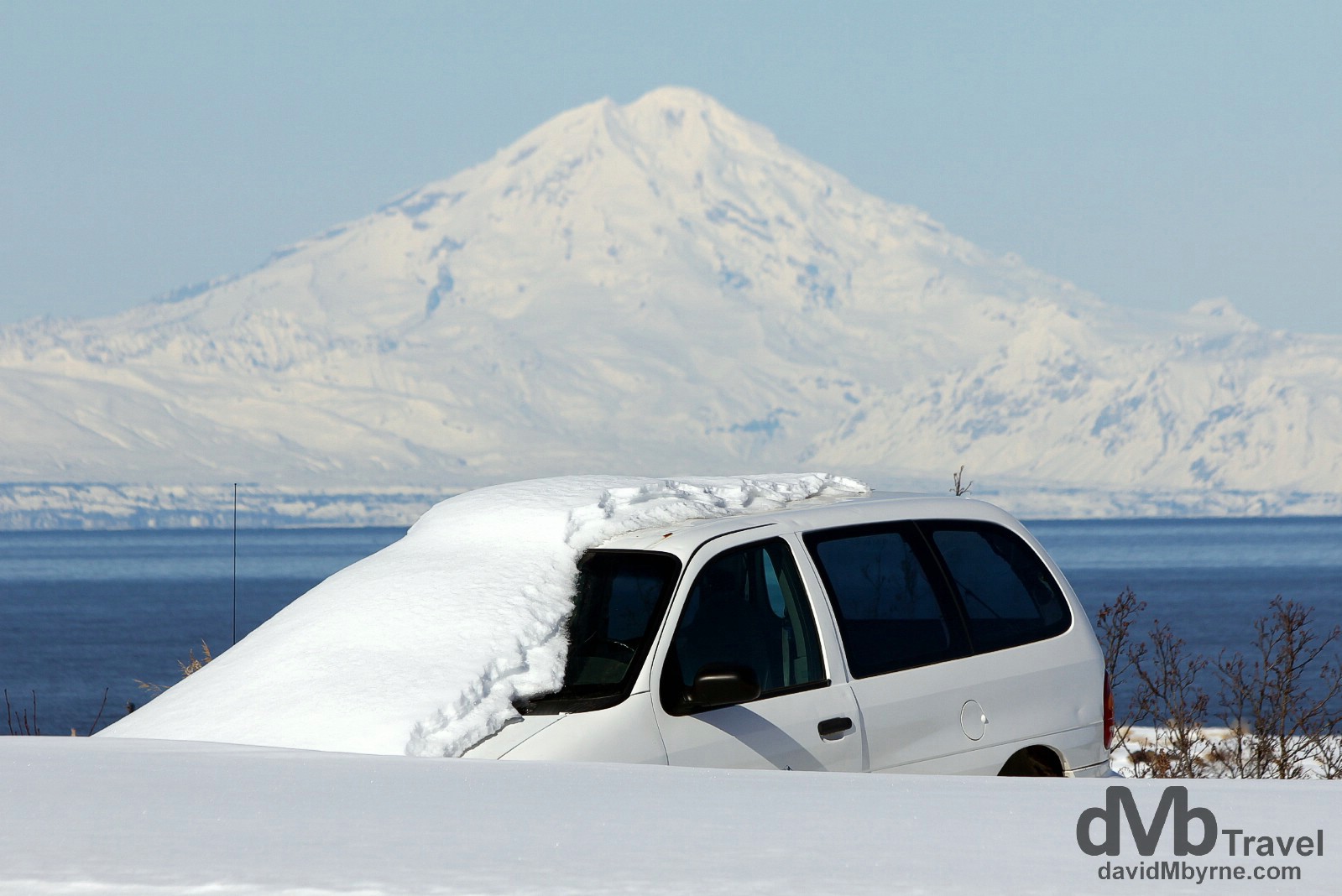
Abandoned in the village of Ninilchik off the Sterling Highway. The village of Ninilchik, a very quick diversion off the Sterling Highway, was founded by Creoles, Russians & Aleuts at the turn of the 19th Century. It has a population of less than 1,000 and when I drove through it seemed deserted – there has been an eerie absence of people in Alaska in general. Again it offered great views across the Cook Inlet of the Gulf of Alaska to the Mount Redoubt and the other peaks of Lake Clarke National Park. Kenai Peninsula, Alaska, USA. March 18, 2013.
– Information signage posted in the sleepy village of Ninilchik
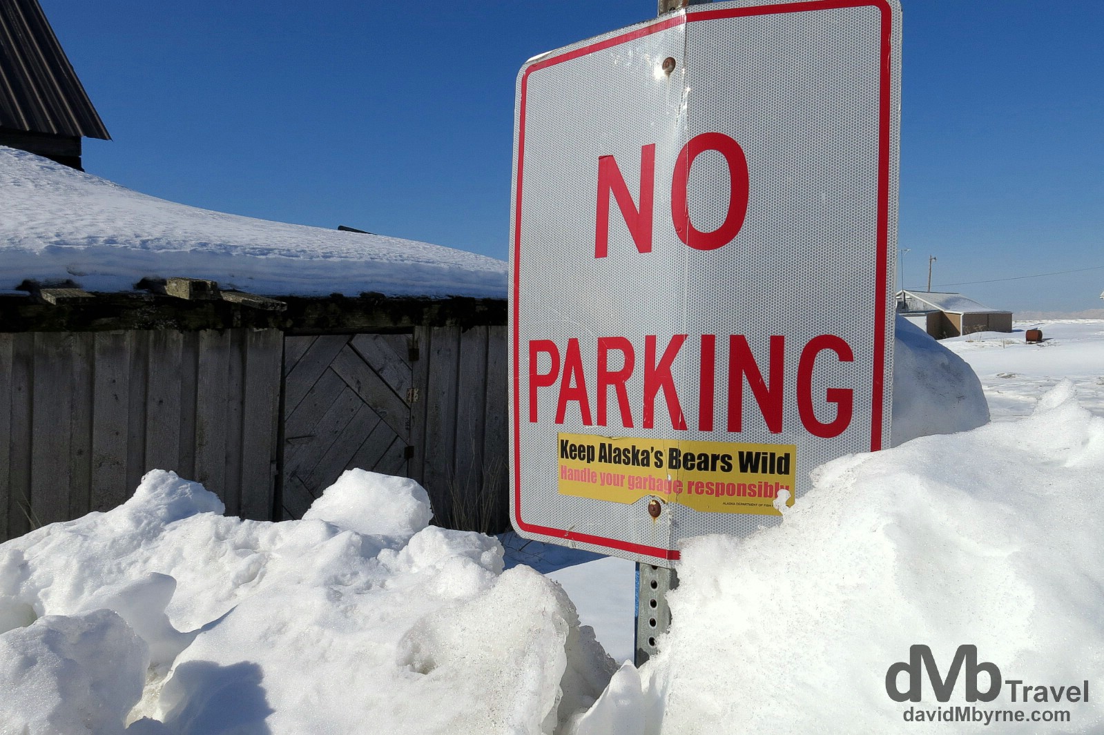
‘Keep Alaska’s Bears Wild’. I like this. Ninilchik on the Kenai Peninsula, Alaska, USA. March 18, 2013.
Kenai National Wildlife Refuge
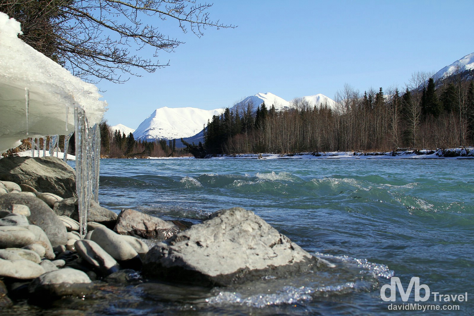
Ice hangs from a snowy overhang by a river beside the Sterling Highway near Kenai National Wildlife Refuge on the Kenai Peninsula, Alaska, USA. March 18, 2013.
Tern Lake – Highway Junction
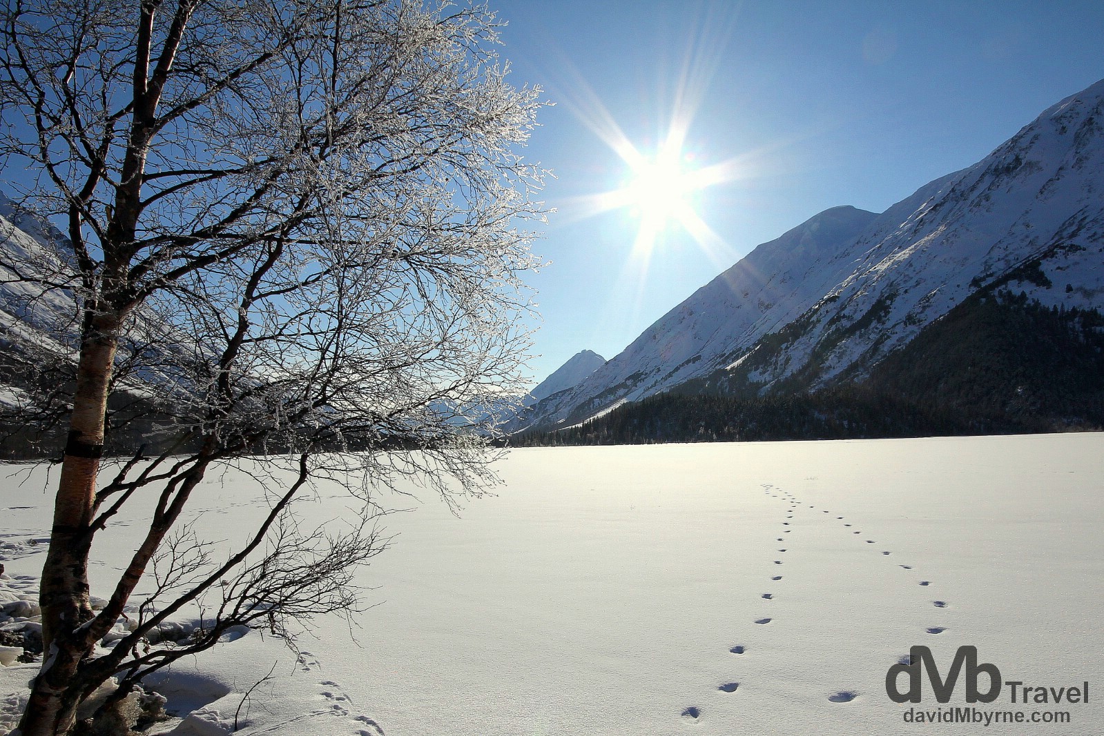
Tern Lake at the junction of the Sterling & Seward Highways. This is the official start/end of the Sterling Highway – the rest of the 140-kilometre / 90-mile trip to Anchorage is on the Seward Highway. I’m not too sure who or what created the prints in the snow seen here – they weren’t human prints – but they added a nice touch to the already special scene. Kenai Peninsula, Alaska, USA. March 18, 2013.
Snowmobile || The Great Outdoors
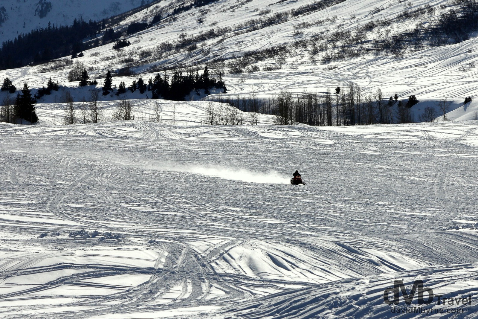
Snowmobile action of the Seward Highway, Kenai Peninsula, Alaska, USA. March 18, 2013.
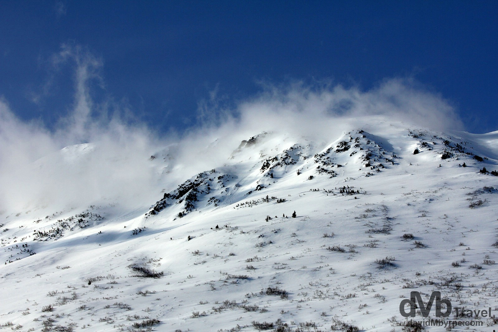
Mountain scenery as seen from the Seward Highway en route to Anchorage. Kenai Peninsula, Alaska. March 18, 2013
Roadside Vistas || Lookout Sign

Roadside signage provides advanced warning for upcoming scenic viewpoints. I must have hit most of these scenic vista points while driving both the Seward & Sterling Highways on Alaska’s Kenai Peninsula. This particular sign is on the Seward Highway not too far from my destination of Anchorage. Alaska, USA. March 18, 2013.