Day 4 || March 3, 2008
Location || Kathmandu, Nepal ( )
)
Altitude || 1,337 metres (4,400 ft)
Day 4 Hours Driving || 10
Day 4 Highs ||The Lalung La Pass & our welcome to Nepal
Day 4 Low || 10 (more) hours inside a jeep
Day 4 Route Information || Tingri to Zhangmu/Kodari
Continuing southwest, the highway climbs over Lalung La (5,050 m / 16,570 ft) and crosses shortly after the Tong La (also known as Thong La, Yakri Shung La or Yakrushong La) (5,150 m / 16,900ft), which marks the water divide between the Bum-Chu / Arun and the (Matsang Tsangpo / Sun Kosi) rivers. The Friendship Highway then descends along the Matsang Tsangpo through Nyalam, then more steeply through a canyon to Zhangmu. The road ends at the Friendship Bridge on the China-Nepal border at a mere 1,750 m / 5,740ft elevation. The continuation of the road between the border town of Kodari to Kathmandu is named Arniko Rajmarg.
Day 4 Recap
We made it through the night. Again I credit layers and the human will for survival. However, my watch wasn’t so lucky. I woke this morning to find it dead. 9:05 a.m. on March 3, 2008, was when it died. That was mere minutes after I checked it having been raised from our slumber by a chorus of stray dogs patrolling Tingri’s main/only street. Maybe its time was up (no pun intended) or maybe, & as was more likely the case, it was the cold in the room that killed my timepiece, the same cold that froze my contact lens solution to a block and depleted the power in my digital camera batteries. Burr.
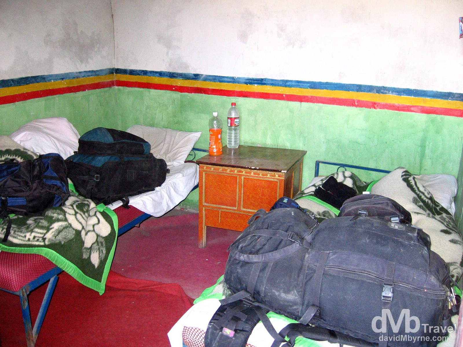
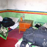
Day 4 || 09:32 || Home away from home. Our Amdo Hotel room. It looked bad in the dark of night and even worse in the light of day. That said, we slept surprisingly well. Exhaustion will do that I guess. Tingri (![]() ), Tibet. March 3, 2008.
), Tibet. March 3, 2008.
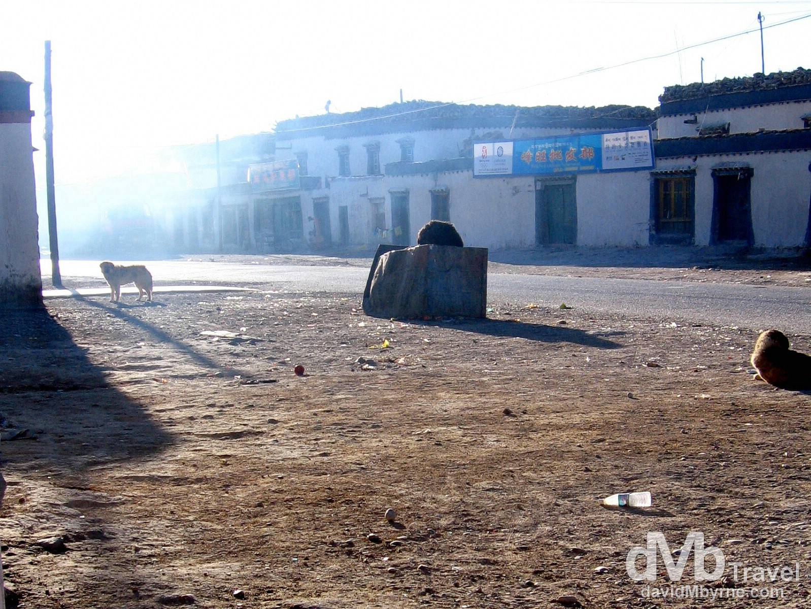
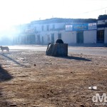
Day 4 || 09:40 || Early morning in Tingri, home to few people & many, many stray dogs. Tingri, Tibet. March 3, 2008.
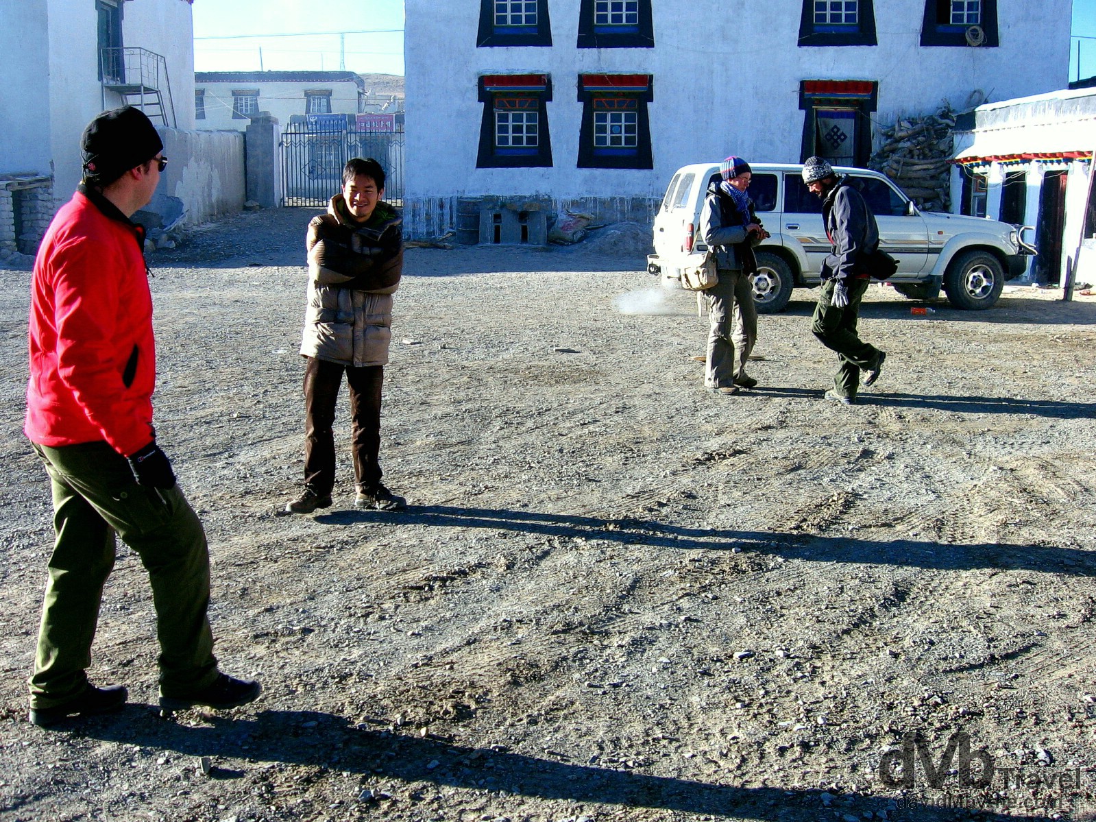
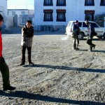
Day 4 || 09:50 || Trying to keep warm pre-departure in the courtyard of the Amdo Hotel, Tingri, Tibet. March 3, 2008.
Nepal Bound
Having endured the night we endured we weren’t too fond of hanging around Tingri, as nondescript a town as I have ever seen. Deeming the jeep the warmest place we could probably be, we passed on breakfast and by 10 a.m. we were back on the road, this time for the last time, heading for border with Nepal. Five to six hours we were told the trip would take. Five and one-half hours is what took & we felt every minute of those 5 1/2 hours. The Chinese haven’t yet gotten around to paving the final stretch of the Friendship Highway from Tingri to Zhangmu on the Tibet-Nepal border. So, and once again, we spent the day bouncing around the inside of a no-spare-tire Toyota Land Cruiser feeling like crumbs in a biscuit tin. But discomfort aside the trip was, of course, a splendid spectacle.
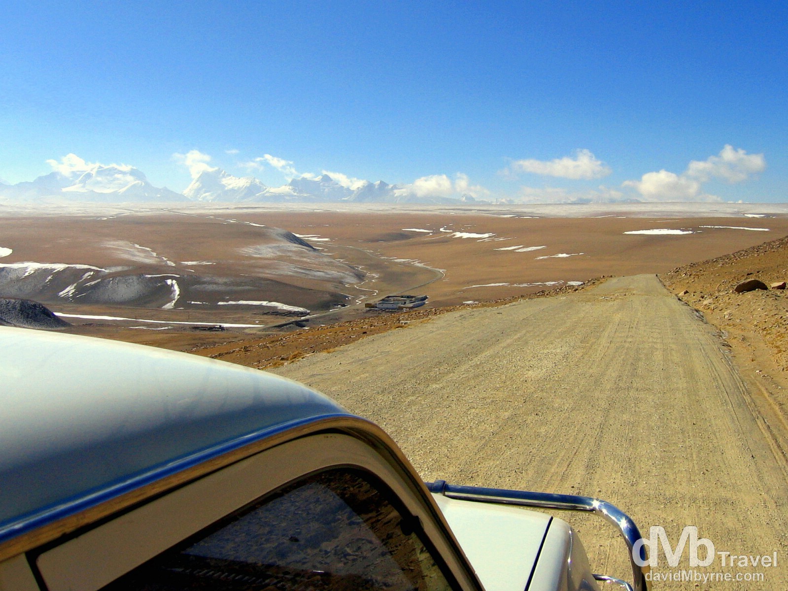
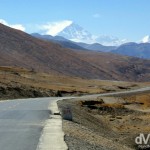
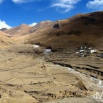
Day 4 || 11:44 || Almost 2 hours into our 5 1/2 hours of Day 4 jeep travel and we are approaching the end/edge of the Tibetan Plateau & the end of the stunning Himalayan vistas. But as it turned out we’d left the best vista for last. The Friendship Highway, Tibet. March 3, 2008.
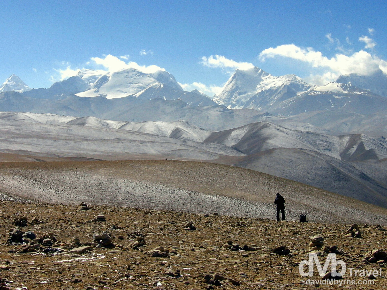
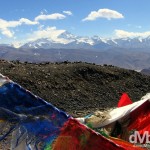
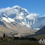
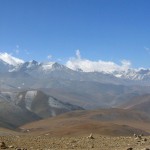
Day 4 || 12:06 || Not long after taking the previous picture we arrived at the 5,050-metre (16,650 ft) Lalung La Pass. We spent quite a while here savouring the scene in front of us, all the while in agreement that yes, the vista afforded by this pass was the best vista of the whole trip. The distant Himalayas from the Lalung Pass, Friendship Highway, Tibet. March 3, 2008.
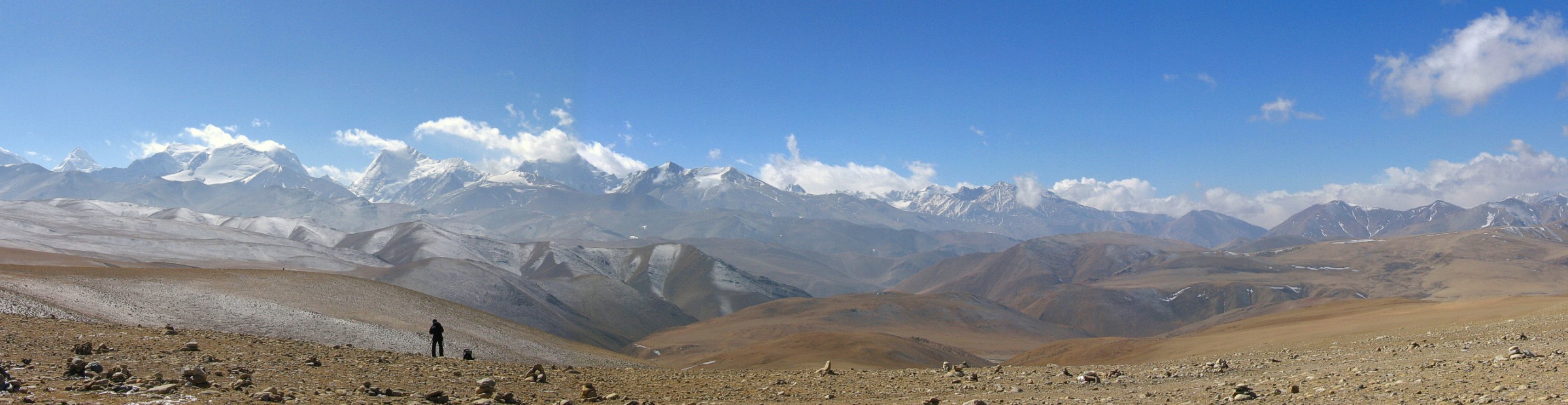
Day 4 || 12:06 || Himalayan vista on the 5,050-metre (16,650 ft) Lalung La Pass on the Friendship Highway en route to Zhangmu, Tibet. March 3, 2008
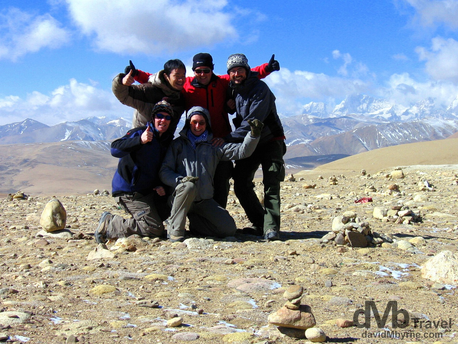
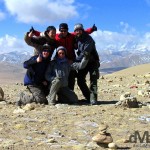
Day 4 || 12:09 || Trip buddies. Guigui, Oliver, Ricky, Pat & I on the 5,050-metre (16,650 ft) Lalung La Pass on the Friendship Highway en route to Zhangmu, Tibet. March 3, 2008
The Descent || 5,050 metres (16,650 ft) to 1,750 metres (5,740 ft)
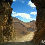
From the Lalung La Pass it was downhill the whole way to Zhangmu, the border town with Nepal & the end of the Friendship Highway proper. As we descended from the Tibetan Plateau the scenery changed dramatically & we quickly said goodbye to the bright, sunny, dry weather and the barren, rocky, dusty landscape we’d become accustomed to over the past 3 days. We entered a massive, damp, humid gorge alive with vegetation (trees and stuff) and as soon as we did it clouded over and snowed heavily, making the twisty and dramatic mud & gravel road we were traveling on that much more twisty and that much more dramatic. It was a precarious section of the trip to say the least, clinging as we were to the side of a cliff as we descended further and further into the wet gorge, one we couldn’t see the bottom of. We spent the couple of hours alone on one 33-kilometre stretch of cliff-hugging road trying as we descended to peer out of the jeep into the abyss below. As we did we couldn’t help but wonder exactly how far down the valley floor was and that if today – March 3, 2008 – was indeed the day we were all going to die. Any thoughts of enjoying what lay ahead on this trip were put on hold until we successfully navigated the “precipice” (Pat’s word) we found ourselves in.
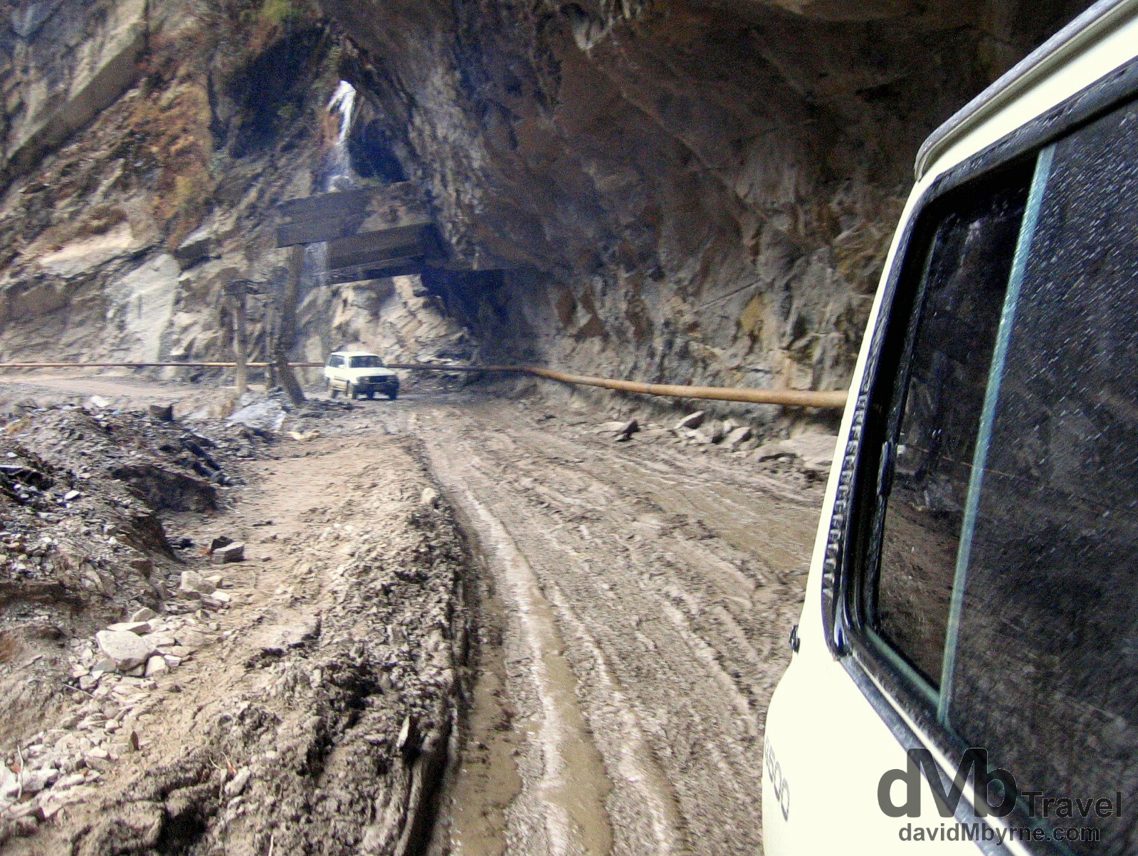
Day 4 || 14:31 || A part of the road near the end of the Friendship Highway approaching the Tibetan town of Zhangmu on the border with Nepal. March 3, 2008.
Zhangmu || The End/Start Of The Friendship Highway
We eventually made it to Zhangmu, a Chinese-Tibetan-Nepalese hybrid border town that clings gamely to the side of the gorge we had finally descended to the bottom of. It was raining & visibility was poor but from what we could see of Zhangmu it looked like a shambolic collection of tin shacks, construction sites, wooden huts, shops, brothels (we assume) & border-related offices. According to our guidebook the town is a “great place with a Wild-West-comes-to-Asia atmosphere”. Wild West indeed. We didn’t think it was such a “great place” & having come this far on this day we were keen to keep going, as quickly as possible, for Nepal. So shortly after saying goodbye to our driver (we commiserated with him for having to make the return trip to Lhasa) we hired a car to take us the remaining 8 kilometres to the China-Nepal border proper, another 8 kilometres of dramatic, cliff-hugging road, the end of which is marked by the so-called Friendship Bridge, the actual border crossing between China/Tibet and Nepal.
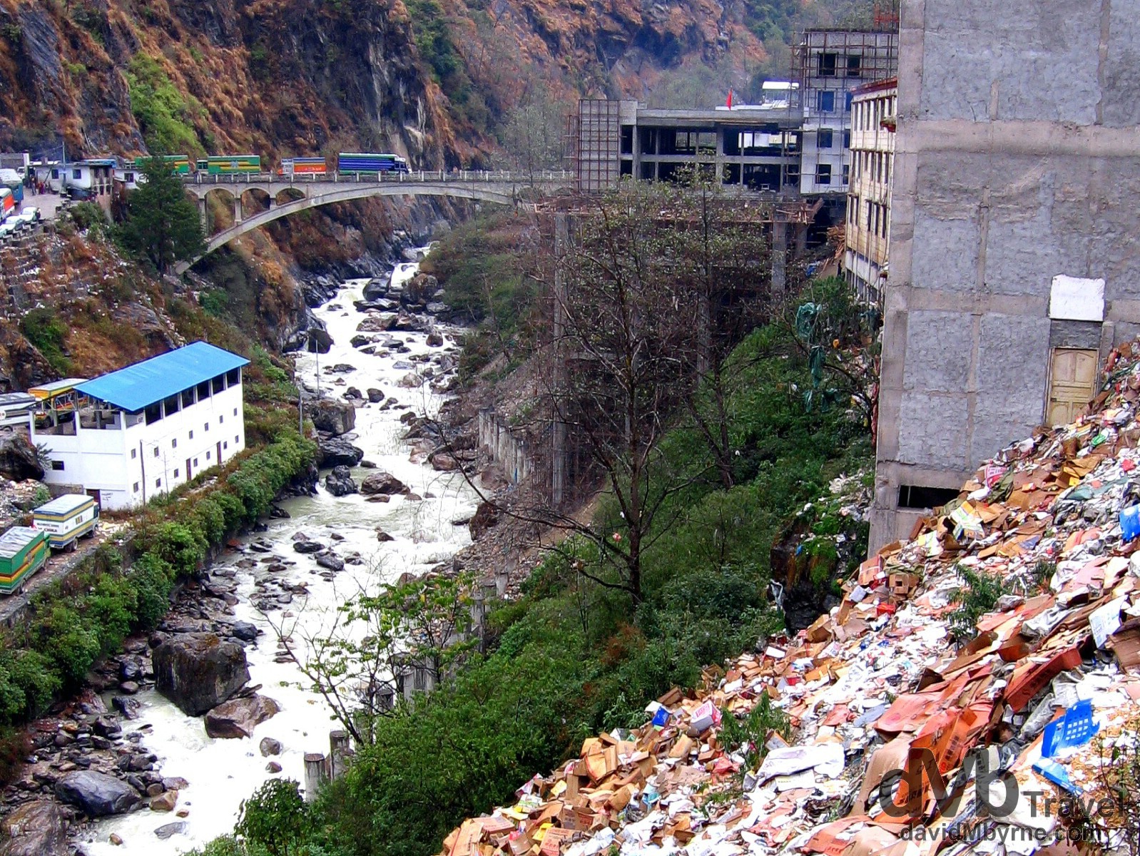
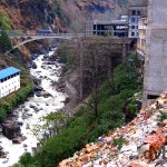
Day 4 || 14:36 || This picture was taken from the Tibetan/Chinese side of the border with the Nepalese border town of Kodari on the left bank of the gorge. In the distance is the so-called Friendship Bridge separating the two countries, the bridge we crossed on foot a few minutes after capturing this picture. From here it’s 120 kilometres (75 miles) to Kathmandu, the capital of Nepal. Oh and yes, that is rubbish in the foreground. Lots of it. At the Zhangum/Kodari China/Nepal border crossing in Tibet. March 3, 2008.
It was as busy, lawless and chaotic an area as one would expect any international border crossing in this part of the world to be. But it was also surprisingly hassle free for us 5 westerners and shortly after walking across the Friendship Bridge we were in Kodari, Nepal, and organising onward transport for the 4 hour drive to Kathmandu. I remember Pat proclaiming as we crossed the bridge that we were now “Nepal’s problem,” an utterance that for some reason comforted us both.
Day 4 Observations
• Breathing Easier
We began breathing easier once we got to the Chinese-Nepal border. Not because the danger of falling off the edge of a cliff into an bottomless gorge had subsided but because of the drop in altitude. It was pretty dramatic – 3,000 metres (10,000 ft) in the space of a few hours. It’s nice to know that with each breath we’re now getting our regular intake of oxygen (to supplement our regular intake of carbon monoxide).
• Counting Our Blessings
We’re glad, so glad, we weren’t born in Tibet. If the 4 day trip through Tibet has taught us anything, it’s how appreciative we are of the fact that we were born into a western society. Seeing the hardships of everyday life in Tibet really makes one crave for the so-called luxuries of home. Heating and hot water come to mind straight away but the poor Tibetans go without so much we take for granted – infrastructure, democracy, freedom of speech etc. Because of all the hardships they endure Pat reckons the Tibetans are “a broken race.”
• A Happier Lot
The Nepalese are a happy, more laid-back lot than the Tibetans (in much the same way we commented on observing the Tibetans being a happier lot than the Chinese). Maybe it’s because they realise, not to mention appreciate, that they are not Tibetans (or Indians for that matter). Dealing with the border officials – two young, jovial guys in casual clothes in a room immediately off the Friendship Bridge – was like dealing with a member of your own family and organising onward jeep transport to Kathmandu was not the exercise in negotiating it would have been in Tibet (or China). It made the long uncomfortable trip from the border to Kathmandu that bit more bearable. As did the jeep driver who tried to educate us on the ways of life in Nepal, his limited grasp of the English language aside. He told us that Nepal has “many, many rice” in response to a question on the numerous paddy fields we passed en route to Kathmandu. He wasn’t the only Nepali to make us smile on the drive to Kathmandu. At one of the military checks we passed through (yes, they have them here too) the boyish-looking soldier smiled at me in the back of the jeep before proclaiming “Welcome! Happy journey!”
• Colourful
In keeping with their happier demeanor, the Nepalese also seem to like to colour things, especially buses and trucks, the colours & hand-painted designs of which would lighten any mood.
• Lefties
This is more like it. Familiarity breeds comfort. The Nepalese drive on the left, which is the right (as in correct, not as in the opposite of left) side of the road.
• The Beer Index
It looks like things are cheaper in Nepal than in China and that prompted Pat to ask me in the jeep to Kathmandu how much I thought a beer will cost here in Nepal.
“Dunno lad, but we’ll soon be finding out.”
The cost of a beer is our gauge as to how cheap/expensive a country is. It works well and is as good a method as any, even better than the McDonald’s index we find. After all, (most) everywhere has beer but not everyplace, mercifully, has McDonald’s.
• GMT +5.75
Nepal is 5.75 hrs ahead of GMT. That’s a weird time zone, especially having come from China with its GMT +8 hrs time zone. Rumour has it Nepal chose that time zone to firmly distinguish itself as a separate country from India, its southern neighbour, which is GMT +5.50 hrs.
• Much Ado About Nothing
Just like the Y2K bug all those years ago, we needn’t have worried about altitude sickness during our Friendship Highway adventure. Granted we only peered at Everest, not scale it. But regardless, none of us suffered so much as a headache over the last 4 days.
The Friendship Highway Gallery
The best of the images from the last 4 days spent traversing the Friendship Highway.
-
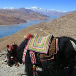
- A yak on the Kamba-la pass (15,800ft, 4,794m) of the Friendship Highway overlooking a frozen Yamdrok-tso lake, Tibet. February 29th 2008.
-
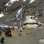
- A family portrait in front of a stupa, a dome-shaped shrine erected by Buddhists, at the foot of a peak on the Friendship Highway, Tibet. February 29th 2008.
-
- On the Friendship Highway from Lhasa to Gyantse, Tibet. February 29th, 2008.
-
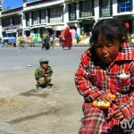
- Children on the streets of Shingtse, Tibet. March 1st, 2008.
-
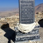
- The Martyrs Monument atop Dzong, the Old Fort in Gyantse, Tibet, March 1st, 2008.
-
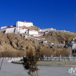
- Dzong, the Old Fort in Gyantse, Tibet. March 1st, 2008.
-

- For Sale on the streets of Shingtse, Tibet. March 1st, 2008.
-
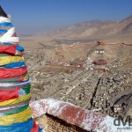
- The view from atop Gyantse Old fort, Gyantse, Tibet. The fort was built to guard the Nyang-chu valley (seen here) that the town of Gyantse is strategically located in. The town is often referred to as the “Hero City” because of the resistance of 500 Tibetan soldiers to a British invasion in 1904. March 1st 2008
-
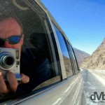
- Front seat reflection selfie on the Friendship Highway, Tibet. March 2, 2008.
-
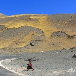
- The 5,260-metre (17,257 ft) Gyatso La Pass, the highest point on The Friendship Highway connecting Lhasa, Tibet to the border with Nepal. March 2nd, 2008.
-
- First look at Everest from the 5115 kilometre marker (distance from Shanghai) on The Friendship Highway, Tibet. March 2nd, 2008.
-
- The glory of the Everest region as seen amidst prayer flags atop the Pang La pass, Tibet. The Rongbuk valley, which marks the approach to Everest Base Camp, is connected to the Friendship Highway via a long, bumpy & windy 90 kilometre dirt road. Some 20 kilometres off the highway one reaches the Pang la Pass from where the full glory of the Everest region is laid out before you & from where this picture was taken, showing 4 of the world’s 14 8,000+ metre peaks: Cho Oyu (8,153 m / 26,904 ft); Lhotse (8,501 m / 28,053 ft); Makalu (8,463 m / 27,927ft); & of course Everest (8,848 m / 29,028 ft), the triangular peak in the centre of the image. Pang La pass, Tibet. March 2nd 2008.
-
- Yurgya Hamlet on the bumpy road to Rongbuk Valley, Everest region, Tibet. March 2nd, 2008.
-
- A section of the Zhufeng Road connecting the Friendship Highway to the Rongbuk Valley, Tibet. March 2, 2008.
-
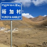
- Yurgya Hamlet as seen from the Zhufeng Road en route to the Rongbuk Valley, Tibet. March 2, 2008.
-
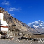
- A stupa of the Rongbuk Monastery in view of the north face of Mt. Everest. Tibet, China. March 2nd 2008
-
- A lone figure stands silhouetted in the Rongbuk Valley in view of the north face of Mount Everest, Everest region, Tibet. March 2nd, 2008.
-
- Amdo Hotel room, Tingri, Tibet. March 3rd, 2008.
-
- Early morning in Tingri on the Friendship Highway in Tibet. March 3rd, 2008.
-
- Trying to keep warm pre-departure in the courtyard of the Amdo Hotel, Tingri, Tibet. March 3rd, 2008.
-
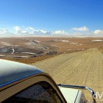
- Approaching the end of the Tibetan Plateau en route to the border with Nepal. The Friendship Highway, Tibet. March 3rd, 2008.
-
- On the 5,050-metre (16,650 ft) Lalung La Pass on the Friendship Highway from Tingri to Zhangmu, Tibet. March 3rd 2008
-
- Himalayan vista on the 5,050-metre (16,650 ft) Lalung La Pass on the Friendship Highway, Tibet. March 3rd, 2008.
-
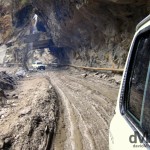
- A part of the road near the end of the Friendship Highway approaching the Tibetan town of Zhangmu on the border with Nepal. March 3rd 2008
-
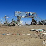
- The Friendship Bridge at the Zhangum, China (right) / Kodari, Nepal (left) border crossing. March 3rd 2008