Death Valley National Park
Hottest. Driest. Lowest. A Deserted Below-Sea-Level Basin In Eastern California. Officially The hottest place On Earth, & A Damn Photographic One At That
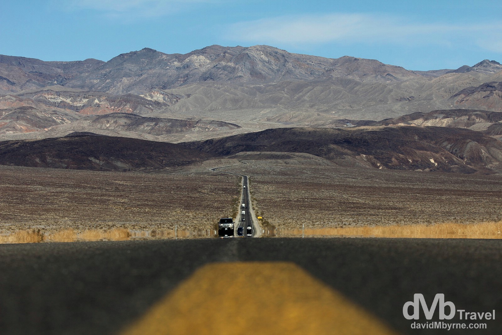
Traffic & heat shimmer on State Route 190 running through Death Valley National Park, California. April 3, 2013
Hottest. Driest. Lowest. That’s how the U.S. Department of the Interior’s National Park Service describes Death Valley National Park, a deserted below-sea-level basin that is part of the Mojave Desert in eastern California and south-western Nevada. The mercury here hit a toasty 134°f/57°c on July 10, 1913, still the hottest air temperature ever recorded on a property sited & maintained thermometer anywhere in the world. I drove through the park – from west to east – en route from Sequoia National Park to Las Vegas as part of a wider 8-day US Southwest road trip, meaning that in the space of less than a day I went from being wrapped up against the cold at 2,133 metres (7,000 ft) among the massive trees of Sequoia’s Giant Forest to feeling the heat near the lowest point in North America, Death Valley’s Badwater Basin at 86 metres (282 ft) below sea level. The 130 kilometre (80 mile) west-to-east drive through the park on State Route 190 didn’t take very long, but would have been much quicker if not for the numerous photographic surprises that sprung from amid all that arid desolation. Yes, I never expected Death Valley to be the photographic treat it proved to be.
– Jacob Twist
Father Crowley Vista Point
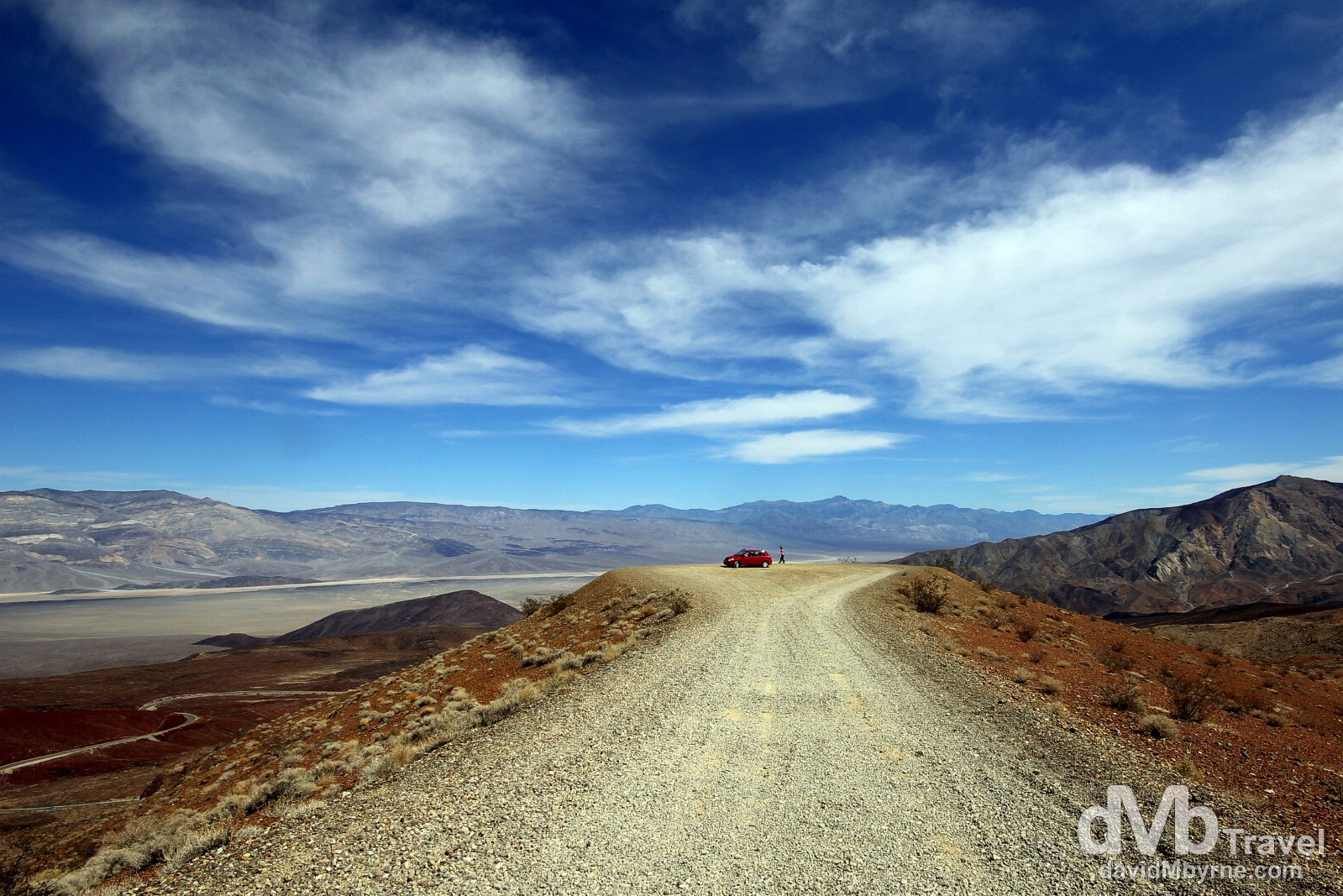
Overlooking Rainbow Canyon from the Father Crowley Vista Point, just beyond the location of a newly constructed parking near the western entrance/exit to the park and where a paved road ends. The overlook affords great views down into Death valley’s Rainbow Canyon in the distance, a nice introduction to the park if entering from the west. Off State Route 190 in Death Valley National Park (![]() ), California, USA. April 3, 2013.
), California, USA. April 3, 2013.
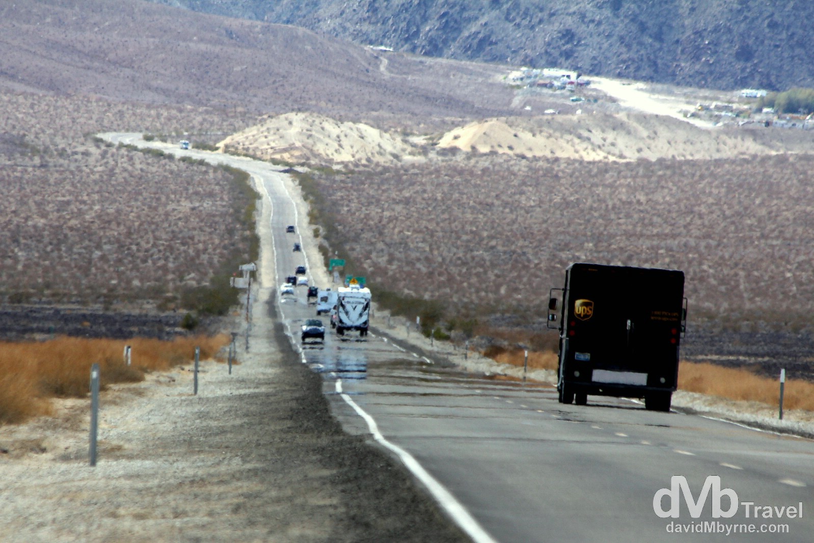
Traffic and heat shimmer on State Route 190 running through Death Valley National Park. This is what a road in this arid & desolate part of the world is like – long & full of mundaneness. Enjoyable, photogenic mundaneness. In the distance (top-right of frame) is the small historic village of Stovepipe Wells where I had just left. The village, a 40-minute, 65-kilometre (40 mile) drive from the Father Crowley Vista Point, started life as a small way-station in 1906, when it was nothing more than a tent settlement for miners. It wasn’t until 1925 that construction began on a hotel and scenic toll road through the valley, marking the beginning of the transition of the village from a mining community into the popular tourist destination it is today. Death Valley National Park, California, USA. April 3, 2013.
Hitting the road for Death Valley & Vegas! Day 394 http://t.co/D6yEwUlC0S #travel #lasvegas #deathvalley #roadtrip #nevada
— davidMbyrne.com (@ByrneDavidM) April 3, 2013
What’s In A Name?
Death Valley was given its forbidding name by a group of pioneers lost here in the winter of 1849-1850. Even though, & insofar as is known, only one of the group died here they all assumed that this valley would be their grave. Hence the name. It’s a place known around the world for its unique landscapes and its geological beauty, and despite being the picturesque version of some deserted, Martian landscape or a hotter, drier version of Hell, Death Valley actually contains some of the most amazing plant and animal life on the planet.
Mesquite Flat Sand Dunes
While boasting some of the most amazing plant and animal life on the planet, Death Valley also has some pretty big sand dunes, something I wasn’t expecting to see on my drive through the park.
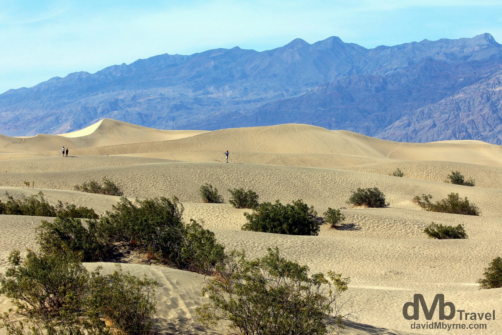
The 30-metre-high Mesquite Dunes are the smaller of two areas of sand dunes found in the 3.4 million acre, 14,000 km² park, but the only ones easily accessible laying as they are just off State Route 190 outside the village of Stovepipe Wells. Mesquite Flat Sand Dunes, Death Valley National Park, California, USA. April 3, 2013.
Zabriskie Point
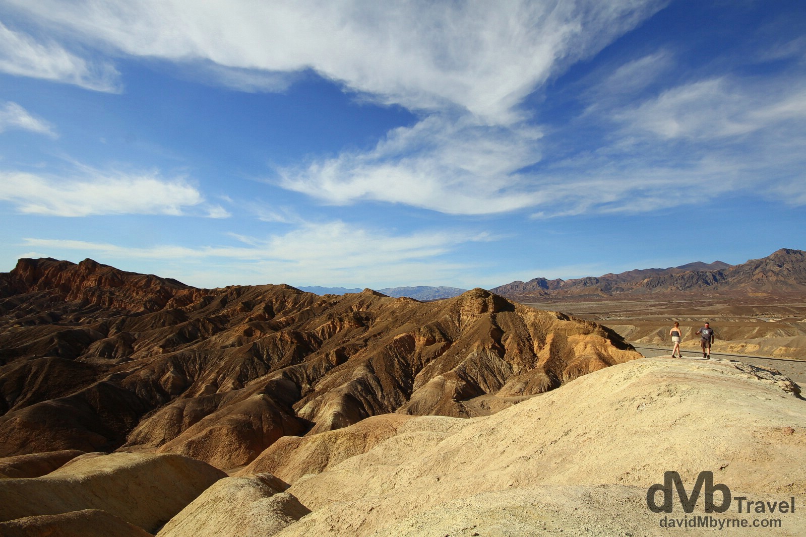
The odd geologic formations & weathered canyons of Death Valley National Park are great for photography, especially in the early morning or late evening (the above picture was captured in mid-afternoon). The most popular area of the park for photographers is here at Zabriskie Point, just east of Furnace Creek near the eastern Nevada entrance/exit to the park and some 2 hours by car from Las Vegas. The vista here, again just a short walk off State Route 190, is of a maze of wildly eroded and vibrant coloured badlands, one the band U2 particularly liked – it is here they shot the cover photo for their album The Joshua Tree. Death Valley National Park, California, USA. April 3, 2013.
Playing photography chicken on State Route 190 en route to Las Vegas, Nevada. Death Valley National Park, California, USA. April 4, 2013.