US Southwest Road Trip
California, Nevada, Arizona – Three States, Eight Days, 2,000 Miles & Lots Of Pictures
Road Trip. State Route 190 through Death Valley National Park, California, USA. April 3, 2013
I‘m back in San Francisco having just spent the last 8 days touring some of the tourist highlights of the US Southwest. The hire car was returned dirty (I drove through some dusty parts of the country) & with an extra 3,210 kilometres (1,995 miles) on the clock. Considering the car stayed parked in Las Vegas car parks for 2 of the road trips 8 days then that averages out at about 530+ kilometres (330+ miles) a day. That’s a lot of driving. But that’s OK because I love driving. Love road trips. Twice now I’ve road-tripped in the US, having driven from LA to Washington DC in back in 2003, and both times it has been the same, enjoyable experience; the radio provides the soundtrack (the same dozen or so chart songs on repeat interspaced by personal finance/insurance/payday-loan adverts), you’re never quite sure what’s around the next corner (or at the end of the latest seemingly endless stretch of road), & you’re always aiming to reach somewhere for the night that you rarely actually reach. It helps to like driving of course. I do & I enjoyed driving for hours at a time, even through endless mundaneness, the kind of mundaneness you see in sections of eastern California, Nevada & Arizona, an arid & desolate but beautiful part of the world.
Californian road trip! Day 392 http://t.co/FVIX8zU8FN #california #roadtrip
— davidMbyrne.com (@ByrneDavidM) April 1, 2013
I kept a digital diary of the trip. Not an extensive one mind, just a nightly update. This is it with inks to more in-depth blog entries for all of the main highlights. And there were lots of those.
Day 1 || April 1 2013
Diary Entry Location: Groveland, California, USA ( )
)
Kilometres / Miles Driven: 374 / 233
Today’s Highlights: Getting on the road & arriving in Yosemite Valley
Three hundred seventy-four kilometres (two hundred thirty-three miles) I drove today, day 1 of my week+ road trip, in my little Nevada registered Nissan Versa. The weather was nice and the scenery en route from San Francisco to Yosemite National Park wasn’t bad either.
California State Route 140 leading to Yosemite National Park, California, USA. April 1, 2013.
I hit the road from San Francisco Airport just after noon & headed east, eventually making it to Yosemite National Park just after 4 p.m.
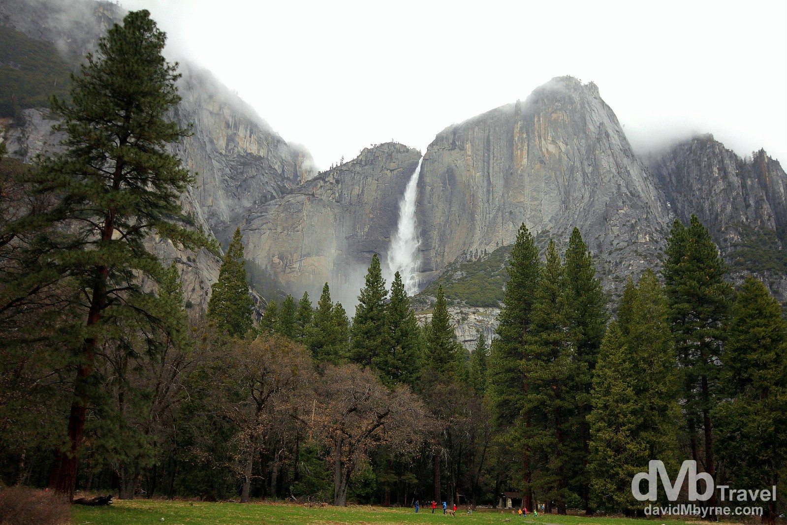
The most visited part of Yosemite is here, Yosemite Valley, where I took the above picture of towering trees, the Upper Yosemite Falls & mist shrouding the tops of the granite peaks along the valley edge. Yosemite National Park, California, USA. April 1, 2013.
Yosemite National Park
Occupying over 3,000 km² of mountainous terrain in the Sierra Nevada of Northern California, 95% of it officially designated as wilderness, Yosemite National Park was one of the world’s very first national parks and was central to the development of the national park idea; calls to protect Yosemite Valley from development ultimately led to President Abraham Lincoln’s signing the Yosemite Grant in 1864, although it wasn’t until October 1, 1890, that it officially became the third member of the United States national park system (after Yellowstone National Park, established March 1, 1872, & nearby Sequoia National Park, established September 25, 1890). Designated a UNESCO World Heritage Site in 1984, the park, which boasts thousands of lakes & ponds, 2,500 kilometres of streams, 1,300 kilometres of hiking trails, & almost 600 kilometres of roads, attracts some 4 million visitors each year, all drawn here to sample its spectacular scenery, granite rock formations, & unique biological diversity.
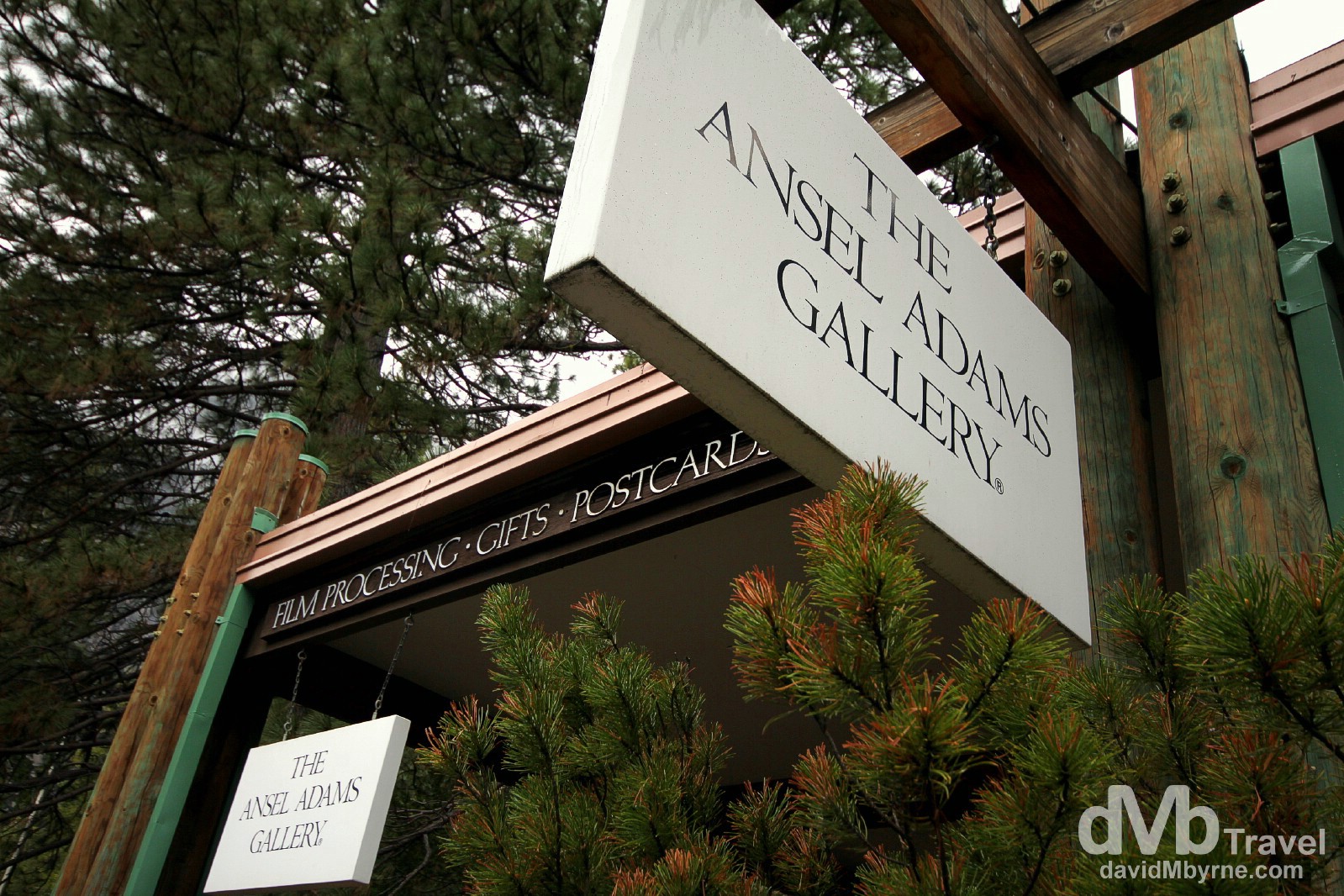
A couple by the name of Harry & Ann Best started a photography business in Yosemite Valley in 1902. Their only daughter, Virginia, married an aspiring photographer by the name of Ansel Adams. Adams, widely regarded as the best photographer who ever lived, went on to immortalise Yosemite National Park though his classic black & white images. His images pushed the popularity of landscape photography while helping to motivate the American environmental movement. Today the Best family continues to operate their photography business here, at The Ansel Adams Gallery. Needless to say I find all of this very neat. The Ansel Adams Gallery in Yosemite Valley, Yosemite National Park, California, USA. April 1, 2013.
I was, & as per the tentative itinerary I had setting out from San Francisco earlier today, supposed to leave Yosemite first thing in the morning for Sequoia National Park south of here. Instead I’ll be spending a bit more time in the park in the morning, partaking in a free 1-hour Yosemite Valley photo walk organised by the good folk at The Ansel Adams Gallery. It happens but a few times a week with tomorrow being one of those itinerary-altering-worthy times.
More: You’ll find more Yosemite goodness over at the Yosemite National Park post.
Day 2 || April 2 2013
Diary Entry Location: Bakersfield, California, USA ()
Kilometres / Miles Driven: 566 / 352
Today’s Highlights: Yosemite Tunnel View & the Sequoia National Parks misty Giant Forest
One of the last views I got of Yosemite National Park as I was leaving earlier this morning for Sequoia National Park & it was probably the best of the lot, especially considering it was such a glorious day. I’m glad I hung around.
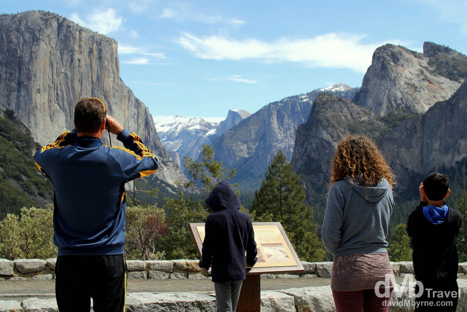
Admiring the Yosemite Valley from Tunnel View in Yosemite National Park, California, USA. April 2, 2013.
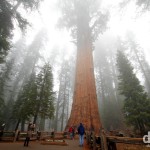
After Yosemite National Park it was on to Sequoia National Park, about a 4-5 hour drive from Yosemite & the 2nd oldest national park in the US. Driving through the park, which sits at about 2,133 metres (7,000 ft), was slow going due to the thick fog, quite the contrast to the weather I’d experienced earlier in the Yosemite Valley. The mist didn’t lift and I was fearful I wouldn’t be able to get any pictures, good or bad, of the park. However, when I eventually got to the main attraction, General Sherman of Sequoia’s Giant Forest, the fog only seemed to only add another layer of wow to the already awesome location.
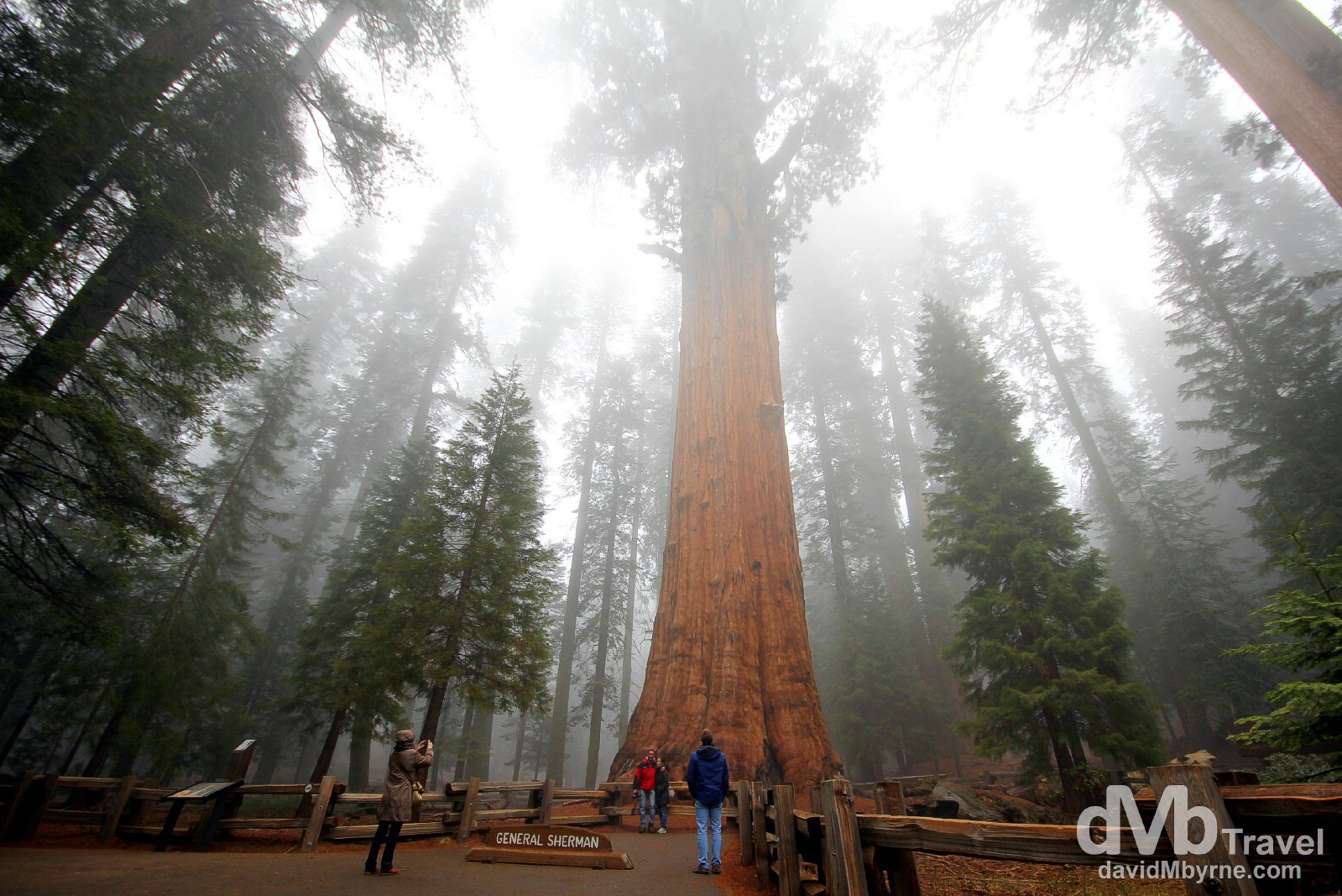
He is 84 metres (275 ft) high (his canopy is dead so unfortunately he won’t be growing any taller); his ever-expanding, nearly-conical trunk – which is estimated to weigh 1,385 tons – has a circumference at ground level of 31.3 metres (103 ft); his largest branch is almost 2.1 metres (7 ft) in diameter; & every year he grows enough new wood to produce an 18.2 metre (60 ft) tree of normal proportions. All of that is makes this, the 2,200-year-old General Sherman, the largest tree on earth. In the Giant Forest of Sequoia National Park, California, USA. April 2, 2013.
In volume of total wood the giant sequoia is the Earth’s largest living tree. At least one species of tree lives longer, one has a greater diameter, three grow taller, but none are larger/has a greater mass. Sequoias only grow here on the west slope of the Sierra Nevada, at altitudes between 1,524-2,133 metres (5,000-7,000 ft).
John Muir, Scottish-born American nationalist
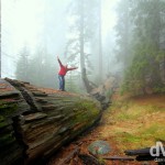
Muir was partly right. Chemicals in the wood & bark provide resistance to insects and fungi, and thick bark insulates them from most fire. The main cause of sequoia deaths is toppling; they have a shallow root system with no taproot, the main root of a plant growing straight downward from the stem. Soil moisture, root damage, & strong winds can, and do, lead to toppling, which gives people like me the opportunity to get pictures like this.
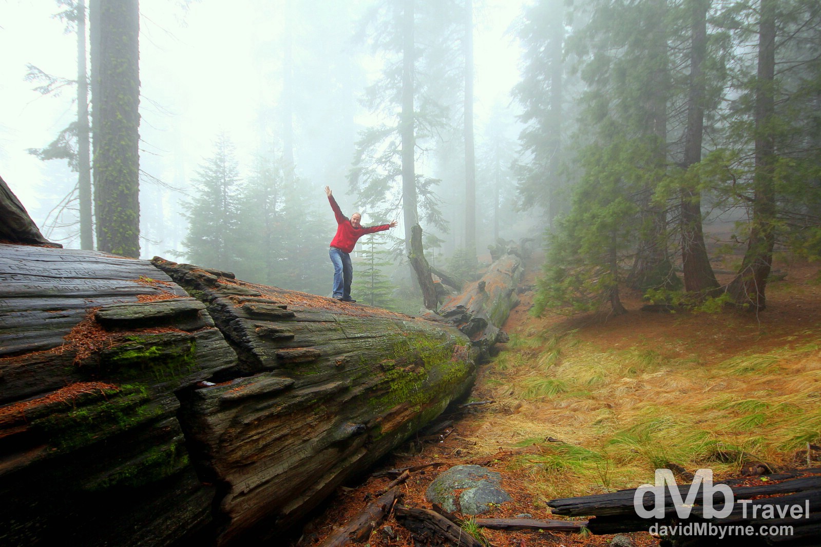
Fooling around on a fallen giant in The Giant Forest of Sequoia National Park. No one knows how long this tree has been lying here. Suffice to say it’s a long time, and it’ll be here for a lot more time to come. The Giant Forest of Sequoia National Park, California, USA. April 2, 2013.
More: You’ll find more from a foggy Sequoia National Park over at the dedicated Sequoia National Park post.
Day 3 || April 3 2013
Diary Entry Location: Las Vegas, Nevada
Kilometres / Miles Driven: 585 / 364
Today’s Highlight: Death Valley’s Surprising Beauty
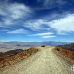
Today was the second straight day of almost 600 kilometres of driving, yet I felt like I covered so much more ground today than I did yesterday. The most direct route between Bakersfield, California, where I overnighted last night, and Las Vegas, Nevada, where I’ve just arrived, is not via Death Valley National Park. You’ll clock an extra 130 kilometres (80 miles) going that way, but if you do won’t regret one single wheel revolution of that distance if you do.
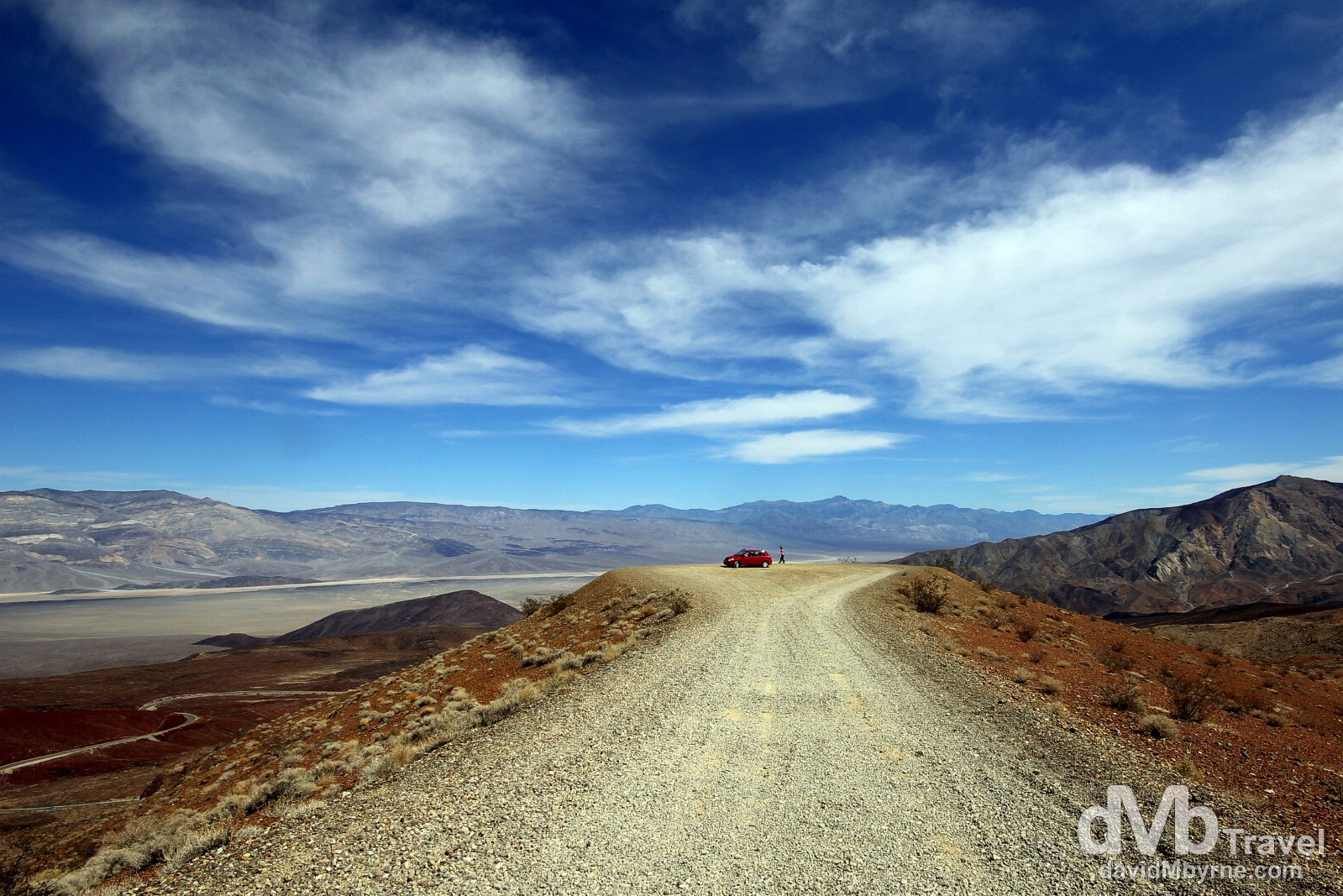
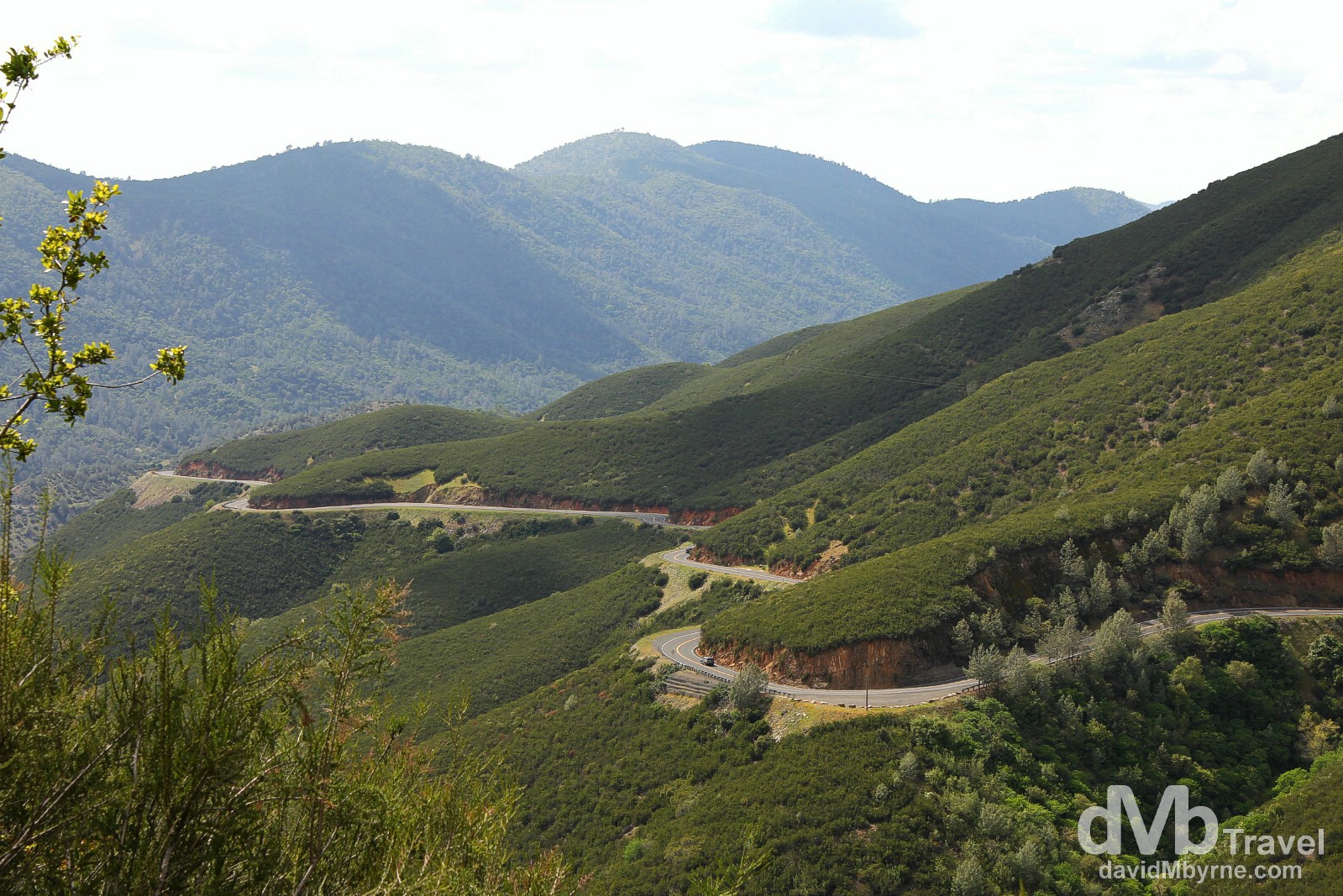
Overlooking Rainbow Canyon from the Father Crowley Vista Point in Death Valley National Park, California, USA. April 3, 2013.
Death Valley is a deserted below-sea-level basin that is part of the Mojave Desert in eastern California and south-western Nevada. It’s full of desolation, odd geologic formations, weathered canyons & heat – the mercury here hit a toasty 134°f/57°c on July 10 1913, the hottest air temperature ever recorded on a property sited and maintained thermometer anywhere in the world. Yesterday I was wrapped up against the cold at 2,133 metres (7,000 ft) in Sequoia National Park yet today I was feeling the heat near the lowest point in North America, Badwater Basin at 86 metres (282 ft) below sea level. Quite the contrast.
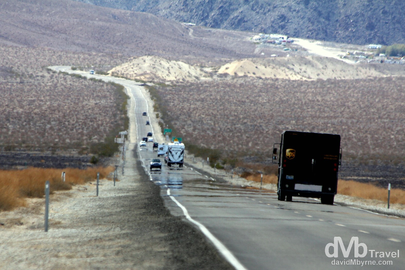
Traffic and heat shimmer on State Route 190 running through Death Valley National Park, California, USA. April 3, 2013.
In the distance (top-right of frame) is the village of Stovepipe Wells, where I had just left. A small way-station first settled in 1906, when it was nothing more than a tent settlement for miners, it wasn’t until 1925 that construction began on a hotel and scenic toll road through the valley, marking the beginning of the transition of the village from a mining community into the popular tourist destination it is today. This is what a road trip in this arid, desolate part of the world is like – long roads full of mundaneness. Enjoyable mundaneness.
More: I was surprised how photogenic Death Valley’s arid landscape proved to be. See more pictures & information on this unique location over at my Death Valley National Park post.
Days 4 & 5 || April 4 & 5 2013
Diary Entry Location: Las Vegas, Nevada
Kilometres / Miles Driven: 51 / 32
I‘ll be leaving Las Vegas later today after three day & three nights of dealing with its crowds, its heat & its money-siphoning everything. Three days & three nights that felt like three weeks. Las Vegas is that kind of place, an adult playground full of excesses, fabricated this & superficial that. All that said, I had fun. Quite a bit of fun. It was tiring, but fun. I just won’t be in a rush to go back. Once was enough but I guess I had to pay it a second visit (I was first here in 2003) to fully realise that.

Lucky chips in Las Vegas. I spent a lot of money in the money pit that is Vegas. But not on gambling. My outgoings on that quintessential Vegas vice totalled $2, which enabled me to hit the flashing buttons on two of those electronic one-armed bandit machines a total of 3 times. However, it sure is/was fun to walk around the behemoth, themed, window-less & clock-less casinos, reaffirming myself as I went that I’m just not the gambling type. If you are then needless to say options abound for trying your luck, with ample help on hand to boot. Free classes with insights into how to beat the dealer are available at most casinos, all in a bid to part you from your money. Las Vegas, Nevada, USA. April 4, 2013.
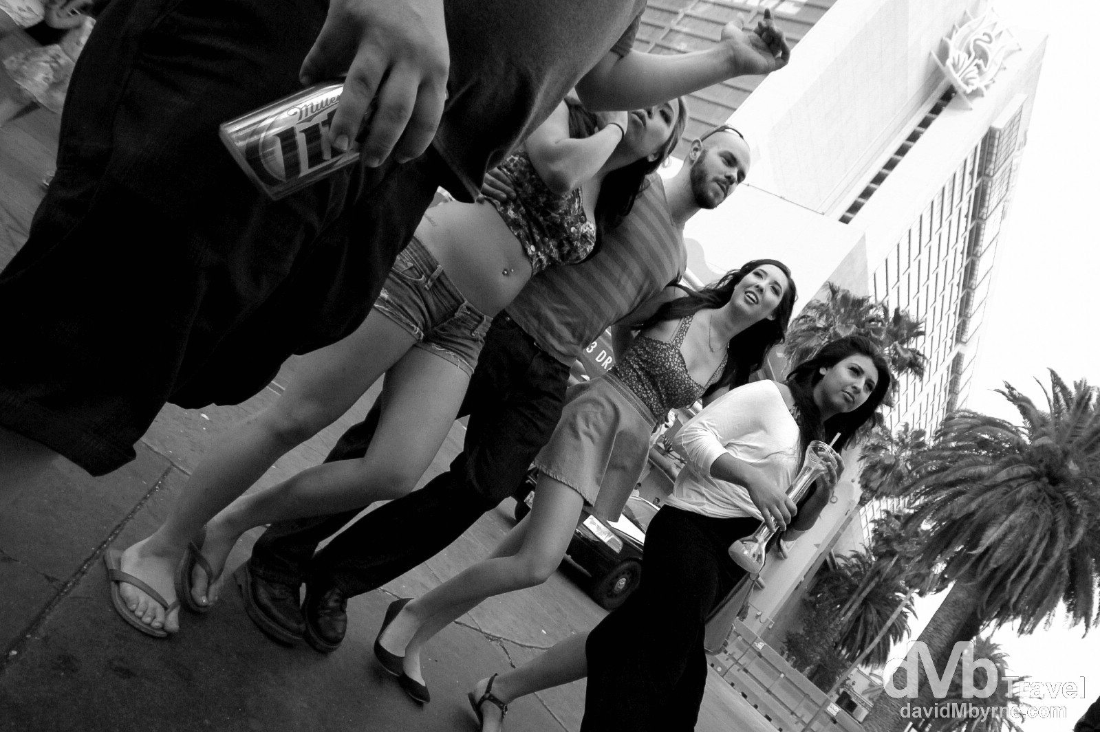
The start of another ‘What happens in Vegas stays in Vegas’ night. Although it is officially prohibited as per the law, drinking in public in Vegas is commonplace, amply fuelling the everyday-is-New-Years-Eve vibe that’s hard to avoid embracing when in Sin City. Las Vegas Boulevard (The Strip), Las Vegas, Nevada, USA. April 4, 2013.
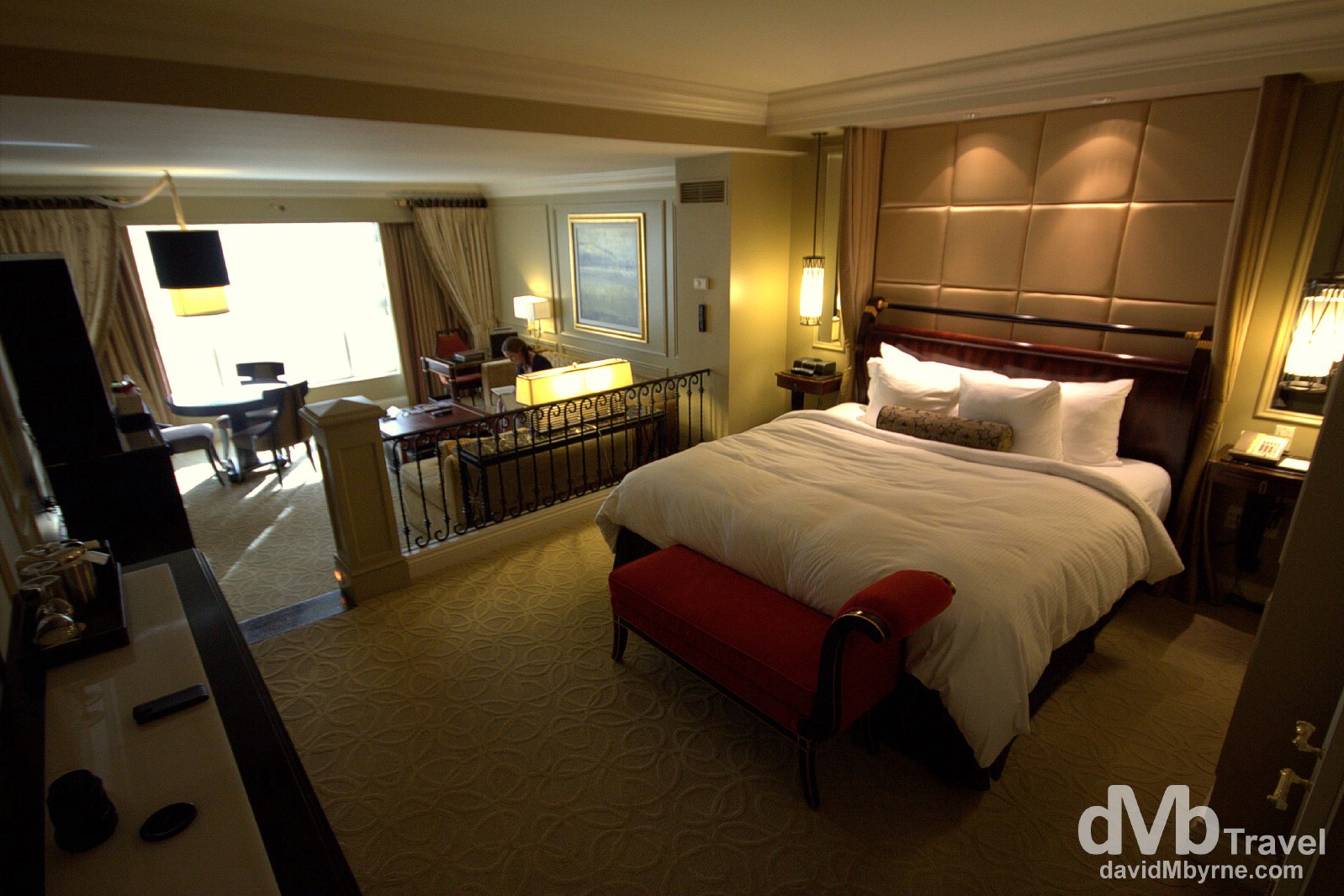
Vegas is renowned for it’s many mega-hotel/casino complexes, each creating exotic & fantasy destinations & mimicking others. I splurged for one of the 3 nights I spent in Vegas (the other two were spent the has-seen-better-days Rivera Hotel & Casino & the, em, Travelodge). This room in the luxury, all-suite Venetian Resort Hotel & Casino cost me $200, a lot of money for a Vegas room – they can be had for as little as $30, sometimes less, although rarely on weekends, when the vast majority of Vegas revellers are in town. My (foolish) intention was to get some semblance of value for money by spending time in here pretending to order room service, prancing around in a robe, & playing with the various remote controls and switches dotted here & there. Of course this is Vegas and spending much time in a room, even one that cost $200, is not likely to happen. Shouldn’t happen. Didn’t happen. The Venetian Resort Hotel & Casino, Las Vegas, Nevada, USA. April 4, 2013.
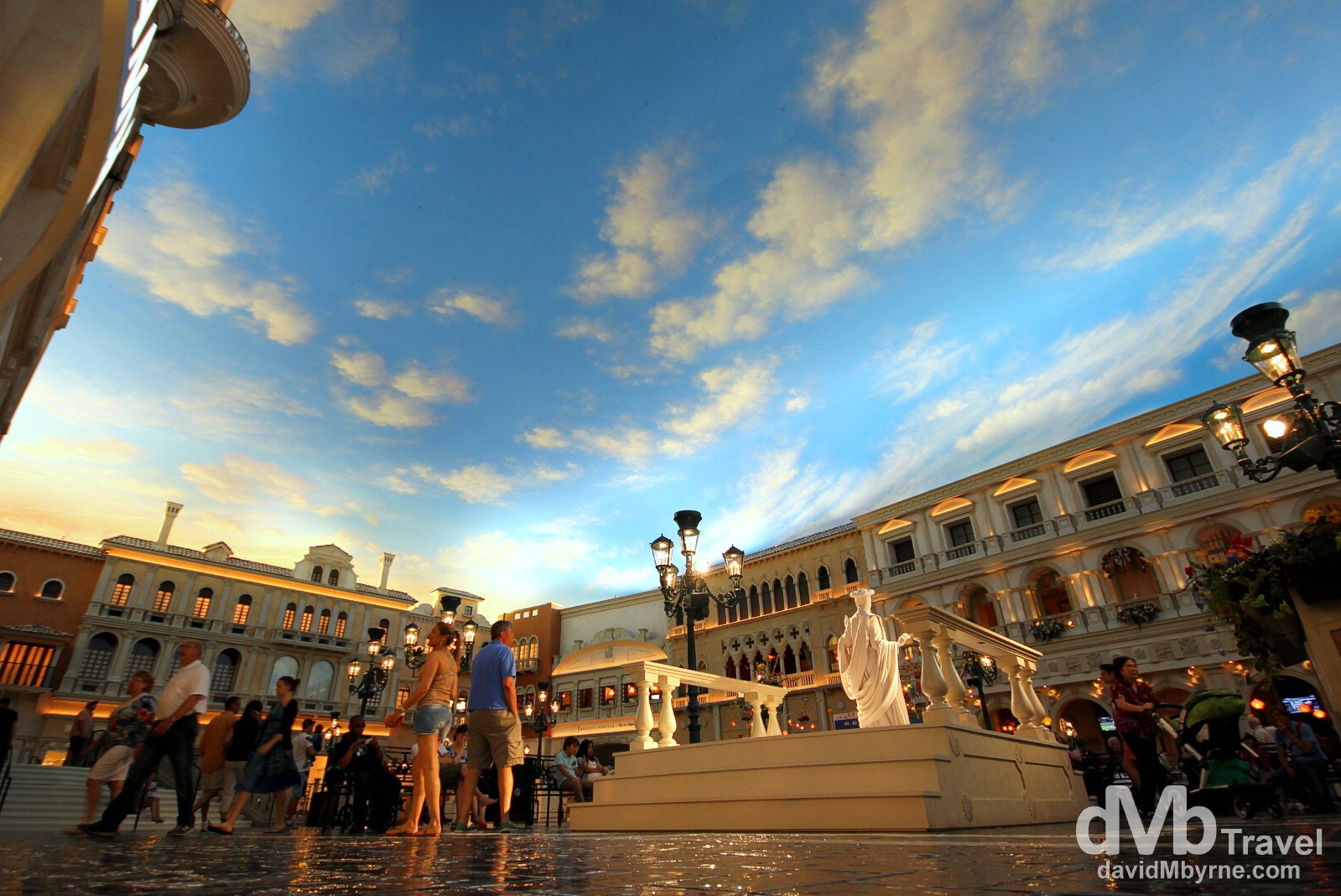
It’s like being in Venice, except you’re in the desert, & not to mention on the other side of the world. The Venetian boasts a fully functional canal & gondola system complete with singing gondoliers ($15 for 4 minutes), as well as lifelike replicas of St Mark’s Campanile, the Rialto Bridge & this, a mock-up of St Mark’s square with real human statues (seen here) but minus the pigeons. It’s no wonder this place, part of the largest five-diamond hotel and resort complex in the world, offering 4,049 suites and a 11,000 m² (120,000 ft²) casino, cost $1.5 billion, one of the most expensive resorts of its kind when it opened in May 1999. The Venetian Hotel & Casino, Las Vegas, Nevada, USA. April 4, 2013.
More: See a more in-depth look at my time in Sin City by visiting my Las Vegas post.
Day 6 || April 6 2013
Diary Entry Location: Kingman, Arizona ()
Kilometres / Miles Driven: 428 / 266
Today’s Highlight: A Grand Canyon Sunset
The hire car got dusty today, I got to point my wide-angle lens and a big dam & I got to witness a nice sunset at a pretty special location. All told, a great day.
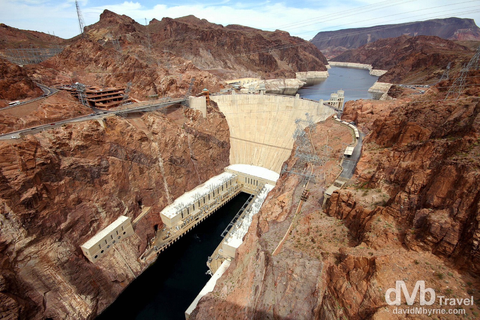
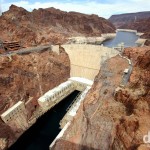
The Hoover Dam as seen from the new Mike O’Callaghan-Pat Tillman Memorial Bridge spanning Black Canyon on the Nevada (left) & Arizona (right) border, USA. April 6, 2013.
The Hoover Dam is a concrete arch-gravity dam on the border between the US states of Nevada (to the left) & Arizona (to the right). One of modern engineering great successes, it was constructed between 1931 and 1936 during the Great Depression, the result of a massive effort involving thousands of workers, but at the cost of over one hundred lives. The dam impounds Lake Mead (in the distance) and is located about 55 kilometres (35 miles) southeast of Las Vegas. It’s a major tourist attraction – nearly a million people visit each year. The main west-east/east-west route, U.S. 93, ran along the dam’s crest until October 2010, when the Hoover Dam Bypass opened. Part of the bypass was the Mike O’Callaghan-Pat Tillman Memorial Bridge, from where this picture was taken. The bridge wasn’t here in 2003 when I was last here so it was good to get a fresh prospective on the area.
More: See more from the Hoover Dam on my Hoover Dam post.
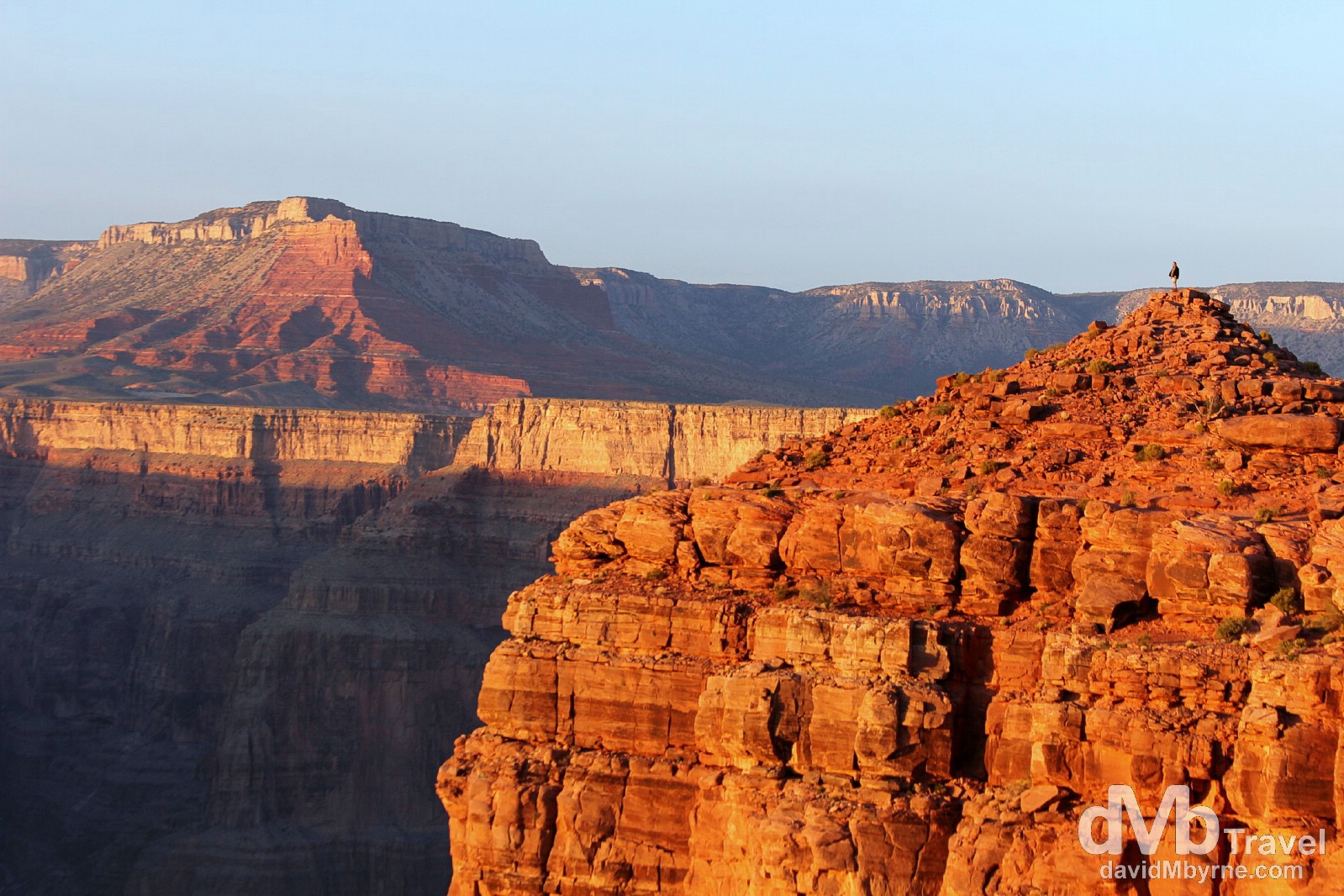
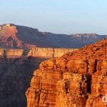
Sunset from a perilous position at Eagle Point, The Grand Canyon West, Arizona, USA. April 6, 2013.
– Edward Abbey
From the Hoover Dam it was a long drive to The Grand Canyon, one of the 7 Natural Wonders of the World. It needs little introduction, but just in case – it’s a massive, steep-sided, 1,600-metre-(1 mile)-deep canyon carved by the Colorado River in the state of Arizona. It’s not the longest, widest or even deepest canyon on earth but it’s still considered the grandest of them all. It’s a 160 kilometre (100 mile) drive from the Hoover Dam to the western rim of the Grand Canyon, aka Grand Canyon West, the last 16 kilometres (10 miles) of which is dirt road. I pushed my little Nissan Versa hire car, all Colin McRey like, in a bid to get to the canyon in time for sunset. I did, & it was awesome.
More: For more pictures & text from this visit to the Grand Canyon West check out my Grand Canyon West post.
Day 7 || April 7 2013
Diary Entry Location: Atascadero, California ()
Kilometres / Miles Driven: 727 / 452
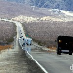
Nothing to report from today & no time for photography on what was a long day of east-west driving , from Kingman, Arizona, to Atascadero, California. I bid the desert adieu en route & now I’m geographically nicely poised for tomorrow’s drive on California’s Pacific Coast highway & the return San Francisco.
Day 8 || April 8 2013
Diary Entry Location: San Francisco, California
Kilometres / Miles Driven: 460 / 286
Today’s Highlight: Pacific Coast Highway Vistas
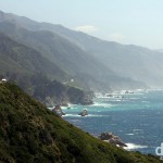
I spent the majority of today driving back to San Francisco via a section of State Route 1, aka the Pacific Coast Highway. One of the most picturesque coastal drives in the world, it was a real photographic treat and after all the aridness & dust of the last week it was nice to get to the ocean & its sea breezes. A great end to the road trip.
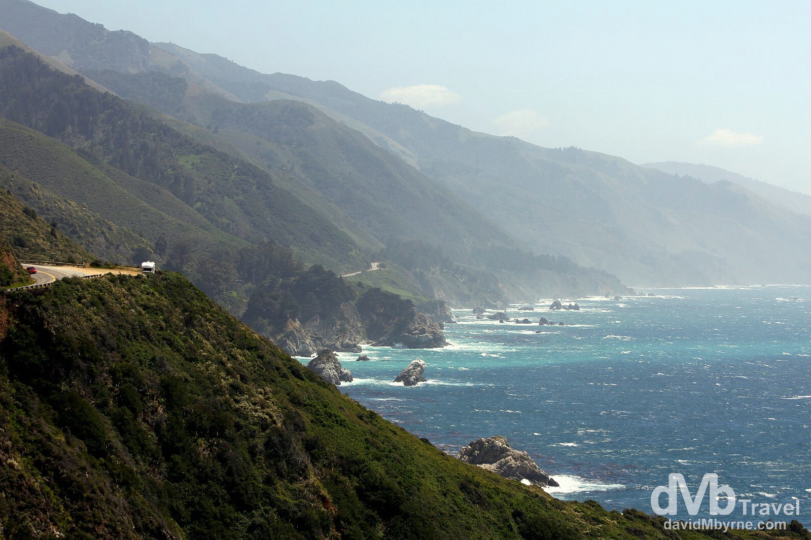
A campervan on a bend atop a cliff on a section of the Pacific Coast Highway in Point Sur State Historic Park near Big Sur, California. The Pacific Coast Highway is a 200 kilometre (123 mile) stretch of the 1,055 kilometre (655 mile) State Route 1, a major north-south highway that runs along most of the Californian coastline. It’s an exhilarating driving experience, a twisting, cliff-hugging route which, at a leisurely pace (meaning plenty of stops to enjoy the vistas), takes about 4-5 hours of driving. Designated an All-American Road – among the nation’s most scenic – the route, which in many places has narrow shoulders and sharp drop-offs, passes through dramatic scenery, charming pacific coast towns and oak-studded hills. State Route 1/Pacific Coast Highway, California, USA. April 8, 2013.
More: For more pictures & text from my Pacific Coast Highway jaunt check out my Pacific Coast Highway post.
Day 399. Back in San Fran. 2,000 miles driven over the past week. It'll be nice not to ove for a few days! http://t.co/FVIX8zU8FN #sanfran
— davidMbyrne.com (@ByrneDavidM) April 9, 2013
US Southwest Road Trip Itinerary Map
The California-Nevada-Arizona-California Road Trip. Eight days, three thousand two hundred ten kilometres (one thousand nine hundred ninety-five miles) & lots of pictures.
Road Trip Daily Overview
Day 1: San Francisco to Yosemite National Park
Day 2: Yosemite & Sequoia National Park
Day 3: Death Valley National Park & Las Vegas
Days 4 & 5: Las Vegas
Day 6: Hoover Dam & The Grand Canyon
Day 7: Kingman, Arizona, to Atascadero, California
Day 8: State Route 1/Pacific Coast Highway, California
US Southwest Road Trip || The Gallery
-
- California State Route 140 leading to Yosemite National Park, California, USA. April 1st 2013.
-

- Upper Yosemite Falls as seen from the Yosemite Valley floor, Yosemite National Park, California, USA. April 1st 2013.
-
- Admiring the Yosemite Valley from Tunnel View in Yosemite National Park, California, USA. April 2nd 2013.
-
- General Sherman, the largest tree on earth, in Sequoia National Park, California, USA. April 2nd 2013.
-
- Overlooking Rainbow Canyon from the Father Crowley Vista Point in Death Valley National Park, California, USA. April 3rd 2013.
-
- Traffic and heat shimmer on State Route 190 running through Death Valley National Park, California, USA. April 3rd 2013.
-

- Lucky chips in Las Vegas, Nevada, USA. April 4th 2013.
-

- The start of another ‘What happens in Vegas stays in Vegas’ night. Las Vegas Boulevard, Las Vegas, Nevada, USA. April 4th 2013.
-
- The Hoover Dam as seen from the new Mike O’Callaghan-Pat Tillman Memorial Bridge. On the Nevada (left) & Arizona (right) border, USA. April 6th 2013.
-
- Sunset from a perilous position at Eagle Point, The Grand Canyon West, Arizona, USA. April 6th 2013.
-
- State Route 1/Pacific Coast Highway, California, USA. April 8th 2013.