The Bay of Kotor, Montenegro
Unrivalled Scenery, Labyrinth Walled Old Towns, Shore-Skirting Drives & Marina Bling”The spectacular topography of the 88 km² bay… means there isn’t a whole lot of room in which to squeeze those picturesque Medieval walled Old Towns. There’s even less room for roads. But roads there are and with a shoreline of some 110 kilometers that equates to over 100 kilometres of winding, one-lane, water-hugging driving delights while skirting the feet of steep mountains. It’s a geographical setting rivalled by very few places on earth, if any.”
Image || The Bay of Kotor‘s Gulf of Kotor as seen from the road to Lovcen National Park, Montenegro. April 20, 2017.
Montenegro
I won’t lie; first impressions of Montenegro were not good. It was bucketing down when taxiing to the terminal of Podgorica Airport. I almost didn’t want to subject myself to it. It was early. It was glum. It was cold & I was tired, a consequence of having spent the previous night trying – and failing miserably – to sleep in London’s Stansted Airport, the only way I deduced that I’d guarantee making the 06:55 Ryanair departure to the Montenegrin capital, one of the few direct flights from my corner of Europe to this corner of Europe at this time of the year. I had limited time in Montenegro so I was hoping the conditions would improve, and fast; with the scenery on show in these parts you really need good weather to do the country justice. The weather did improve – on and off – and I found myself leaving Montenegro some days later for neighbouring Kosovo wondering why it had taken me so long to point my camera at this particular Balkan gem.
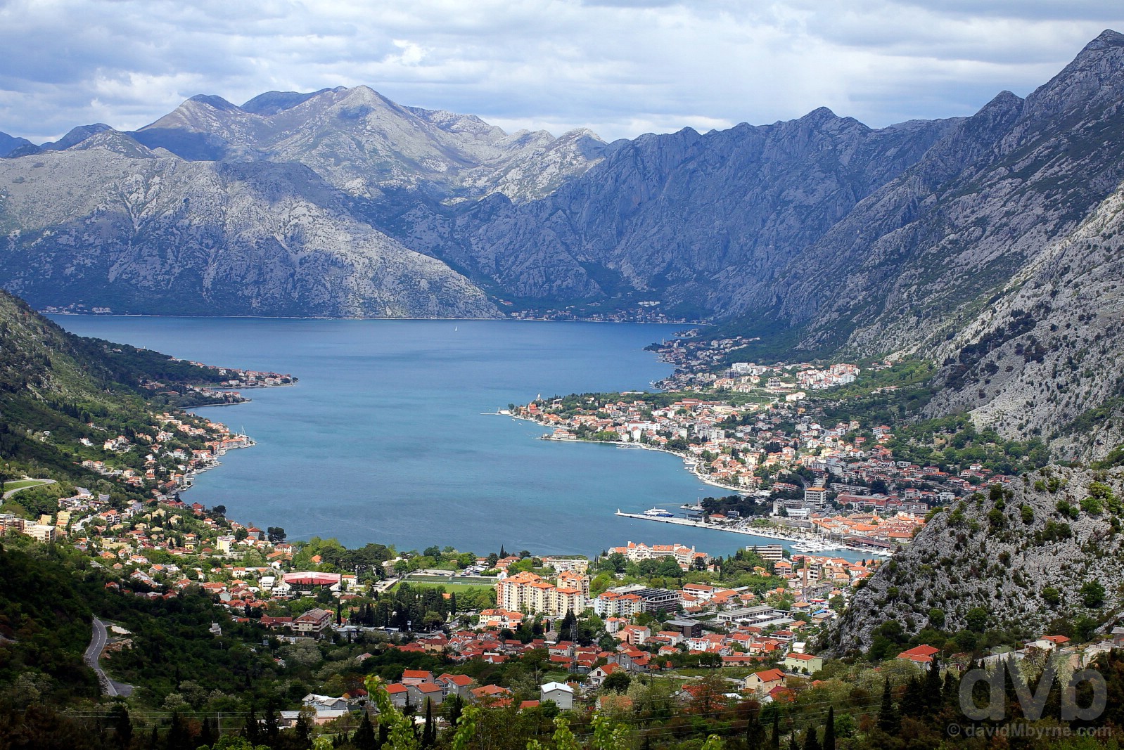
Kotor & the stunning Bay of Kotor‘s Gulf of Kotor as seen from the tight, winding road – no shortage of those around these parts – to Lovcen National Park, Montenegro. April 20, 2017.
Montenegro Overview
 Montenegro
Region – Southeastern Europe/The Balkans (dMb tag: The Balkans). Capital – Podgorica. Population – 680,000. Official Language – Montenegrin. Currency – €uro. GDP (nominal) per capita – US$6,630 (80th). Political System – Parliamentary republic. EU Member? – No (as of April 2017). UN Member? – Yes (admitted June 2006). G20 Member? – No. Size – 14,000 km² (Europe’s 10th smallest country, slightly larger than the US state of Connecticut, or about two-thirds the size of Wales). Topography – Varied. Mostly mountainous interior with a narrow coastal plain. Formation/Independence – 2006 (following the peaceful dissolution of the former State Union of Serbia and Montenegro, itself formed in 1992 following the breakup of Yugoslavia). UNESCO World Heritage sites – 4. Tourism Catchphrase/Slogans – Breathtaking Beauty; Wild Beauty. Famous For – Being Europe’s baby, its newest country; historic walled old towns, scenery; the azure Adriatic; partying. Highlights – The Bay of Kotor; the Adriatic coast; Durmitor National Park. Montenegro Titbits – Officially Crna Gora, Montenegro is the country’s better-know Italian name (which translates into English as ‘Black Mountain’); the country’s 294-kilometer-long azure Adriatic coastline boasts 117 beaches. Montenegro Observations – The roads are tight; as in most of the Balkans, unfinished construction projects are everywhere & blight the otherwise stunning landscape; most essentials – coffee, beer, meals out, a hostel bed, parking – are very economical, petrol not so much; everyone seems to smoke everywhere including in cafes & restaurants; the locals are, for the most part, very welcoming & friendly; you’re never far from a church or monastery (or from anything in tiny Montenegro); coffee is served with a straw. You don’t have to use it of course but it’s a somewhat bizarre accompaniment to an espresso.
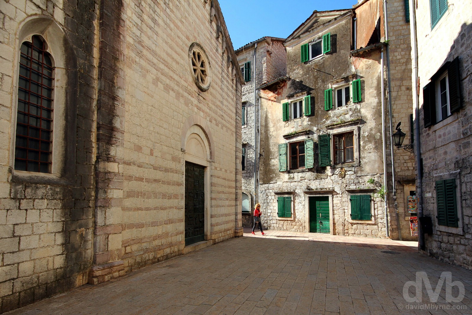
Trg sv Luke (St. Luke’s Square), Stari Grad (Old Town) Kotor, Montenegro. April 19, 2017.
Visits – 1 (April 2017). Where I went/What I saw – The Bay of Kotor (Perast, Kotor & Porto Montenegro); Lovcen National Park & the Njegos Mausoleum; The Adriatic Coast (Budva & The Budva Riviera (Sveti Stefan)); Lake Skadar National Park & Podgorica.
The Bay of Kotor || Perast, Kotor & Porto Montenegro
It was always going to be my first port of call and it didn’t take long to get there. A 90-kilometre drive from Podgorica Airport via Lake Skadar National Park and Budva & Sveti Stefan of the Adriatic Coast, obvious Montenegrin highlights I’d sample on the return journey, got me to the fringes of Montenegro’s UNESCO-listed Bay of Kotor, easily one of Europe’s most beautiful bays. Inhabited since antiquity and dotted with well-preserved Medieval walled Old Towns, the bay is a spectacular natural inlet from the Adriatic that resembles the fjord it isn’t (it’s actually a submerged river canyon). It’s also a staple on any Adriatic cruise ship itinerary, its numerous Orthodox and Catholic churches and monasteries making the region as equally popular with pilgrims as it is with tourists.
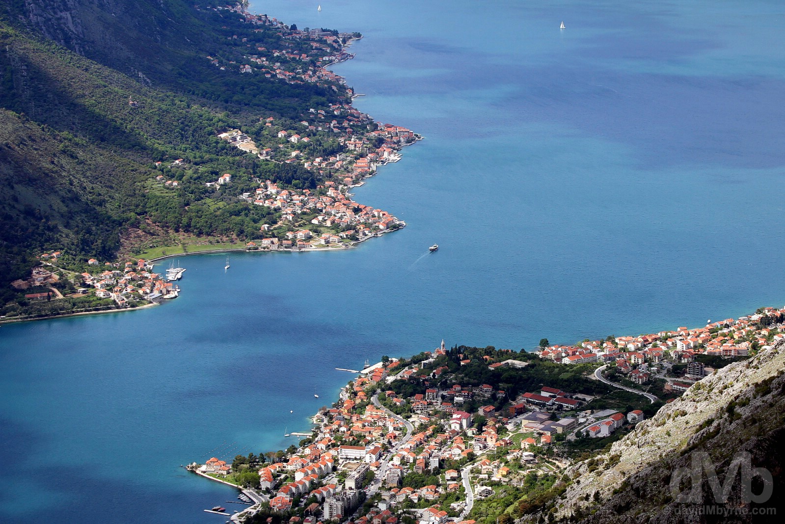
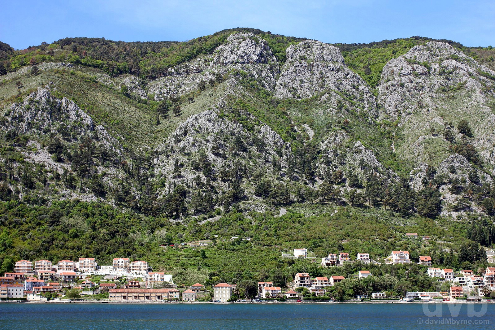
A portion of the Bay of Kotor‘s Gulf of Kotor as seen from the winding road above Kotor, Montenegro. April 20, 2017.
… The Outstanding Universal Value of the Culturo-Historical Region of Kotor is embodied in the quality of the architecture in its fortified and open cities, settlements, palaces and monastic ensembles, and their harmonious integration to the cultivated terraced landscape on the slopes of high rocky hills. The Natural and Culturo-Historical Region of Kotor bears unique testimony to the exceptionally important role that it played over centuries in the spreading of Mediterranean cultures into the Balkans.
– UNESCO commenting on the Natural and Culturo-Historical Region of Kotor
Water-Hugging Driving Delights
Steep mountains dropping from on high down to the water’s edge. That’s the Bay of Kotor. The spectacular topography of the 88 km² bay, which comprises 4 smaller gulfs – the gulfs of Herceg Novi, Tivat, Risan & Kotor – and which extends inland for some 30 kilometres, means there isn’t a whole lot of room in which to squeeze those picturesque Medieval walled Old Towns. There’s even less room for roads. But roads there are and with a shoreline of some 110 kilometers that equates to over 100 kilometres of winding, one-lane, water-hugging driving delights while skirting the feet of steep mountains. It’s a geographical setting rivalled by very few places on earth, if any.
Looking across the Bay of Kotor‘s smaller Gulf of Kotor from the shores of Kotor, Montenegro. April 20, 2017.
– Lonely Planet who named Kotor the Number 1 Best in Travel City for 2016
The Bay of Kotor || Perast
Destination reached, Kotor was my introduction to the region, the most famous & the most visited by far of the bay’s many historic & picturesque settlements. But Kotor proper and its walled wonderments would have to wait. I initially drove through, passing the historic Old Town walls and continuing on for another 12 kilometres while skirting the Gulf of Kotor’s shoreline until I reached Perast, just another beautifully preserved Medieval town and the first place in which I was happy, the overcast conditions aside, to park the car, get out & explore. And for a split second after arrival I thought I was back in Venice.
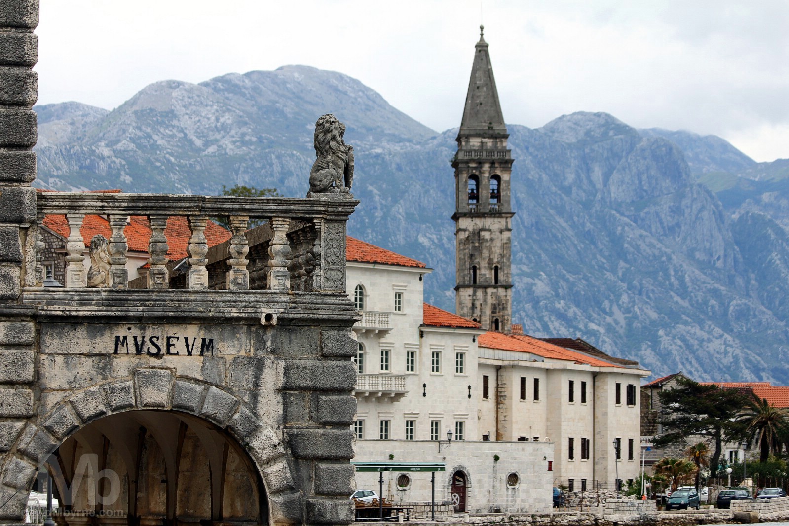
Unmistakably Venetian. Perast, Bay of Kotor, Montenegro. April 19, 2017.
Perast
At a key strategic location protecting both the bay & the settlement of Kotor, Perast has had many landlords who have tried to leave their mark on the town down through the years. The Byzantine Empire, the Hungarians, the French and the Austrians were all here at one stage or another, but it’s the Venetians who are largely responsible for how the region’s towns, including Perast, look today; the town’s best preserved architecture dates to the 17th and 18th centuries when Perast belonged to the Republic of Venice, the Venetians holding sway here for almost 4 centuries, from 1420 to 1797. It was during this period that wealthy maritime captains built an array of grand & typically-Venetian baroque palaces, many of which survive today as nothing more than a ruined remnant of a time when Perast was both rich & powerful. Still somewhat swish today, Perast is pitching itself as something of a high-end tourist destination, one full of tight explorable lanes & steep inclines, boutique accommodation in restored palazzos, museums, churches, cafes and restaurants.
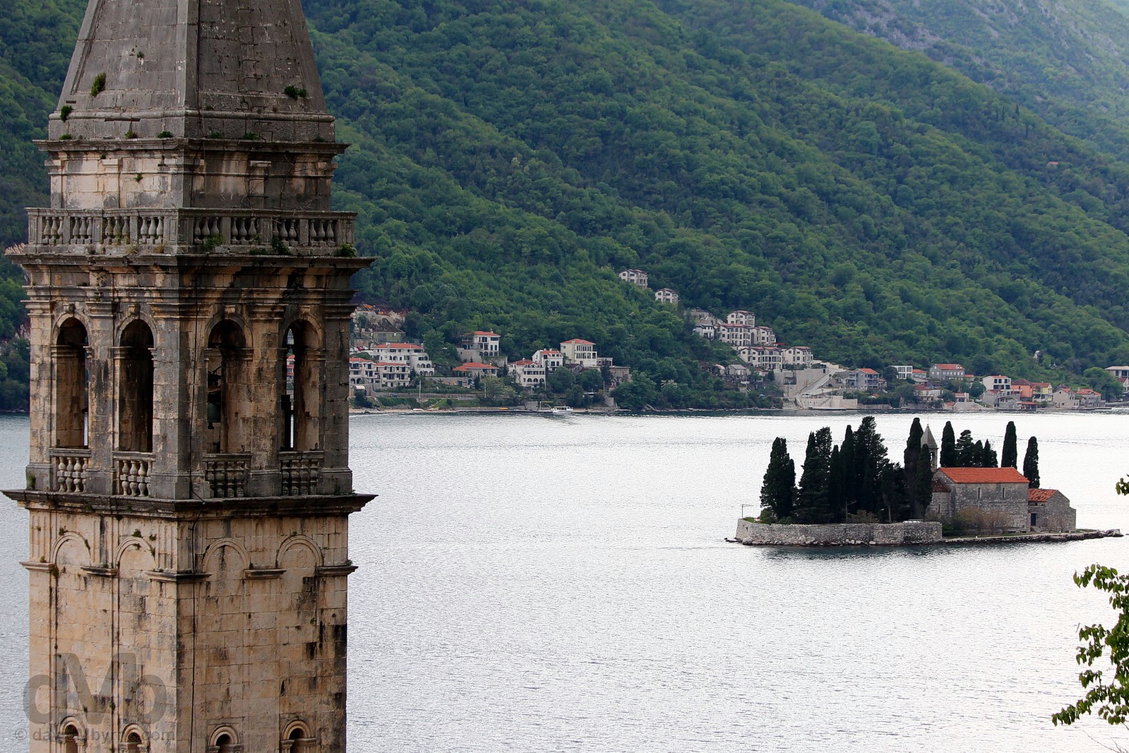
ST NICHOLAS CHURCH, SVETI DORDE & OUR LADY OF THE ROCKS || Exploring the steep & uneven cobbled lanes of Perast brought me high above the town with views over the Perast rooftops and out over the Bay of Kotor. Seen here is the mammoth 55-metre-high belfry of the 17th-century St. Nicholas Church, the town’s unmissable landmark that was never quite finished (and doubtless never will be) and amazingly one of 16, yes 16, churches to be found in the tiny town. Seen in the distance is the natural isle of Sveti Dorde (Island of St. George), home to the 12th-century Saint George Benedictine monastery. It’s one of two tiny islets offshore of Perast, the other (not seen here) being the man-made Our Lady of the Rocks, built according to legend by local seaman and sailors throwing stones into the sea after finding the icon of Madonna and Child on submerged rocks (the reality doesn’t deviate too far from legend in that the island was formed by a bulwark of rocks). Today the island is the location for the revered Roman Catholic Church of Our Lady of the Rocks & a museum, collectively Perast’s biggest draw and one accessible via boat from the Perast waterfront, a narrow road that doubles as the town’s main – & only – street. Perast, Bay of Kotor, Montenegro. April 19, 2017.
The Bay of Kotor || Kotor – Day 1
It was still overcast by the time I got back from Perast to have a proper & first look around Kotor, the undisputed jewel in Montenegro’s crown. Wedged at the farthest-flung corner of the mountain-rimmed bay, the town has developed around its iconic fortified Stari Grad (Old Town), a compact and atmospheric jumble of cobblestone & marble alleyways, blindly navigating which is probably the best way to uncover the wealth of museums, ancient churches, secluded piazzas & restored baroque palaces you’ll invariably stumble upon when exploring this stuck-in-time Medieval walled labyrinth.
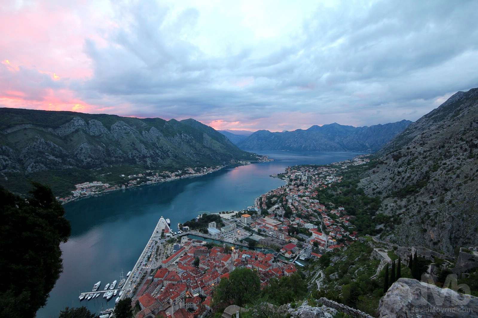
Red roofs & red sky. The red rooftops of the rectangular-shaped Stari Grad (Old Town) & the narrow Kotor Gulf of The Bay of Kotor at sunset on an overcast day as seen from Castle St. John, the highest point of the extensive fortifications on St. John’s Hill overlooking the town. The Bay of Kotor, Montenegro. April 19, 2017.
Kotor History
While they know that the city was Greek through approximately the 4th to 7th centuries BC, archaeologists don’t quite know when Kotor was founded, a long time ago being a safe guesstimate. Much like Preast, the town passed through many foreign hands, its appearance today strongly influenced by almost four centuries of Venetian rule (1420 to 1797). Most recently, a large number of the town’s monuments (including four Romanesque churches and the town walls) were seriously damaged by an earthquake in 1979, the same year the town was granted UNESCO World Heritage status. It has since been extensively restored, largely with UNESCO’s help, and is today open to all and, of course, eminently explorable.
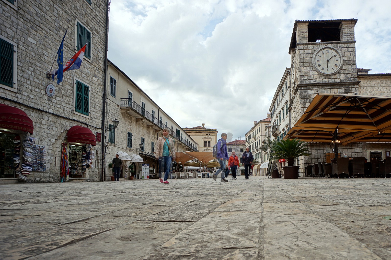
ARMS/WEAPONS SQUARE || In a walled town of many squares, Trg od Oruzja (Arms/Weapons Square) is Old Town Kotor’s main civic space. Even on chilly days like today options to lounge in cafes spilling from attractive buildings abound, and all in view of the square’s landmark stumpy clock tower which dates to 1602 and which is still in working order. Trg od Oruzja (Arms/Weapons Square), Stari Grad (Old Town) Kotor, Montenegro. April 19, 2017.
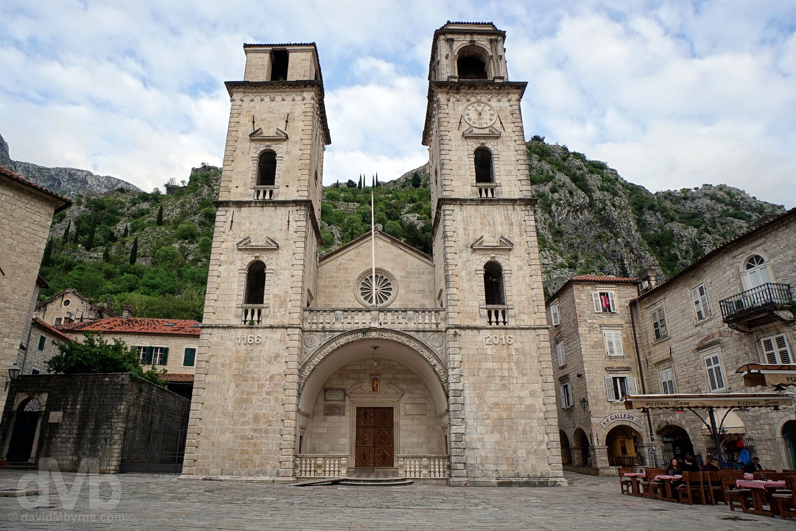
ST. TRYPHON’S CATHEDRAL || First constructed between 1124 and 1166 and built on the foundations of an older edifice (dating to 809), St. Tryphon’s Cathedral, named after the town’s patron saint, is Kotor’s most significant sacral building, one of the first large Romanic churches erected anywhere in the Balkan region and the Old Town’s most impressive structure, both inside & out (the stunning backdrop of St. John’s Hill adds to its appeal). But it has had a tough time of it, having been reconstructed several times mostly as a result of earthquakes; a quake in 1667 necessitated a renovation that saw Romanic church towers replaced by the present-day baroque bell towers, the left one of which remains unfinished to this day. The Cathedral of St. Tryphon, Trg sv. Tripuna (St. Tryphon’s Square), Stari Grad (Old Town) Kotor, Montenegro. April 19, 2017.

ST JOHN’S HILL FORTIFICATIONS || The earliest portions of the fortifications snaking up St. John’s Hill behind Old Town Kotor, illuminated to great but somewhat spooky effect at night, date to the 9th century, but it wasn’t until 14th century that a protective loop was completed with additions tacked on right up until the 19th century (although built to protect Kotor from attack from the east, given the hill’s topography and its apparent natural impenetrability from any direction, I couldn’t help but wonder, through the sweat, why such extensive fortifications were needed at all). It’s a short but energetic climb to the top, a 1.2-kilometre-long hoof up some 1,500 steps to Castel St. John at the summit – needless to say the views get better the higher you go, easing the exertion somewhat. This is a picture, captured on the descent at dusk, of the Bay of Kotor from just above the Church of Our Lady of Remedy, a Roman Catholic fortification landmark that dates to 1518 and that is encountered at about the halfway point of the trek to the top. Kotor, Montenegro. April 19, 2017.
The Bay of Kotor || Kotor – Day 2
It was an eventful start to day 2 in the Bay of Kotor region. I was out early exploring the maze of cobbled alleyways and secluded piazzas that is Kotor’s Stari Grad (Old Town). It was quiet, businesses just setting up for the day and doors & closed shutters sporadically swinging open as kids skipped past on the way to school. Shadows among the alleyways were prevalent, the clouds of the previous day having given way to glorious early morning sunshine. Yes, the sun was out on this beautiful Balkan morning, as were a few grumpy locals.
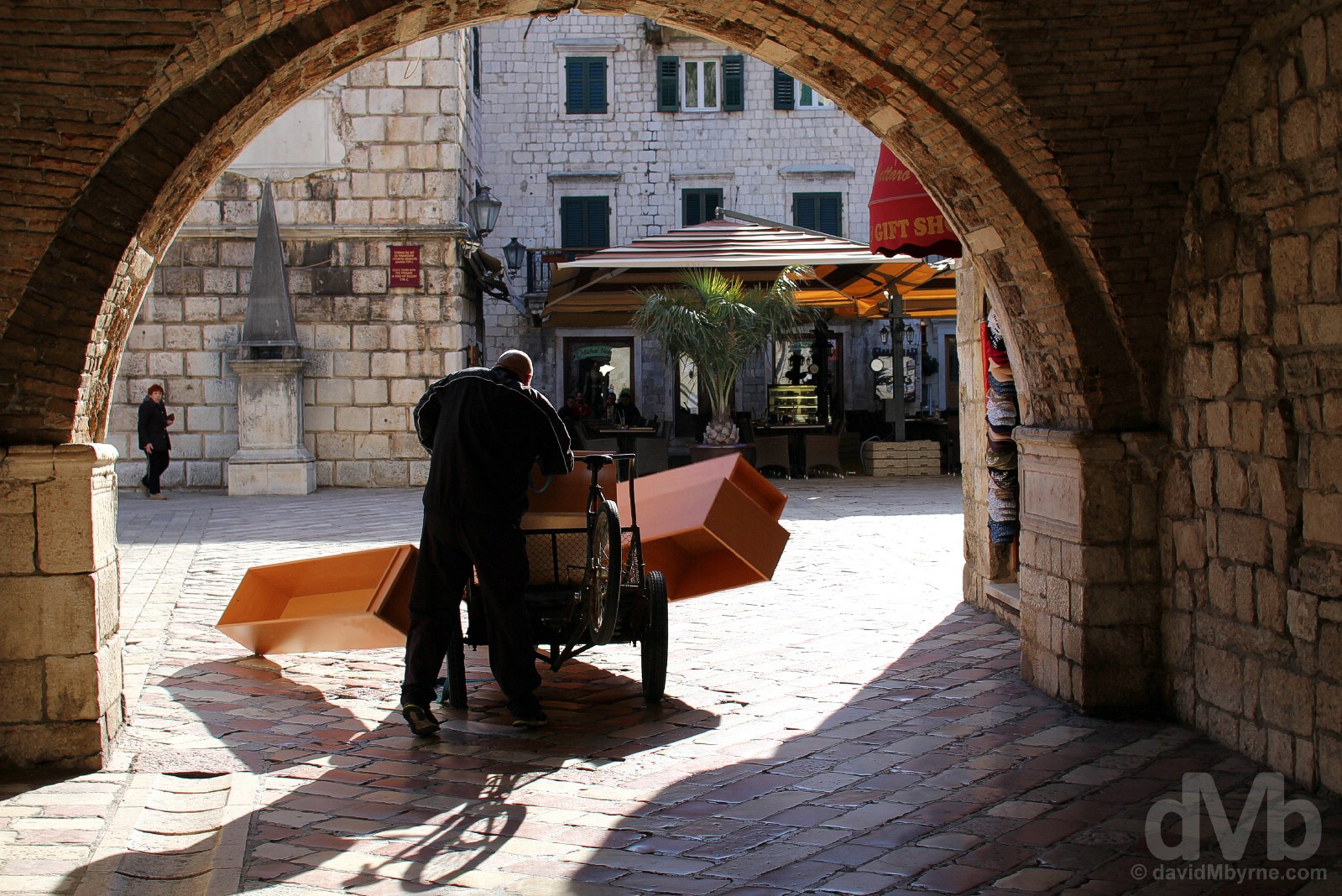
THE DOUCHE & THE SEA/WEST GATE || This douche shouted angrily at me to get out of his way, feeling the need to scowl at me for good measure as he passed under the arch of the Sea Gate, the main gate and one of three gates providing access to Kotor’s Old Town through its ancient walls. Needless to say, I couldn’t help but laugh out loud moments later when he lost his load. Karma. Be nice to dMb. The gate dates to 1555 when Kotor was under Venetian rule (the external walls flanking the gate house the winged lion of St Mark, the symbol of Venice) and provides access to Trg od Oruzja (Arms or Weapons Square). In the distance, at the base of the square’s Clock Tower, is another square landmark, an ornate stone pyramid that is said to have once served as a pillory for punishing perverse locals (and I know who I’d have liked to introduce it to on this particular morning). The external facade of the gate itself displays the date of the city’s World War II liberation from the Nazis (November 21 1944), a communist star and a quote from Tito, the Yugoslav statesman who led the resistance to German occupation during the war. It also boasts a 15th-century stone relief of the Madonna & Child flanked by St. Bernard of Siena, standing as protector of sailors and all in contact with the sea, and St. Tryphon, the town’s patron saint. Stari Grad (Old Town) Kotor, Montenegro. April 20, 2017.
– UNESCO commenting on the Venetian Works of Defence between 15th and 17th centuries: Stato da Terra – western Stato da Mar, of which the Fortified city of Kotor is included.
Laid out by the Venetians for protective purposes as a disorientating rectangular-shaped urban maze of pedestrianised streets, getting lost while exploring Kotor’s Old Town is a given, at least initially; it’s small enough that you eventually find yourself covering old ground & thus getting your bearings. Plus, orientation is always aided by the reappearance of many a striking Old Town landmark.
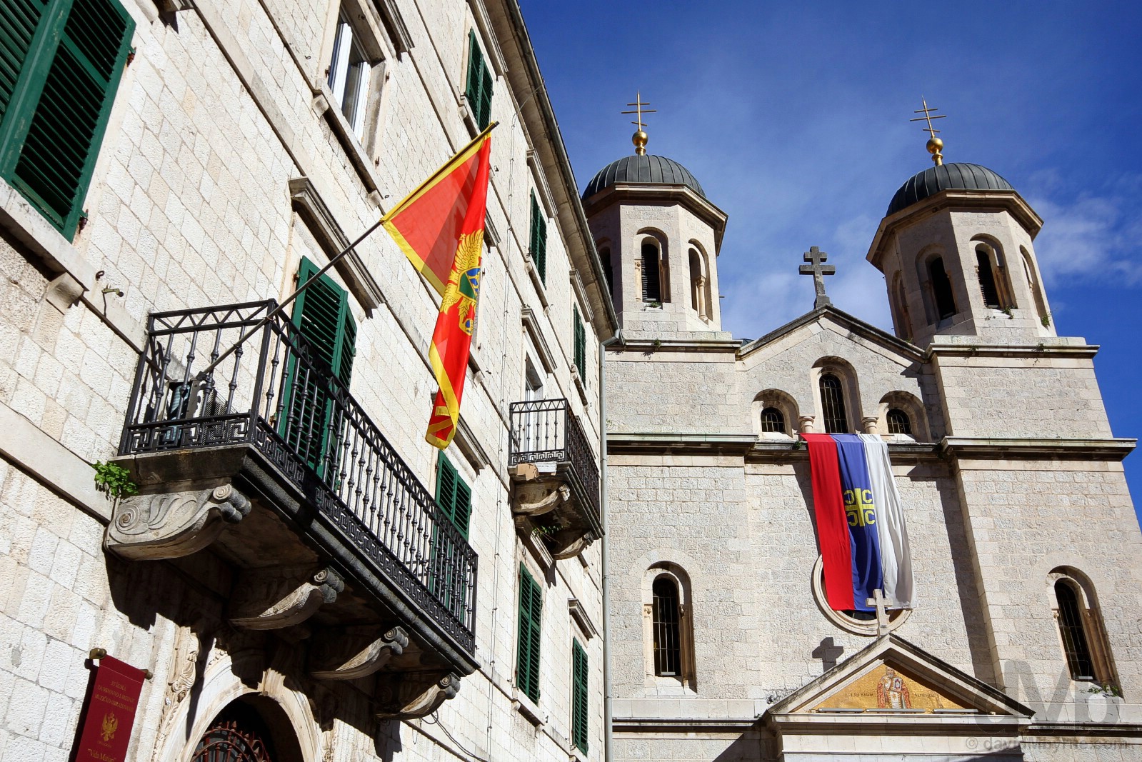
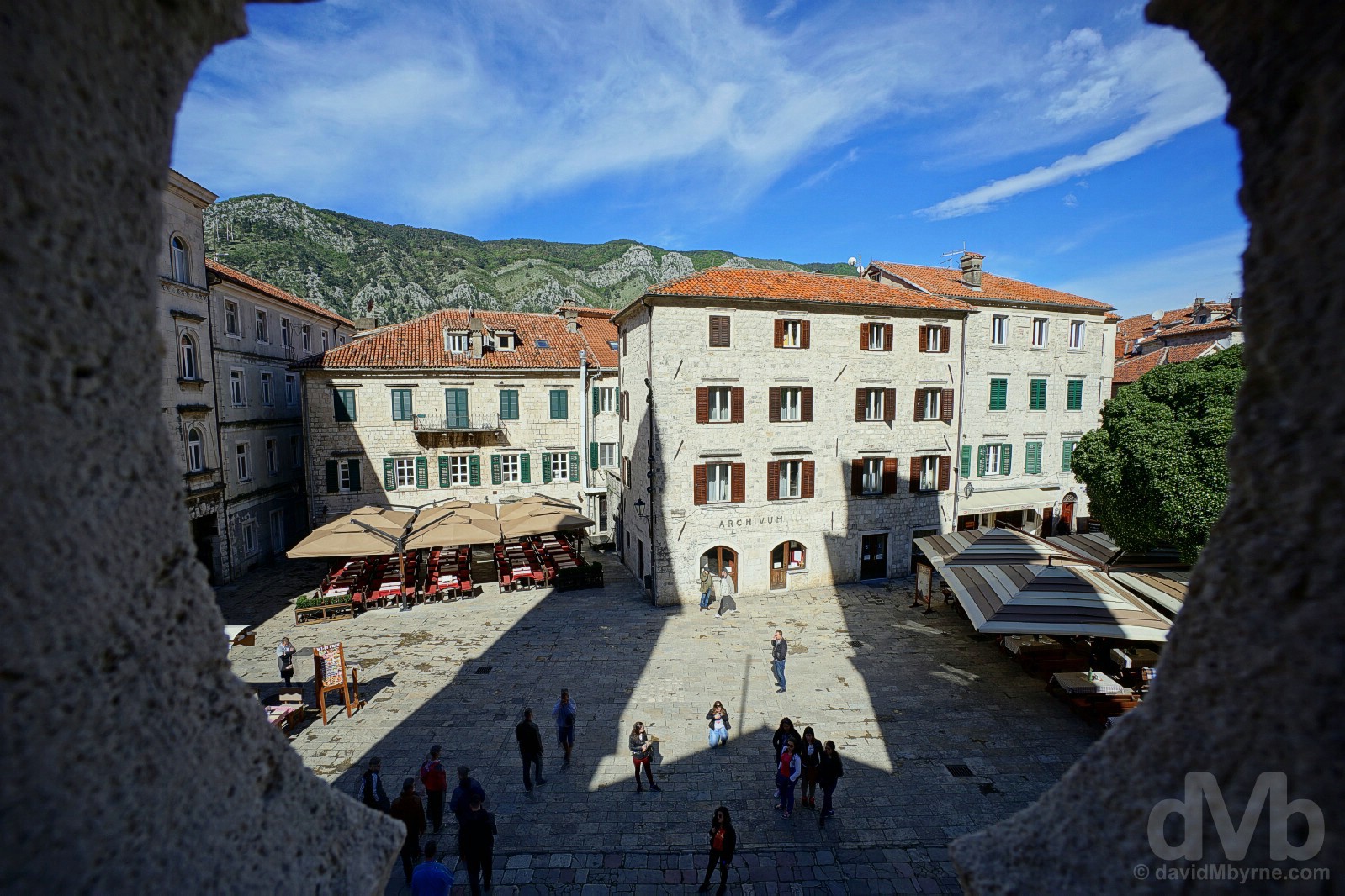
ST NICHOLAS’ CHURCH & ST LUKE’S SQUARE || Playing second fiddle to the larger and older St. Tryphon’s Cathedral, Kotor’s Church of St. Nicholas is nonetheless the town’s preeminent Orthodox church. Dating to 1909 & built over the foundations of an older building that was destroyed by fire in the 19th century, it is something of a simple affair both inside & out, its exterior appearance aided by the presence of twin domed bell towers, a nice mosaic above the entrance, a Serbian flag and, on this particular morning, brilliant sunshine. Undeniably atmospheric, the dark, silent & compact interior smells of incense and beeswax and is full of iconostasis with dark wood set against bare grey walls and with murky light struggling to break through openings in the dome and the narrow stained-glass windows. The church overlooks Trg sv Luke (St. Luke’s Square). Home to the quaint St. Luke’s Church (dating to 1195), the square is just another riot of shutters & wrought-iron balconies, those seen here belonging to the square’s baroque stone Vida Matjan building. Trg sv Luke (St. Luke’s Square), Stari Grad (Old Town), Kotor, Montenegro. April 20, 2017.
Shadows, sunlight & shutters off Trg od Drva (Tree Square) in Stari Grad (Old Town) Kotor, Montenegro. April 20, 2017.
Setting up shop for the day opposite the 18th-century Baroque Grgurina Palace, home Kotor’s impressive Maritime Museum. Stari Grad (Old Town) Kotor, Montenegro. April 20, 2017.
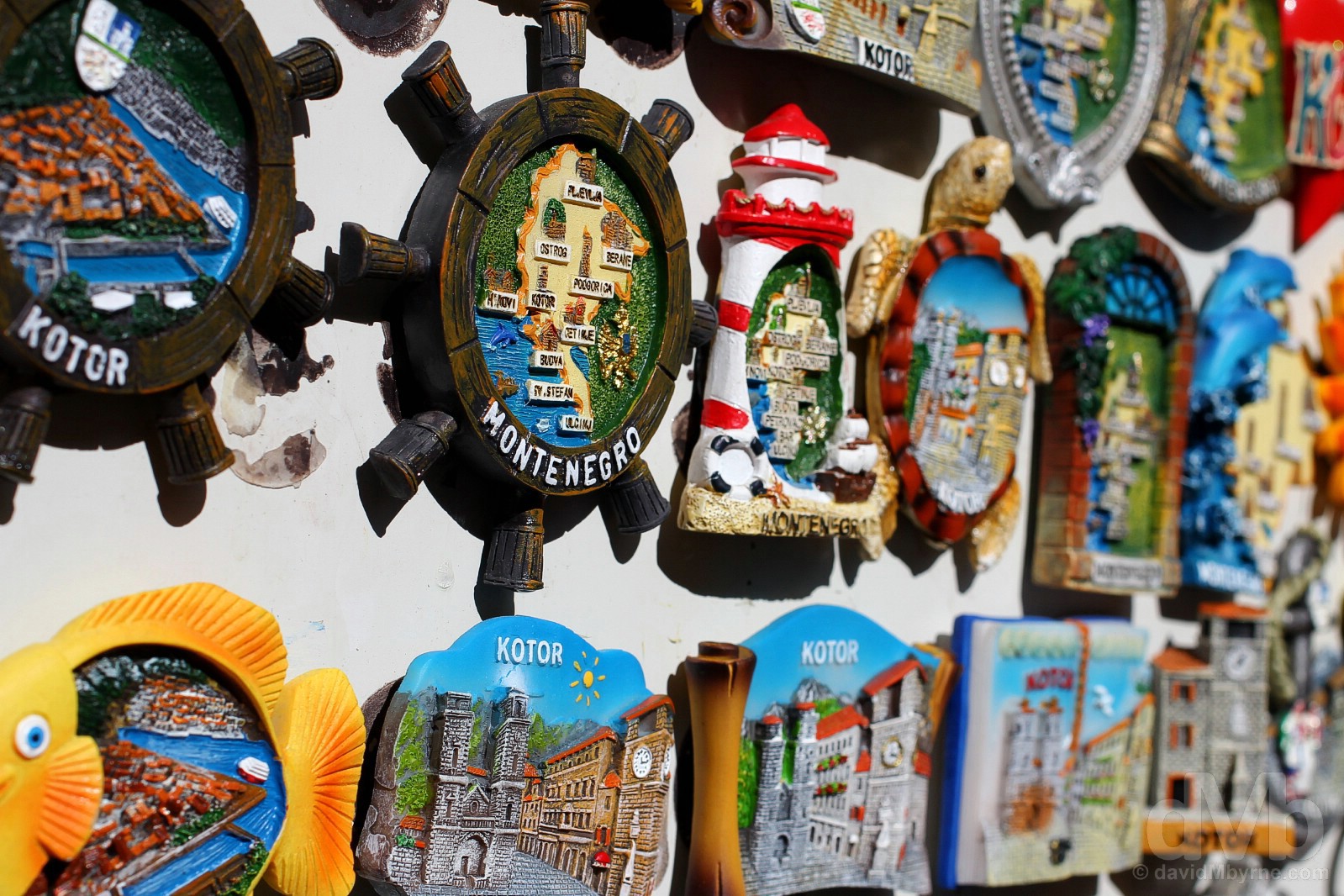
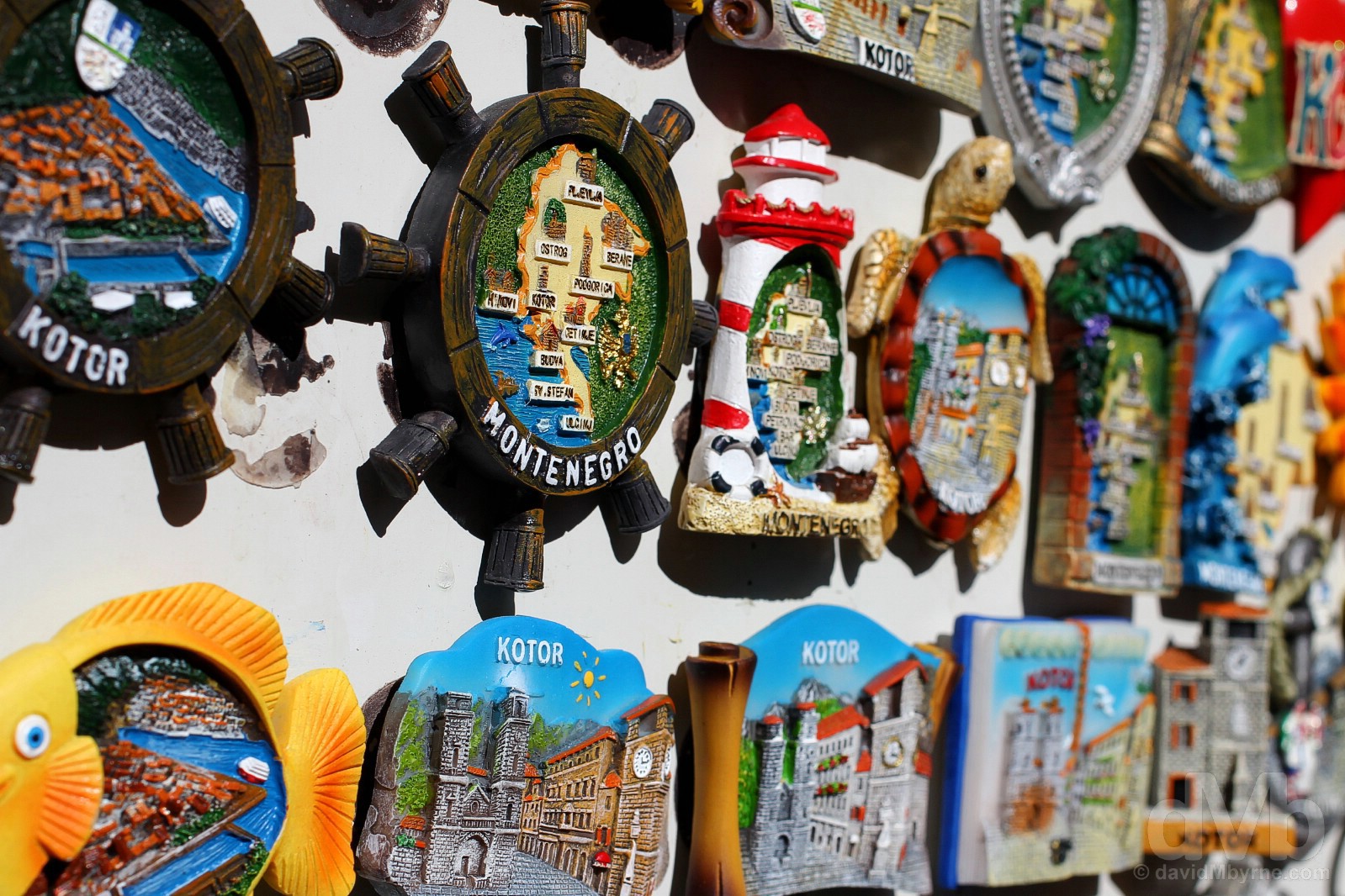
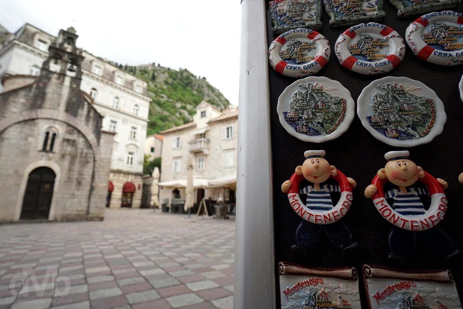
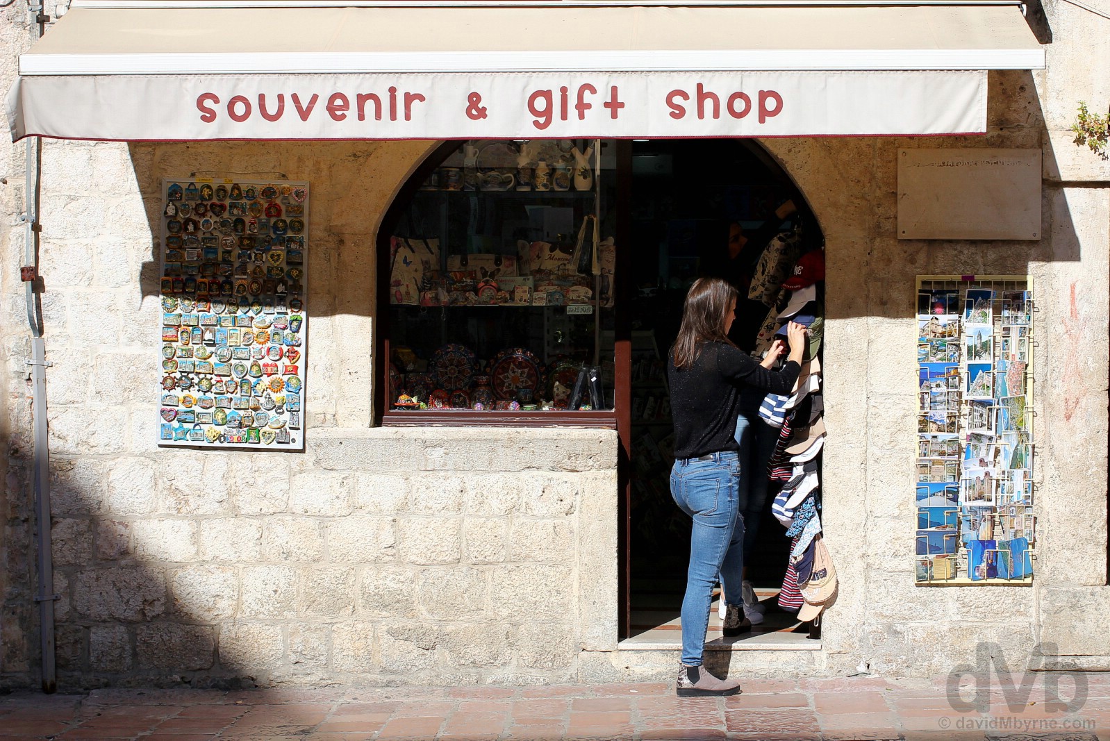
Souvenirs for sale in Stari Grad (Old Town) Kotor, Montenegro. April 20, 2017.
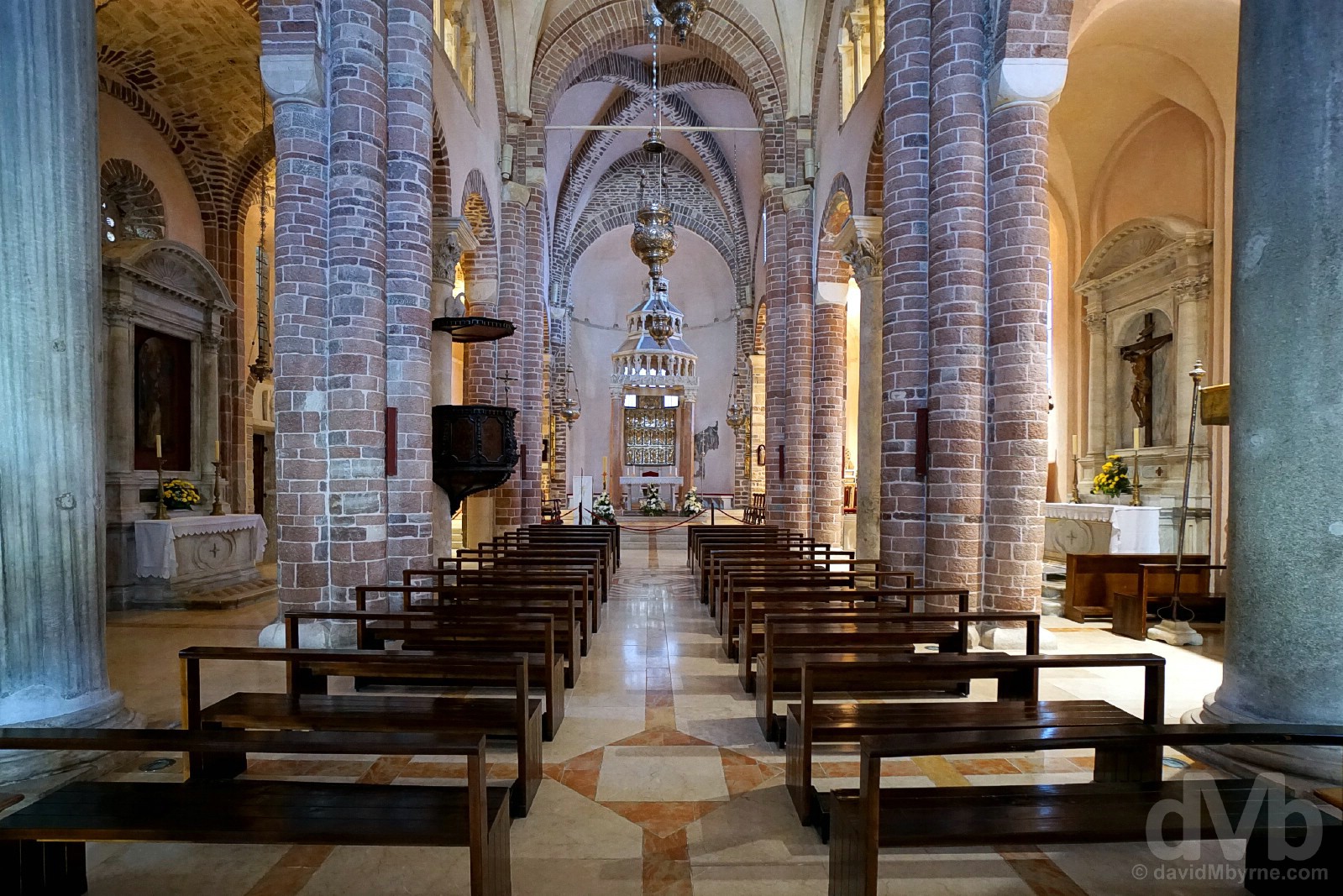
ST. TRYPHON’S CATHEDRAL || Closed the previous evening, on this day I got to covet a look of the airy interior of Kotor’s St. Tryphon’s Catherdral. Home to a gilded silver bas-relief altar screen that is considered Kotor’s most valuable treasure, the interior is said to be a masterpiece of Romanesque architecture with slender Corinthian columns alternating with pillars of pink stone thrusting upwards to support a series of vaulted roofs. A reliquary chapel houses some lovely icons, a wooden crucifix dating to 1288 and assorted body parts of saints including the man himself, St. Tryphon, an early martyr whose importance to both the Catholic and Orthodox churches makes him a fitting patron for the town. The Cathedral of St. Tryphon, Stari Grad (Old Town) Kotor, Montenegro. April 20, 2017.
More sunlight & shadows. The baroque bell towers St. Tryphon’s Cathedral casting shadows across Trg sv. Tripuna (St. Tryphon’s Square) in Stari Grad (Old Town) Kotor, Montenegro. April 20, 2017.
The Bay of Kotor || Porto Montenegro
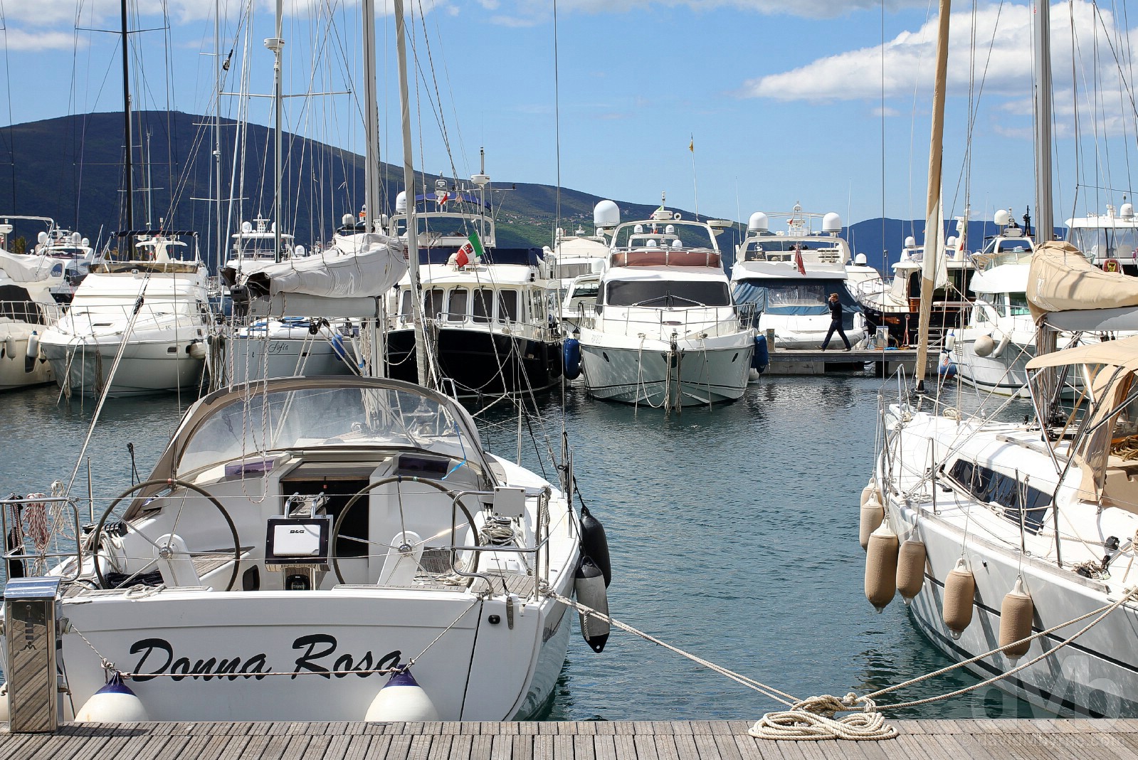
Things are a little different in Porto Montenegro. Very different actually. There are no restored Baroque palaces here, no ancient churches, no disorientating cobbled alleyways and certainly no snaking stone fortifications. Recent investment – mostly overseas investment – along this stretch of the Bay of Kotor shoreline has seen the water’s edge at the town of Tivat transformed into Montenegro’s Blingville, a full-service community of luxury apartments, hotels, shops, restaurants and other sports and entertainment amenities, all centered around a luxury marina where polished chrome & palm trees dominate. It’s very flash and a million miles removed from the antiquity of Kotor, a 10 kilometre drive away but geographically only some 5 kilometres as the crow flies.
– The Sunday Times commenting on Porto Montenegro.
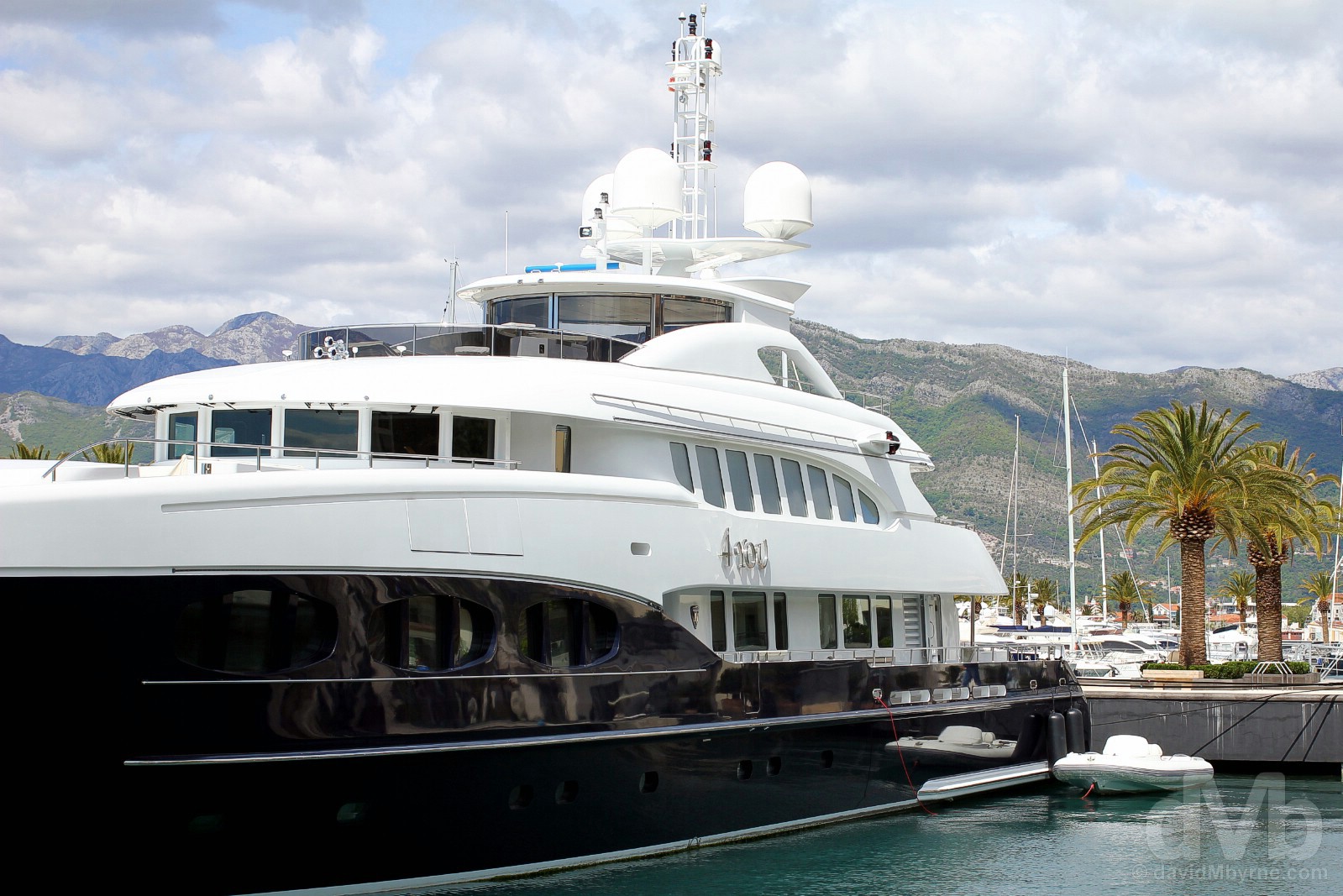
Yachts. Mega-yachts. I’ll be honest, I was not expecting this. The favourable position of Tivat in a secluded part of the Bay of Kotor made it an ideal location for a marina, and thus one was built, a luxury marina for mega-yachts that will eventually offer over 600 berths of all sizes and at least 130 reserved for yachts of over 30 metres. Pictures are frowned upon here; I was shooed away by a security guard for pointing my camera at this beast. Touchy touchy. Jetty 1, Porto Montenegro, Tivat, Montenegro. April 20, 2017.
Venice Square, Porto Montenegro, Tivat, Montenegro. April 20, 2017.
Affordable Luxury?
There is no tourist tat here and very little riffraff, but there are a lot of clean lines, polished surfaces (chrome, one-way windows, yacht hulls, brass plates etc.), manicured bushes and money, the latter an obvious observation when snooping around here. Billed as a one of the best investment options in the region over the last 25 years, this is luxury packaged as attainable to all according to VisitMontenegro.com, they claiming that ‘affordable prices will surprise you in this luxurious complex’. The developers have certainly done their damndest, and they are not done yet – plans are afoot for even more luxury this and high-end that. Build it and they will come? Porto Montenegro certainly thinks/hopes so.
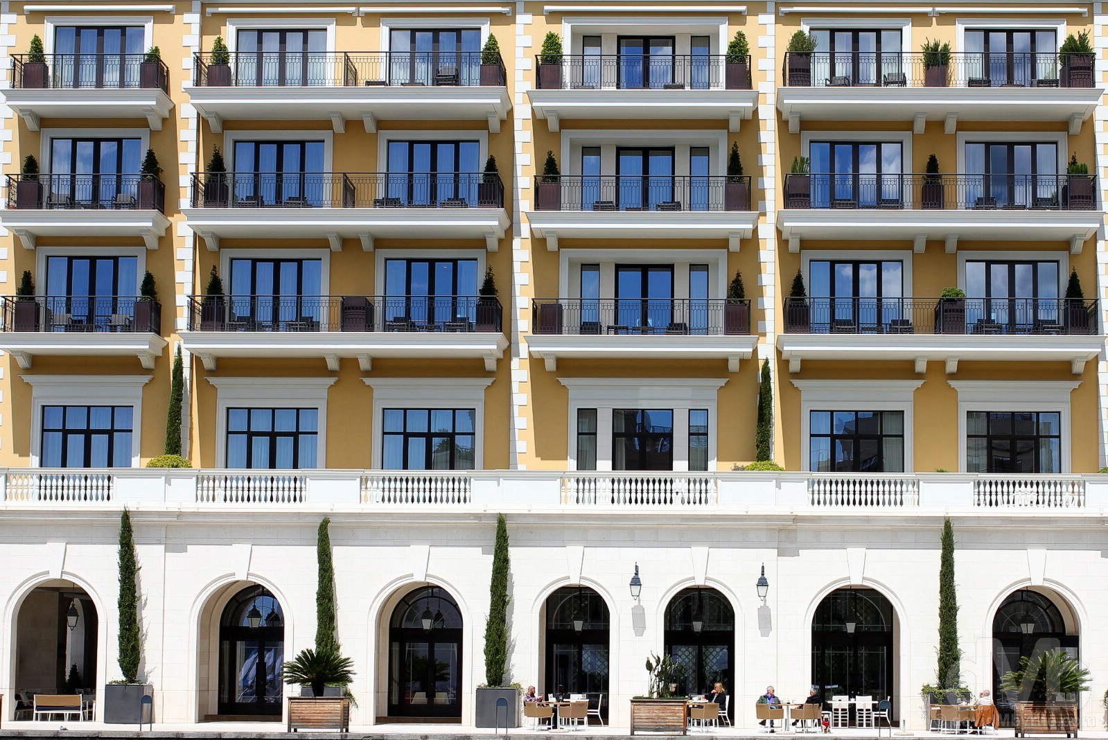
Regent Hotel & Residences, Porto Montenegro, Tivat, Montenegro. April 20, 2017.
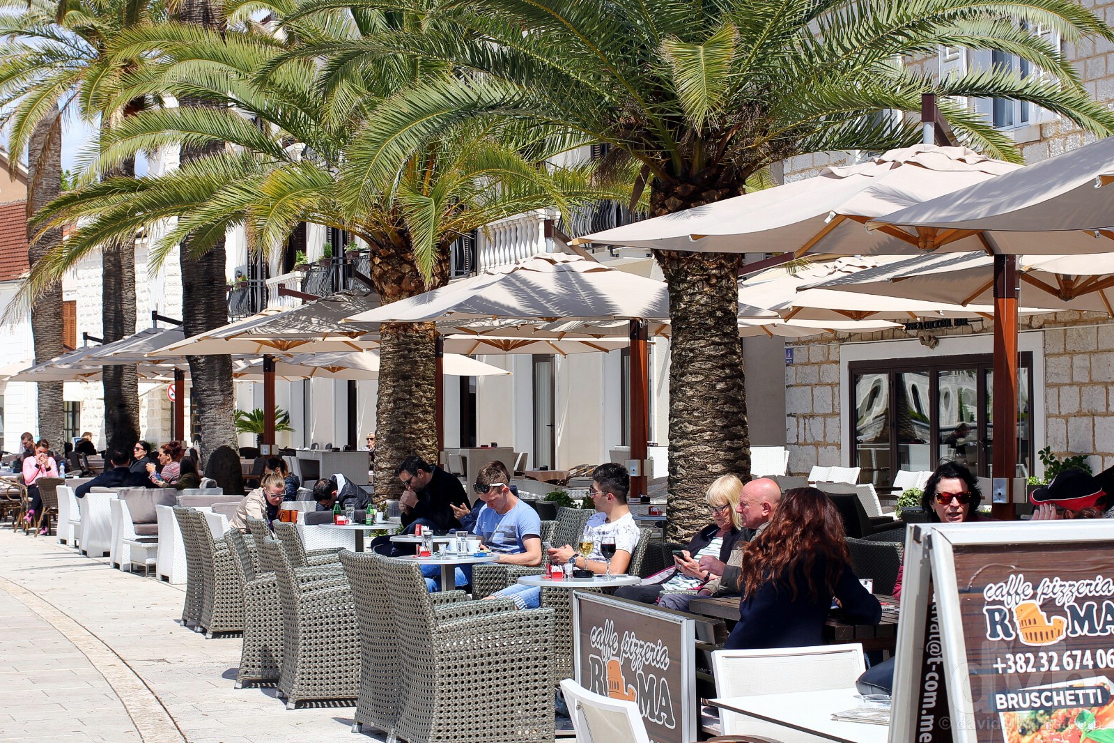
I didn’t have a coffee here but I can only assume it’d be priced slightly higher than the coffee on offer in Kotor. Cafes on Abala Marsala TIta, Porto Montenegro, Tivat, Montenegro. April 20, 2017.
Signing Off | The Complete Bay of Kotor Gallery