Puerto Rico
America Transported To The Steamy Caribbean
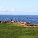
Castillo San Felipe del Morro, Viejo (Old) San Juan, Puerto Rico. June 2, 2015
Puerto Rico
The Caribbean is not very conducive to spontaneous, whimsical independent travel. Maybe that’s why the region doesn’t attract too many of the spontaneous, whimsical independent type of traveller, travellers who, like me, embark on a spot of Caribbean island-hopping (all-inclusive cruise, anyone?). Earlier in the trip I managed to sweet-talk my way out of Cuba and onto my flight to Jamaica, despite not having a confirmed onward flight (out of Jamaica). At the time it was an issue, as was arriving in Puerto Rico, the smallest, eastermost & last of the Caribbean’s Greater Antilles I was to visit en route to the so-called Lesser Antilles. The US Immigration official in San Juan’s Luis Muñoz Marín International Airport didn’t like the fact that I had no idea how long I’d be spending on the island, or where I’d be flying to once all was said and done – with so many options “east” was about the best I could muster. He couldn’t care less for my island-hopping exploits. Ditto for my desire to be as impulsive as possible en route. But as hard-nosed as he was, he did create a Wi-Fi hotspot on his iPhone to allow me book onward passage. That saw me jumping immediately on a $50 JetBlue flight east to Sint Maarten/Saint Martin in 9 days’ time, securing ludicrously inexpensive passage in a region where ludicrously inexpensive passage is the exception rather than the rule. Only then was I free to be enchanted by the Caribbean’s self-titled Isla del Encanto, Island of Enchantment. And enchanted I was. I had many but, and somewhat unexpectedly, Puerto Rico was to prove to be the highlight of my time in the Caribbean. And now that I’ve left the region, I still can’t quite explain why, other than to say it’s, emm, well, enchanting. All I know is that if I had to revisit one Caribbean destination in the morning, it would be Puerto Rico.
Isla del Encanto. Plaza Del Mercado, San Juan, Puerto Rico, Greater Antilles. June 1, 2015.
HISTORY, DEBT & STATUS WITHIN THE US
The island of Puerto Rico was claimed for the Kingdom of Spain in 1493 by Christopher Columbus on his second voyage to the New World, a.k.a. the Americas, conveniently ignoring in the process the native Taino Indians who had called the island home for centuries. Known to the natives as Borinquen (Land of the Noble/Valent Lord), a name some Puerto Ricans still use to this day, Columbus christened the island San Juan Bautista in honor of the Catholic saint, John the Baptist (it was renamed to its present Puerto Rico, meaning Rich Port, in 1521 with the founding of the capital San Juan, the second oldest European-established capital city in the Americas after Santo Domingo in the Dominican Republic). It wasn’t until 1508 that the Spanish, under Juan Ponce de Leon, actually got around to establishing a colony on the island. Right from the get-go they were looking over their shoulder. Revolt by the Taino was brutally crushed in 1511 & by the 1530s they were also fighting off threats to their colony from European privateers & pirates, all of whom were lured by the wealth flowing out of Spain’s New World colonies & many of whom were armed by Spain’s European colonial rivals, the French, the English, & the Dutch. The English themselves, under Sir Francis Drake, attacked in 1595 & again in 1598, while the Dutch gave it a go in 1625. All advances were repelled, although the British attack of 1598 did have some success which resulted in the British holding the island for a limited time. At the time of the English attacks San Juan’s Castillo San Filipe del Morro was the city’s lone defensive structure guarding the entrance to Bahia de San Juan (San Juan Bay) & protecting it from naval attack. Continuing threats meant defences had to grow to meet the challenges, although a lot of it was reactive – the impressive defensive system of walls and fortifications eventually built to defend the city from land attack were only initiated after the Dutch attack of 1625. Wars raged between European powers throughout the 1700s. Losses to British forces in the Caribbean during the Seven Years’ War (1756-1763) only served to heighten the strategic importance of Puerto Rico to the Spanish & they continued to rebuff all hostile advances thus protecting their vital New World communication & trading routes.
– Philip IV of Spain (reigned 1621-1665)
Spanish Colony To US Commonwealth
The 1800s was a period of decline for the Spanish. Weakened by international conflict & a Civil War at home, Spain lost its grip on much of its New World empire; in the 1810s & 1820s Mexico, Columbia, Venezuela, Argentina, Peru & Chile all gained independence & by 1870 only Cuba & Puerto Rico remained under Spanish control. But not for long. The outbreak of the Spanish-American War in 1898 was the final knell of the Spanish in the Caribbean & by the end of the 108-day war they had lost control of not only Puerto Rico but also Cuba, Guam, & the Philippines. Ouch. The island became an official territory of the US, and its inhabitants US citizens, in 1917. Thirty-five years later, in 1952, the island’s first constitution was approved, its flag flew officially (& legally) for the first time and the island became the self-governing US commonwealth it remains today, neither a full-blown state nor an independent country but somewhere in between.
Present-Day Puerto Rico (& Statehood?)
 Today Puerto Rico, with a population of 3.5 million, is the Caribbean’s US-sponsored economic powerhouse. Needless to say, over a century of American supervision & decades of American-style development means Puerto Rico is as you’d expect (you just don’t expect it in the steamy, laid-back Caribbean) – mega malls, factory outlets, fast-food joints & clogged multi-lane highways; Puerto Ricans, and just like their mainland cousins, have an unhealthy obsession/reliance on the car (although, and in their defense, public transport on the island, as I was to learn, is abysmal). Although boasting the highest GDP per capita in the region & tax-free earnings (Puerto Ricans pay no income tax), Puerto Rico is still poorer than the poorest US state (Mississippi) & broke as a joke – the island is a whopping & well-publicised US$72+ billion in debt. It works hard to keep its tourist numbers high – the island is a popular destination and thus tourism a big earner – thanks to its combination of rich history, tropical climate, diverse natural scenery & passport-less travel for mainlanders. But the island also seems to work hard at trying to figure out where exactly it fits in. Four times since the late 20th century Puerto Ricans have voted to resolve their political status, most recently in November 2012. That resulted in a majority (54%) voting in favor of a change in status, with full statehood the preferred option (as opposed to keeping the status quo or full-blown independence, the latter a pipe-dream for a small few). However, the result was highly controversial with nearly half a million votes left blank leading statehood opponents to suggest that the referendum actually revealed only 45% support for statehood. The Legislative Assembly of Puerto Rico has since enacted a resolution requesting the President & Congress to end its current status as an unincorporated US territory and begin the process of admission to the union as a state. Puerto Rico. The 51st state? Maybe. Maybe not. Watch this space.
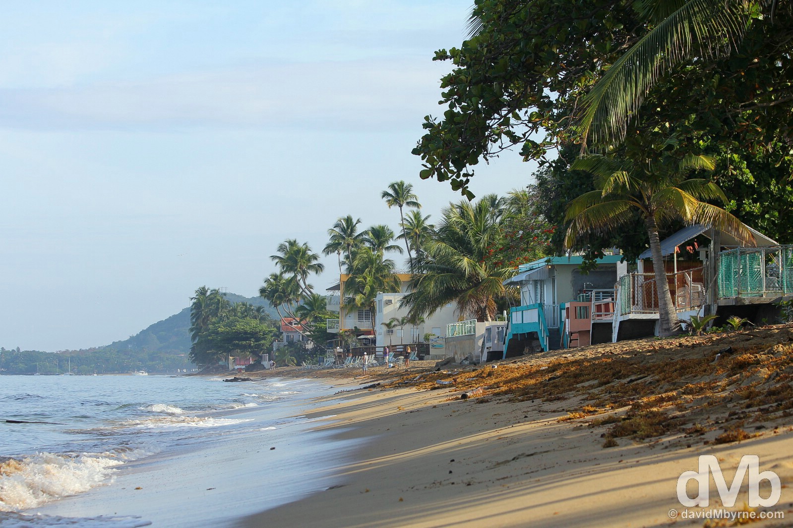
Playa Luquillo, eastern Puerto Rico, Greater Antilles. June 5, 2015.
Discovering Puerto Rico
A ubiquitous Puerto Rican traffic jam saw me missing my flight off the island, a scheduled 8-night stay extended out to 9. Not for one minute of that time did I ever feel like I was in the Caribbean, the stifling heat, palm trees, gorgeous beaches & abundance of rum notwithstanding. But make no mistake, this is the Caribbean. It’s just the Caribbean Americanised. For me Puerto Rico was to be the last of the so-called Great Antilles islands I was to visit – following on from time warp Cuba, moneyed Grand Cayman, Rastafarian Jamaica, Third World Haiti, & historic Dominican Republic – but it was also to prove to be my favourite location of the lot. And here’s why.
Read all Puerto Rico location postings in chronological order or jump to specific postings using these links.
Capital Region – San Juan & Cataño (Casa Bacardi)
Western Puerto Rico – Isabela, Rincón, & the Arecibo Observatory
Central Puerto Rico – Ruta Panoramica
Eastern Puerto Rico – Playa Luquillo, El Yunque National Forest, Fajardo, & the traffic jam/missed flight
CARIBBEAN ISLAND HOPPING – Moving On || Puerto Rico to Sint Maarten/Saint-Martin
Puerto Rico Locations Map
Love Puerto Rico. Viejo (Old) San Juan, Puerto Rico, Greater Antilles. May 31, 2015.
Capital Region
San Juan & Cataño
A sentry box on a section of the Viejo (Old) San Juan walls, Puerto Rico. June 2, 2015
Capital Region
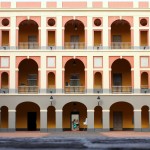
San Juan & Cataño || The second-oldest European-established capital city in the Americas, chock-full of colourful cobblestone backstreets, gorgeous architecture, historic fortifications, & awesome street murals. Oh, and not forgetting the world’s largest rum distillery.
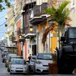
The majority of my time in Puerto Rico was spent in its capital, San Juan, the historic second-oldest European-established capital city in the Americas. This is where the Island of Enchantment first got its clutches into me, and it never let go. A spread-out city with a population of 400,000, I fell head over heals for its seductive combination of colourful backstreets, gorgeous architecture, historic fortifications (walls & forts) & awesome street murals, some of the best I’ve seen on all of my travels.
Avenida Manuel Fernandez Juncos, San Juan, Puerto Rico, Greater Antilles. June 6, 2015.
It rained a lot when I was in the capital. Mostly in the afternoon – the mornings & evenings were typically sunny & clear. Regardless of the time of day or the climatic conditions, it was hot. Hot & sticky in the hot & sticky Caribbean.
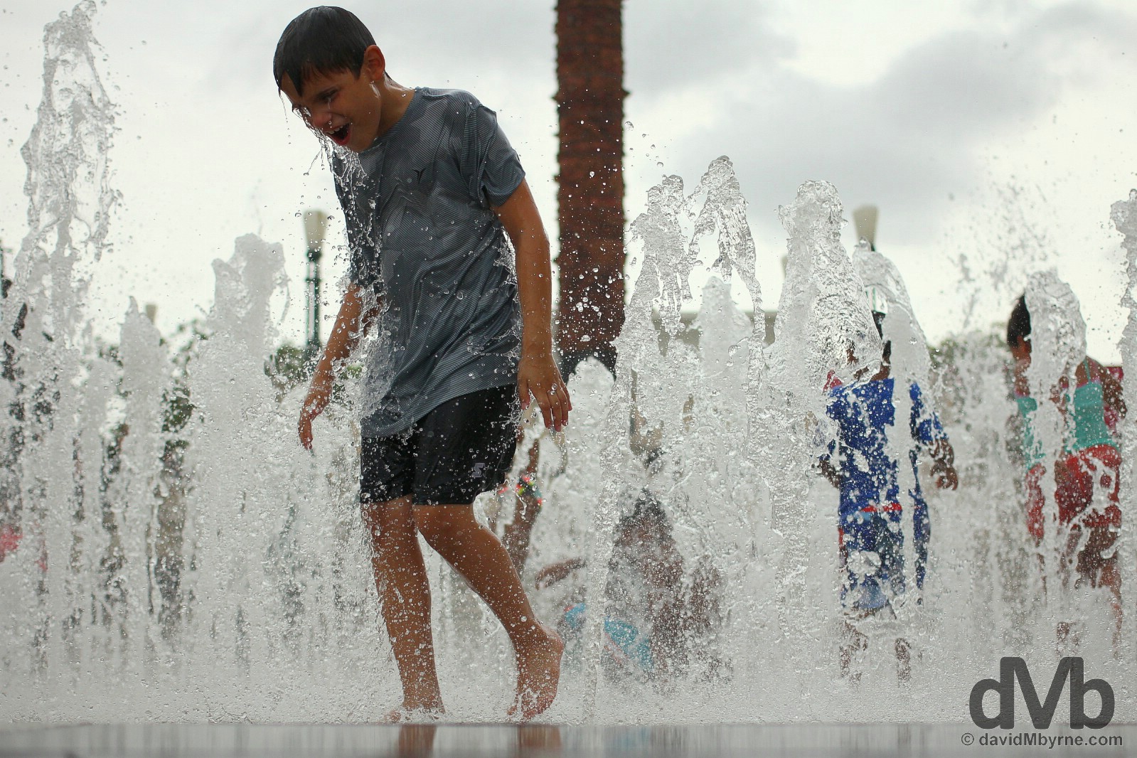
It would have been nice to cool down with the kids in the fountain of Plaza del Quinto Centenario in UNESCO-listed Viejo (Old) San Juan but I thought better of it, opting to photograph them instead. After all, it’s what I do. Viejo (Old) San Juan, Puerto Rico, Greater Antilles. May 31, 2015.
Viejo (Old) San Juan & Its Fortifications
Viejo (Old) San Juan is the compact & mostly walled northwestern portion of wider San Juan, itself an islet connected to mainland Puerto Rico via bridges. A seemingly endless labyrinth of crooked cobblestone streets, pastel-painted colonial buildings and historical fortifications, it is the oldest Puerto Rican settlement & one of the oldest & best preserved colonial cities in the Americas. It’s one hell of a visual & historical treat.
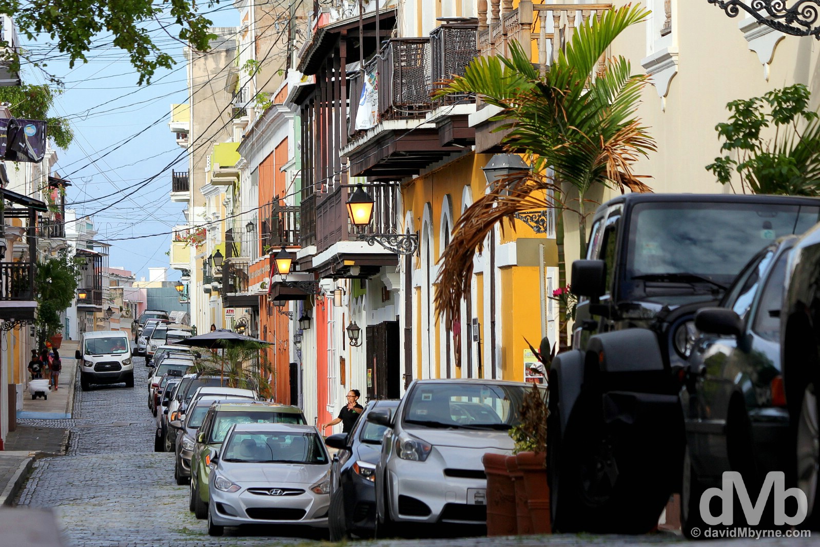
Calle de San Sabastian in Viejo (Old) San Juan. A centuries-old bastion that combines modern vibrancy with some of the most historic sites in the hemisphere, the compact district of Viejo (Old) San Juan is characterized by both its narrow, colourful cobblestone streets lined by grille-balcony-boasting 16th & 17th century buildings & its amazing array of 15th & 16th century military fortifications. Viejo (Old) San Juan, Puerto Rico, Greater Antilles. June 2, 2015.
I spent a lot of time snooping around and exploring Veijo (Old) San Juan, popping in and out of shops, historic buildings & museums, ogling at gorgeous architecture, lazing in open-air cafes overlooking tree-shaded plazas, & walking atop historic fortifications.
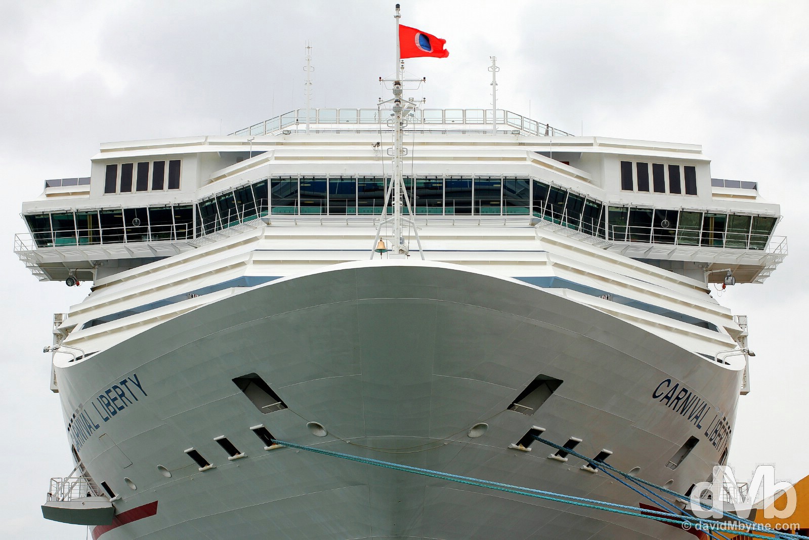
Viejo (Old) San Juan has lots to do & see, and lots of tourists come to do & see (at least some of) it. This is tourist central in Puerto Rico. Every visitor to the island gravitates here eventually, and rightfully so. But given the fact that the island’s main cruise terminal deposits cruisers right into the heart of Viejo (Old) San Juan then this is also the only part of Puerto Rico that 100% of whistle-stop cruise passengers, the majority of travellers to the island, get to experience. That’s a travesty. No doubt. But I guess not visiting at all would be an even bigger travesty. This is a picture of the Carnival Cruise Line’s 110,000-tonne, 290 metre-long, 13 deck-high Carnival Liberty cruise ship docked in Viejo (Old) San Juan, its passengers no doubt out exploring Viejo (Old) San Juan’s streets for the limited time they have to do so before setting sail for their next location; cruise ships, which are getting bigger and bigger, sail at night and sit in port during the day to facilitate excursions. Two million cruise-ship passengers a year makes the Caribbean the world’s largest cruise-ship destination, with San Juan one of three US-based main departure points for regional cruises, the other two being Miami and Fort Lauderdale in Florida. The typical cruise-ship holiday is the ultimate package tour; all that’s required is the effort in selecting the cruise and showing up. And while I can understand the appeal (& convenience) of visiting many islands in a few days, it just doesn’t do it for me. Viejo (Old) San Juan, Puerto Rico, Greater Antilles. May 31, 2015.
While Viejo (Old) San Juan is characterised by its quaint streets, numerous public plazas, buildings & churches, including San José Church and the Cathedral of San Juan Bautista, the latter of which contains the tomb of the Spanish explorer & original European island settler Juan Ponce de León, the highlight of the district for me was its UNESCO-listed system of fortifications; even to this day the oldest parts of the district remain mostly enclosed by massive walls dotted with iconic sentry boxes and anchored by two massive forts.
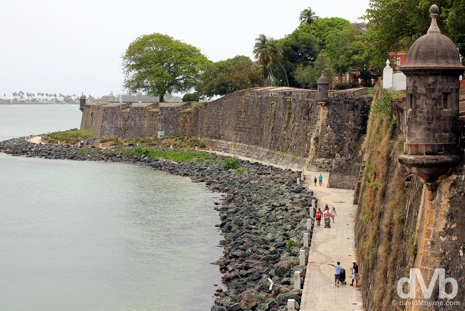
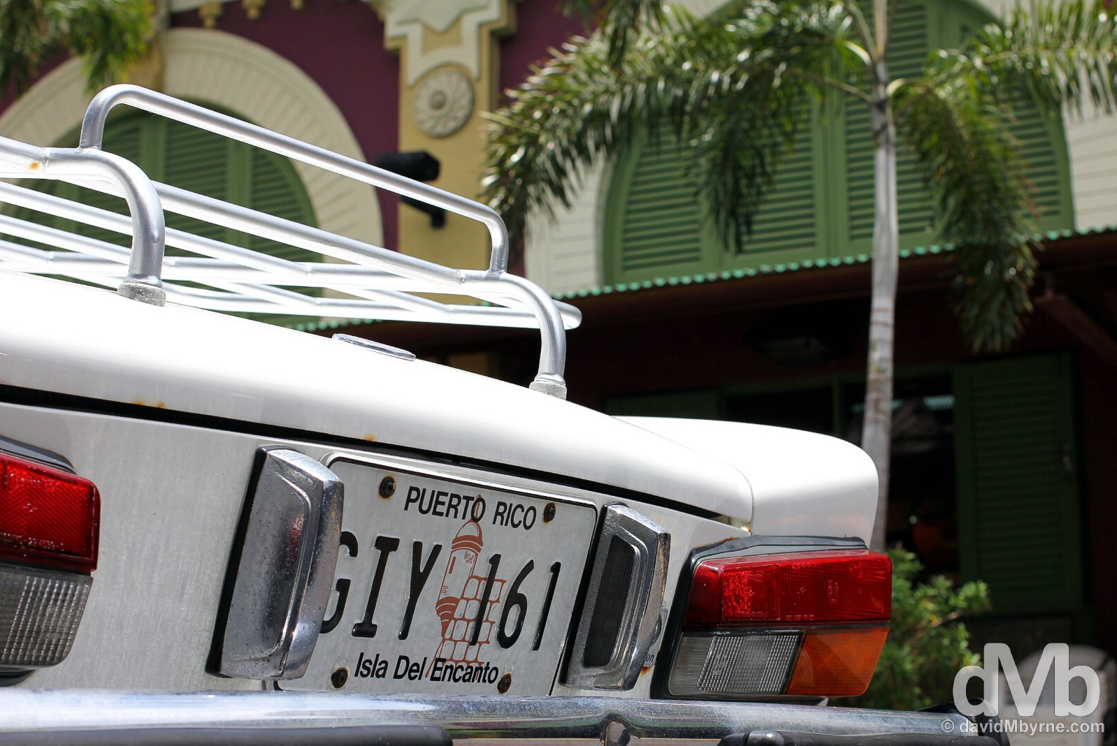
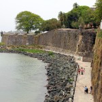
Walking Paseo del Morro at the base of a section of the impressive Viejo (Old) San Juan walls. Constructed between 1625, following a Dutch attack on the city, & 1790, the walls once encircled the entire city and formed an integral part of a wider fortification & outer defensive system designed to disorient, unnerve, & exhaust would-be attackers. Between 1894 and 1897 the southeastern portion of walls were removed to allow for city expansion and today a little over 5 kilometres (3 miles) of the original walls remain, dotted with embrasures, gunports for firing cannon, & garita, sentry boxes perched at key viewpoints, the latter an iconic symbol of present-day Puerto Rico (they appear on the island licence plates). Paseo del Morro by the edge of Bahia de San Juan (San Juan Bay). Viejo (Old) San Juan, Puerto Rico, Greater Antilles. May 31, 2015.
San Juan’s Importance & Fortification System
Puerto Rico was strategically vital to the Spanish. The position of the island at the eastern, European end of the Greater Antilles meant it was an eastern gateway to the Caribbean region & the very first major island in the region with water, shelter, and supplies that sailing ships came to en route to the Americas from Europe; trade winds, helped by strong ocean currents, propelled sailing ships here from Europe & vice versa. Effectively guarding access to the unimaginable riches of the Spanish New World beyond (in Mexico & Central and South America), in holding Puerto Rico the Spanish possessed the key to the whole New World, the Western Hemisphere. As such they built, over a 250 year period, a massive & complex system of impregnable fortifications centered on the northwestern tip of the islet at the mouth of the island’s primary harbour, present-day San Juan Bay, a deep, sheltered and readily defended bay. Their so-called “Defence in Depth” system fortified San Juan Islet against enemy entry with three lines of defence. The structures of the first and second defensive lines no longer exist, but the third and final line – the walls of present-day Viejo (Old) San Juan & its two major fortifications of Castillo San Felipe del Morro (a.k.a. El Morro) & Castillo San Cristobal – still stand to this day and remain as not only the oldest European-type masonry fortifications in the US but also as the UNESCO-listed remnants of the high point of 1600s and 1700s military engineering, a time when war and trade travelled on sailing ships.
– UNESCO commenting on La Fortaleza and San Juan National Historic Site in Puerto Rico
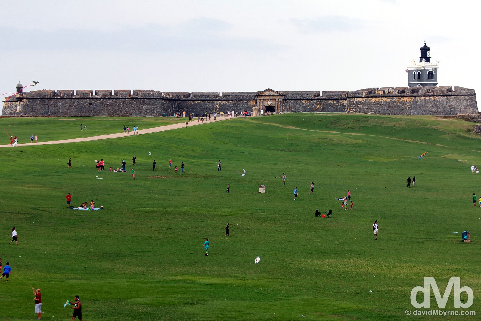
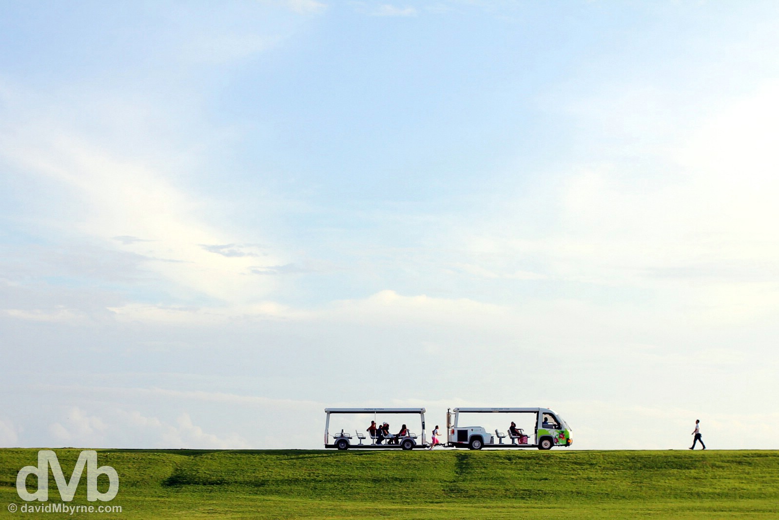
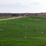
Popular with loungers, families, & kite flyers, windswept Campo del Morro is the flat, expansive & picturesque approach to Castillo San Felipe del Morro, a.k.a. El Morro, seen in the distance at the very northwestern tip of the San Juan Islet guarding the entrance to Bahia de San Juan (San Juan Bay). All locations of interest in Viejo (Old) San Juan are liberally dotted with historical plaques & dual English/Spanish signage meaning a stroll around the district is quite the educational endeavour. The info boards lining the walkway to the fort’s entrance on Campo del Morro informed me that during the 1625 attack on San Juan by the Dutch, prior to the construction of San Juan’s walls and at a time when the city itself was vulnerable to attack from the east, assailants charging the walls of El Morro across this open space were easy targets for fort defenders. Viejo (Old) San Juan, Puerto Rico, Greater Antilles. May 31, 2015.
Campo del Morro in Viejo (Old) San Juan, Puerto Rico, Greater Antilles. June 2, 2015.
Castillo San Felipe del Morro, a.k.a. El Morro
Viejo (Old) San Juan’s emblematic Castillo San Felipe del Morro is one of two forts, the other being Castillo San Cristóbal, that acted as the primary defenses of the settlement. Perched on the very western tip of the San Juan Islet and guarding the entrance to San Juan Bay, construction on El Morro started in 1539 when it was nothing more than a promontory with a single cannon. Beefed-up numerous times over the years, by its completion in 1790 it was the powerful six-level fortress it is today, one boasting 40-meter-high & 5-metre-thick walls. Part of a U.S. Army post, Fort Brooke, right up until 1961, the fort, today probably Puerto Rico’s most famous & most visited attraction, houses an informative military museum on the history of the occupation of the island and on the construction of the fort. But more than that, it survives as a UNESCO-listed masterpiece of military engineering from the 1500s to the present.
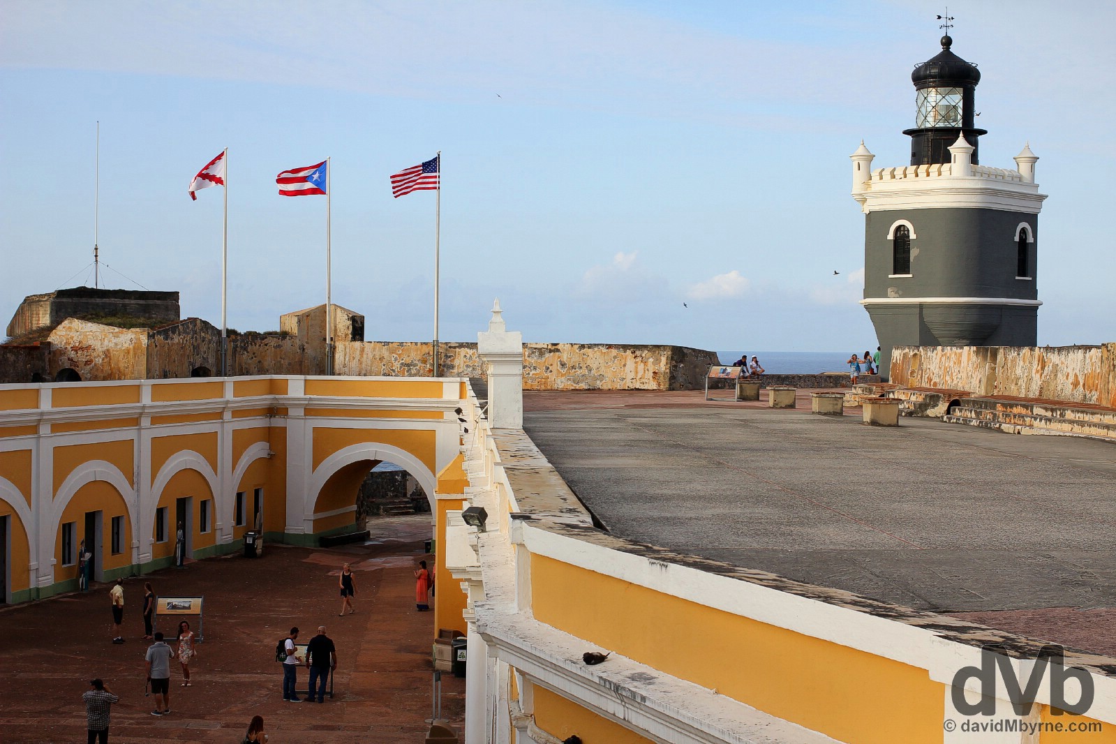
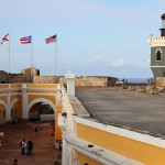
The El Morro money shot, a picture captured on the upper ramparts/level of the 6-level Castillo San Felipe del Morro showing its lone grey, castellated lighthouse. Although there has been a lighthouse here since as early as 1846, the present structure dates to 1908 and is today the oldest light station still in use in Puerto Rico. Also see here are the three flags permanently flown over El Morro: the US flag (right); the Puerto Rican flag (middle); &, to the left, the “Cross of Burgundy,” a Spanish military flag used from the 16th to the 18th century to identify warships, forts, and regiments of troops loyal to the king of Spain. Castillo San Felipe del Morro in Viejo (Old) San Juan, Puerto Rico, Greater Antilles. June 2, 2015.
– Lonely Planet
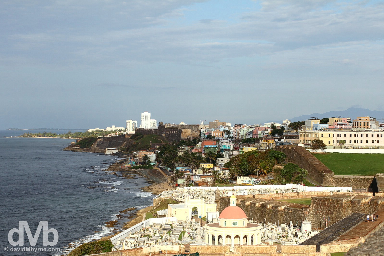
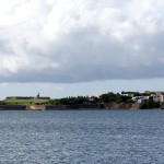
Lonely Planet is not wrong. The view from the upper ramparts of El Morro back to Veijo (Old) San Juan and along the northern, Atlantic-facing coast of the San Juan Islet are rather impressive, especially late in the afternoon or early evening when the sun is low in the sky (this picture was taken at 17:42). Seen here in the foreground is the Cementerio de San Juan with its distinctive circular neoclassical chapel. Sitting just outside the city walls, San Juan’s earliest settlers are buried here. Beyond the cemetery, and overlooked by the city walls, is the neighbourhood of La Perla (see next picture). The walls extend beyond the cemetery & La Perla to San Jaun’s second major fort, Castillo San Cristobal, its hulking mass seen in the distance. Built between 1634 and 1783 to protect El Morro and the city from attack from the east, it was designed by Irishman Thomas O’Daly, in the service of Spain as Ireland and Spain shared a common enemy – England. Bigger than El Morro, the 3-level Castillo San Cristobal is the largest European fortification in the Americas (although it’s still smaller than Citadelle Laferrière in Haiti, the largest fort in the Americas). Finally, and around the headland beyond San Cristobal, are the recreational beaches of the Condado and Ocean Park areas of San Juan (see later pictures). Viejo (Old) San Juan, Puerto Rico, Greater Antilles. June 2, 2015.
A few other captures from my ambles around Viejo (Old) San Juan.
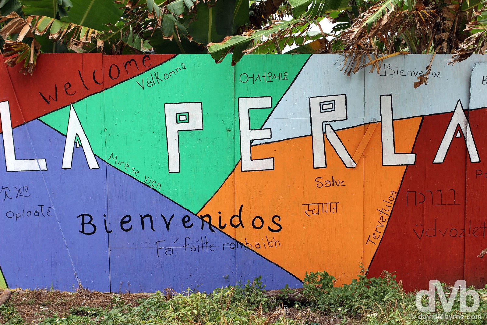
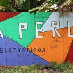
I descended down from the Viejo (Old) San Juan walls to take a look a round the La Perla neighbourhood, even though it’s not recommended to do so – it’s one of Puerto Rico’s most notorious slums and the standard advice is for tourists to steer clear and view it only from a distance. While La Perla is an undeniably gritty & high-crime neighbourhood with a seemingly incurable drug problem, its colourful, ramshackle buildings, murals and tight, narrow roads make it a rather picturesque place to wander. However, and as picturesque as it may be, I still didn’t feel 100% comfortable brandishing a camera down here and was happy to capture this image of many La Perla welcomes, including one in Irish, near the entrances of the district just beyond the Viejo (Old) San Juan walls. La Perla, San Juan, Puerto Rico, Greater Antilles. May 31, 2015.
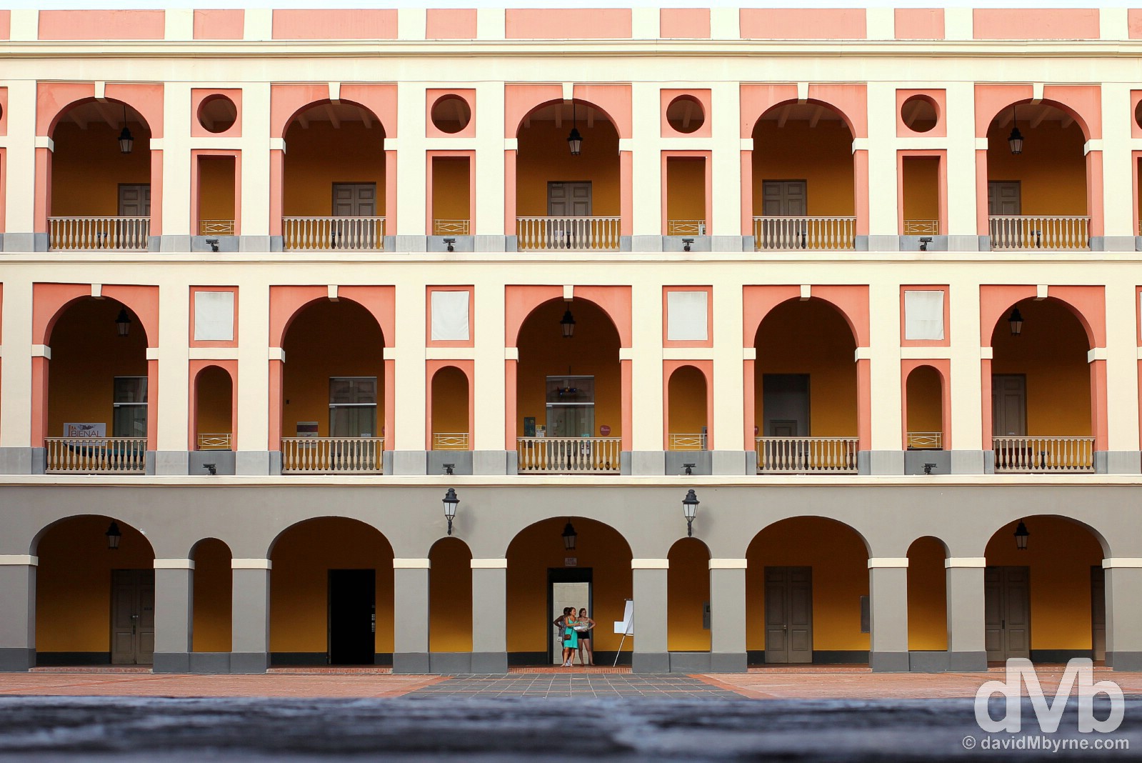
One of the most impressive, and largest, of all Viejo (Old) San Juan buildings is the square Cuartel de Ballaja just off Campo del Morro. The three-tier building – home to the Museo de las Americas, housed on the second/middle level and providing an overview of cultural development in the New World – was built in 1854 as a military barracks and holds the distinction of being both the largest & last building constructed by the Spanish anywhere in the New World. The building’s central courtyard, where this picture was captured, is a soothing pastel-coloured riot of balconies, arches and repetition and it is easily one of the most photogenic locations among many, many photogenic Viejo (Old) San Juan locations. The interior courtyard of Cuartel de Ballaja in Viejo (Old) San Juan, Puerto Rico, Greater Antilles. June 2, 2015.
Another museum, this one the Museo de San Juan, probably the city’s definitive take on San Juan’s 500-year history. Viejo (Old) San Juan, Puerto Rico, Greater Antilles. May 31, 2015.
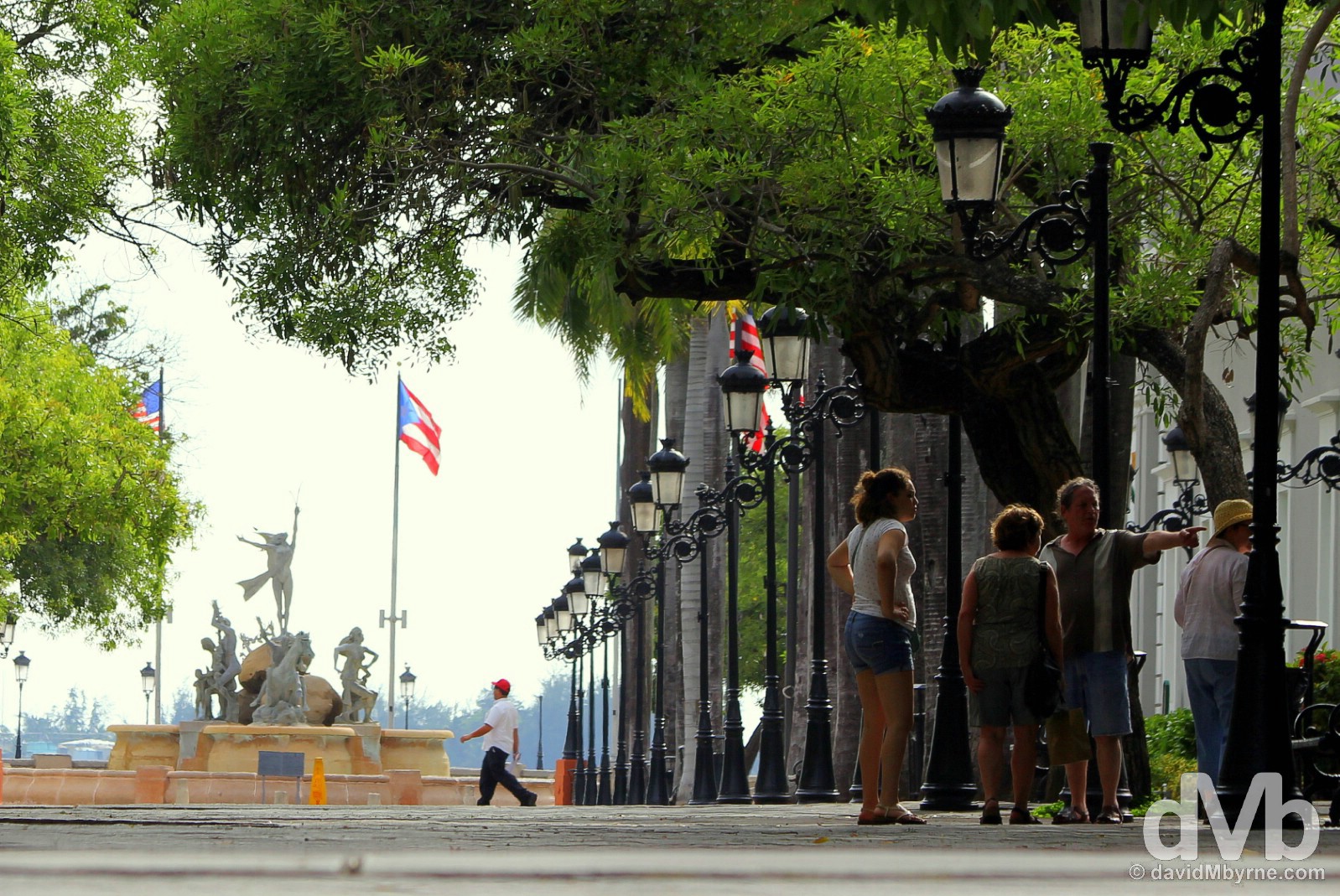
Sitting outside the city walls, Paseo de la Princesa (Walkway of the Princesses) is a picturesque 19th-century esplanade lined with antique street lamps & shaded by palm trees. A popular stroll for romantics and leading to the Paseo del Morro skirting the base of the city’s towering external walls, the walkway ends at the impressive Raices Fountain, seen here in the distance. Unveiled on May 30, 1992, for the inauguration of the walkway, & in commemoration of the Fifth Centennial of the Discovery of America, the group of sculptures collectively symbolise the roots that gave birth to Puerto Rico’s cultural heritage, so says the placard fronting it. Viejo (Old) San Juan, Puerto Rico, Greater Antilles. June 2, 2015.
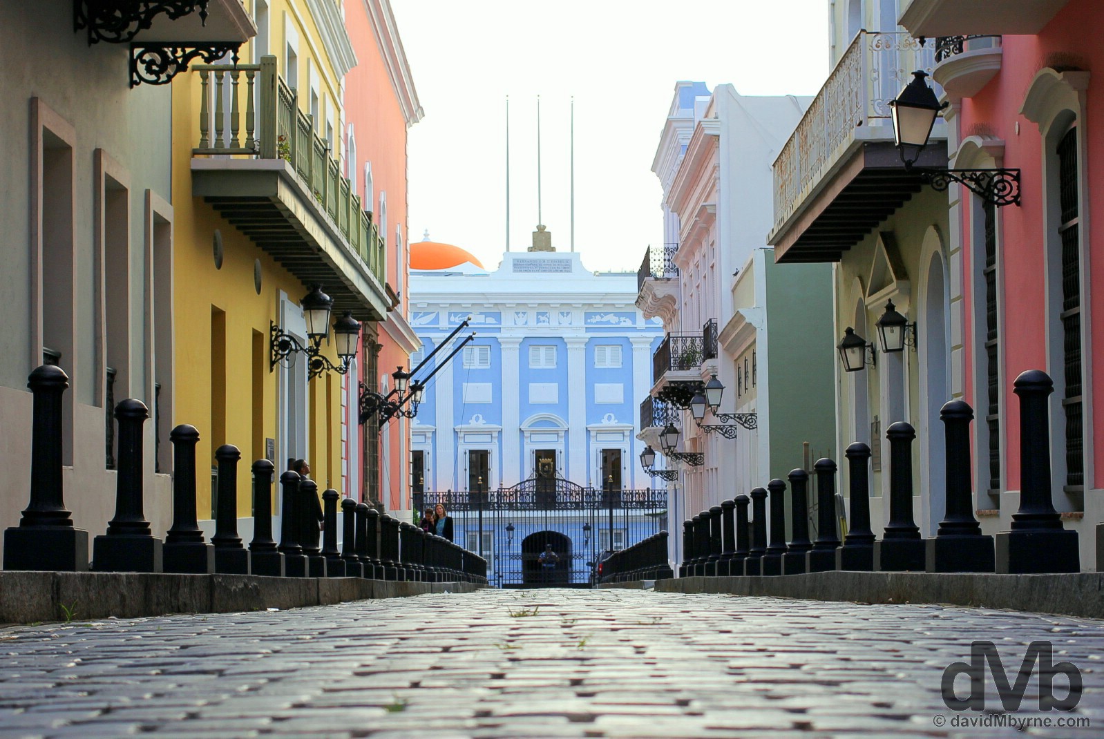
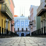
In a district full of wonderfully picturesque cobblestoned streets, multicoloured Calle Fortaleza is probably the prettiest of the lot. It terminates at the guarded iron gates, seen in the distance, of a city icon, El Palacio de Santa Catalina, commonly known as La Fortaleza. The settlement’s original fortress, construction started on it way back in 1533 making it the oldest building in the present-day San Juan. Its use as a fort was eventually superseded by the newer, bigger & more capable El Morro & Castillo San Cristobal and thus it was remodeled for use by successive island governors. Sitting atop the city’s imposing walls and overlooking San Juan Bay, today the pastel-blue building, one of San Juan’s prettiest, still serves as the executive mansion for the Governor of Puerto Rico meaning it’s also the oldest executive mansion in continuous use in the Western Hemisphere. Calle Fortaleza, Viejo (Old) San Juan, Puerto Rico, Greater Antilles. June 2, 2015.
– Lonely Planet Puerto Rico
(New) San Juan
San Juan isn’t all about Viejo (Old) San Juan. Of course not. There’s a city beyond the walls and the cobblestone streets of the San Juan Islet’s northwestern tip. Here are a few pictures from my explorations away from the UNESCO-listed portion of the city, somewhere that is no less interesting an area to explore, although a lot more spread-out.
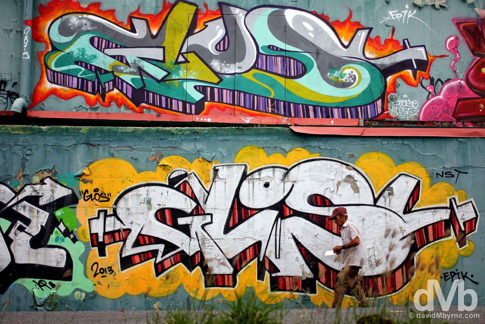
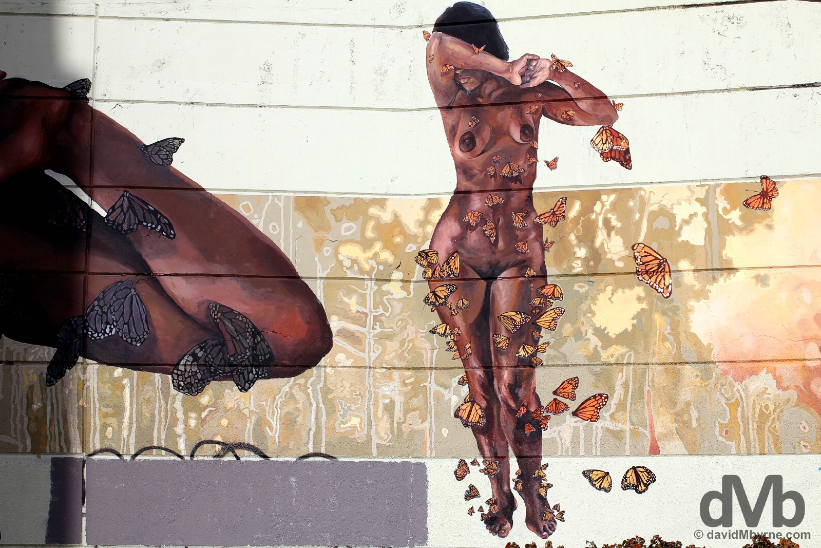
I loved the murals on the streets of San Juan, a city awash with some striking street art. I spent a bit of time searching out some of the San Juan’s bolder creations with some of my favourites located here on Calle Julian Pesante in the largely rundown residential Santurce district of the city, somewhere with an abundance of overgrown roadside greenery. San Juan, Puerto Rico, Greater Antilles. June 1, 2015.
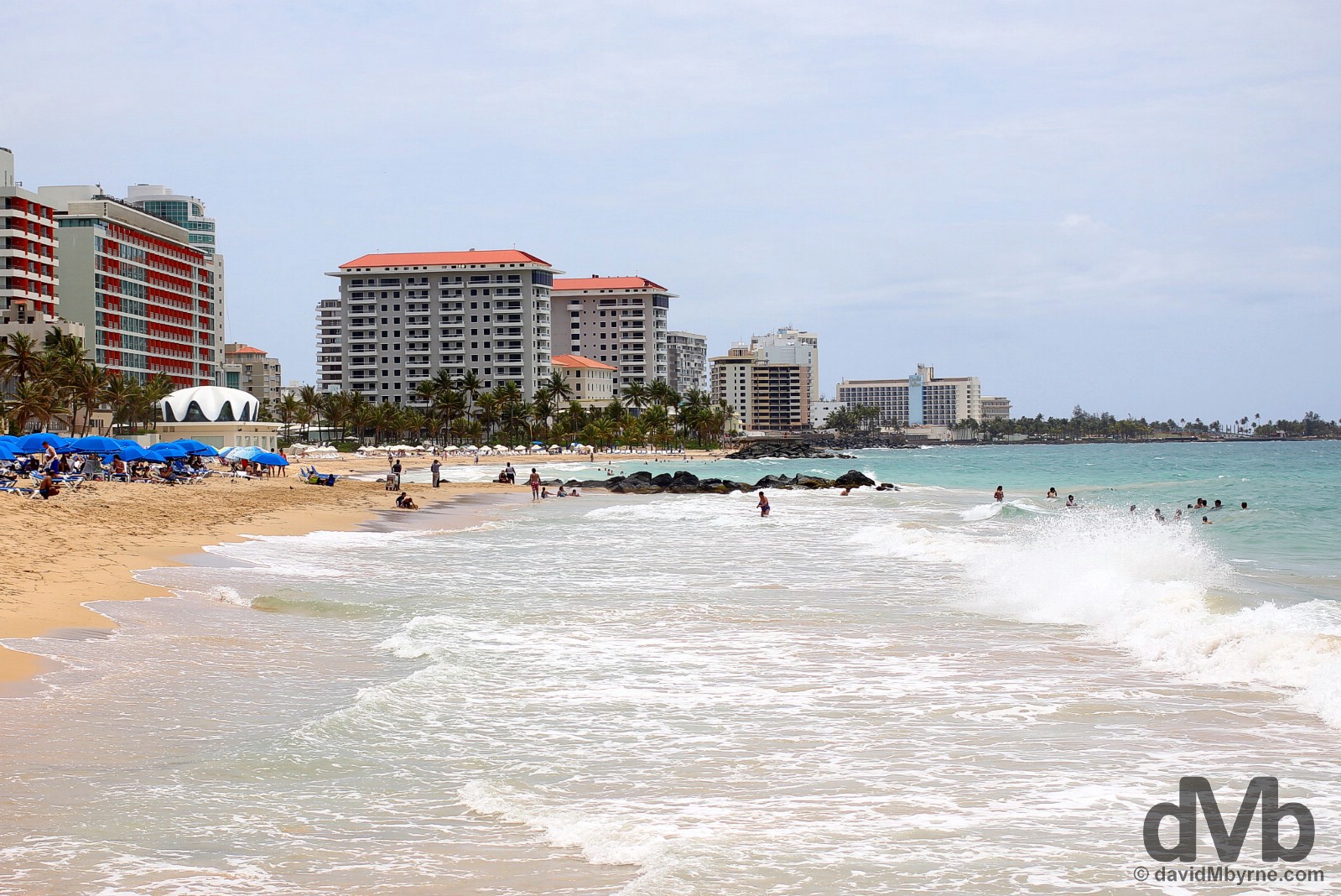
With some rather nice municipal beaches on which to sun yourself, San Juan can rightfully claim to be a beach city (although there are better beaches elsewhere on the island, as I was to discover). This is a section of San Juan’s Ocean Park. Fronted by high-rise condos & leafy residential streets, themselves interesting places to explore, it’s one of three popular beach hangouts on the northern, Atlantic-facing side of the city, the other two being the more crowded Condado and the somewhat exclusive Playa Isla Verde. San Juan, Puerto Rico, Greater Antilles. June 1, 2015.
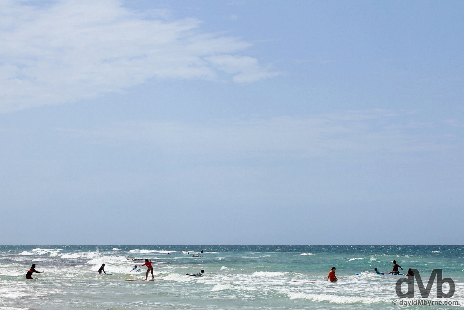
Surfing lessons in the tame Atlantic surf off Playa Ocean Park in San Juan, Puerto Rico, Greater Antilles. June 1, 2015.
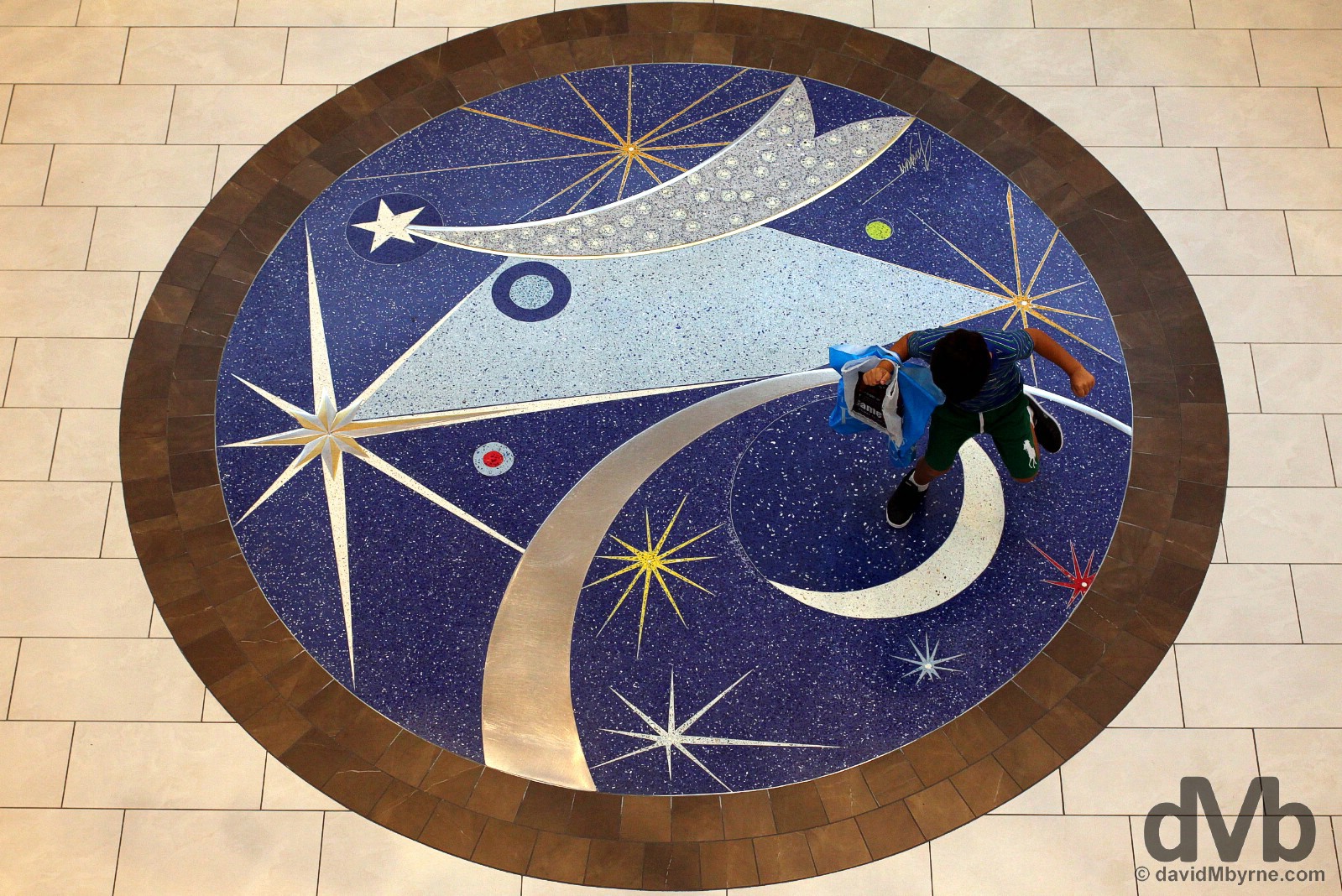
Upon arrival in Puerto Rico I was in need of some retail therapy, needing to replace a pair of sunglasses stolen from me a few days earlier in Cap-Haitien, Haiti. As it turns out, I couldn’t have come to a better place. Plaza Las Américas is aptly named – it’s about as American as you’re going to find in Americanised Puerto Rico. The massive 200-store shopping mall is the largest shopping mall in the Caribbean so needless to say it had exactly what I needed. I spent quite a bit of time in here over a few visits. I didn’t always bring my camera but when I did I captured this overhead image of a boy dancing on one of the plaza’s decorative floor murals. Plaza Las Américas, San Juan, Puerto Rico, Greater Antilles. May 30, 2015.
Cataño & Casa Bacardi
Rum is the national drink of Puerto Rico so it didn’t come as much of a surprise to me to learn that the island is home to the largest rum distillery in the world, Casa Bacardi, the so-called ‘Cathedral of Rum’. Located across Bahia de San Juan (San Juan Bay) in the Cataño region of the island, it’s a short ferry ride from the passenger ferry terminal in Viejo (Old) San Juan and a Puerto Rican must-see.
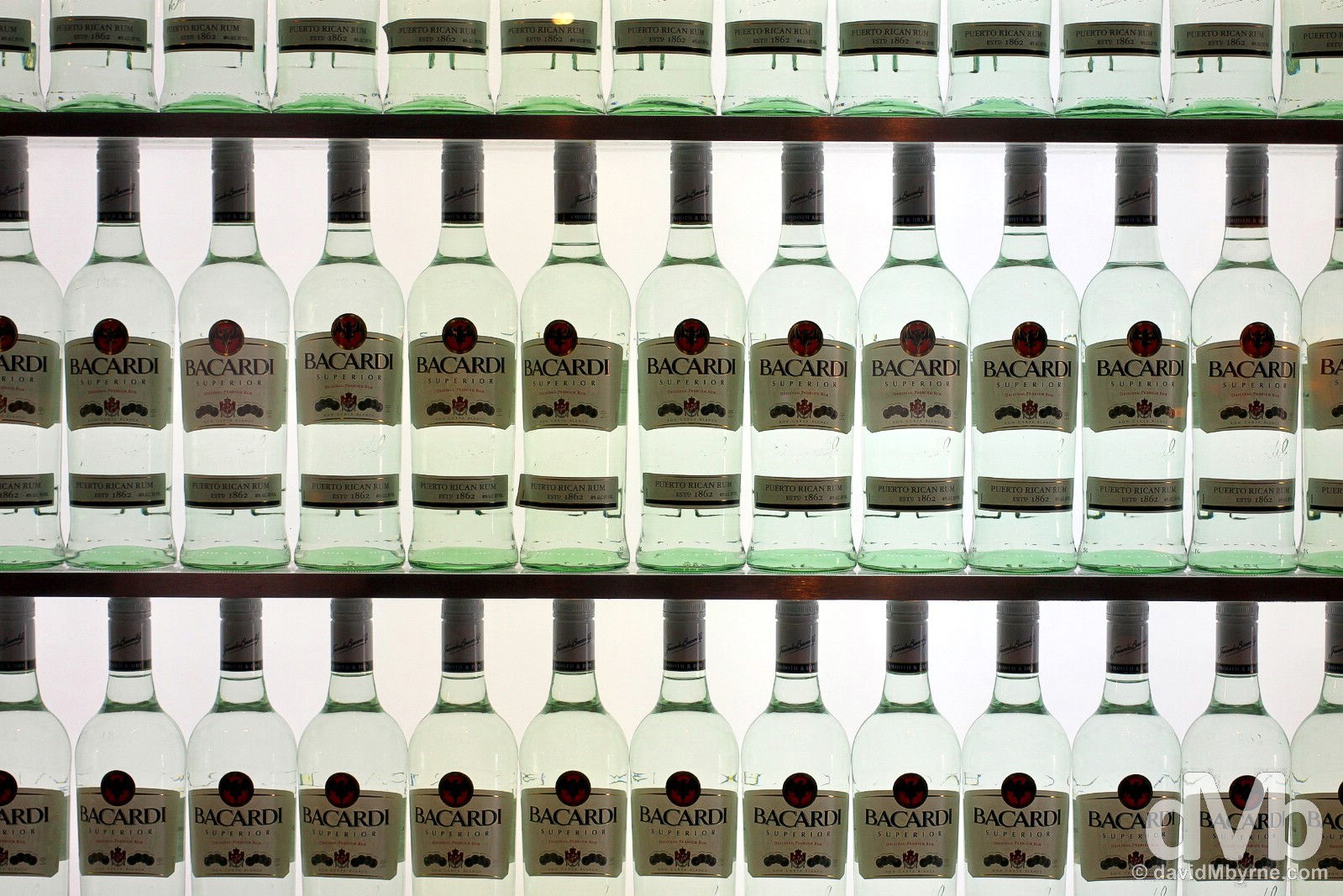
Bacardi, the world’s most famous rum-producing family, started producing rum in Cuba in 1862 but moved their operations to Puerto Rico in the mid-1930s because of political instability in their homeland resulting from the Cuban Revolution. This place now produces about 400,000 litres of rum a day, some 85% of what is the world’s most popular & awarded rum. Casa Bacardi, Cataño, Puerto Rico, Great Antilles. June 2, 2015.
Casa Bacardi is a busy place. While the tour of the distillery is rather quick & well rehearsed (& no longer free, as it once was), I still enjoyed it. However, it was the freebies afterwards that were the highlight for me, all the more so when gifted a handful of bar tokens as compensation for the inconvenience of having to sit around in the breezy, open-air bar area waiting an extra 15 minutes for my tour to start. I was in no hurry so I harboured the ‘inconvenience’ well, if I do say so myself. Of course the glorious, cherry-infused, orange-heavy rum punch helped pass the time, as did the mojito. Both went down well. Very well.
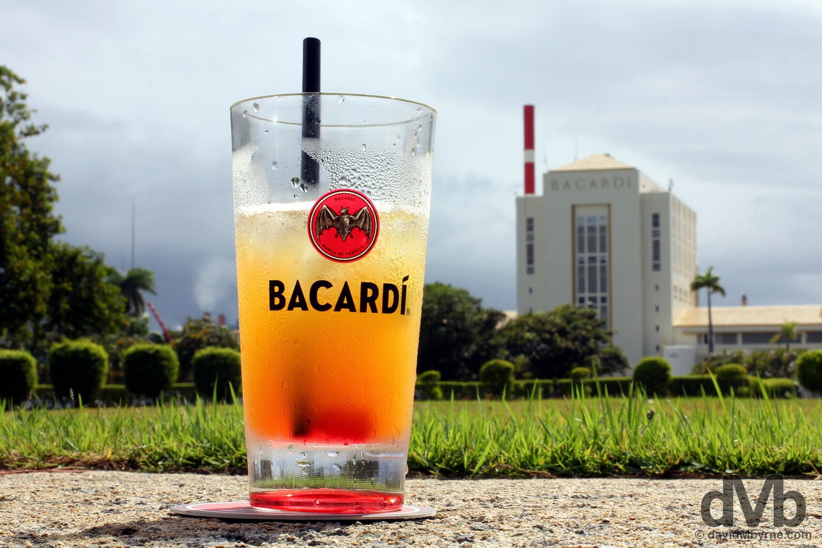
One fast depleting cherry-infused, orange-heavy rum punch with the compliments of Bacardi. Seen here in the background is Bacardi’s 6-storey distillation tower, the ‘Cathedral of Rum’ itself, the centrepiece of the 127-acre site and somewhere the tour of the site doesn’t even mention let alone visit. It’s yet another another Puerto Rican icon, one clearly visible like a massive beckoning beacon across Bahia de San Juan (San Juan Bay) in Viejo (Old) San Juan whence I came. Casa Bacardi, Cataño, Puerto Rico, Great Antilles. June 2, 2015.
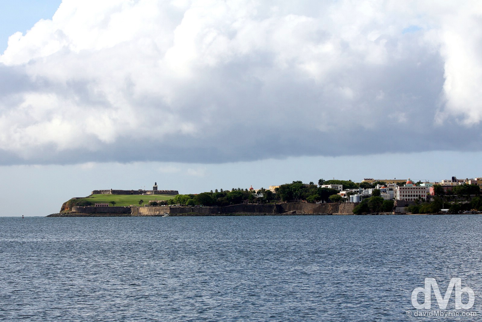
Castillo San Felipe del Morro & the western portion of Viejo (Old) San Juan as seen from across Bahia de San Juan (San Juan Bay) in Cataño, Puerto Rico, Greater Antilles. June 2, 2015.
Western Puerto Rico
Isabela, Rincón & the Arecibo Observatory
At the Arecibo Observatory, Puerto Rico. June 4, 2015
Western Puerto Rico
Isabela, Rincón & the Arecibo Observatory || Beaches, surfer dudes, as far west as you can go, a lighthouse, and the world’s largest radio telescope set among rolling karst countryside.
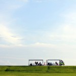
Puerto Rico isn’t big, the 9,000 km² rectangular main island only measuring some 180 kilometres east to west & 65 kilometres north to south. I’m assuming one can get around via public transport, but I’d imagine it would be painfully slow going. There was no way I wasn’t going to tour the island and there was no way, & having waited in San Juan for buses that never came (and inordinate amounts of time for those that did), that I was going to do so via public transport, assuming that was even an option. So I hired a car for three days, the only realistic way to see the island, and headed west via the PR2, Puerto Rico Highway 2, the island’s longest highway, on the first leg of a scoot around the island; a road trip will always be a highlight of any visit to any destination, even brief ones on small Caribbean islands. Puerto Rican road trip!
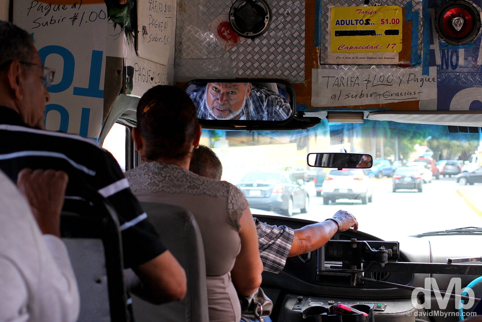
Captured in the first of two publicos – slow-paced, 15-seater minibuses with no printed timetable & no pre-arranged departure times – that I had to ride to get from downtown San Juan to the city’s Luis Muñoz Marín International Airport to collect my hire car on my sixth day on the island. Although only a distance of less than 10 kilometres, it was slow going – it took me almost as long to get from downtown San Juan to the airport via public transport than it did for me to drive from the airport to Isabela, 80 kilometres away at the western end of the island. Traffic, waits for transfers, the sparsity of services and the general confusion of the public transport system all combine to make hiring a car in Puerto Rico the obvious choice for getting around – there’s really no other plausible option for island-wide explorations. On the streets of San Juan, Puerto Rico, Greater Antilles. June 3, 2015.
– Lonely Planet Puerto Rico on the island’s publicos
Isabela & Playa Jobos
A 2-hour, 130-kilometre drive from San Juan’s Luis Muñoz Marín International Airport on PR2 brought me to Isabela, a region of wild & rugged coastline dotted with surf-lashed beaches at the island’s northwestern corner. A small & welcomed detour off PR2 brought me onto Route 466, a narrow, winding, hugging coastal road providing access to a number of beaches. Having just spent the last 5 days in built-up San Juan, the sense of freedom and calm here was awesome; although it is actually only some 80 miles, being here one feels a million miles removed from the capital & its environs.
Although relatively small, Playa Jobos is still the biggest beach on this stretch of coast, and probably the most popular. The eastern end of the crescent-shaped beach is protected by a large headland of dead coral, somewhere I walk to the end of in order to capture this image looking back to the beach over a sheltered section of water. But it’s not all bathtub tranquility here. Oh no. A consistent surf break off the headland I was standing on makes this beach a world renowned surfing location (the 1989 World Surfing Championships were held here), one boasting a perennial après-surf vibe. Playa Jobos, Isabela, western Puerto Rico, Greater Antilles. June 3, 2015.
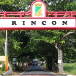
Rincón
A short 40 kilometre drive from Playa Jobos and I was at my overnight destination for this day, Rincón, Puerto Rico’s surfing central shoehorned out in the island’s most psychedelic corner. And once you make the effort to get here you can go no further west.
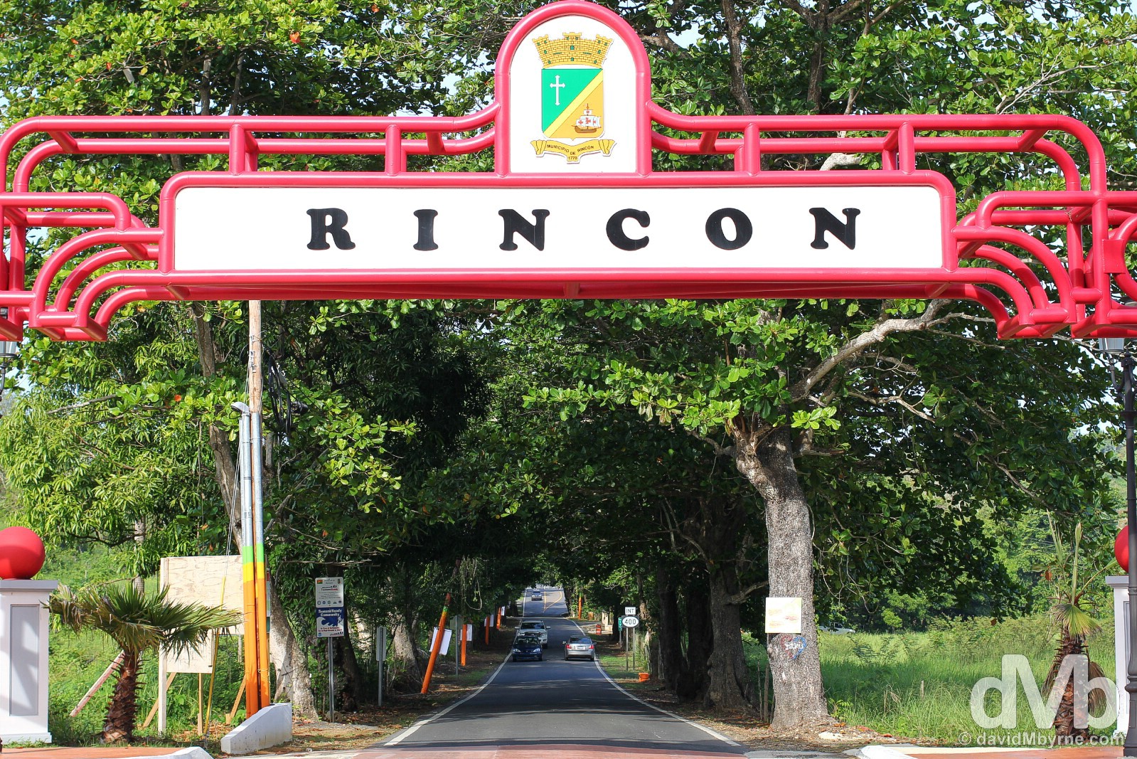
Well hello Rincón. Western Puerto Rico, Greater Antilles. June 4, 2015.
Rincón is Puerto Rico’s idyllic wave riding retreat, one that was immortalized in the 1962 Beach Boys anthem Surfin’ Safari and further brought to the attention of wave riders and alternative lifestyles after staging the 1968 World Surfing Championships. By all accounts, and although this is still Puerto Rico at it most unguarded, Rincón’s hedonistic peak has passed and things are a tad sedater these days. I’d well believe it. It was rather quiet when I was in town – both the waves & the scene – although there were a few devil-may-care ‘dudes’ havin’ a good ol’ time in the bar of the town’s Rincón Inn where I holed up for the night.
Most of Rincón’s coast is surf territory, too rough for swimming. But not here, a stretch of sand around Balneario de Rincón. Captured early in the morning of Puerto Rican road trip day 2, there wasn’t much stirring either on Rincón’s main drag, the PR 115 passing through town parallel to the shore, or on this stretch of Puerto Rican sand. It was very tranquil, very beautiful. Rincón, western Puerto Rico, Greater Antilles. June 4, 2015.
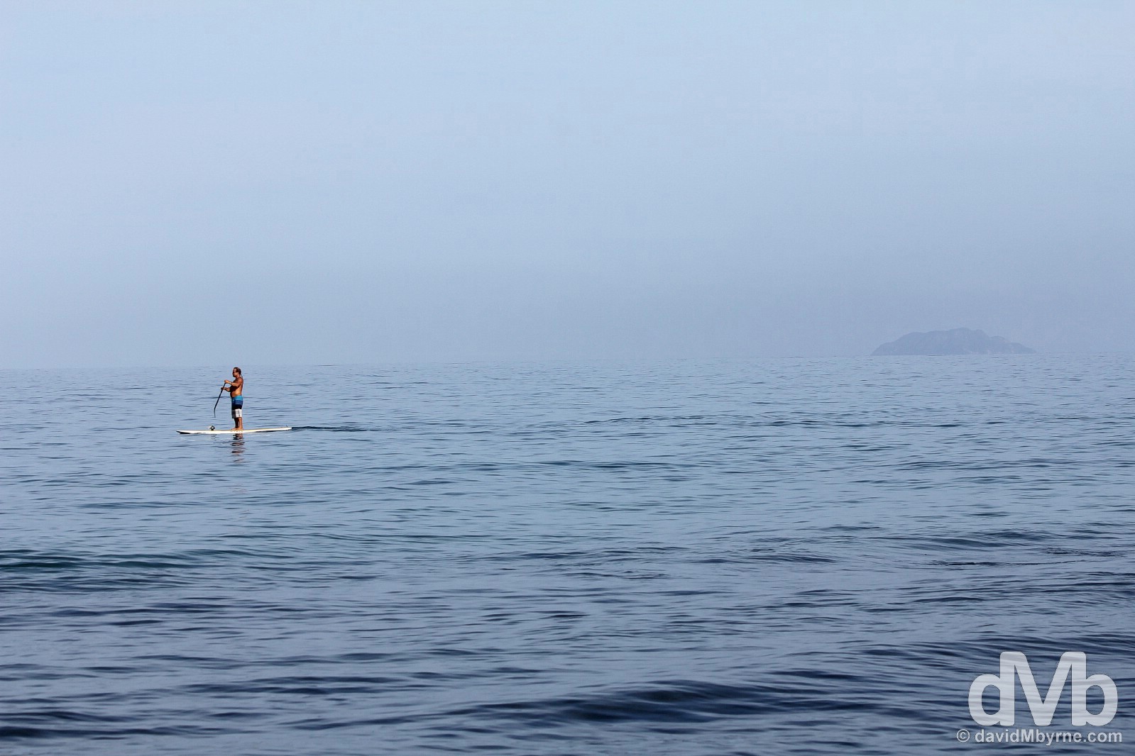
SUP. In fact, the waters offshore at this particular time of this particular day were so calm they were perfect for some early morning stand up paddle boarding. In the background, on the horizon, is the small 1.5 km² uninhabited off-shore island of Desecheo (Isla Desecheo), some 20 kilometres from my position here near the very western tip of the main island of the Puerto Rican archipelago. Rincón, western Puerto Rico, Greater Antilles. June 4, 2015.
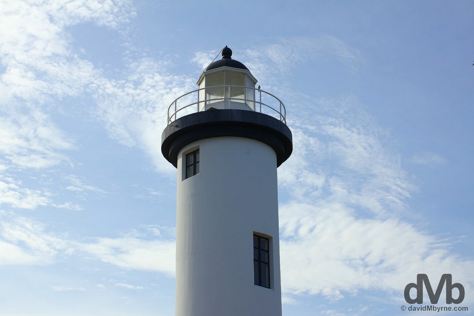
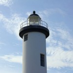
My last port of call before leaving Rincón for good was the very western tip of the island, the location for the Faro de Punta Higuero, the Punta Higuero Lighthouse, one of 16 that dot the Puerto Rican coastline, 11 of which are still operational. Dating from 1892, devastated in a tsunami in 1918, restored in 1922, and automated in 1933, it’s a popular landmark on the western coast of Puerto Rico, and not just with passing mariners; the park surrounding its base is a popular recreation and whale watching area. Rincón, western Puerto Rico, Greater Antilles. June 4, 2015.
Heading inland from Rincón, it wasn’t long into the 2-hour, 80-kilometre drive to the Arecibo Observatory that I hit the hills – Puerto Rico’s narrow coastal plain quickly gives way to its largely mountainous interior.
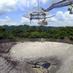
The Arecibo Observatory
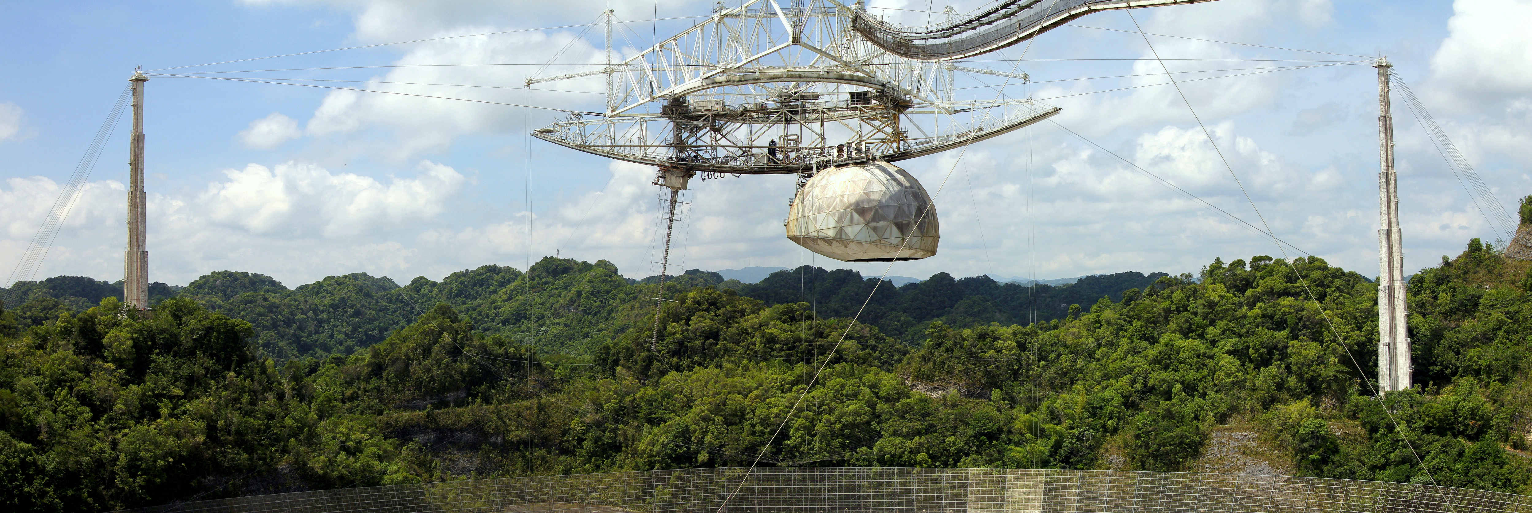
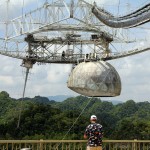
This, the amazing Arecibo Observatory, is the reason I hired a car in Puerto Rico, the vast and iconic research centre where the mysteries of the universe are explored.
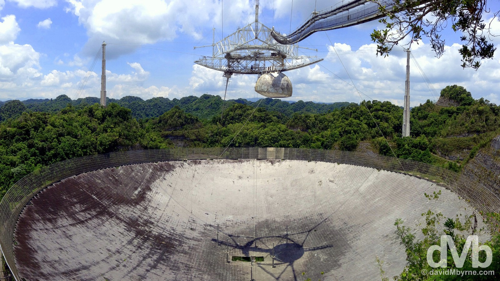
Completed in 1963 and measuring 305 metres (100 ft) across, the dish of Puerto Rico’s Arecibo Observatory is the largest radio telescope & largest dish antenna in the world, for now – the spoilsport Chinese are busy working on a bigger, 500-metre-wide dish that’s set to come online sometime in 2016. Constructed inside a massive depression left by a karst sinkhole, of which there are many in the surrounding hilly karst landscape, so-called Karst Country, the fixed dish, comprised of almost 40,000 perforated aluminium panels, reflects radio waves from space into the movable Gregorian dome dangling from a platform 140 metres above the dish, one held in place by 3 towers & a mesh of some rather BIG cables. To me this was an iconic Puerto Rican must-see – the observatory has appeared in many film and television productions – and although I knew I would I found the spectacle fascinating. As luck would have it, my wide-angle lens was out of commission when I found myself standing here ogling at this wide-angle nirvana so I was forced to take this picture via the panorama feature of my iPod. It’s doubtful a wide-angle lens would have taken it all in anyway. The Arecibo Observatory, Puerto Rico, Greater Antilles. June 4, 2015.
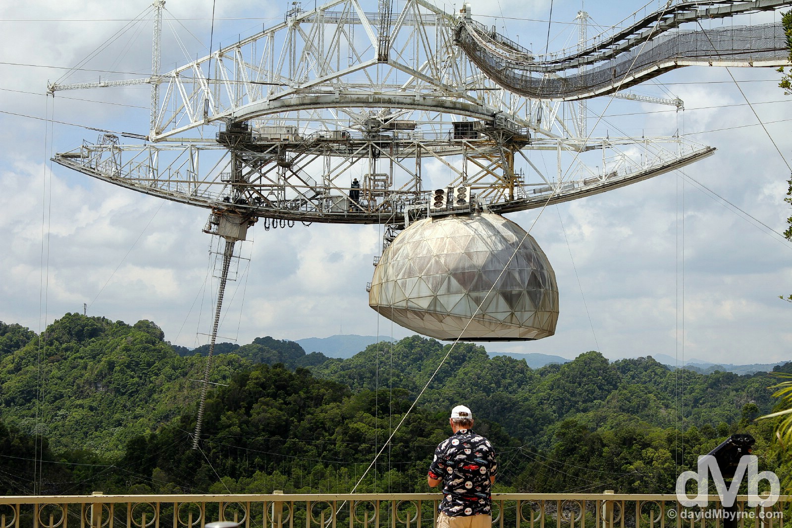
At the Arecibo Observatory, Arecibo, Puerto Rico, Greater Antilles. June 4, 2015.
– Bill Gordon, Father of the Arecibo Telescope
Arecibo Observatory, Arecibo, Puerto Rico, Greater Antilles. June 4, 2015.
Central Puerto Rico
Ruta Panoramica || A narrow, winding road that cuts through the island’s mountainous centre. Up there as one of the world’s most scenic drives.
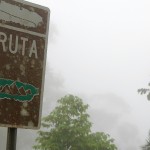
I was looking forward to the visual spectacle of Puerto Rico’s Ruta Panoramica (Panoramic route). How better to traverse the island from west to east than via its famed scenic route, a combination of winding, narrow mountain roads cutting straight through the island’s Cordillera Central (Central Mountain Range) and boasting numerous scenic lookouts, rest areas, and recreational facilities en route. Supposedly it’s up there with the best of the world’s scenic drives. Indeed, Lonely Planet, never known to wildly exaggerate, claims tacking the route is ‘the ultimate thrill’. Wowzers. I was worried, Could I handle it? Should I even try? I did but once I got to where I expected to be thrilled, all I saw was mist. Lots of mist.
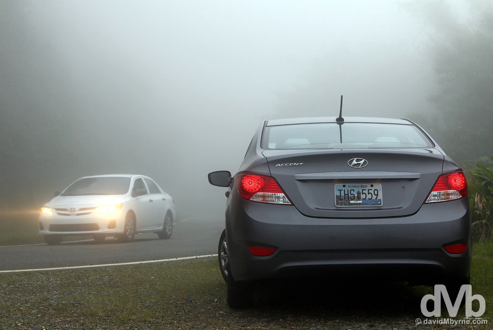
My hire car (& mist) on Ruta Panoramica, central Puerto Rico, Greater Antilles. June 4, 2015.
I still drove the Ruta Panoramica, I just don’t have anything to show for it save for these few images of mist, cars, mist, signage, & more mist.
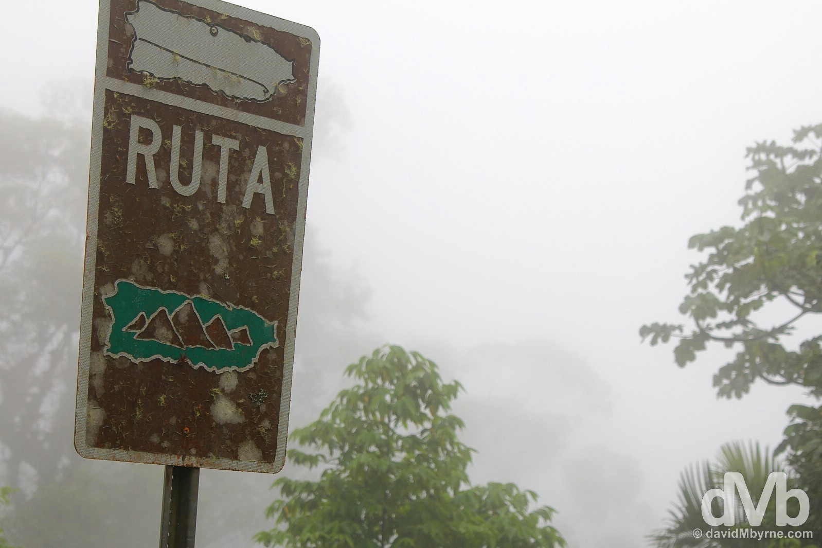
Signage on Ruta Panoramica central Puerto Rico, Greater Antilles. June 4, 2015.
Eastern Puerto Rico
Playa Luquillo, El Yunque National Forest & Fajardo
Playa Luquillo, eastern Puerto Rico. June 5, 2015
Eastern Puerto Rico
Playa Luquillo, El Yunque National Forest & Fajardo || Probably Puerto Rico’s best beach, a tropical rainforest high, & the wonderful architecture of the east’s marina city.
The mist of the island’s Ruta Panoramica wasn’t long about dissipating when descending from the Cordillera Central & approaching Fajardo at the eastern tip of the island. From one side of the island to the other, via the Arecibo Observatory & the Ruta Panoramica, and all a few leisurely & pleasurable hours of driving. Yes, Puerto Rico is indeed small.
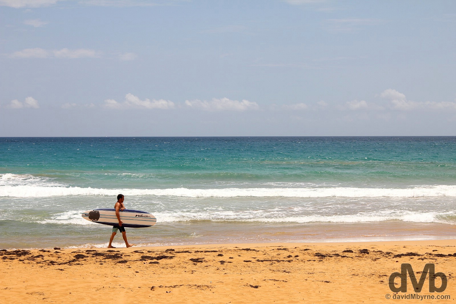
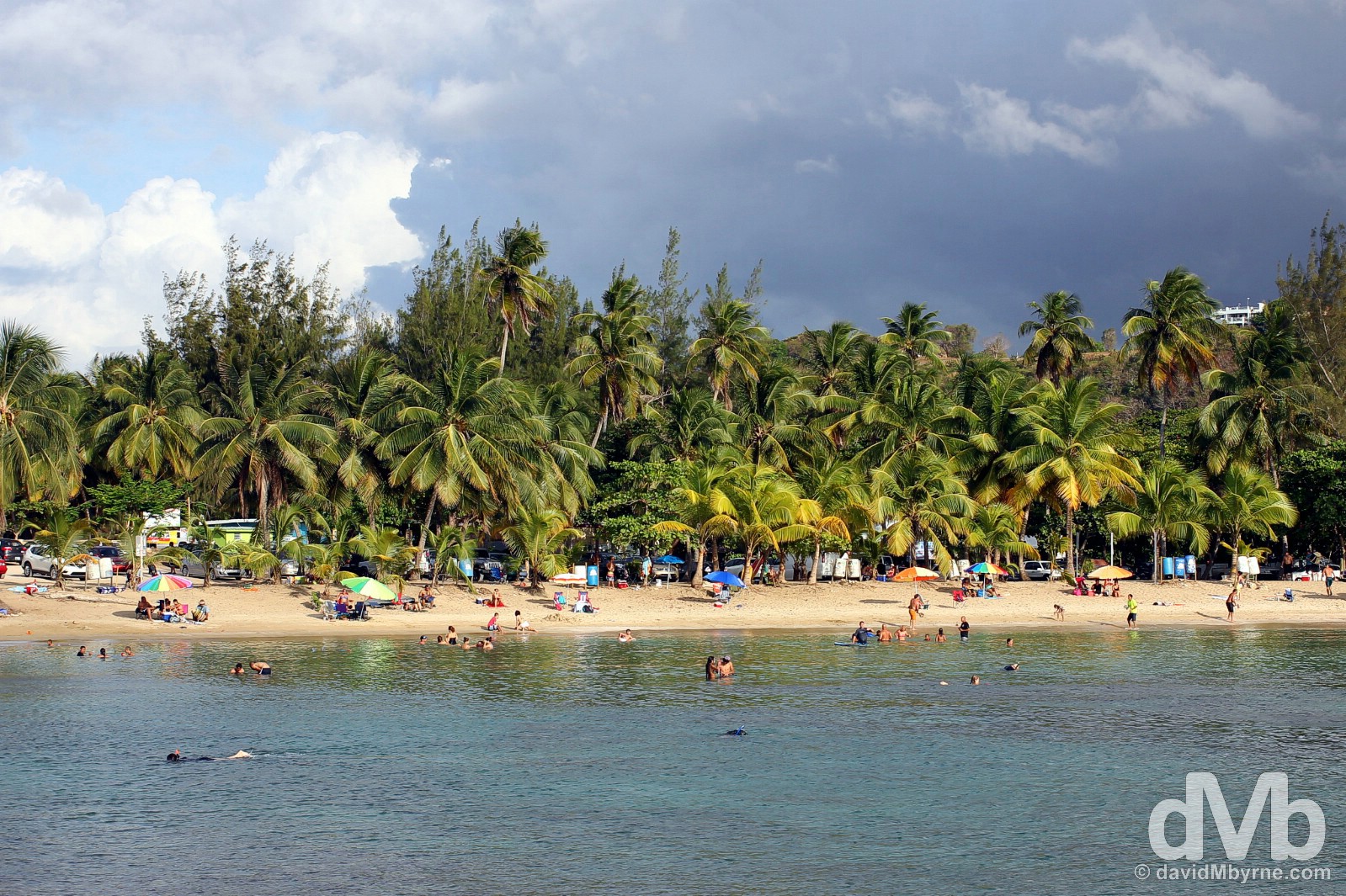
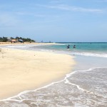
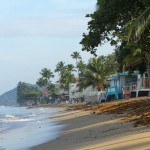
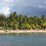
Playa Luquillo
A popular beach, probably the island’s finest stretch of sand and definitely the best of the Puerto Rican beaches I expereinced. Supposedly ‘action-packed’ at weekends (this was a Friday) & famous island-wide for its many food kiosks, mile-long Playa Luquillo was a postcard-picture scene of tranquillity, idyllically and downright loungeability for the time I spent ankle deep among its delightfully powdery & warm sand.
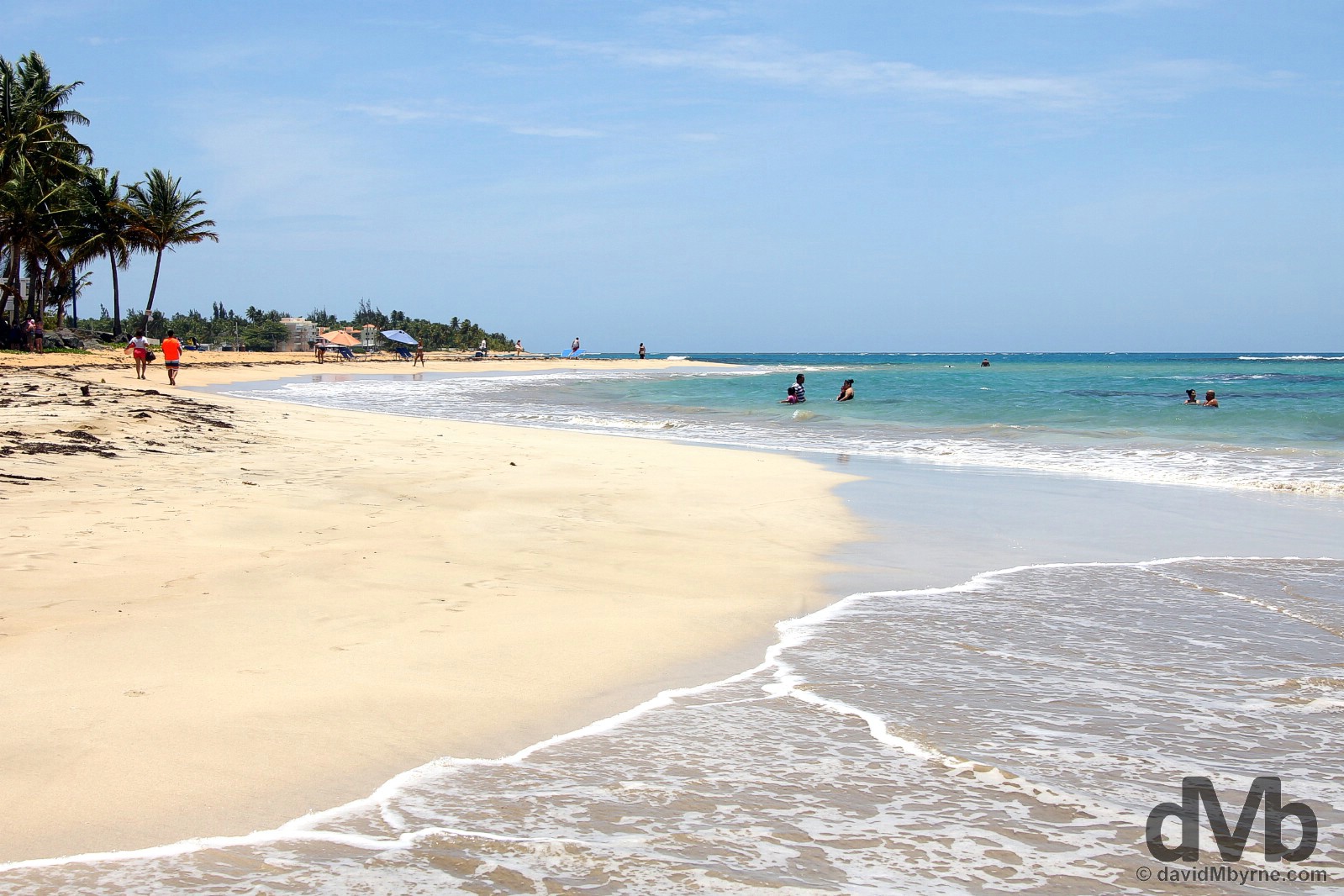
Playa Luquillo, eastern Puerto Rico, Greater Antilles. June 5, 2015.
El Yunque National Forest
Although it used to be a lot bigger prior to the efforts of axe-wielding Spanish colonisers, today 113 km² (28,000 acres) of public land, the largest swath of public land on the island, in the eastern Sierra de Luquillo is given over to El Yunque National Forest, the only tropical rainforest in the US (yes, the US mainland has rainforests). Today the Commonwealth’s green lungs are easily Puerto Rico’s biggest outdoor draw boasting walking trails, interpretive centres, waterfalls, swimming holes, and odd – as in totally out of place – observation towers, including one atop its very highest point.
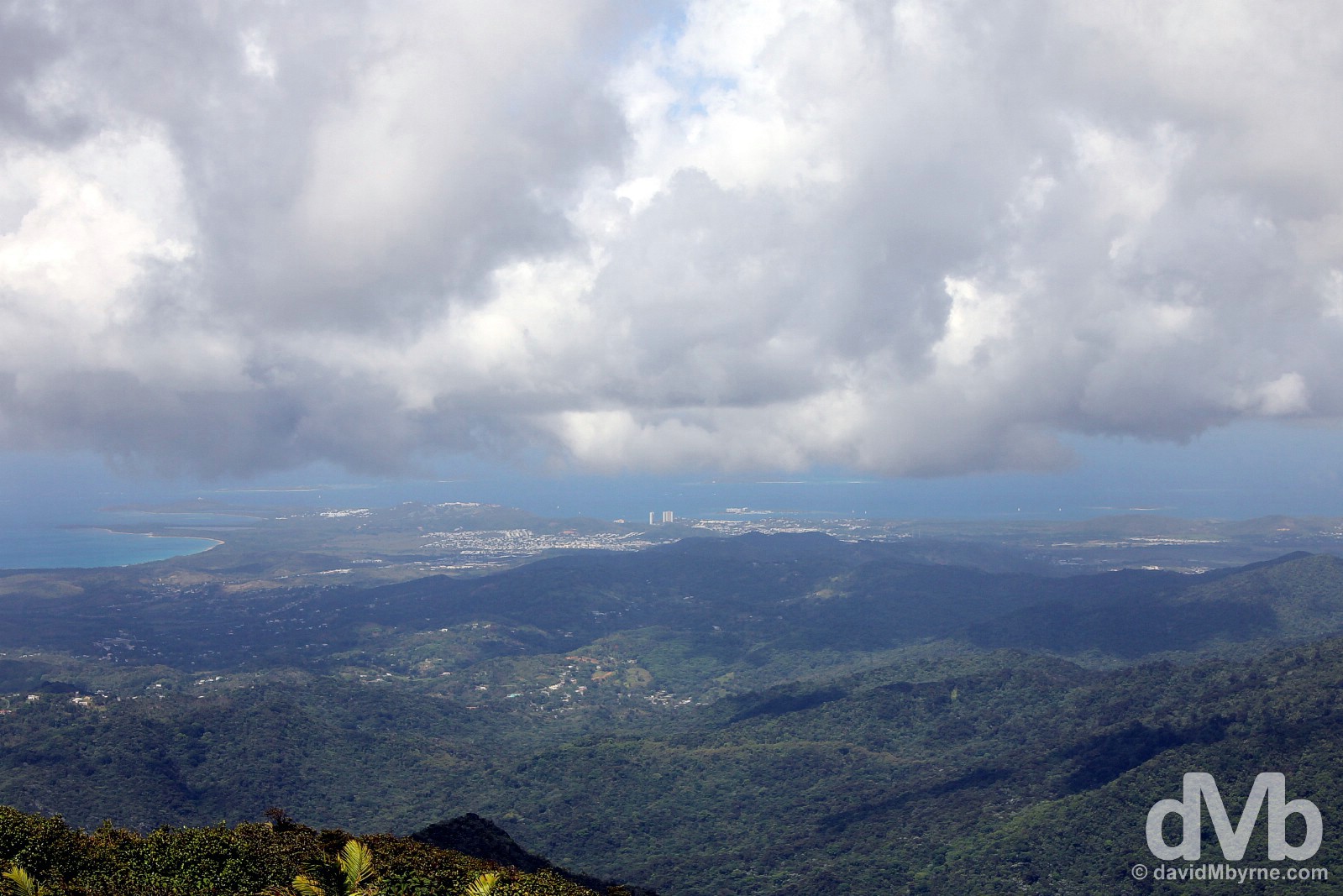
I drove from Playa Luquillo at the coast the short distance (8 kilometres of so) to El Yunque National Forest, taking Highway 191 into the heart of the lush rainforest. The car could only go so far on the twisty forest road so I hoofed it the rest of the relatively short distance uphill, sweating buckets in the process, to El Yunque peak, at 1,065 metres (3,494 feet) the highest point in the Sierra de Luquillo of El Yunque National Forest. The summit is home to a castle-esque observation tower, Mount Britton Tower, the highest of two rather ugly observation towers found in the forest. The views from the summit of the whole island, but especially the eastern portion of the island shown here (that’s Fajardo, my eastern base, in the distance), were rather nice, if a little shrouded in mist at times; I never felt anywhere other than above the cloud line. I sat here waiting to dry out before retracing my steps to go in search of some of El Yunque’s many waterfalls. El Yunque National Forest, eastern Puerto Rico, Greater Antilles. June 5, 2015.
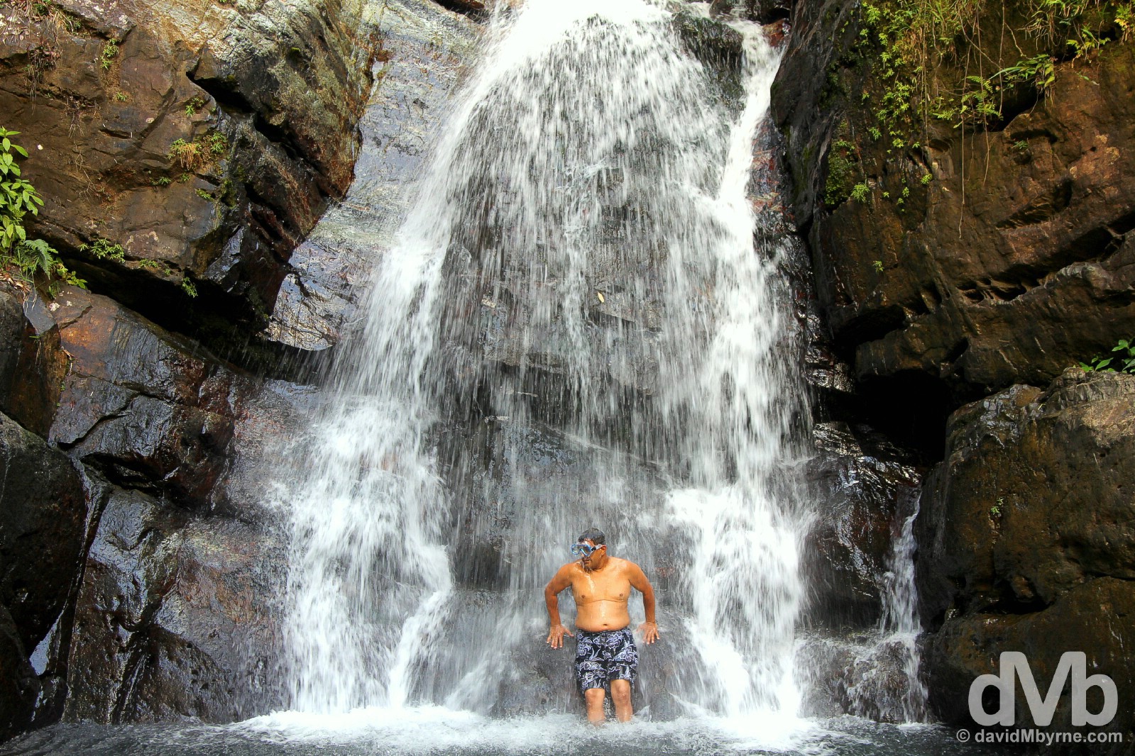
El Yunque, in the care of the US National Forest Service, is well geared for tourists. It boasts a bright, breezy, informative and well staffed information centre, the inviting El Portal Rain Forest Center, & its trails are well marked, relatively short & easy to follow, tame enough affairs really. While hardly true wilderness, this is still a rainforest so needless to say ample rainfall creates a jungle-like setting of lush foliage, crags, rivers, swimming holes and waterfalls, the latter two a great option for cooling down in the tropical heat. This is a picture of a well-prepared visitor cooling down in La Mina Falls of the La Mina Trail. The most popular trail in the forest, it’s a 2.3 kilometre (1.5 mile) round-trip hike following the course of the La Mina River downward through lush tropical trees, shrubs and flowers to the La Mina Waterfall (Cascada La Mina). El Yunque National Forest, eastern Puerto Rico, Greater Antilles. June 5, 2015.
Fajardo
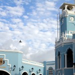
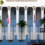
I was only ever going to use Fajardo as a base for El Yunque. By all accounts it’s a place one comes to to get elsewhere so I wasn’t expecting anything from Puert Rico’s so-called water sports capital, access point for off-shore islands and jumping-off point for popular trips to the psychedelic delights of Bioluminescent Bay, a Puerto Rican must-do that I didn’t. Yuppie types are forced to deal with the somewhat sprawling & scruffy outskirts of the town en route to Fajardo’s Puerto del Rey, the largest marina in the Caribbean (if it floats you’ll find it here), but I’m hoping in doing so that they stop to admire the architecture of the town’s awesomely photogenic central square, Plaza de Fajardo.
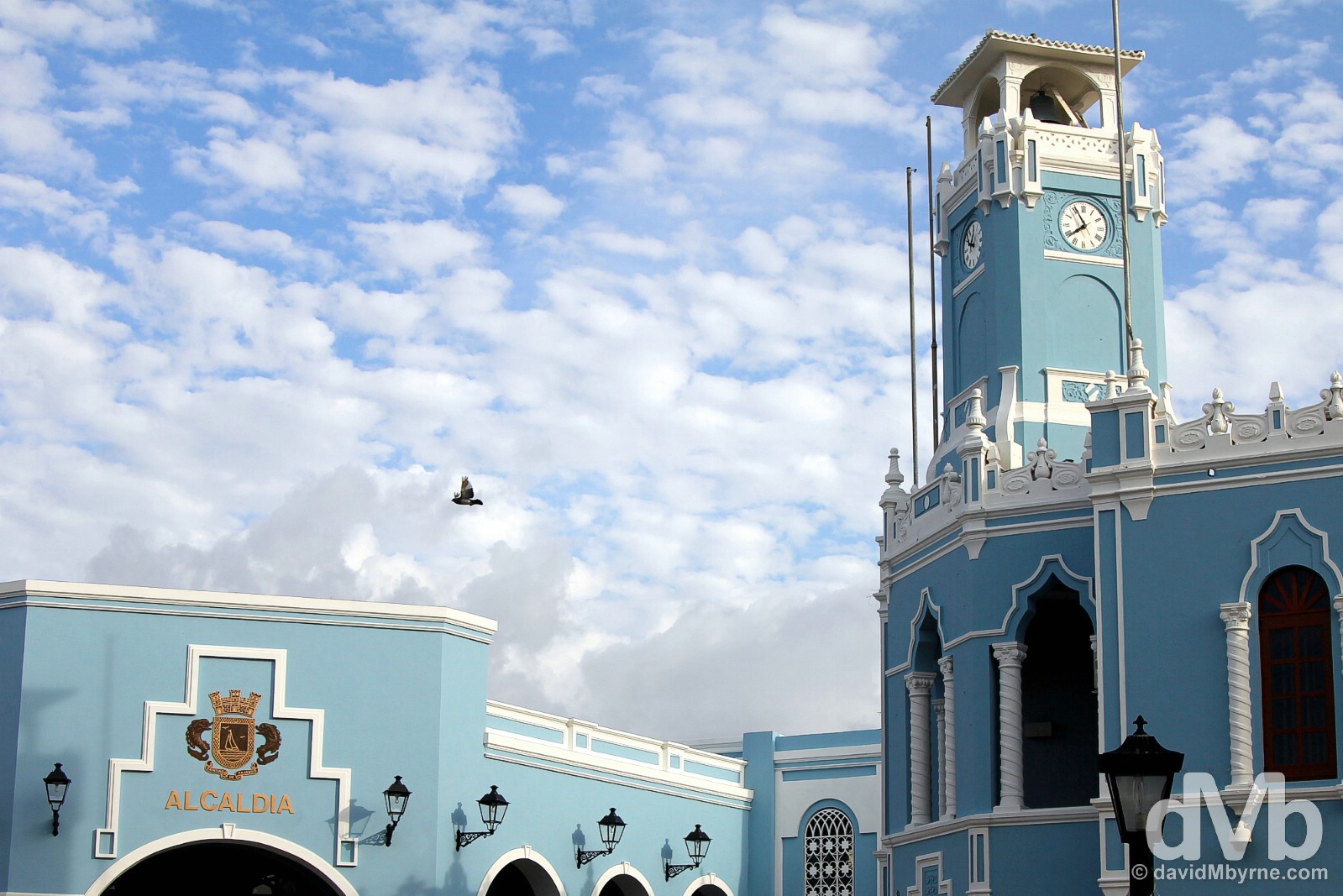
Surrounded by many gorgeous buildings, Fajardo’s central plaza was an unexpected treat. I drove through initially but quickly found a parking spot and went exploring in more detail, something the plaza warrants. This is probably the most impressive of the plaza’s many impressive buildings, the Alcaldia, the Municipality of Fajardo building. Fajardo, eastern Puerto Rico, Greater Antilles. June 5, 2015.
– Arleen Pabon, Architectural Historian
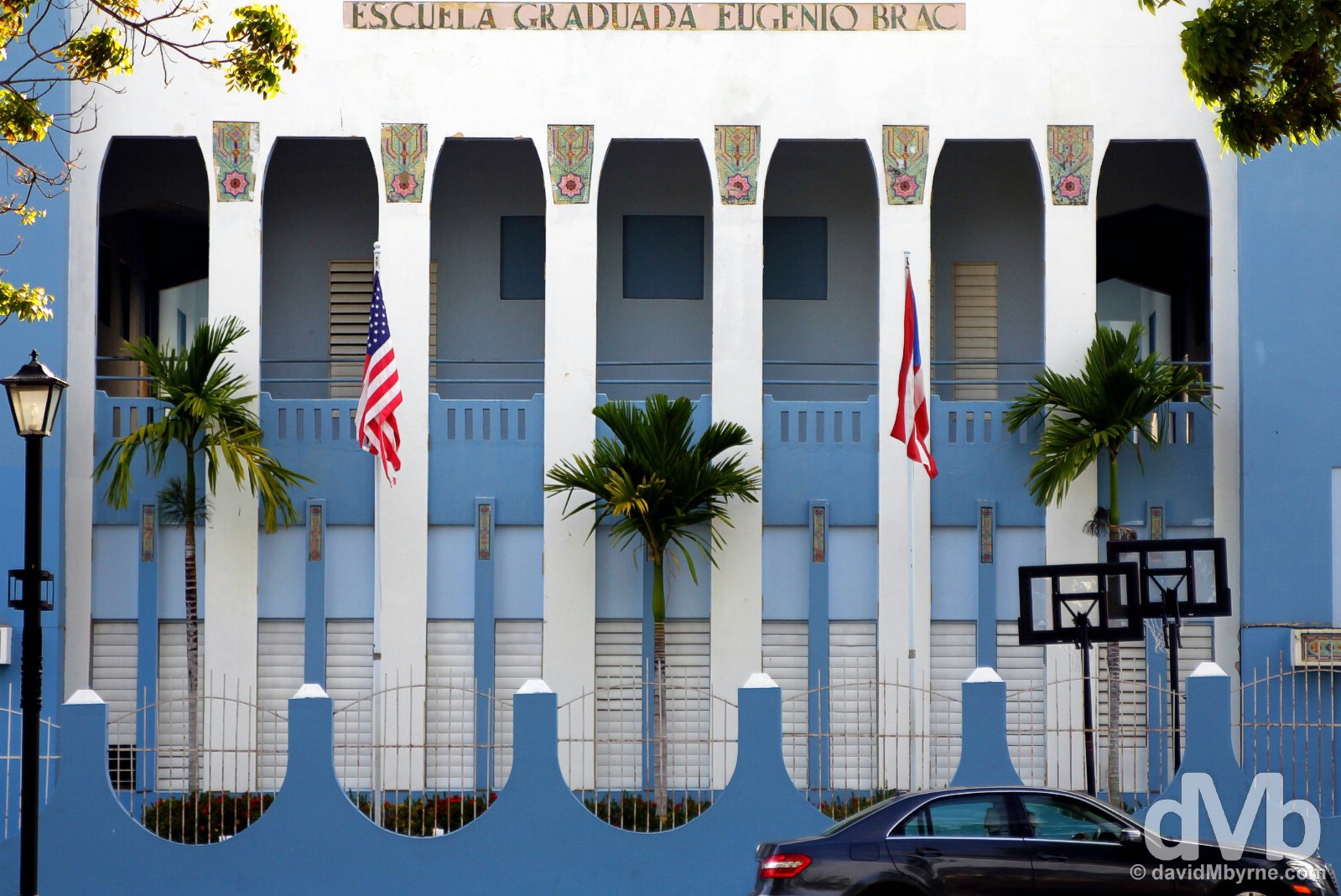
Escuela Graduada Eugenio Brac off Plaza de Fajardo in Fajardo, eastern Puerto Rico, Greater Antilles. June 5, 2015.
– Wikipedia
Time to hit the road. Plaza de Fajardo, Fajardo, eastern Puerto Rico, Greater Antilles. June 5, 2015.
The Flight-Missing Traffic Jam
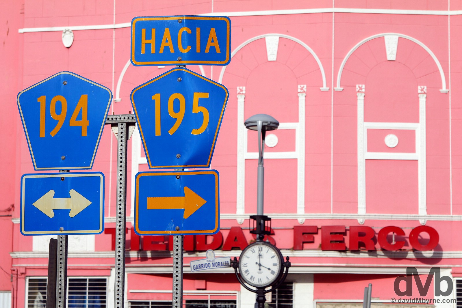
It’s not far from Fajardo to San Juan’s Luis Muñoz Marín International Airport, only 50 kilometres or so via the two-lane Interstate 3/PR3 & Highway 66. It’s a brief drive, or at least it should be.
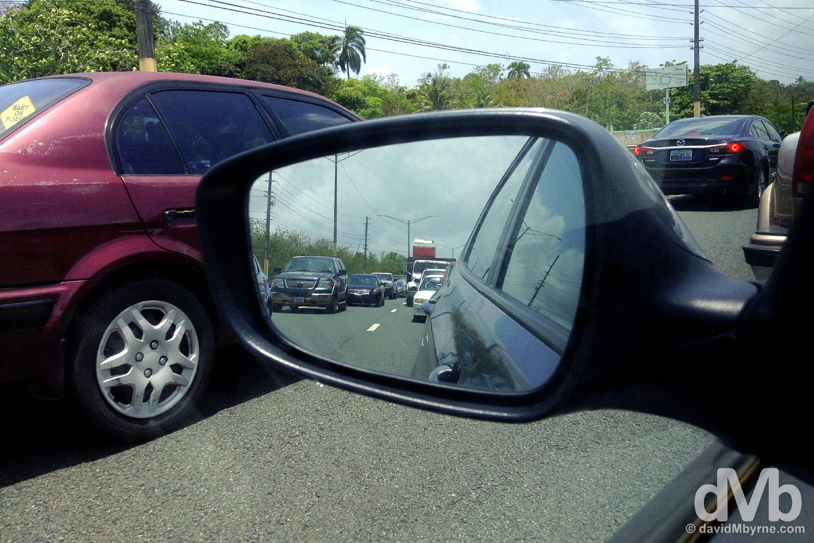
A flight-missing traffic jam on Interstate 3 (PR3) outside Fajardo. Even leaving Fajardo early – to, you know, allow for such eventualities – wasn’t sufficient to prevent me missing my third Caribbean island-hopping flight in as many weeks. I initially wasn’t too worried about hitting this traffic jam – I assumed it would clear. It didn’t. I’d never experienced a traffic jam, or frustration, like it. So much for the laid-back Caribbean. After 3 hours of crawling along, and my flight check-in time having passed, I pulled in & spent some time cooling down in a roadside McDonald’s before eventually making it to the airport at 4 p.m., 2 hours after my scheduled flight time. JetBlue came to the rescue once again, just like they did previously with my missed flight to Puerto Rico from Punta Cana, Dominican Republic, and my booking was rescheduled, free of charge, for the same flight the following day. An extra night in Puerto Rico. An extra night in San Juan, one I spent the majority of waiting for a car hire official to free the keys I locked inside the hire car shortly after arrival back in the city. All told, it wasn’t the best of days. Sitting in a flight-missing traffic jam on Interstate 3 (PR3) outside Fajardo, eastern Puerto Rico, Greater Antilles. June 6, 2015.
A Greater Antilles Departure
Leaving Puerto Rico brought to an end the first half of my Caribbean adventure. The last of the so-called Greater Antilles islands that I visited, Puerto Rico was just the latest in a string of stark Caribbean contrasts following on from time warp Cuba, moneyed Grand Cayman, Rastafarian Jamaica, Third World Haiti, & historic Dominican Republic. But the contrasts didn’t stop there as I embarked on a 2-week post-Puerto Rico Lesser Antilles island-hop south that ultimately got me to the South American continent. First of the Lesser Antilles was Sint Maarten / Saint Martin, a small 90 km² island rather bizarrely divided roughly in half by the Netherlands (Sint Maarten) & France (Saint Martin). Contrasts indeed. You probably can’t point to the island on a map but I bet you’ve seen images from the approach to its just-off-the-beach airport.
Puerto Rico Gallery
-
- Plaza de Fajardo in Fajardo, eastern Puerto Rico, Greater Antilles. June 5, 2015.
-
- Old San Juan, Puerto Rico, Greater Antilles. June 2, 2015.
-

- Cooling down in Plaza del Quinto Centenario in Old San Juan, Puerto Rico, Greater Antilles. May 31, 2015.
-

- Cooling down in La Mina Falls of El Yunque National Forest, eastern Puerto Rico, Greater Antilles. June 5, 2015.
-
- Rincon, western Puerto Rico, Greater Antilles. June 4, 2015.
-

- A flight-missing traffic jam on Highway 3 (PR-3) outside Fajardo eastern Puerto Rico, Greater Antilles. June 6, 2015.
-

- Avenida Manuel Fernandez Juncos, San Juan, Puerto Rico, Greater Antilles. June 6, 2015.
-
- Campo del Morro in Old San Juan, Puerto Rico, Greater Antilles. May 31, 2015.
-
- Playa Luquillo, eastern Puerto Rico, Greater Antilles. June 5, 2015.
-

- SUP. Rincon, western Puerto Rico, Greater Antilles. June 4, 2015.
-
- Campo del Morro in Old San Juan, Puerto Rico, Greater Antilles. June 2, 2015.
-

- Museo de San Juan, Old San Juan, Puerto Rico, Greater Antilles. May 31, 2015.
-

- Paseo del Morro, Old San Juan, Puerto Rico, Greater Antilles. June 2, 2015.
-
- Campo del Morro in Old San Juan, Puerto Rico, Greater Antilles. June 2, 2015.
-

- Eastern Puerto Rico from the highest point in El Yunque National Forest, Puerto Rico, Greater Antilles. June 5, 2015.
-
- Alcaldia, the Municipality of Fajardo building overlooking Plaza de Fajardo in Fajardo, eastern Puerto Rico, Greater Antilles. June 5, 2015.
-

- Old San Juan, Puerto Rico, Greater Antilles. May 31, 2015.
-
- Calle Julian Pesante in Santurce, San Juan, Puerto Rico, Greater Antilles. June 1, 2015.
-
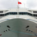
- The Carnival Cruise Line’s 110,000-tonne, 290 metre-long, 13 deck-high Carnival Liberty cruise ship docked in Old San Juan, Puerto Rico, Greater Antilles. May 31, 2015.
-
- La Perla, Old San Juan, Puerto Rico, Greater Antilles. May 31, 2015.
-
- Paseo del Morro by the edge of Bahia de San Juan, Old San Juan, Puerto Rico, Greater Antilles. May 31, 2015.
-
- Old San Juan as seen from Bahia de San Juan in Cataño. Puerto Rico, Greater Antilles. June 2, 2015.
-
- Arecibo Observatory, Puerto Rico, Greater Antilles. June 4, 2015.
-
- Plaza Las Américas, the biggest mall in the Caribbean. San Juan, Puerto Rico, Greater Antilles. May 30, 2015.
-
- Escuela Graduada Eugenio Brac off Plaza de Fajardo in Fajardo, eastern Puerto Rico, Greater Antilles. June 5, 2015.
-
- Paseo de la Princesa in Old San Juan, Puerto Rico, Greater Antilles. June 2, 2015.
-

- A parting shot. Luis Muñoz Marín International Airport, San Juan, Puerto Rico, Greater Antilles. June 7, 2015.
-
- Signage on Ruta Panoramica, central Puerto Rico, Greater Antilles. June 4, 2015.
-
- Rincon, western Puerto Rico, Greater Antilles. June 4, 2015.
-
- Calle de San Sabastian in Old San Juan, Puerto Rico, Greater Antilles. June 2, 2015.
-

- With the compliments of Bacardi. At Casa Bacardi, a.k.a. the Cathedral of Rum. Cataño, Puerto Rico, Great Antilles. June 2, 2015.
-

- Hire car (& mist) on Ruta Panoramica, central Puerto Rico, Greater Antilles. June 4, 2015.
-

- Surfing lessons on Playa Ocean Park in San Juan, Puerto Rico, Greater Antilles. June 1, 2015.
-
- At the Arecibo Observatory, Arecibo, Puerto Rico, Greater Antilles. June 4, 2015.
-
- Castillo San Felipe del Morro in Old San Juan, Puerto Rico, Greater Antilles. June 2, 2015.
-
- Playa Jobos, Isabela, Puerto Rico, Greater Antilles. June 3, 2015.
-
- Plaza Del Mercado, San Juan, Puerto Rico, Greater Antilles. June 1, 2015.
-

- Playa Ocean Park in San Juan, Puerto Rico, Greater Antilles. June 1, 2015.
-
- The interior courtyard of Cuartel de Ballaja in Old San Juan, Puerto Rico, Greater Antilles. June 2, 2015.
-

- Playa Luquillo, eastern Puerto Rico, Greater Antilles. June 5, 2015.
-
- The lighthouse in Rincon, western Puerto Rico, Greater Antilles. June 4, 2015.