Haiti
The Western Hemisphere’s Poorest Country, One Still Recovering From The Devastating 2010 Earthquake
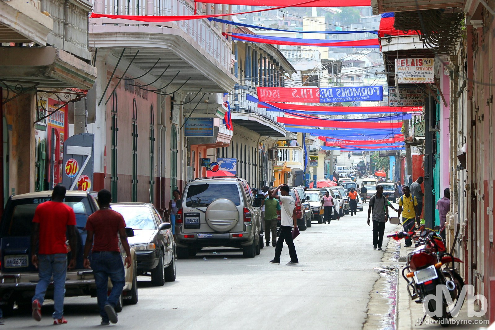
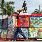
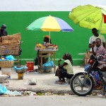
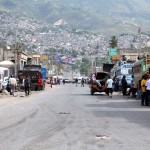
Traffic (& chaos) on Delmas, Port-au-Prince, Haiti. May 17, 2015
Haiti
Haiti was an eye-opener and no mistake. In a region renowned for its palm trees, Caribbean breezes and laid-back vibes, Haiti, a failed state & regional media whipping boy, can only be classed as something of an anomaly. The world’s first black-led republic and the first independent Caribbean state when it threw off French colonial control and slavery in the early 19th century, decades of poverty, environmental degradation and political instability in the form of dictatorships and often violent coups means that today Haiti is the Western Hemisphere’s poorest country, one still recovering from the devastating 2010 earthquake. The time I spent touring the country – between arriving by air from Jamaica to the west to escaping east over the border to Dominican Republic – was challenging but it was also, and as most challenging jaunts are, an immensely rewarding experience. Here’s a recap of my time spent exploring the chaotic streets of the nation’s capital Port-Au-Prince, Jacmel, the country’s laid-back cultural capital by the Caribbean, & the UNESCO-listed hilltop fort outside Haiti’s northern second city resting on the Atlantic Ocean, Cap-Haïtien.
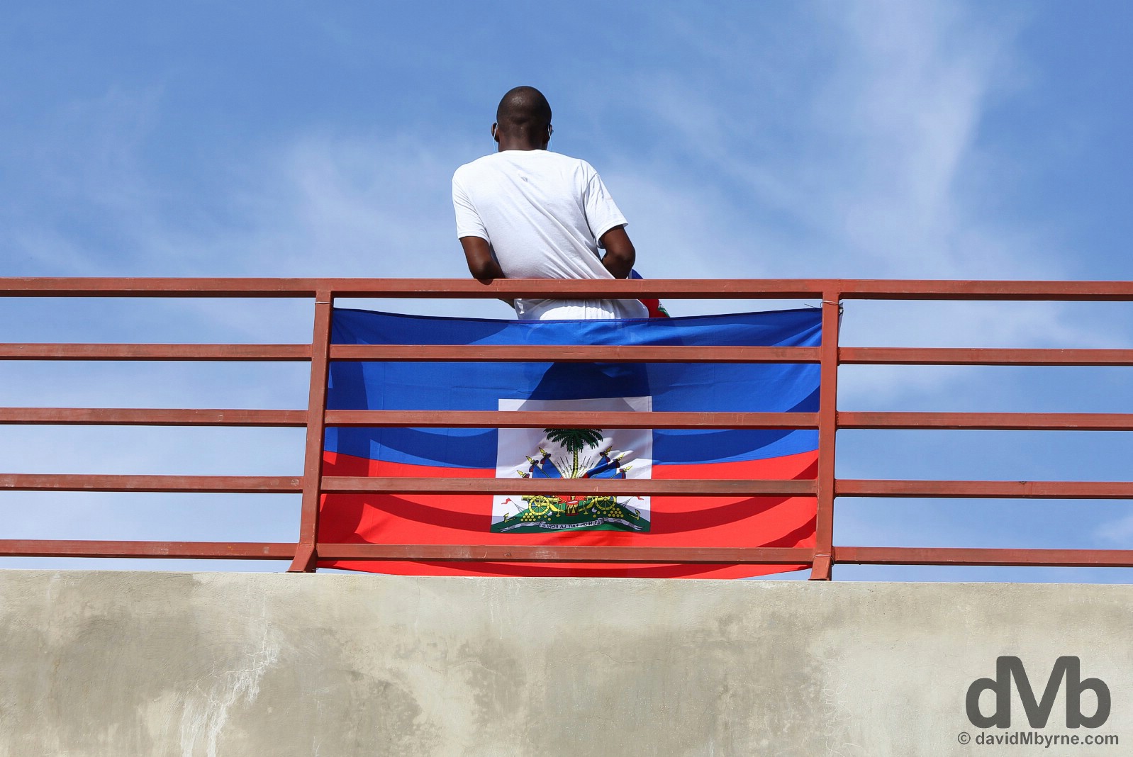
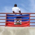
Flag and Universities’ Day in Champs de Mars, Port-Au-Prince, Haiti. May 18, 2015.

Read all postings from the road in chronological order or jump to specific postings using these links.
THE CAPITAL || Port-Au-Prince
BUSTED || Bus From Port-Au-Prince To Jacmel
THE CARIBBEAN SOUTH || Jacmel
THE ATLANTIC NORTH || Cap-Haïtien, Sans-Souci Palace & Citadelle Laferrière
MOVING ON || Onward to Dominican Republic, Prestige Beer & The Joke From Hell
Haiti, the indigenous Taino name meaning ‘Mountainous Land’, The Pearl of the Antilles. On the streets of Cap-Haïtien, northern Haiti, Hispaniola, Greater Antilles. May 22, 2015.
Haiti (May 16-24 2015)
Archived Entries Posted From The Haitian Road (In Chronological Order)
ARRIVAL & FIRST IMPRESSIONS
Date || May 16, 2015
Location || Port-Au-Prince ( )
)
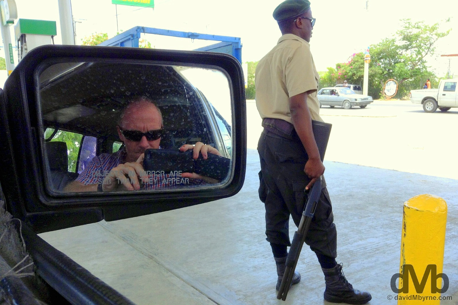
I had one of those ‘wtf am I doing here?’ moments today. I’d not long since landed from Jamaica. I was on time but my pre-arranged airport pickup was nowhere to be seen. I hung around outside the arrivals hall of Aéroport Toussaint L’Ouverture for a bit, still on the airside of a rudimentary wire-fence barrier. It was warm, it was dusty & people were milling here & there. It looked somewhat chaotic beyond the barrier but I couldn’t tell for sure. I eventually found myself convinced to take a taxi by a persistent Pierre. He was my driver, although he was quick to point out he was a ‘chauffeur’, not a taxi driver – he used the word more than once. His 4X4 was clapped out. It looked far from roadworthy but somehow it was still running. Belying the woebegoneness that surrounded me, Pierre was all business; he even had a business card, one from the Association des Chauffeurs Guides d’Haiti. Yes, Pierre seemingly was a bona fide chauffeur. He was an affable guy, a very affable guy with a good grasp of English, switching between it and a language he was later to inform me upon querying was Haitian Creole, local pidgin that’s predominately a mix of French & African; 92% of the vocabulary is derived from French, the official administrative language but one spoken by only some 15% of Haitians. I’d never heard a language like it. It was very unique sounding. Coarse but unique. It was a short ride from the airport to my guesthouse off Delmas but en route Pierre pulled into a petrol station to refuel (I got the impression he was waiting for his next fare to enable him to do so). The petrol station forecourt was to offer up just the latest Haitian eye-opener. Whereas petrol stations in most countries have pump attendants, Haiti has gun-toting guards. Yes, it’s that kind of place.
Just sitting here for a few minutes waiting for Pierre to do his thing was sufficient time for a few traffic junction beggars to approach the taxi window, all attracted to my white, moneyed skin like moths to a flame. A petrol/gas station in Port-Au-Prince, Haiti. May 16, 2015.
I’ve only been here a few hours, ample enough time to sample this city’s all-enveloping, crippling poverty. That’s something that blighted the city, the capital of the Western Hemisphere’s poorest country, even before the disaster that was the January 2010 earthquake. It levelled large parts of the already dishevelled city and left over 100,000 dead (conservative estimate), piling yet more hardship on the long suffering, beleaguered locals. I always knew Haiti was going to be a different, new kind of travel experience/challenge but this is something else. This may still be the Caribbean but make no mistake, it’s far from downing cold beers while watching the latest idyllic sunsets on the latest sandy beach I am now.
PORT-AU-PRINCE - THE CAPITAL
Date || May 17, 2015
Location || Port-Au-Prince ()
I‘ve walked many but I’ve never before walked streets like those here in Port-Au-Prince, a chaotic developing-world city, one that had for decades prior to the January 2010 earthquake been on the verge of collapse & one that on that fateful day actually did.
On the streets of Port-Au-Prince, Haiti. May 17, 2015.
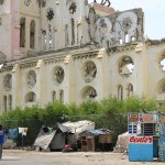
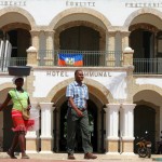
There’s not much to see here in the helter-skelter Haitian capital and anything there was to see was destroyed by the devastating earthquake that struck on January 12 2010 – the Palais National, razed & presently being rebuilt from the ground up behind a ring of fencing, & the Port-Au-Prince Cathedral, presently laying in ruin, are two notable former city landmarks. It’s the streets themselves, and the mayhem they serve up, that’s the city’s main & presently only attraction, for want of a better word.
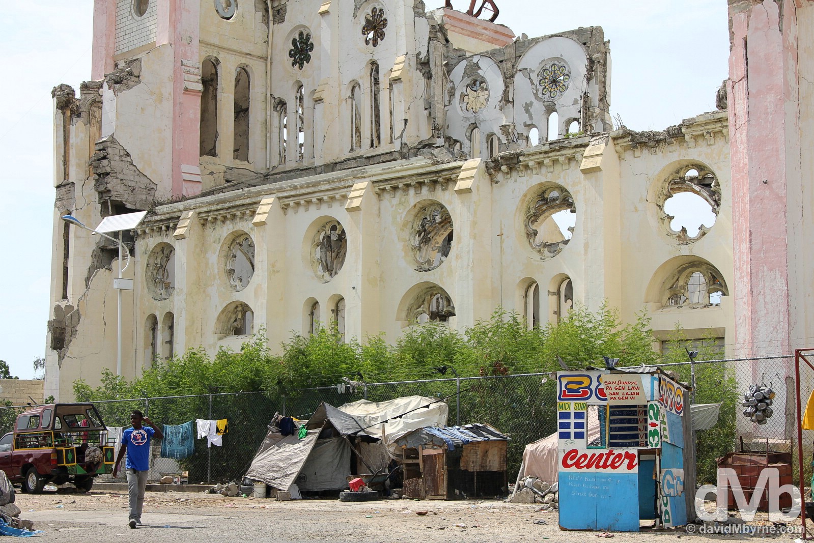
The ruins of the cream-&-pink Cathedral of Our Lady of the Assumption, a.k.a. Port-Au-Prince Cathedral. Built between 1884 and 1914, it was destroyed during the January 2010 earthquake that levelled much of the city, killing the Archbishop & Vicar General in the process. Plans are afoot to rebuild Port-Au-Prince’s largest church but I’d imagine it’ll be a while yet before that happens. In the meantime, the devoted still continue to pray outside its broken husk with funerals held in an adjacent plaza. Port-Au-Prince, Haiti. May 17, 2015.
Haiti & Voodoo
A popular maxim has it that Haiti is 80% Catholic, 20% Protestant & 100% Voodoo, a misunderstood but uniquely Haitian & deeply spiritual religion which blends many traditional Africa religions with Catholic elements & which involves witchcraft and animistic deities.
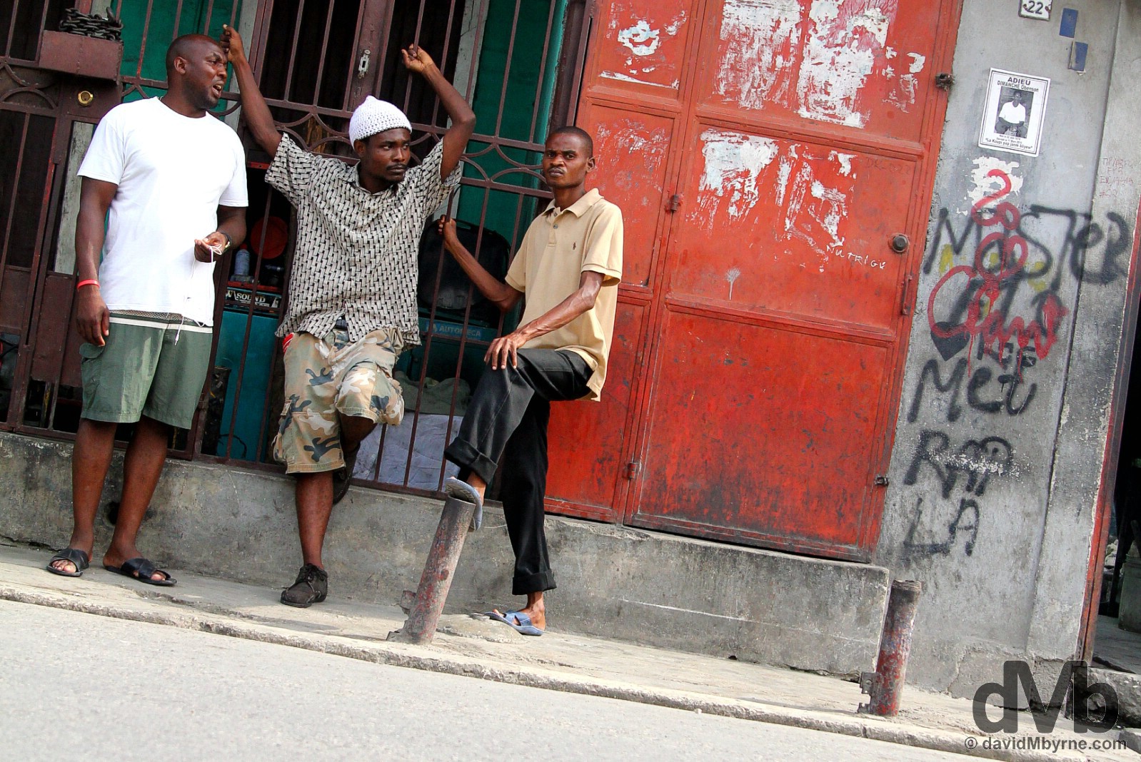
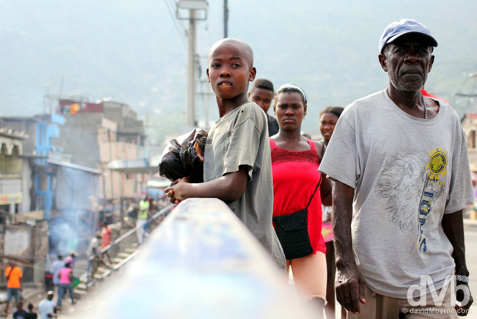
I spent this afternoon walking this way and that trying to stay orientated on the vast grid of frenetic streets that is Port-Au-Prince. It’s hard to keep your bearings when there are no street signs, no noticeable landmarks and no reprieve from the in-your-face theatre all around you. This place doesn’t see many tourists – I didn’t see one other white person the whole afternoon and all eyes were on me at all times. They watched me from afar, watched as I approached, and turned to follow me as I passed. I was a bit wary about wielding a camera at first but I eventually grew a pair. I never felt threatened. Just studied. Intently analysed, like a goldfish in a bowl.
Eyes on me today on the streets of Port-Au-Prince, Haiti. May 17, 2015.
On the streets of Port-Au-Prince, Haiti. May 17, 2015.
Among the curious stares I got a few smiles, a few gestures of welcome. A few people even approached me. They seemed friendly enough, trying as they did to converse with me in Creole. I tried to reply in French but they didn’t understand me, which probably says more about my woeful Gallic tongue than that of the locals – Haiti achieved independence from France way back in 1804 and today French is still an official language. I tried to be friendly but it’s hard when there’s the language barrier and you’re constantly alert, constantly on your guard. Israel was a nice guy. He introduced himself to me when I was in Champs de Mars, the city’s central park, and was checking out the rather forgotten-looking Statue of the Unknown Slave, a monument depicting a slave blowing into a conch-shell to signal the start of the Haitian Slave Revolution (see below). Israel spoke OK broken English, enough to tell me he was a policeman (he showed me his badge, & his gun), that he had the day off, and that he was taking his niece, whose name I didn’t catch, for a walk. He was keen to paint his city in a good light, keen to hear my opinion of it. I told him I like it. I wasn’t lying but he eyed me suspiciously regardless. In parting, Israel firmly shook my hand and warned me to ‘be careful’, going on to explain that there are a lot of ‘bad boys’ in Port-Au-Prince. He left giving no opinion on the girls.
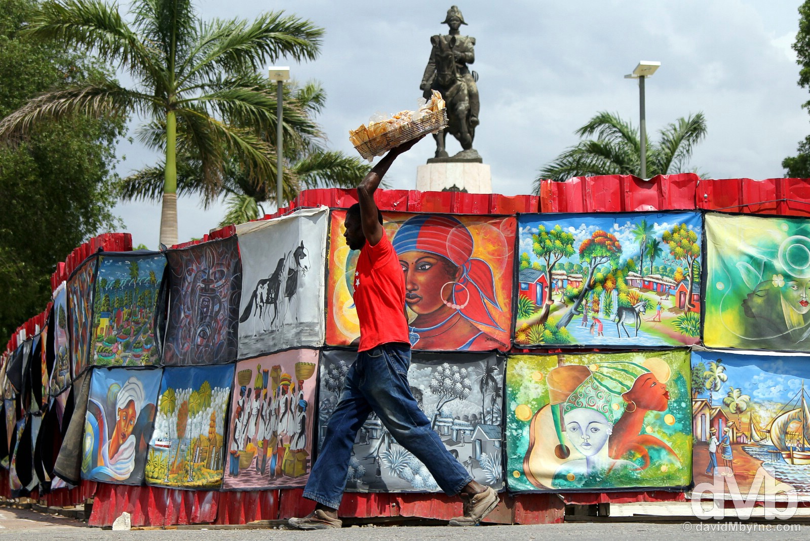
Champs de Mars is Port-Au-Prince’s central square, its largest public space, one that was turned into a tent city for thousands of the city’s displaced following the 2010 earthquake. Laid out in the 1950s, it’s here you’ll find what remains of the Palais National, a few museums, lots of reconstruction hidden behind red, art-covered fencing, & a statue or two, including that of Henri Christophe, seen here, a former slave and key leader in the 1791-1804 Haitian Revolution which succeeded in gaining independence from France – Haiti is the only country in colonial history to successfully stage a slave rebellion meaning it has retained its African roots more than any other Caribbean country (people of African origin make up nearly 95% of Haiti’s population). Port-Au-Prince, Haiti. May 17, 2015.
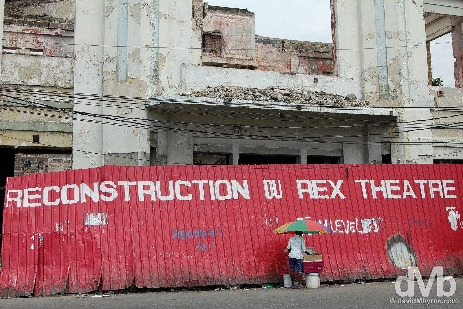
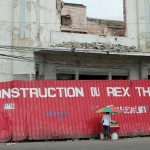
Once a city landmark, the 1935 Rex Theatre off Champs de Mars was taken over for refurbishment by the Ministry of Culture in November 2009, only 2 months before the earthquake. The Rex Theatre off Champs de Mars, Port-Au-Prince, Haiti. May 17, 2015.
Another local met today, whose name was not forthcoming, spoke almost perfect English. His tone was a tad aggressive when he asked me, while looking at the camera strapped firmly to my wrist, if I was a journalist. I said no, I was a tourist, a visitor to his city. ‘But why are you taking photos?’ he asked. ‘Because I’m a tourist,’ I repeated. He comprehended me but I could tell he didn’t quite understand the concept of visiting Port-Au-Prince (or Haiti) for no other reason than to visit it. Yes, few visit Haiti purely for visiting sake.
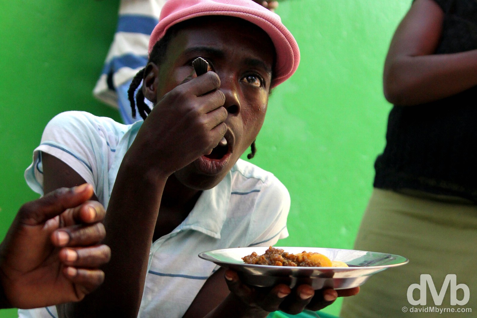
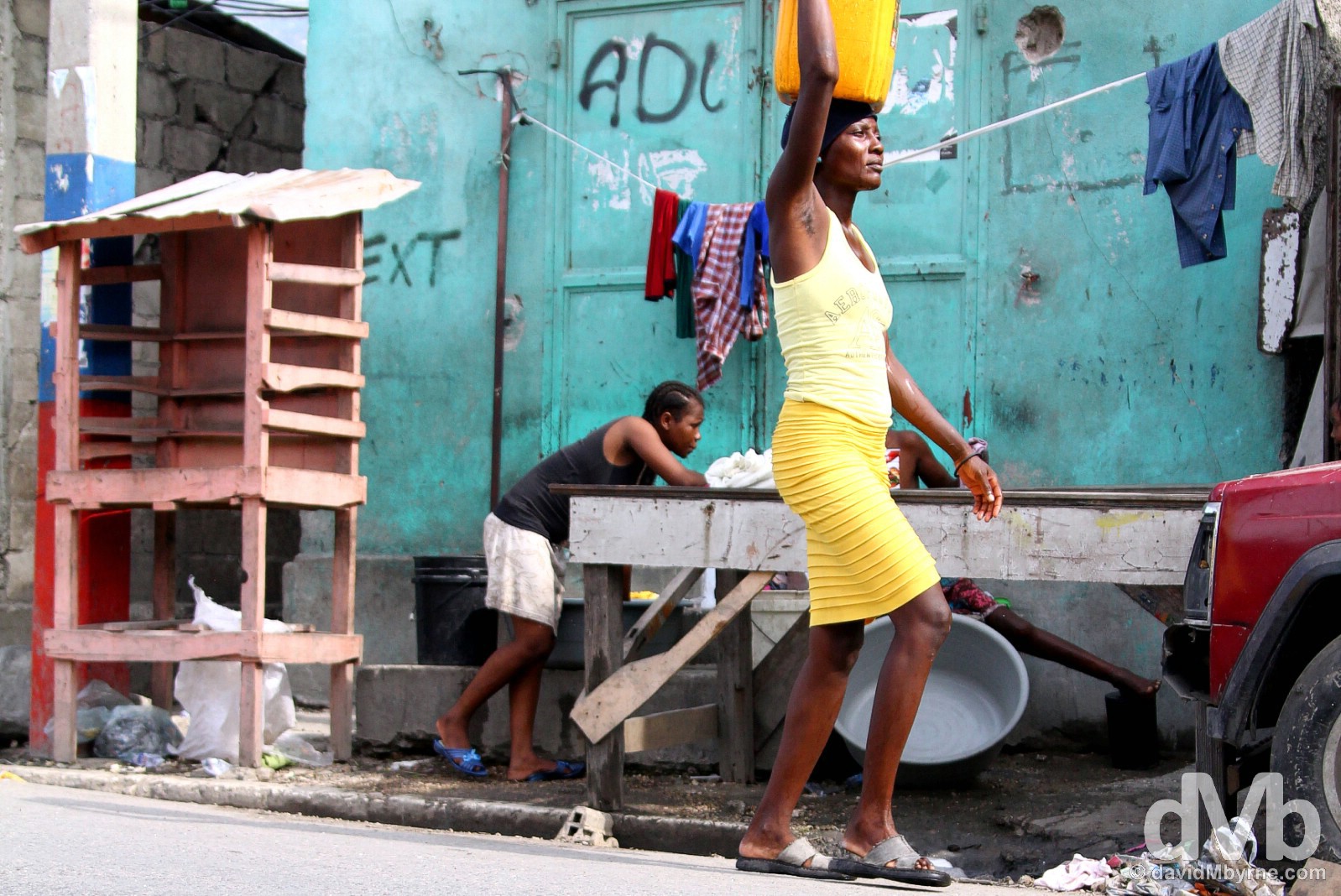
A few more captures from today on the streets of Port-Au-Prince.
On the streets of Port-Au-Prince, Haiti. May 17, 2015.
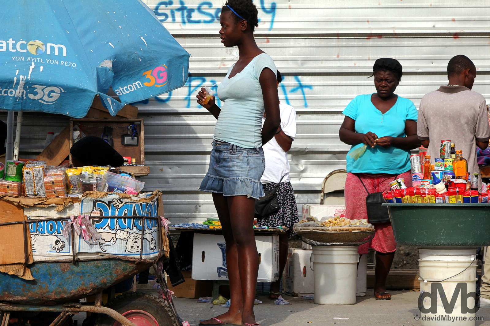
For sale on the streets of Port-Au-Prince, Haiti. May 17, 2015.
Port-Au-Prince’s layout is such that it’s commercial district – the vast, bustling, decrepit grid of streets I walked today, the centre of which is Champs de Mars – is located near the water and is overlooked by more affluent hillside residential neighborhoods such as Pétionville, or Pétion-ville, a city suburb popular with diplomats, foreign businessmen, expats & the country’s elite, the 1% of Haitian society that holds nearly half of the country’s wealth. I didn’t venture there. Port-Au-Prince, Haiti. May 17, 2015.
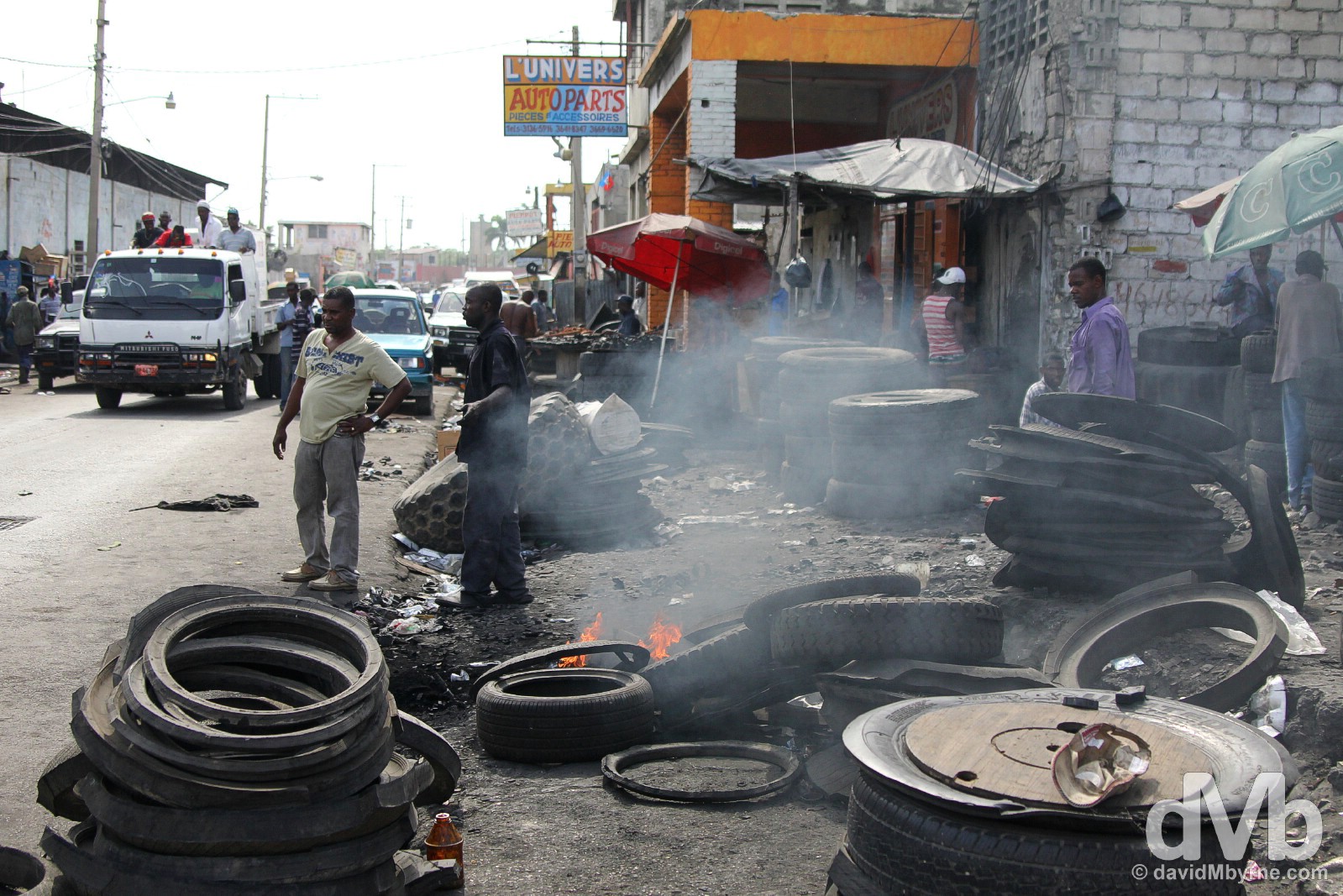
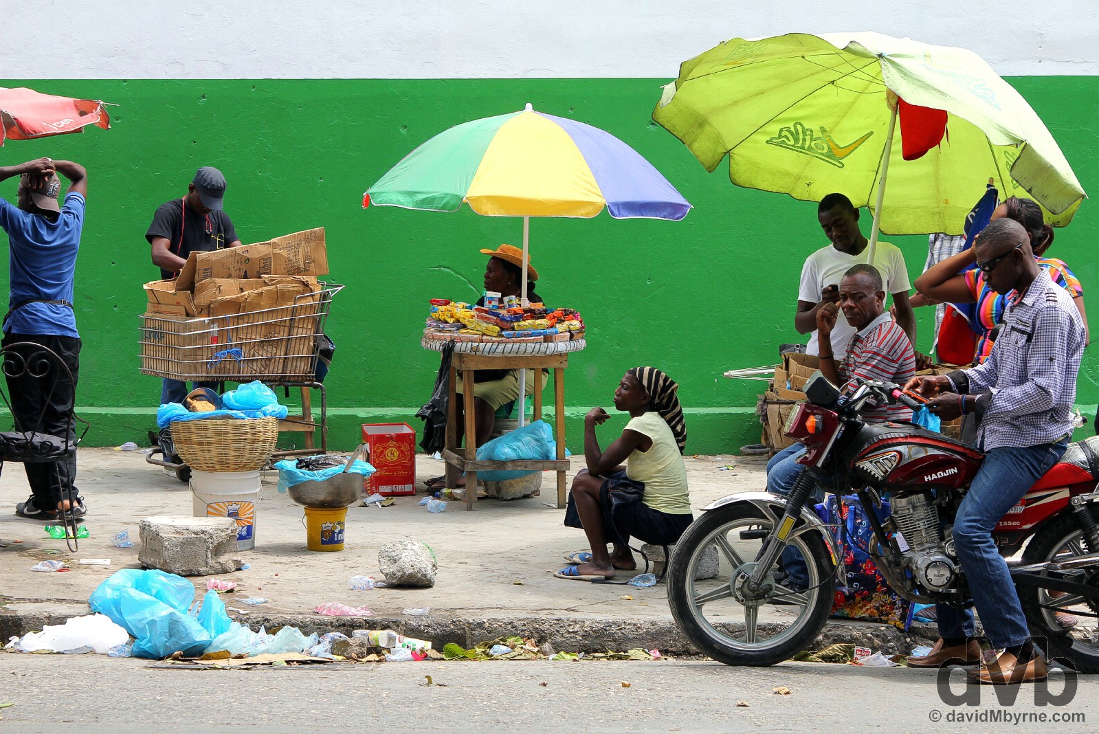
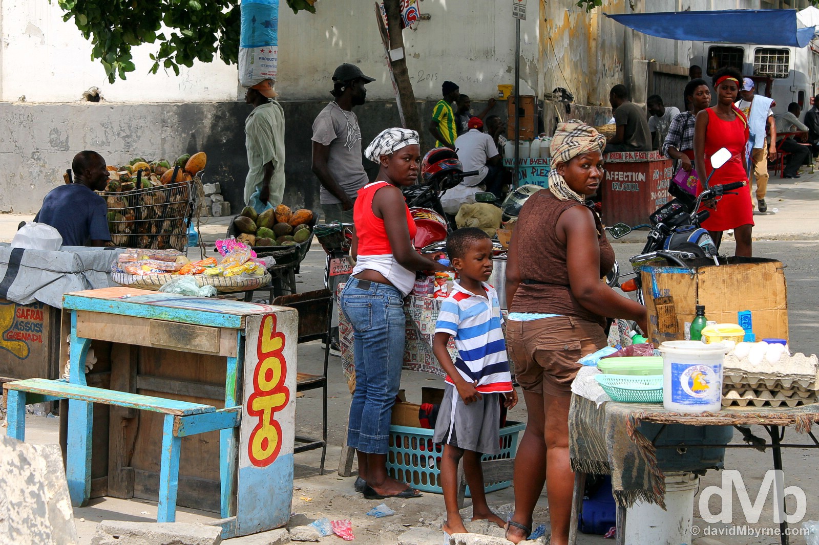
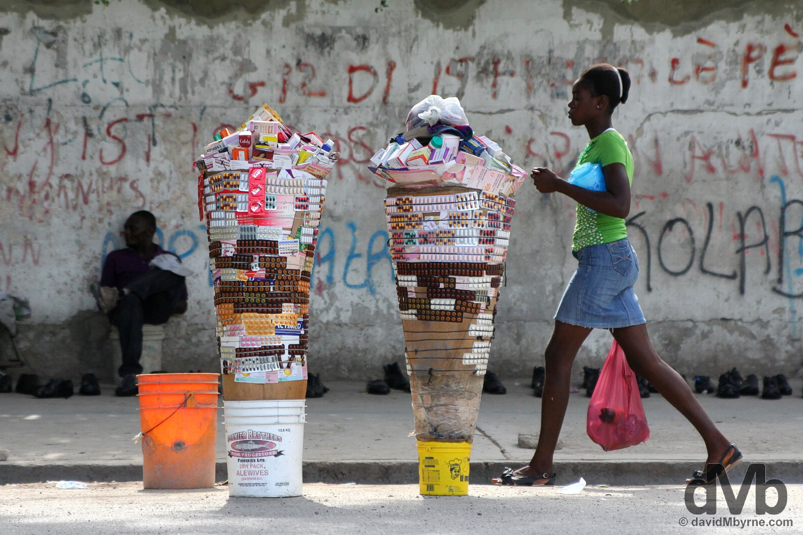
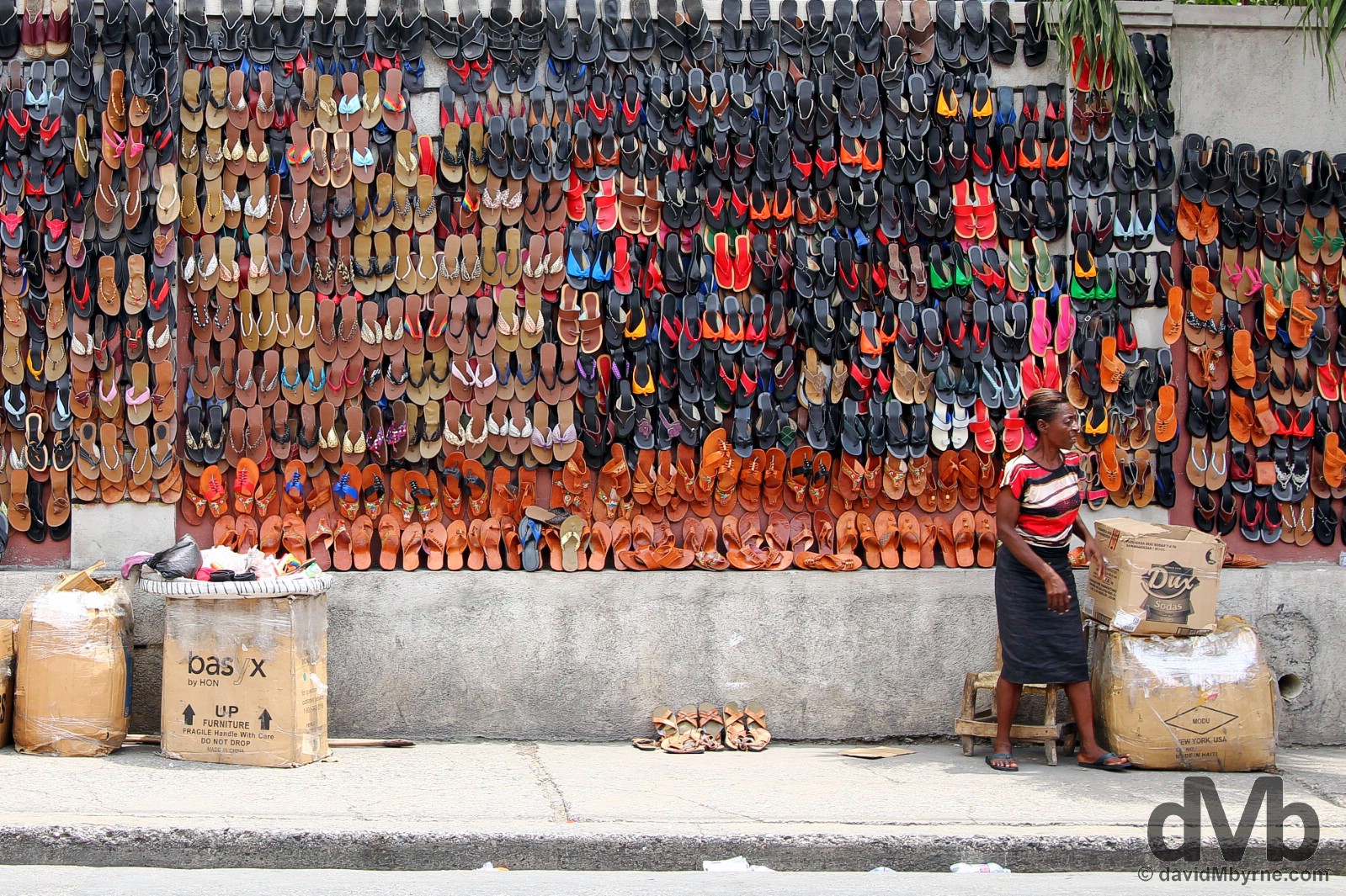
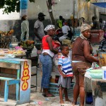
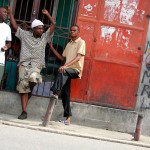
Anything goes on the streets of the city. I passed many a vendor, many a open-air shop/business. The whole city felt like one massive market. Nothing seemed ordered, everything chaotic. Port-Au-Prince, Haiti. May 17, 2015.

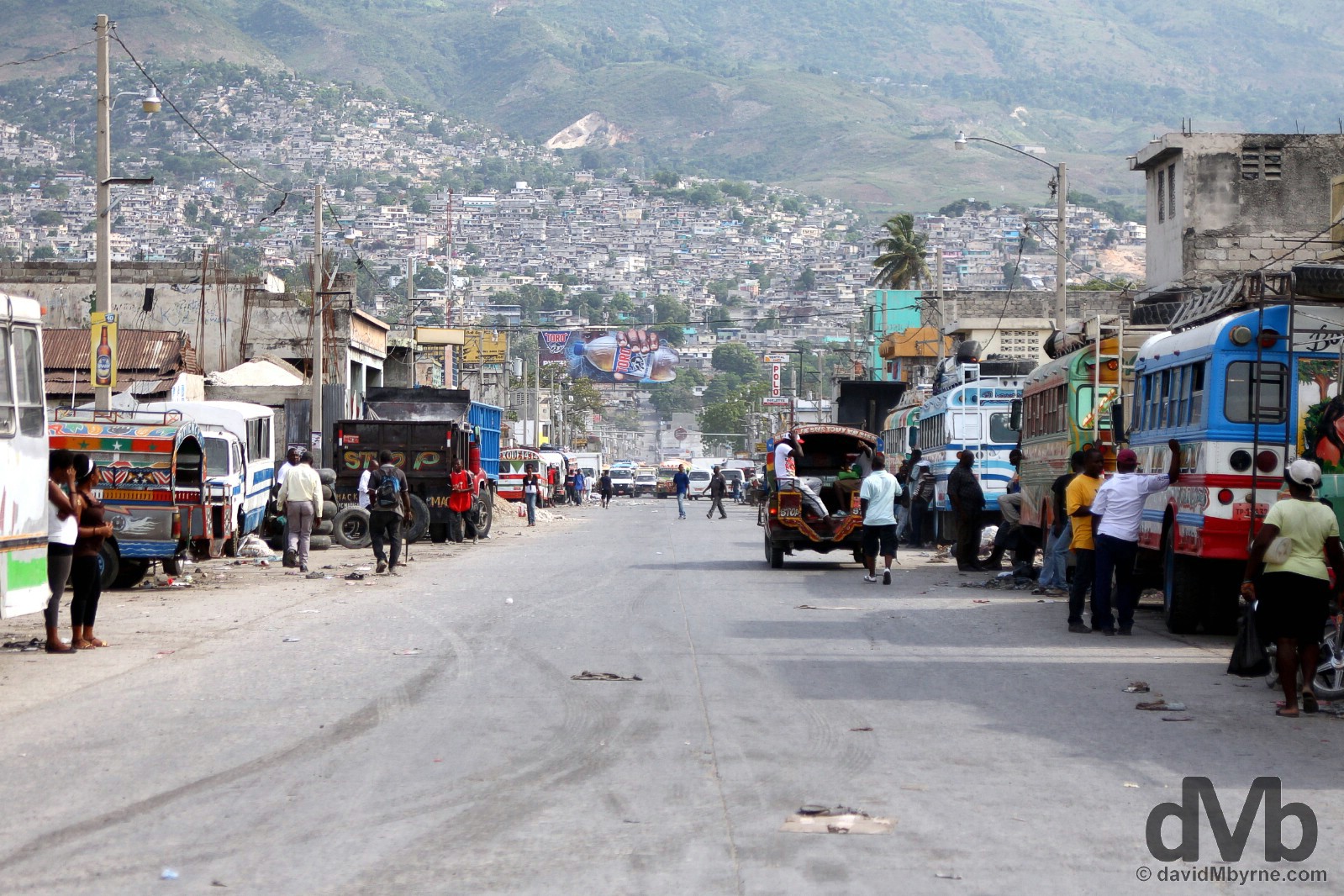
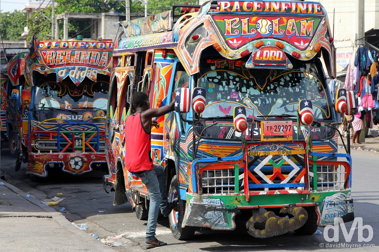
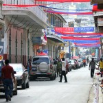
Traffic on Delmas. Seen here is the ubiquitous taptap, an open-back, colourful pick-up truck converted for people carrying that ply routes around the city, keeping it moving (just… somehow). They are cheap – 5 HTG (€0.10) a ride – & come with the added bonus of offering a quintessential Haitian experience. Needless to say I was of intense interest to the locals when I rode these today. I smiled & nodded and they smiled & nodded back. As you do. Port-Au-Prince, Haiti. May 17, 2015.
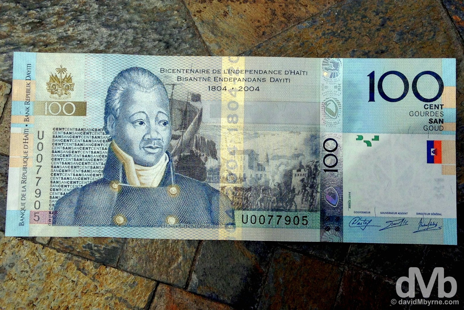
It’s slave rebellion leader Henri Christophe again, this time on the 100 Goud (€2) note/bill, good for 20 taptap rides. Port-Au-Prince, Haiti. May 16, 2015.
Port-Au-Prince, Haiti. May 17, 2015.
On the streets of Port-Au-Prince, Haiti. May 17, 2015.
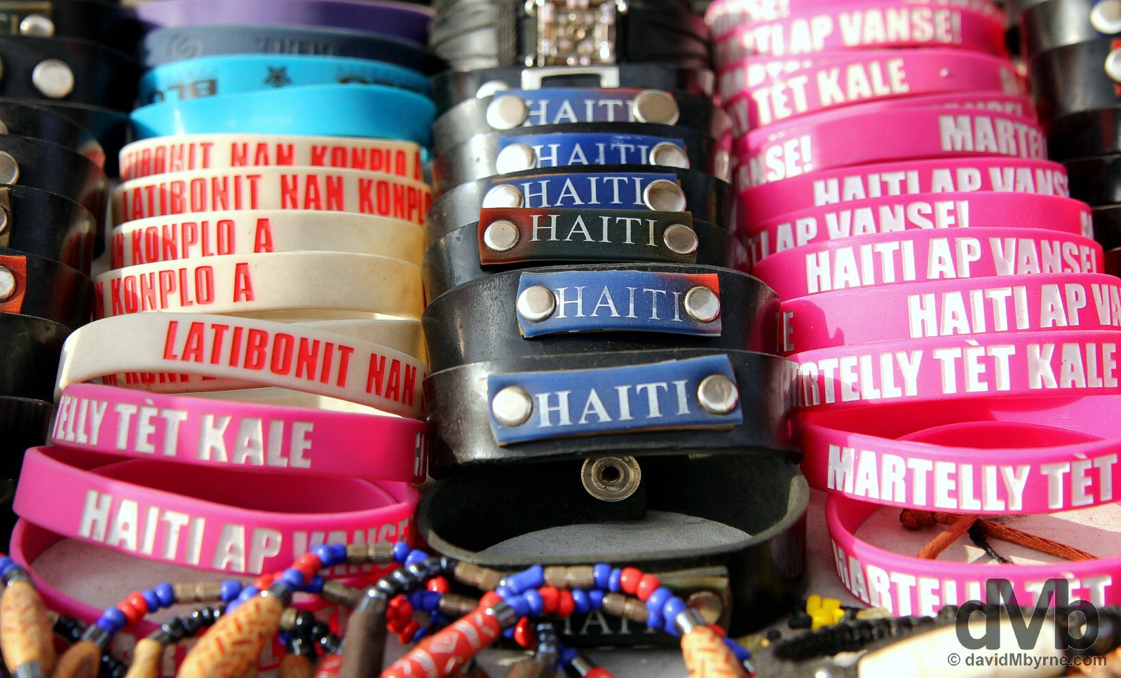
Handmade bracelets for sale on the streets of Port-Au-Prince, Haiti. May 17, 2015.
On the streets of Port-Au-Prince, Haiti. May 17, 2015.
Flag and Universities’ Day
I was going to leave the city tomorrow, May 18, but, and as luck would have it, it’s a national holiday. It’s Jour du Drapeau et de l’Université, Flag and Universities’ Day, a day that commemorates both the creation of the blue & red Haitian flag (in 1803, a year before independence) & the country’s educational system, a strange aspect of Haitian society to commemorate considering the fact that the country is the most illiterate in the western hemisphere – the Haitian illiteracy rate is approximately 50%. I’m in no rush so it’s reason enough to stick around I guess.
– Wikitravel
Date || May 18, 2015
Location || Port-Au-Prince ()
There weren’t too many festivities today on the streets of Port-Au-Prince. There were a few more people milling around Champs de Mars alright, the city’s central square. Most of those that were there were, & for the day that was in it, brandishing Haitian flags, and all of those that were there seemed to be waiting for something to happen in the square’s small open-air theater (and as far as I could discern nothing of note actually happened). Apart from that, today, a holiday Monday, was business as usual – chaos, mainly – on the streets of the Haitian capital.
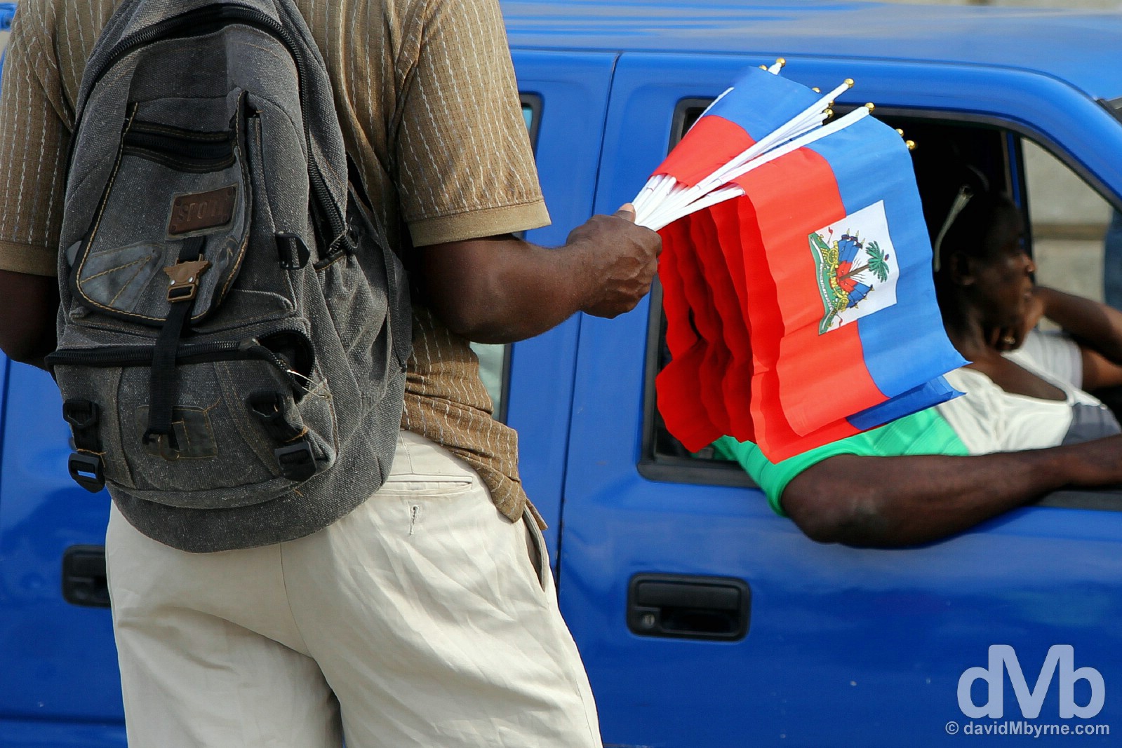
Selling Haitian flags on Jour du Drapeau et de l’Université, Flag and Universities’ Day, at a busy traffic junction on Delams. The story goes that in 1803, a year before independence from France, a slave rebellion general by the name of Jean-Jacques Dessalines, who would go on to be the first post-independence leader of Haiti until his assassination in 1806, took the French tricolour and, ripping the white out of it, declared he was ripping the white man out of the country. The red & blue were stitched together and the motto Liberte ou la Mort (Liberty or Death) added, thus creating the present-day flag of Haiti. Port-Au-Prince, Haiti. May 18, 2015.
BUSTED - BUS TO JACMEL
Date || May 19, 2015
Location || Jacmel ()
There’s not a whole lot of information online about travelling in Haiti, not when compared to other, more established travel destinations. The limited information I had read about getting around the country warned me to avoid travelling with Joe public, citing the hazards & general discomfort of it (from what I could discern, most of what I read was posted by aid workers stationed in Haiti, workers who see what they see of the country from behind the darkened windows of their air-conditioned Toyota Land Cruiser 4X4 & workers who, and again as far as I can discern, are prohibited by their organisations from taking public transport in Haiti altogether).
– Wikitravel
Colourful buses on the streets of Port-Au-Prince, Haiti. May 17, 2015.
I’ve had my fair share of arduous travel experiences over the years (bone-shaking overnight bus trips in South-East Asia, hot & sweaty train rides in India, so-called Hard Seat train trips in China, chicken bus trips in Central America, & 3rd class/Platzkart train trips through Siberian Russia all readily come to mind) but the 3-hour, 120-kilometre, 100 Goud (€2) bus journey I took today from Port-Au-Prince to Jacmel was easily the most intense & the most uncomfortable public travel experience I’ve yet had throughout all of my travels.

A vendor peddling her wares to me & my fellow bus passengers in Port-Au-Prince today prior to departure for Jacmel. Even when in motion, vendors would appear out of nowhere, jumping on the back of the moving bus with alarming dexterity to offer their stock, mostly food (bread, fruit, sweets/candy etc.) & water, to all on board. Port-Au-Prince, Haiti. May 19, 2015.
Public buses in Haiti, while brightly painted & decorated on the outside, are nothing more than covered trucks with 3 rows of narrow wooden benches on the inside. They are sturdy & cheap but woefully slow & terribly uncomfortable. There’s not enough room for the people (& cargo) carried so every available space is utilised, including the roof & floor space. It’s a noisy place to be, too. Haitians love to talk – it seems to me like they talk just for talking sake – and rarely, if ever, do they verbalise discreetly; without being able to understand the creole language, this “blanc” (French for white), as all foreigners in Haiti are called, gets the impression the locals are always arguing. Finally, riding a public bus in Haiti is a hot & steamy endeavor with ventilation provided only via motion. Haitian buses leave when full operating under the principle that there’s always room for one more passenger, one more 20 kg bag of rice, one more parcel of whatever. When sitting in the stifling bus innards for close on 1 hour today while waiting for it to fill to (way over) capacity, I must have lost a few pounds in sweat; in doing so I took some solace from the fact that the Haitians in there with me, for whom discomfort is a way of life, were sweating just as much as I was (although I imagine they, unlike me, didn’t look like they were slowly dying).
Things improved slightly, ever so slightly, when we set off (again, motion = ventilation) but despite 3 hours of wriggling, 3 hours of jostling with the Haitians in my (very) immediate vicinity, I could still barely move my legs for the whole journey, couldn’t stretch at all. But at least I could breathe & at least I was at the back, giving me views of life on the Haitian roads & in the surrounding countryside. I tried to capture some video of my experience today. I did but it, the video, is not very good. I’m no videographer but in the environment I found myself today it was hard to brandish a video capturing device, even something small like an iPod, let alone get some decent footage. What I did record was captured just as the bus was pulling out of what passed for a bus ‘station’ in Port-Au-Prince as we mercifully set off for Jacmel, my present location on Haiti’s southern Caribbean coast.
Right. I’m off to bed. I need to get some rest. I’ve the return journey back to Port-Au-Prince to look forward to in the morning.
JACMEL
Date || May 20, 2015
Location || Port-Au-Prince ()
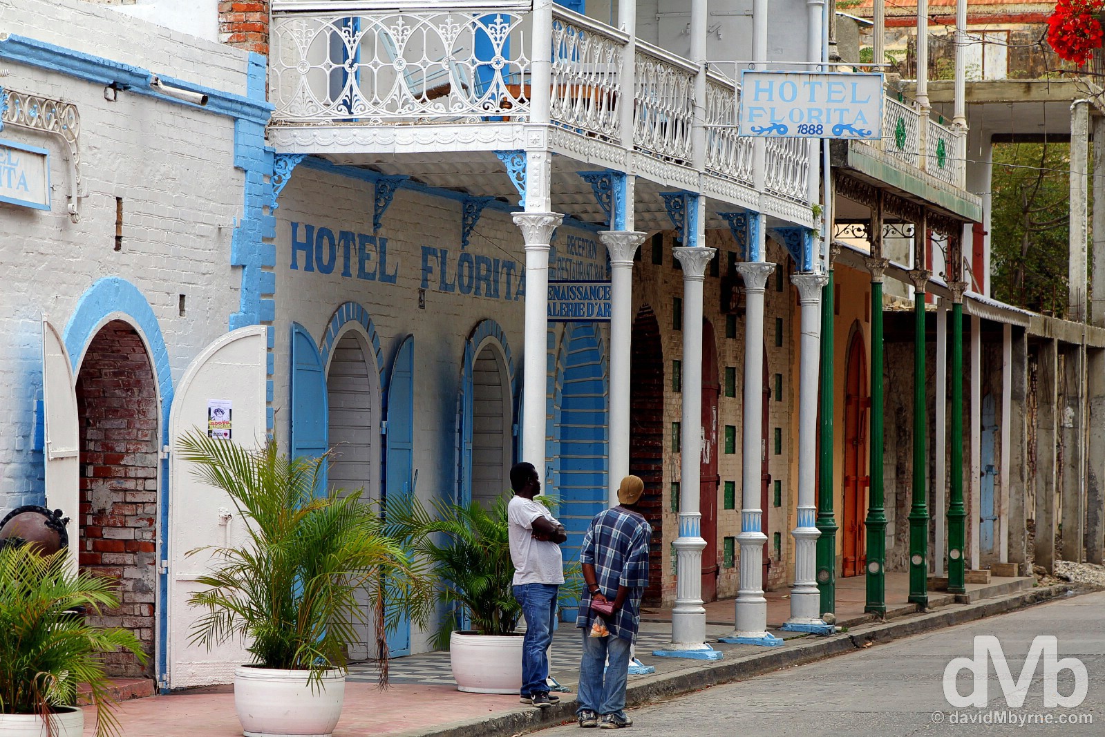
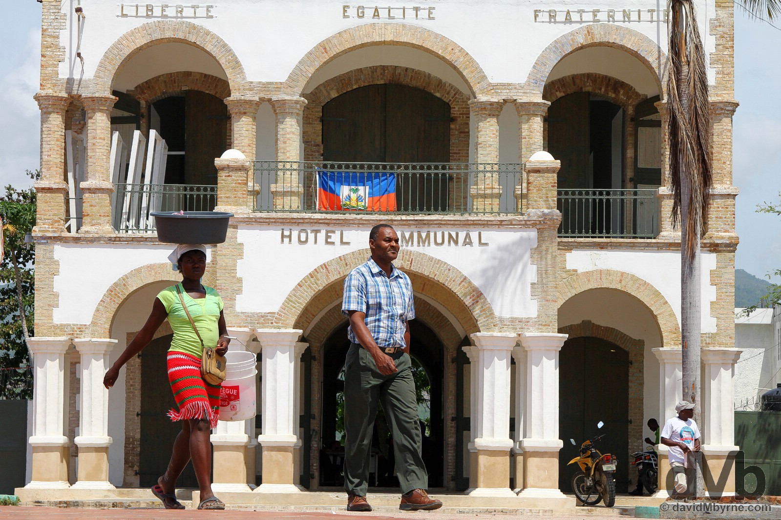
Jacmel may not exactly get the pulse racing or detain you for very long. But it will get you out of the capital and that for me was the town’s biggest attraction. The country’s so-called laid-back (although to me it still felt like a town on steroids) arts & culture capital, Jacmel is a manageable, colourful port city on the Haitian Caribbean.
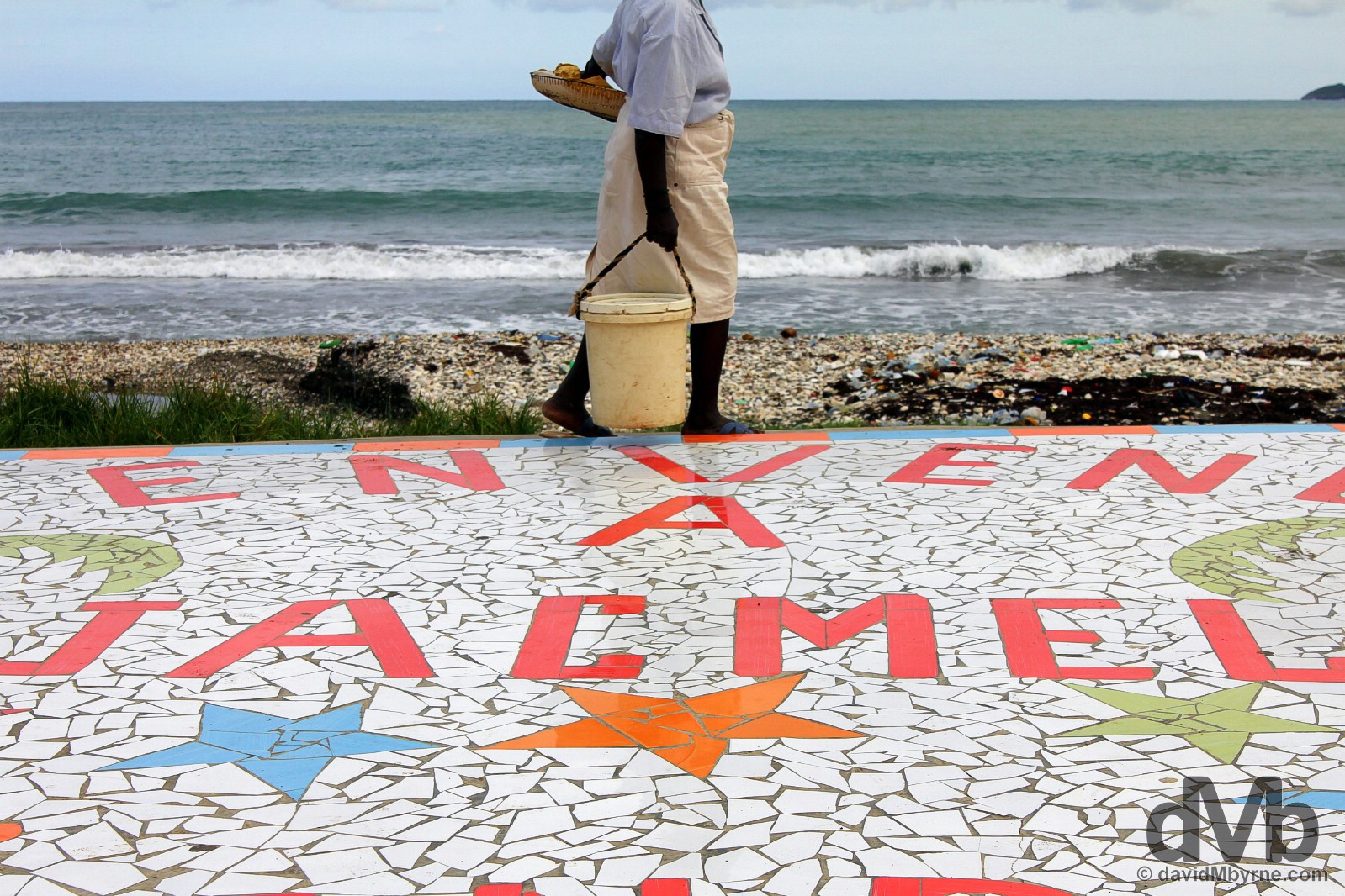
On the beachfront promenade in Jacmel, southern Haiti. May 19. 2015.
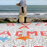
Jacmel Promenade
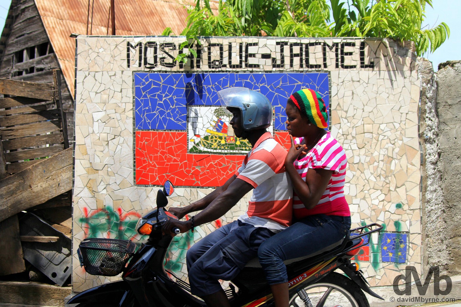
Oh yes, the artists have been here alright and they have managed to make certain parts of Jacmel aesthetically pleasing, especially the town’s promenade fronting Jacmel’s you-don’t/shouldn’t swim-in-there beach. Walls & buildings are brightly painted and even the wheelie bins have seen an artist’s spray can. Mosaics abound too, most of which are at pains to remind you where you are.
A few more pictures from the colourful Jacmel promenade.
-
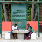
- Study time on the beachfront promenade in Jacmel, southern Haiti, Hispaniola, Greater Antilles. May 19, 2015.
-
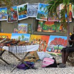
- For sale on the beachfront promenade in Jacmel, southern Haiti, Hispaniola, Greater Antilles. May 19, 2015.
-
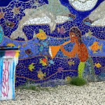
- On the colourful beachfront promenade in Jacmel, southern Haiti, Hispaniola, Greater Antilles. May 19, 2015.
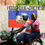
Historic Jacmel
You’d scarcely believe it today but Jacmel was once a prosperous place by virtue of the fact that by the mid-19th century the town was a leading Caribbean port for Europe-bound steamships. It also can boast a few rather impressive regional firsts; it was the very first town in the Caribbean to have telephones & portable water, and it was also, get this, the first town in the Caribbean to boast electric lighting thanks to the illuminations of its cathedral in December 1895. You go Jacmel.
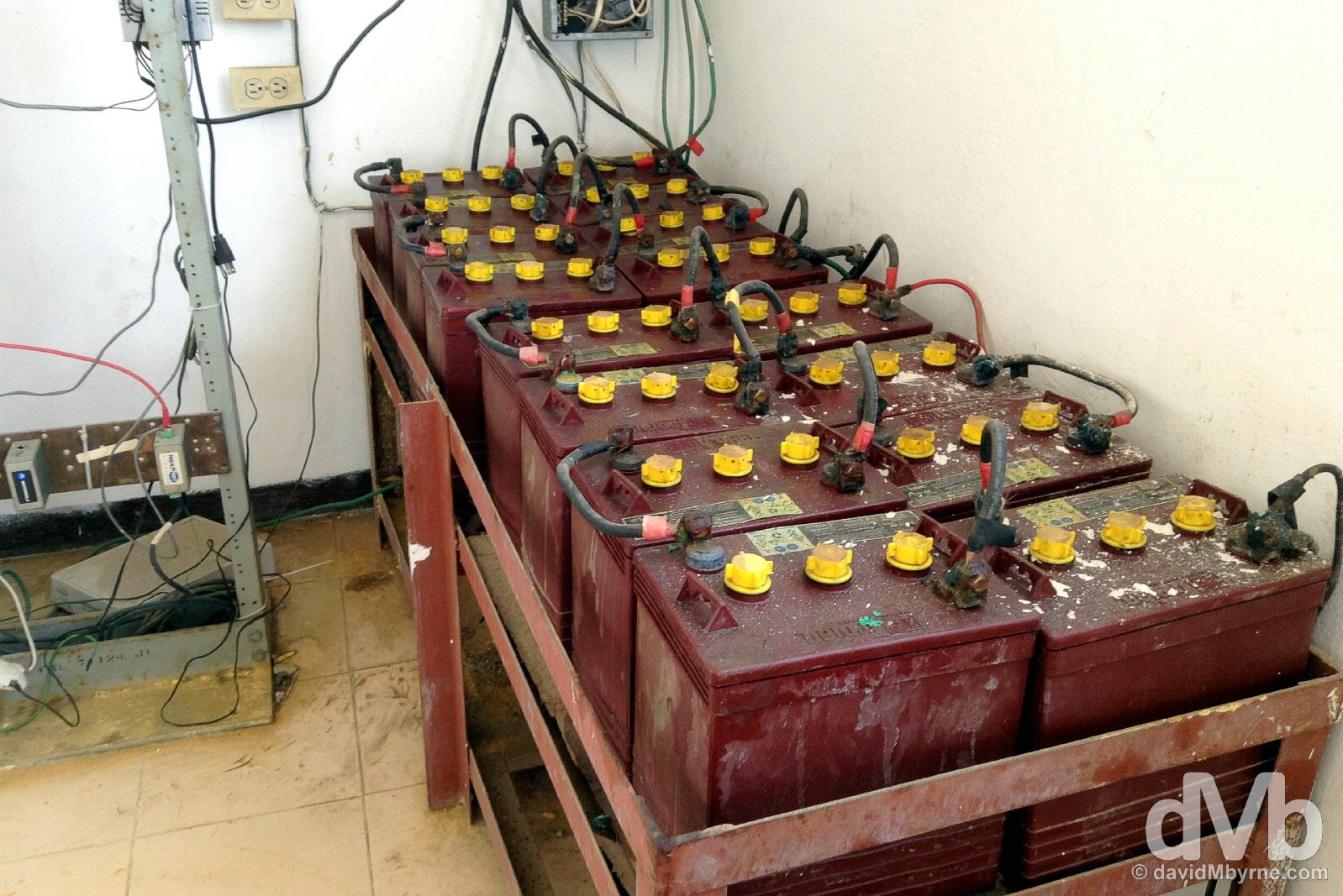
Irony. The first town in the Caribbean to boast electric lighting it may have been but today Jacmel deals with the same Third World infrastructure deficiencies that blight the rest of the county. Long electricity outages are a fact of daily life all over Haiti and backup power solutions, like this array of car batteries on the top floor of the city’s Hôtel de la Place, my home in Jacmel, are not uncommon. This crude daisy-chained backup solution didn’t actually seem to work – there was no power throughout my stay at the hotel, even in the dead of night. Hôtel de la Place, Jacmel, southern Haiti. May 20, 2015.
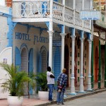
By the turn of the 20th century Jacmel was a busy coffee trading port, the profits from which saw the construction of many fine buildings – warehouses, merchants mansions & town houses etc. Some of these elegant buildings still survive in different guises today with Rue de Commerce near the waterfront, seen here, boasting the greatest collection of remaining late-Victorian buildings in the town. Rue de Commerce, Jacmel, Haiti. May 19, 2015.
Jacmel, Haiti. May 20 2015.
Place Toussaint L’Ouverture in central Jacmel, Haiti. May 20, 2015.
I got the bus back to Port-Au-Prince earlier today, back to the chaos of the capital (although chaos is definitely more tolerable when it’s familiar). I expected to ride a variant of the stuffy boneshaker I rode yesterday to get to Jacmel but as it turned out the mototaxi driver I befriended brought me to a lot on the outskirts of the town, the departure point for quicker and infinitely more comfortable mini buses to the capital. If only I could have found one of those yesterday.
CAP-HAITIEN
Date || May 22, 2015
Location || Cap-Haïtien ()
I spent a lot of time yesterday after arriving off the Sans-Souci Tours bus from Port-Au-Prince walking in and out of various hotels and guesthouses here in Cap-Haïtien, Haiti’s somewhat historic northern second city. After haggling hard I eventually deemed US$160 for two nights in Hotel Beck Universal Colonial, a well-appointed hotel providing security & breakfast and guaranteeing electricity, Wi-Fi & air-con, a much better value option than US$100 for two nights in a flea-bitten roadside guesthouse, the next best option. Yes, laying your head in Haiti is an inexplicably expensive ordeal, something I was already well aware of prior to getting to Cap-Haïtien.
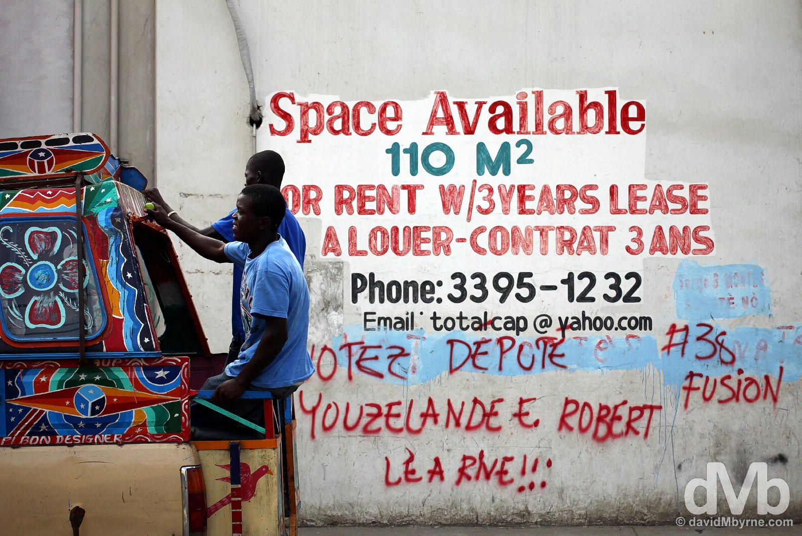
Space Available. Riding a taptap on the streets of Cap-Haïtien, northern Haiti, Hispaniola, Greater Antilles. May 22, 2015.
Cap-Haïtien || ‘Au Cap’, ‘Le Cap’ or ‘Cap’
Also referred to as ‘Au Cap’, ‘Le Cap’ or just ‘Cap’ and historically known as the “Paris of the Antilles” (I guess somewhere in the region had to lay claim to the title), Cap-Haïtien is a city of 180,000 perched on the Haitian northern Atlantic coast. The city shone during the French colonial period, when it was the richest port in the Caribbean, and served as the Haitian capital until 1770 when the title was moved to Port-Au-Prince. It regained capital status, albeit of the now defunct Kingdom of Northern Haiti, following the death of Jean-Jacques Dessalines in 1806. This was only 2 years into full independence from France and resulted in Civil War between the black north, led by Henri Christophe, and the mulatto south. Christophe’s death (by suicide, see below) in 1820 once again unified the country. Much faded today, the city itself has few sights of note; just like Port-Au-Prince & Jacmel before it, the highlight of a visit to Cap-Haïtien is the in-your-face spectacle the city invariably throws up.
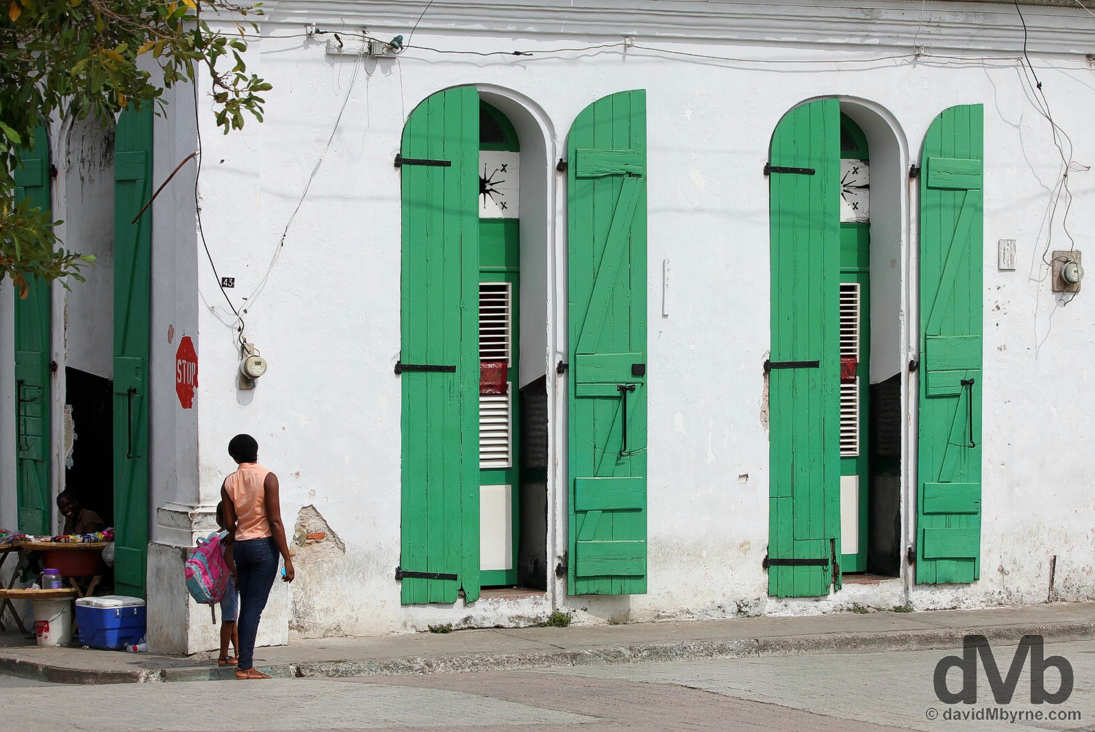
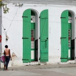
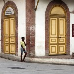
The French are over two centuries removed from Haiti now and in places it seems Cap-Haïtien, the former “Paris of the Antilles”, hasn’t received a lick of paint in just as long. That said, in some areas the city is rather colourful, rather, and dare I say it, photogenic. An earthquake in 1842 put paid to the city’s colonial-era buildings and today Cap’s streets, laid out on a functional grid system, are a mishmash of styles. At its most photogenic, the city boasts old commercial buildings with colourful high shop fronts, tall shuttered doors & windows, and wide overhanging balconies. It can be pretty but rest assured, and this being Haiti, it doesn’t stay pretty for very long. On the streets of Cap-Haïtien, northern Haiti, Hispaniola, Greater Antilles. May 22, 2015.
On the streets of Cap-Haïtien, northern Haiti, Hispaniola, Greater Antilles. May 22, 2015.
The streets of Cap-Haïtien, while narrower, more colourful & more claustrophobic than those in Port-Au-Prince, were no less attritional. Here’s a few more captures from an afternoon amble around the city.
-

- On the streets of Cap-Haïtien, northern Haiti, Hispaniola, Greater Antilles. May 22, 2015.
-
- On the streets of Cap-Haïtien, northern Haiti, Hispaniola, Greater Antilles. May 22, 2015.
-

- On the streets of Cap-Haïtien, northern Haiti, Hispaniola, Greater Antilles. May 22, 2015.
You need to be alert on the streets of Haiti. Alert, not paranoid. As a rare foreigner on the streets, you’ll always be visible but rarely a target. I was a target today when taking this picture, probably my favourite capture from Cap-Haïtien, while on a bridge having just returned to the city from a visit to the nearby Sans-Souci Palace & Citadelle Laferrière (see below). The few seconds it took me to capture this image was all that was needed for a sleight of hand passerby to somehow open my hip bag and blindly relieve me of an external USB power supply, my sunglasses and my hat. My defenses breached, I was initially shocked although shock quickly turned to relief when I discovered my wallet, nestling in the same violated portion of my bag, was still in my possession. A close call. On the streets of Cap-Haïtien, northern Haiti, Hispaniola, Greater Antilles. May 22, 2015.
SANS-SOUCI PALACE & CITADELLE LAFERRIERE
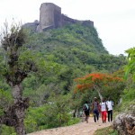
As already mentioned, few people visit Haiti purely for visiting sake. Fewer still, if any, venture up north to Cap-Haïtien from Port-Au-Prince to take in the city itself. Most, & me included, use it as a base to access the nearby twin delights of the UNESCO-listed Sans-Souci Palace & Citadelle Laferrière. Two of the largest structures in the whole of the Caribbean region, they alone are reason enough to visit Haiti, the astonishing & impenetrable Citadelle Laferrière, perched high in the tropical mountains, Haiti’s best-known landmark and only the largest fortress in the Americas, a.k.a. the Western Hemisphere.
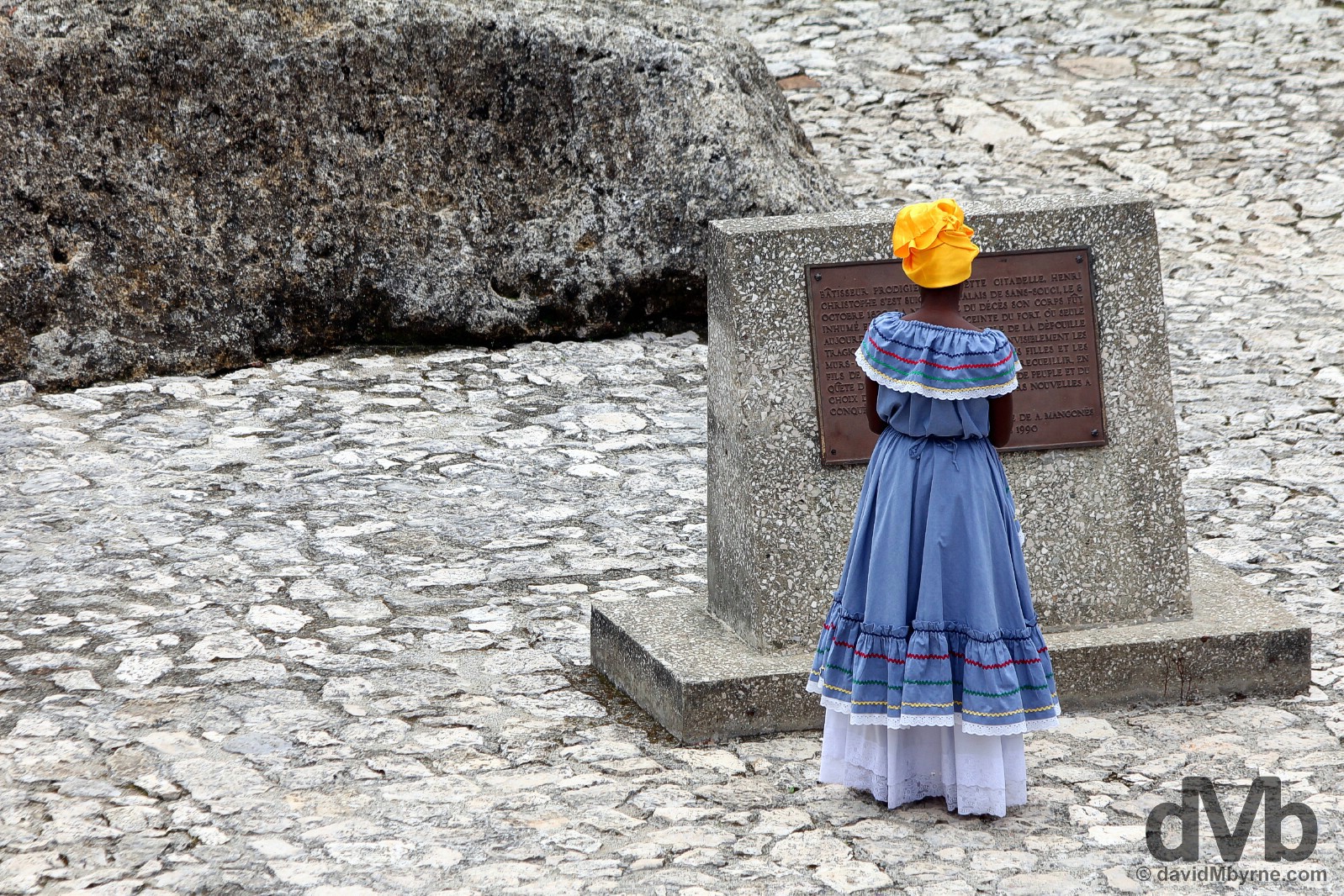
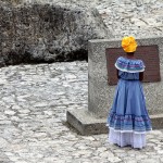
A traditionally dressed Haitian tourism representative in the grounds of the UNESCO-listed Citadelle Laferrière atop Bonnet a L’Eveque, National History Park – Citadel, Sans Souci, Ramiers (NHP-CSSR), northern Haiti, Hispaniola, Greater Antilles. May 22, 2015.
National History Park – Citadelle, Sans-Souci, Ramiers
Haiti’s National History Park – Citadelle, Sans-Souci, Ramiers (NHP-CSSR) remarkably Illustrates the history of Haiti at the dawn of its independence. The 27 km² remote mountainous park, located at the junction of Haiti’s northern coastal plain and its mountainous interior, is home to three historic structures of outstanding universal value dating from the early eighteenth century: Sans-Souci Palace, Citadelle Laferrière, and the stronghold of Ramiers, the latter of which I didn’t visit. Collectively declared a World Heritage sites by UNESCO in 1982, these three massive symbols of freedom were the first monuments to be erected by Haitian slaves who had just broken free of their shackles, erected as part of a program to demonstrate to foreigners, particularly Europeans and Americans, the power and capability of the black race. All told, they were quite the statement.
– UNESCO commenting on National History Park – Citadel, Sans Souci, Ramiers
The impressive approach to the even more impressive UNESCO-listed Sans-Souci Palace outside the village of Milot, northern Haiti, Hispaniola, Greater Antilles. May 22, 2015.
Sans-Souci Palace
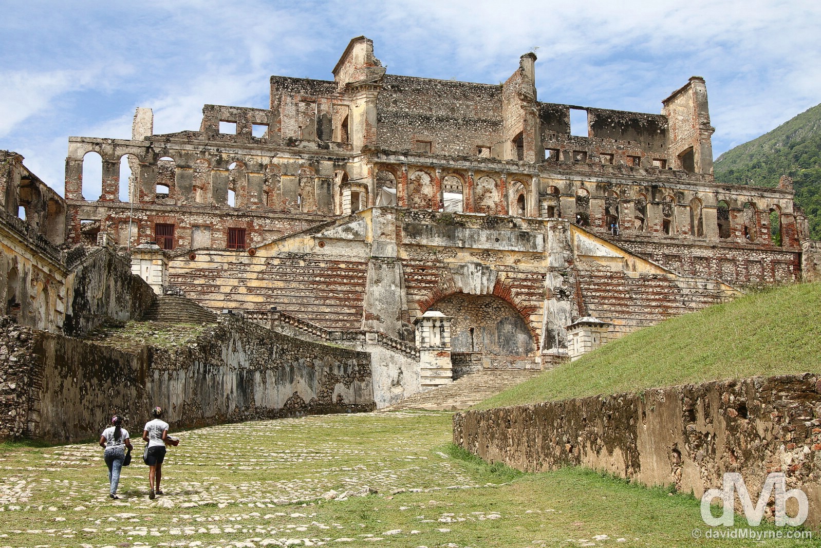
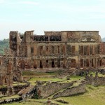
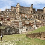
Located 20 kilometres south of Cap-Haïtien (a 40-minute taptap ride or 20 minutes if you hop on the back of a mototaxi as I did) on the edge of the village of Milot, Sans-Souci (meaning carefree in French) Palace was the royal residence of King Henri I (better known as Henri Christophe), the aforementioned hero of the war of Independence & the King of Northern Haiti from 1811 to 1820. The huge complex answered the need to concentrate all essential administrative functions of the monarchy around the royal residence. Construction started in 1810 and was completed three years later in 1813. But its demise wasn’t long in coming. Looting followed shortly after the king’s death in 1820 (crippled by a stroke, Christophe committed suicide on the grounds of the palace on October 8 of that year) & the abandoned palace was largely destroyed by the same earthquake of 1842 that ravaged Cap-Haïtien. The palace was never rebuilt and what was once described as the Caribbean equivalent of the Palace of Versailles in France today sits in ruins.
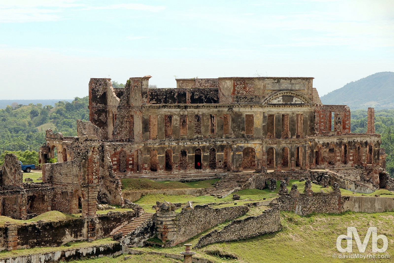
The rear of the ruined Sans-Souci Palace as captured from among the remains of the ornamental fountains that once adorned the Place’s King’s & Queen’s Gardens. || The palace itself was/is a massive rectangular building adjacent to a large open area where, under the shadow of a cayemite tree, the king rendered justice. According to oral tradition and descriptions from Christophe’s time, the building was designed by Cheri Warloock, an architect of the first royal court, and was originally decorated in European style: mirrors, paintings and draperies decorated the rooms; the locally manufactured mahogany furniture, like the flooring, was of the best quality; and silk drapes adorned stained-glass windows. Externally, the southern side of the Palace was painted white with a soft yellow, while the northern side was of an ocre tint. Water was brought to the Palace through the expansive King’s & Queen’s Gardens via conducts measuring over 300 metres long, an elaborate aqueduct system carrying water from the nearby mountainside. Today the building, completely open to the elements, is nothing more than a pile of bricks, albeit a very impressive UNESCO-listed pile of bricks and one that looks & feels like it would tragically offer very little resistance when the next tremor decides to put its structural integrity to the test. It’s a fascinating place to explore, drawing as you do a mental picture in your mind as to what the palace would have looked like during its heyday all those years ago.
Sans-Souci to Citadelle Laferrière
It’s an arduous 8-kilometre uphill slog on a windy road in tropical temperatures from the grounds of Sans-Souci Palace to Haiti’s best-known landmark, the astonishing Citadelle Laferrière, the country’s renowned mountaintop fortress. I naively assumed I’d walk the trail and did so only for long enough to realise that there had to be an easier way. There was. Horses abound but the persistent & friendly mototaxi driver who trailed me while I was stubbornly hoofing it up the trail, & until such time as I succumbed to the inevitable and eventually availed of his services (he knew what he was doing, I clearly didn’t), earned his reward of $10 for ferrying me up & down the mountain. It was money very well spent.
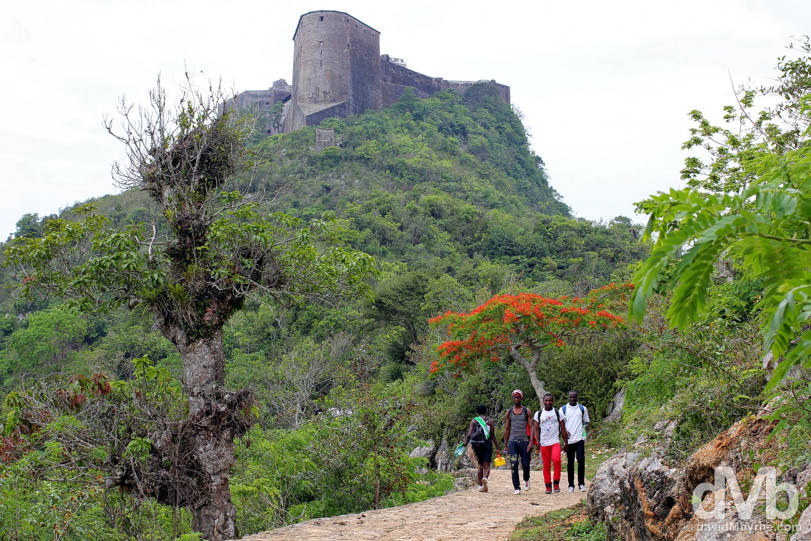
You see the Citadelle Laferrière well before you reach it, perched as it is atop the 950 metre-high mountain Bonnet a L’Eveque. The final push from the transport drop off area to the citadelle itself is via a well-maintained path, seen here, with the monumental mountaintop fortress, looking like the prow of a great stone ship jutting out of the mountain as seen from this approach, growing ever bigger the closer you get to it. On the path to the UNESCO-listed Citadelle Laferrière in northern Haiti, Hispaniola, Greater Antilles. May 22, 2015.
Citadelle Laferrière
The construction of the Citadelle Laferrière was initiated by, you guessed it, Henri Christophe. The mountaintop fortress required a workforce of some 20,000 & 15 years of toil – it was built between 1805 to 1820 in the aftermath of the Haitian slave revolution & of Haiti’s independence from France and was designed as a part of a fortification system intended to defend newly independent Haiti from reprisal invasions from the French Army, invasions that never occurred. Referred to by locals as the Eighth Wonder of the World, the massive stone construction occupies an area of some 10,000 m² making it the largest fortress in the Americas. The largely angular structure, designed as such to repel external attack, the structure’s foundation stones are directly fastened to the mountain rocks above which tower 3 metre-thick & 40 metre-high external walls. Practically unassailable, the fortress was built to enable the use of so-called scorched earth military tactics, i.e. in case of attack the surrounding territory would be burnt and the local population, the army and the king would find shelter in the unconquerable Citadelle – numerous food storehouses and water cisterns meant the Citadelle could shelter a population of 5000 for a whole year. Damaged over the years by numerous earthquakes and renovated several times, the latest spruce up coming in the 1980s, today the Citadelle Laferrière is presented much as it was when first built. A Haitian icon that’s depicted on local currency, stamps and postcards, this amazing structure has become the symbol of Haiti’s power and independence.
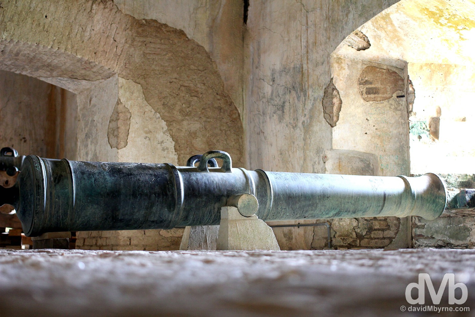
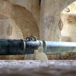
A cannon pointing out of an opening in the lower reaches of the Citadelle Laferrière, just one of some 160 defensive cannons of varying size found throughout the structure. Citadelle Laferrière, in northern Haiti, Hispaniola, Greater Antilles. May 22, 2015.
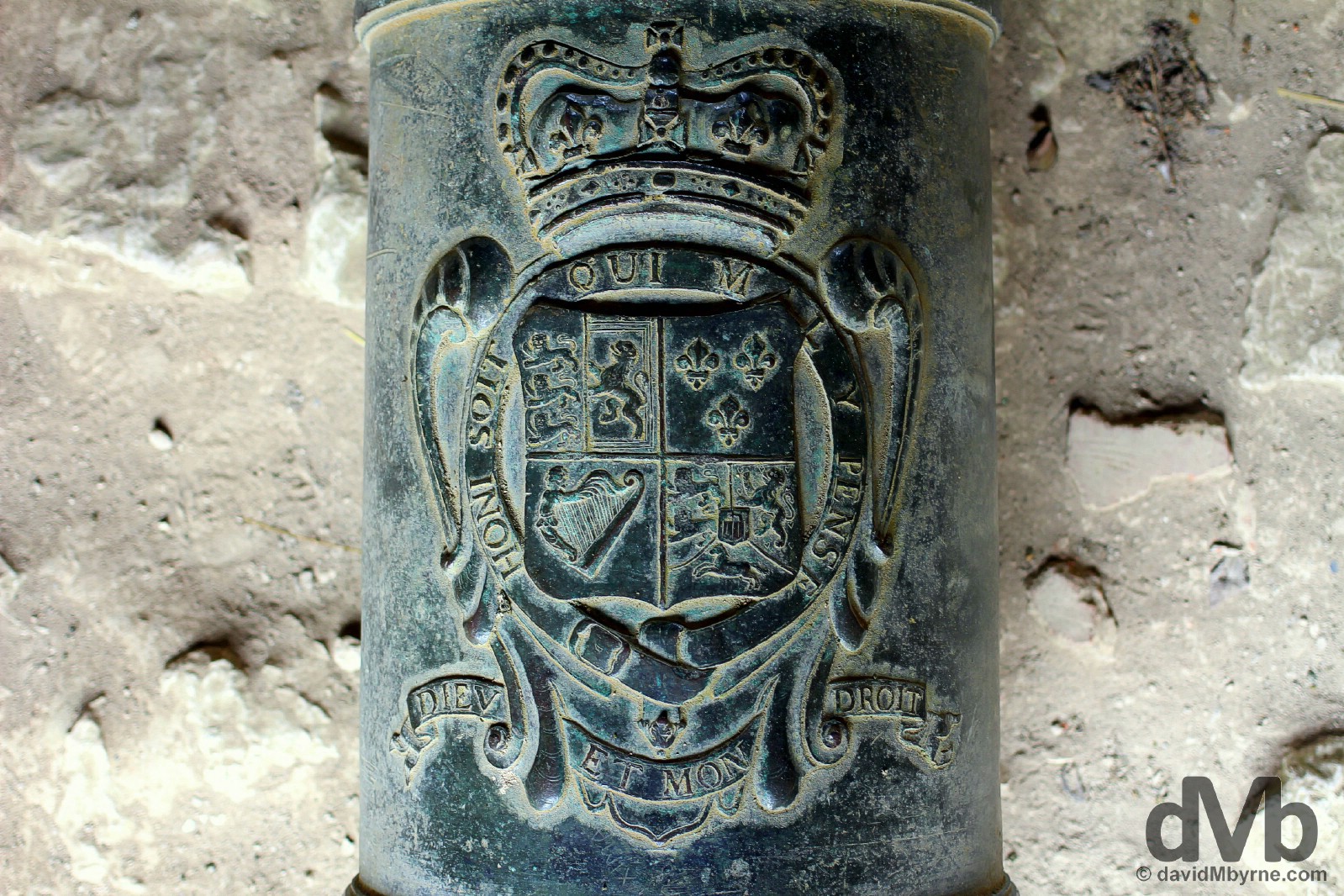
Most of the Citadelle’s bronze cannons were captured in battles from the English, French & Spanish. Some of them, royalist cannons, still have clearly visible crests of famous European monarchs of the 18th century. This particular cannon caught my eye as it boasted an Irish harp. A little bit of home in the most unlikely of places. In the Citadelle Laferrière in northern Haiti, Hispaniola, Greater Antilles. May 22, 2015.
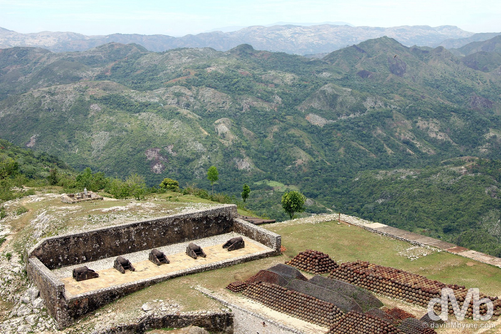
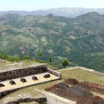
The Citadelle’s location on the top of 950 metre-high mountain Bonnet a L’Eveque was chosen to foresee and repel the attacks of the enemy. Needless to say the 360-degree views of the surrounding landscape from the imposing Citadelle walls are rather impressive. Some say on clear days it’s possible to see the eastern coast of Cuba, some 140 kilometres to the west. No chance on hazy days like this. In this picture is also visible some of the enormous stockpiles of cannonballs, some 50,000 in total, that still today sit stacked neatly in piles in various corners of the fortress. Citadelle Laferrière, northern Haiti, Hispaniola, Greater Antilles. May 22, 2015.
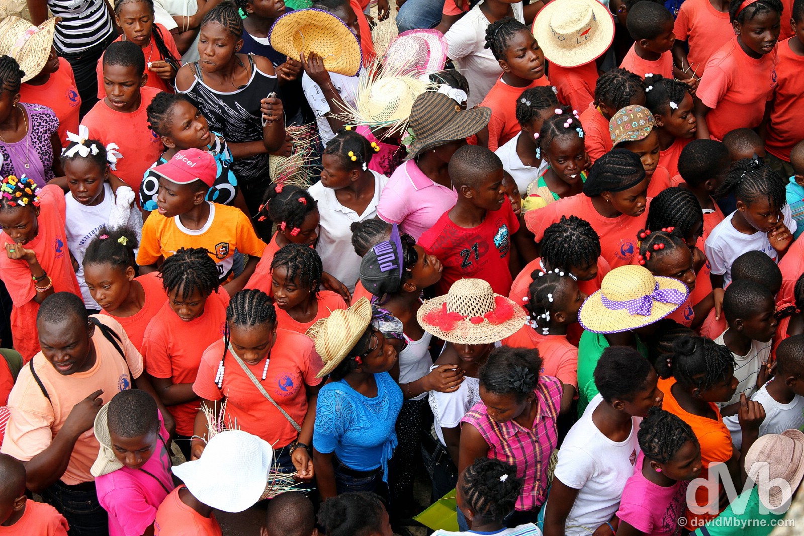
I was the only white person snooping around the innards of the Citadelle Laferrière for the few hours I did so earlier today. That said, I wasn’t alone. It got rather busy at one stage, and noisy, when a group of colourful schoolchildren made what felt like a fleeting visit to the central courtyard of the fortress; one minute they were there, the next they were gone. I captured this image from on high with a large party exiting the courtyard through a narrow doorway below me, and a rather picturesque scene of orderly chaos it was too. In the grounds of the UNESCO-listed Citadelle Laferrière in northern Haiti, Hispaniola, Greater Antilles. May 22, 2015.
MOVING ON (HAITI TO DOMINICAN REPUBLIC) & THE JOKE FROM HELL
Date || May 24, 2015
Location || Port-Au-Prince ()
I‘m back in the capital, back in Port-Au-Prince having returned from Cap-Haïtien yesterday. I leave the city later this afternoon, leave Haiti for neighbouring Dominican Republic. The last week in Haiti has been eyeopening. It has been attritional and it has been expensive. Materialistically speaking I’m leaving Haiti with less than I entered it with, but I’m also leaving Haiti with so many cherished memories of a country as chaotic as any I’ve ever visited, one that needs to be given a chance in more ways than one.

A farewell Prestige beer, Haiti’s award-winning beer. I had a few cooling down beers up here on the rooftop of the city’s Estinfil Guesthouse. Jude, the guesthouse owner who moved back to Port-Au-Prince from Florida following the 2010 earthquake, has big plans for this space, hoping eventually to turn it into a rooftop bar. He’s waiting for the country to stabalise somewhat before committing to such an investment. I guess that’s what most Haitians are waiting & hoping for – a more stable country. Port-Au-Prince, Haiti. May 24, 2015.
The Call From Hell
Jude told me a joke earlier when bringing me to the bus station for the cross-border bus to Santo Domingo, the Dominican Republic capital. I didn’t find it all that amusing but I laughed anyway. A charity laugh I guess. Three guys – an American, a German & a Haitian – were in Hell. The Devil granted them each one final phone call, warning them that to keep it brief as it’s an expensive business making calls from the world of the dead. The American called home. One minute cost him $3,000. Expensive indeed. The German was next. Forty seconds talk time saw him billed $2,400. The Haitian guy seemed to ignore the warning, spending over an hour on the phone to all and sundry. The American & the German complained when the Haitian was charged only $1 for the call. The Devil explained that for the Haitian it was a local call; he lived in, & thus was calling, Hell.
Haiti || The Gallery
-
- In the grounds of the UNESCO-listed Citadelle Laferrière in northern Haiti, Hispaniola, Greater Antilles. May 22, 2015.
-
- On the streets of Port-Au-Prince, Haiti. May 17, 2015.
-

- On the streets of Port-Au-Prince, Haiti. May 17, 2015.
-
- In the grounds of the UNESCO-listed Citadelle Laferrière in northern Haiti, Hispaniola, Greater Antilles. May 22, 2015.
-
- On the streets of Cap-Haïtien, northern Haiti, Hispaniola, Greater Antilles. May 22, 2015.
-

- On the streets of Cap-Haïtien, northern Haiti, Hispaniola, Greater Antilles. May 22, 2015.
-
- On the streets of Cap-Haïtien, northern Haiti, Hispaniola, Greater Antilles. May 22, 2015.
-
- On the streets of Port-Au-Prince, Haiti. May 17, 2015.
-
- On the streets of Port-au-Prince, Haiti. May 17, 2015.
-
- The Haitian countryside as seen from the UNESCO-listed Citadelle Laferrière in northern Haiti, Hispaniola, Greater Antilles. May 22, 2015.
-
- A cannon in the UNESCO-listed Citadelle Laferrière in northern Haiti, Hispaniola, Greater Antilles. May 22, 2015.
-
- Study time on the beachfront promenade in Jacmel, southern Haiti, Hispaniola, Greater Antilles. May 19, 2015.
-
- The Rex Theatre off Champs de Mars, Port-Au-Prince, Haiti. May 17, 2015.
-

- Port-au-Prince, Haiti. May 17, 2015.
-
- On the streets of Cap-Haïtien, northern Haiti, Hispaniola, Greater Antilles. May 22, 2015.
-
- Champs de Mars, Port-au-Prince, Haiti. May 17, 2015.
-
- Flag Day in Champs de Mars, Port-au-Prince, Haiti. May 18, 2015.
-

- On the streets of Cap-Haïtien, northern Haiti, Hispaniola, Greater Antilles. May 22, 2015.
-

- Traffic on Delmas, Port-au-Prince, Haiti. May 17, 2015.
-
- On the path to the UNESCO-listed Citadelle Laferrière in northern Haiti, Hispaniola, Greater Antilles. May 22, 2015.
-

- On the streets of Port-au-Prince, Haiti. May 17, 2015.
-
- Jacmel, Haiti. May 20 2015.
-
- On the streets of Port-au-Prince, Haiti. May 17, 2015.
-
- The ruins of Cathedral of Our Lady of the Assumption in Port-au-Prince, Haiti. May 17, 2015.
-
- Sans Souci Palace, Milot, northern Haiti, Hispaniola, Greater Antilles. May 22, 2015.
-
- On the streets of Cap-Haïtien, northern Haiti, Hispaniola, Greater Antilles. May 22, 2015.
-
- For sale on the beachfront promenade in Jacmel, southern Haiti, Hispaniola, Greater Antilles. May 19, 2015.
-
- On the colourful beachfront promenade in Jacmel, southern Haiti, Hispaniola, Greater Antilles. May 19, 2015.
-

- Buses on the streets of Port-au-Prince, Haiti. May 17, 2015.
-

- On the streets of Port-Au-Prince, Haiti. May 18, 2015.
-

- Prestige Beer. Estinfil Guesthouse, Port-Au-Prince, Haiti. May 24, 2015.
-
- Down on the beachfront promenade in Jacmel, Haiti. May 19. 2015.
-
- On the streets of Port-au-Prince, Haiti. May 17, 2015.
-
- Place Toussaint L’Ouverture, Jacmel, southern Haiti, Hispaniola, Greater Antilles. May 20, 2015.
-
- Rue de Commerce, Jacmel, Haiti. May 19, 2015.
-
- On the streets of Port-Au-Prince, Haiti. May 17, 2015.
-
- The approach to Sans Souci Palace, Milot, northern Haiti, Hispaniola, Greater Antilles. May 22, 2015.
-
- Port-au-Prince, Haiti. May 17, 2015.
-
- On the streets of Cap-Haïtien, northern Haiti, Hispaniola, Greater Antilles. May 22, 2015.
-
- Jacmel, southern Haiti, Hispaniola, Greater Antilles. May 19, 2015.