Golden Gate Bridge
The US West Coast’s Most Iconic Structure
Traffic on the Golden Gate Bridge. April 9, 2013
I spent a lot of my present, & first visit to San Francisco photographing the Golden Gate Bridge, the city’s not to mention the US West Coast’s most iconic structure. I knew I would. It was expected. But even that said, I still think, & assuming it’s even possible, I may just have just overdid it – I photographed the iconic bridge at four different times of day (sunrise, mid-afternoon, sunset & in the dark of night) & from four different vista points. And here’s the proof. Brace yourself for a Golden Gate Bridge pixel (& information, if you’re that way inclined) overload.
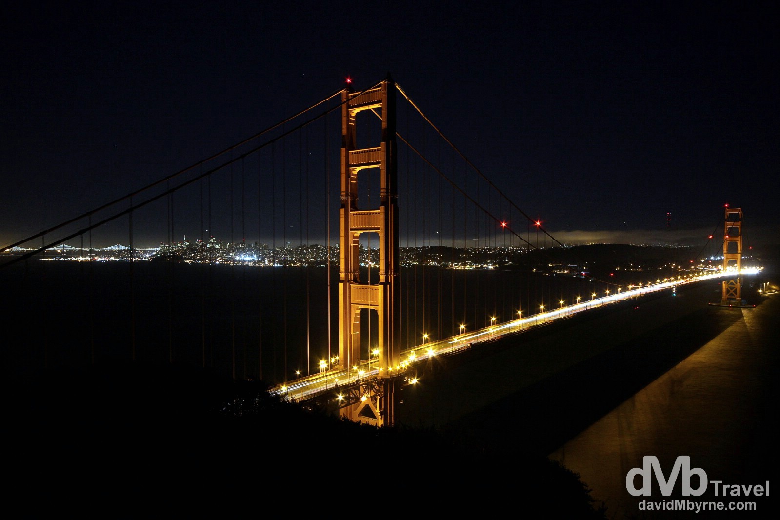
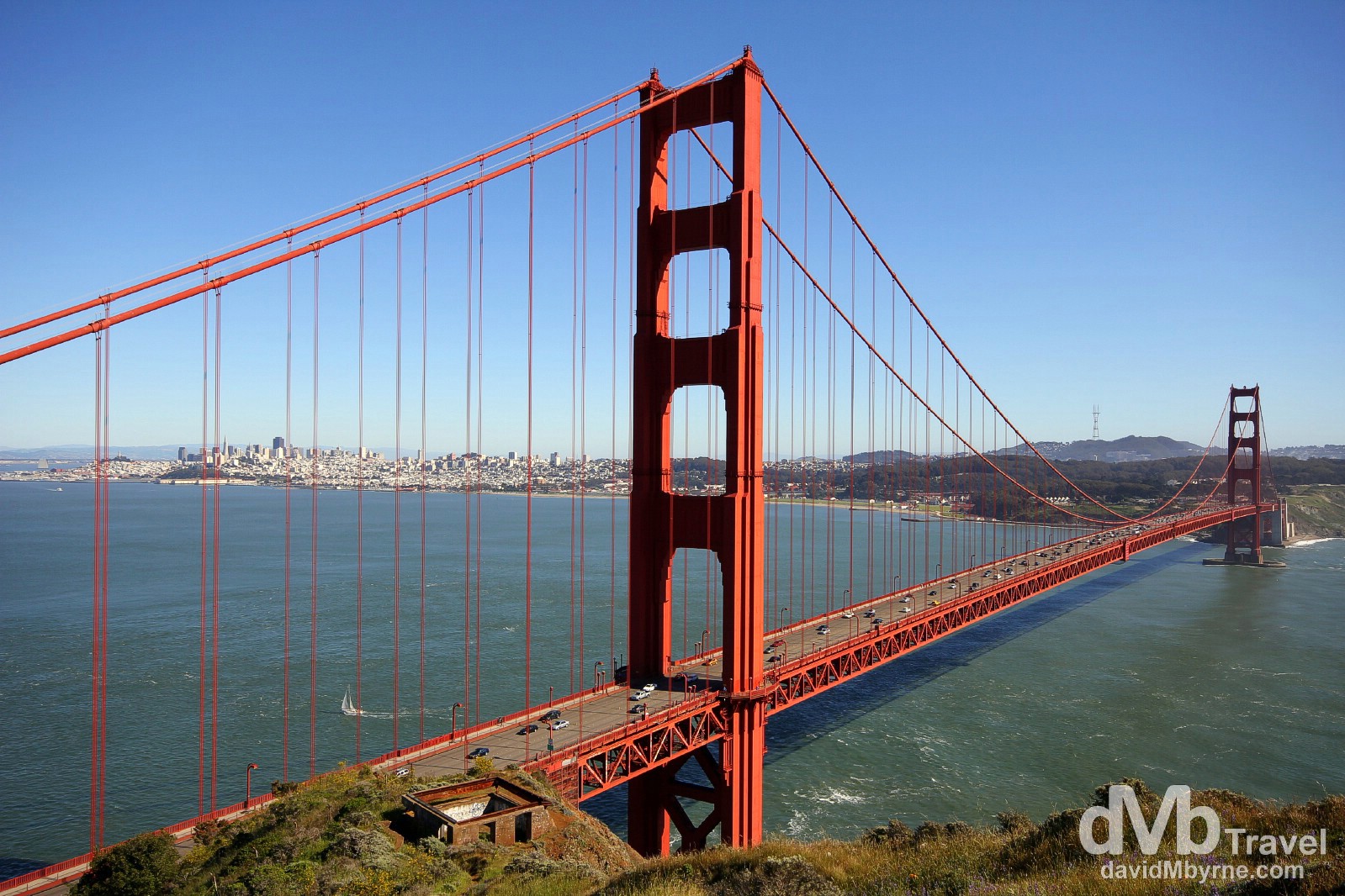
The Golden Gate Bridge, the city of San Francisco & the distant lights of the Bay Bridge as seen from Battery Spencer, Marin Headlands, Marin County, San Francisco. The Golden Gate Bridge is a suspension bridge spanning the Golden Gate strait, a 1.6-kilometre-wide, 4.8-kilometre-long strait in western California connecting the Pacific Ocean and San Francisco Bay that was discovered in 1579 by Sir Francis Drake – it was known as the Golden Gate long before the name gained popularity during the gold rush of 1849 & the completion, in 1937, of the iconic bridge which spans it. The bridge links the city of San Francisco, situated on the northern tip of the San Francisco Peninsula, to Marin County, bridging both U.S. Route 101 and California State Route 1 across the strait. It is one of the most internationally recognized symbols of San Francisco, the US West Coast & the US. It has been declared one of the Wonders of the Modern World by the American Society of Civil Engineers & the Frommers travel guide considers it “possibly the most beautiful & certainly the most photographed bridge in the world.” The Golden Gate Bridge (![]() ), San Francisco, California, USA. April 10th 2013.
), San Francisco, California, USA. April 10th 2013.
Sunrise || Take I
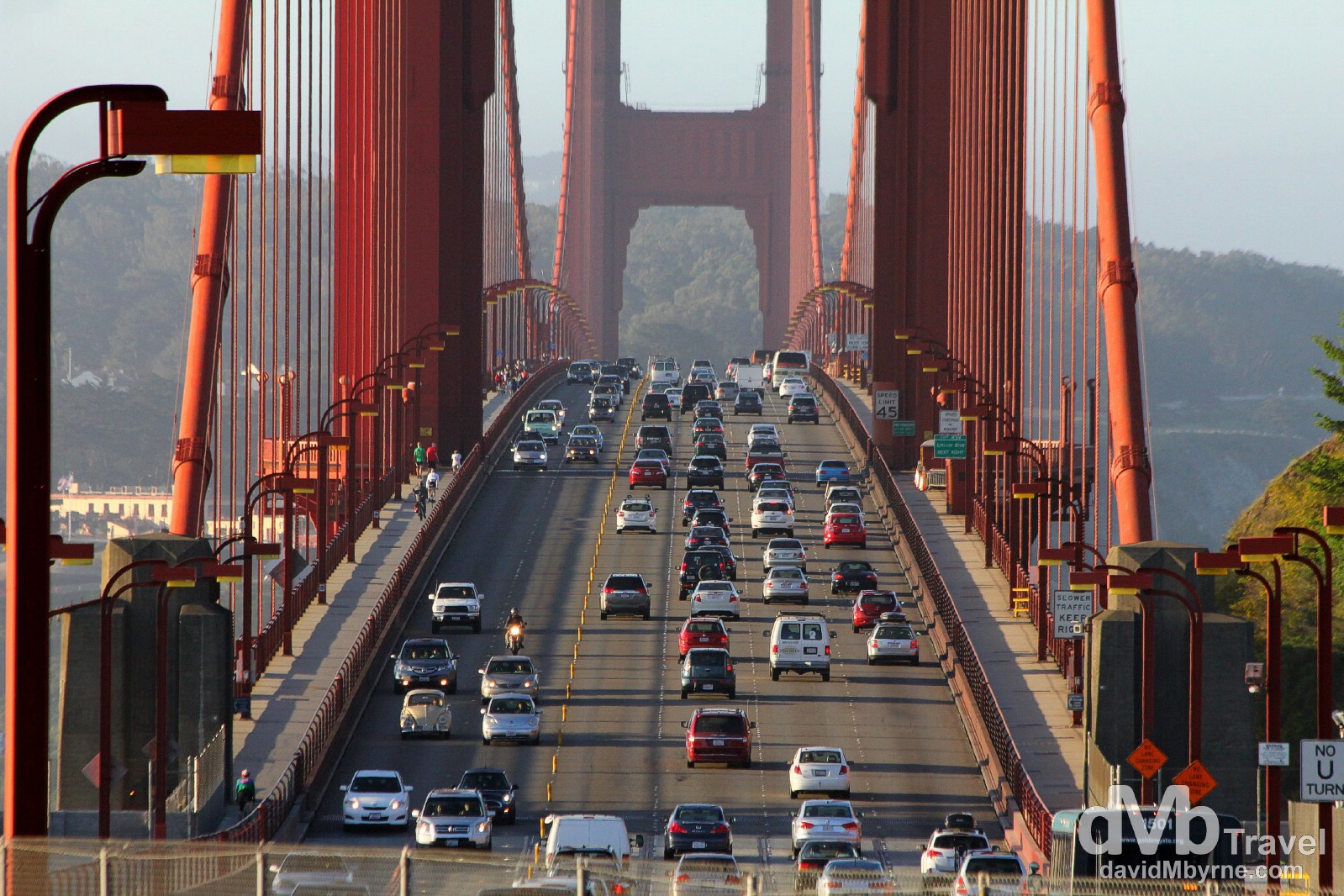
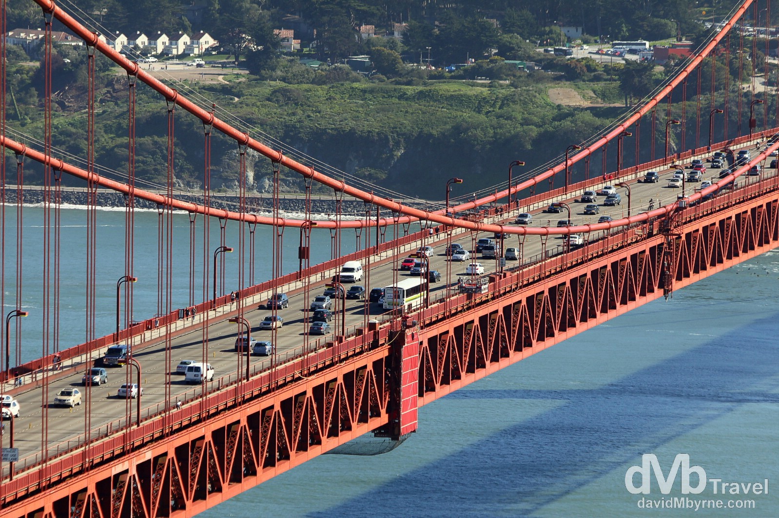
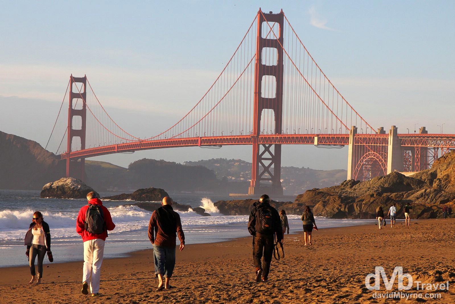
Early morning traffic traversing The Golden Gate Bridge as seen from Vista Point on the north-eastern side of the bridge. The bridge is estimated to carry 110,000 vehicles a day with only south/city bound vehicles having to pay the $6.00 toll (fee as of early 2013) – there is no toll for northbound traffic. Fatalities from head-on collisions are not uncommon & plans are afoot for the installation of a moveable median barrier. However, for now traffic on the 6 lane bridge is separated by small, plastic pylons, pylons that are shifted at various times of day depending on traffic levels – this is early morning so 4 lanes are dedicated to inbound city traffic. The bridge is popular with pedestrians and bicyclists and was built with walkways on either side of the traffic lanes. Initially these walkways were separated from the traffic lanes by only a metal curb. Railings were added in 2003, primarily as a measure to prevent bicyclists from falling into the roadway. The eastern, Bay side walkway (left side of the image) is open to pedestrians, the western/Pacific side walkway isn’t (which accounts for why there are no pedestrians on the right of the image), although the bridge is off-limits to pedestrians at night, mostly to deter suicides – it’s the second most ‘popular’ suicide site in the world, after the Nanjing Yangtze River Bridge in China, and to date 1,600+ people have made the 75 metre, 4-second plunge into the waters below, 95% of which die on impact. San Francisco, California, USA. April 9th 2013.
Sunrise light illuminates the span of The Golden Gate Bridge as seen from Vista Point on the north-eastern side of the bridge. The Golden Gate’s distinctive colour, officially an orange vermillion called international orange, was originally used as a sealant for the bridge. The US Navy, who were against the bridges construction from the outset, believing it to be a target for saboteurs to enable them to block San Francisco Bay, had wanted it to be painted with black and yellow stripes to ensure visibility by passing ships. I can’t see how that would have ever worked. San Francisco, California, USA. April 11, 2013.
Midday
Not normally the best time for photography but I’ll make an exception for The Golden Gate. After all, it’s not everyday one is in San Francisco.
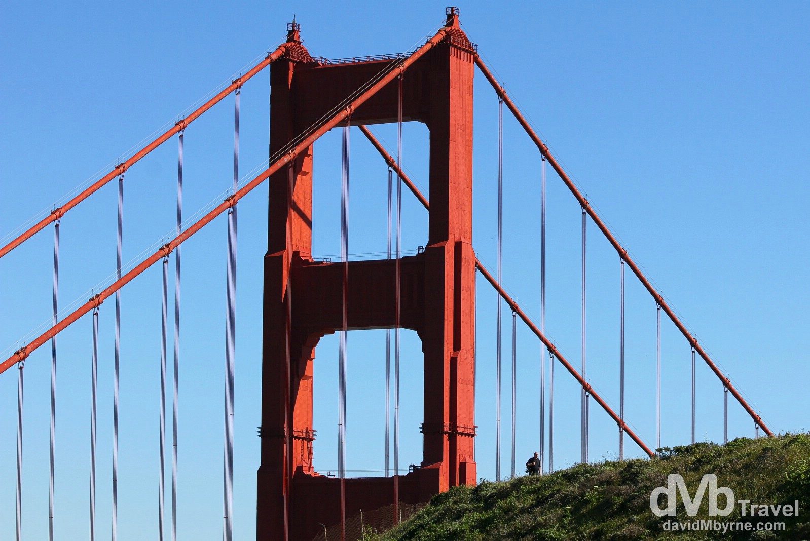
A figure looking oh-so small in view of the north pylon of the Golden Gate Bridge as seen from Battery Spencer, Marin Headlands. The Golden Gate’s massive twin towers either end of the main bridge span are 227 metres (746 ft) above the surface of the water of Golden Gate strait. Up until 1998, these were the tallest towers on any suspension bridge anywhere in the world when bridges in both Denmark and Japan were completed. San Francisco, California, USA. April 9, 2013.
The Golden Gate Bridge & the distant city of San Francisco as seen from Battery Spencer on Marin Headlands. This picture shows well the total length of 2,737 metres (8,981 ft) from abutment to abutment. San Francisco, California, USA. April 9, 2013.
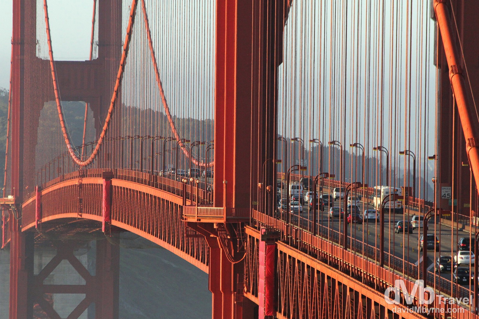
Traffic on the central span of the Golden Gate Bridge as seen from Battery Spencer, Marin Headlands. The weight of the bridge’s roadway is hung from the two main cables that pass through the towers and are fixed in concrete at each end. Each cable is made up of 27,572 strands of wire with some 129,000 kilometres (80,000 miles) of wire total. Until 1964 the Golden Gate boasted the longest suspension bridge span in the world. San Francisco, California, USA. April 9, 2013.
Sunset
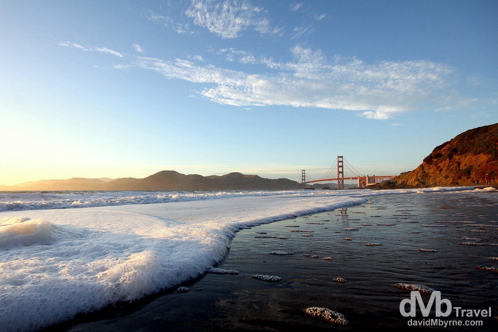
Nearing sunset on Baker Beach, San Francisco. I spent a few hours at sunset on Baker Beach, a very popular vantage point to the south-west of the bridge. The sun seemed to take forever to set – Bay Area sunsets in April don’t seem to be in any kind of hurry. I took shots from the beach but then I spent most of my time with shoes & socks off & jeans rolled up, low in the water. San Francisco, California, USA. April 10, 2013.
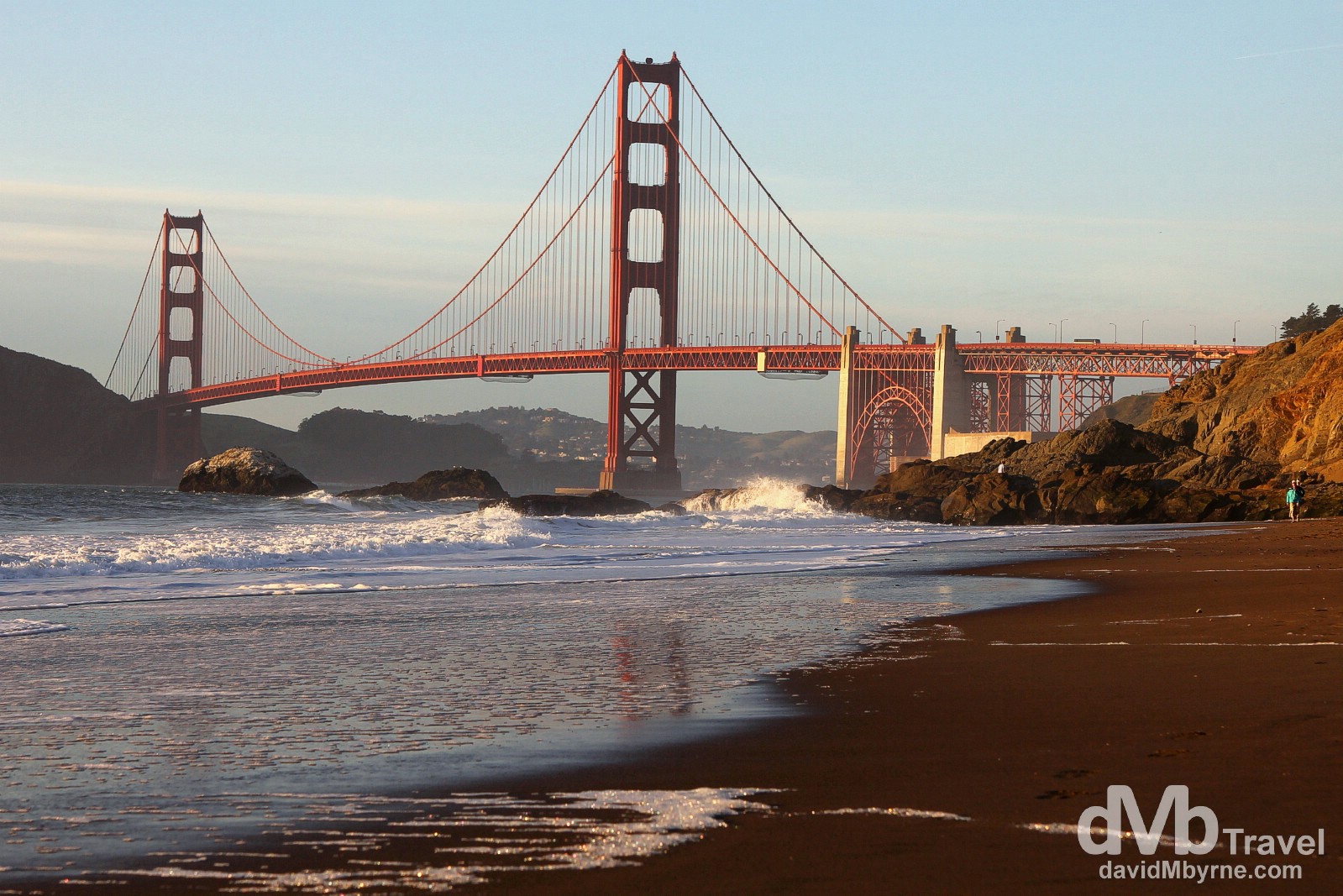
The Golden Gate Bridge as seen from Baker Beach nearing sunset. Before the bridge was built the only practical short route between San Francisco & what is now Marin County was by boat across a section of San Francisco Bay (a ferry service began as early as 1820). At the time San Francisco was the largest American city still served primarily by ferry boats & because it did not have a permanent link with communities around the bay the city’s growth rate was (well) below the national average. San Francisco, California, USA. April 10, 2013.
Many so-called experts said that a bridge couldn’t be built across the 2,042 metre (6,700 ft) strait. It – the strait – had strong, swirling tides and currents, deep water (113 metres (372 ft) deep at the centre of the channel), frequent strong winds & thick fog. Construction cost $35 million & began on January 5th, 1933. It was completed, ahead of schedule & under budget but with the loss of 11 lives, on April 19th, 1937, with the official opening being on May 27th of that year. Baker Beach, San Francisco, California, USA. April 10, 2013.
After Dark
From Baker Beach it was up to Marin Headlands once again, this time for some night shots.
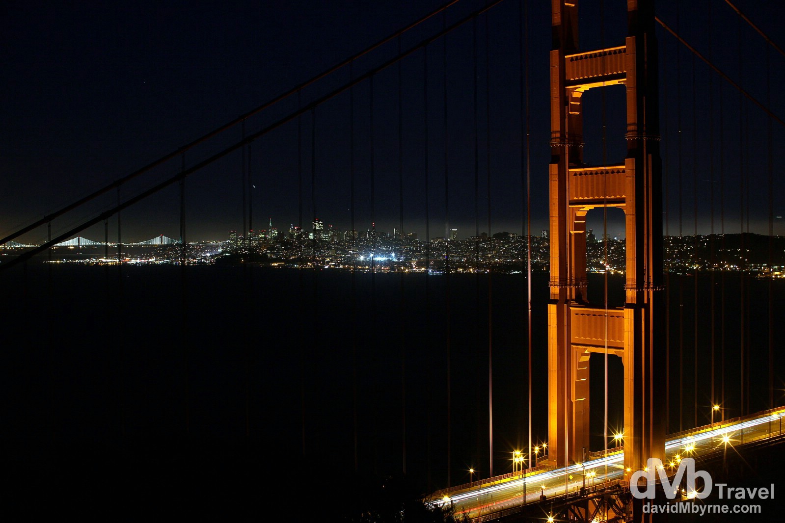
The north pylon of the Golden Gate Bridge, the city of San Francisco & the distant lights of the Bay Bridge as seen from Battery Spencer, Marin Headlands, San Francisco, California, USA. April 10, 2013.
Sunrise || Take II
This morning I was up for sunrise and back pointing my camera in the general direction of the bridge, but from a different vantage point.
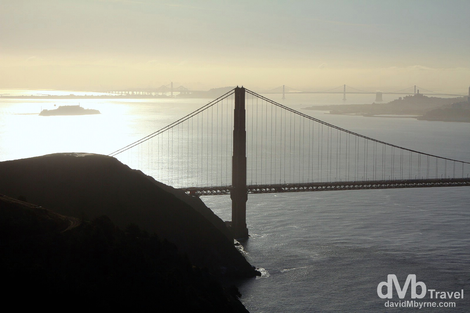
The view from near Point Bonita Lighthouse, the last manned lighthouse on the California coast, at the San Francisco Bay entrance in the Marin Headlands. This picture was taken just after 8:00 a.m. The glare of the rising sun, just out of frame (top-left), was intense – perfect silhouette territory. This view shows the northern half of The Golden Gate Bridge, Alcatraz Island, the marina district of San Francisco & the Bay Bridge to Oakland. San Francisco, California, USA. April 11, 2013.