Day 3 || March 2, 2008
Location || Tingri, Tibet ( )
)
Altitude || 4,390 metres (14,500 ft)
Day 3 Hours Driving || 10
Day 3 High || Laying eyes on the north face of Mount Everest
Day 3 Low || Being banished from the Rongbuk Valley
Day 3 Route Information || Shigatse to Tingri/Rongbuk Valley
From Shigatse, continuing west parallel to the Yarlung Tsangpo valley, the road passes Lhatse and forks just beyond at Chapu, where China National Highway 219 continues west and upriver, finally crossing the Brahmaputra/Indus divide near sacred Mount Kailash and Lake Manasarovar, then on to Ali in Gar County.
From Chapu near Lhatse, the Friendship Highway maintains the Hwy 318 route number and turns southwest and crosses the main Brahmaputra-Ganges divide at Gyatso La (5,260m), the highest pass on the road. Descending 1,000 meters onto alluvial plains of the Bum-Chu, also known as the Arun river in Nepal, the highway passes near Shelkar (New Tingri) then through Old Tingri, both gateways to Rongbuk Monastery and the north side of Mount Everest.
Day 3 Recap
Day 3. Today had potential. It was supposed to be the day we spent the night in Rongbuk Valley near EBC (Everest base camp). We’re supposed to be there right now. But we’re not. Instead we’re in another disheveled Tibetan Friendship Highway town, this latest one called Tingri, somewhere we’re not supposed to be until tomorrow. But now that we are here we find ourselves trying to keep warm as we grumble over our chocolate & instant noodles, cursing the Chinese & lamenting about that should have been. It ended bad but it wasn’t all disappointment & letdown today. Quite the contrary – it was actually great, beyond great, up to a point. Enter the Chinese.
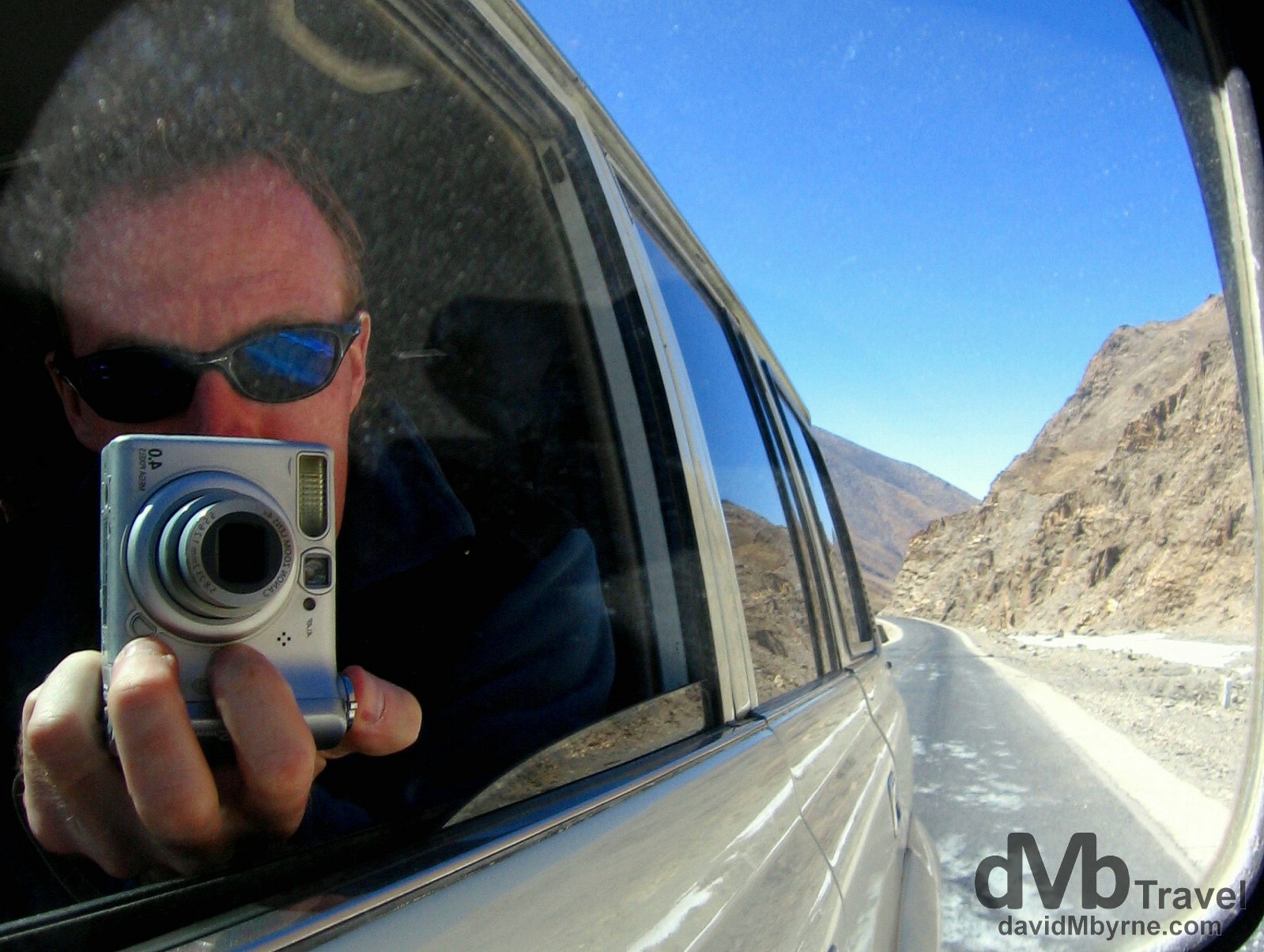
Day 3 || 12:45 || As I said, things on this day started out well. And the weather was great too. We rotate seats in the Toyota Land Cruiser jeep/4×4 daily and today, the day the itinerary said we’d drive from Shigatse & up the Rongbuk Valley in full view of Mount Everest, just happened to be my day to enjoy the best seat in the house, the lone front seat, perfect front seat reflection selfie territory. I couldn’t resist. On the Friendship Highway, Tibet. March 2, 2008.
Gyatso La Pass
Not long after taking my selfie we reached the Friendship Highway’s Gyatso La Pass, not only the highest point of the day but also of the whole trip, not to mention the highest I’ve ever been on planet earth. It was one hell of a (cold) buzz, albeit only for the few minutes to subjected ourselves to the elements.
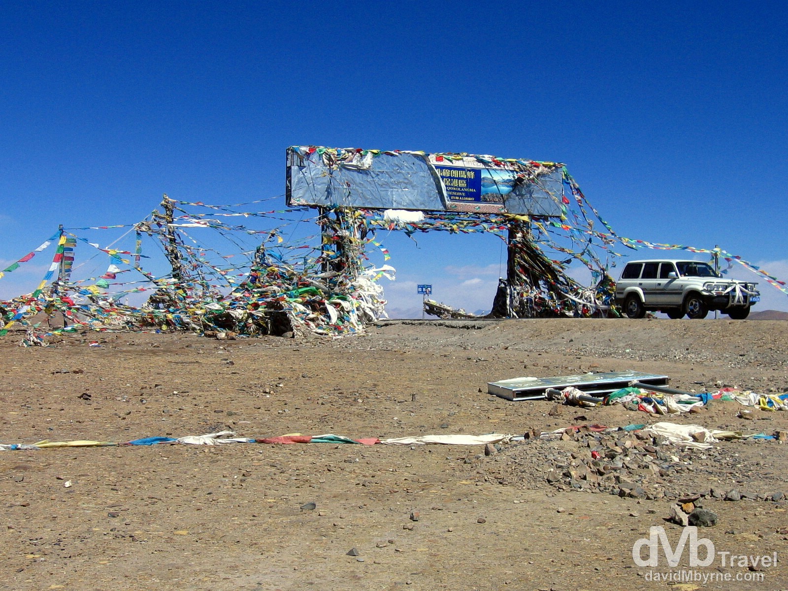
Day 3 || 13:04 || Our Toyota Land Cruiser on the 5,260 metre (17,257 ft) Gyatso La Pass, the highest point on The Friendship Highway. Easily the highest point I’ve ever been on the earth’s surface, the Gyatso La Pass has, according to dangerousroads.org, ‘a well-deserved reputation for being dangerous because of unpredictable snowstorms and blizzards.’ At this altitude I would imagine so. We didn’t hang around here too long; the wind was almost bowling us over & as one might expect it was bitterly cold. Plus, the views weren’t that great, surprising really. But just standing out in the thin air knowing you were on the highest point of the Friendship Highway was one hell of a (cold) buzz. Gyatso La Pass on the Friendship Highway, Tibet. March 2, 2008.
Our First View Of Everest
The hits just kept on coming. And the next one was to be a big one. Shortly after leaving the Gyatso La Pass we got our first look at a distant Mount Everest, the first time we laid eyes on the world’s highest peak (yes, it’s the ‘preposterous triangular lump’ in the distance).
– George Mallory, explorer, commenting on Mt. Everest
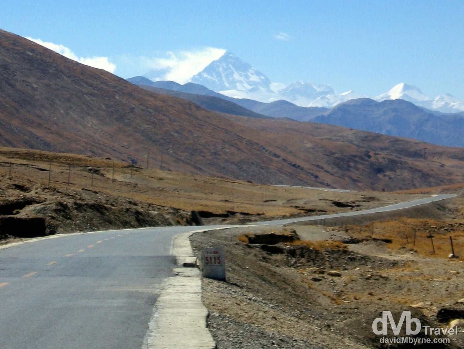
Day 3 || 13:36 || We kept going, didn’t pull over; this image was captured from the front seat of the moving jeep hence its blurriness. The marker here tells us we are a mere 5,115 kilometres from Shanghai on China’s east coast – The Friendship Highway is the westernmost part of the 5,470 kilometre (3,400 mile) China National Highway 318 connecting Shanghai to Zhangmu, the border town with Nepal marking the end of the Friendship Highway proper. We passed the huge, black granite 5,000 kilometre marker earlier in the morning, at 11:34 a.m. to be precise, almost exactly 2 hours previous. We did stop there and did take pictures, none of which were very good. On The Friendship Highway, Tibet. March 2, 2008.
Zhufeng Road & The Pang La Pass
Time for a lineup, a unrivalled alpine lineup as seen from yet another lofty mountain pass, this one the Zhufeng Road’s Pang La Pass.
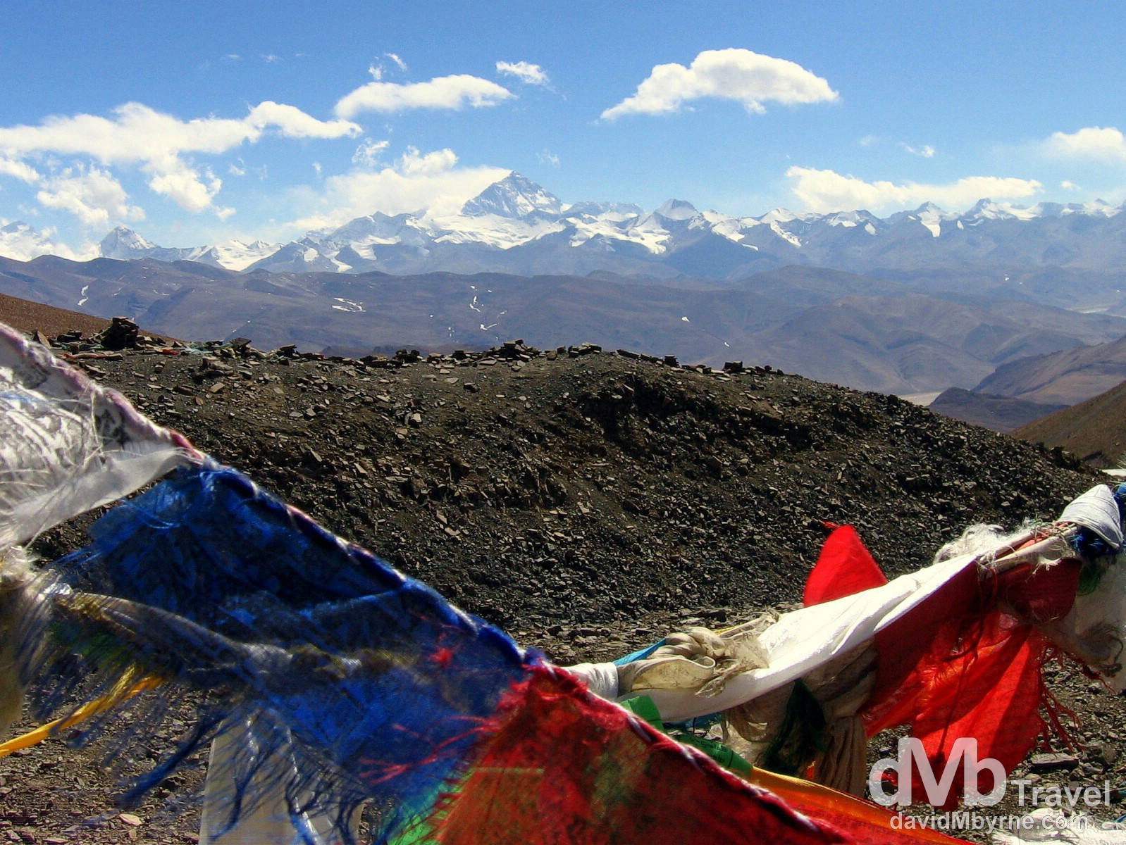
Day 3 || 15:54 || The glory of the Everest region as seen beyond a sea of prayer flags at the Pang La Pass. The 5,205 metre (17.076 ft) Pang la Pass is the highest point on Zhufeng Road, a 90 kilometre gravel & sand road connected to the (paved) Friendship Highway which marks the Tibetan approach to the Rongbuk Valley (& Monastery) & Everest Base Camp (EBC). Having turned off the paved Friendship Highway onto this dirt road, we spent close to three hours bouncing along it – with a total of 64 switchbacks, it’s a long, bumpy, windy, dusty but spellbinding trip and the going is slow. Some 20 kilometres off the Friendship Highway one reaches here, the Pang la Pass, from where the full glory of the Everest region is laid out before you. A picture on the rear of the National Park entrance ticket we had paid €18 for earlier in the day helped us identify the individual peaks we were gazing at from the pass. They include no less than 4 of the world’s 14 so-called eight-thousanders, peaks reaching over 8,000 metres in height: Cho Oyu (8,153 m || 26,904 ft); Lhotse (8,501 m || 28,053 ft); Makalu (8,463 m || 27,927ft); & of course Everest (8,848 m || 29,028 ft) which is, needless to say, the triangular peak sitting rather appropriately in the dead centre of the image. On the Pang La Pass, Rongbuk Valley, Everest Region, Tibet. March 2, 2008.
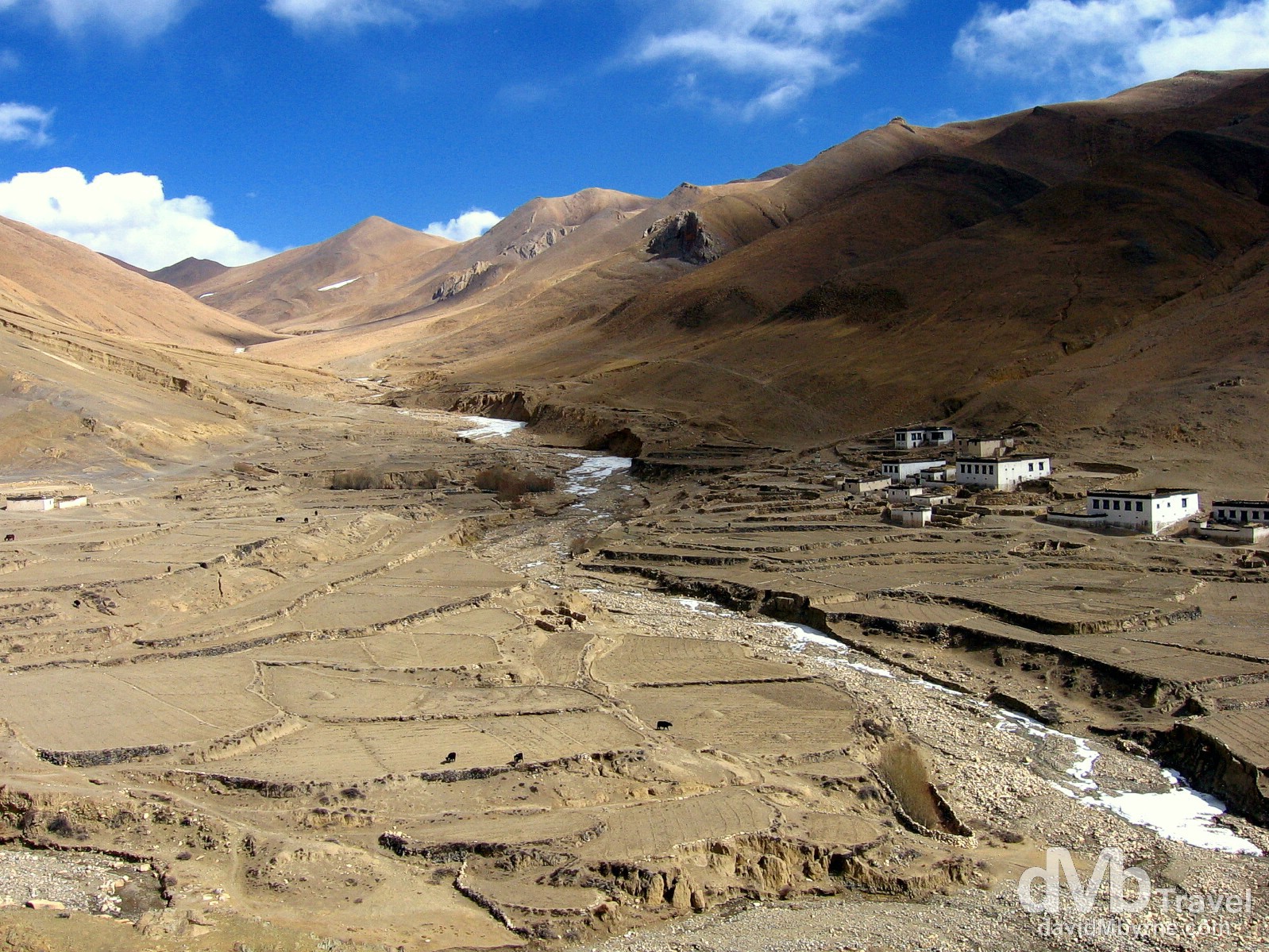
Day 3 || 16:35 || One of the many small, remote villages found along the bumpy 90 kilometre Zhufeng Road connecting the Friendship Highway to the Rongbuk Valley. Make no mistake – living anywhere out here has got to equate to an oh so bleak existence. Yurgya Hamlet, Everest region, Tibet. March 2, 2008.
– dangerousroads.org commenting on Zhufeng Road & The Pang La Pass
A few more captures from the trip along the unforgiving Zhufeng Road.
-
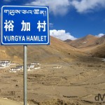
- Yurgya Hamlet as seen from the Zhufeng Road en route to the Rongbuk Valley, Tibet. March 2, 2008.
-
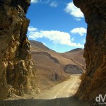
- A section of the Zhufeng Road connecting the Friendship Highway to the Rongbuk Valley, Tibet. March 2, 2008.
Rongbuk || The Arrival
We departed Shigatse earlier today at 11 a.m. & we arrived in the Rongbuk Valley (which Everest, in all its glory, sits in) at 6 p.m. having spent the best part of 7 hours inside our hired Toyota Land Cruiser jeep, 4 of those hours hours on the nicely paved Friendship Highway traversing the highest pass of the trip & getting our first views of Everest, & 3 hours bouncing around the inside of the jeep as it slowly made its way up the windy, 90 kilometre Zhufeng Road that links the valley to the Friendship Highway proper. Everything up to that point had been great. Better than great. And it got even better when we were greeted by the Chinese military personnel who patrol the Everest area with a big “Welcome to Everest” cheer as we got out of the jeep, gazing in awe up the valley at the north face of Everest as we did. Geographically we were at the end of the road, outside the only guesthouse in the valley, right beside the Rongbuk Monastery, the highest monastery in the world, and some 7 kilometres down the valley from Everest Base Camp (EBC).
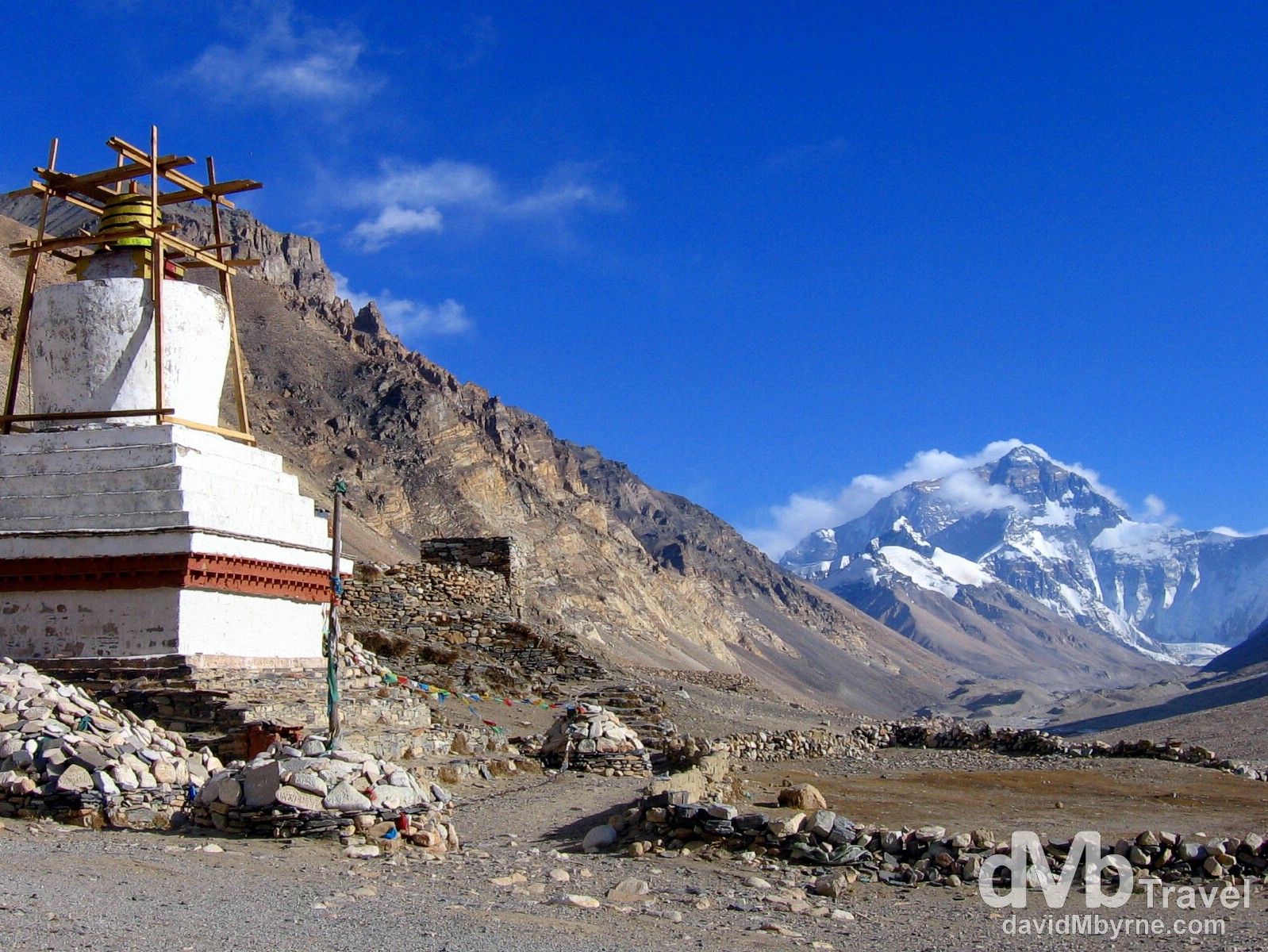
Day 3 || 18:24 || A stupa of the Rongbuk Monastery in view of the north face of Mount Everest. The Rongbuk Monastery is, at 4,980 metres (16,430 ft), the highest monastery in the world. Prior to the creation of the dirt road we had just driven up explorers such as George Mallory and Sandy Irvine had to walk for five weeks from Darjeeling, in the Indian foothills of the Himalaya, to reach this location. The monastery was founded in 1902 by the Nyingma Lama although a hardy community of nuns had used meditation huts on the site for hundreds of years before this. The chapels themselves were of limited interest but the position of the monastery, perched on the side of the Rongbuk Valley leading straight towards the north face of Everest, is stunning. According to my guidebook just to sit outside and watch the play of light on the face of the mountain is the experience of a lifetime. Rongbuk Valley, Everest region, Tibet. March 2, 2008.
– John Noel, British explorer, commenting on the Rongbuk Monastery
When Good Days Turn Bad
Seven kilometres. Having come this far we were only 7 kilometres from EBC and even having spent 7 tiring hours inside a 4×4 jeep we were as pumped as could be. We were eager to stash our bags, settle into the guesthouse and take a look around the monastery and valley and so just after receiving our greeting we began to unload our luggage. We did so until we were told to produce our passport for yet another check, just like all the other checkpoints we’d passed through earlier in the day en route to our present location. It was then that everything stopped going to plan.
“You not staying here. You don’t have correct permission,” was the official line they spun us.
“Correct permission! What?”
According to the military guy raining on our parade the person we hired the jeep from in Lhasa, the guy who was supposed to arrange the permits to enable us to have the “correct permission”, didn’t do what he was supposed to do. So we found ourselves standing in the Rongbuk valley, in full view of the north face of Mount Everest, arguing our case with two Chinese military personnel who were having none of it. Pat was a model of calmness during the negotiations. I wasn’t.
“We just doing our job,” they kept reminding us. (They seemed to know which lines to utter in order to scupper our plans, & which line – singular – to utter to justify their decisions, but nothing beyond that. Hence it became quickly obvious that attempting to rebutting them was a pointless endeavour).
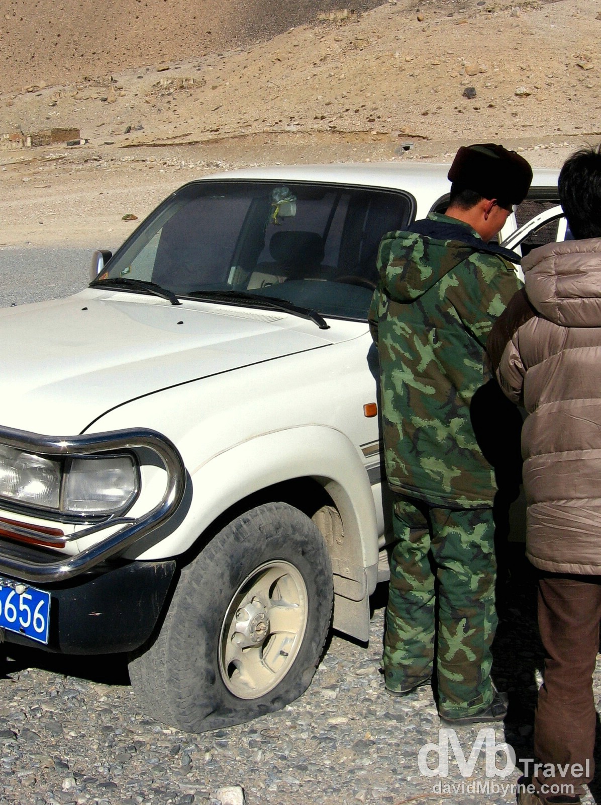
Day 3 || 18:13 || Deflated tyre (& ambitions). Checking our ‘permission’. The results weren’t good. Rongbuk Valley, Everest region, Tibet. March 2, 2008.
It was somehow communicated to us that we were granted 30 minutes to take pictures after which we’d have to pile back into the jeep and head back down the 90 kilometre dirt road to the Friendship Highway. Adding another 3+ hours of driving, 3+ hours of nighttime driving on the dirt road we’d just driven up, wasn’t in anyway appealing, least of all to our driver who spent the 30 minutes we’d been granted to take pictures changing the jeep tire, it obviously having succumbed to the conditions of Zhufeng Road en route to the Rongbuk Valley.
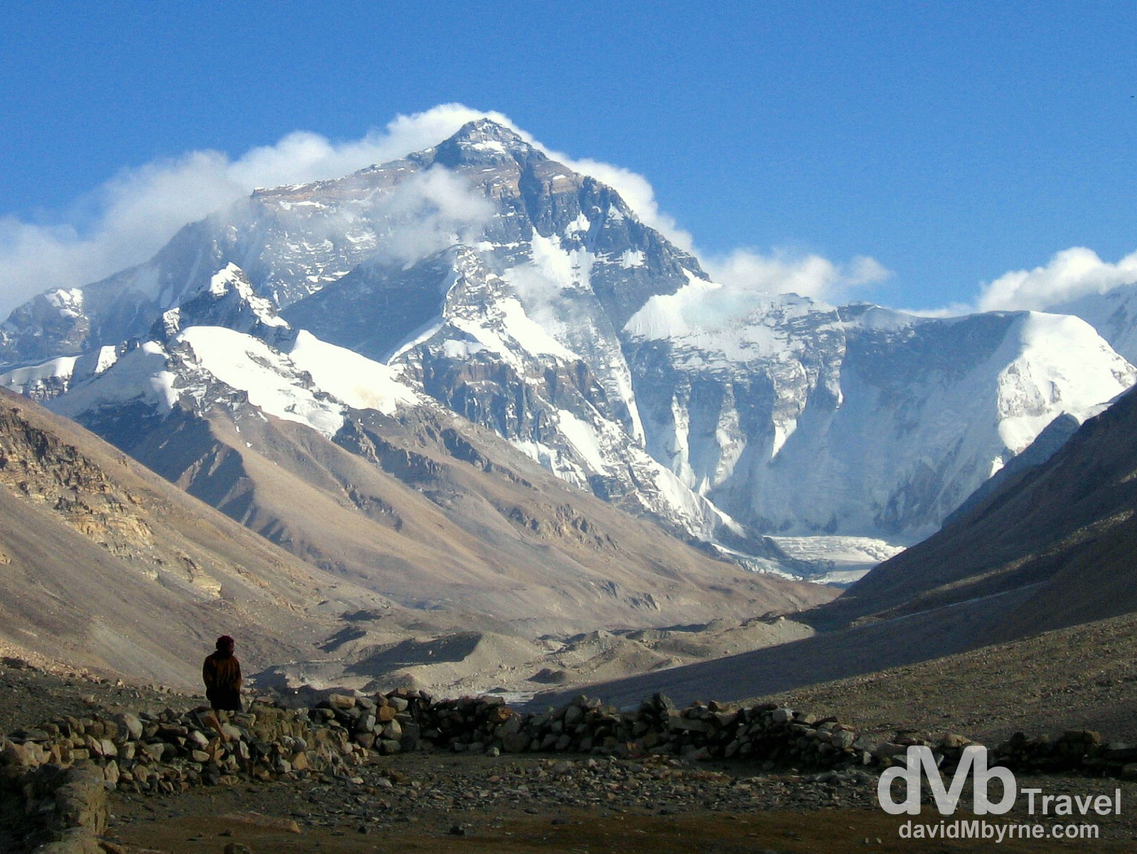
Day 3 || 18:34 || A lone, distant figure stands silhouetted in the Rongbuk Valley in full view of the north face of Mount Everest. Tibetan Everest Base Camp is some 7 kilometres up the valley from this point, a distance we had planned on trekking early on day 4 of our Friendship Highway trip. Planned. Past tense. Rongbuk Valley, Everest region, Tibet. March 2, 2008.
The Reluctant Retreat
Nighttime quickly fell as we reluctantly left the Rongbuk Valley which made the 90 kilometre drive back to the Friendship Highway that bit slower and that bit more dangerous. There was a strange mood in the jeep – we were well aware that the jeep was using the only spare tire we had and were also fully aware that a breakdown of any kind would have put us in a rather grim predicament. Seventy kilometres into the trip we stopped on the Pang La Pass, the same pass we had stopped at earlier in the day to gaze and marvel at the Everest region spread out in front of us. This time, however, we stopped to give our driver a rest. Of course we couldn’t see anything that the jeep lights weren’t illuminating, except for the stars in the sky which made for a wonderful spectacle.
We set off again, bouncing the remaining 20 kilometres to the paved Friendship Highway where we all drew a collective sigh of relief. And so three hours after leaving the Rongbuk Valley we limped into the dusty courtyard of the Amdo Hotel here in Tingri, 24 hours earlier than initially planned. It was 10 p.m. and it had been a long, long day of sitting in a jeep, showing our passports at numerous Chinese military checkpoints and gazing at mountains from high-altitude passes. The cold Gyantse hotel room from two nights previous was still fresh in our memory as we were shown earlier the €6 room that was to be our accommodation for the night. The room is small, it is dingy, it is dirty, and it’s not 7 kilometres from Everest Base Camp. But at 10 p.m. it was pretty much our only option – we doubt there are many better accommodation options in this one-horse looking town anyway. Of course the room has no heating and being at 4,390 metres (14,500 ft) means it is also cold. Very cold. As I type (23:15) we’re hoping the combination of our exhaustion and layers of clothing will, again, get us through the night.
“Here lad, where are the sleeping pills you bought in Lhasa?”
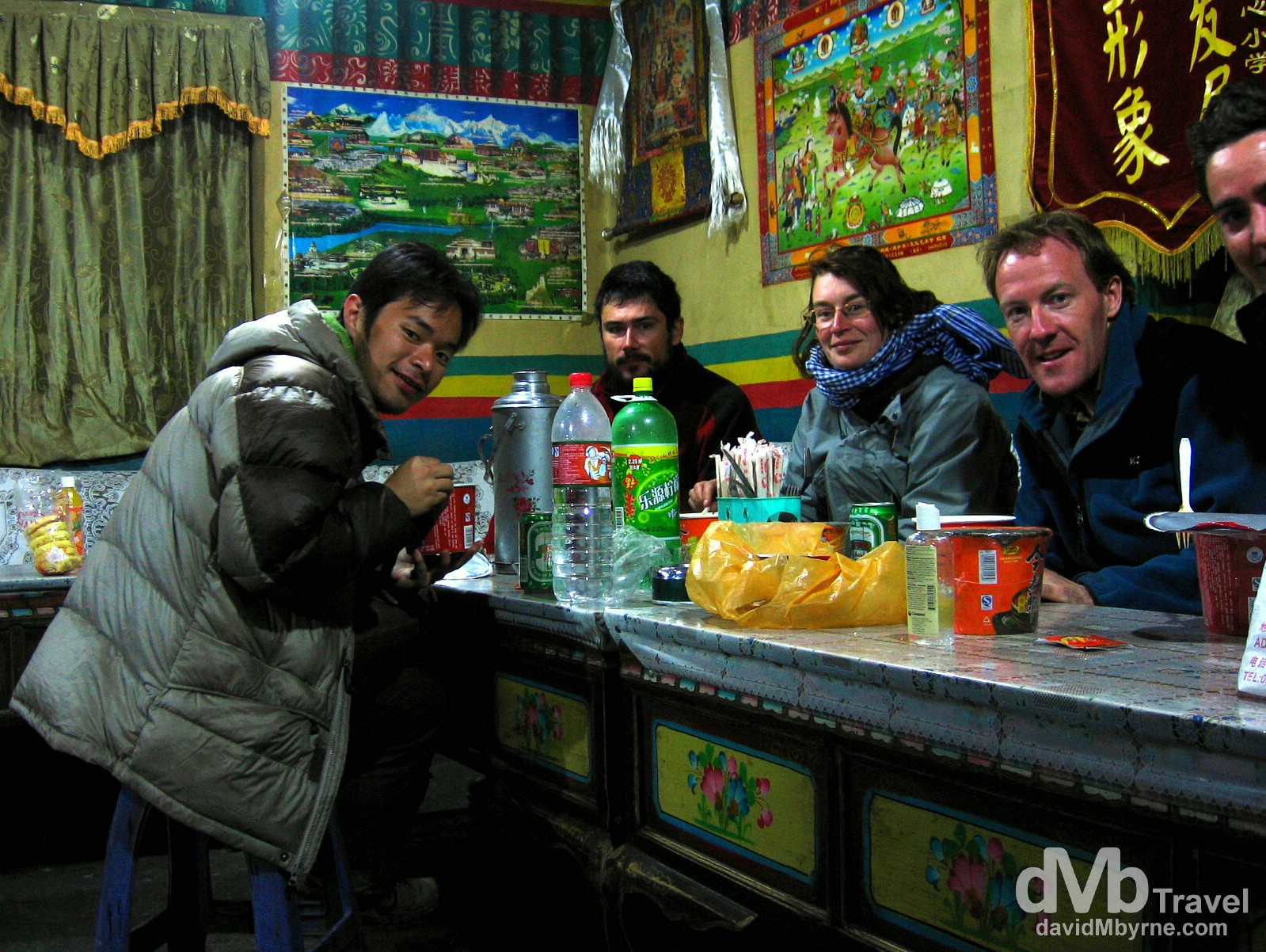
Day 3 || 22:27 || Beaten. Pat didn’t quite make the cut for this picture of our group (L-R: Ricky, Oliver, Guigui, yours truly & Pat) feasting on the supplies (instant noodles, chocolate etc.) that we had purchased to get us through the night and following morning at the guesthouse in the Rongbuk Valley. Being in Tingri 24 hours earlier than planned means shortening our Friendship Highway trip from 5 to 4 days. As a group we have discussed ways in which we could possibly get back to EBC in the coming days but we quickly reached a consensus that it’s not possible based on the logistics of what needs to be done. We’re chalking it down as a disappointment, a major disappointment, but we’re still grateful we got as close to Everest as we did. 7 kilometres. So close yet so far. Amdo Hotel, Tingri (![]() ), Tibet. March 2, 2008.
), Tibet. March 2, 2008.