The DMZ (Demilitarized Zone), Korea
”A poignant bridge to nowhere; rusting Korean War remnants; a polished but deserted train station; infiltrating The Third Infiltration Tunnel; & trying to espy the illusion of activity in a North Korean propaganda village.”
Image || At the Third Infiltration Tunnel of The DMZ (Demilitarized Zone), South Korea.
The DMZ (Demilitarized Zone), Korea
To the victor go the spoils, except when there is no victor. Divided by the U.S. & the Soviet Union into two zones along the 38th parallel following the 1945 WWII surrender of the Japanese, who annexed the Korean Peninsula in 1910, ultimately it was the failure to negotiate reunification that led to the 1950-1953 Korean War. The conflict – between the Communist-backed North Korea, the aggressors, & the US- & UN-backed South Korea – ended in a stalemate, a recent & all too tragic substantiation of the futility of war. It resulted in a nation & a people divided, the peninsula separated into (Communist & closed) North & (democratic & capitalist) South by the infamous Demilitarized Zone (DMZ). The 250-kilometre-long, 4-kilometre-wide strip of no-man’s land is today the most heavily fortified border on earth, one that separates two nations still technically at war; fighting to a stalemate, the war ended in July 1953 with a fragile truce and the signing of an armistice but not a peace treaty, a Cold War no-war-no-peace hangover now stubbornly persisting well into the twenty-first century.
– The Two Koreas, A Contemporary History, Third Edition (2013), p464
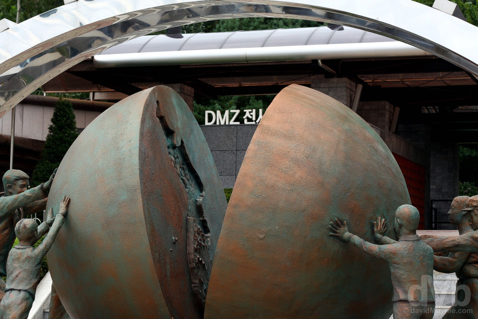
The This One Earth statue, one of a number of pro-unification artworks and sculptures found on both sides of the Demilitarized Zone (DMZ) & signifying the sadness of a country torn in two – men, women and children on either side of the divide attempt to push the earth back together in a symbol of peace and forgiveness. At The Third Tunnel of the Demilitarized Zone (DMZ) outside the city of Paju, South Korea. August 21, 2009.
Republic of (South) Korea Overview
 Republic of (South) Korea
Region – East Asia (dMb tag: East Asia). Capital – Seoul. Population – 52 million. Official Language – Korean. Currency – South Korean Won (KRW). GDP (nominal) per capita – US$27,500 (26th). Political System – Presidential republic. UN Member? – Yes (admitted September 1991). G20 Member? – Yes. Size – 100,295 km² (one-fifth smaller than North Korea, its northern & only neighbour, and slightly smaller than the US state of Kentucky). Topography – Mostly mountainous; a hikers nirvana, over 70% of the country is covered in largely uninhabitable mountains. Climate – Hot & sticky summers, bitterly cold winters. Formation/Independence & Brief History – Independence from Japan, who annexed the Korean Peninsula in 1910 ending centuries of dynastic rule, on August 15, 1945, thereafter the peninsula officially divided by the US & the Soviet Union at the 38th parallel. The Republic of Korea declared on August 15, 1948, 3-plus weeks before the September 9 formation of the Democratic People’s Republic of Korea, a.k.a. North Korea. The failure of talks to unify the peninsula sparked the 1950-1953 Korean War, with the communist-led North invading the South. This ended in a military stalemate, the formation of the DMZ (Demilitarized Zone) and the signing of an armistice (but no peace treaty). UNESCO World Heritage sites – 12. Tourism Catchphrase/Slogans – Imagine Your Korea. Famous For – Sharing the world’s most fortified border with its troublesome & aloof northern neighbour; cosmetics; electronics (home to Samsung, the world’s largest electronics firm, & LG); internet connectivity; cars (home to Hyundai & Kia); K-pop & the Korean Wave; ajumma power; Psy’s Gangnam Style; its cuisine (kimchi & BBQ) & communal eating; soju (a clear, colourless distilled beverage liberally drank in shots); noribang (karaoke rooms); hospitality. Highlights – The buzz & palaces of Seoul, a.k.a. The Soul of Asia; Jeju Island; Gyeongju; Seoraksan National Park. South Korea Titbits – Rising from the ashes of the Korean War, a multi-decade economic surge, termed the ‘Miracle on the Han River’, means that today South Korea is the world’s sixth largest exporter (it ranks 1st in worldwide mobile phone shipments, 2nd in shipbuilding & semiconductor sales and 5th in automobile production). Not bad for a country that has been officially at war since 1950; after many failed bids, South Korea’s PyeongChang will host the 2018 Winter Olympics; pre-empting the future & echoing the wish of the South Korean populous, the country’s constitution officially recognises the Korean peninsula as one country; the world’s first country to fully transition to high-speed Internet (in 2005), today South Korea boasts the world’s fastest internet speeds; although largely insular, Korean society is truly one of a kind with its own language, script (hangul), food & culture.
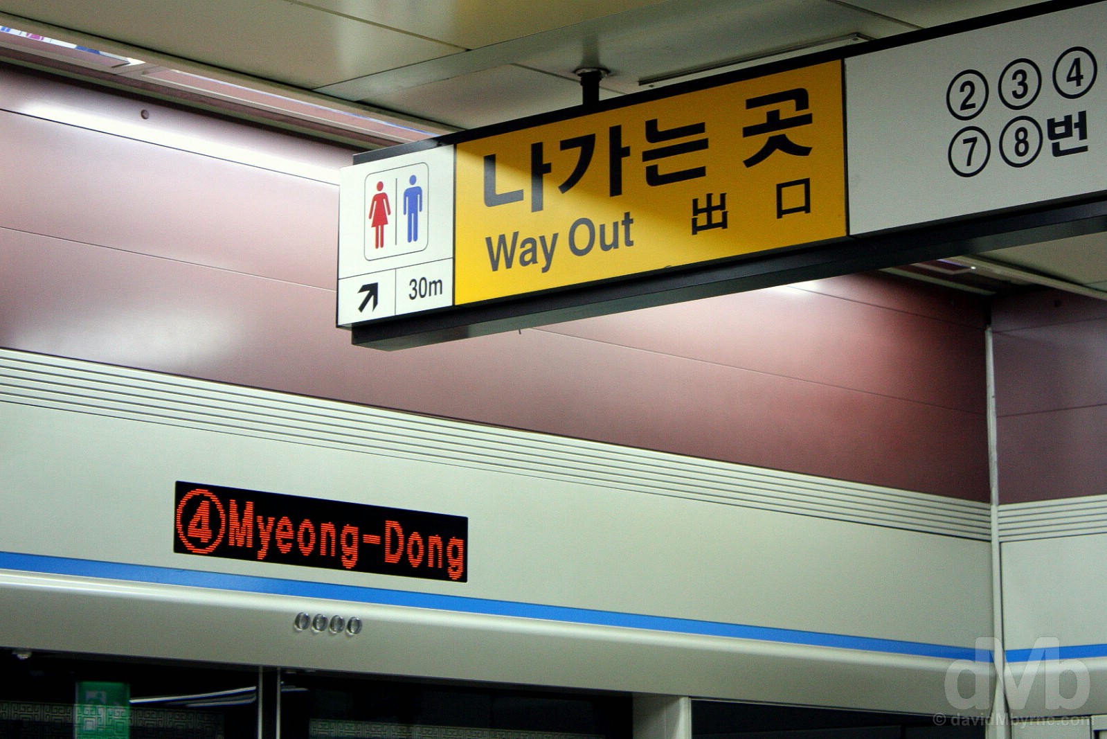
Myeong-dong Metro Station, Seoul, South Korea. July 8, 2008.
Visits – Numerous (1st visit December 2003). Where I went/What I saw (selected South Korea highlights) – Seoul; Gyeongju; Jeju Island; Suwon Hwaseong Fortress; Busan; Yongin Folk Village; The Demilitarized Zone (DMZ).
The DMZ Attraction
The DMZ is also, given the regions dearth of human activity for 60-plus years, a natural preserve for a wide variety of plant & animal species, an ecological treasure house seeking UNESCO designation as a biosphere reserve, a heavily mined, off-limits biosphere, but a biosphere reserve nonetheless. Yes, the DMZ is an attraction on many levels & one of the peninsula’s must-sees (from a distance), but it’s an attraction of a different kind, one that for almost 6 decades has divided a peninsula and one that has turned progressive & democratic South Korea into a virtual island.
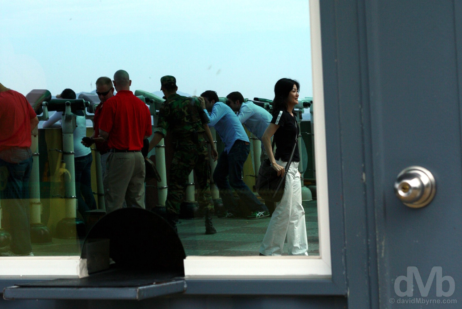
Viewing is fine (they even provide binoculars), but being prohibited from pointing a camera directly towards North Korea saw me playing with reflections at the Dora Observatory, the closest one can get to the Hermit Kingdom from within South Korea. Overlooking the Demilitarized Zone (DMZ) from the Dora Observatory outside Paju, South Korea. August 21, 2009.
The DMZ Quartet – Imjingak, Dorasan Station, The Dora Observatory & The Third Tunnel
Most associate visiting the DMZ with a visit the JSA, the Joint Security Area, a.k.a. Truce Village, in the village of Panmunjom, the only portion of the DMZ where tense, stone-faced & sunglasses-wearing North & South Korean forces stand within spitting distance of each other in a rather bizarre & unique show of border bravado (you’ve probably seen the pictures of the long blue huts straddling the demarcation line and from where the two sides conduct mostly fruitless diplomatic engagements). But there’s more to the DMZ than the JSA. A poignant bridge to nowhere; rusting Korean War remnants; a polished but deserted train station; infiltrating The Third Infiltration Tunnel; & trying to espy the illusion of activity in a North Korean propaganda village. This is the gist of what can be experienced by visiting the quartet of DMZ sites – Imjingak, Dorasan Station, the Dora Observatory & The Third Tunnel – located just outside of the South Korean city of Paju approximately 50 kilometres north of Seoul and just beyond the southern border of the DMZ itself. On the majority of DMZ Tour itineraries, collectively this quartet brings home both the uniqueness & the tragedy of the DMZ while providing the closest access to the Hermit Kingdom from within South Korea.
– US President Bill Clinton commenting on the DMZ during his State of the Union address. February 4, 1997.
1. Imjinjak Village
Overlooking the Imjin River, Imjinjak Village is a park with various statues and monuments relating to the Korean War. With a observation deck, restaurants & even an amusement park, the village feels a tad touristy (some even refer to it as a resort). During the Korean War some 5 million Koreans from the North fled to the South, fleeing their ancestral home in a bid to escape the oppression & brutality of the U.S.S.R.-led Northern regime. Most were unable to return home once the peninsula was divided. Imjinjak was built primarily as a place of pilgrimage for those Koreans south of the border who found themselves stranded following the division of the peninsula; this is as far north in South Korea as Koreans can venture, meaning Imjinjak also scratches the DMZ curiosity itch for many a South Korean.
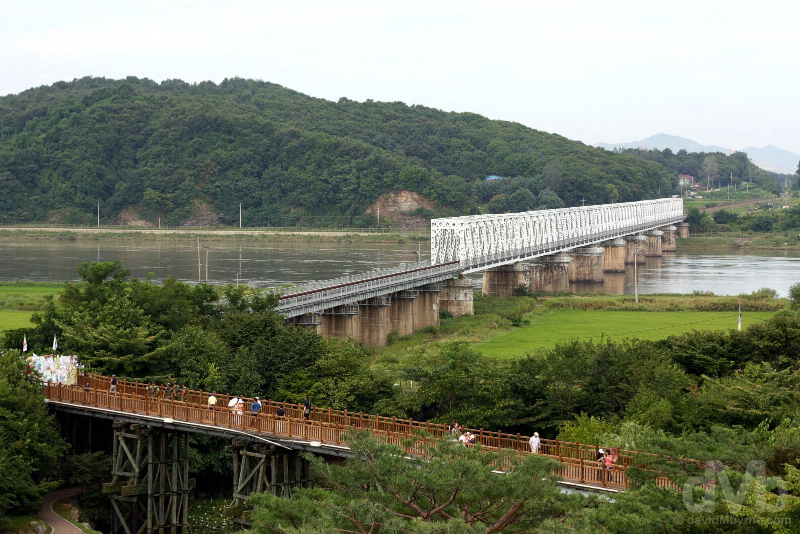
THE FREEDOM BRIDGE & THE BRIDGE OF FREEDOM || Crossing the Imjin River towards the southern boundary of the DMZ, still some 3-4 kilometres northwest of here, the Freedom Bridge is a disused railroad bridge that was used as a conduit for trading POWs at the end of the Korean War. The small wooden footbridge in the foreground, the Bridge of Freedom, was built to provide access to the larger Freedom Bridge. Over 10,000 POWs were traded from this bridge at the end of the war. The very tip of the bridge, to the left of the image and officially as close to North Korea as Koreans in the South can go, now serves as a place of remembrance for a divided people. Koreans come here to pray for reunification & to tie coloured offerings and leave messages for family & friends, both alive & dead, located on the opposite side of the divide, all in the hopes that someday they can return to their ancestral lands. Imjingak, Paju, South Korea. August 21, 2009.
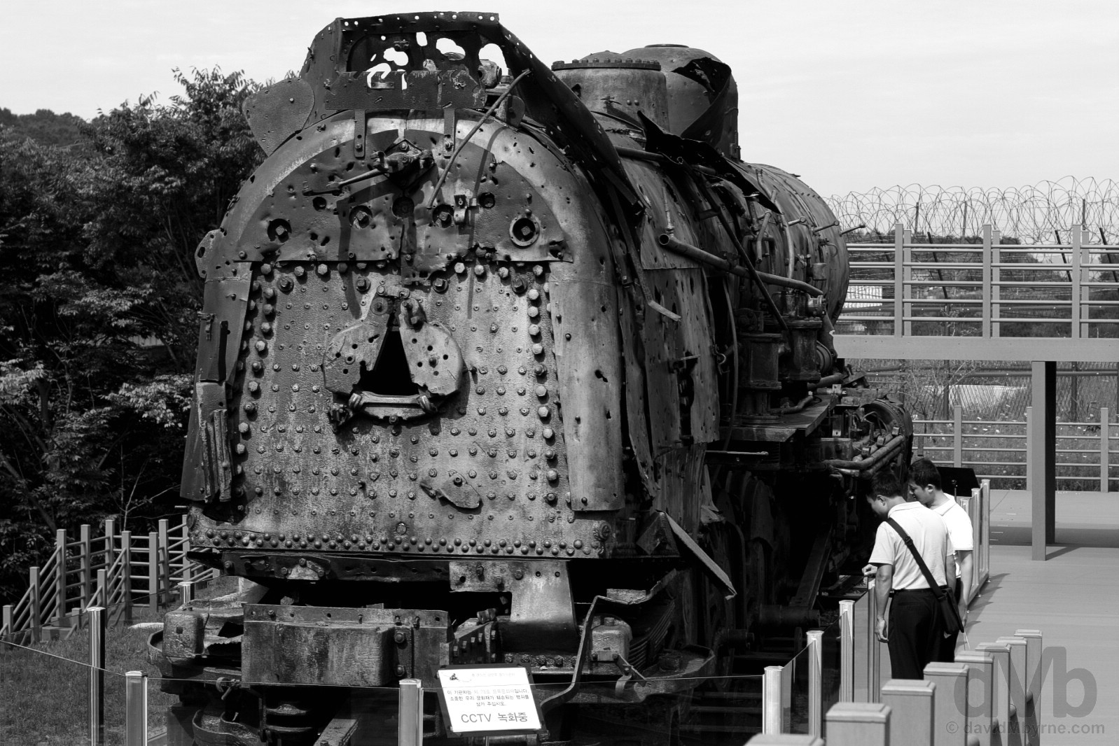
WAR REMNANTS || This discarded steam locomotive by the side of the Bridge of Freedom is probably Imjingak’s most poignant reminder of the Korean War, a stalled representation of almost 6 decades of stagnation & division. Today listed as object number 78 on South Korea’s Registered Cultural Heritage List, it was derailed by wartime bombing. It hasn’t moved since, the rusting hulk riddled with over 1,000 bullet holes. Imjingak, Paju, South Korea. August 21, 2009.
South Korean President Kim Dae-jung, a Nobel Peace Prize recipient who pushed the so-called Sunshine Policy of positive engagement with North Korea, during a speech in Dorasan Station. February 20, 2002.
2. Dorasan Station
The poignancy of the DMZ is taken to new heights by paying a visit to Dorasan Station, about 1 kilometre northwest of Imjinjak across the Imjin River, that bit closer to the DMZ itself and somewhere that’s off-limits to Korean nationals (documents are checked).
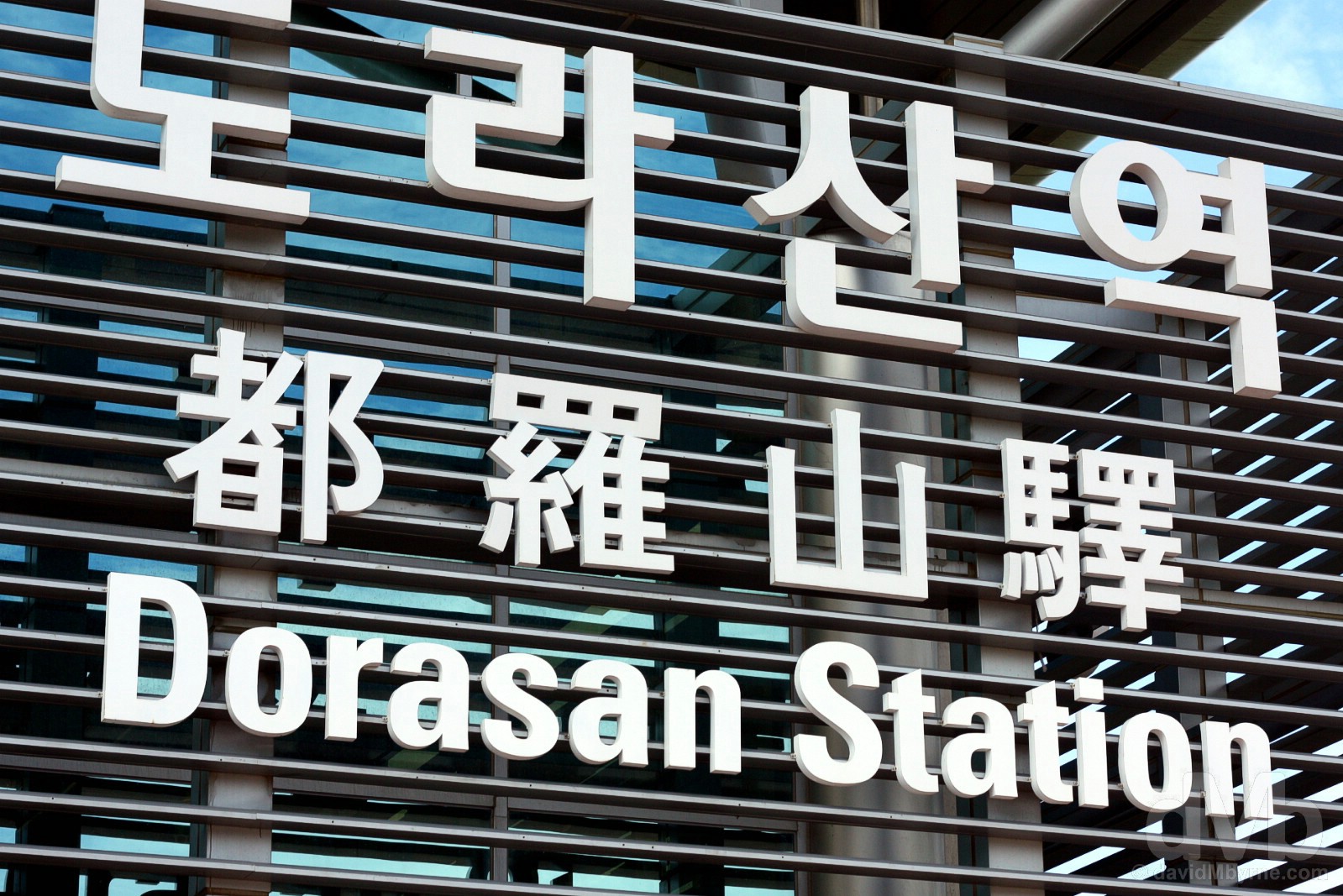
Dorasan Station, the northernmost railway station in South Korea. August 21, 2009.
2000 South-North Joint Declaration & The Kaesong Industrial Region
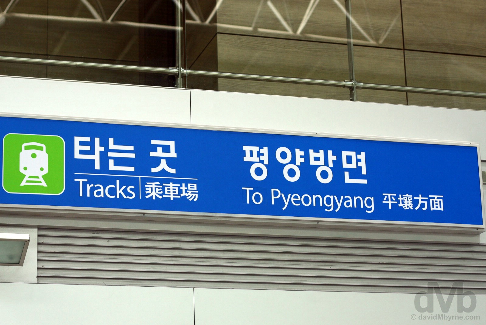
The South-North Joint Declaration made by the two Koreas in June 2000 set out an agreement to reconnect the Gyeongui Railroad Line that was broken during the Korean War, a line that once connected the South Korean capital of Seoul to the North Korean capital of Pyeongyang. Dorasan Station was opened in April 2002 a little over a year before the June 2003 re-connection of the railroad at the Military Demarcation Line in the DMZ. In December 2007 the rails across the divide were used for the first time with freight trains travelling north past Dorasan Station a short distance into North Korea taking materials to the Kaesong Industrial Region, a feel-good collaborative economic initiative between the two nations that saw South Korean companies employing North Korean workers, a valuable source of foreign currency for the impoverished North. The harmony didn’t last long, the North closing the rail link in December 2008 citing a confrontational policy by the South. Today there are minimal tourist services south to Seoul but no cross-border traffic.
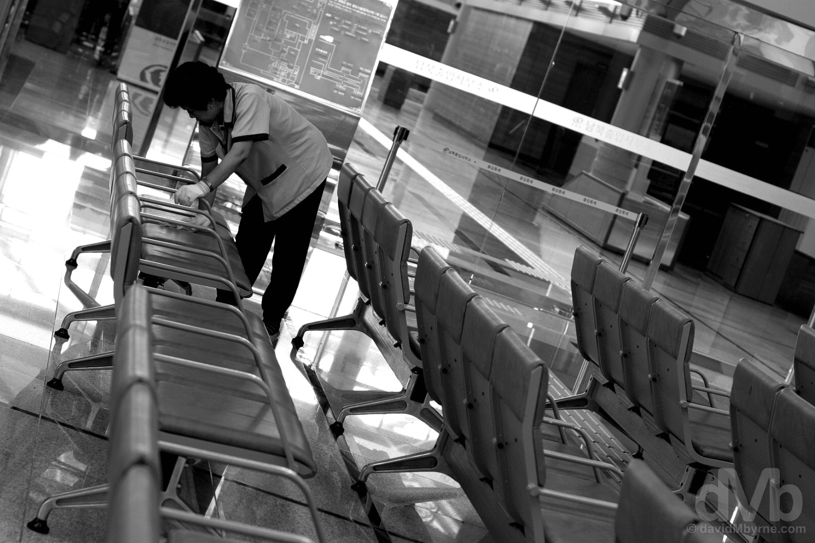
DORASAN || Today Dorasan Station is a station only in name & appearance. There is an eerie absence of the hustle & bustle of passengers & cargo one might expect of a train station, even a quiet one. In Dorasan the rails are laid but rusting, the station gleaming but empty awaiting the day that the two countries are reunited so it can serve its purpose of reconnecting the peninsula and opening it to the wider region; connecting the peninsula via rail would allow the completion of the wider Trans Eurasian Railway Network making it possible to travel via rail all the way from the southern tip of the Korean Peninsula to Western Europe. Dorasan Station, South Korea. August 21, 2009.
U.S. President George W Bush during a visit to Dorasan Station. February 20, 2002.
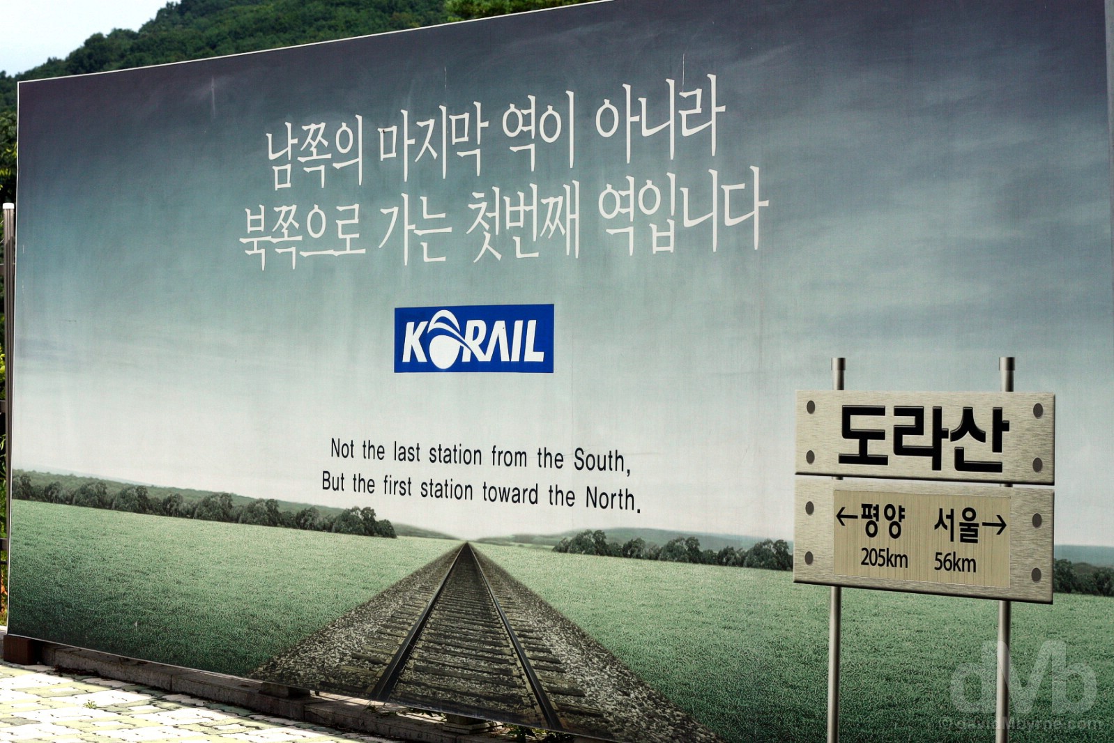
The first station toward the North. 56km south to Seoul, 205km north to Pyeongyang, North Korea. Dorasan Station, South Korea. August 21, 2009.
Someday. Dorasan Station, South Korea. August 21, 2009.
3. The Dora Observatory (& Kijong-dong/Propaganda Village)
A short distance from Dorasan Station is the Dora Observatory, an ugly observatory on top of Dorasan (Mount Dora). Geographically the observatory is as far north in South Korea as non-Koreans may venture; overlooking the DMZ itself, this is as close to North Korea as you can get without visiting the reclusive Hermit Kingdom itself.
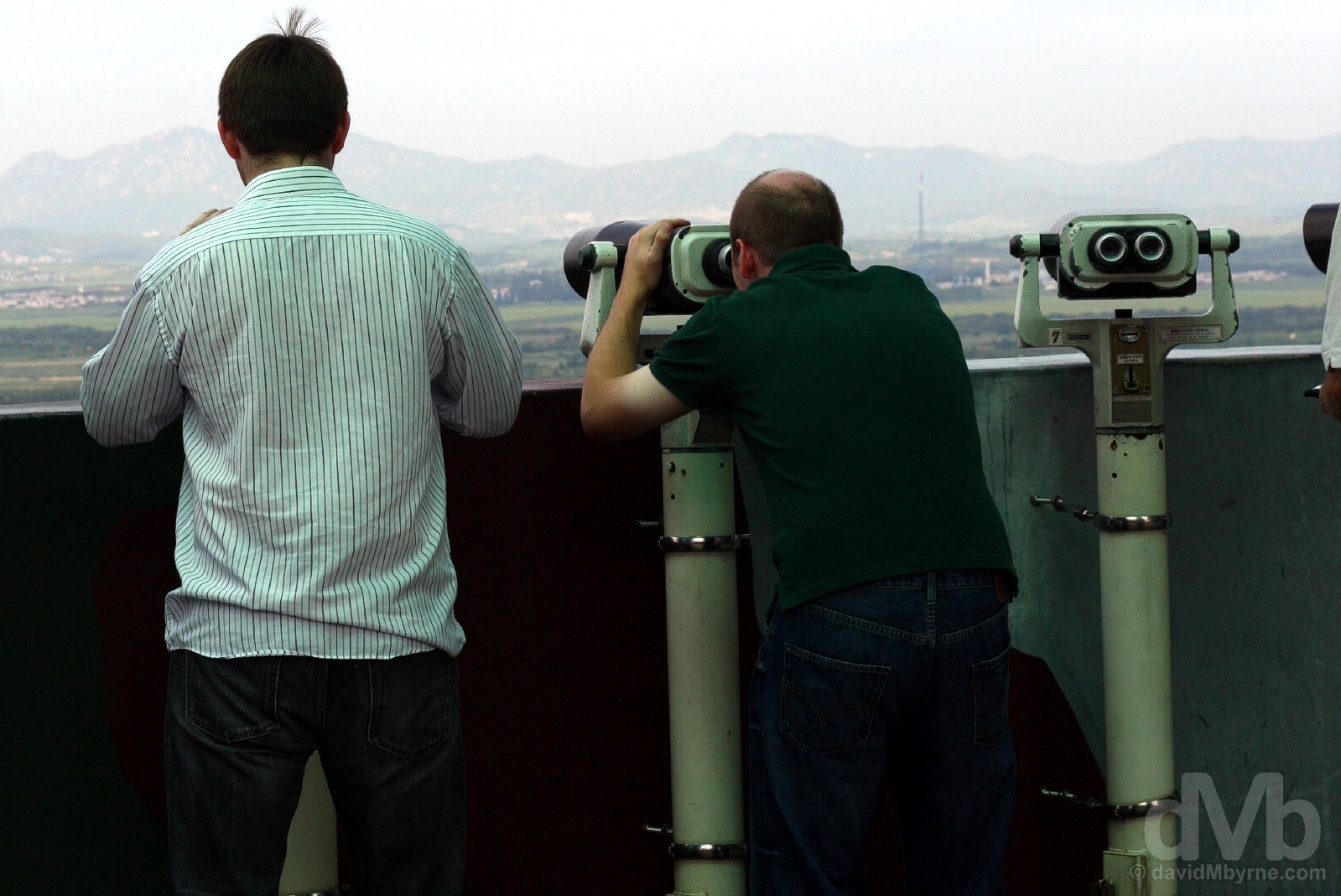
DORA OBSERVATORY || Although binoculars are on hand, there’s really not a whole lot to see from the platform of the Dora Observatory, the buzz of espying North Korean terra firma the main attraction here. Pictures beyond a point are not allowed and pointing a camera towards North Korea is likely to get you in trouble. What you can see in the hazy distance 1.2 kilometres away is the North Korean village of Kijong-dong, a.k.a. Peace Village or Propaganda Village, one of only two settlements permitted to remain within the DMZ as part of the 1953 armistice ending the Korean War, the other being the South Korean village of Daeseong-dong, about 2 kilometers away. Believed uninhabited despite North Korean efforts to promote the illusion of activity, the village is home to the 160-metre-high Panmunjom flagpole (seen here to the right of frame). The flagpole was erected in the 1980s in response to the South Korean erection of a 96-metre-high flagpole in the aforementioned Daeseong-dong, an act of one-upmanship coined at the time as the Flagpole War. It was the tallest flagpole in the world until 2010 and is still today the world’s fourth tallest. On the Dora Observatory overlooking the Demilitarized Zone (DMZ), South Korea. August 21, 2009.
4. The Third Tunnel
A short distance from the Dora Observatory is The Third Tunnel, a.k.a. Third Tunnel of Aggression or the Third Infiltration Tunnel, so-called because it was the third of 4 known tunnels – and the closest to Seoul, only 44 kilometres away – discovered under the border between the two Koreas. Built in order to facilitate another invasion of the South by the North, it is believed there are upwards of 20 more such tunnels left to be discovered along the course of the 250-kilometre-long DMZ (seemingly the South Koreans are more concerned these days with curbing the North’s nuclear/ballistic missile ambitions rather than searching out subterranean tunnels).
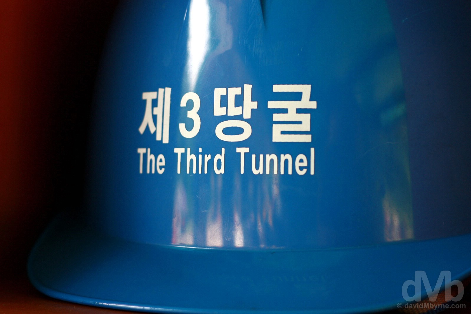
THE THIRD TUNNEL || Hard hats required at The Third Tunnel under the Demilitarized Zone (DMZ), South Korea. August 21, 2009.
Discovered in 1978 as the result of a tip-off from a North Korean defector, it is estimated that the narrow 2-metre-wide by 2-metre-high tunnel could facilitate the delivery of some 30,000 North Korean soldiers per hour across the DMZ into the South, an estimate one would scarcely believe when experiencing the dark & tight confines of the subterranean world, somewhere cameras are not allowed. Chiselled out of bedrock at a dept of 73 metres, the 1.7-kilometre-long tunnel when discovered penetrated 435 metres beyond the southern boundary of the DMZ into the South. Their cover blown & in clear breech of the 1953 Korean Armistice Agreement, initially the North Koreans denied building the tunnel before claiming it to be part of a coal mine; a geological survey of the region didn’t discover any coal deposits.
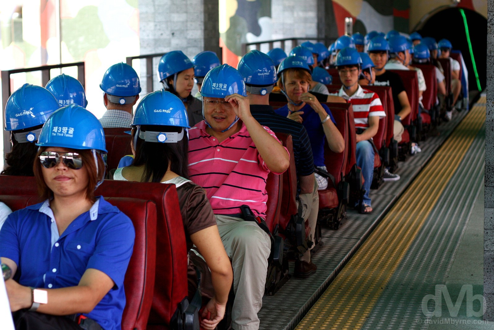
A popular stop today on the DMZ circuit, a 265-metre-long stretch of the tunnel is accessible to tourists, the passage further north, and across the DMZ into North Korea, halted by a preventative series of concrete barricades – tourist can go as far as the so-called third blockade. Tourist access to the tunnel is via the train system seen here, one that descends a smaller intercept tunnel that was dug in a successful bid to discover the main infiltration tunnel below. Preparing to descend into The Third Tunnel under the Demilitarized Zone (DMZ), South Korea. August 21, 2009.
Further reading – North Korea – Check out my 2017 visit to North Korea.