The Big Island To Maui || Flying High
Epic Views Of The Hawaiian Islands En Route From The Big Island To Maui
From Hawaiian Airlines flight HA167 en route from the Big Island to Maui, Hawaii. March 4, 2013
I took one of my more memorable flights today, a flight from Kona Airport on the Big Island of Hawaii to Maui, the third Hawaiian island I’ll be visiting on this my second visit to the Hawaii Islands. The shores of the neighbouring islands are less than 100 kilometers apart so the flight was a quick up & down affair, a very pleasant, relaxed one given the open-air laid-backness of Kona’s Airport & the friendliness of the airline’s Aloha/Hawaiian shirt-wearing crew. And the view. Oh the view.
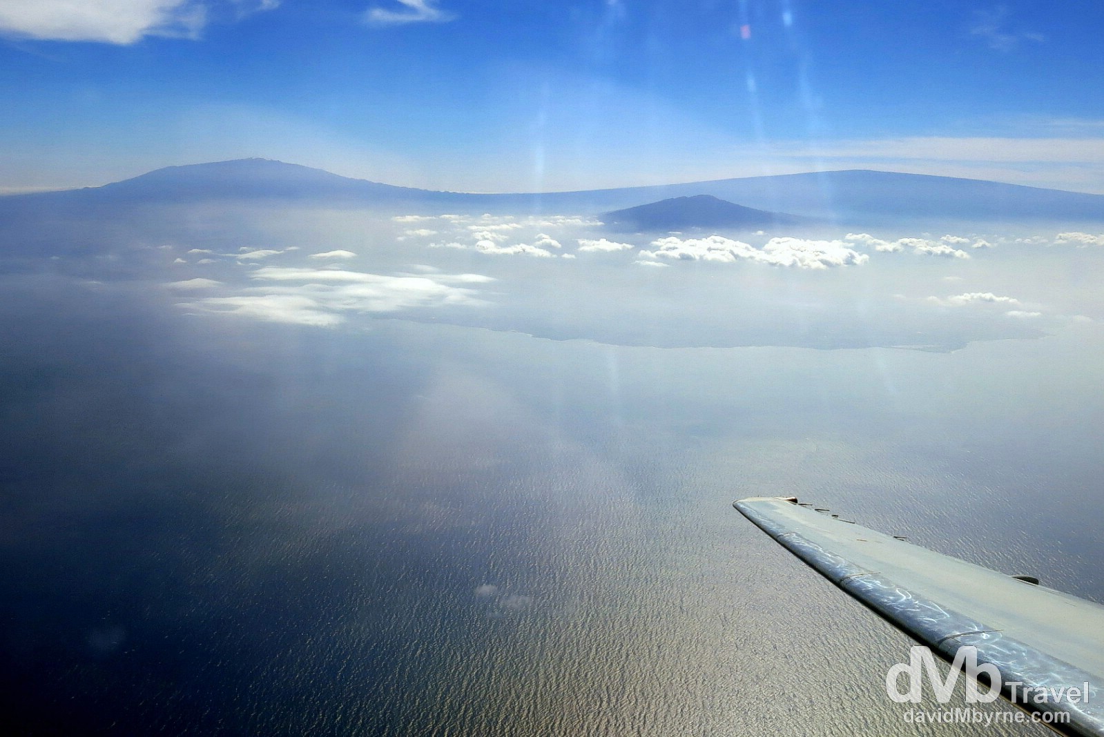
This is a quick image I captured looking back to the west coast of the Big Island with its two prominent peaks clearly visible – Mauna Kea (4,205 metres (13,796 ft), left & from where I witnessed sunset the previous evening, & Mauna Loa (4,169 metres (13,679 ft), right. I tried to get a panorama of the stunning right-to-left view from the west coast of the Big Island to the south coast of Maui, separated only by some 40 kilometres of shimmering blue Pacific Ocean, but it proved beyond me. But that’s OK as I stored it as a (fond) cranial memory, not a digital one. From Hawaiian Airlines flight HA167 en route from the Big Island to Maui, Hawaii, USA. March 4, 2013.
The Making Of Paradise
From this vantage point one can really get an appreciation for the formation of the 2,700 kilometre (1700 mile)-long stretch of the isolated Hawaiian Islands. Built from lava and rising directly from the sea floor, the eight islands of the Hawaiian archipelago are the result of the Pacific Plate, on which the archipelago rests, moving (very slowly) over a volcanic hot spot, an undersea magma source called Loihi, in the earth’s crust on the ocean floor. The islands are one of the youngest areas of terra firma on earth, ranging from less than 1 million years old at the youngest point, at the south east corner of the Big Island, to nearly 6 million years old at the oldest point, the most northern point of archipelago. And with the movement of the Pacific Plate, islands continue to be formed today from volcanic activity initiated under Loihi. The newest volcano, Loihi Seamount, is located about 35 kilometres southeast of the Big Island. It has been forming for about 400,000 years and at present its peak is about 1 kilometre below the ocean’s surface meaning that the newest Hawaiian Island is expected to pierce the Pacific Ocean surface in approximately 10,000-100,000 years from now (& I won’t be here to photograph it).
Further Reading
If you want to see a good visual interpretation as to how the Hawaiian Islands were & continue to be formed then you can do a whole lot worse than to read this awesome article.