Cape Town & Environs, Western Cape, South Africa
The Most polished, Most Visited & Most Un-African Part Of The Country“Cape Town’s spectacular geographical setting and all the outdoorsy adventure options that presents might by itself be enough to lure some, but the region’s vineyards, agreeable climate, beaches, European colonial-era architecture (& history) and epic coastal drives, among other attractions, would, I’d imagine, deter very few.”
Image || Day 6. Late afternoon scenery off the coastal-hugging Clarence Drive, Western Cape. February 20, 2017.
Cape Town & Environs – Introduction
While it was on the bucket list by virtue of having never been, I can’t ever recall having a desire to go to South Africa. If I had I’d have probably visited by now. Being honest, the country, the world’s 24th-largest, has something of an image problem, one not helped by stories of crime & worries over personal safety, by the poverty & the obvious haves & have-not societal inequality, and the scars that linger from the divisive Apartheid era when the vast majority of the country’s black population – some 80% of the population – were disenfranchised. Oh, and there’s the hum of those annoying buzzing vuvuzelas during the FIFA 2010 World Cup (the things that stick in one’s memory). But I’ve been wooed. By Cape Town, and a Capetonian (and the accent, too), so now I find myself en route to the Mother City.
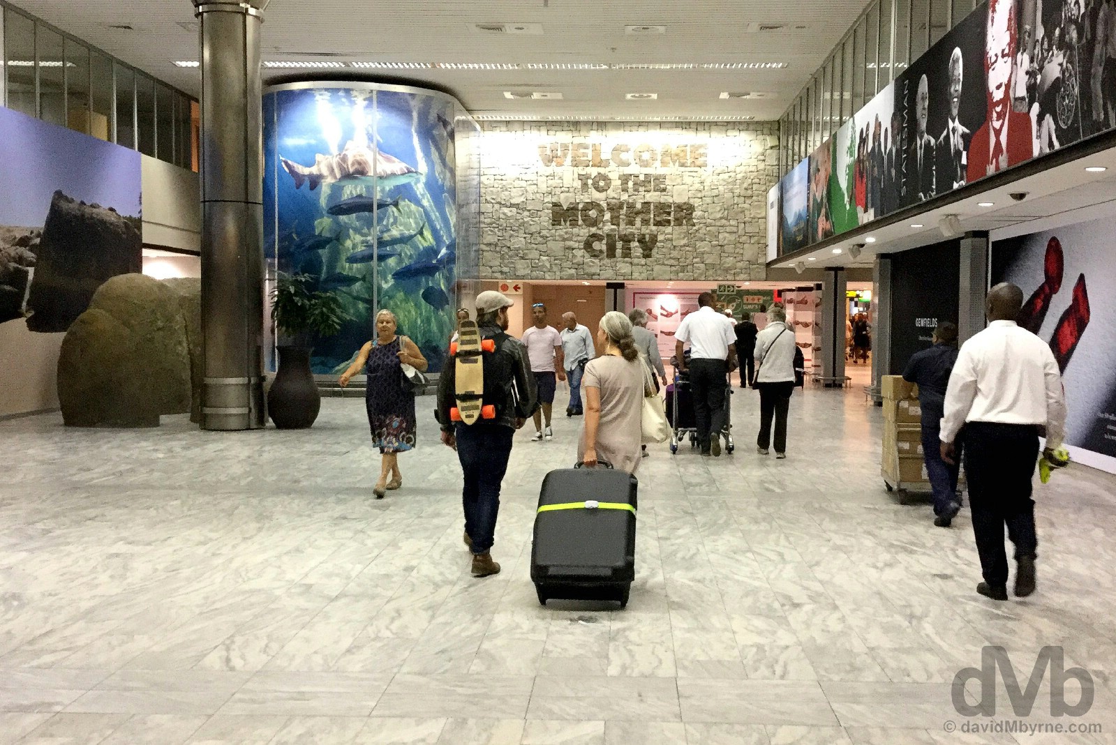
Welcome To The Mother City. Cape Town International Airport, Western Cape, South Africa. February 15, 2017.
– Patricia de Lille, Executive Mayor, City of Cape Town, from the 2017 Official Visitors’ Guide Cape Town
Cape Town – The Mother City
Cape Town, a.k.a. the Mother City, so-called because it seemingly takes 9 months to get anything done down here, or so I’ve been told, is the capital of Western Cape, both the most southerly & the most popular of South Africa’s 9 provinces with tourists (and the one with a character & look most shaped by the country’s European colonial past). This is by some way both South Africa’s most un-African and its most visited city, and upon investigation it’s not hard to see why. Cape Town’s spectacular geographical setting and all the outdoorsy adventure options that presents might by itself be enough to lure some, but the region’s vineyards, agreeable climate, beaches, European colonial-era architecture (& history) and epic coastal drives, among other attractions, would, I’d imagine, deter very few. I’d always envisioned visiting the city, and South Africa itself, as part of an epic African overland odyssey, a Cape Town to Cairo or vice versa sort of jaunt. That might very well still happen one day, but for now I’m happy to give myself over to 9 days of Cape Town & its environs to see for myself if it really is as idyllic and as photogenic as it reads.
Cape Town & Environs Highlights Gallery
Cape Town & Environs Day-by-Day Overview
DAY 01 || BLOUBERGSTRAND || Cape Town International Airport to Bloubergstrand.
DAY 02 || THE CITY (a #CTBig7 attraction) || The Castle of Good Hope, Parliament Buildings & Company’s Gardens, St George’s Cathedral, the Bo-Kaap, Truth Coffee, Woodstock, & the open-air Galileo Cinema at the V&A Waterfront.
DAY 03 || THE CAPE PENINSULA || The Atlantic Seaboard (Sea Point, Clifton, Camps Bay, Llandudno, Hout Bay, Chapman’s Peak Drive, & Noordhoek Beach), The Cape of Good Hope & Cape Point (a #CTBig7 attraction), & The False Bay Seaboard (Boulders Beach & Simon’s Town, Fish Hoek, Kalk Bay, St James, & Muizenberg).
DAY 04 || THE WINELANDS & STELLENBOSCH || Root 4 Market at the Audacia Wine Estate, Blaauwklippen Vineyards, & Stellenbosch.
DAY 05 || KIRSTENBOSCH || Summer Sunset Concert in Kirstenbosch National Botanical Garden. (a #CTBig7 attraction)
DAY 06 || THE WINELANDS & CLARENCE DRIVE || Franschhoek, Babylonstoren, Clarence Drive, Betty’s Bay, & The Coastal R44 & R43 to Hermanus.
DAY 07 || CAPE OVERBERG || Hermanus, De Kelders, Gansbaai, Kleinbaai, Pearly Beach, Elim, L’Agulhas & Cape Agulhas, Bredasdorp, Swellendam, Ashton, Robertson, Worcester, & Du Toits Kloof Pass.
DAY 08 || HISTORY & HIKING HIGHS || The V&A Waterfront (a #CTBig7 attraction), Robben Island (a #CTBig7 attraction), & Lion’s Head.
DAY 09 || WELLINGTON WIND DOWN || Wellington, road to Bain’s Kloof Pass, & the Napier Winery.
Cape Town & Environs
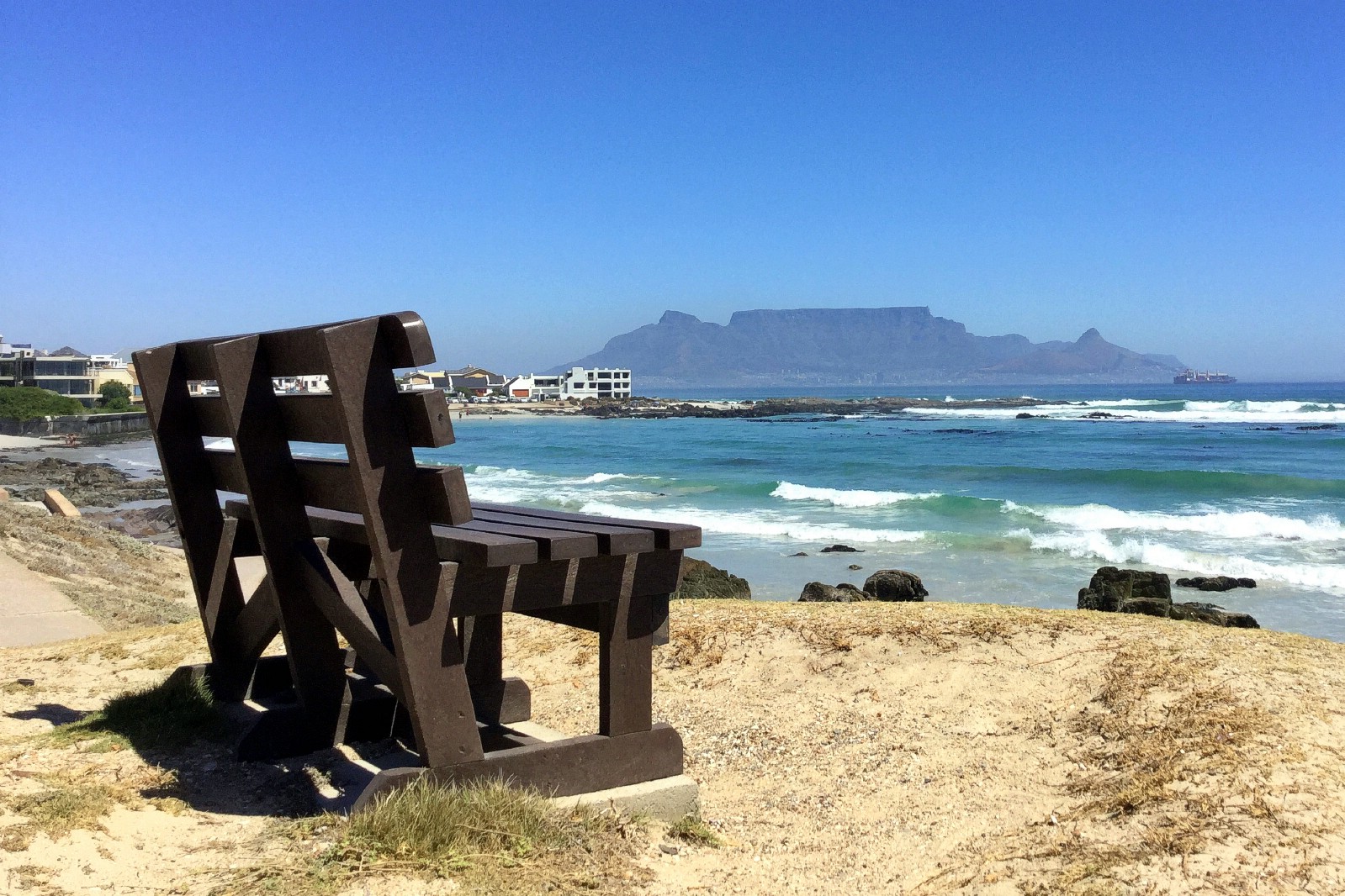
PICTURE OF THE DAY || DAY 1 || February 15, 2017Image || The distant city of Cape Town & Table Mountain as seen from across Table Bay in Bloubergstrand.
“The waters off Blouberg’s long, rocky coastline are a haven for kite surfers; as idyllic as the beaches are, with their white sand encroaching on the sea-facing settlements, seemingly there are better swimming options elsewhere. Out here is both relaxed & scenic, the perfect place to ease into Cape Town after the 22-hour transit from the (much) chillier climes of the Northern Hemisphere.”
Day 1 || February 15, 2017
Posted From || Wellington, Western Cape
Day 1 Overview || BLOUBERGSTRAND – Cape Town International Airport to Bloubergstrand
I didn’t even take the real camera out today, day one in Cape Town & its environs, leaving the photographic duties to my trusty iPod instead; there’s plenty of time for proper photography. After picking up the hire car – a brandy-new, no-frills, white Volkswagen Polo with 25 kilometres on the clock – it was an hour drive from Cape Town International Airport to the windswept white-sand shoreline of Bloubergstrand from where there were nice views, if a bit hazy, back towards the regional centerpiece of iconic Table Mountain (& the city of Cape Town) from across Table Bay. It was a nice introduction to the city and its picture-postcard setting.
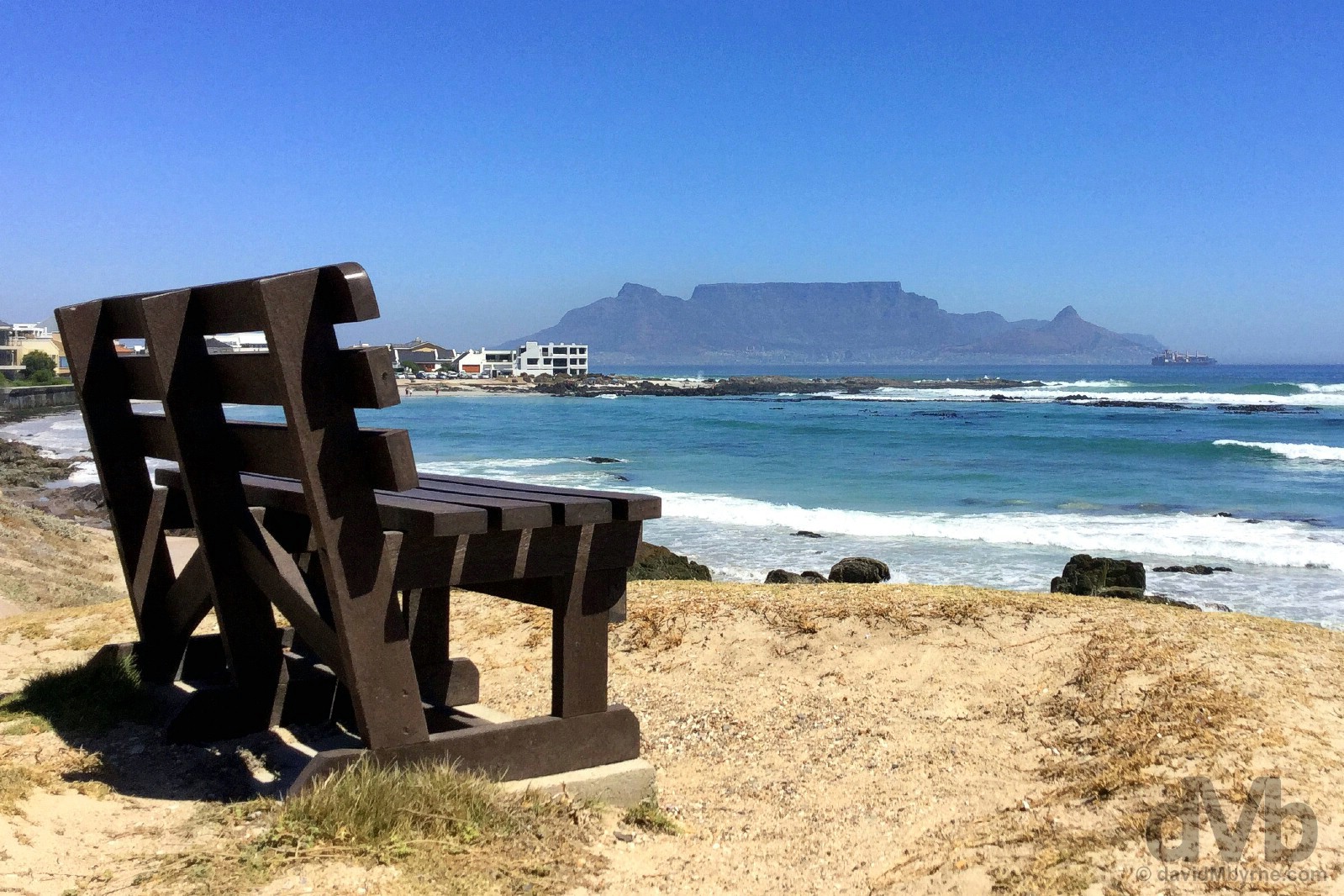
BLOUBERGSTRAND || The waters off Blouberg’s long, rocky coastline are a haven for kite surfers; as idyllic as the beaches are, with their white sand encroaching on the sea-facing settlements, seemingly there are better swimming options elsewhere. Out here is both relaxed & scenic, the perfect place to ease into Cape Town after the 22-hour transit from the (much) chillier climes of the Northern Hemisphere. Bloubergstrand. February 15, 2017.
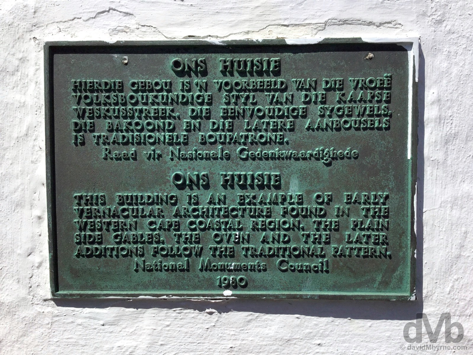
ONS HUISIE || A renowned casual restaurant serving West Coast cuisine overlooking the water & lapped by sea breezes, Ons Huisie, which directly translates to ‘Our Small Home’ and which is billed as a ‘world renowned and recognised traditional restaurant’ according to the restaurant’s website, is housed in a squat, whitewashed building, a beautifully restored example of typical early regional vernacular architecture, an architectural style design based on local needs, availability of material and reflecting local traditions of the time. Photographing the building itself was something of a challenge given the abundance of inviting patio shades obscuring the view, so I settled instead for photographing this plaque embedded in the walls of the historic building. Ons Huisie, Bloubergstrand, Cape Town. February 15, 2017.
Cooling down. Ons Huisie, Bloubergstrand, Cape Town. February 15, 2017.
Plenty more to come from down here. Eight days of it. I just gotta get some rest first, and adjust to this heat.
Cape Town & Environs
PICTURE OF THE DAY || DAY 2 || February 16, 2017Image || In the colourful Bo-Kaap district of central Cape Town.
“It’s the same the world over. Get a string of adjoining structures, paint them in bright colours and bam, you’ve immediately got yourself a tourist attraction. It’s simple, it’s tried, it’s tested, and it works.”
Day 2 || February 16, 2017
Day 2 Overview || THE CITY – The Castle of Good Hope, Parliament Buildings & Company’s Gardens, St George’s Cathedral, the Bo-Kaap, Truth Coffee, Woodstock, & the open-air Galileo Cinema at the V&A Waterfront.
Between observing the Grand Parade from atop the yellow walls of the Castle of Good Hope, to walking the European-esque streets of the CBD, to sampling the Muslim Cape Malay charm of the Bo-Kaap, to trying to figure out exactly what kind of vibe the hypsterie Woodstock neighbourhood is trying to peddle, I found myself commenting on more than one occasion today how I’d never experienced anything quite like the City of Cape Town. Of course this is all new to me; as travelled as I am, I’ve never been to such a place in Africa, the chaos of energetic Egypt & the mystic of Morocco, both very much on the northern fringes of the continent, not registering at all down here at it’s southern extremity. With a whole continent separating my past from my present African exploits, the resemblances so far are few. Very few. It’s all very different down here, all very new.

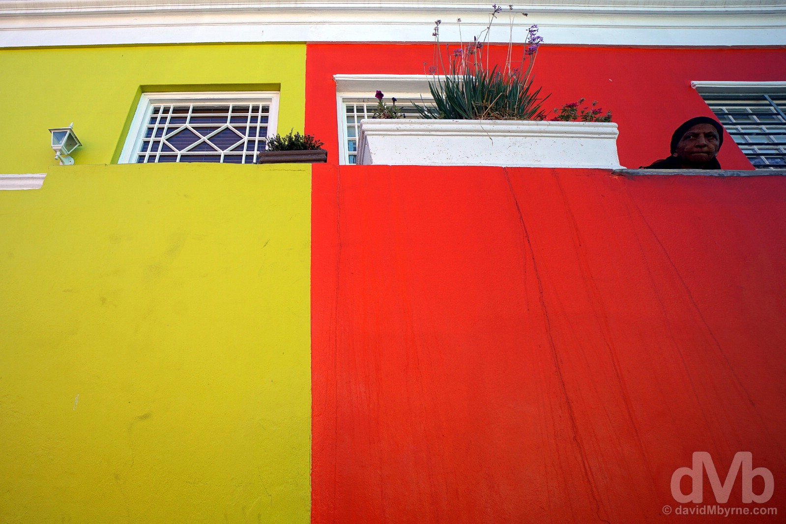
Observing all the camera-toting tourists. A resident in the colourful Bo-Kaap district of central Cape Town. February 16, 2017.
CapeTownBig7.co.za – City Walk, one of Cape Town’s Big 7, the best of what the city has to offer (#CTBig7)
Historic Central City
While Cape Town and its surrounding suburbs sprawl, its business-centred City Centre is compact, not to mention lively & very colourful. There’s plenty to see – handsome buildings, historic fortifications, inviting gardens, & world-class museums – in what is the oldest developed suburb in the Western Cape, and thus South Africa; earmarked as a supply station for the maritime trade route to the East by the Dutch East India Company as early as the mid-1600s, Cape Town was to become the region’s first European outpost, remnants of which still stand to this day.

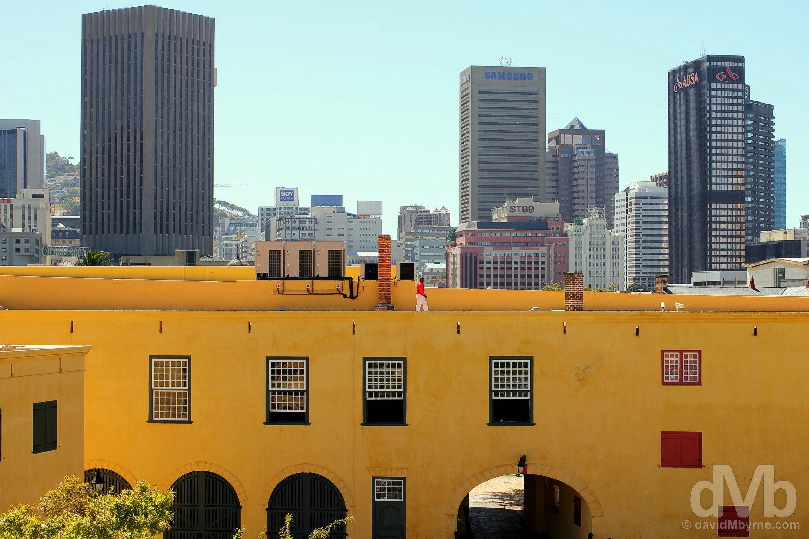
CASTLE OF GOOD HOPE || A massive five-cornered stronghold with imposing walls situated slap-bang in the centre of the city, surrounded by modern-day Cape Town and overlooking Grand Parade, Cape Town’s large central square/market place/rallying point, the Castle of Good Hope is South Africa’s oldest official building – sporting Cape Town’s trademark yellow (Pantone 109-C), it was first erected by the Dutch in early 1666 to replace an earlier fortification. (The Dutch first arrived in April 1652, much to the ire of the native Khoi who, along with the native San, had already been here for over 2,000 years. The Dutch named their little outpost de Caabsche Vlek, ‘the Cape Hamlet’, later renamed Cape Town, a much-needed replenishing station for mariners making the six to eight month voyage from Europe to the Far East.) Construction of the present-day Castle of Good Hope officially started in January 1666 with the first major phase of construction completed in 1679; it was subsequently added to over the years. Built according to the design of Dutch fortifications of the day, it was, for over 150 years (from 1674 until the mid-1800s), the symbolic heart of the Cape administration & the military seat of successive governments. It was also used, among other things, as a prison and a slave market – slavery, introduced by the Dutch in the 1650s, was officially abolished at the Cape by the British in 1834, the Brits nabbing the Cape from the Dutch in 1795 (& again for the final time in 1806) after which they introduced their own British Regency style to portions of the Castle’s interior. The combination of years of military use and neglect & its growth as a tourist attraction prompted a massive multi-year restoration which began in 1975, a restoration that dragged on for some 30 years. Today the Castle of Good Hope boasts tours, exhibitions, displays and ceremonies, all related to the past, not to mention great views of the city of Cape Town from its ramparts. Cape Town. February 16, 2017.
– Reproduced from the official Castle of Good Hope Collector’s Edition 2016 pamphlet
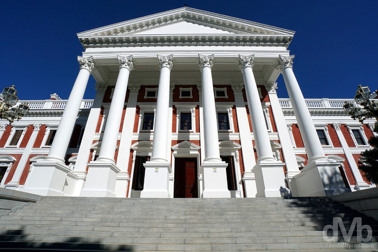
PARLIAMENT BUILDINGS || Talk about sharing the spoils. While Pretoria is the executive capital and Bloemfontein the judicial capital, Cape Town is the country’s legislative capital and the site of the South African Parliament. Housed in a rather impressive complex of interlinking buildings, the first wing of which was completed in 1885, this is where over 70 years of repressive legislation, including antediluvian Apartheid laws, were passed. Things don’t always go smoothly behind these impressive columns & doors. The latest state of the nation address – only 1 week ago, February 9th last – descended into total chaos when members of the opposition Economic Freedom Fighters (EFF), claiming President Jacob Zuma to be an “illegitimate president” who is a “scoundrel” and “rotten to the core” after he was found to have violated his office by the country’s highest court in 2016, were violently removed from the parliamentary chamber, the third consecutive state of the nation address that has been so disrupted. We did pass something of a protest (it was rather staid) fronting the parliament buildings on St Johns Street, but here on the leafy & pedestrianised Government Avenue at the rear of Parliament & lining the city’s Company’s Gardens, established by the Dutch in 1652 to supply fresh produce to passing maritime traffic, it was a whole lot more tranquil, and a whole lot more picturesque. King’s Gallery of Parliament Buildings, Government Avenue, Cape Town. February 16, 2017.
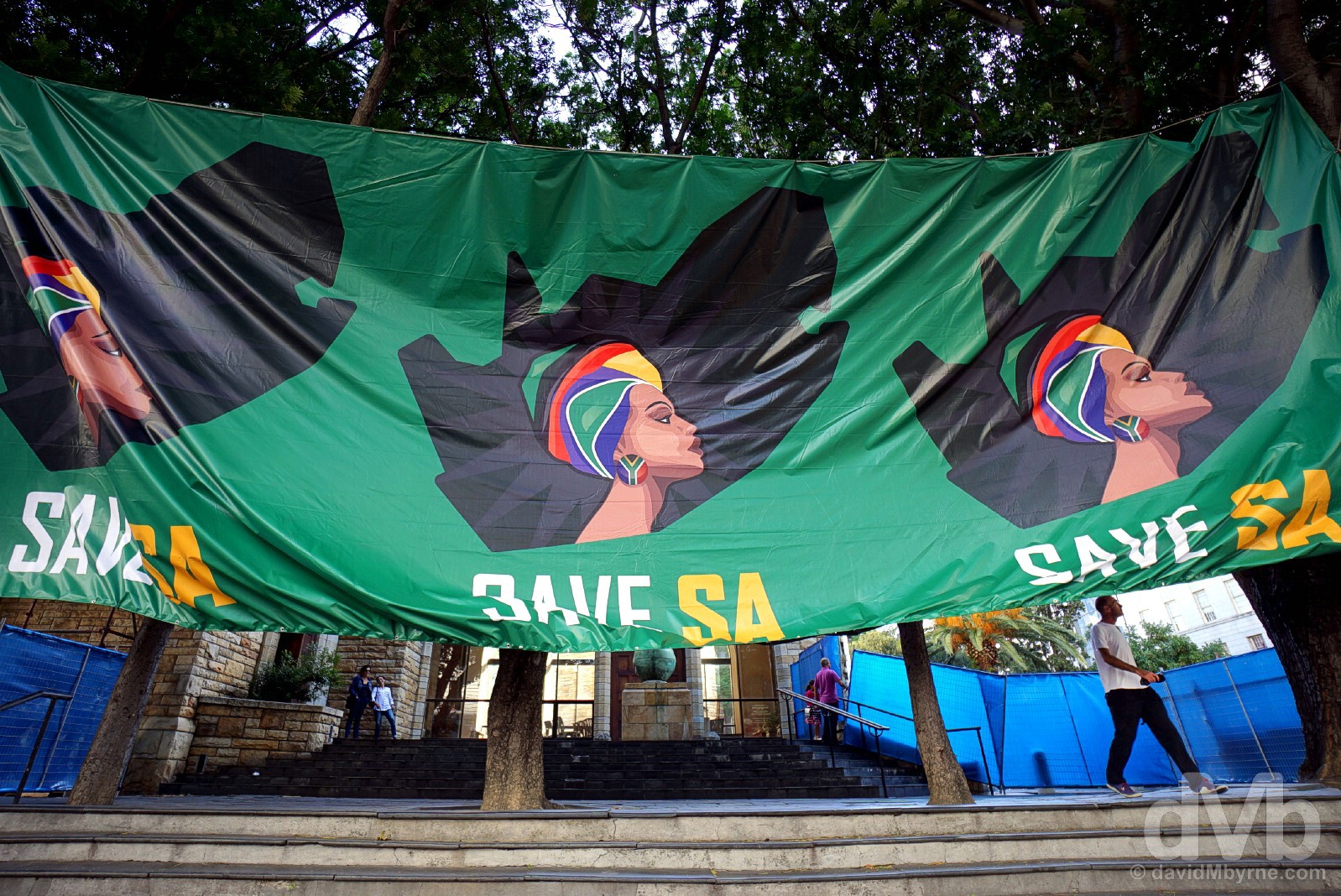
Save SA. From what I’m not sure. A banner erected outside St George’s Cathedral on Wale Street, Cape Town. February 16, 2017.
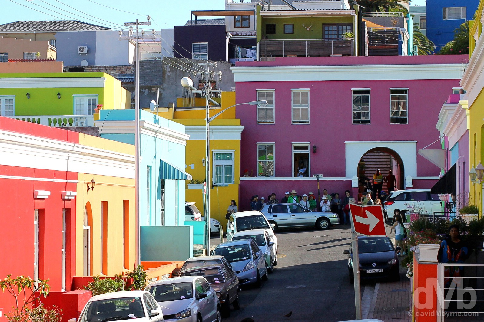
BO-KAAP || It’s the same the world over. Get a string of adjoining structures, paint them in bright colours and bam, you’ve immediately got yourself a tourist attraction. It’s simple, it’s tried, it’s tested, and it works. Established as a slave quarter over 360 years ago & today home to over 10,000 residents, the Bo-Kaap is Cape Town’s oldest residential area, a picturesque warren of steep, cobblestone streets and stumpy minarets that’s the hub for the city’s Muslim population – still the oldest mosque in the southern hemisphere, Cape Town’s first mosque was built here in the 1790s by freed slaves shortly after the Cape’s takeover by the British who, unlike the Dutch before them, allowed freedom of religion. But ignoring all of that history, it’s still the bright, colourful nineteenth-century Cape Dutch & Georgian terrace architecture that draws the hordes. Yes, it’s the same the world over. Bo-Kaap, Cape Town. February 16, 2017.
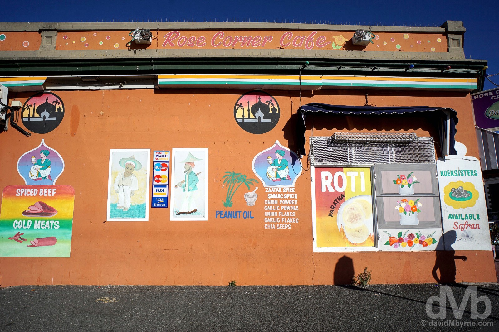
ROSE CORNER CAFE || There’s more to the Bo-Kaap district than eye candy. With its own unique identity, there’s a museum here detailing Bo-Kaap history & traditions, artisan shops aplenty, and myriad boutique accommodation options. There’s also the Rose Corner Cafe. More a deli than a true cafe, it dishes up spiced, curried & sugary Cape Malay favourites like worsies (hot sausages) & koe’sisters (small coconut-dusted donuts). Best get there early for the latter – there were none to be had when we passed by mid-afternoon. (Descendants of Dutch slaves of the 16th & 17th centuries, Bo-Kaap residents became known as Cape Malay, even though most originated in Africa, India, Madagascar & Sri Lanka, with very few actually originating from Malaysia.) Bo-Kaap, Cape Town. February 16, 2017.
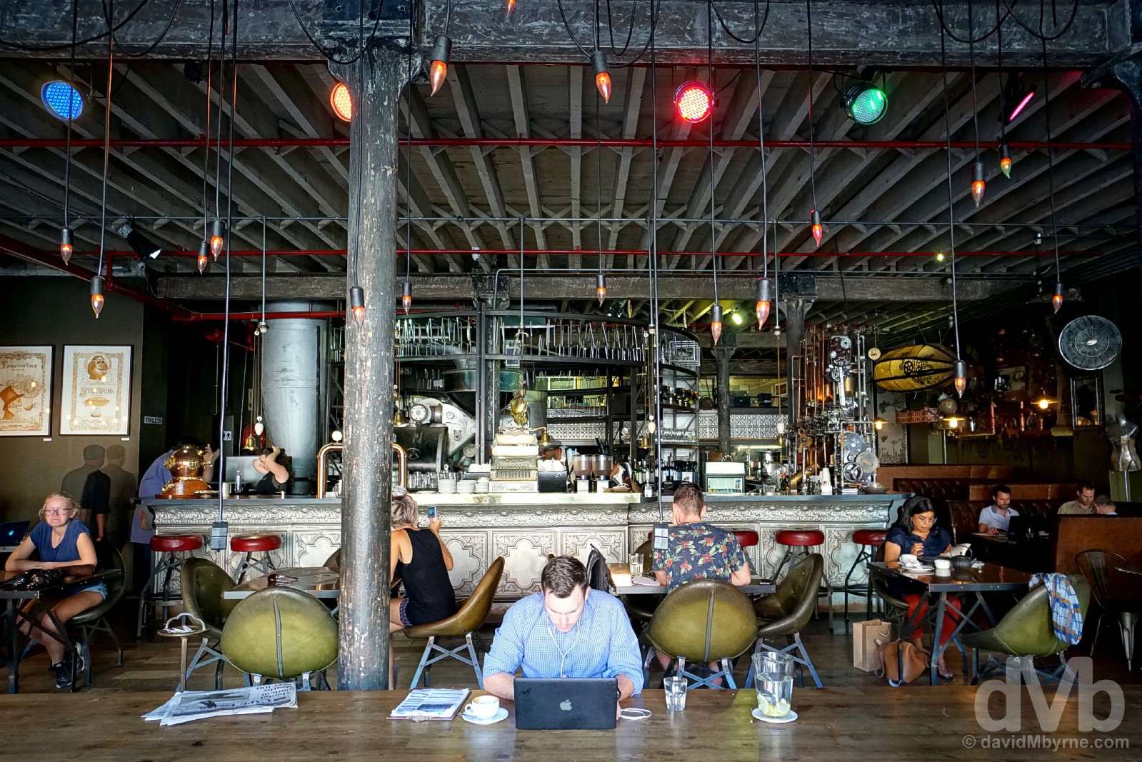
TRUTH COFFEE || By all accounts the compact grid of streets & squares – Church, Harrington & Greenmarket etc. – that adorn Cape Town’s CBD are as close as Africa gets to a European quarter. I’d well believe it after walking through the city’s core in getting from the Bo-Kaap to Truth Coffee, somewhere we only just got to before they shut up shop for the day (I’m surprised how early things – attractions, shops, cafes etc. – close down here, especially as it’s the height of the southern hemisphere summer). Something of an institution that is being billed as the world’s coolest cafe (by whom I’m not overly sure), it’s not only the coffee that is the attraction here, but the cafe’s Victorian steam-punk theme design also seems to attract the crowds. Truth Coffee, Buitenkant Street, Cape Town. February 16, 2017.
The rest of day two was spent driving through the Woodstock neighbourhood, a hub for creative & bohemian types and a visually curious mix of old and new. A working & living social/design experiment in action and the the region of the city to benefit most from Cape Town being awarded World Design Capital in 2014, this once run-down suburb has been given a new lease of life through the Neighbourgoods Market selling artisan goods in the old neighbourhood landmark biscuit factory: The Old Biscuit Mill. Woodstock is also home to the Doubletree by Hilton, our overnight location for this night, but not before an evening spent at the Galileo open-air cinema at the V&A Waterfront, the city’s restored, tourist-friendly, harbourside residential, shopping & dining district. More to come from there in due course; I’m far from done with the Waterfront (see Day 8 for more).
Cape Town & Environs
PICTURE OF THE DAY || DAY 3 || February 17, 2017Image || African penguins on the rocks of Boulders Beach on the shores of False Bay, Cape Peninsula.
“I’d read about Boulders Beach prior to arrival. The sheltered setting, the boardwalks, the 540-million-year-old granite rocks/boulders and yes, of course, the penguins. But having been to Antarctica, I wasn’t too pushed about seeing penguins on a warm beach fronting a residential area of Cape Town.”
Day 3 || February 17, 2017
Day 3 Overview || THE CAPE PENINSULA – The Atlantic Seaboard (Sea Point, Clifton, Camps Bay, Llandudno, Hout Bay, Chapman’s Peak Drive, & Noordhoek Beach), The Cape of Good Hope & Cape Point, & The False Bay Seaboard (Boulders Beach & Simon’s Town, Fish Hoek, Kalk Bay, St James, & Muizenberg).
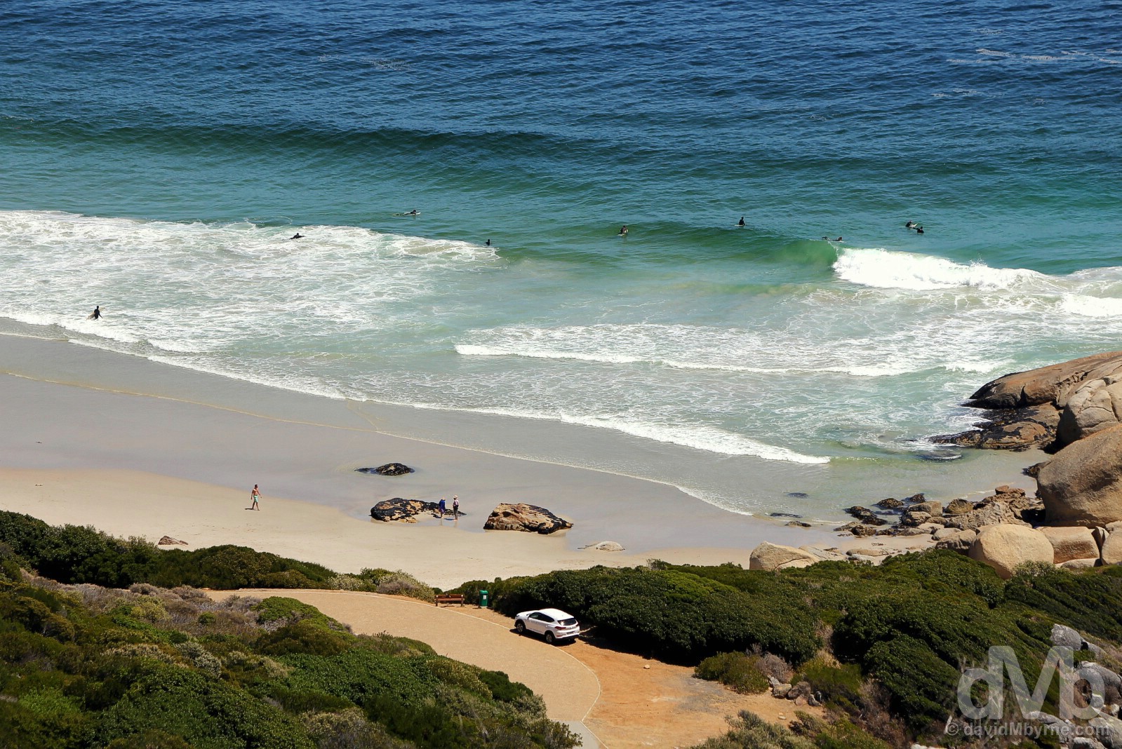
And now for some scenery, some epic coastal scenery via some epic coastal drives of the region’s Cape Peninsula, that rocky finger of land that juts out into the Atlantic Ocean at the southwestern extremity of the African continent, the same appendix-shaped landmass that was described by Sir Francis Drake more than four centuries ago as the most beautiful Cape in the world. We drove over 100 kilometers today in going from the city to The End, to Cape Point at The Cape of Good Hope at the very southern tip of the peninsula, and back again – down one side, the western-facing Atlantic Seaboard, and up the other, the eastern-facing False Bay Seaboard. Terra firma narrows as you go and the coast is rarely far away so there were some expected highlights en route: cliff-hugging drives; wild, windswept coastline; salty air; plush seaside settlements; bays, coves & white-sand beaches; working fishing villages; barren & rocky scrubland; epic vistas & end-of-the-world vibes; and emm, penguins. Penguins? In Africa? Well I never.
African Penguins late afternoon shadows on Foxy Beach on the shores of False Bay, Cape Peninsula. February 17, 2017.
Day 3 Road Trip Part I – Southbound – The Atlantic Seaboard
It was a leisurely drive south along the portion of the Cape Peninsula’s two-lane M6, a.k.a. Victoria Road, that separates Sea Point & Chapman’s Peak on the western side of the peninsula. This stretch of windy, coastal-hugging road only measures some 30 kilometres, but there are plenty of reasons to pull over en route.
Viewing a portion of the beach at Llandudno from the coastal Victoria Road, Cape Peninsula. February 17, 2017.
Pretty, Pushed & Plush
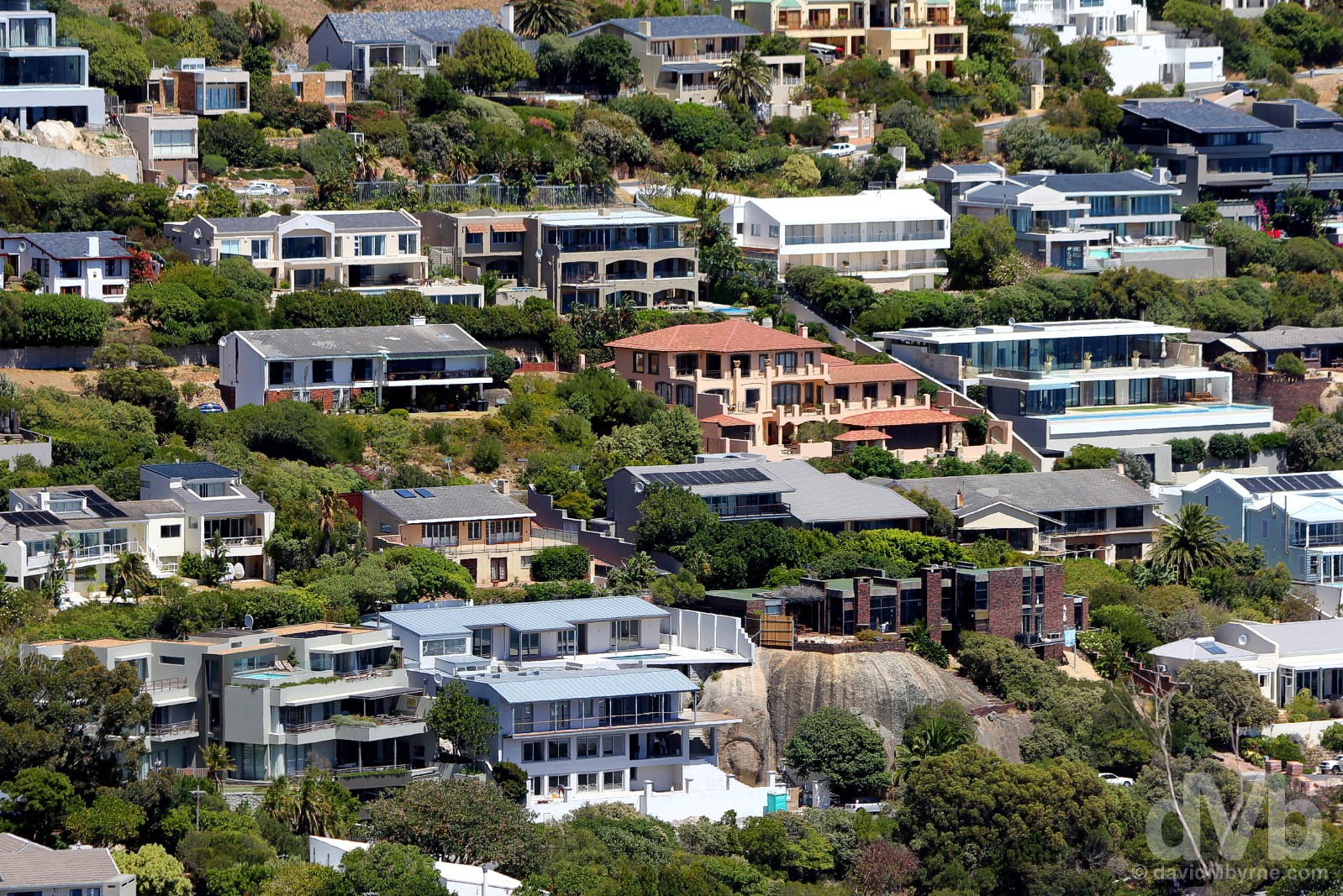
Victoria Road winds through some pretty settlements pushed up against the steep western-facing slopes of Table Mountain and the Twelve Apostles of the Table Mountain Chain. Plush settlements – the Atlantic Seaboard beaches are overlooked by some of Cape Town’s, and Africa’s, priciest real estate. They are a combination of residential social hubs & popular tourist attractions lined with sundowner bars & restaurants, as at Clifton & Camps Bay, and secluded & sheltered sunbathing options, such as at Llandudno.
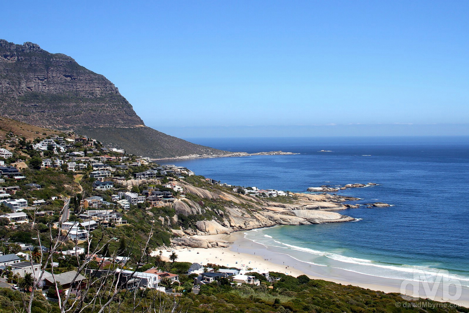
LLANDUDNO || Happy to drive through settlements up to this point, the Victoria Road overlook high above the small & exclusive sheltered cove of Llandudno, named after the North Wales seaside resort of the same name, was our first Cape Peninsula stop of this day. Less developed than settlements further north (Llandudno doesn’t even have street lighting & there are no shops or commercial activity of any kind), the suburb certainly wins top marks for its picture-postcard setting. Cape Peninsula. February 17, 2017.
As inviting as the sands along this stretch of coast may seem from afar (or on high), the frigid waters of the Atlantic deter all but surfers and the most hardy from entering these waters. But fear not, if you reside in these quarters your million-dollar pad with wall-to-ceiling windows and sweeping sea views will invariably come with a swimming pool.
Residences in the hills overlooking Llandudno, Cape Peninsula. February 17, 2017.
For Sale roadside on Victoria Road overlooking Llandudno, Cape Peninsula. February 17, 2017.
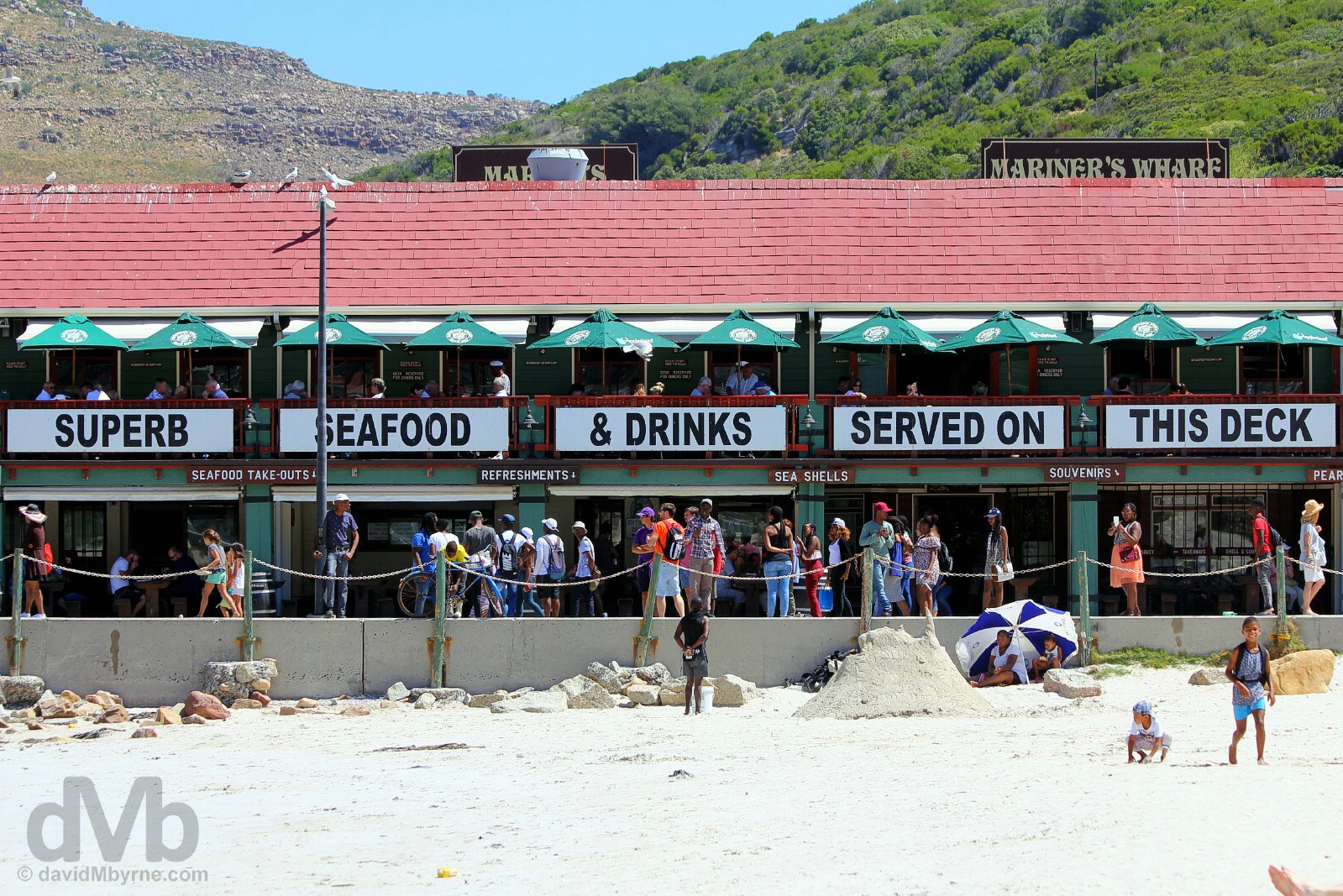
HOUT BAY || It’s only 6 kilometres from Llandudno to the town of Hout Bay. Home to massive sand dunes, World of Birds (Africa’s largest bird park), & the ImiZamo Yethu township, a tightly packed shantytown crawling up the hillside that I almost drove into, the town’s setting is spectacular, hugging as it does aquamarine Hout Bay and surrounded by peaks – the town is only accessible via any one of three mountain passes. A crayfishing centre, the town has a busy working harbour that’s home to Mariner’s Wharf. Opened in 1984, billed as Africa’s first harbourfront emporium (whatever that is), and relying heavily on tourism, it’s famous for its live lobsters, pearls in oysters, and natural antiques – the restaurants, shops and markets found here push the whole maritime vibe into overdrive. AHOY AHOY! Hout Bay Harbour, Cape Peninsula. February 17, 2017.

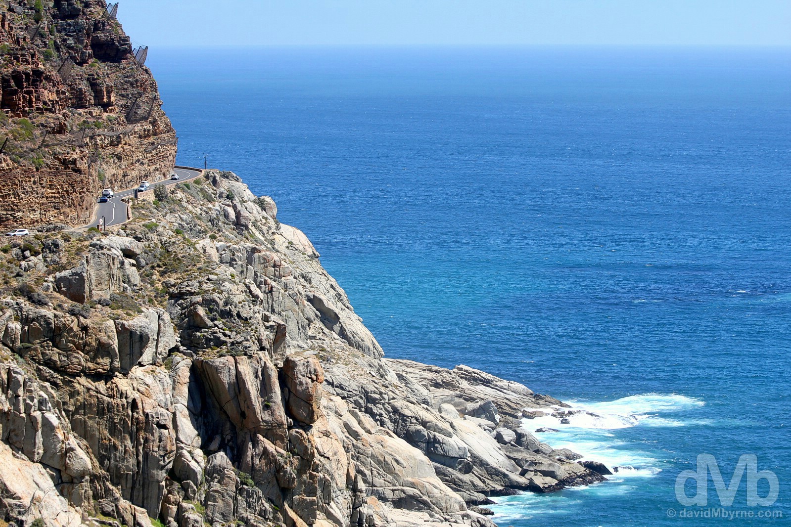
CHAPMAN’S PEAK DRIVE || Chapman’s Peak Drive isn’t long – cut into the edge of the region’s 592-metre-high Chapman’s Peak, it’s the 9-kilometre-long stretch of Victoria Road that connects Hout Bay & Noordhoek – but the drive, affectionately known as Chappies, is still billed as one of the world’s most spectacular coastal drives. The tolled road with 114 curves was formally opened in 1992 and is sometimes closed due to rock falls, the massive nets on the cliffs high above the road an ever-present reminder of the hazards lurking above. Cape Peninsula. February 17, 2017.
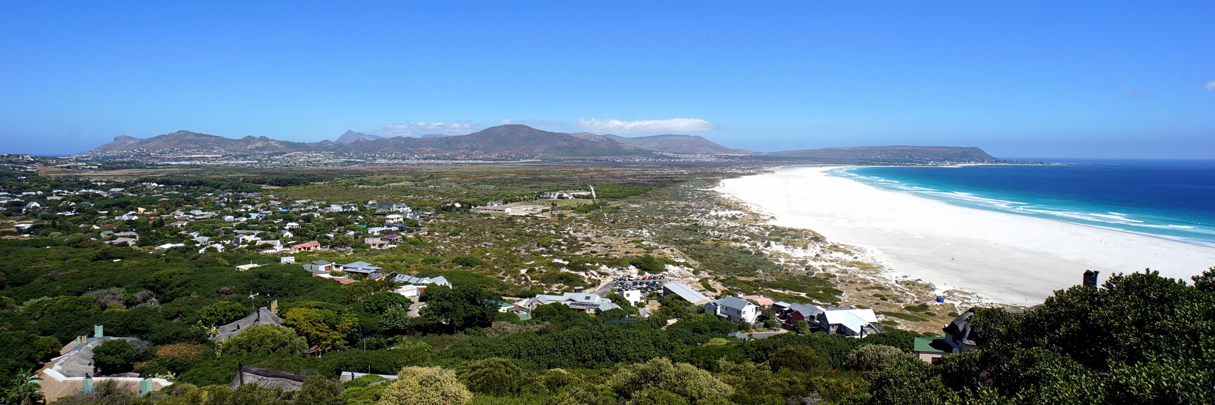
NOORDHOEK BEACH || Heading south, Chapman’s Peak Drive opens out into a gentle valley with the wide white expanse of Noordhoek Beach bordering on wetlands to the left/east and Chapman’s Bay to the right/west. It’s perfect panorama material, the beach, stretching to the town of Kommetjie in the distance, particularly striking. There are no amenities here on this wild and oft-windswept stretch of sand – this is long sunset walk or horse riding territory. Cape Peninsula. February 17, 2017.
The Cape of Good Hope & Cape Point
Leaving the Atlantic Seaboard at Noordhoek but continuing in a roundabout way south, it’s a 40+ kilometre drive via the M65 through the middle of the finger-shaped Cape Peninsula to the Cape of Good Hope & neighbouring Cape Point. Needless to say, things get a little more rugged down here & there’s a lot less development than there is up north, but that’s because it’s a lot more protected.
Table Mountain National Park & The UNESCO-listed Cape Floral Region Protected Areas
The majority of the rocky 70-kilometre-long Cape Peninsula, from Table Mountain overlooking Cape Town in the north to Cape Point at the extreme south of the peninsula, is given over to Table Mountain National Park, one of South Africa’s 19 National Parks. Cloaking the natural areas of what is essentially Cape Town’s back yard, the park was proclaimed in May 1998 for the purpose of protecting the unique natural environment of the peninsula and its Table Mountain Chain, and in particular the rare fynbos vegetation that’s abundant here – the 500 km², 123,500-acre Cape Peninsula alone boasts over 2,200 species of fynbos plants, nearly twice as many as all of Britain, which is some 5,000 times bigger. Oh, and the region is also home to a whopping 20% of Africa’s flora. UNESCO took note of this and jumped on board in 2004 by lobbing World Heritage status on the region.
– UNESCO commenting on the Cape Floral Region Protected Areas
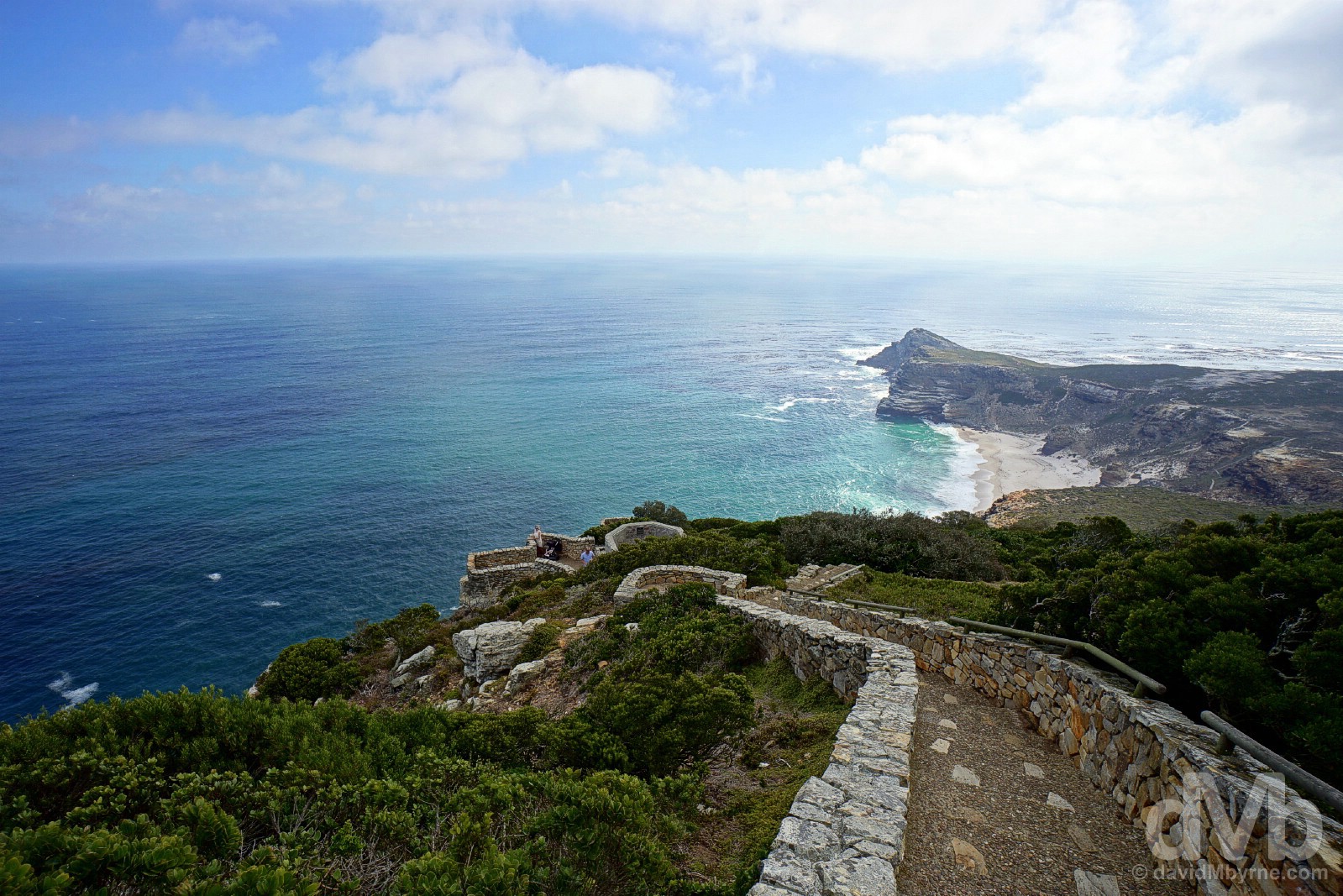
CAPE OF GOOD HOPE || Looking across Dias Beach to Cape Maclear &, further still, the Cape of Good Hope from the trail to the Old Lighthouse at Cape Point, Cape Peninsula. February 17, 2017.
CapeTownBig7.co.za – Cape Point, one of Cape Town’s Big 7, the best of what the city has to offer (#CTBig7)
Cape Point – The End
You can tell that you’re coming to the end. Things narrow and eventually all you can see is rock & water in three directions – left, right & straight ahead. You eventually reach a point which prevents you driving any further (it’s called the car park at Cape Point) and then you feel it, that end-of-the-world vibe that’s inescapable down here. Of course it’s not quite the end of the world, but when standing at the base of Cape Point’s Old Lighthouse looking out to nothing over the vast expanse of ocean it sure feels that way.

CAPE POINT || The Old Lighthouse at Cape Point and, in the distance, Dias Peak as seen from the trail to the Old Lighthouse, Cape Point, Cape Peninsula. February 17, 2017.
The Cape of Good Hope - 'Discovery' & Today
The 15th century blockage by the Turkish Empire of the overland route East was the catalyst for a European search for a sea route to India. The first European to see the Cape was Portuguese mariner Bartolomeu Dias. On a mission to find a stop off point en route to East Africa and the East Indies, he first rounded the Cape in 1488, although he didn’t actually see it; he only ‘discovered’ it upon his return, something of a consolation having failed to reach India. Not enamored with the place or its nasty southeast-orientated breezes, Dias named it Cape of Storms – it was later renamed Cabo de Boa Esperanza, Cape of Good Hope, by Portugal’s King John II who had initially sent Dias on his way & who foresaw the realisation of the long sought-after passage to India (Vasco de Gama would eventually ‘find’ India & thus a profitable trade route for Portugal that bypassed the Middle East, passing the Cape of Good Hope on his return journey in 1499). For centuries, Cape Point, easily one of the most dramatic coastal locations on earth, has been a navigational landmark for mariners, one that was a menace beset by violet storms, mountainous waves and treacherous underwater reefs – to date 26 shipwrecks have been recorded in the Cape’s vicinity. Today 30% of the Middle East’s oil exports, mostly en route to the America’s & Europe, pass the Cape of Good Hope, a hazard to both shipping and the region’s ecosystem – most recently, shipping disasters off Cape Town in 1994 & 20002 caused oil spills that took months to clear & killed thousands of seabirds.
– Text reproduced from display on Cape Point
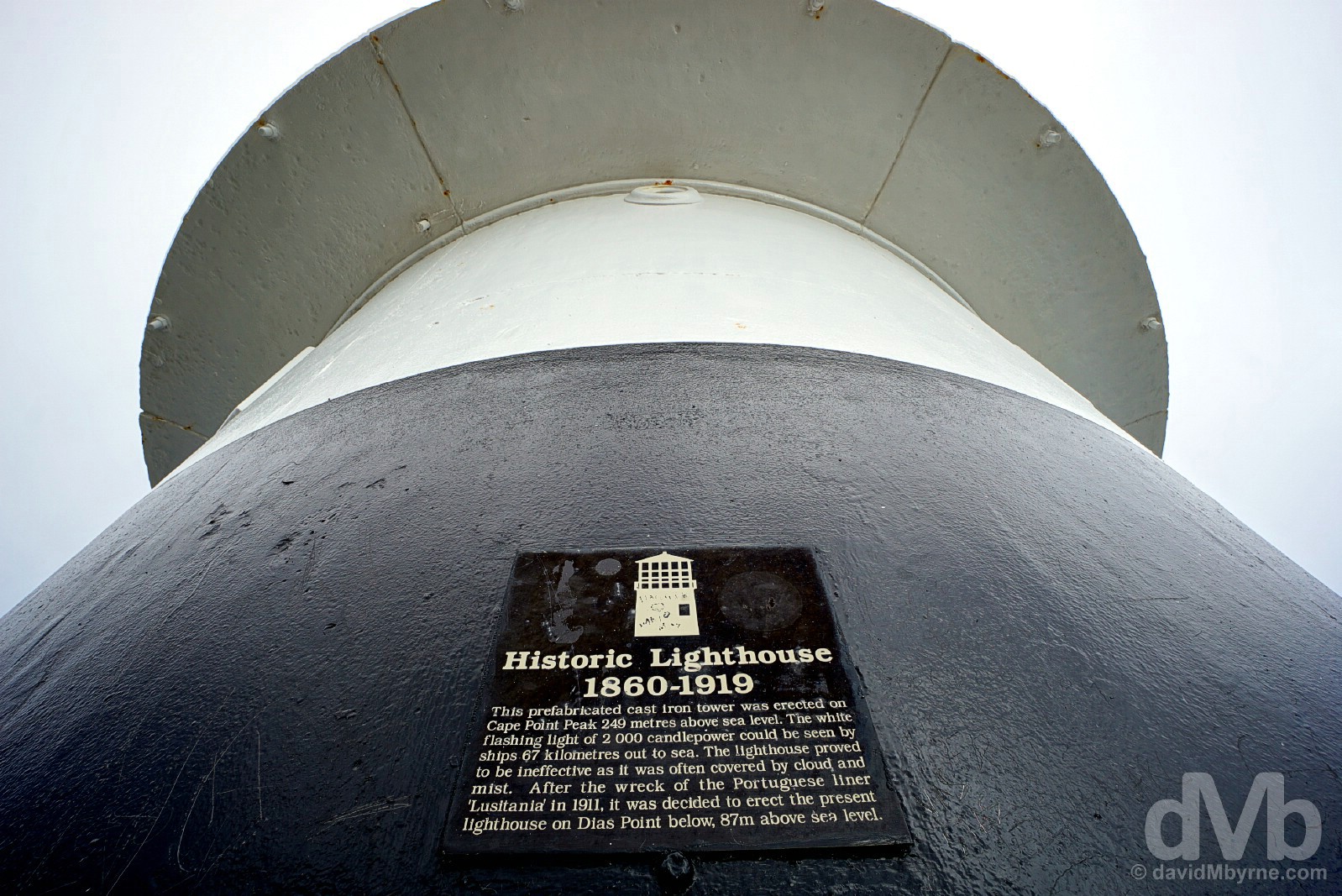
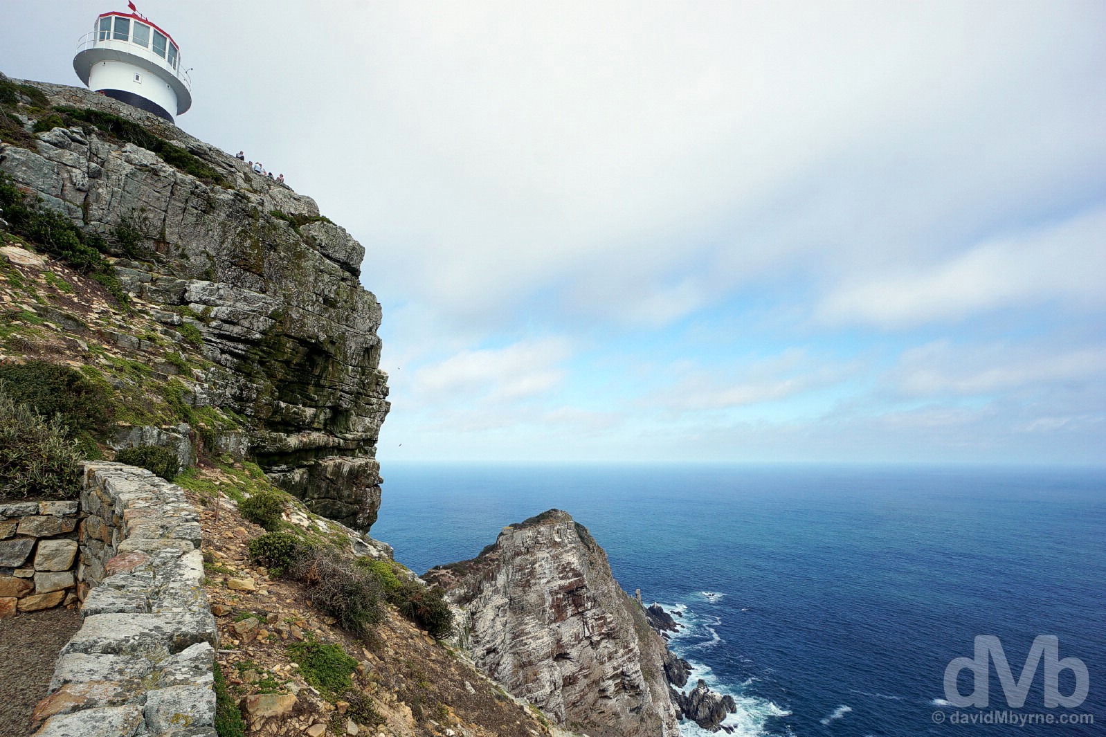
OLD LIGHTHOUSE || Construction of Cape Point’s squat historic first lighthouse, the Old Lighthouse, began in 1850. Completed in 1859 and first lit in May 1860, it stands 249 metres above sea level on the highest point at Cape Point. Low-lying clouds, which obscured its light for up to 900 hours a year, meant this wasn’t the best place for such a vital maritime aid so a second ‘New’ lighthouse, 87 metres above sea level at Dias Peak, was started in 1913. Completed in 1919 & electrified in 1936, this New Lighthouse, pumping out 10 million candlepower in three flashes every 30 seconds to a range of over 60 kilometres, is still the most powerful light on the continent of Africa. And although not perfect it still does a much better job of keeping passing traffic off the rocks as did its predecessor, it now serving the role of being the centralised monitoring point for all the lighthouses dotted along the 2,800-kilometre-long South African coastline. Cape Point, Cape Peninsula. February 17, 2017.
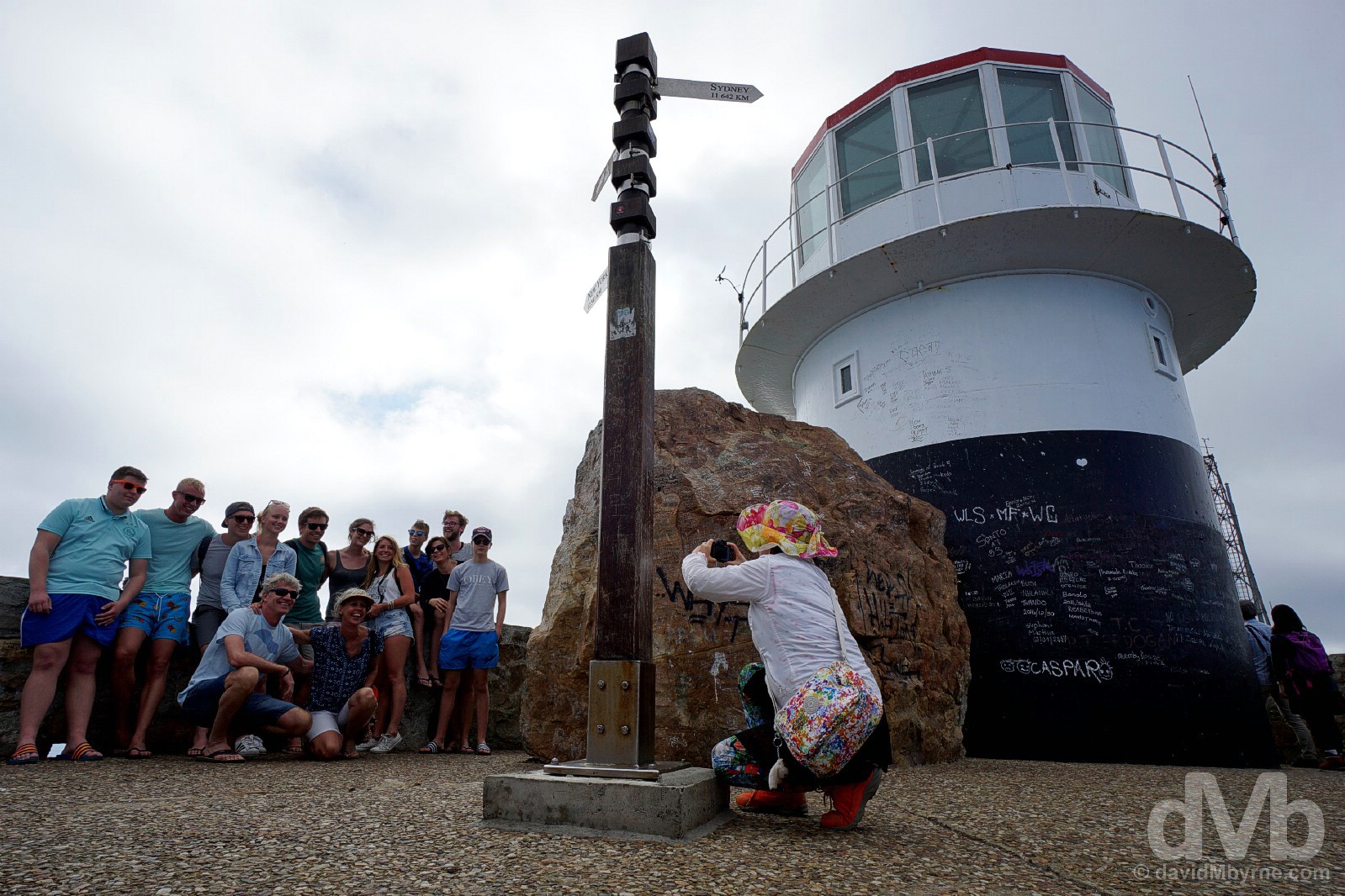
Group shot at the Old Lighthouse at Cape Point, Cape Peninsula. February 17, 2017.
– W Porter, financial secretary of the Cape Colony, July 11, 1840, to the critics who doubted lighthouses served a useful purpose.
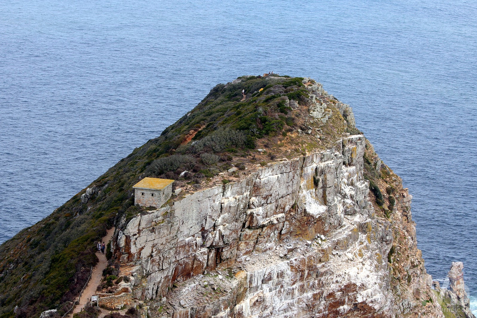
CAPE POINT || Towards The (very) End. The view from the Old Lighthouse of the trail towards the New Lighthouse on Dias Peak (not visible), Cape Point, Cape Peninsula. February 17, 2017.
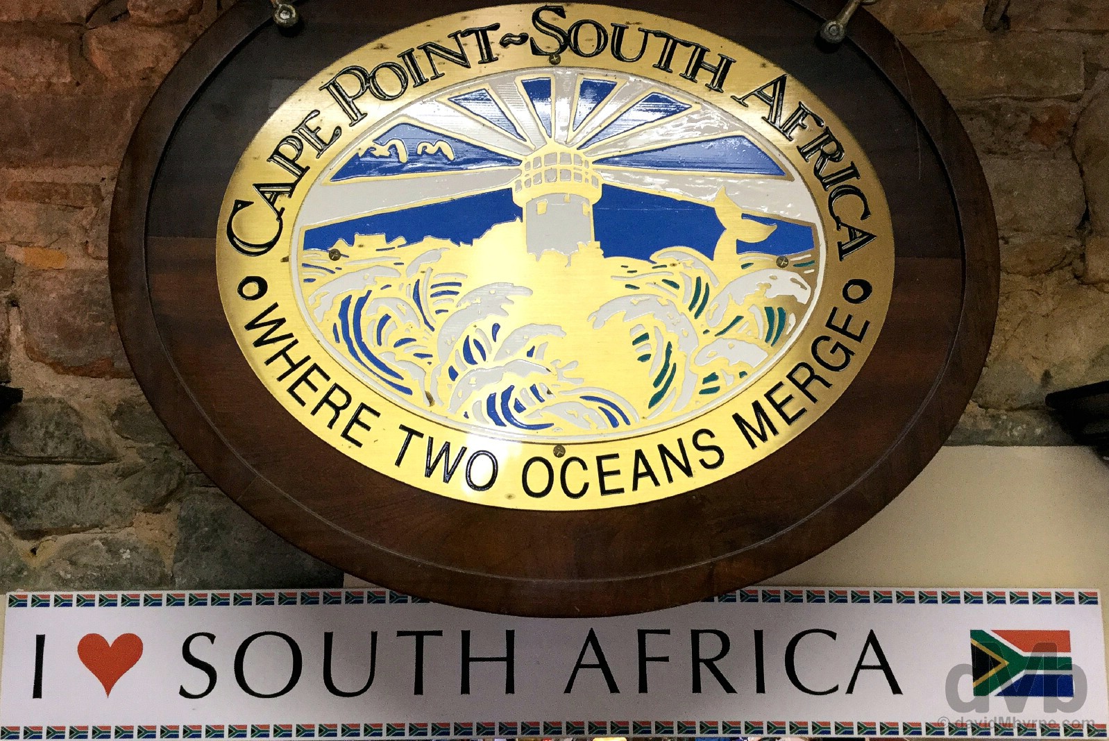
Cape Point. Where Two Oceans Merge. Not quite. It’s something of a misconception that Cape Point is where two of the world’s largest bodies of water, the Atlantic & Indian Oceans, meet. It’s not. That officially happens at Cape Agulhas, the most southern point of the African continent some 120 kilometres east of here as the crow flies, twice that via the most direct road route (see Day 7). Here at Cape Point it’s the Atlantic Ocean and the Atlantic Ocean only (although the cold Benguela current of the Atlantic Ocean & the warmer Agulhas current of the Indian Ocean do blend slightly east of here in False Bay, a titbit I’d have thought the gift shop at Cape Point, where they are seemingly happy to peddle falsehoods, would have known). Cape Point, Cape Peninsula. February 17, 2017.
What Goes Down Must Come Up
Nearly 1 million people visit Cape Point each year and even down here there’s infrastructure to meet the demand, everything from walking trails to gift shops to restaurants – there’s even a 585-metre-long funicular providing access to the lofty heights of the Old Lighthouse for those needing it (who mentioned the Chinese?). But regardless of how you spend your time down here, eventually you’ll have to retrace your steps and head back whence you came. Me? I headed north via the False Bay Seaboard on the east of the peninsula. I may have reached the end down here at Cape Point but this day wasn’t done yet. It wasn’t even close.
Switching sides. On the boardwalks to the African Penguin colony at Foxy Beach on the shores of False Bay, Cape Peninsula. February 17, 2017.
Day 3 Road Trip Part II – Northbound – The False Bay Seaboard
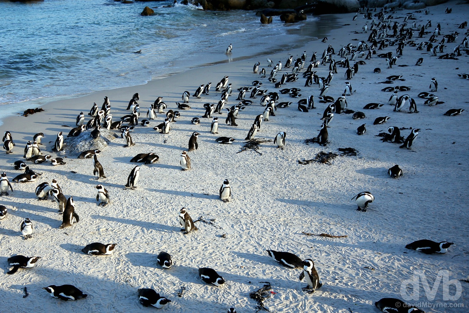
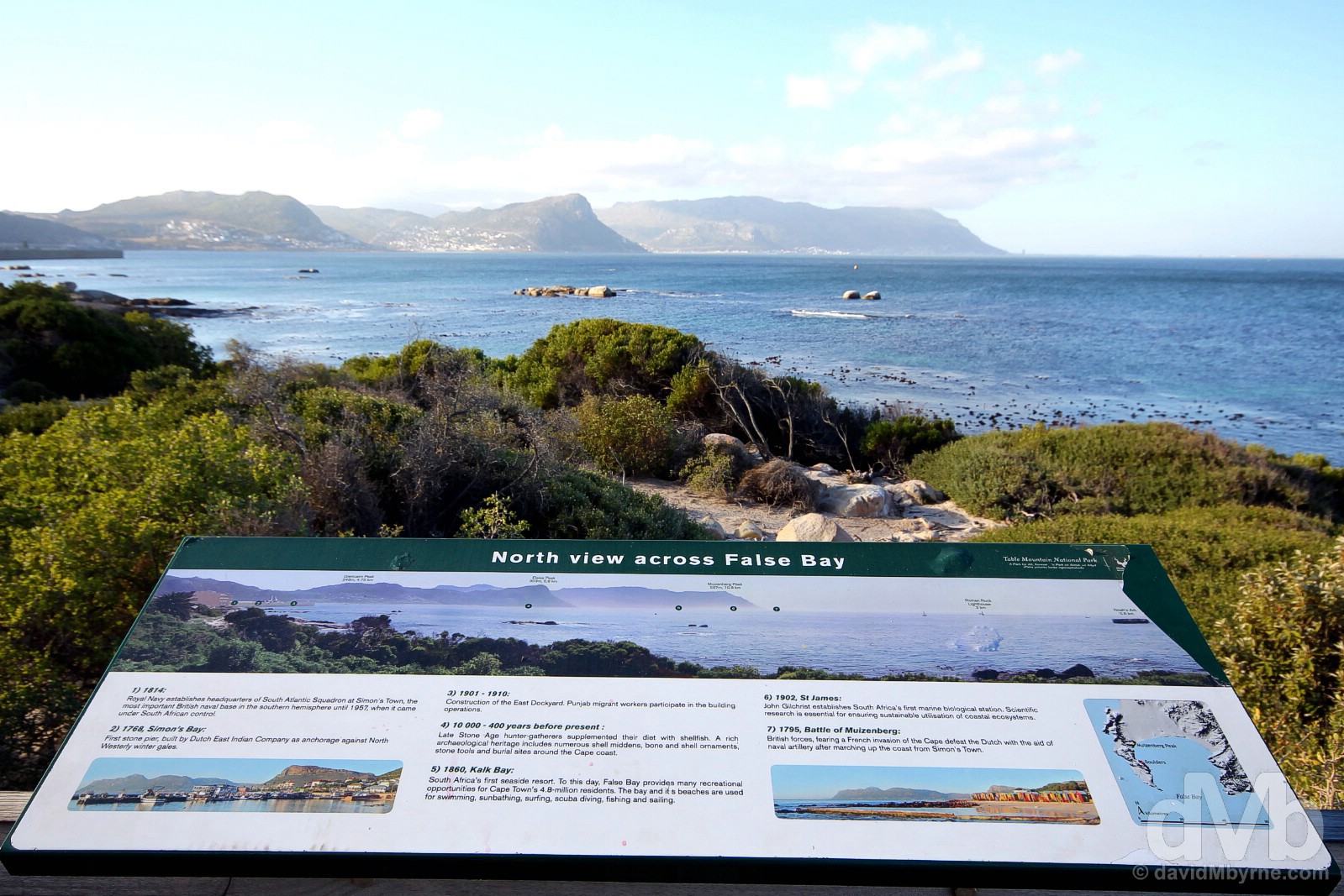
The waters of False Bay on Cape Peninsula’s eastern shore, so named as it fooled sailors of yesteryear into believing the large bay was Table Bay on the Atlantic Seaboard, are warmer than those of the peninsula’s Atlantic-facing western coast. Thus some of Cape Town’s oldest and most popular seaside suburbs are found here in a 17-kilometre-long arc of developments stretching from Simon’s Town in the south to Muizenberg in the north. First up when heading north from Cape Point is historic Simon’s Town. The country’s third-oldest European settlement & home of the South African Navy it may be, but the main attraction in these parts is undoubtedly the African penguins that reside at the penguin reserve on the town’s outskirts.
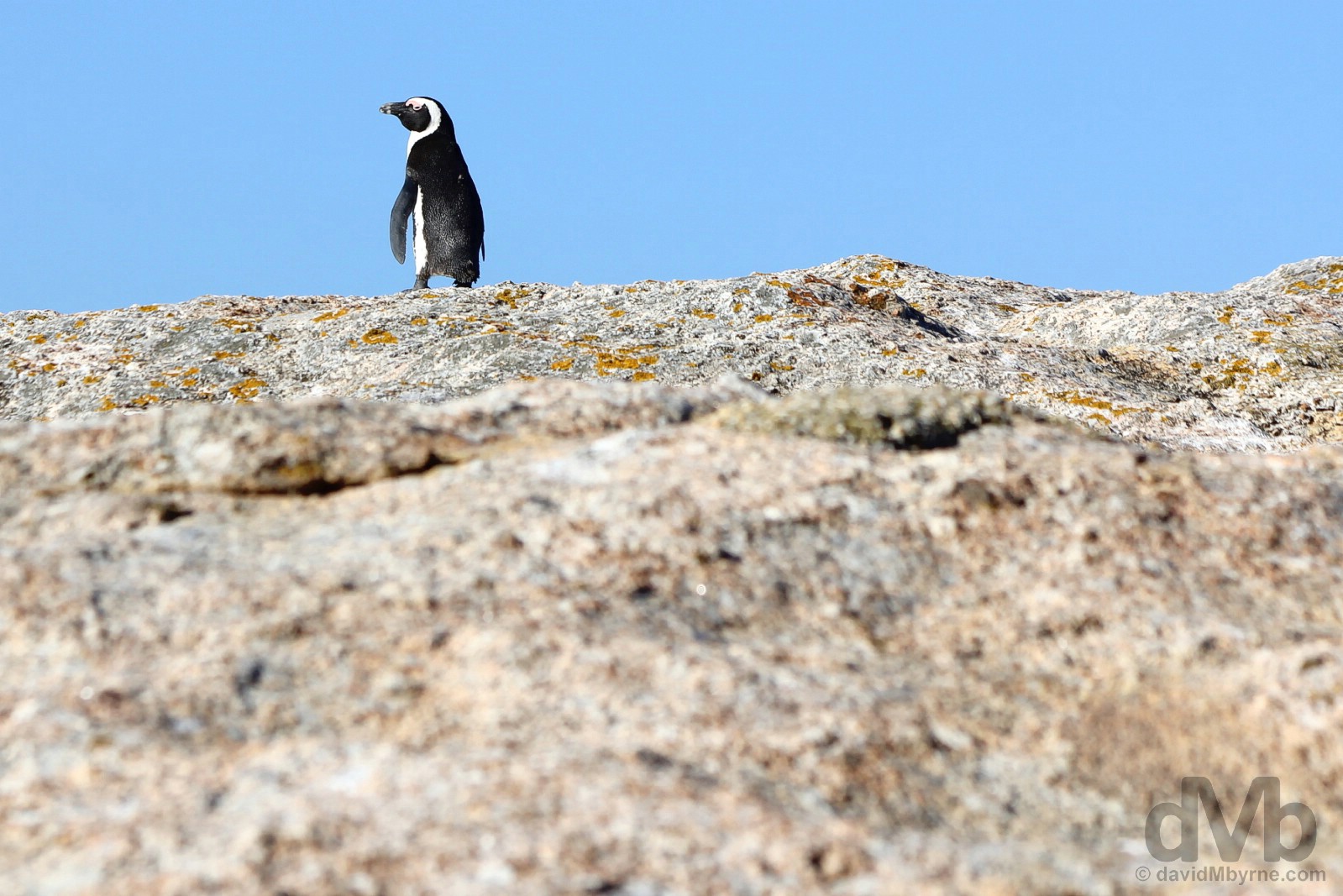
A lone African Penguin on the rocks of Boulders Beach on the shores of False Bay, Cape Peninsula. February 17, 2017.
Boulders (& Foxy) Beach
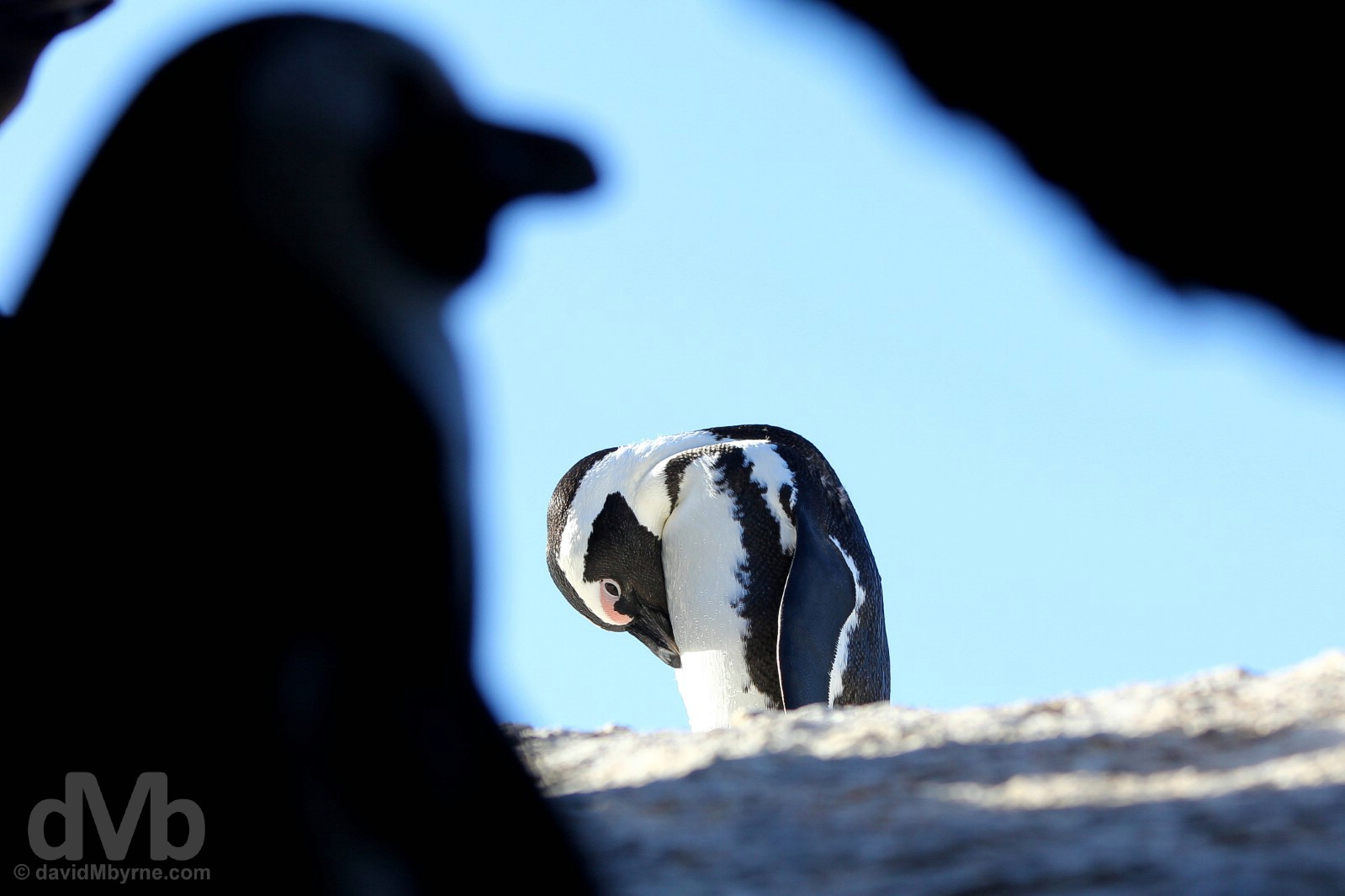
I’d read about Boulders Beach prior to arrival. The sheltered setting, the boardwalks, the 540-million-year-old granite rocks/boulders and yes, of course, the penguins. But having been to Antarctica, I wasn’t too pushed about seeing penguins on a warm beach fronting a residential area of Cape Town. But the uniqueness, and absurdity, of that scenario – penguins on a warm beach in a residential area of Cape Town – is reason enough to appreciate the sight. And appreciate it I did. Yes, and whether I intended it to or not, my visit to Boulders Beach and neighbouring Foxy Beach, both part of Table Mountain National Park’s Marine Protected Area, was all about the little penguins. In hindsight, I guess that was always going to be the case.
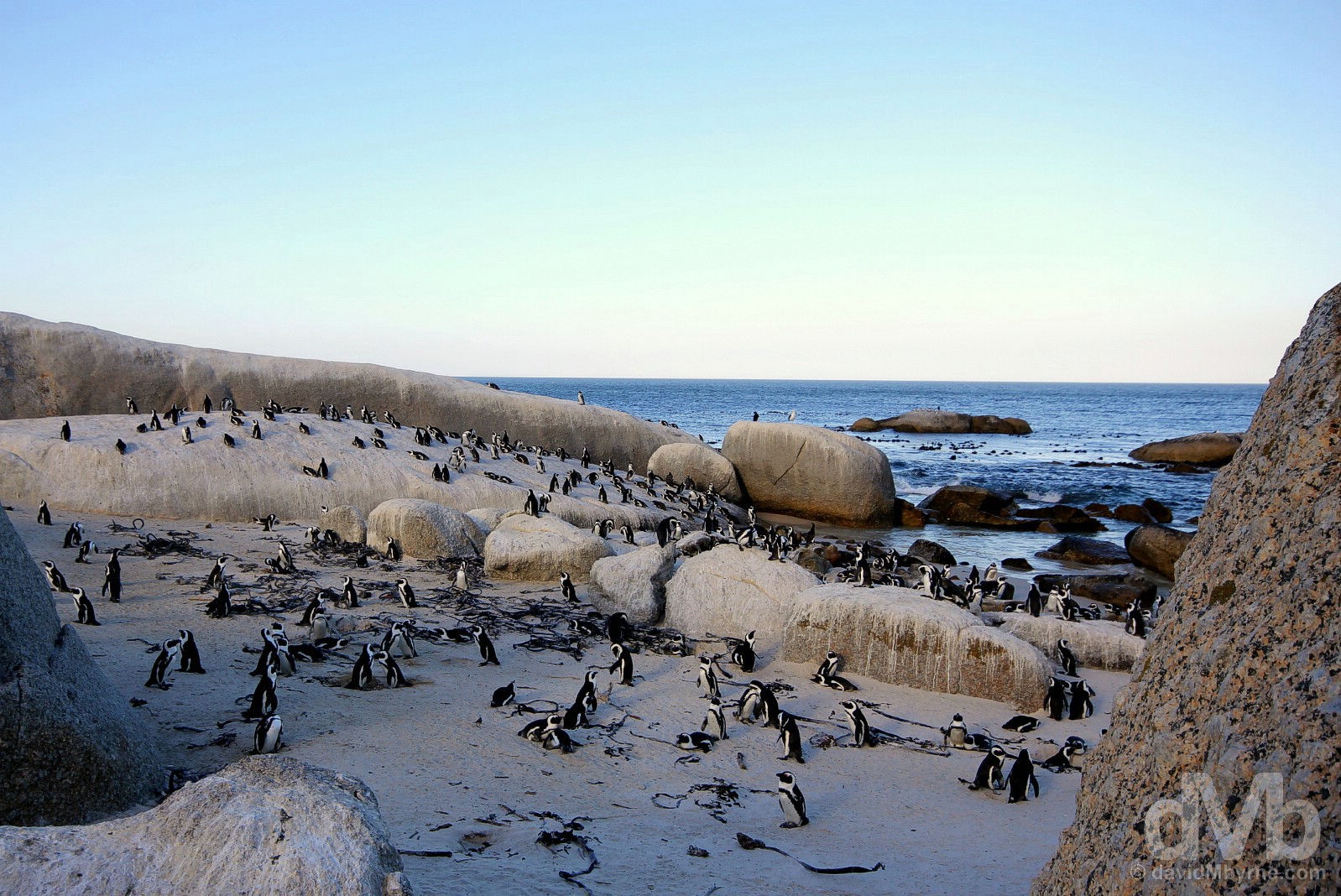
FOXY BEACH || From just 2 breeding pairs in 1982, today the thriving African Penguin colony the resides between Boulders Beach & Foxy Beach – about 600 metres apart and separated by an elevated boardwalk, Willis Walk – number some 2,200 birds, most of which seem quite content hanging out here on Foxy Beach; unlike neighbouring Boulders Beach, Foxy Beach is off-limits to humans with the fenced boardwalks of the seafront Penguin Reserve overlooking the beach as close as one can get to the natives. One of only two mainland penguin colonies in the world (I’ve no idea where the other is), it was a somewhat surreal experience watching penguins cast sunset shadows on a warm sandy beach towards the end of a hot summers day. Foxy Beach on the shores of False Bay, Cape Peninsula. February 17, 2017.
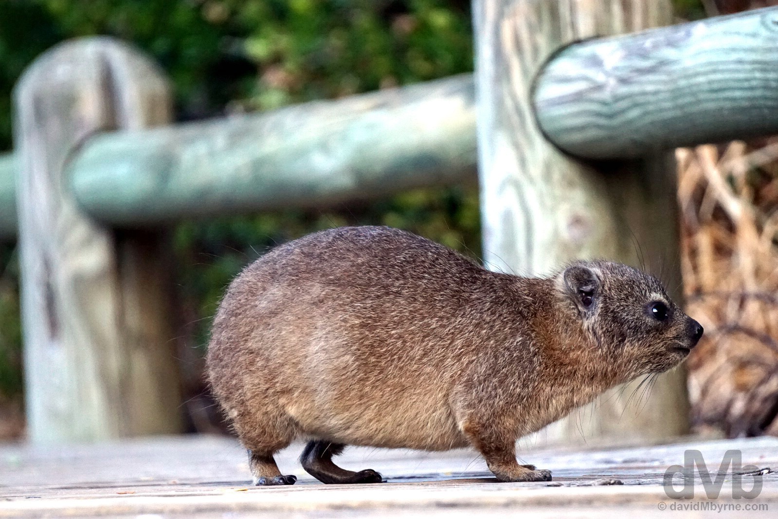
DASSIE || While I’d met penguins before, I’d never before been acquainted with the Rock Hyrax. Also called a Cape hyrax or rock badger, it is affectionately & lovingly known in South Africa as a dassie, a name meaning ‘little badger’ that was bestowed upon them by the first Dutch settlers. A medium-sized terrestrial mammal resembling a guinea pig with short ears and tail, it’s actually the closest living relative of the elephant and is widely distributed having thrived in South Africa in the absence of any real predators. And it was here on the Willis Walk boardwalk connecting Foxy Beach with Boulders Beach where I first encountered them. Willis Walk, Boulders Beach, False Bay, Cape Peninsula. February 17, 2017.
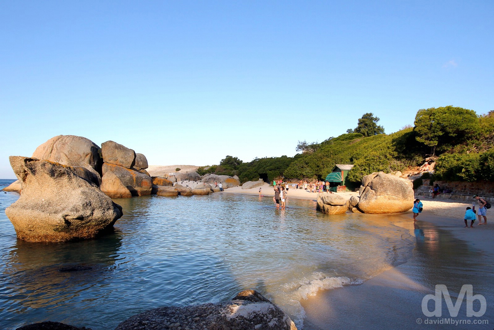
BOULDERS BEACH || Back at Boulders Beach, both a popular recreational beach for locals and something of a penguin highway, the sun was setting on this day through the huge granite boulders from which the secluded beach, one of many coves along this stretch of coastline, takes its name. Boulders Beach, False Bay, Cape Peninsula. February 17, 2017.

African Penguins among the rocks of Boulders Beach on the shores of False Bay, Cape Peninsula. February 17, 2017.
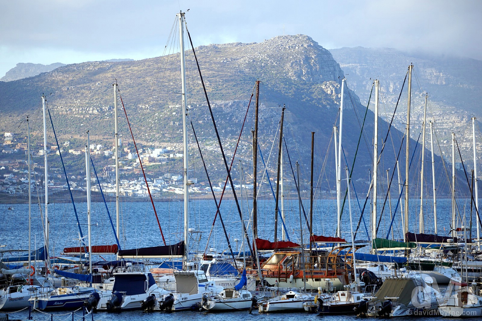
SIMON’S TOWN || The light was fading fast by the time we got to look around Simon’s Town, an historic maritime town and South Africa’s third-oldest European settlement (after Cape Town, founded in 1652, and Stellenbosch (see tomorrow, Day 4), founded in 1679). Simon’s Town was founded as a safe winter harbour by the Dutch way back in 1687 and is still to this day home of the South African Navy, something of a blight on this otherwise pretty stretch of coast. The town’s historic and picturesque streetscape of preserved and restored buildings lining its main drag, St Georges Street, didn’t photograph well in the dampened light, but the last rays of this day falling on the peaks across False Bay, seen here beyond the boats moored in the Simon’s Town marina as seen from the Town Square, was very much photo worthy. Simon’s Town on False Bay, Cape Peninsula. February 17, 2017.
We continued north from Simon’s Town for 17 kilometres passing through Fish Hoek, Kalk Bay, and St James to arrive at Muizenberg. A surfers hangout that was once the country’s most fashionable seaside resort, today Muizenberg is well past its prime and feels a little seedy, notwithstanding its status as the peninsula’s biggest & best beach and as the location for the much-photographed brightly coloured Victorian-style bathing boxes, also found in neighbouring St James. We didn’t even get out of the car in Muizenberg, returning instead to quaint, charming, eclectic, picturesque, whimsical (insert adjective here) Kalk Bay before bringing a close to this busy day with dinner in Cape To Cuba, food fused with ‘Caribbean undertones’ while ‘adding a little Spanish and African flavor’. It’s flavour guys, flavour.
Cape Town & Environs
PICTURE OF THE DAY || DAY 4 || February 18, 2017Image || Among the vines of the Blaauwklippen Vineyards, Stellenbosch.
“Needless to say, wine & wine tourism is big business down here; each of the region’s wine hubs, of which Stellenbosch is the largest, has their own established Wine Route where wineries – sprawling, picturesque estates in glorious surrounds that are heavy on European colonial-era architecture and family-friendly attractions & amenities – can be visited for tastings, cellar tours and any manner of wine-related activities.”
Day 4 || February 18, 2017
Day 4 Overview || THE WINELANDS & STELLENBOSCH – Root 4 Market at the Audacia Wine Estate, Blaauwklippen Vineyards, & Stellenbosch.
It’s the weekend and after the last two days of being a full-on tourist, today it was time to slip down a gear or two. Cue Stellenbosch, with its gorgeous leafy streetscapes, whitewashed Cape Dutch architecture, nearby wine estates, & nightlife, coming to the rescue in a way that I doubt many other good-time-vibe-inducing South African towns could.
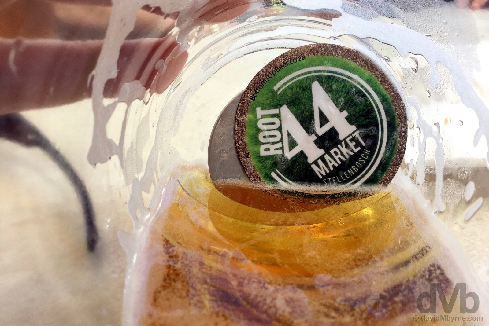
Overdue. So that’s what they meant by ‘do not stick finger in (the bottom of the) cup’. That’s where the take-way souvenir fridge magnet sits. Keeping contents in check, it’s yours for keepies as a reward for finishing your craft brew. Brilliant. Bottoms up at the Root 44 Market on the Audacia Wine Estate on the R44 between Stellenbosch & Somerset West. February 18, 2017.
Stunning Stellies
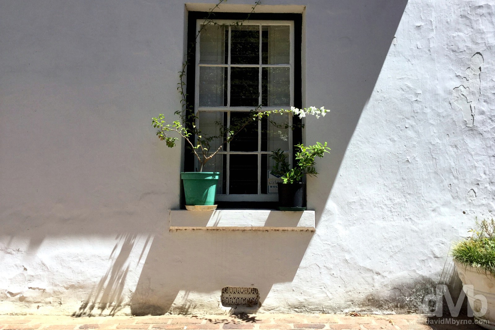
Yes, Stellenbosch, or Stellies as it’s affectionately known, is indeed stunning, and it has been for a long time; founded in 1679, this is South Africa’s second-oldest settlement. Known for its beauty, everything from its centuries-old oak-lined avenues to its immaculate Cape Dutch architecture, this university town, some 50 kilometres east of Cape Town, might just be South Africa’s prettiest.
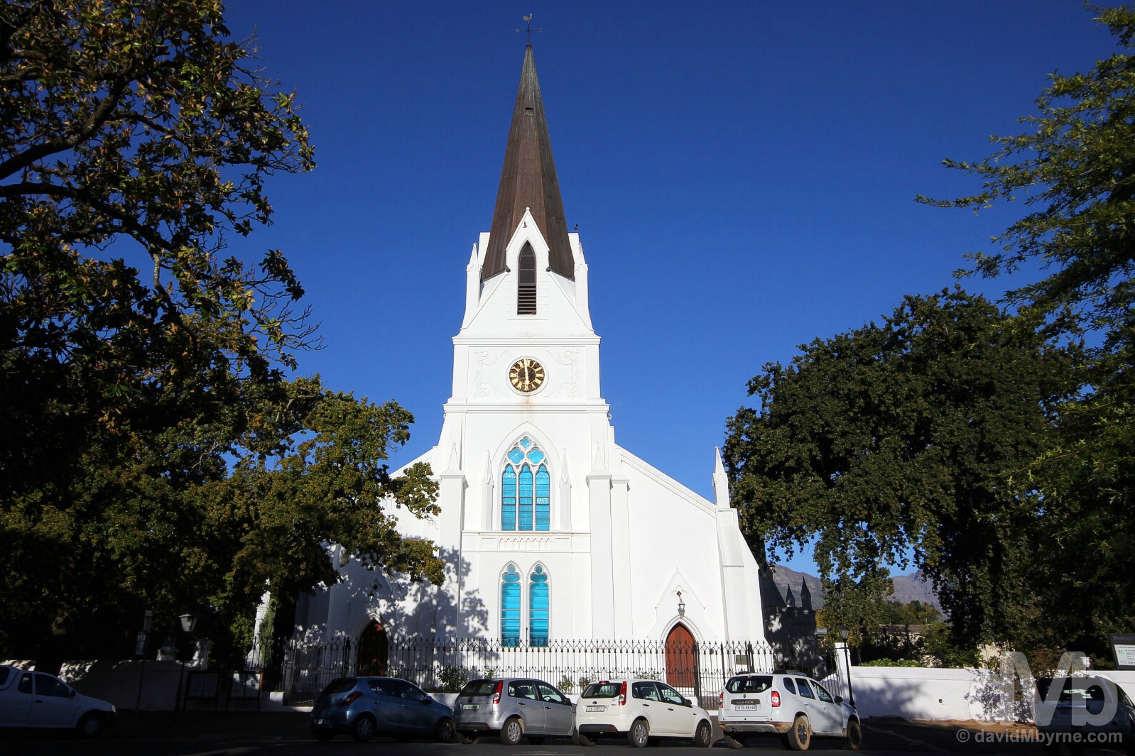
MOEDERKERK (& AFRIKAANS) || I didn’t have nearly as much time snooping around the inviting leafy streets of Stellenbosch as I would have liked, or they deserve, didn’t take as many pictures as I should have. But I couldn’t pass this structure without photographing it, the 1863 pristine white Moederkerk Dutch Reformed church – Moederkerk means ‘Mother Church’ in Afrikaans, a close relative but the somewhat bastardised version of Dutch that is South Africa’s third mother tongue (of, gosh, 11 official languages) and that is spoken as a first language by approximately 15% of the population. Drostdy Road, Stellenbosch. February 18, 2017.
STELLENBOSCH UNIVERSITY || Stellenbosch’s appeal is enhanced even further by its status as a university town, something that adds a youthful vibrancy to the historic mix. Dating to 1863 and set among suitably leafy and picturesque grounds, this is one of the country’s leading universities, a 10-faculty educational institution that’s Afrikanerdom’s most prestigious. Die Rooiplein (Red Square), Stellenbosch University, Stellenbosch. February 18, 2017.
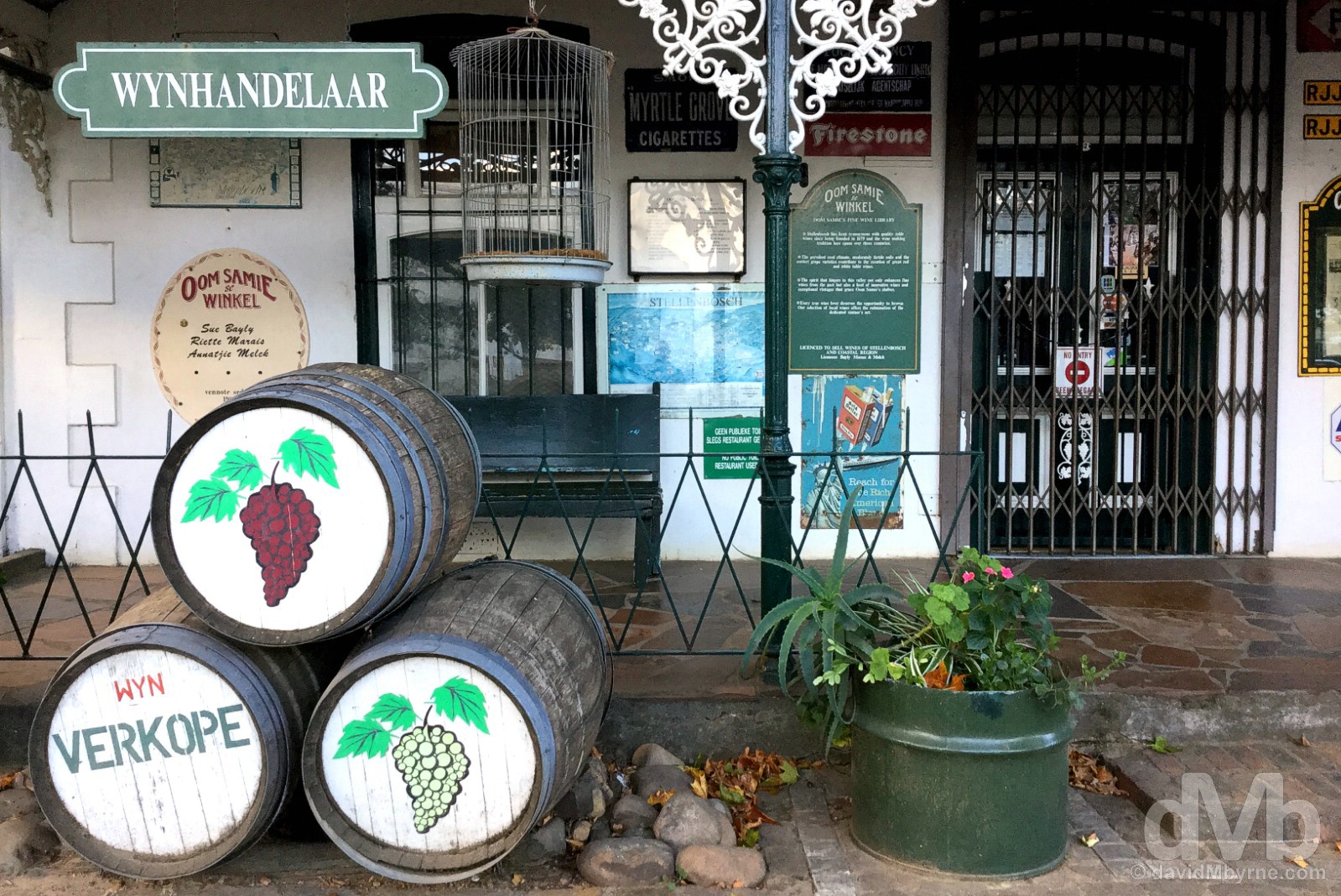
DORP STREET || Dorp Street is Stellenbosch’s best-preserved historic axis, a photogenic ensemble of preserved buildings, some of which even have decorative Victorian-era features adorning older Cape Dutch facades, such as this Dorp Street wine shop (Wynhandelaar is ‘Vintner’ in Afrikaans), of which there are many in Stellenbosch. This is wine country after all. Oom Samie se Winkel, Dorp Street, Stellenbosch. February 18, 2017.
– Ernie Els, 4-time Major-winning professional golfer & Stellenbosch winery owner
The Western Cape Winelands & Wineries
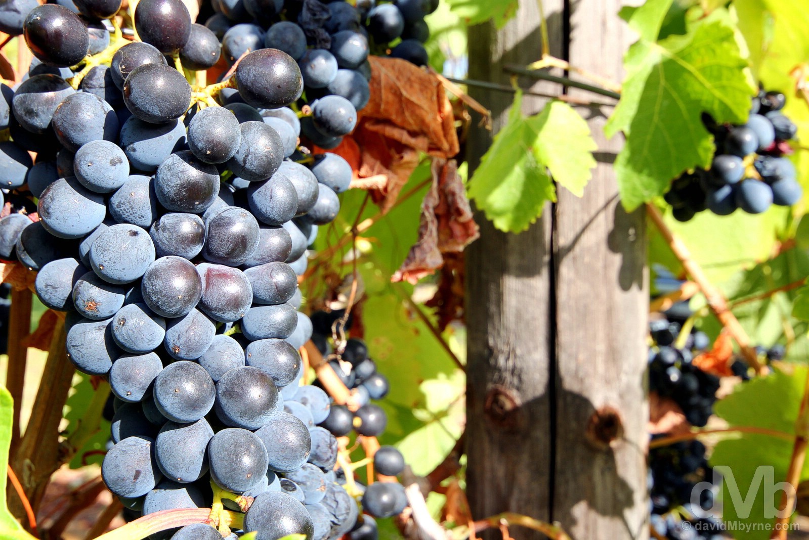
As if Stellenbosch hasn’t alrealy got enough going for it, the town also sits in the heart of the famed Western Cape Winelands; grapes were first planted in the mineral-rich soil of the fertile valleys surrounding the town in the 1680s and today the Stellenbosch region is home to over 200 wine and grape producers, the most of any region in South Africa, one of the world’s Top 10 wine producers by volume (the country also produces the world’s largest volume of Brandy, made by distilling wine or fermented fruit juice).
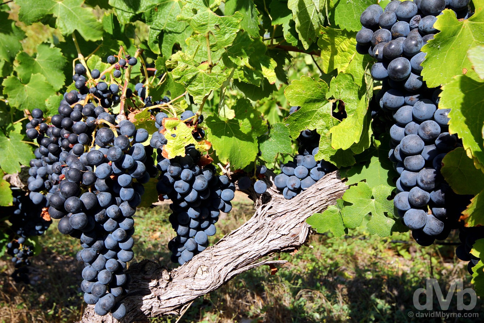
Among the vines of the Blaauwklippen Vineyards, Stellenbosch. February 18, 2017.
The Wine Routes
Needless to say, wine & wine tourism is big business down here; each of the region’s wine hubs, of which Stellenbosch is the largest, has their own established Wine Route where wineries – sprawling, picturesque estates in glorious surrounds that are heavy on European colonial-era architecture and family-friendly attractions & amenities – can be visited for tastings, cellar tours and any manner of wine-related activities. We have Day 6 set aside for some wine tasting but today started with some wine-free wining & dining at the Root 44 Market in the grounds of the 32-hectare, red-wine-only Audacia Wine Estate by the R44 on the fringes of Stellenbosch, one of the wineries firmly established on the Stellenbosch Wine Route.
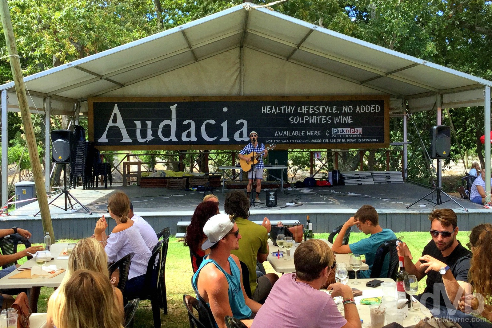
AUDACIA WINE ESTATE || Billing itself as ‘The Red Wine Boutique Winery’, Audacia has, since 2012, been enticing the crowds to its popular all-weather weekend ROOT 44 Market; the winery itself has been here since 1930. Located in the grounds of the estate’s farm, it’s a relaxed craft stall extravaganza in inviting, family-friendly surrounds where beautiful people enjoy ‘the Cape’s finest gourmet food and refreshments’ while being entertained in the process. It’s all very la belle vie and you could easily while away an afternoon here forgetting all that ails you, which I guess is the whole point. Audacia Wine Estate, Stellenbosch. February 18, 2017.

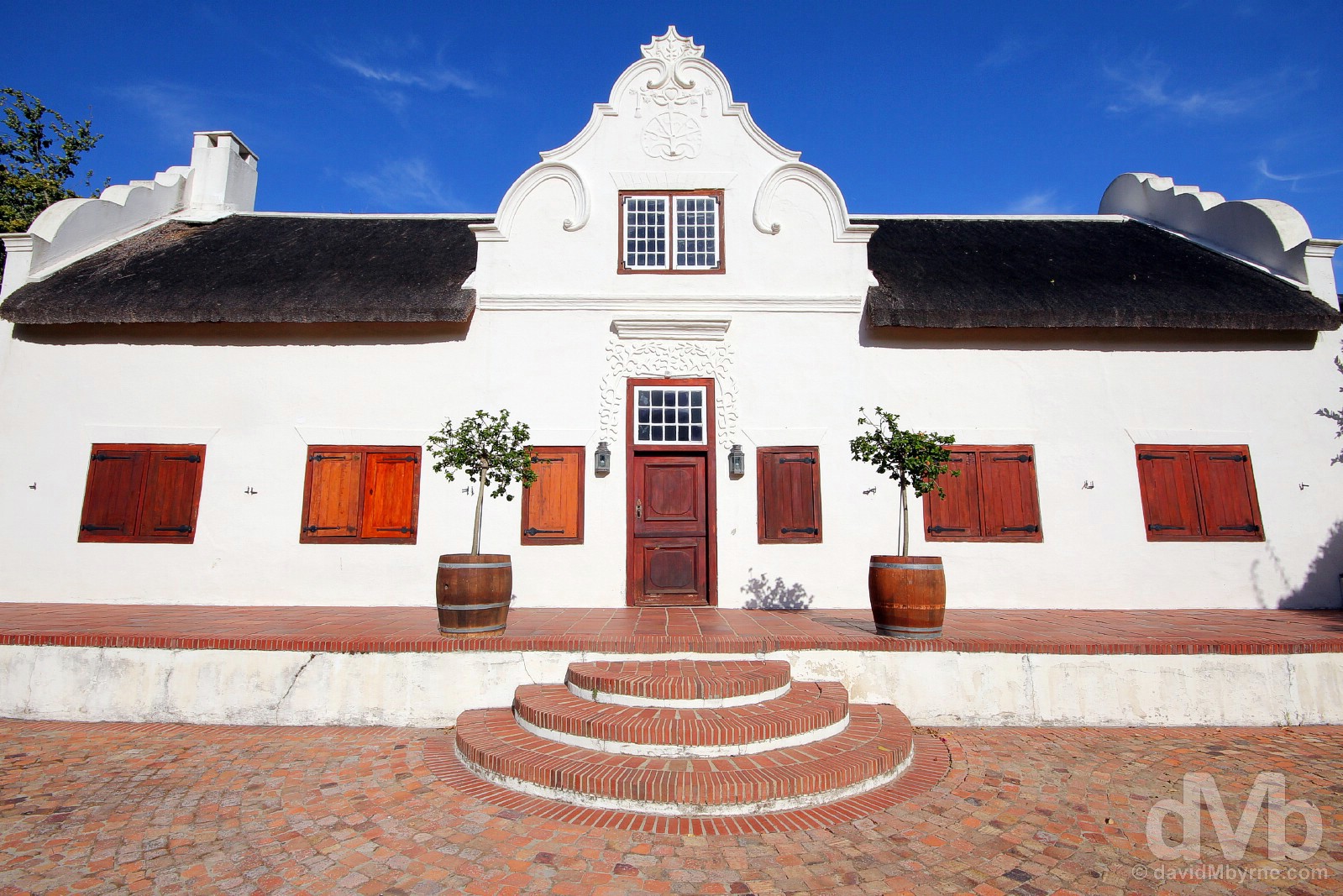
BLAAUWKLIPPEN VINEYARDS || Growing, harvesting, & fermenting grapes since as far back as the late 1680s, Blaauwklippen Vineyards on the edge of Stellenbosch, another estate firmly established on the Stellenbosch Wine Route since its inception as a tourist attraction in 1971, also has a family market, tasting rooms, and a bistro. I poked around the vines of a while which looked great in the late afternoon light. Stellenbosch. February 18, 2017.

CAPE DUTCH ARCHITECTURE || The Blaauwklippen Vineyards also boasts some rather striking Cape Dutch architecture, an attraction at many of the Cape wineries (that and the Victorian architectural styles subsequently introduced by the British once they had rid the Cape of the Dutch). Some estates do dazzling architecture better than others and you would need a lot of time moving from estate to estate in a bid to sample all the best of the architectural delights on offer – if your three passions in life just happen to be wine, photography & architecture, then I fear you may never leave the Western Cape Winelands. As an introduction to the gleaming architectural gems on show, this glorious & unmistakably Cape Dutch building in the grounds of the Blaauwklippen Vineyards did just fine. Just fine indeed. Prevalent in the Western Cape, the distinctive Cape Dutch architectural style – typically squat, H-shaped buildings with grand & ornately rounded gables, whitewashed walls and thatched roofs – was prominent in the early, 17th-century days of the Cape Colony, the name obviously derived from the fact that the early Cape settlers were Dutch. Stellenbosch. February 18, 2017.
As a university town, Stellenbosch is a good place to spend a night on the town, especially a summer Saturday night. And that’s how we brought an end to this particular day – out on the town. I just wish I knew what everyone was saying. That Afrikaans again. As if things weren’t blurry enough.
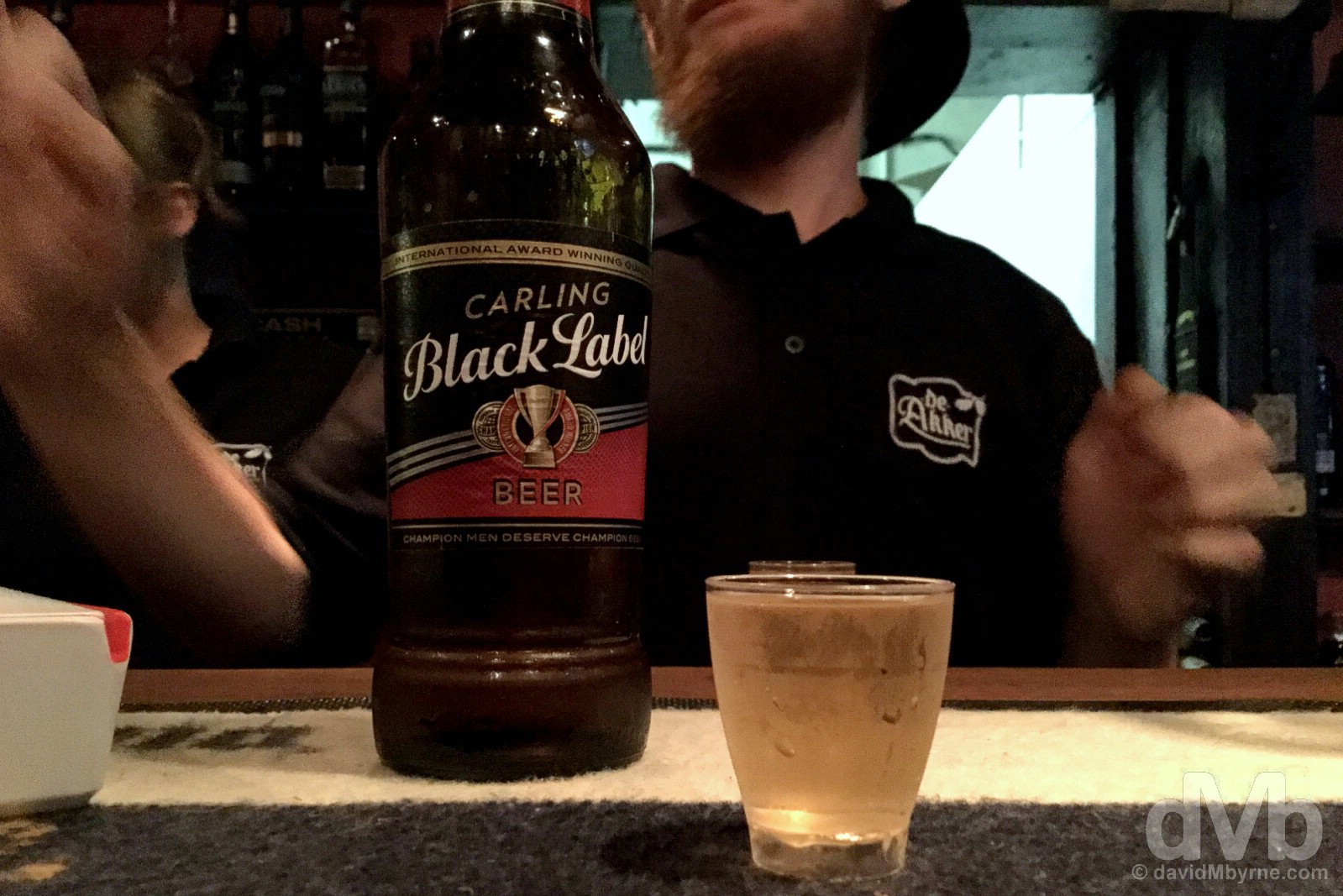
Nightcaps. Rounding off day 4, early into day 5. Beer & tequila, but no wine, in De Akker. While it may be a top ten winemaking country by volume, beers still seems to rule the roost down here, Carling Black Label one of the more popular brews – I’m finding it surprisingly hard to get a (non-lite) Castle Lager, South Africa’s signature beer, on draught. Dorp Street, Stellenbosch. February 18, 2017.
Cape Town & Environs
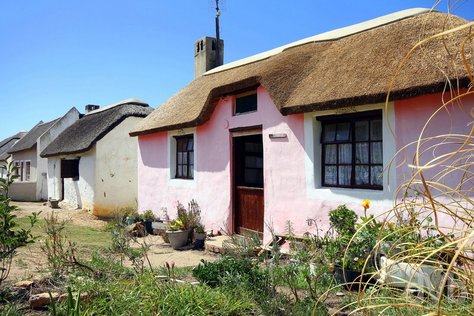
PICTURE OF THE DAY || DAY 5 || February 19, 2017Image || Cape Dutch cottage on Herte Road, Stellenbosch.
“Stunning Stellies… Stellenbosch… is indeed stunning, and it has been for a long time; founded in 1679, this is South Africa’s second-oldest settlement. Known for its beauty, everything from its centuries-old oak-lined avenues to its immaculate Cape Dutch architecture, this university town, some 50 kilometres east of Cape Town, might just be South Africa’s prettiest.”
Day 5 || February 19, 2017
Day 5 Overview || KIRSTENBOSCH – Summer Sunset Concert in Kirstenbosch National Botanical Garden.
I can think of worse places to wake if one must wake to the adverse effects of a late night. Stellenbosch looked even better this morning than it did the previous evening. I’ve said it before and I’ll say it again – what a beautiful place this is.
We might just have picked one of the most picturesque streets in Stellenbosch on which to park. Herte Road, tree-lined and with a picturesque terrace of whitewashed Cape Dutch cottages. Beautiful, even with a hangover. February 19, 2017.

Cape Dutch cottages on Herte Road, Stellenbosch. February 19, 2017.
Goldfish In The Garden
Sunday was always going to be a go-slow day of rest (Amen), but revelling last night like the university student I haven’t been for many a year ensured that to be the case. About all that was on the itinerary for today was a concert in Cape Town’s UNESCO-listed Kirstenbosch National Botanical Garden.
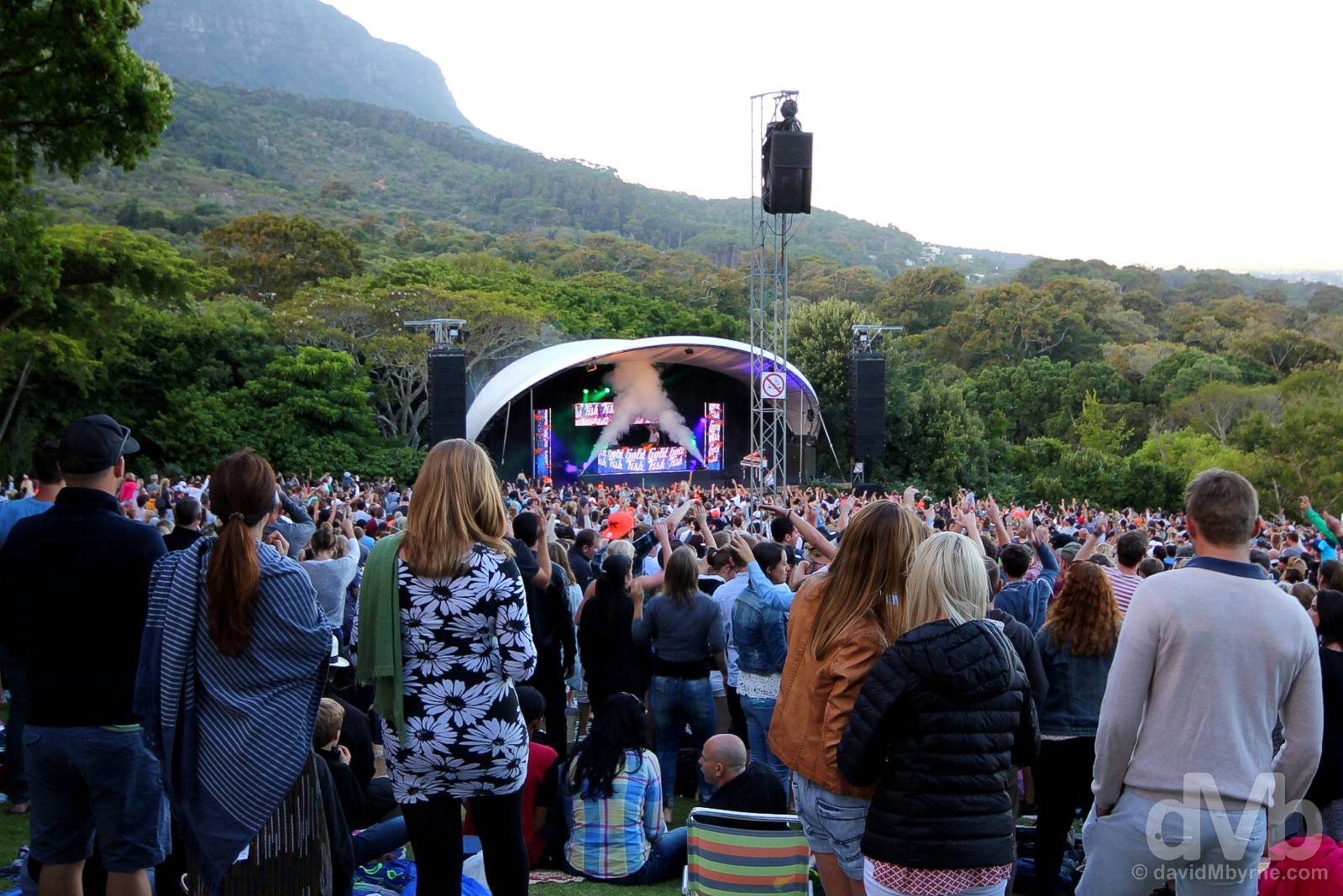
KIRSTENBOSCH NATIONAL BOTANICAL GARDEN || Established in 1913 & in a breathtaking setting cozying up the rugged eastern slopes of Cape Town’s Table Mountain, Kirstenbosch National Botanical Gardens are both the oldest and, at 36 hectares, the largest such gardens in South Africa. Boasting over 22,000 indigenous plants, this floral paradise was the world’s very first botanical gardens to be granted World Heritage status when, in 2004, UNESCO deemed the Cape Floristic Region of Table Mountain National Park worthy of the designation. A great place to walk (especially via the curved and elevated steel and timber Centenary Tree Canopy Walkway), picnic, or just lounge, in the summer Kirstenbosch is also the location for a series of open-air concerts, the Kirstenbosch Summer Sunset Concerts. Headlining tonight was homegrown electronica and dance act Goldfish, what we saw of their 90-minute set (not a lot, long story) going down a storm with the sell-out crowd. Kirstenbosch National Botanical Garden, Cape Town. February 19, 2017.
CapeTownBig7.co.za – Kirstenbosch, one of Cape Town’s Big 7, the best of what the city has to offer (#CTBig7)
Cape Town & Environs
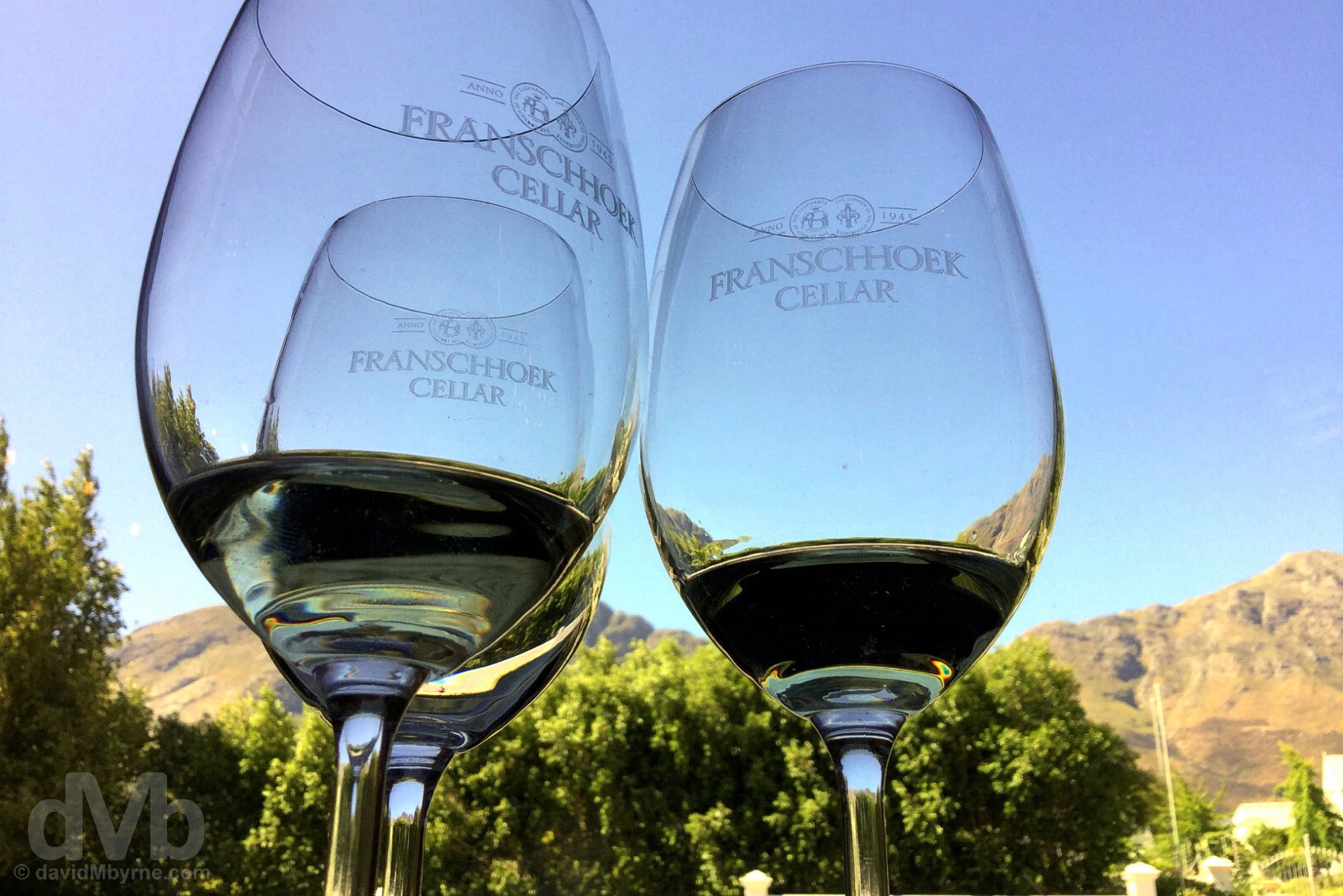
PICTURE OF THE DAY || DAY 6 || February 20, 2017Image || Wine tasting at the Franschhoek Cellar, Franschhoek.
“At Franschhoek’s Franschhoek Cellar, dating to 1945, is where we did some wine tasting, when even wine novices turn into wine snob wannabes by sampling wines in a bid to discern the advertised expressions, aromas, undertones, balance, and finish of various vintages.”
Day 6 || February 20, 2017
Day 6 Overview || THE WINELANDS & CLARENCE DRIVE – Franschhoek, Babylonstoren, Clarence Drive, Betty’s Bay, & The Coastal R44 & R43 to Hermanus.
Certain desirable elements of the last few days, namely the wildlife & epic coastal scenery of Day 3 and the architecture & wonderful wine estates of Day 4, combined to concoct today, Day 6. Today was the first day of a mini 2-day road trip, a day on which there was no escaping beauty; it was everywhere, both on the road and off it, but especially by the side of it.
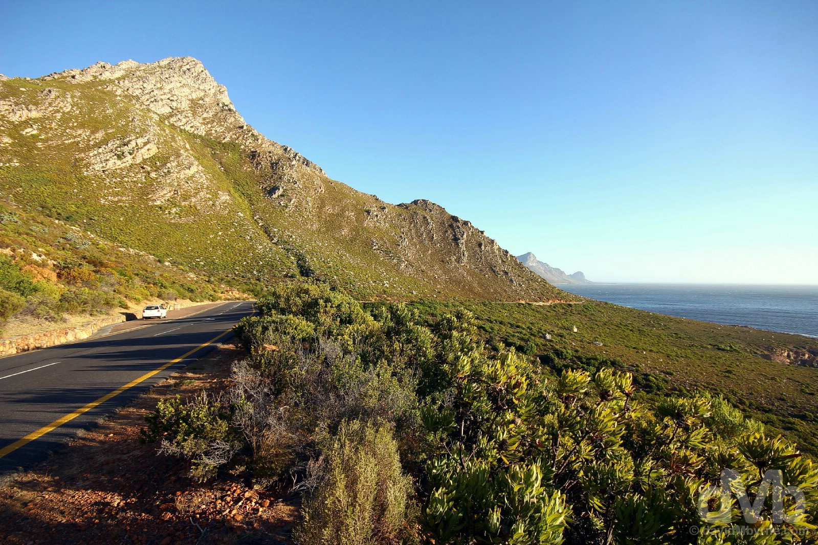
Coastal Beauty. Scenery off the Clarence Drive portion of the coastal-hugging R44 between Gordon’s Bay and Rooi-Els, eastern False Bay. February 20, 2017.
Fabulous Franschhoek
The day 6 beauty started in earnest in Franschhoek, the smallest of the region’s established wine centres. Small it may be but Franschhoek’s setting, at the head of a valley and with mountains on three sides, is one of the region’s prettiest, and that, Ladies & gentlemen, is making a statement.
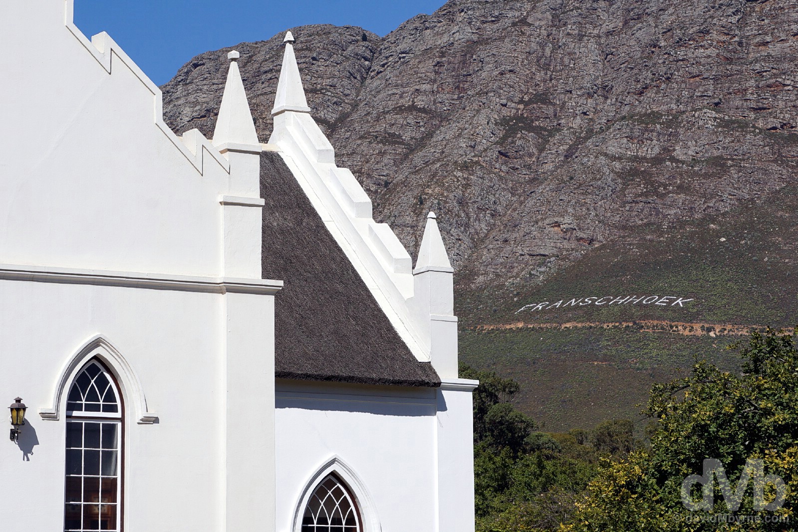
Architectural & Geographical Beauty. A portion of the 1847 Dutch Reform Church in Franschhoek. February 20, 2017.
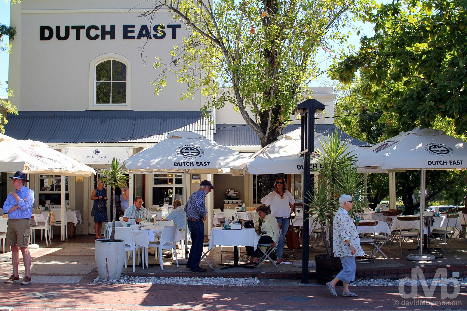
Fine Wining & Dining Beauty. First settled in the 1680s by French refugees granted land by the Dutch, Franschhoek still today has more of a Gallic flare than anywhere else in the Cape; some of the region’s wine estates still have their original French names, and the French influence means the fine wine & dining synonymous with the Winelands is seemingly a tad finer here, a centre of culinary excellence, than elsewhere. Oh la la. The Dutch East Craft Butchery & Restaurant, Huguenot Street. February 20, 2017.
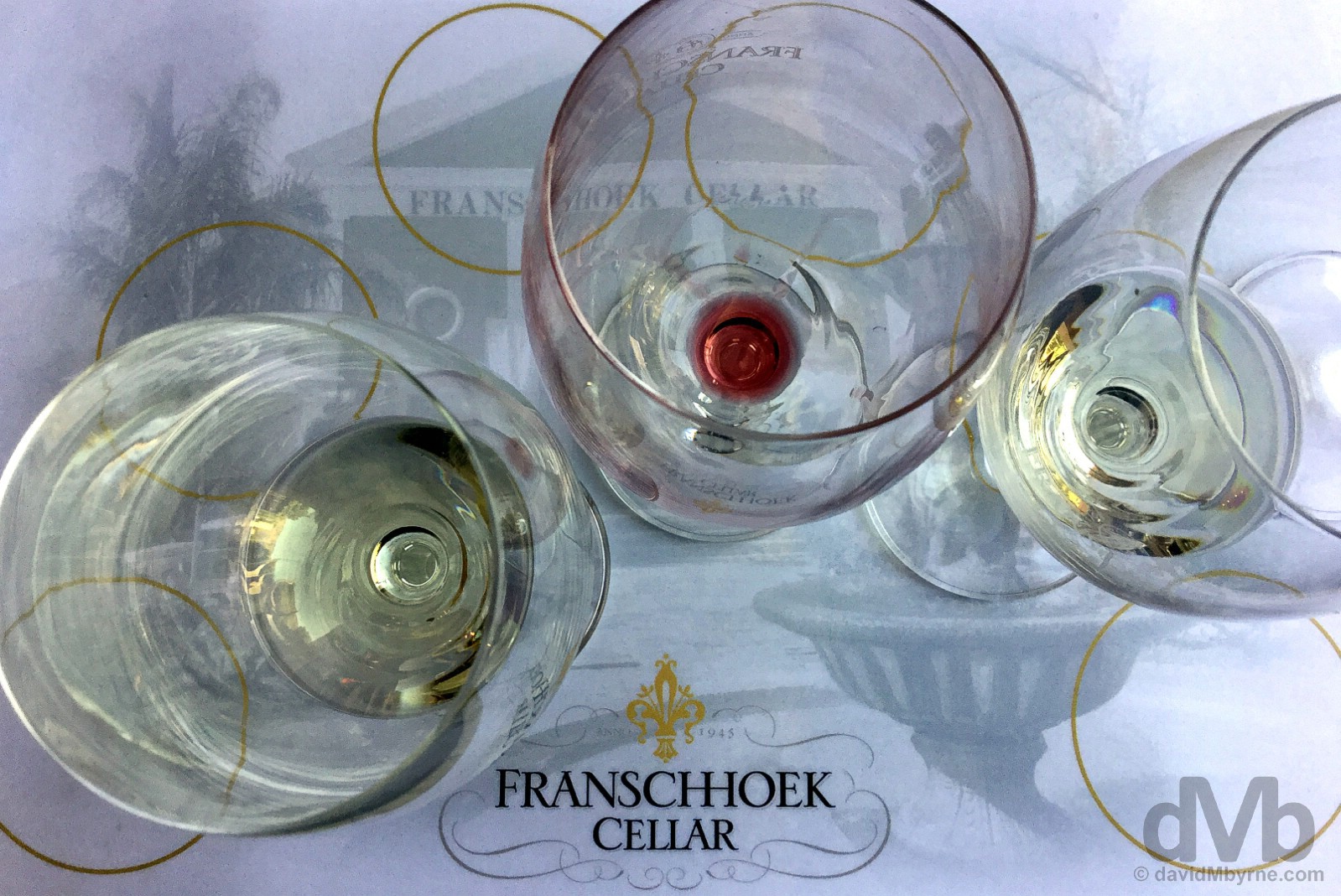
WINE TASTING || At Franschhoek’s Franschhoek Cellar, dating to 1945, is where we did some wine tasting, when even wine novices turn into wine snob wannabes by sampling wines in a bid to discern the advertised expressions, aromas, undertones, balance, and finish of various vintages. Regardless of whether or not you can tell a Sauvignon blanc from a Chardonnay or a Cabernet Sauvignon from a Pinotage, South Africa’s signature variety of grape that was first bred in Stellenbosch region in the mid-1920s, wine tasting is a lot of fun, not to mention an integral part of the Western Cape Winelands experience. Franschhoek Cellar, Franschhoek. February 20, 2017.
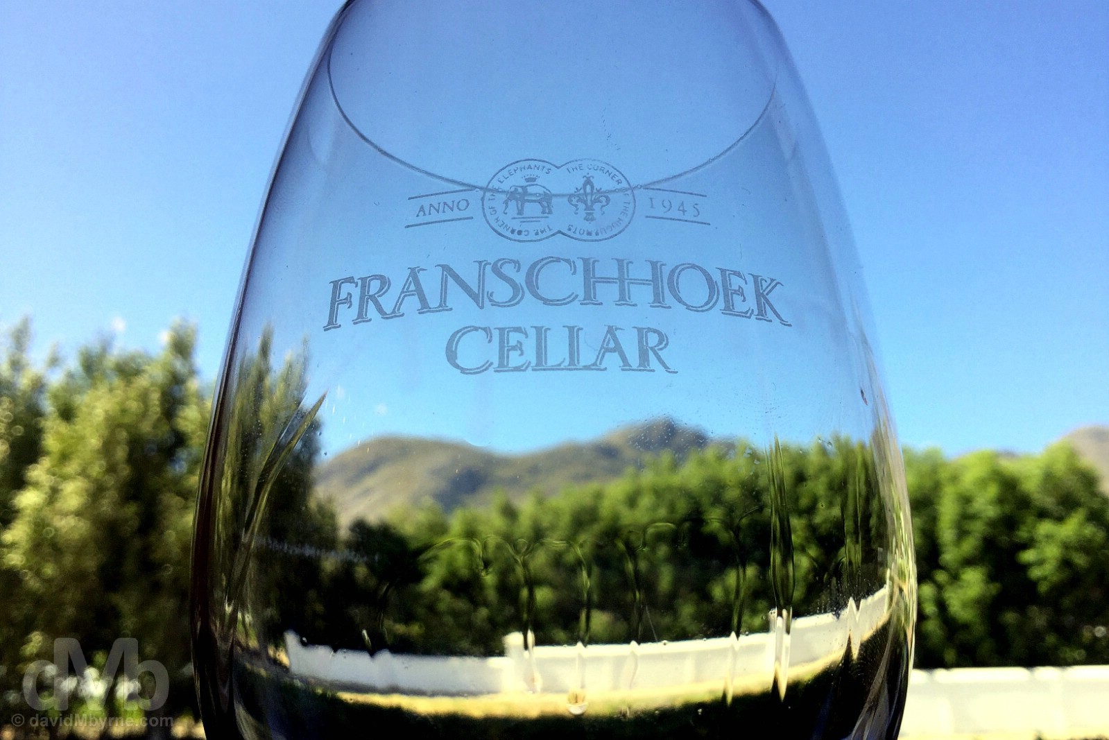
Wine Tasting Beauty. Examining the ‘legs’ while wine tasting at the Franschhoek Cellar, Franschhoek. February 20, 2017.
A 20-kilometre drive from Franschhoek brought us to Babylonstoren on the outskirts of Paarl, another regional wine centre with its very own Wine Route. While primarily a winery like all the others – it has 178 acres of vines producing 13 different grape varieties – there’s a lot more strings to the Babylonstoren bow than initially meets the eye, which I assume is why it’s as popular as it is.
Pottery Beauty. Babylonstoren. February 20, 2017.
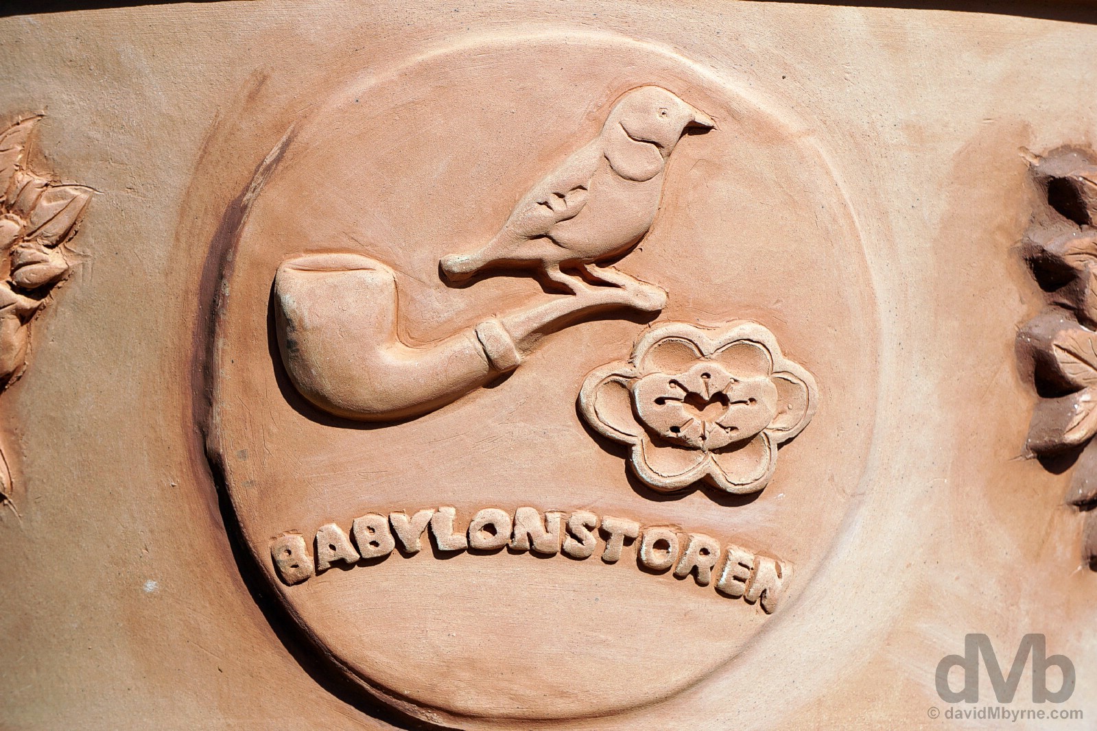
Babylonstoren
Dating to 1692, Babylonstoren is one of the region’s oldest Cape Dutch estates. Way more than just a vineyard, the estate boasts a contemporary 5-star Farm Hotel & Spa, 2 restaurants, & a Farmhouse cum Farm Shop. In fact, Babylonstoren seems more farm less vineyard, especially when exploring the estate’s extensive gardens where you won’t find a grape, be it white or red, for love nor money.
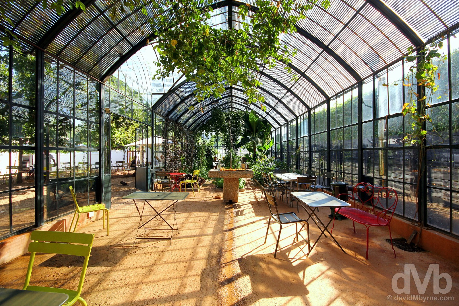
Glasshouse Beauty. The picturesque glasshouse among the gardens at Babylonstoren. February 20, 2017.
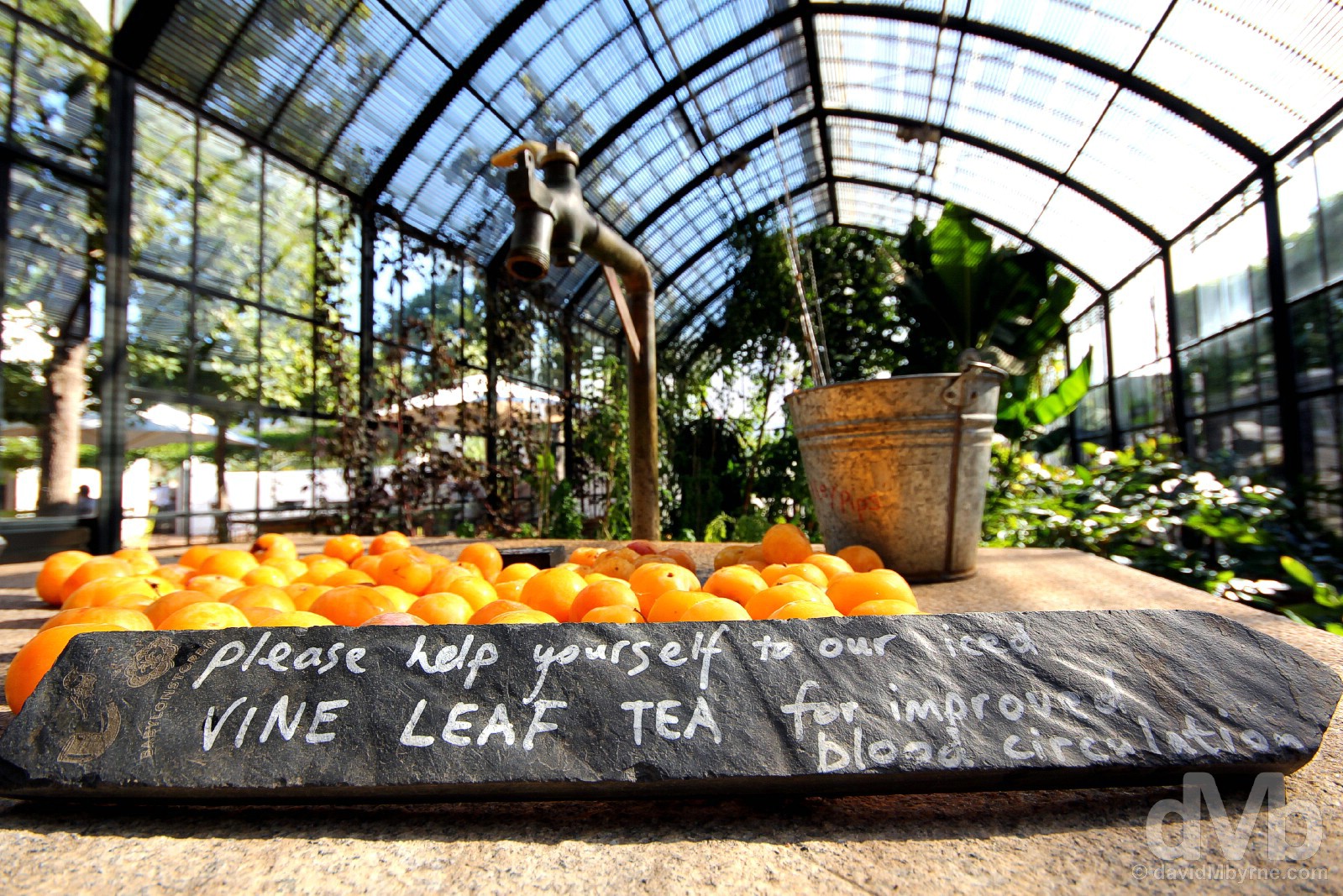
Wellbeing Beauty. A gardeners Shangri-la, the Babylonstoren gardens are dotted with fragrant lawns & water features adorned with Cape Dutch-inspired mosaics. Covering 8 acres alone, they are divided into 15 explorable sections of, among other things that grow, subtropical fruit, vegetables, berries, nuts, olives, and indigenous plants. There’s even a prickly pear maze and resident ducks, chickens, and pollinating bees on hand for the enjoyment of the little ones. Covered walkways means there’s also plenty of idyllic foliage dangling here & there; it’s easy to tell that the gardens took their inspiration from the mythical Hanging Gardens of Babylon, hence the estate’s name (they also took some inspiration from the Company’s Gardens in central Cape Town). With plenty of stuff growing here, the estate can afford to give away a few freebies, like these indigenous Sun Kiss (Africa Pride) plums laid out for the taking in the airy greenhouse. Oh, and there’s even iced Vine Leaf Tea on hand too, it supposedly good for improved blood circulation. Babylonstoren – looking after your wellbeing one (free) Sun Kiss plum and cup of Vine Leaf tea at a time. Babylonstoren. February 20, 2017.
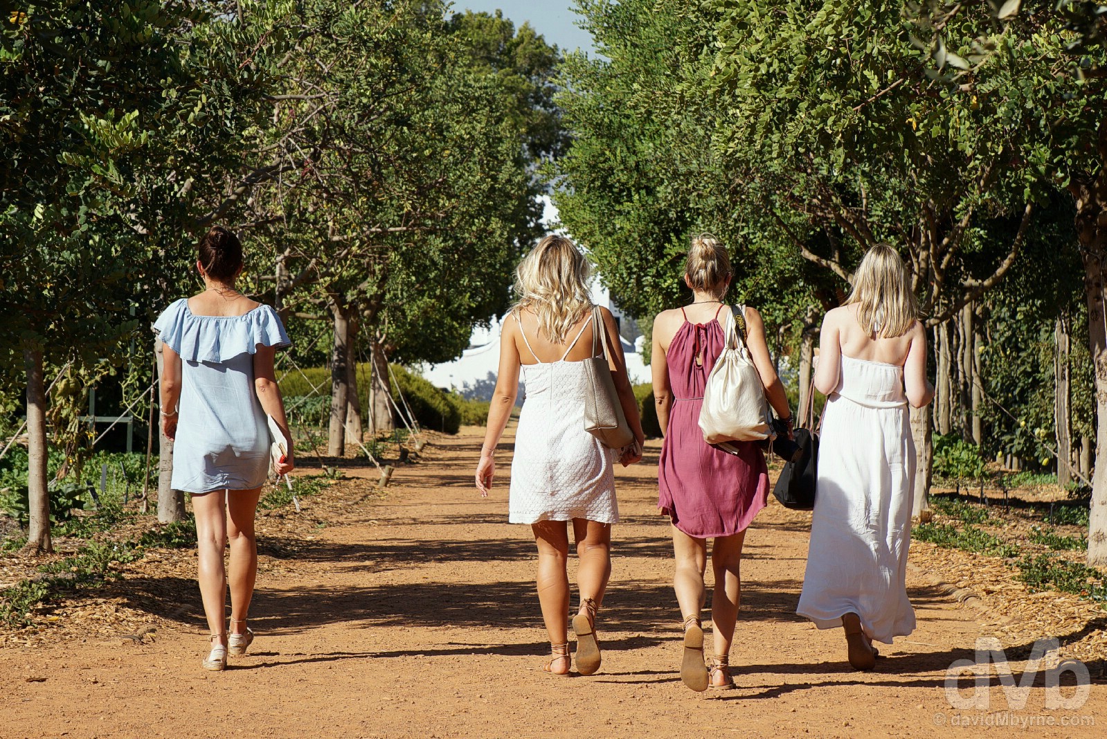
Beauty. It attracts beauty. Obviously. Babylonstoren. February 20, 2017.
Return To The Coast – Gordon’s Bay & Beyond
Bidding adieu to the Western Cape Winelands, it was a 50-kilometre drive through Stellenbosch, Somerset West, and Strand to get to Gordon’s Bay, a naval town on the northeastern crook of False Bay. Having last left it late on Day 3, we were back on the Western Cape coast, and back to some more awe-inspiring coastal scenery.
Road Trip Beauty. On the Clarence Drive portion of the coastal-hugging R44 in eastern False Bay between Gordon’s Bay & Rooi-Els. February 20, 2017.
Timing
I sensed that by the time we got back to the False Bay coast at Gordon’s Bay on this day that it – late evening – would be a good time to be driving the west-facing R44 coastal road hugging the bay. And so it proved. OK, so it was dark by the time we reached Hermanus, our overnight destination for this day 84 kilometres away via Betty’s Bay, but by that stage we had been treated to the best of the region’s scenery bathed in the best of the day 6 light. Yet more beauty to end this most beautiful of days.

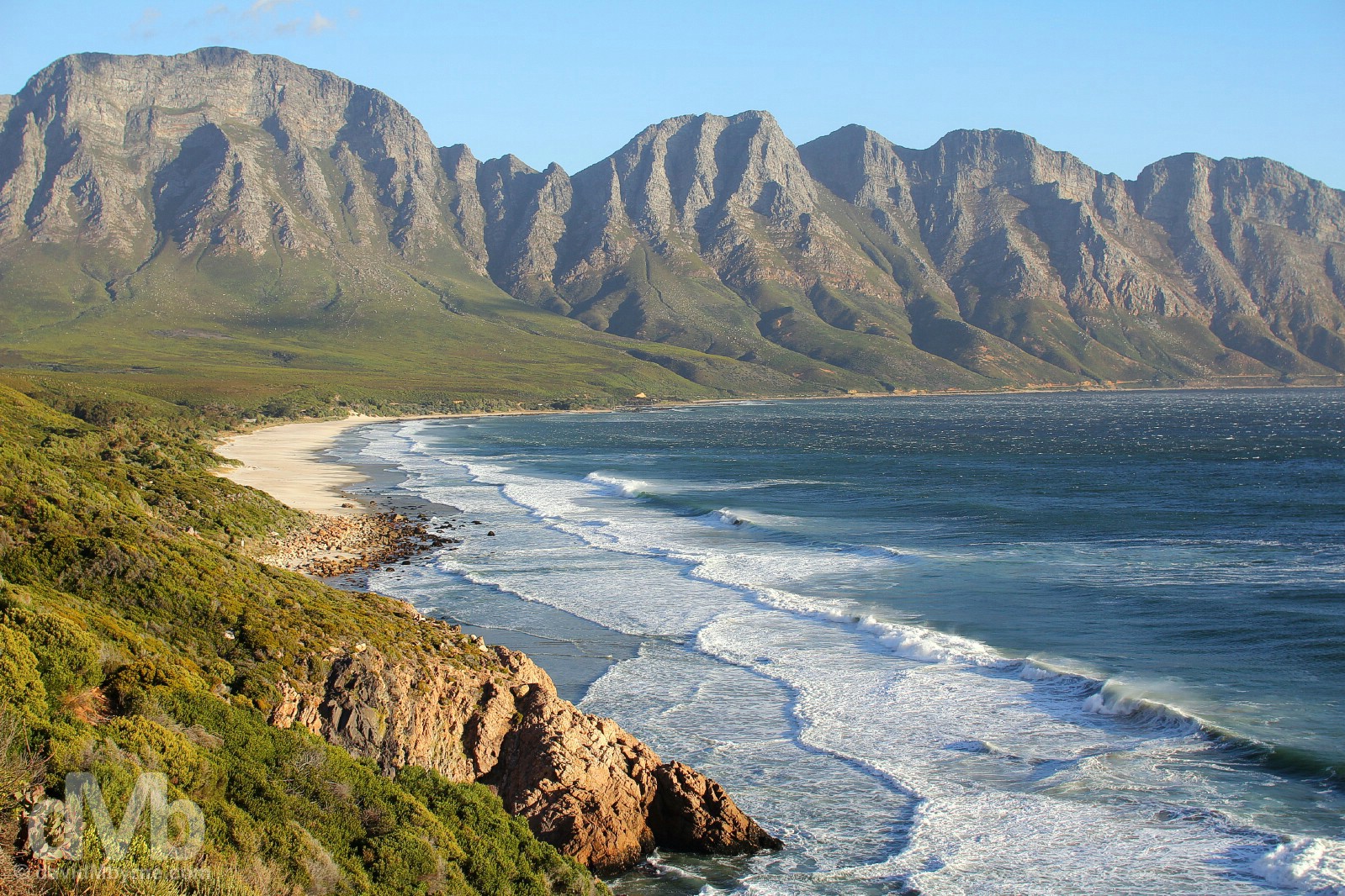
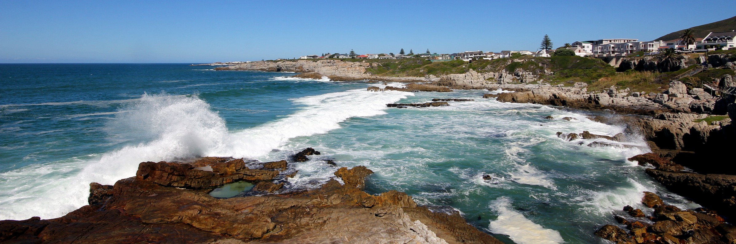
CLARENCE DRIVE || It’s over 220 kilometres of mostly coastal driving via the R44 & R43 from Gordon’s Bay to Cape Agulhas, our ultimate mini 2-day road trip destination. The first 24 kilometres of the R44, from Gordon’s Bay to Rooi-Els, is designated as Clarence Drive, one of the world’s best coastal drives (yes, another one), a magnificently scenic route with 77 bends that follows the course of the wild, windswept & turquoise False Bay coastline. The views to the west, 50 kilometres across False Bay to the Cape Peninsula and all the way down to Cape Point, were memorable, but obscured by the low-lying, setting sun. Regardless, it was hard to look anywhere but dead ahead to the Kogelberg Mountain Range, a protected reserve whose slops are closed to the public. Towering over the road hugging the wild, curving coastline, it was/is an unforgettable sight. Clarence Drive eastern False Bay. February 20, 2017.
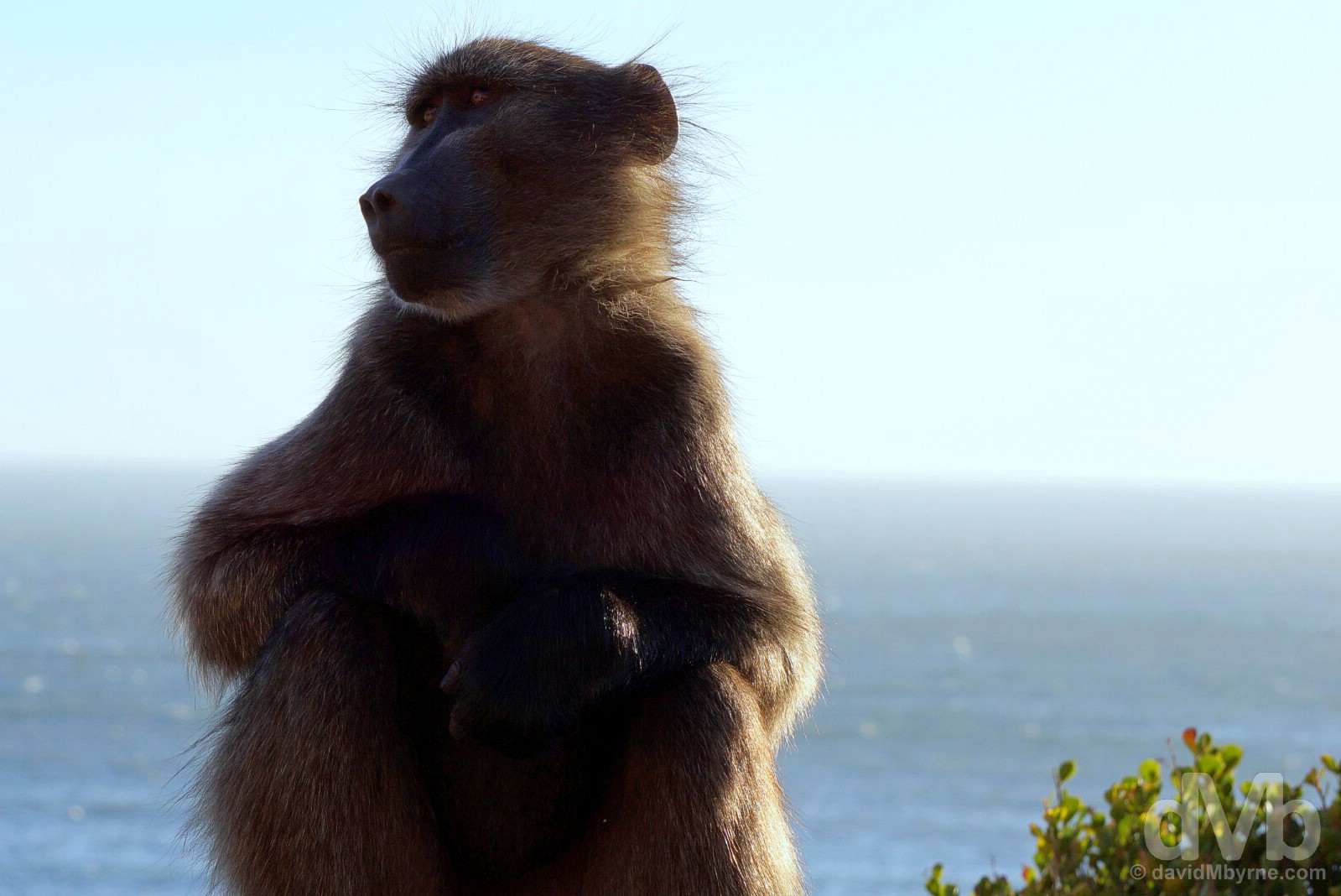
KOGELBERG NATURE RESERVE, CAPE OVERBERG, WHALE COAST ROUTE, & BABOONS || There’s a lot more here than just epic coastal scenery. This section of the False Bay coast falls within the boundaries of the Kogelberg Nature Reserve, part of the aforementioned and UNESCO-listed Cape Floral Region Protected Areas that also covers large swathes of the Cape Peninsula. The reserve here is a little special as it’s the most species-dense of all the world’s flora ecosystems; with over 1,600 species of plants, the 30 km²/7,400-acre Kogelberg Nature Reserve contains a floral diversity per unit area that is greater than anywhere else on earth. So there. This area also marks the beginning of the region known as the Overberg (Afrikaans for ‘over the mountain’), the southern-most region of South Africa; and it’s also the official beginning of the region’s so-called Whale Coast Route (see tomorrow, Day 7, for more) – this is generally regarded as one of the best places on earth to view whales from shore. It’s also a popular region with Baboons, like this one sitting by the side of Clarence Drive. A common sight all over the Cape, they are opportunists and something of a menace, and possibly even dangerous; unlike the cute little Dassie, there’s little love for the baboon, beautiful in their own unique way, among your average Capetonian. Clarence Drive between Gordon’s Bay and Rooi-Els, eastern False Bay. February 20, 2017.
Cape Town & Environs
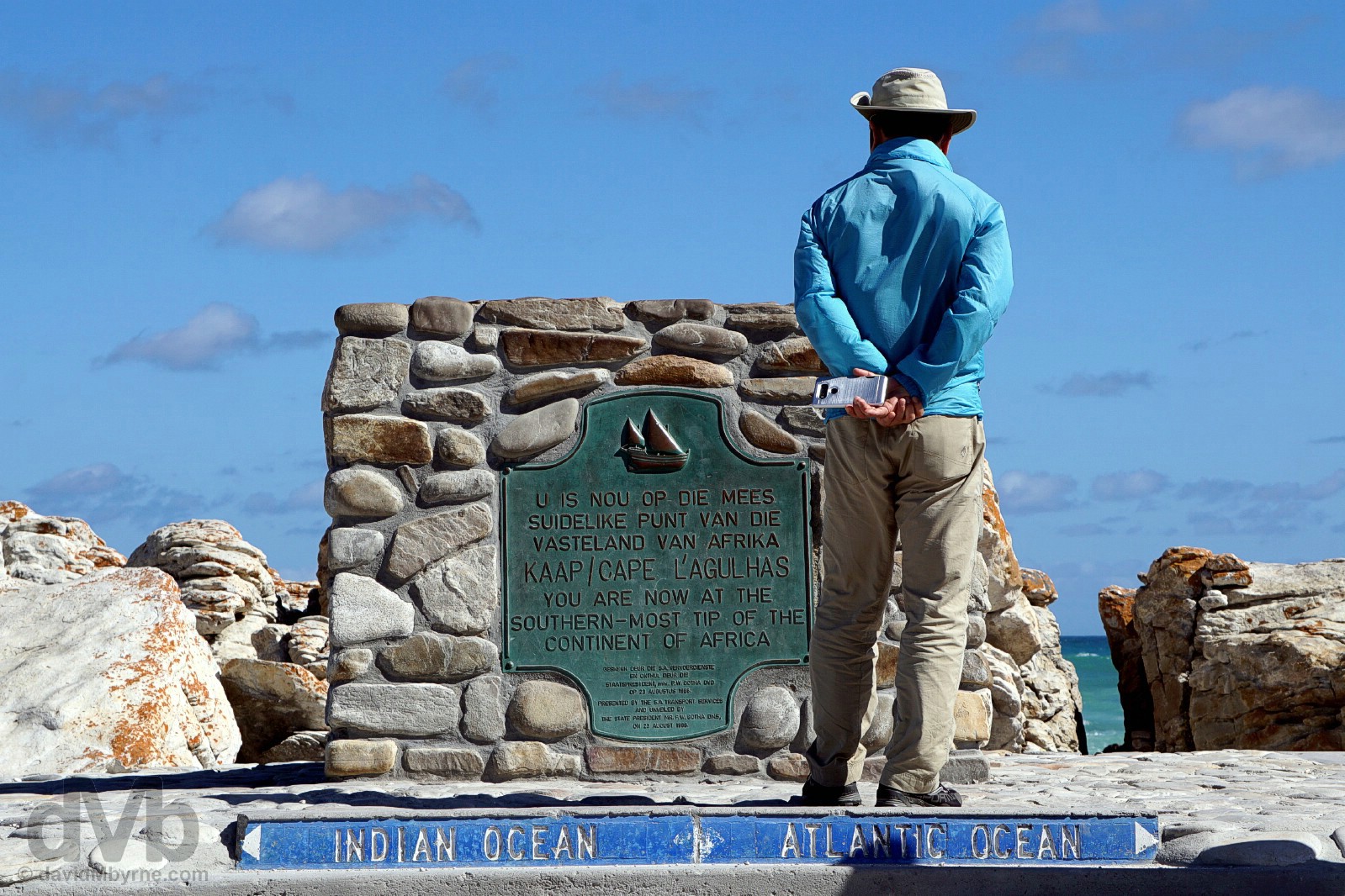
PICTURE OF THE DAY || DAY 7 || February 21, 2017Image || Cape Agulhas, the southern-most tip of the African continent.
“It’s unspectacular, nothing more than a nondescript rocky headland accessed via an unpaved road & boardwalk; it takes time & effort to get here; it doesn’t have the towering sea cliffs nor the dramatic coastal setting and thus that end-of-the-world vibe that’s unmistakable at its much better-known relative, Cape Point; and it doesn’t attract anywhere near as many visitors as Cape Point… but none of the detracts from the awesomeness of being here, the southern-most tip of the African continent and the official meeting point of two of the world’s three largest oceans…”
Day 7 || February 21, 2017
Day 7 Overview || CAPE OVERBERG – Hermanus, De Kelders, Gansbaai, Kleinbaai, Pearly Beach, Elim, L’Agulhas & Cape Agulhas, Bredasdorp, Swellendam, Ashton, Robertson, Worcester, & Du Toits Kloof Pass.
While not as dramatic a coastal location as the much busier Cape Point of the Cape Peninsula, Cape Agulhas is actually the southern-most point of the vast African continent. I’ve a thing for such locations so this particular enticing geographical landmark was always going to be on the itinerary, was always going to be top of the Cape Town & Environs bucket list. Someone – Ralph Waldo Emerson, actually – once famously said, “Life is a journey, not a destination.” True that as getting to Cape Agulhas today via the region’s Whale Coast Route was as much a highlight of day 7 as was the southern-most point itself.
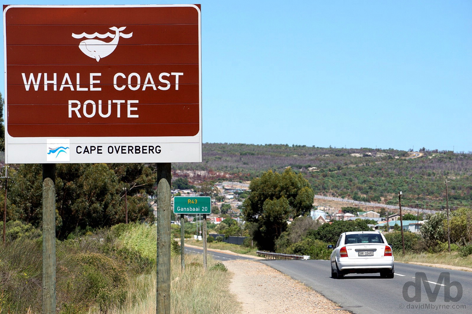
Equidistant between Hermanus and Gansbaai on the R43, the so-called Whale Route Coast of Cape Overberg, the region at the southern-most tip of the Western Cape, & the continent of Africa. February 21, 2017.
It’s all about the coastline down here in the Overberg, but there’s still some nice Cape Dutch architecture to feast your eyes on.
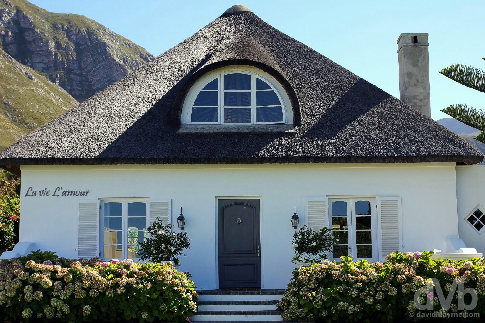
As if it isn’t gorgeous enough, this immaculate, picture-perfect Cape Dutch Cottage even comes adorned with a nice message in French reminding us to ‘Love Life’. Good advice. 9th Street, Hermanus, Cape Overberg. February 21, 2017.
Hermanus
We woke to day 7 in Hermanus, the jewel of the Overberg, the capital of the Whale Coast Route, & one of South Africa’s most popular holiday destinations; a water sports haven, having fun above or below the waterline is the town’s big draw. That includes ogling at whales, visitors to the waters off Hermanus from July through December (to calve & raise their young), a period which sees the waters declared a marine reserve and designated off-limits to holidaymakers.
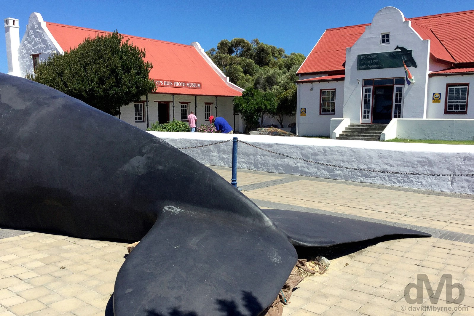
HERMANUS || Hermanus bills itself as the Whale Capital of South Africa so you’re never too far away from a whale this or a whale that when in town. It’s a pretty place & well geared for tourists, especially down by Market Square/Village Square where there’s a healthy gathering of ocean-view restaurants, market stalls, and water-based tour agencies. It’s here where you’ll also find the Whale House Museum fronted by a rather lifelike statue (I’ve seen it classed as a ‘replica’) of a Southern right whale, the most common of the cetacean mammals that visit the sheltered inlet of Walker Bay that Hermanus sits on. Market Square, Hermanus, Cape Overberg. February 21, 2017.
The odd tidal pool aside, the craggy, rocky cliff coastline of Hermanus isn’t a place for swimming, but it’s a great place to brandish a camera. Hermanus, Cape Overberg. February 21, 2017.
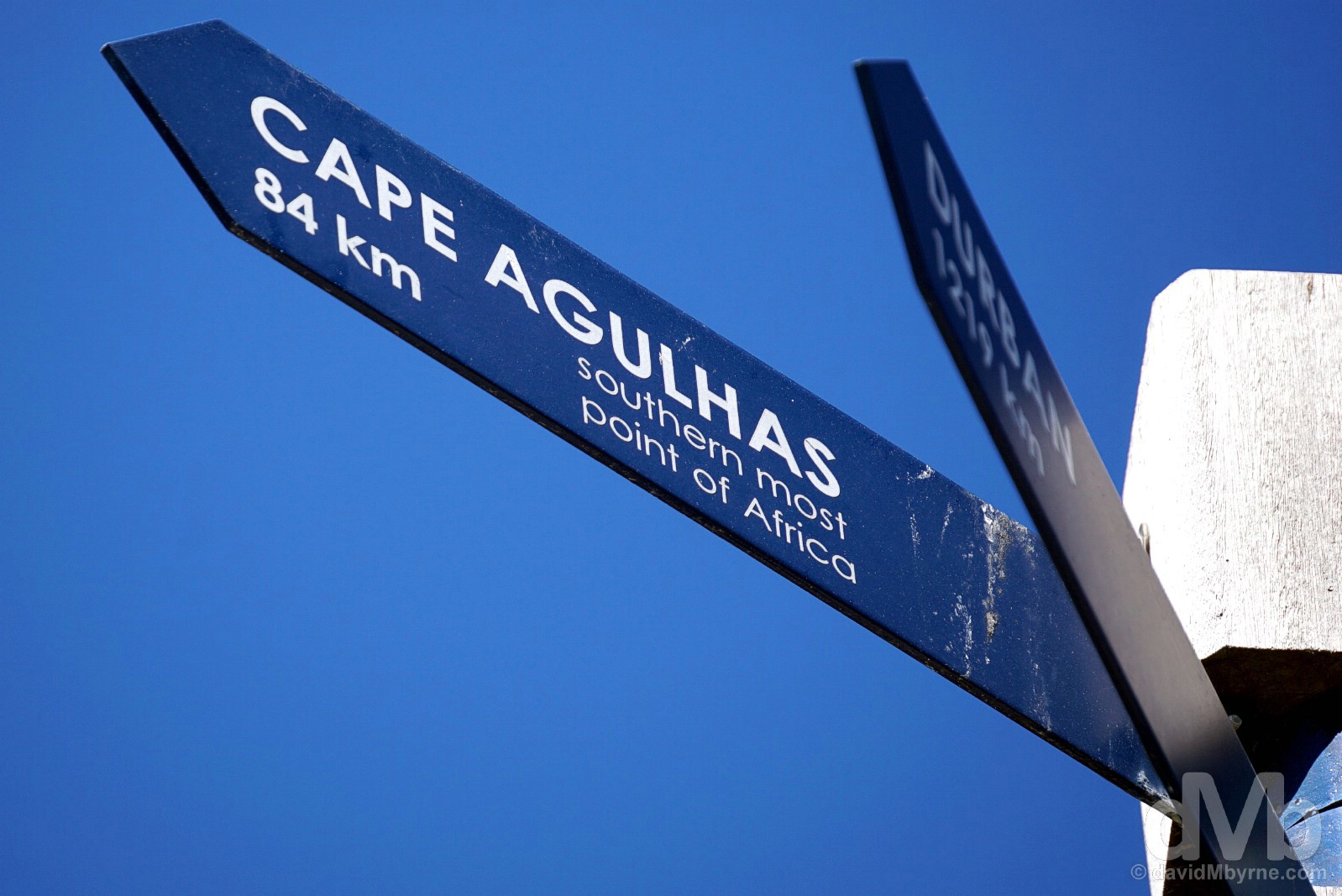
South Africa seems very fond of the multi-geographical signpost; you’ll find them anywhere you’ll find tourists. While always good for a picture, I have reason to question their accuracy. This signpost on Marine Drive in Hermanus proclaims it to be 84 kilometres to Cape Agulhas. As the crow flies maybe, but it’s actually anywhere between 110 kilometres and 150 kilometres, assuming you utilise the region’s roads and depending on which route you take. We went via Gansbaai, Pearly Beach (an unnecessary diversion thanks to GPS issues), and Elim, all told an enjoyable drive of 180 kilometres, not all of it coastal. Hermanus, Cape Overberg. February 21, 2017.
From Whales to Sharks
From the whale capital, it’s a 40-kilometre drive via the Whale Coast Route to Gansbaai, known as the ‘The Great White Shark Capital of the World’ because of, you’ve guessed it, the sheer number of these dangerous predators found lurking in the warm waters off the coast.
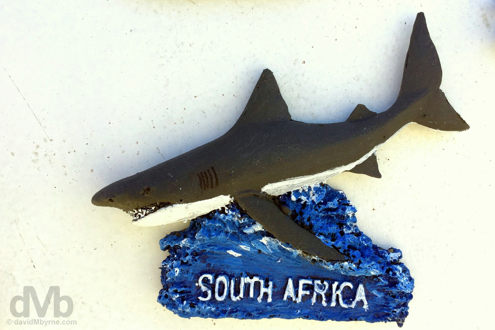
A handmade fridge magnet for sale in Kleinbaai. While Gansbaai gets all the credit, it’s actually from the harbour in the tiny picturesque settlement of Kleinbaai, 6 kilometres from Gansbaai, where shark cage diving tours depart to the so-called Shark Alley, 10 kilometres offshore. Kleinbaai, Cape Overberg. Febraury 21, 2017.
There wasn’t a whole lot happening when we swung by the pier in Kleinbaai mid-afternoon on a summer’s day; prime cage diving season is June, July & August, the southern hemisphere winter. However, the pier was hosting the vessels of various tour operators offering cage diving trips. Out of the water, orderly lined, and clearly not going anywhere for a while, and certainly not going anywhere on this day, they proved rather photogenic.
SHARK CAGE DIVING || With 241 attacks leading to 54 fatalities over the past 100 years, the waters off South Africa are statistically the most dangerous in the world for shark attacks. However, that doesn’t seem to deter people from flocking to this tiny harbour in Kleinbaai to embark on an adventure to dive with sharks, albeit from behind the bars of a submerged protective cage hanging off the back of a boat. Of the at least 98 species of shark known to inhabit the waters off the coast here, it’s the… duunnn dunnn… duuuunnnn duun… duuunnnnnnnn dun dun dun dun dun… the Great White that gets all the attention. South Africa was one of the first countries in the world to formally protect this species, so while this means they may not be caught, killed or harassed, it has also led to an increase in their population. This combined with the abundance of seals, the Great White’s preferred prey, inhabiting two tiny islands offshore – Dyer Island & Geyser Rock – means the channel separating the islands, Shark Alley, sees massive numbers of the large, aggressive man-eater, the oft-maligned & misunderstood predator that can smell a single drop of blood floating in 10 billion drops of water. While shark diving may provide thrills galore, it’s somewhat controversial. Proponents cite cage diving as safe and a way to learn more about sharks in their natural environment, whereas detractors blame shark diving, still a haphazardly regulated industry, for recent shark attacks, saying it encourages sharks to come closer to shore than they normally do; chumming the water, the practice of putting a mix of fish blood and guts into the water to attract the sharks, could change a shark’s natural behavior. With each new attack, some worry that the sight of humans may become linked to the promise of food, increasing the danger for unsuspecting divers who have no food to offer, apart from themselves. Sounds plausible to me. Kleinbaai, Cape Overberg. February 21, 2017.
Overlooking the shore at Kleinbaai, yet another beautiful part of the country. Cape Overberg. February 21, 2017.
(Inland To) Elim
I had read about Elim. Forty-three kilometres from Kleinbaai, it’s located someway inland on the Agulhas Plain so I never expected to visit the settlement in getting from Kleinbaai to Cape Agulhas, both very much on the coast. But as it turned out we did drive through, such was the route we took in getting to the end of the African continent. And I’m sure glad we did. (Only when here did it become apparent that the coast’s rocky terrain makes it impossible to have any kind of coastal route linking Kleinbaai to Cape Agulhas.)
Parked up in front of the gorgeous, blindingly-white church, dating to 1835, in Elim, Cape Overberg. February 21, 2017.

ELIM || I’d read of the history of Elim, read that is was founded as the Elim Moravian Mission Station in 1824 as one of three Moravian Missions in the Cape, Moravia a region in the central and eastern part of the Czech Republic; the town is still owned by the Moravian Church to this day and the village has national heritage status. I’d also read how Elim is home to South Africa’s first slave monument, built in 1938, the town serving as a refuge for emancipated slaves when slavery was abolished by the British in 1834. Finally, I’d also read about the picturesque nature of the settlement, its streets lined with quaint, colourful, thatched roof cottages. However, I still didn’t expect it to be as photogenic as it was/is. A community of farmers and artisans (Elim’s thatchers in particular are renowned for their craftsmanship), seemingly little has changed here over the years, the sort of forlorn & forgotten place where time seems to have stood still. Such places are always photogenic and Elim was no exception. Elim, Cape Overberg. February 21, 2017.
Cape Agulhas
And so finally to the main event on day 7 and the ultimate destination for our mini 2-day road trip, Cape Agulhas, a 47-kilometre drive southeast of Elim and as far south as you can go on the African continent.

CAPE AGULHAS || It’s unspectacular, nothing more than a nondescript rocky headland accessed via an unpaved road & boardwalk; it takes time & effort to get here; it doesn’t have the towering sea cliffs nor the dramatic coastal setting and thus that end-of-the-world vibe that’s unmistakable at its much better-known relative, Cape Point, 120 kilometres to the west as the crow flies; and it doesn’t attract anywhere near as many visitors as Cape Point – hell, it doesn’t even have the South African stalwart of a multi-geographical signpost. But none of the detracts from the awesomeness of being here, the southern-most tip of the African continent; being here was every bit the highlight I expected it to be, the nothingness aside. South Africa is the only country on the world that borders both the Atlantic and Indian, the second- & third-largest of the world’s oceans respectively, and it’s here at Cape Agulhas where they officially meet (so says the International Hydrographic Organization). Excuse me, but that’s pretty sweet. It was all pretty sweet. Cape Agulhas, Cape Overberg. February 21, 2017.
The actual end. Next stop Antarctica. Yes, such a vast continent as Africa is peters out to this. There’s positively nothing to do here save for wallowing in the surrounds while standing on the rocks listening to the waves crash over the shallow Agulhas Bank offshore (great fishing waters I hear). While here it struck me that if the world wasn’t curved (it is), if there was no atmospheric haze (there is), and if I could see that far (I can’t) then I’d be espying the continent of Antarctica on the horizon, the next anything of note some 3,800 kilometres dead ahead. Cape Agulhas, Cape Overberg. February 21, 2016.
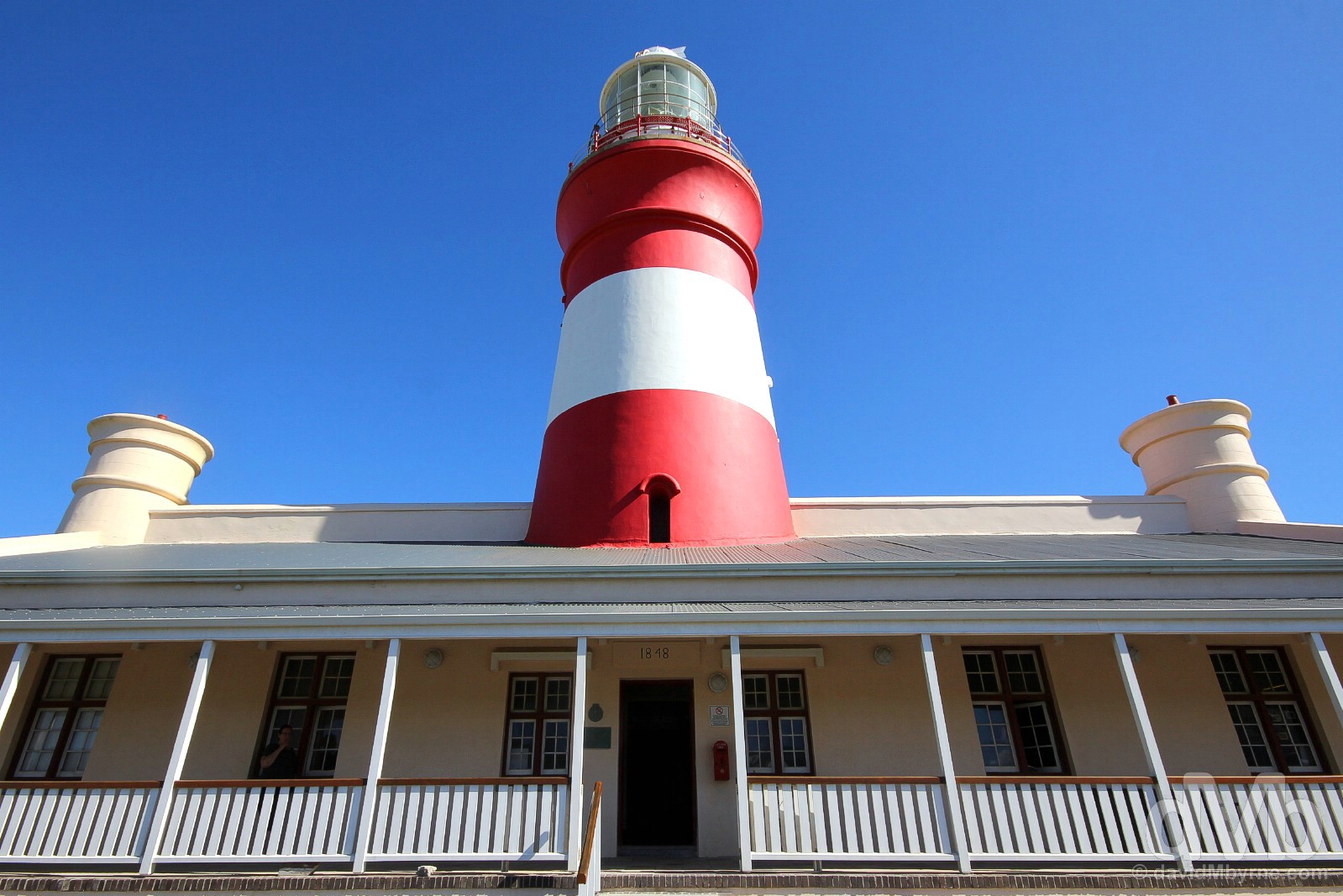
CAPE AGULHAS LIGHTHOUSE || Named by Portuguese sailors (they called it Cabo das Agulhas, Portuguese for ‘Cape of Needles’), the shallow waters off Cape Agulhas, and belying their picturesque calmness today, are notorious for storms and mammoth rogue waves; waves approaching heights of 30 metres have been recorded in these waters and the coast here is littered with wrecks. The job of keeping passing maritime traffic off the treacherous rocks along this portion of coastline falls to the isolated Cape Agulhas Lighthouse, perched on a small hill about a kilometre east of the southern-most point. Africa’s most southerly & second-oldest lighthouse was built in 1848, but it didn’t flick the switch to ‘ON’ until 1849. Modelled on the Pharaohs of Alexandria lighthouse, one of the 7 Wonders of the Ancient World, it pumps out 1.8 million candlepower in a single white flash every 5 seconds to a range of 47 kilometres. Playing host to a museum and a small rustic restaurant, there’s a nominal fee to ascend to the top of the 27-metre-high red and white banded tower. Cape Agulhas, Cape Overberg. February 21, 2016.
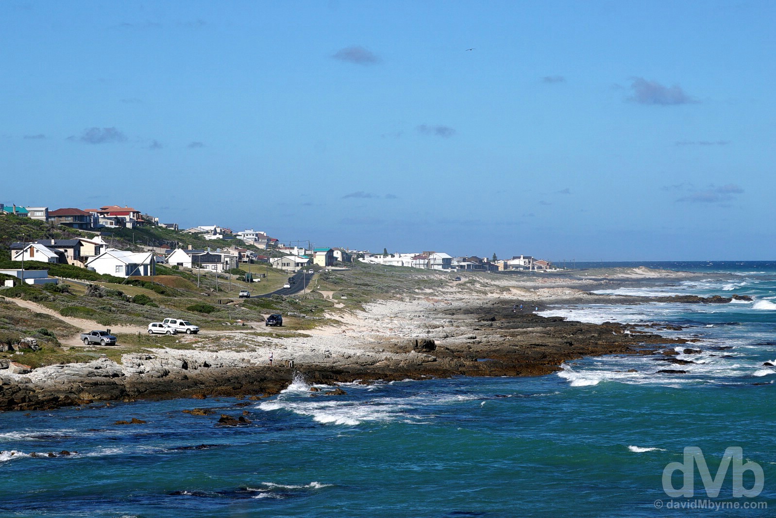
L’AGULHAS || The settlement of L’Agulhas, which you’ve no choice but to pass through en route to Cape Agulhas, hasn’t a whole lot going for it other than the fact that it’s the most southerly town on the continent of Africa. Isolated, a tad exposed to the elements, & short on amenities, it’s mostly made up of holiday homes dotted along the irregular, wave-lashed coast. That said, it’s an immensely photogenic stretch of rugged, windswept, & battered coastline, although it’s not somewhere I’d personally want to be when the wind is blowing and whipping up a fury. Inland would be a much better option. L’Agulhas, Cape Overberg. February 21, 2016.
Homeward
It was a long drive from L’Agulhas back to base, a 300-kilometre drive through Bredasdorp, Swellendam, Ashton, Robertson, Worcester, & over Du Toits Kloof Pass into Welington. I didn’t take the camera out at any point of the drive, although I probably should have; the stretches of agriculture and farmland seen from the R319 between Bredasdrop & Swellendam in particular were photogenic, not to mention a huge contrast to the coastal scenery we’d gorged on over the last two days. Next time.
Cape Town & Environs
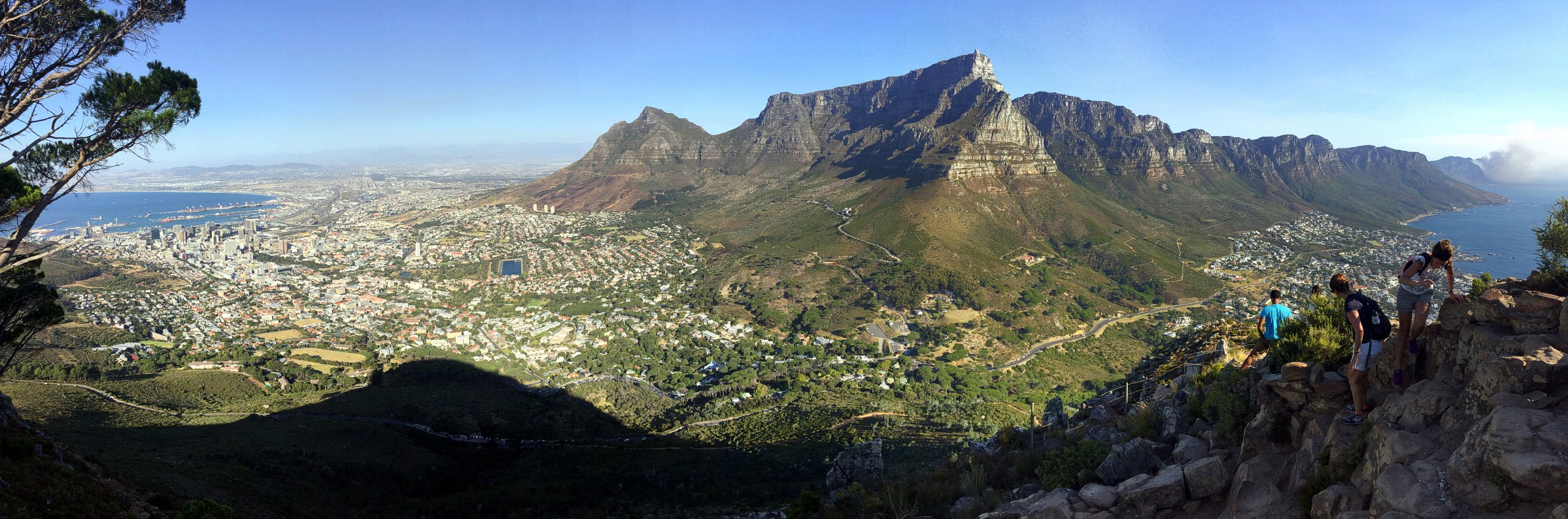
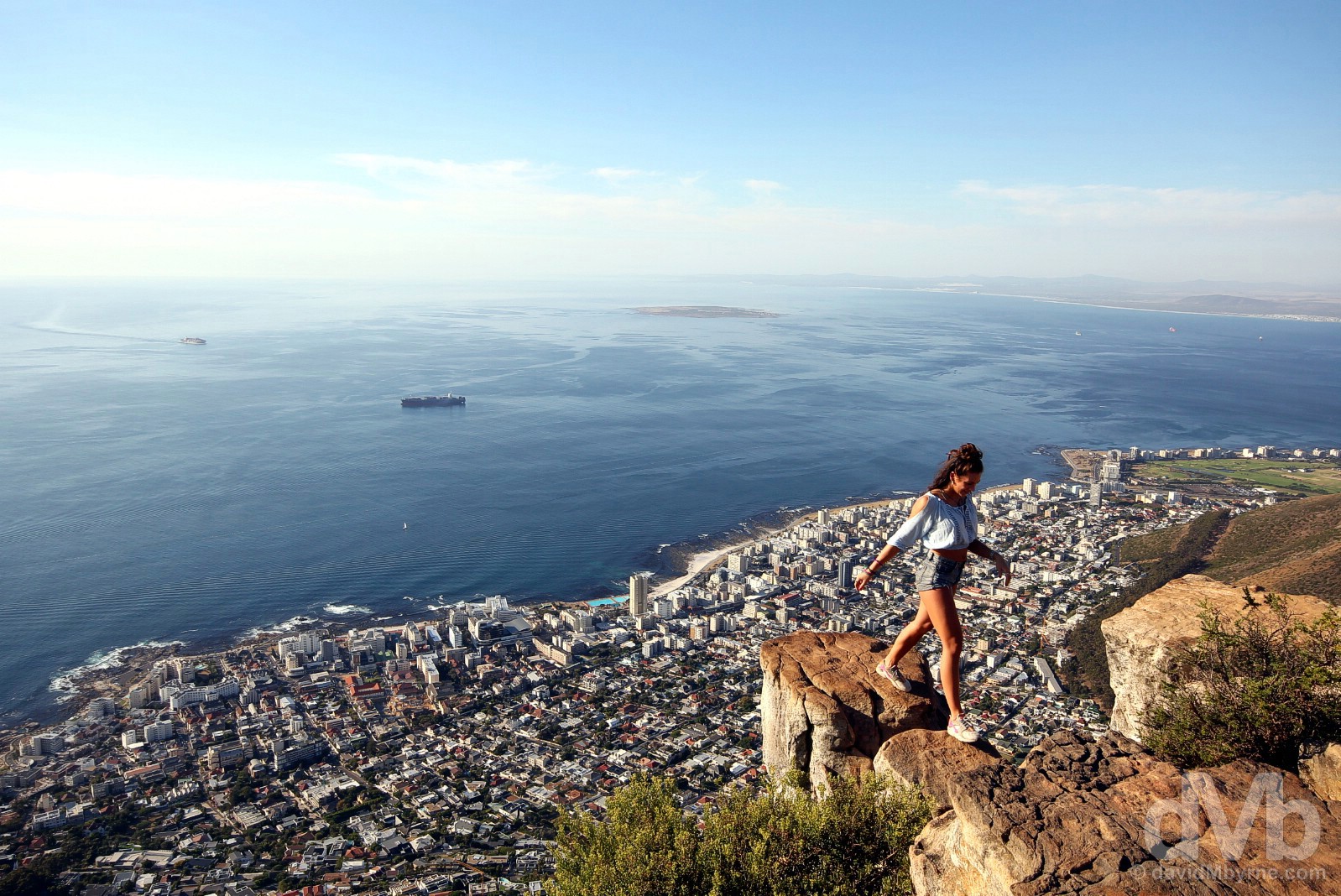
PICTURE OF THE DAY || DAY 8 || February 22, 2017Image || Late afternoon atop Lion’s Head, Cape Town.
“You can attempt to anticipate it by researching it ad nauseam. I did. You can get a better feel for it by exploring the region itself from ground level. I did that, too. But it’s only when you drag yourself up to the summit of the city’s Lion’s Head that you can fully appreciate Cape Town’s awe-inspiring setting.”
Day 8 || February 22, 2017
Day 8 Overview || HISTORY & HIKING HIGHS – The V&A Waterfront, Robben Island, & Lion’s Head.
The aim today, the last full day ‘down here’, was to visit three of the Cape Town Big 7, seven of the best of what the city has to offer as determined by Cape Town itself. A questionable meteorological call scuppered that plan, preventing me from peering over the Mother City from atop its most famous feature. But not to worry, the views from elsewhere were just as good, if not better. Day 8. History, hiking & heart-stopping highs.
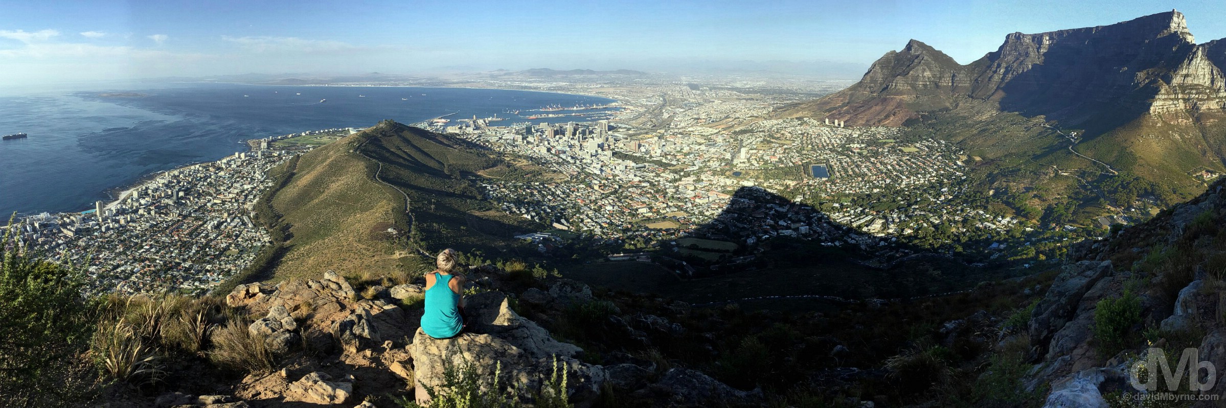
Enjoying the late afternoon view over Table Bay & Cape Town from atop Lion’s Head. February 22, 2017.
The day, & the history lessons, started down by the water’s edge in Cape Town’s historic V&A Waterfront. We got there with sufficient time to spare to allow me capture a few pictures ahead of our departure for Robben Island offshore, where the history lessons continued.
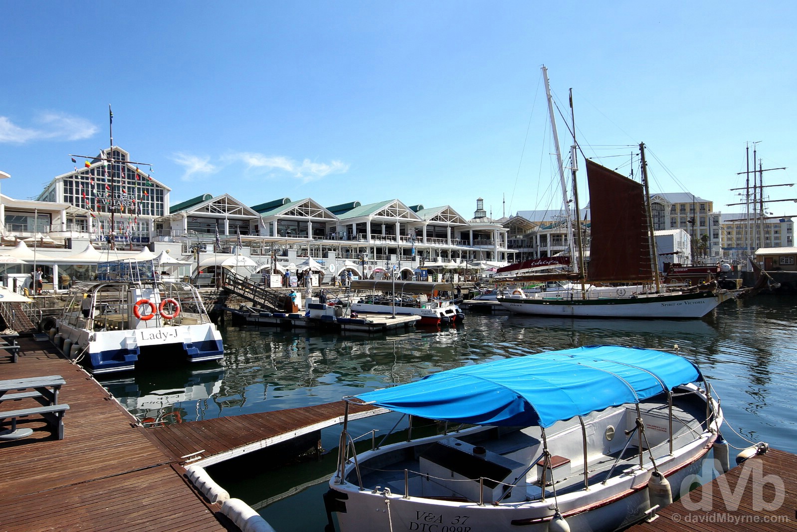
V&A WATERFRONT || Cape Town’s redeveloped Victorian harbour is at the heart of the city’s history. Founded by the Dutch in 1652 as de Caabsche Vlek, ‘the Cape Hamlet’, later renamed Cape Town, this little 17th-century outpost started life as a much-needed replenishing station for mariners making the six to eight month voyage from Europe to the Far East. Increasing trade would see Cape Town become ‘the Gateway to Southern Africa’ and the outpost’s docklands the gateway to the city. But those rudimentary docklands were not up to the task of servicing the growing settlement. That and the notorious gales in Table Bay, which gave the Cape the unwanted nickname of Cape of Storms, necessitated the need for bigger and safer docking facilities. They eventually arrived in the 1860s when the then ruling British somewhat reluctantly agreed to finance their construction. Built in the form of an exterior harbour, the Victoria Basin, and an interior harbour boasting the greatest dry-dock in Africa, the Alfred Basin (a teenage Prince Alfred would ceremoniously tip the first batch of stones into Table Bay to kick the whole project off), the Alfred and Victoria Basins would ably serve as Cape Town’s docklands, facilitating the movement of goods, services, technology & people from all corners of the globe. Restored in recent years, the present-day V&A Waterfront is still a working harbour, but it’s also where locals play, shop, work & live. Tourists too, a whopping 24 million of them coming here every year to enjoy world-class shopping thanks to over 450 retail outlets spread over two levels of a massive mall; laid-back drinks & fine dining on patios with views of either the harbour, Table Mountain, or both; museums; water cruises; helicopter rides; the Two Oceans Aquarium; the Watershed arts & craft workshop; an open-air amphitheatre; a Ferris wheel; and Cape Town’s only comedy club. The V&A Waterfront, Cape Town. February 22, 2017.
CapeTownBig7.co.za – V&A Waterfront, one of Cape Town’s Big 7, the best of what the city has to offer (#CTBig7)

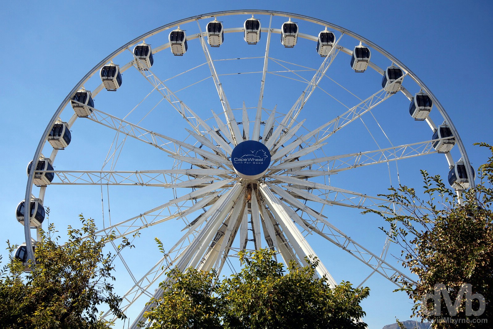
CAPE WHEEL || The most recent addition to the historic V&A Waterfront skyline, the Cape Wheel started life in Germany in 2007, thereafter happily spinning on its axis in 5 different German & Belgian locations. Its European odyssey ended in 2010 shortly after which it found a (permanent?) home here. The 40-meter-high observation Ferris wheel features 30 enclosed air-conditioned capsules, each with room for 6 adults. V&A Waterfront, Cape Town. February 22, 2017.
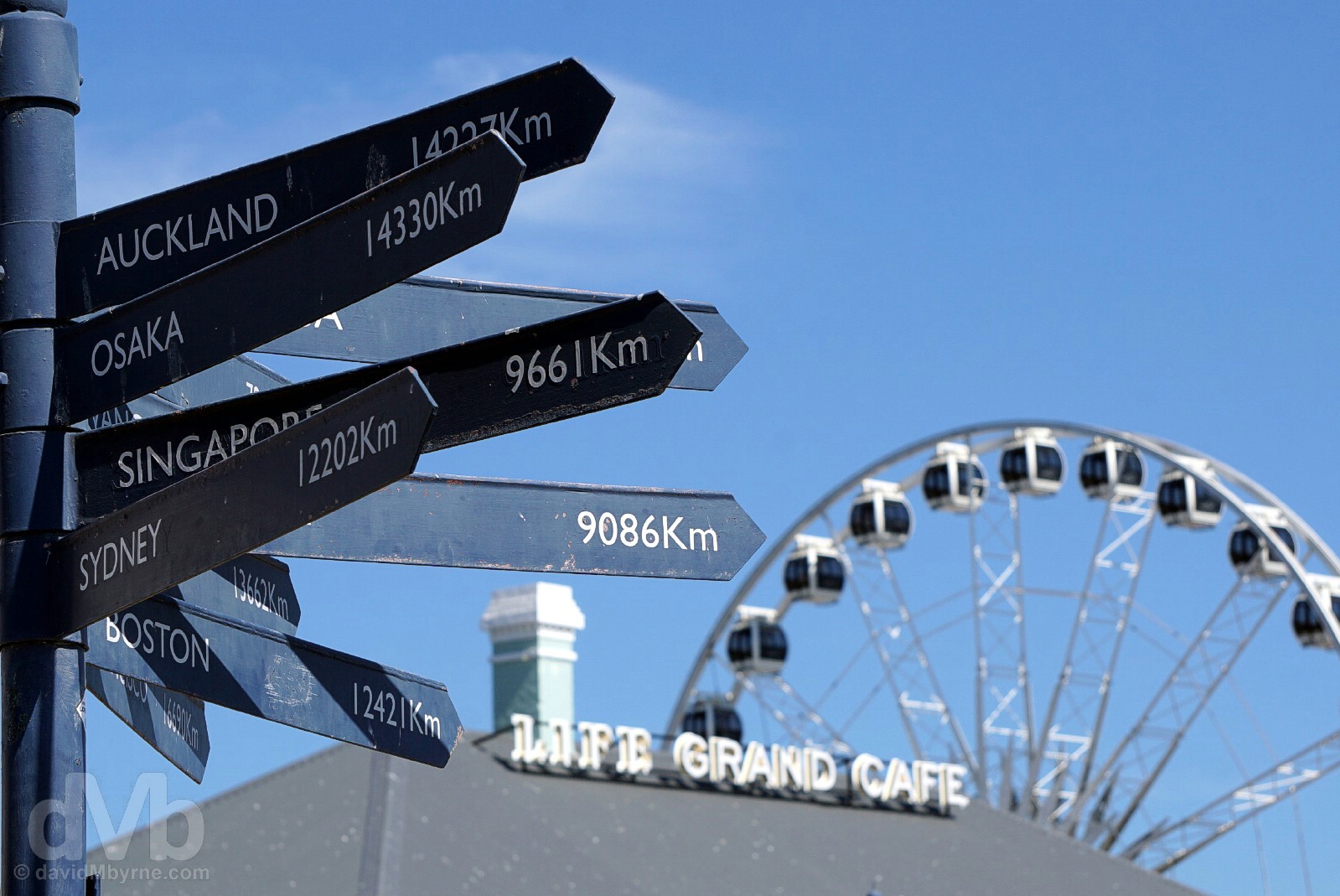
Yes, of course the V&A Waterfront has a multi-geographical signpost. Cape Town. February 22, 2017.
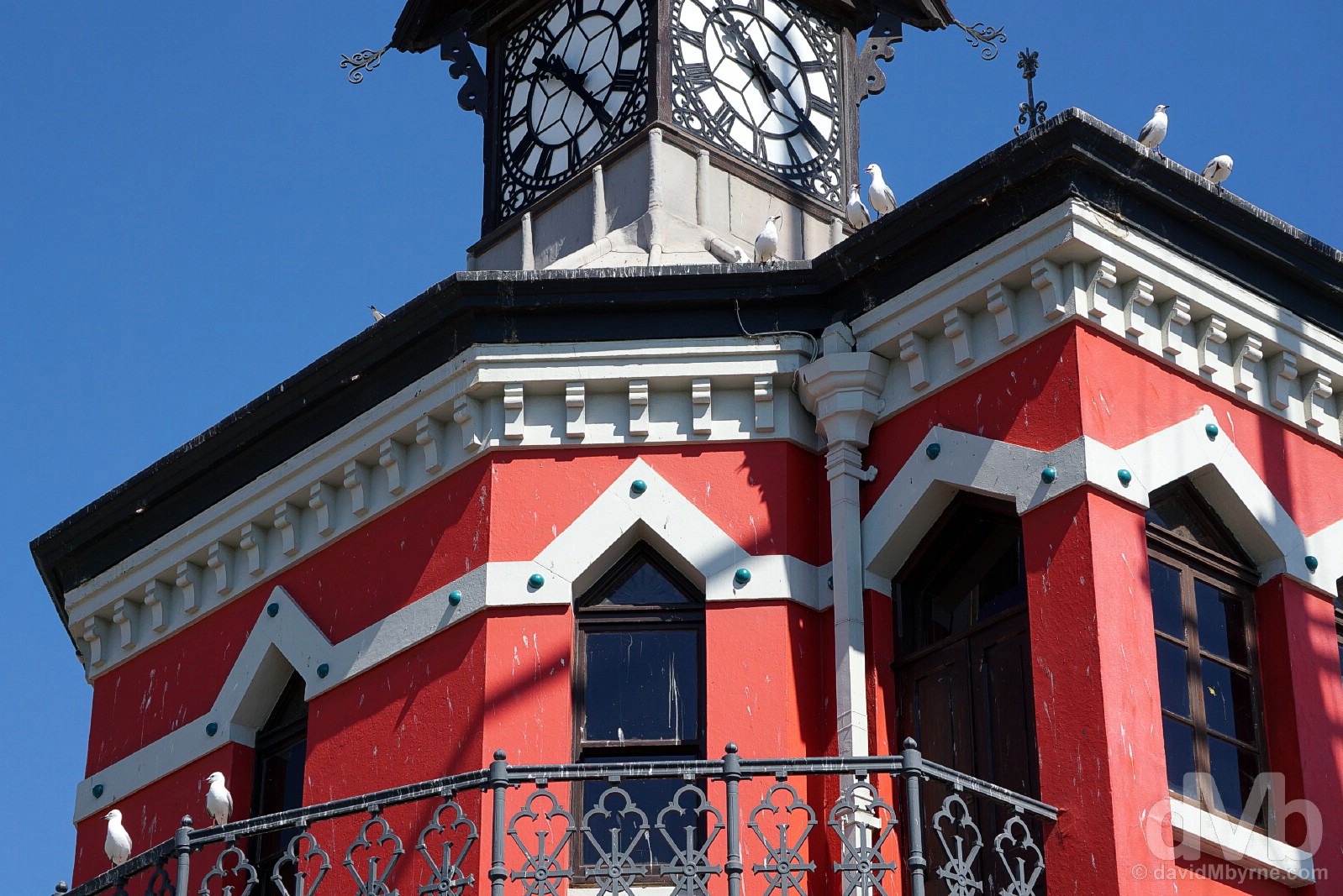
CLOCK TOWER || A V&A Waterfront landmark, the Victorian-era Clock Tower is an icon of the old Cape Town harbour. This National Monument was built in 1882 as the original Port Captain’s Office. Red since its construction, pointed Gothic windows surround the 3-storey structure with the original clock, imported from Edinburgh & restored to full working order in 1997, its main feature. A slight lean of 50 mm to one side has been arrested and is thus not noticeable. Unfortunately the same cannot be said for the defacing efforts of the monument’s upper reaches by the Waterfront’s resident gulls. Horrible creatures. V&A Waterfront, Cape Town. February 22, 2017.
The Nelson Mandela Gateway To Robben Island
You pass over the V&A Waterfront’s Swing Bridge, and past the Clock Tower, en route to the hugely symbolic Nelson Mandela Gateway To Robben Island, the somewhat convoluted name given to the building from which the booked-out-days-in-advance tours to Robben Island depart. Built in 2001 and occupying a prime V&A Waterfront site, this was the original embarkation spot for Robben Island prisoners. There are no prisoners these days – just plenty of fellow tourists – and while you’ll also find here a museum detailing the history of Robben Island and those who fought against Apartheid, there is, of course, a lot more information detailing those dark Apartheid days to be found on Robben Island itself, 9 kilometres across Table Bay from the V&A Waterfront.
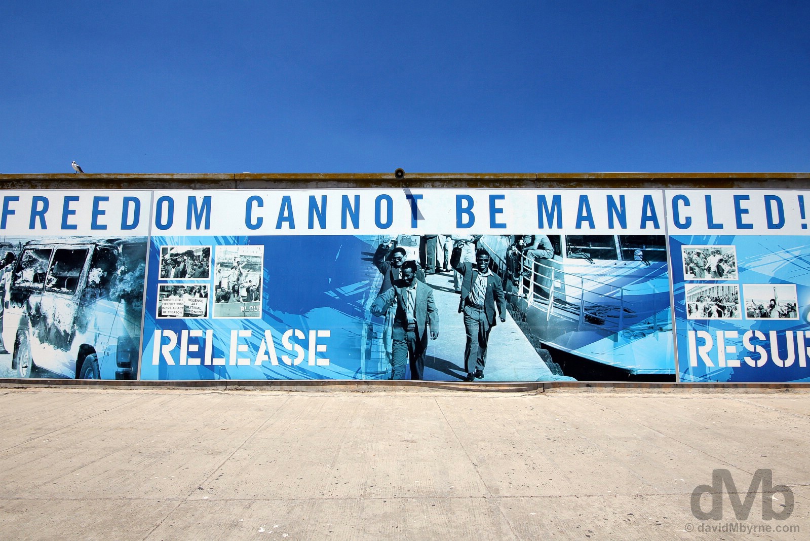
Freedom Cannot Be Manacled! Arriving on the dock of Robben Island, Table Bay. February 22, 2017.
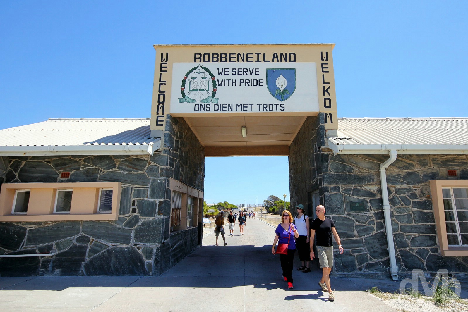
The entrance to Robben Island, Table Bay. February 22, 2017.
Robben Island
Flat, parched, bleak, uninviting and measuring only 6 km², Robben Island was a place of incarceration stretching back to the days of the Dutch in the mid-17th century, but also something of a dumping ground for undesirables – lepers, prostitutes, lunatics and the like – prior to being taken over by the Prisons Department in the early 1960s. Turned into a maximum security prison, it housed common-law felons and, most famously, Nelson Mandela and other subjugated political and anti-Apartheid campaigners. It ceased being a prison in 1996, became a museum in 1997 (yes, the whole island is classed as a museum), gained UNESCO World Heritage status in 1999, and today is one of the must-see Cape Town attractions, one offering a somber look at the dark days of a dark period in the history of South Africa.
– UNESCO commenting on Robben Island
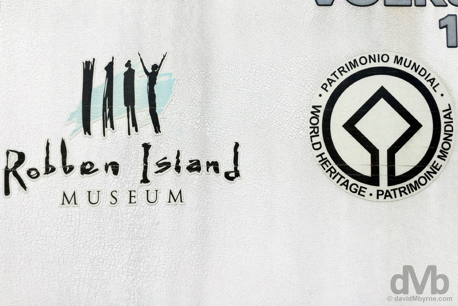
UNESCO-listed Robben Island Museum, Table Bay. February 22, 2017.
Apartheid & A Democratic South Africa
Noun: apartheid
1. A social policy or racial segregation involving political and economic and legal discrimination against people who are not Whites; the former official policy in South Africa (from 1948 to 1991).
While a wholly simplistic generalisation, Apartheid stemmed from the days of Dutch colonial rule, when slaves formed a large portion of the population. Hence societal division was well entrenched in the country prior to the first piece of official Apartheid legislation being adopted into law by the South African government in 1949, it prohibiting marriage or sexual relationships across racial lines. (The Nationalist Government, elected to power by the white electorate in 1948, defined their doctrine of Apartheid, an Afrikaans word, as one of ‘Good Neighbourliness’.) Thereafter widespread racial segregation officially took root based on societal classification; South Africans were classed as belonging to 1 of 4 racial groups – white, coloured, Indian, & black, rights afforded to the latter in particular almost non-existent. Spearheaded by the ANC, the African National Congress, the oldest black political organisation in South Africa and the country’s leading anti-Apartheid political movement, years of domestic unrest followed as a consequence of the push for equality. Not surprisingly, both the antediluvian policies of the Apartheid era and the domestic turmoil born out of the anti-Apartheid movement were not well received by the wider international community – widespread and universal condemnation saw South Africa, embargoed to the hilt, largely ostracised on the global scene. Change was inevitable and it came when, in 1990, Nelson Mandela and other prominent leaders of the ANC were released from prison. Apartheid officially ended in 1991 and the country’s first free, multi-racial elections were held three years later in 1994. With the over 62% of the vote, the ANC won a sweeping victory and Mandela became South Africa’s very first black President, ushering in a new era for the country.
– Nelson Mandela on the occasion of his inauguration ceremony. Pretoria, South Africa. May 10, 1994.
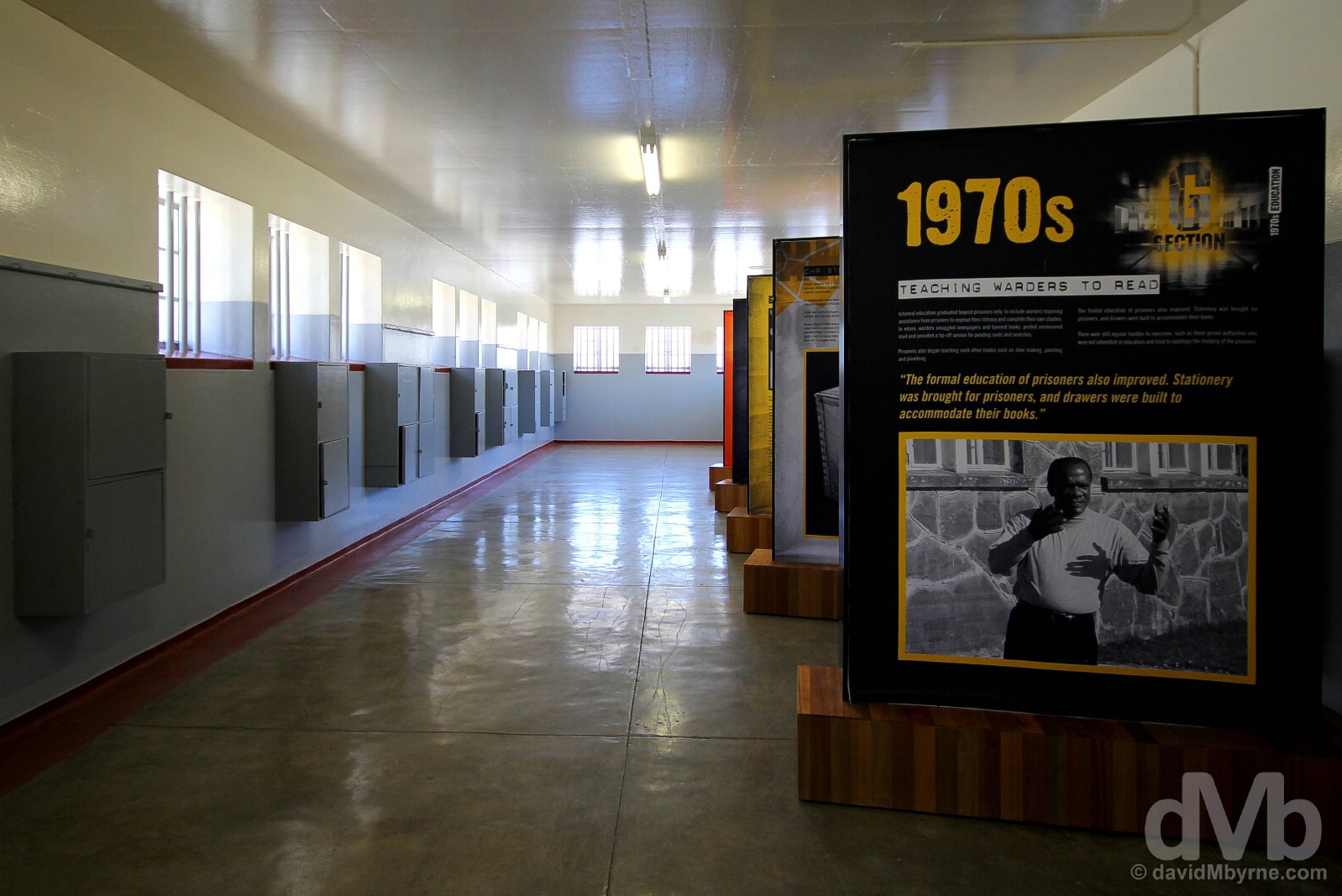
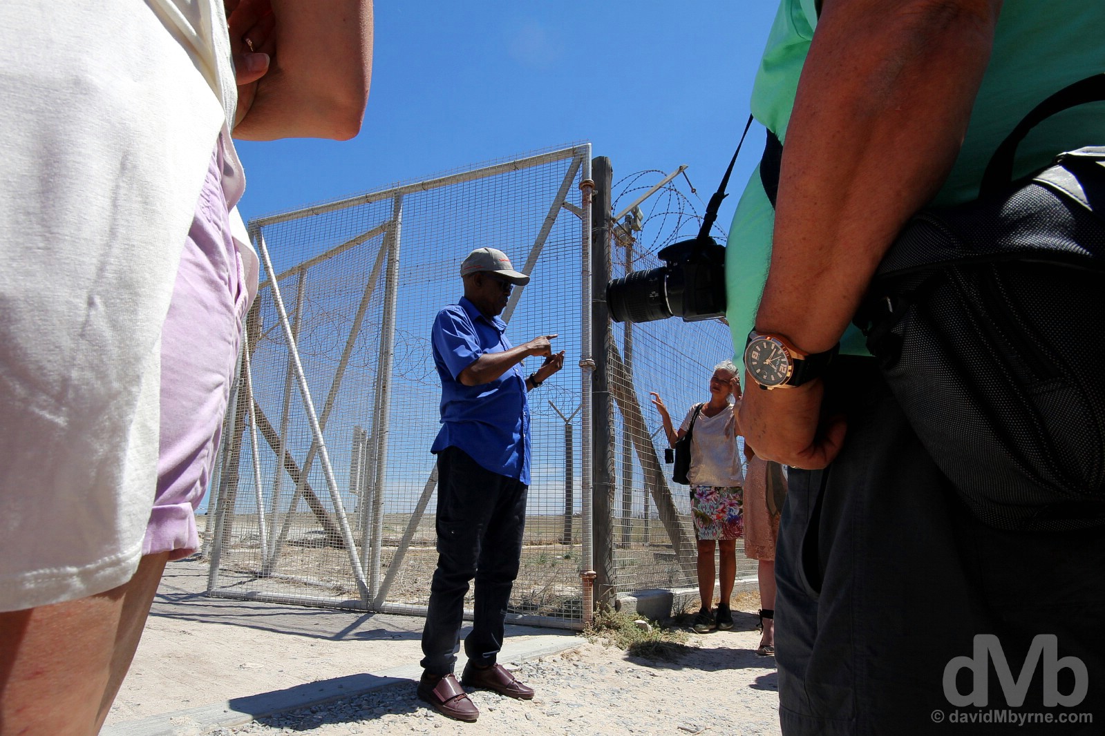
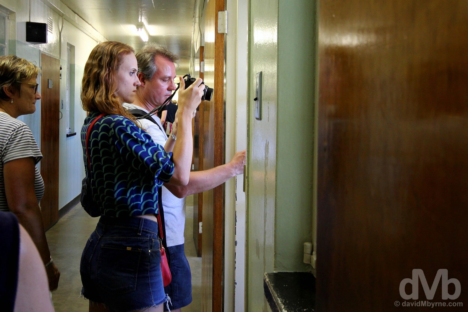
MAXIMUM SECURITY PRISON || The culmination of the 4-hour Robben Island tour, an hour of which, give or take, is spent getting to and from the V&A Waterfront via ferry, is a poke around the innards of the island’s infamous Maximum Security Prison, a soulless complex of interlinking H-block buildings with thick walls and stories galore. As this is a museum, some of the rooms in the prison have today been given over to informative displays on the history of the prison, its inmates and general prison life, specifically during the Apartheid era. There’s a lot to read, but nowhere near enough time is afforded to read it all. Not even close. The tour, led by a former inmate (see the next picture), feels very much like the conveyor belt it is; it’s rushed and unfortunately you’ve no option but to bypass the majority of the displays, found both inside the prison walls and outside under the burning sun in the prison grounds. Robben Island, Table Bay. February 22, 2017.

FORMER INMATE GUIDE || Of course it won’t always be the case but for now tours of Robben Island’s Maximum Security Prison are led by a former inmate who greets tour parties at the entrance of the prison for a briefing and to answer any questions put to him. An anti-Apartheid campaigner sentenced to time on Robben Island for engaging in ‘terrorist activities’, a catch-all ruling used to sentence many a Robben Island inmate, our guide was articulate, informative & approachable. Above all, he was grateful, grateful for the time he spent wrongly incarcerated here. Clearly a man with a great outlook on life & with a capacity for forgiveness, he sufficiently enunciated his reasoning for feeling such, but it was still lost on me. Robben Island, Table Bay. February 22, 2017.
Viewing Nelson Mandel’s cell in the solitary confinement wing of the Maximum Security Prison on Robben Island, Table Bay. February 22, 2017.
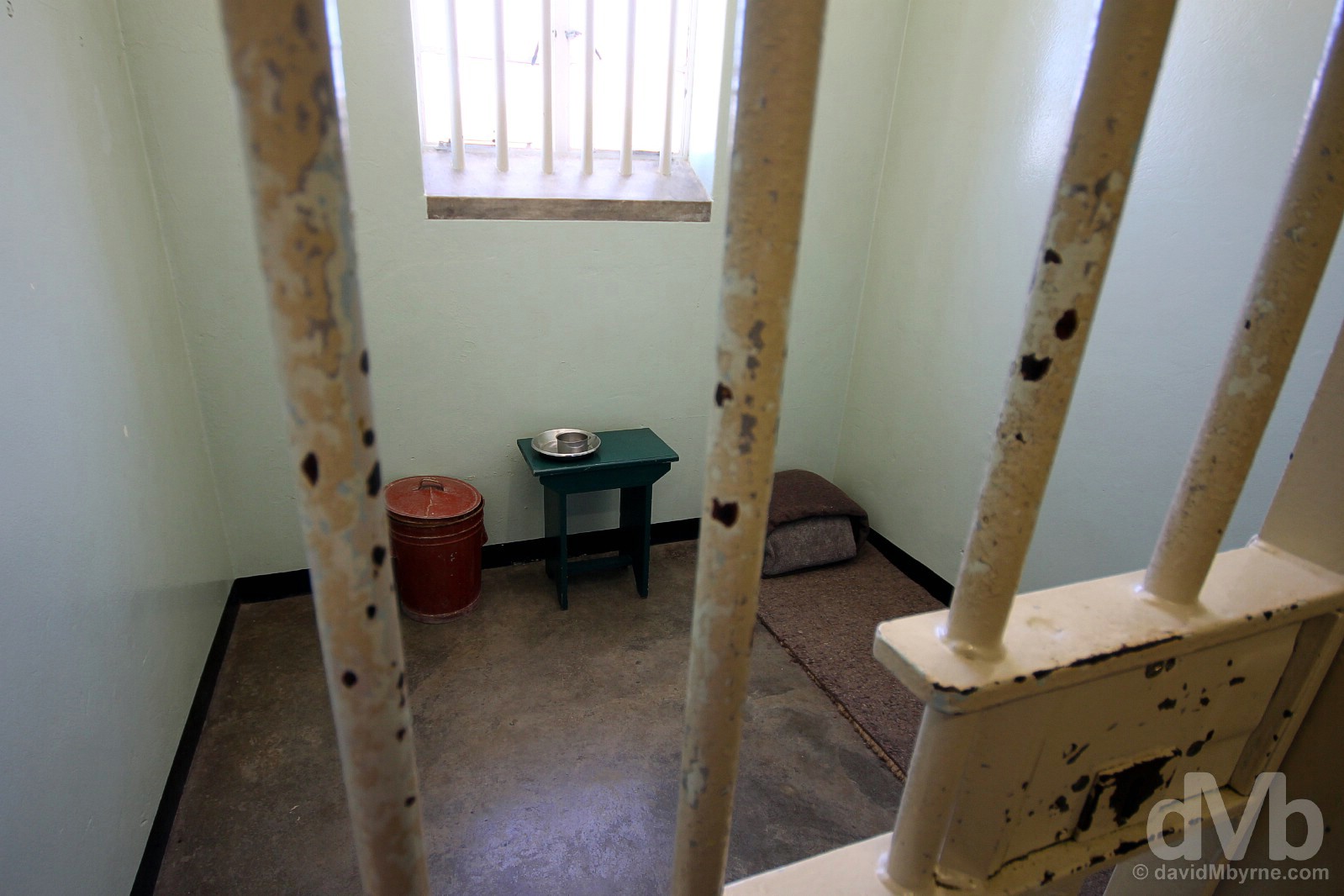
NELSON MANDELA’S CELL || The main event, Number 4 cell in the solitary confinement wing of Robben Island’s Maximum Security Prison. Sentenced to life in prison in 1964 for his part in the life-long struggle to reject the injustice, unfairness, inequality, and racial discrimination entrenched in South African society, and that was ultimately legalised with the introduction of Apartheid in 1948, this cell was, from 1964 until 1982, ‘home’ to Nelson Mandela for 18 of the 27 years he spent behind bars, these actual bars, prior to the fall of Apartheid in 1991. At the time of his arrival in Robben Island Mandela was 45. He would be 71 when he walked free from the Victor Verster Prison near Paarl in the Western Cape, a momentous moment in world history that was broadcast live around the world (I remember it well). Far from being sent into exile, Mandela’s morale leadership & stature continued to grow while he was incarcerated. Universally revered as an icon of leadership & humanity, he died in December 2013 at the age of 95, a huge blow to the new country he help shape. His cell is today presented as it was when Mandela served his time here – a simple mat on the ground, a tiny table with a rudimentary cup & plate, and a red bucket which served as a toilet (although this is not the toilet used by the great man himself). Robben Island, Table Bay. February 22, 2017.
– Nelson Mandela
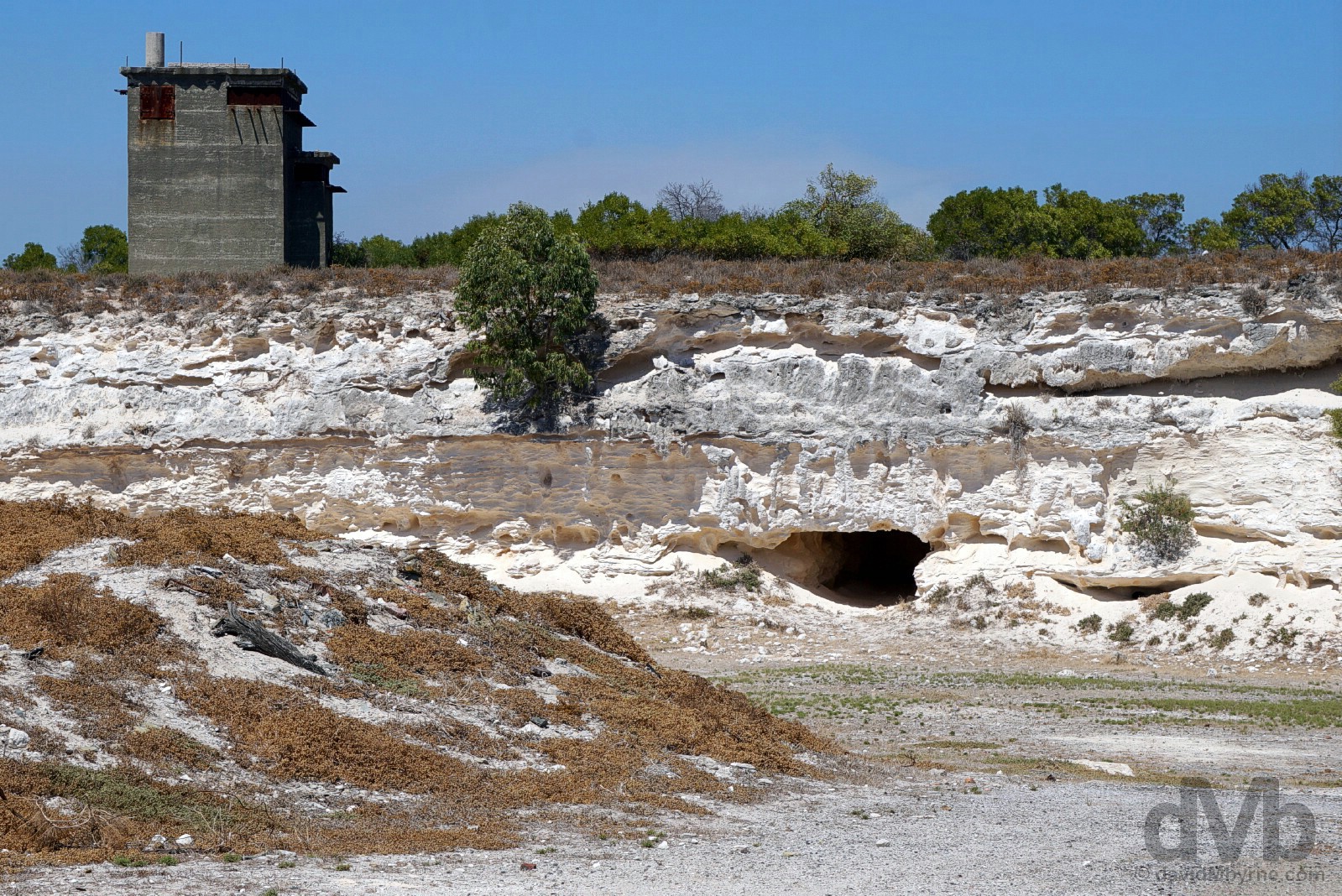
ROBBEN ISLAND TOUR & THE LIME QUARRY || Prior to visiting the prison, the Robben Island tour starts with a narrated bus journey from the docks to the southern tip of the island, passing several historical island landmarks en route. Among them are the Leper Graveyard, the final resting place of the lepers who died on the island, all others – there were some 1,000 lepers on Robben Island at one stage – were removed from the island in 1930; the Church of the Good Shepherd, a.k.a. the Leper Church, built in 1895 by lepers from rock quarried on the island and void of any pews – lepers couldn’t kneel – and the only building on the island used by lepers that was not burned or demolished in 1931; the tiny whitewashed 1841 Anglican Robben Island Garrison Church, built by convict labour, an early example of Cape Gothic style, a national heritage site, & seemingly a cheap place to get married (honest); the Victorian Robben Island Guest House built in 1894, at one stage it served as the British Commissioner’s Residence; the old School for the education of the children of island staff; the Moturu Kramat, a Muslim sacred site built in 1969 to commemorate Sayed Adurohman Moturu, one of Cape Town’s first Imams who was exiled to the island in the mid-1740s and who died here in 1754; and the House of Robert Sobukwe House, a leader of the Pan African Congress, a radical offshoot of the ANC, who was held here in strict isolation between 1963 & 1969 – he was prohibited verbal communication with others, even wardens. The tour also swings by the island’s Lime Quarry, seen here from the bus (we didn’t disembark the tour bus at any of the sites mentioned). One of the earliest features with evidence of human occupation on Robben Island, activity at the quarry dates back to the mid-17th century – it was from here that the dressed stone for the foundations of the Castle of Good Hope in central Cape Town, South Africa’s oldest building, was sourced. A notorious island location, inmates were forced to perform futile hard labour here; there was no demand for the island’s limestone during the Apartheid era, workers basically toiling here daily for something to do (although they used their time in the quarry to educate themselves in everything from literature to philosophy to history). Mandela himself worked here for 13 years, developing eye problems in later life as a result of exposure to the white limestone. Robben Island, Table Bay. February 22, 2017.
CapeTownBig7.co.za – Robben Island, one of Cape Town’s Big 7, the best of what the city has to offer (#CTBig7)
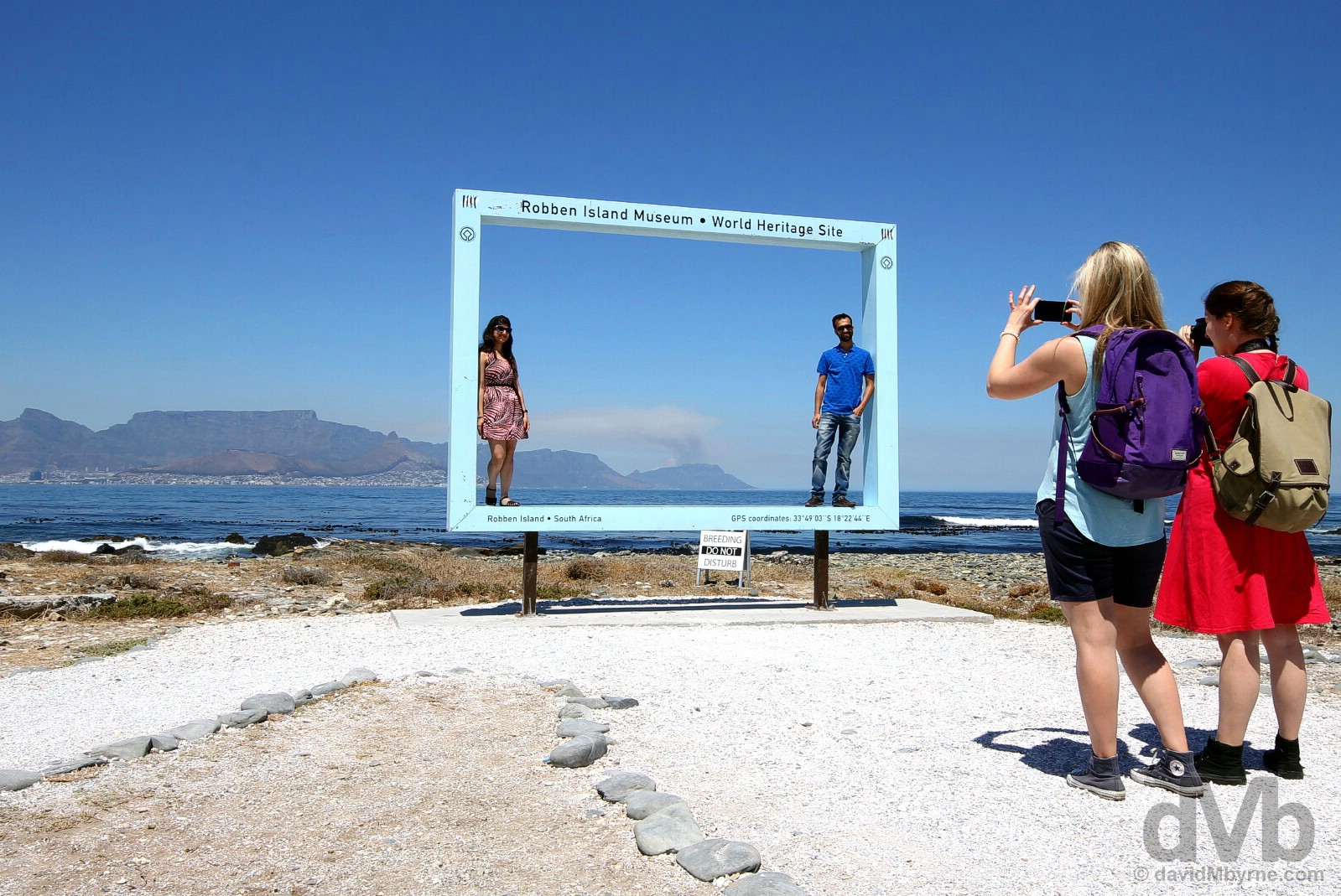
Framed. It’s not all melancholy and sobriety on Robben Island. The very southern tip of the island, were the tour buses do empty their contents, provides some relief in the form of this ‘Look! I was there’ photo op. And why not. It’s a hell of a backdrop. Robben Island, Table Bay. February 22, 2017.
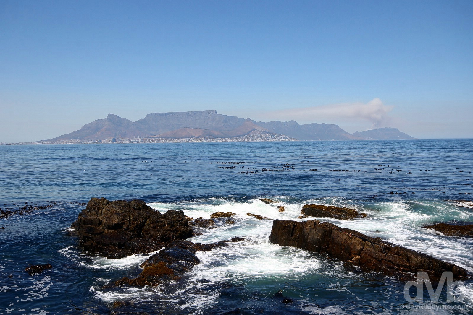
Cape Town & The Cape Peninsula as seen from the southern shore of Robben Island, 9 kilometers away across Table Bay. February 22, 2017.
Back on the mainland and done with history for this day, it was time to get sweaty (& high).

Robben Island in Table Bay and the northern Atlantic Seaboard settlements of Sea Point & Fresnaye as seen from the summit of Lion’s Head, Cape Town. February 22, 2017.
You can attempt to anticipate it by researching it ad nauseam. I did. You can get a better feel for it by exploring the region itself from ground level. I did that, too. But it’s only when you drag yourself up to the summit of the city’s Lion’s Head that you can fully appreciate Cape Town’s awe-inspiring setting.

LION’S HEAD || At 669 metres, the city landmark Lion’s Head is not a particularly high peak and it only takes an hour of sweating to ascend to the summit – while uphill the whole way, it’s not a strenuous hike, although the use of stainless steel chains & ladders at precarious sections might perturb a few. The route to the top sees you corkscrew the slops of the pimple-shaped hill ensuring that you are treated to epic 360-degree vistas of the whole region as you go, eye candy the likes of which I’m not sure is available anywhere else among the virtually endless hiking options Cape Town offers. It’s hard to pick a favourite among all the vistas on offer but this one has to be up there. Captured two-thirds of the way up, it’s a view of (L-R) the city of Cape Town & harbour on Table Bay, Devil’s Peak & Table Mountain, and the western-facing Twelve Apostles formations of Table Mountain & the Atlantic Seaboard side of the Cape Peninsula stretching down towards Cape Point. Looking east, the low-lying sun to the west meant the Lion’s Head end-of-the-day shadow was slowly creeping toward the city of Cape Town. If there’s a better time of the day to ascend this iconic peak then I’m not sure when that is. Lion’s Head, Cape Town. February 22, 2017.
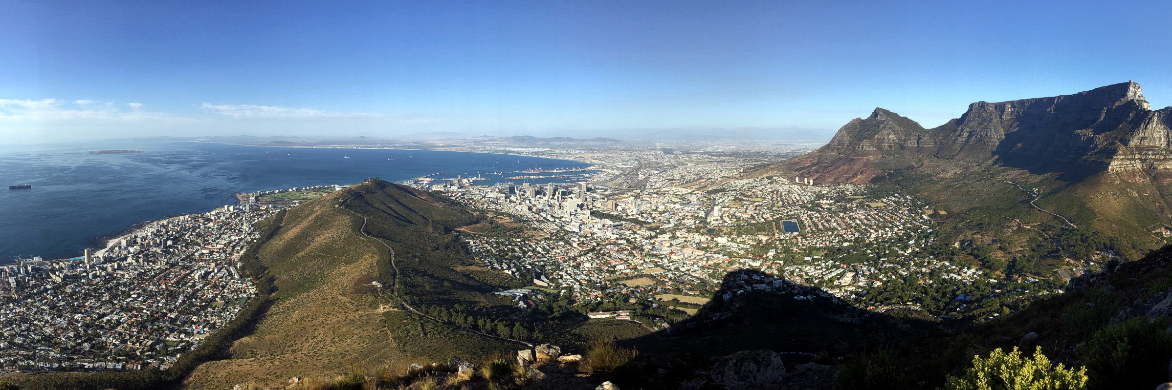
The shadow had encroached a little further towards the city by the time this image was captured from the summit of Lion’s Head, 22 minutes after the above panorama. Seen here is (L-R) shipping & Robben Island in Table Bay; Signal Hill separating the the northern Atlantic Seaboard settlements of Sea Point & Fresnaye from the city of Cape Town; Devil’s Peak; &, of course, the two-mile-long flat plateau of Table Mountain lording over the whole shebang. Lion’s Head, Cape Town. February 22, 2017.
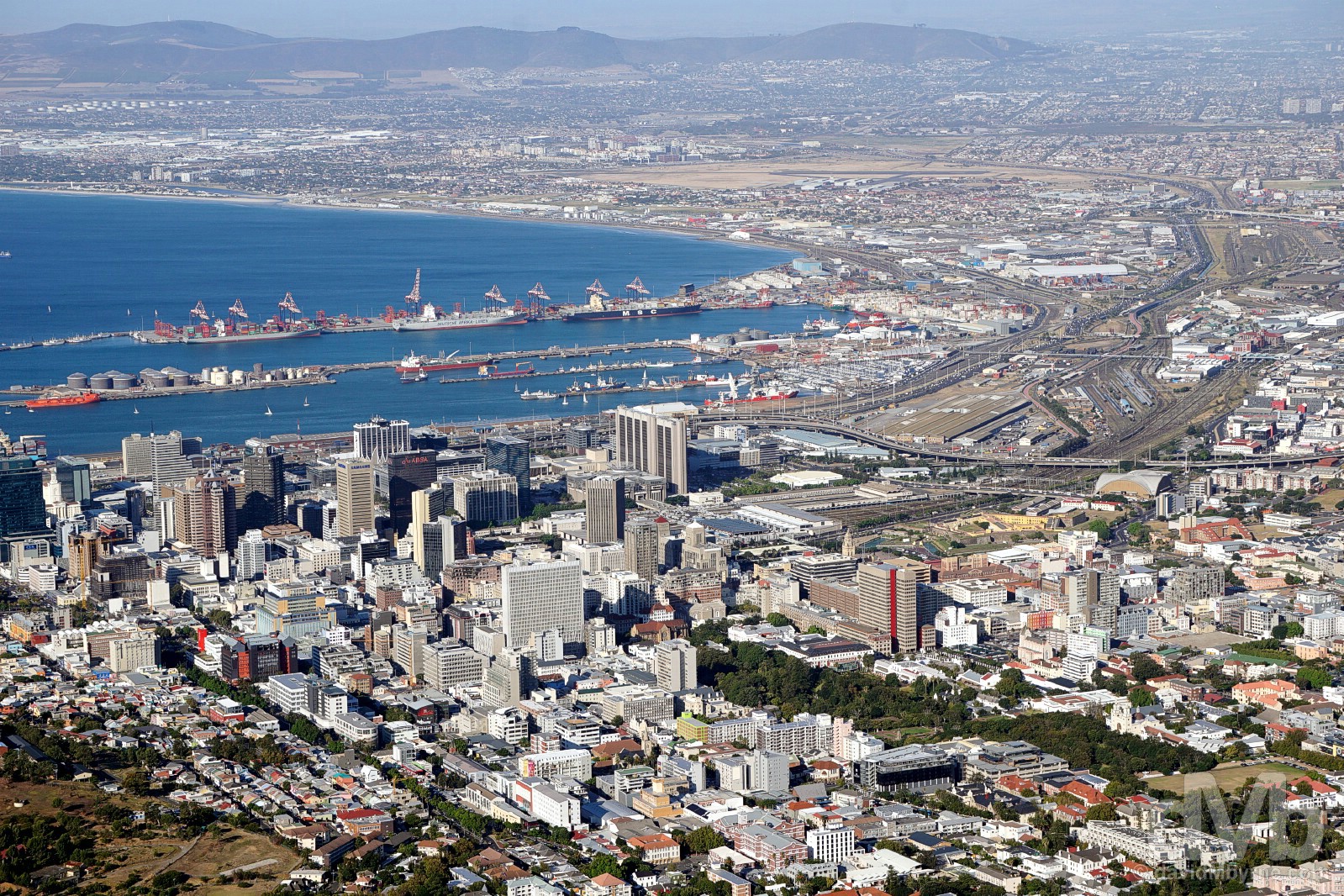
Cape Town Harbour and City Centre, explored on Day 2, as seen from the summit of Lion’s Head. February 22, 2017.
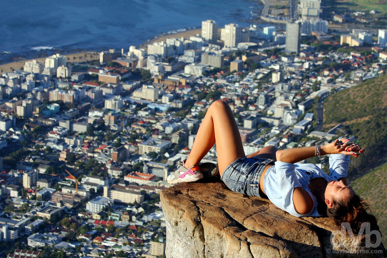
Her again. She seemed to like lounging around for the camera(s). Normally I wouldn’t indulge such narcissism as she displayed up here, but the setting, the lighting, & the background (oh the background) made it hard not to. Late afternoon atop Lion’s Head overlooking Cape Town. February 22, 2017.
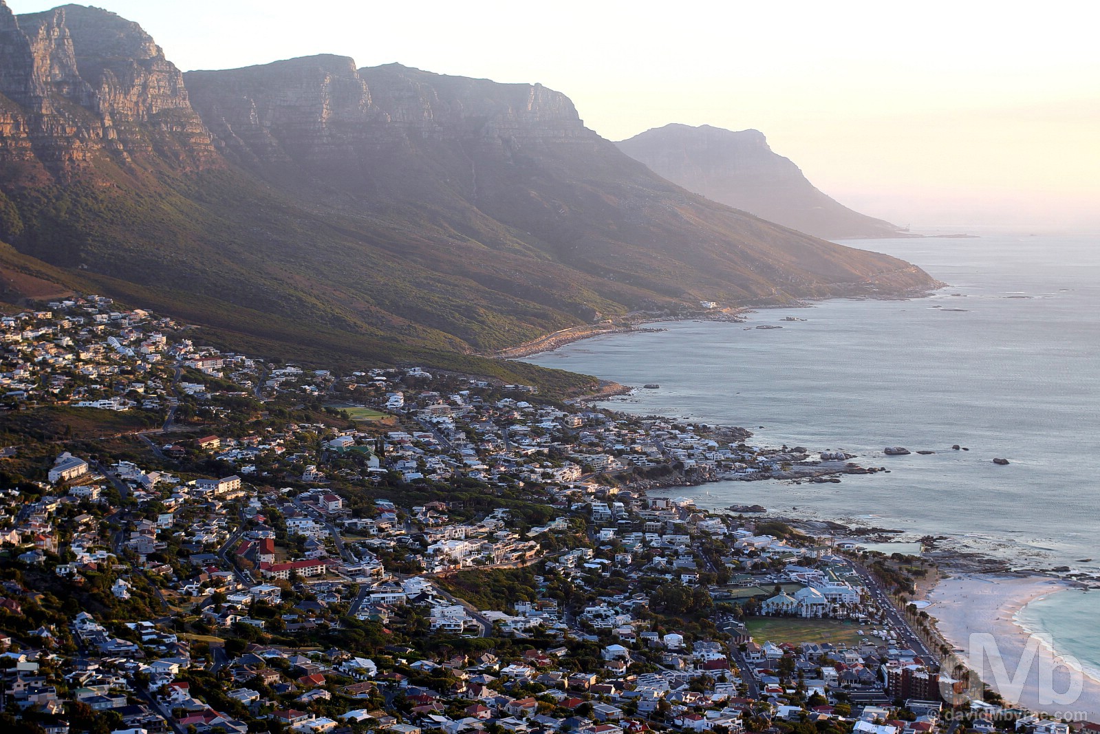
On the descent. Light fading fast over Cape Town’s Atlantic Seaboard settlements and the distant Cape Peninsula as seen on the descent from the summit of Lion’s Head. Cape Town. February 22, 2017.
The Table Mountain Low
The plan was to leave (possibly) the best until last, sunset from the top of Table Mountain, Cape Town’s unmistakable 1,087-metre-high New7Wonder of Nature landmark that is supposedly the most climbed massif on earth. With enough climbing done for today, tickets for the cable car, the much lauded Table Mountain Aerial Cableway, were well since booked. Wind on the summit was the excu… sorry, the reason given for the early suspension of cable car services on this particular day, a somewhat dubious claim given the gloriously still nature of the evening; as far as we could discern there was more air – hot air – emanating from the staff as there was blowing on the summit of Table Mountain itself. Maybe someone wanted to go home early on this day, or they just weren’t bothered. Either way, I’ll need to return to Cape Town to tick this particular #CTBig7 attraction off the list, as good a reason as any to return I guess.
CapeTownBig7.co.za – Table Mountain Aerial Cableway, one of Cape Town’s Big 7, the best of what the city has to offer (#CTBig7)
Cape Town & Environs
PICTURE OF THE DAY || DAY 9 || February 23, 2017Image || Vineyards of the Napier Winery on the outskirts of Wellington.
“I might just have left the best for last. While I wasn’t hung up on getting it, I have been on the lookout for a nice vineyard picture since arriving 8 days ago now.”
Day 9 || February 23, 2017
Day 9 Overview || WELLINGTON WIND DOWN – Wellington, the road to Bain’s Kloof Pass, & the Napier Winery.
The wind down. The day that, and as sure as night follows day, had to come. D-day. Departure day. There was nothing planned for today, no itinerary, no good reason to leave base. But we did anyway, if only for a brief period. And of course it was photogenic.
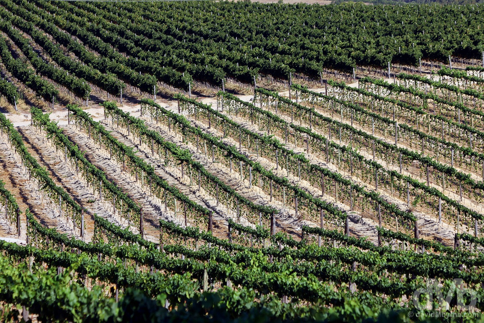
Vines of the Napier Winery as seen from the R301 outside Wellington, Western Cape. February 23, 2017.
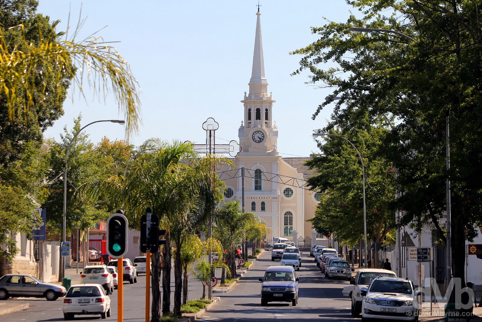
WELLINGTON || Home in the Western Cape, Wellington, founded in 1840 and named after the Duke who defeated Napoleon at the Battle of Waterloo, is 75 kilometres from Cape Town amid the Cape Winelands. I’d driven up and down this road, Church Street, numerous times over the previous 8 days, reminding myself each and every time that I’m to get a picture of the town’s pretty Dutch Reformed Church. So, and with time running out, it was today or never. Wellington, Western Cape. February 23, 2017.
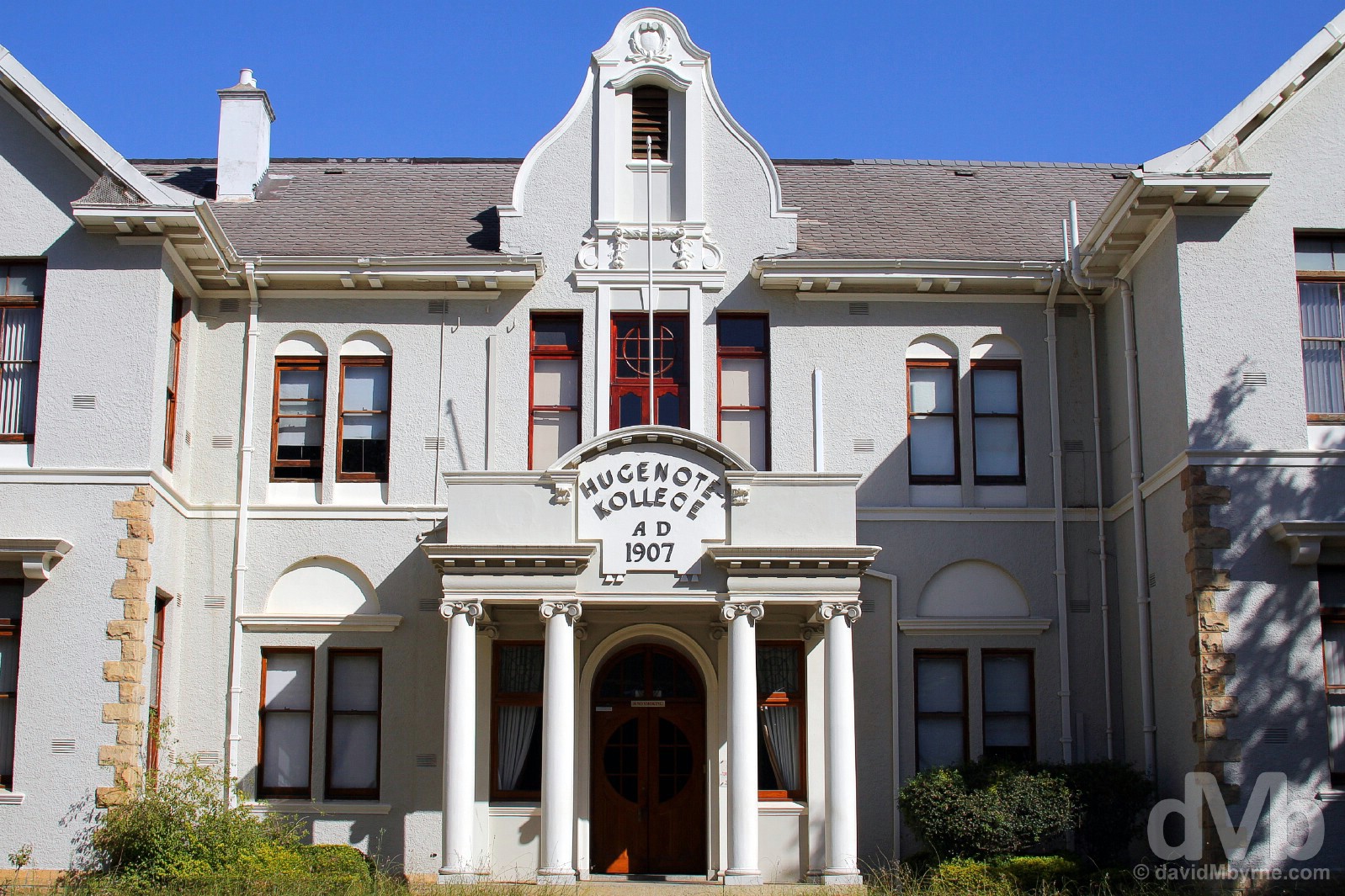
HUGENOTE COLLEGE || Something of a rugby & academic centre, Wellington is home to, among other educational institutions, Hugenote College, a Christian private training institution founded in 1951 that specializes in the training of leaders in various ministries as well as professionals in the social welfare sector. They’ve got a nice library, the building of which dates to 1907. Kollege Street, Wellington. February 23, 2017.
Western Cape Passes
This region of the Western Cape is rather topographically diverse; everything from lush valleys (producing the wine) to highland farmland rests between the rugged coast and seemingly impenetrable mauvish hunks of towering sandstone or shale that are always in view. The hills around here, which are some 350-500 million years old and which once were continuous with mountains in present-day Argentina, Australia & Antarctica (before things started to move, and well before I arrived), are part of the Cape Fold Mountains, a series of parallel ranges running for almost 1,000 kilometres through this southwestern corner of South Africa. Hardly the Himalayas (the region’s highest peak, Seweweekspoortpiek, tops out at only 2,325 metres/7,628 feet), the peaks here don’t throw up much of a challenge for mountaineers, but it was a totally different story when it came to road building.

BAIN’S KLOOF PASS || Wellington nestles at the base of one of the oldest and most famous mountain passes in South Africa, the Bain’s Kloof Pass, a South African National Monument. First surveyed in 1846, started in 1849, and completed in 1853, the 18-kilometre pass, which reaches a height of 594 metres (1,949 feet), was built with the use of convict labour by master road-builder Andrew Geddes Bain, just one of over 30 mountain passes built by Bain and his son Thomas in an effort by the then ruling British to tackle the problem of opening up the Western Cape to wheeled transport. Originally built for horse-drawn traffic, the pass was later paved and today the drive is one of the most spectacular in the region. Western Cape. February 23, 2017.
Regeneration underway. This region of Western Cape is going through something of a drought right now, the adverse affects of which are marring sections of the drive on the R301 from Wellington to Bain’s Kloof Pass. Western Cape. February 23, 2017.

NAPIER WINERY || I might just have left the best for last. While I wasn’t hung up on getting it, I have been on the lookout for a nice vineyard picture since arriving 8 days ago now. As I repeatedly commented on Day 6, beauty is all around in the Winelands and idyllic vineyard scenery isn’t exactly hard to find. However, that picture-postcard Winelands scene of vine repetition in an undulating valley & with a resplendent backdrop had eluded me. Until today that was, until the eleventh hour, presenting itself when it wasn’t even being sought. Driving the short distance via the R301 from Wellington towards the Bain’s Kloof Pass brings you past the Napier Winery where that idyllic scene I spoke of was waiting for me all along, and right on my doorstep too. My very last capture in South Africa, it’s also one of my favourites of the whole trip. Wellington, Western Cape. February 23, 2017.