Bolivia
The Tibet Of The Americas & The Highest, Most Isolated, Rugged & Indigenous Country In South America
Salar de Uyuni, Bolivia. September 3 2015
Bolivia (August 22 – September 4 2015)
Landlocked high in the Andes, Bolivia is the highest, most isolated, most rugged country in South America. Boasting everything from snow-capped peaks to shimmering lakes to dense jungles to the world’s largest salt flat, the so-called Tibet of the Americas is also the continent’s most indigenous country; over 50% of the population claim direct Amerindian descendancy, descendants of Indigenous peoples of the Americas, the pre-Columbian inhabitants of North and South America. What follows is a recap of 2 weeks of travel in the country, a small part of a larger South American odyssey.
Read all postings from the Bolivian road in chronological order or jump to specific postings using these links.
ARRIVAL & THE BORDER – Peru Border Issues
LAKE TITICACA – Copacabana & Isla del Sol
CITIES – La Paz, Sucre, & Potosi
UYUNI – Salar de Uyuni
Postings From The Bolivian Road (In Chronological Order)
BORDER CROSSING
Date || August 22, 2015
Location || Copacabana, Bolivia ( )
)
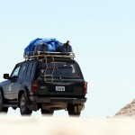
T’was eventful crossing border from Peru to Bolivia earlier today. I almost didn’t make it. Entering Bolivia wasn’t the problem. It was leaving Peru that made things interesting. Seemingly I was only granted 5 days when entering Peru 26 days ago, something I hadn’t even noticed until today (it was there in my passport for all to see). That’s a 21-day overstay. The Peruvian Immigration officer couldn’t explain it (as an Irish/EU passport holder I should have been given 90 days as standard, no questions asked) but had no option but to ‘fine’ me, USD $21 payable only in a nearby bank. But today is Saturday. Banks don’t open on weekends. The official said the ‘problem’ could go away if I paid the equivalent of €30 direct to him. I wasn’t happy. I said OK (what choice did I have) but was wary when he refused to provide a receipt. He didn’t like me from that point onward & gave me back my passport with a deposit slip, totalling $21, for said nearby bank. There was a total absence of officialdom on either side of the helter-skelter border, marked only by a crude arch, beyond which is the sign seen in this picture. So I, & being as stubborn as I am, tried to enter Bolivia without a Peruvian exit stamp – bizarrely you could easily exit Peru & enter Bolivia without checking out of one & into the other, such was the chaotic crossing. That didn’t work (the first thing the Bolivians checked for was a Peruvian exit stamp) so I hoofed it back to the Peruvian hut, tail firmly between my legs, to pay the €30 and be on my way. But it wasn’t that easy. If only. The Peruvian Immigration official now refused to deal with me. He waved his finger. A lot. He kept saying ‘banco’ (bank) & ‘Lunes’ (Monday). I’d clearly burnt my bridges. Big time. I was in a pickle. I pleaded with him, not losing sight of the fact that I was pleading with him to accept payment, without exchange of receipt, to let me OUT of his country. He kept waving his finger. I’d no choice but to go on the charm offensive. I told him I liked his country (I did) & that Peruvians were really nice people (most of them.. my limited Spanish vocabulary meant I used the word ‘beautiful’). He kept waving his finger. I told him I’d spent a lot of money in his country (yes, that too). He kept waving his finger. I said I was sorry and asked for his help. He kept waving his finger. Impasse. I was set to explode but had limited options but to keep calm, keep smiling, keep grovelling. My vocabulary exhausted, I scoured my Spanish phrasebook for nice things to say & kept chipping away. Chip…. chip…. chipping away. I eventually got a smile out of him. He was melting. I was winning. I kept going. Finally, voila, the finger waving stopped. I kept going & eventually he asked for my passport, eventually took my money, eventually didn’t give me a receipt for the €30 I gave him, and eventually I was stamped out of Peru. We parted on good terms, a handshake confirming no hard feelings; according to him he was just doing his job and unknowns to him I was just being me. After that, and back in the Bolivian hut (it was barely a hut), it was plain sailing – I was stamped into the country without having to pay the USD$50 the South African travelling with me had to pay or the – ouch – USD$160 each the two Americans we, myself & the South African, crossing with us had to pay. Yes, holding an Irish passport generally makes crossing international borders a painless endeavour, unless things don’t quite go to plan AND you happen to be a stubborn fool like me. In that case things get a little more interesting, and little more expensive, just like they did today. Well hello Bolivia!
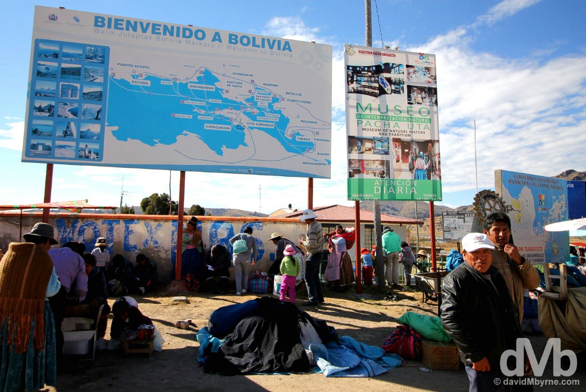
Hello Bolivia. A rushed picture captured on my third crossing of the blink-and-you’ll-miss-it Peruvian-Bolivian Kasani border crossing by the shores of Lake Titicaca, some 8 kilometres from the Bolivian town of Copacabana. My first crossing was after initially passing the Peruvian Immigration hut (easily missed), second crossing was en route to an attempt to enter Bolivia sans Peruvian exit stamp, & third crossing was having successfully grovelled my way out of Peru. At the Peruvian-Bolivian Kasani border crossing on the shores of Lake Titicaca. August 22, 2015.
LAKE TITICACA - COPACABANA
Date || August 25, 2015
Location || Copacabana, Bolivia ()
I’m in Copacabana. No, not that Copacabana. That’s a famous beach in the Brazilian city of Rio de Janeiro, a time zone away & on the other side of the continent. I’ll get there eventually but for now I’m coming to the end of a 3 night stay in the Oh Holy is Thou Bolivian lakeside pilgrimage town after which the better-known Rio stretch of sand is named.
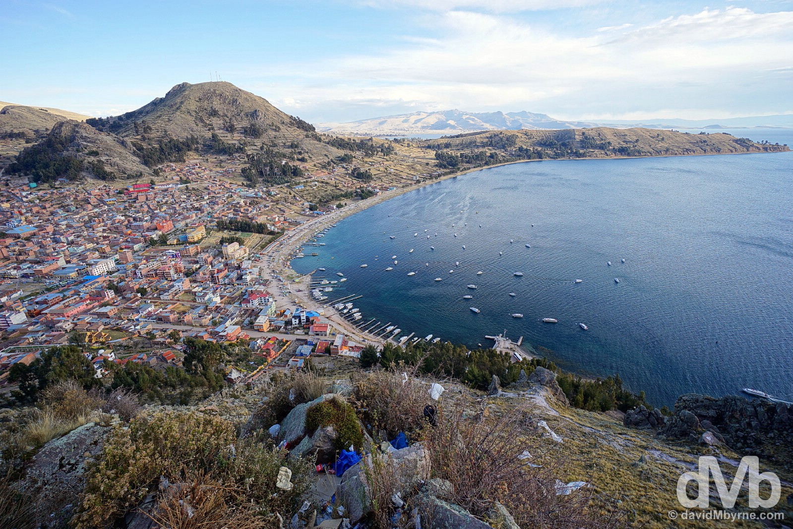
The town of Copacabana on the shores of Lake Titicaca as seen from the pilgrimage mountain Cerro Calvario. Copacabana, Bolivia. August 23, 2015.
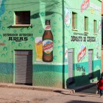
On the streets of Copacabana, Bolivia. August 23, 2015.
Copacabana || For Pilgrims
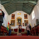
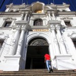
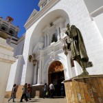
Barry Manilow never sang about this place. Oh no. My first stop in Bolivia, country number five of my on-going South America junket, Copacabana is Bolivia’s holiest town. Home to one of the country’s most impressive churches, an imposing, blindingly white, no-photos-allowed-inside cathedral that houses the Virgen de Copacabana, a small lavishly dressed statue encased in glass above the cathedral’s altar that just happens to be Bolivia’s most revered Catholic image.
The Catedral in Copacabana, Bolivia. August 23, 2015.
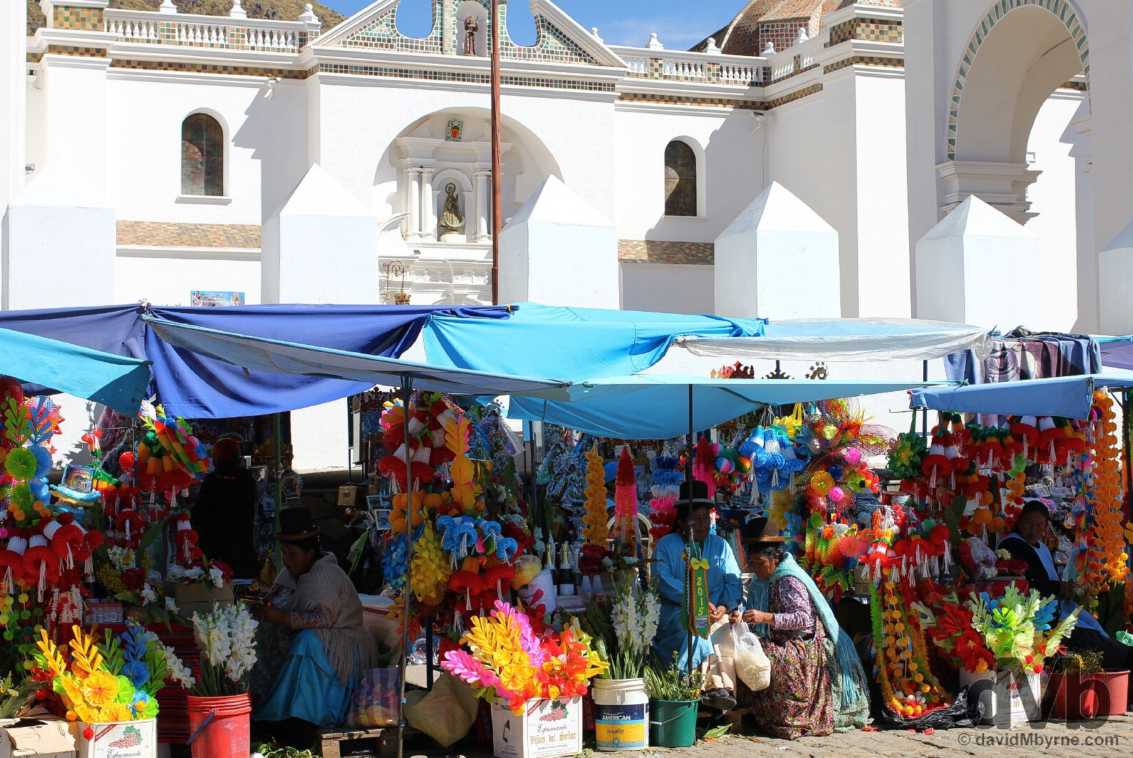
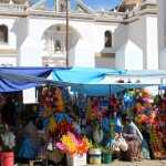
People flock to Copacabana, including from across the border in Peru, to offer up to the Virgen de Copacabana everything from fake money to miniature houses to replica jerseys, all of which can be purchased from the legions of vendors encamped outside the walls of the Catedral most hours of the day. Copacabana, Bolivia. August 23, 2015.
Cerro Calvario
Cerro Calvario is a hill that rises steeply above Copacabana offering great views of the town, its bay & Lake Titicaca. A popular pilgrimage location overlooking a pilgrimage town, the steep 30-minute path to the top, a workout at this altitude, is lined with 12 large stone crosses, the 12 Stations of the Cross, and ends at the somewhat ugly summit, one full of stalls, burning candles, litter, graffiti, scattered offerings, ramshackle stone altars, & spilled alcohol – seemingly wasting alcohol in this way ensures prayers offered up are actually heard. I sure hope so.
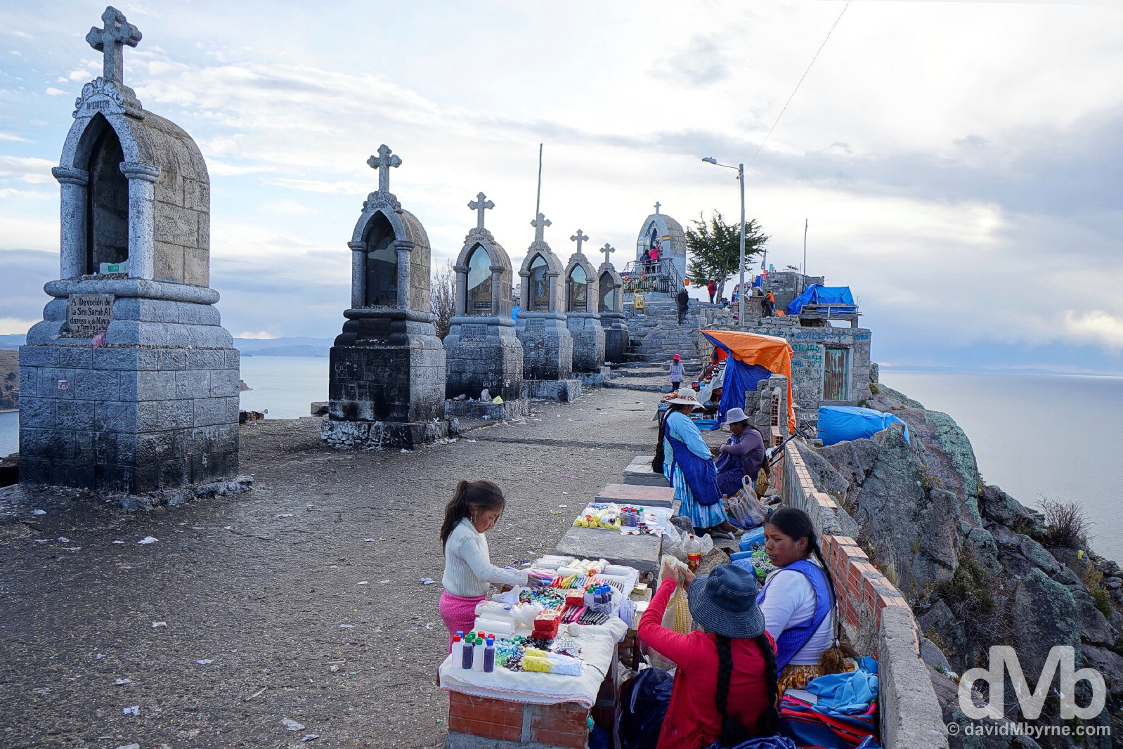
On the summit of Cerro Calvario overlooking Lake Titicaca & the town of Copacabana, Bolivia. August 23, 2015.
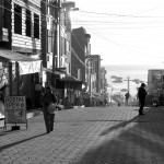
I had a bit of fun from my hostel window on this day playing with shadows.
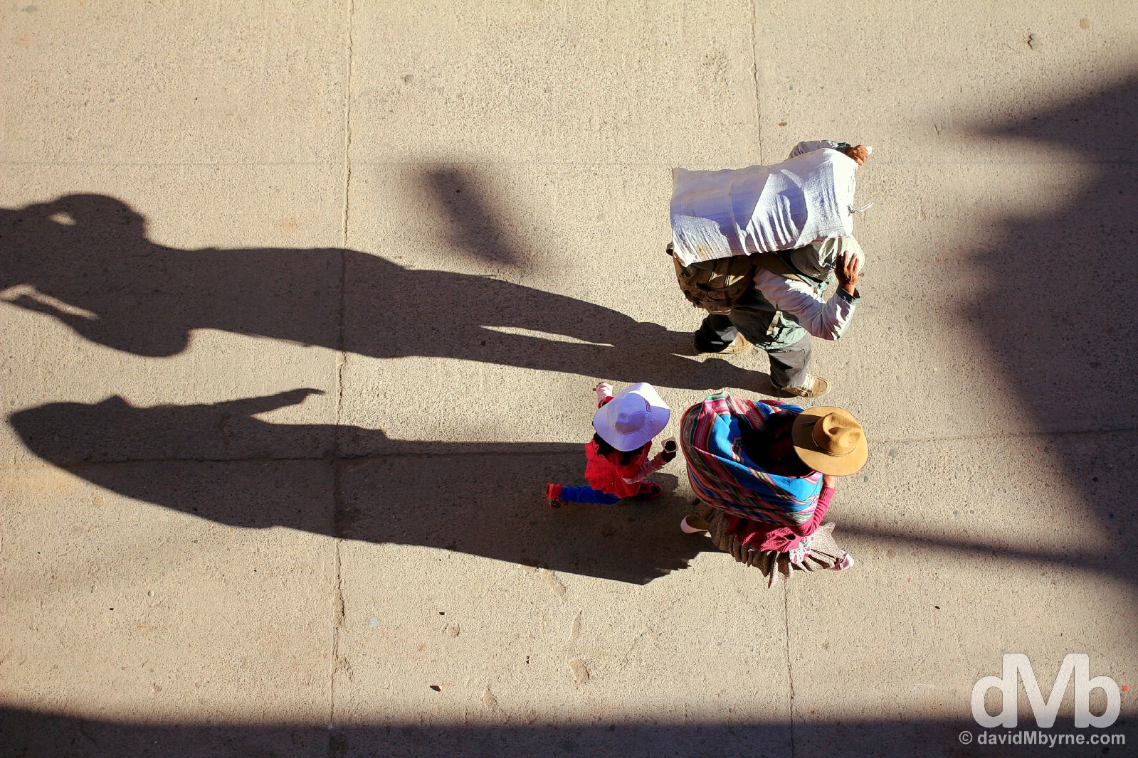
As seen from my hostel window. Avenue Felix Tejada in Copacabana, Bolivia. August 23, 2015.
Shadows on Avenue Felix Tejada in Copacabana, Bolivia. August 23, 2015.
Copacabana || For Tourists
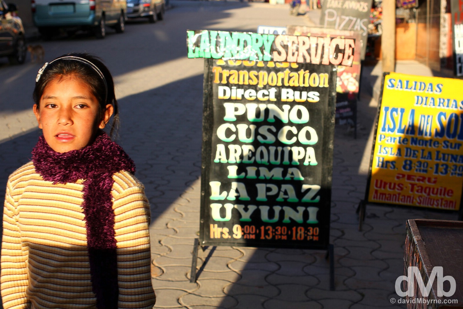
I liked being by Lake Titicaca, extending my time by its shores by 3 days having spent the previous 4 being enchanted by its shimmering blue waters on the Peruvian side of the nearby border. That said, I can’t say I was enamoured with the town of Copacabana itself. Well geared to appease tourists as well as pilgrims, the town, in my opinion, just doesn’t appease very well – internet was sporadic at best, & didn’t work at all for large portions of my stay, & the town is awash with poor value tourist-orientated hostels & eateries, all of which seem content to offer the same Rinse & Repeat, burgers & pizza menu served up with the same piss-poor levels of service (& I say that as someone who is not a foodie – nor am I demanding – but as someone who has come from Peru where I found myself loving the cuisine). You won’t starve (or die of thirst) in Copacabana but you’ll for sure eat (much) better elsewhere in Bolivia (it’d be a poor reflection on Bolivia were that not the case). If fact, if it wasn’t for the nearby offshore Titicaca islands of Isla del Sol & Isla de la Luna, the only reason that most who stop off in Copacabana do so, myself included, then the town wouldn’t have hosted me at all & I wouldn’t have had anything to complain about.
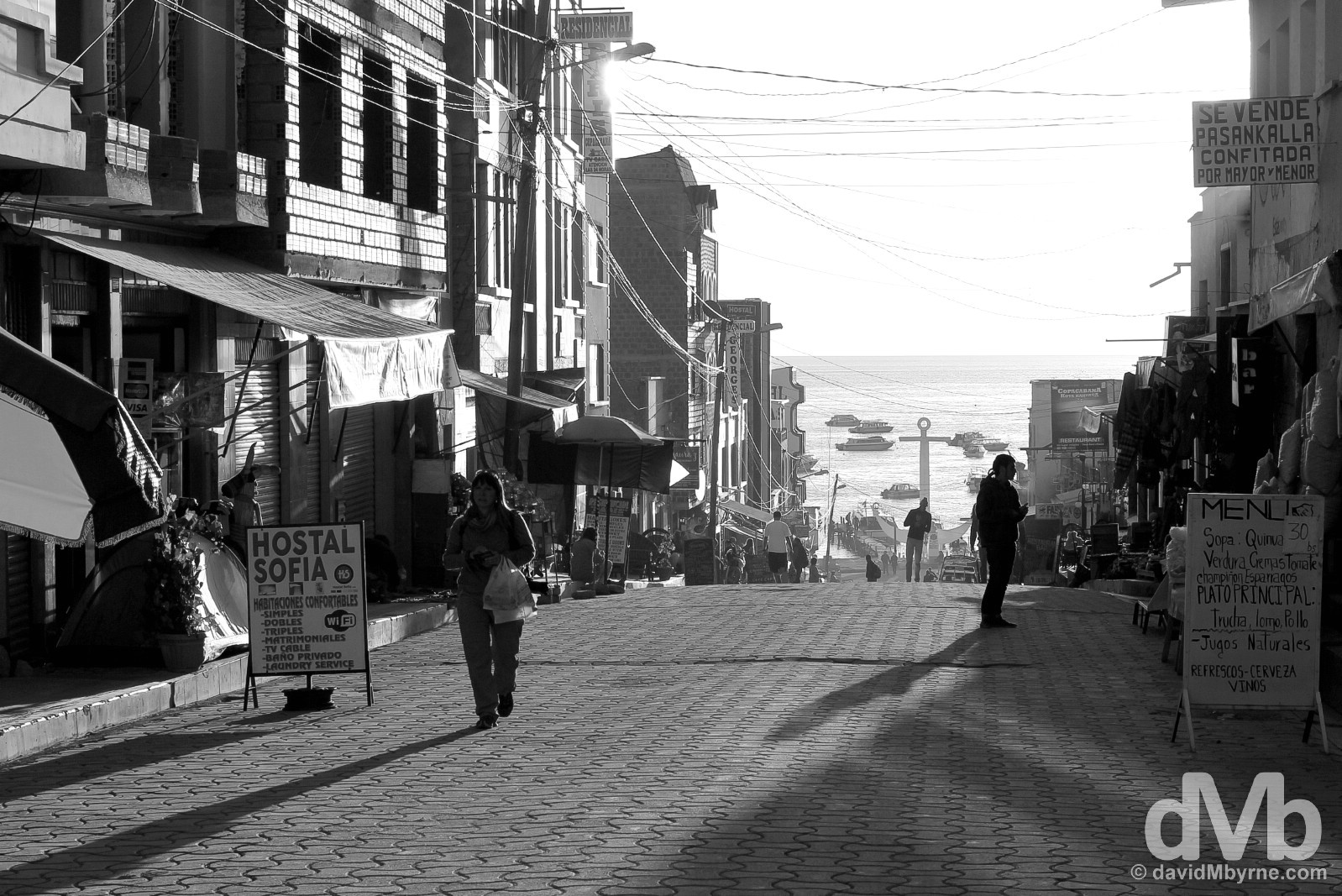
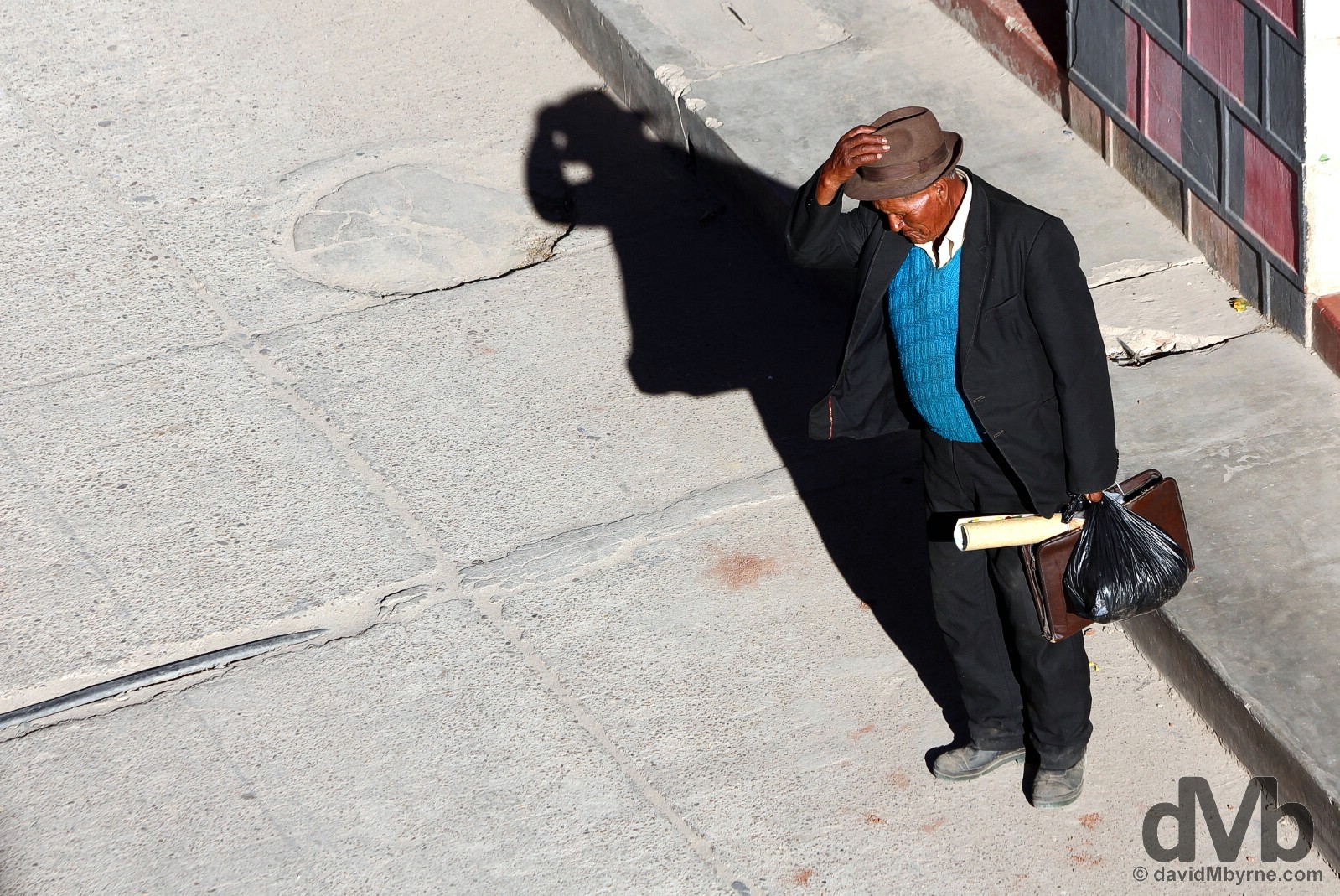
Late afternoon shadows on Avenue 6 de Agosto. Copacabana tourist central, this street, which connects the town’s Catedral to the Titicaca shore, marked by a massive white anchor seen in the distance, is lined with the usual tourist-related outlets – hostels, restaurants, cafes, bars, tour agencies & convenience stores – all of which will (just about) get the job done but none of which will leave much of an impression. Copacabana, Bolivia. August 24, 2015.
Avenue 6 de Agosto, Copacabana, Bolivia. August 24, 2015.
LAKE TITICACA - ISLA DEL SOL
Isla del Sol (Island of the Sun) & Isla de la Luna (Island of the Moon)
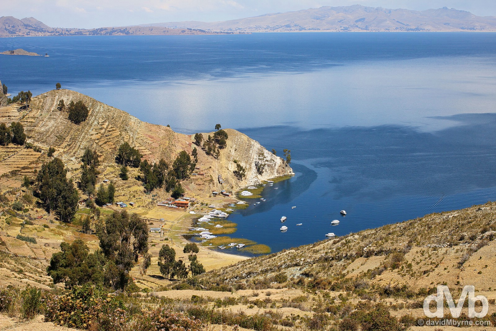
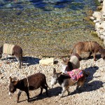
Copacabana is the jump off point for trips to Lake Titicaca’s Isla del Sol & Isla de la Luna. Home to the Aymara people, inhabitants of the Titicaca region whose distinctive culture and language have survived centuries of domination, first by the Incas, then by the Spanish, the islands are a short boat ride across Lake Titicaca from Copacabana’s woebegone port, which is nothing more than a few rickety, half-collapsed wooden piers jutting out into the water.
Walking on Isla del Sol in Lake Titicaca, Bolivia. August 24, 2015.
Isla del Sol
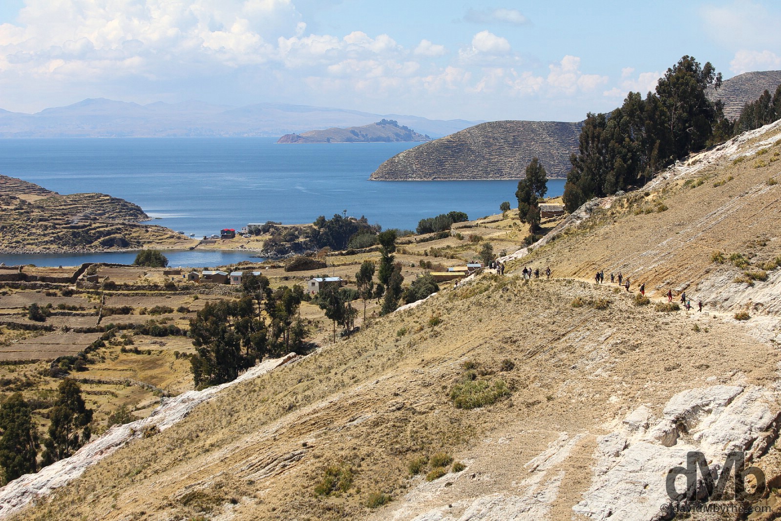
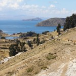
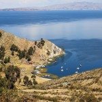
Another pilgrim hotspot, these parched islands have been attracting the devoted for hundreds of years. Once the most important religious site in the Andean world, they are revered as the site where the sun & moon were created and where the Inca dynasty was born – the Incas claim their own ancestors came from here & remains of their shrines & temples still dot both islands. Titicaca is an Aymara word meaning Puma’s Rock, a reference to an unusual rock found on Isla del Sol, the larger of the two islands. Indeed it’s the largest of Titicaca’s over 70 islands & the one that attracts the majority of visitors, myself included. For the non-devout, walking from one end of the 10 kilometre long by 7 kilometre wide island to the other is the thing to do here, a pleasant 4 hour walk that affords great views of the island itself, the lake & surrounds. This was easily the highlight of the time I spent by the Bolivian shores of Lake Titicaca.
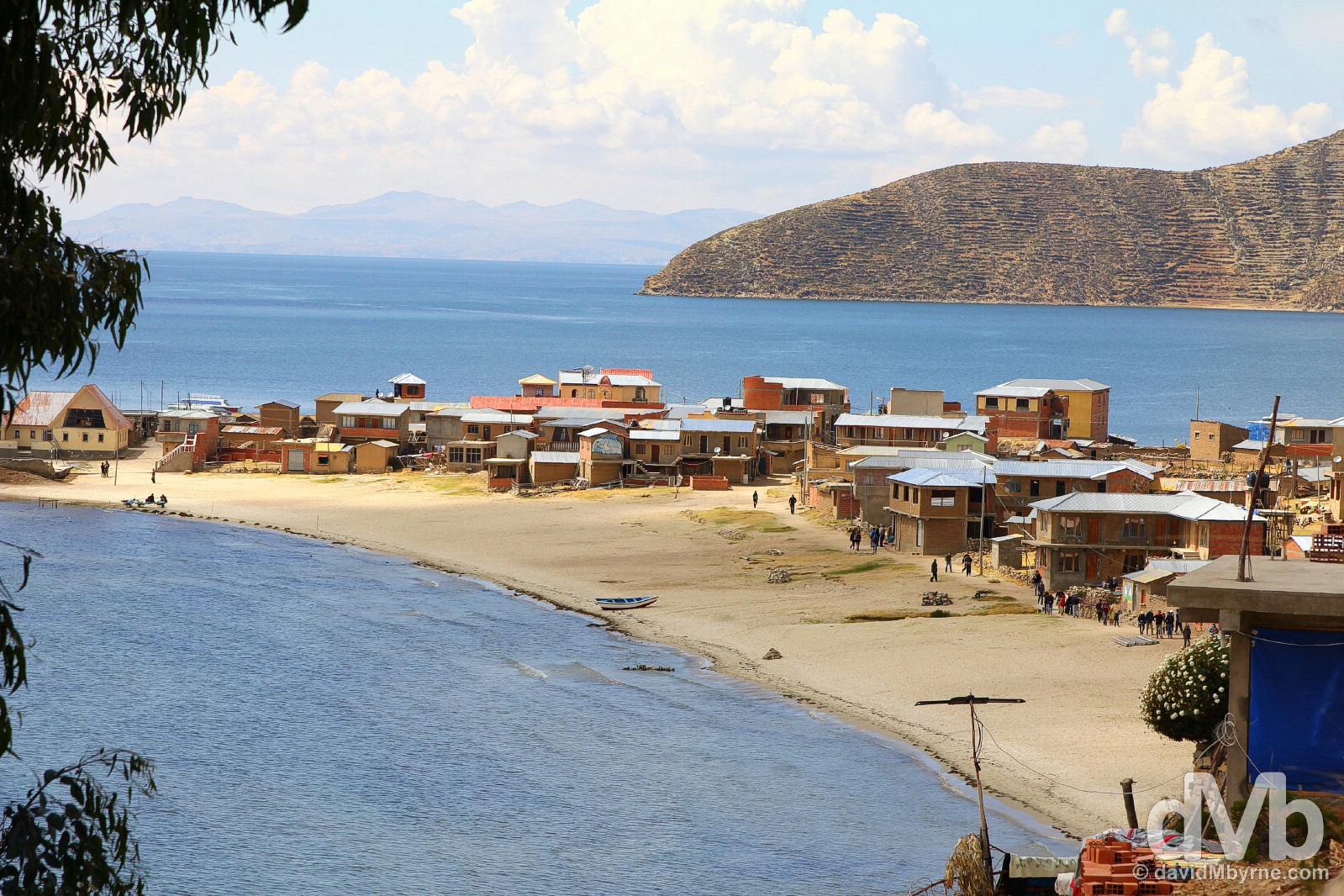
Setting out from the town of Challapampa at the start of walk to Yumani on Isla del Sol in Lake Titicaca, Bolivia. August 24, 2015.
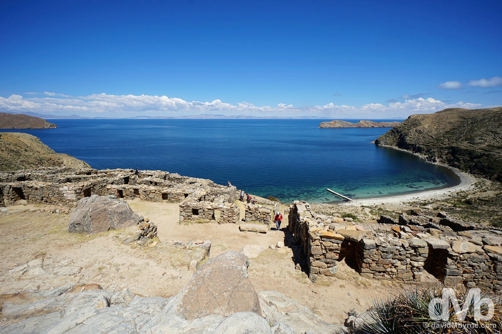
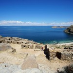
Inca ruins on Isla del Sol overlooking Lake Titicaca, Bolivia. August 24, 2015.
Views from on the path from Challapampa to Yumani on Isla del Sol in Lake Titicaca, Bolivia. August 24, 2015.
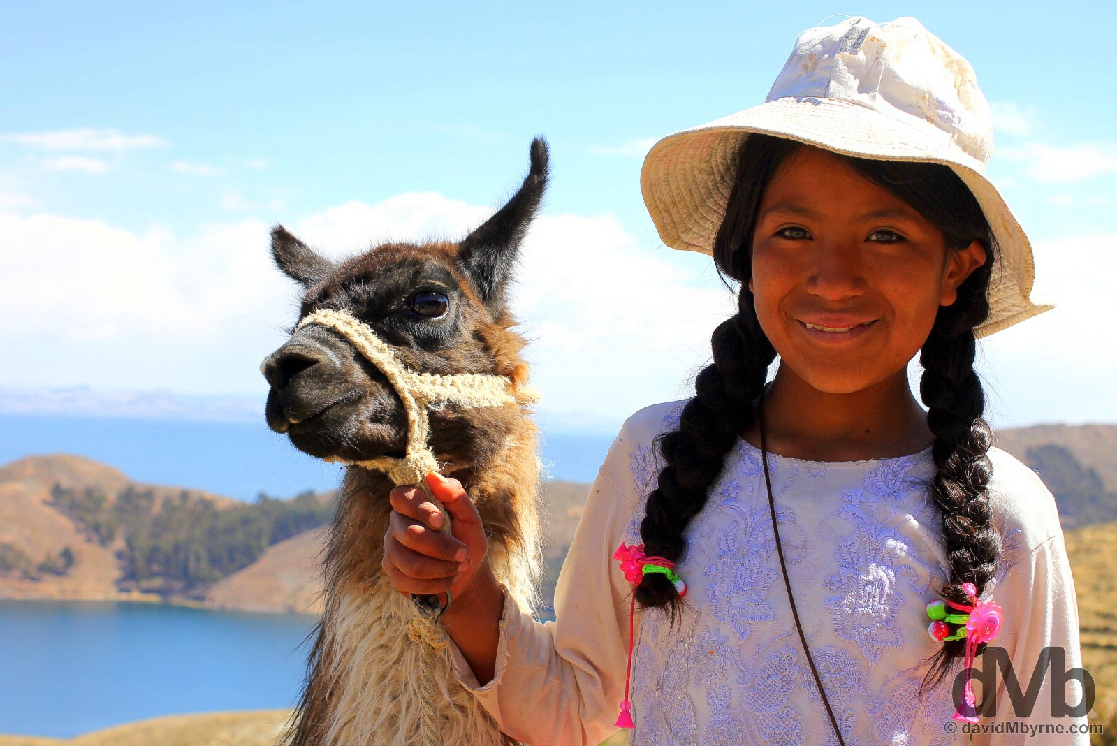
A girl with a llama on the path approaching the village of Yumani towards the end of the 4-hour hike across Isla del Sol. This picture cost me 1.6 Bolivianos/BOB (€0.20). She asked for BOB 2 but was happy to take BOB 1.6, all the change I had on me at the time. Isla del Sol, Lake Titicaca, Bolivia. August 24, 2015.
Captured at the small port in Yumani while waiting for the ferry back to Copacabana on the mainland. Isla del Sol, Lake Titicaca, Bolivia. August 24, 2015.
CITIES - LA PAZ
Date || August 26, 2015
Location || La Paz, Bolivia ()
I’ll never forget my first sighting yesterday of the Bolivian city of La Paz. It came into view as the bus I rode on from Copacabana reached the rim before descended into the gaping 5 kilometre-wide canyon the city rests in. And with the sun shining & the snow-capped 6438 metre-high triple peak of Illimani as a backdrop, I remember quickly agreeing with text I’d read pre-arrival claiming La Paz as having one of the best settings of any city in the world.
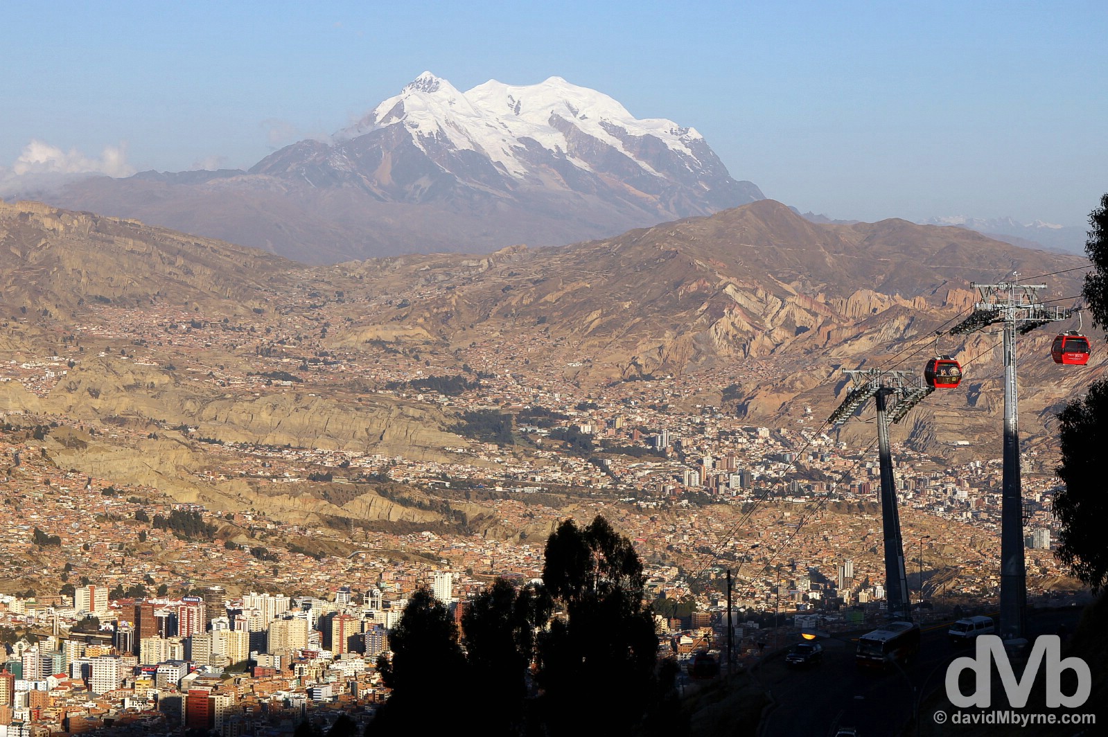
La Paz, which sits at an altitude of over 3600 metres, is one of the highest cities in the world. If the altitude doesn’t take your breath away then views like this will. Having passed this point when arriving into the city via bus yesterday, I made sure to return here today, utlising the cable car seen here in the process. An amble through a rather rundown neighbourhood and past a few rabid looking dogs brought me to a vantage point above the road and of course the city itself. The sun was low and was quickly vacating for this day the canyon that cradles the city, the world’s highest administrative capital; while officially the country’s capital and seat of justice is Sucre, La Paz has more government departments. La Paz, Bolivia. August 26, 2015.
A few more captures from today in La Paz.
-

- La Paz, Bolivia. August 26, 2015.
-

- The central cupola of Government Palace & the central pillar in Murillo Square, the formal city centre of La Paz, Bolivia. August 26, 2015.
-
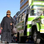
- Chola, traditional voluminous skirt & bowler hat-wearing Aymara women, on the streets surrounding Marcado Buenos Aires in La Paz, Bolivia. August 26, 2015.
-

- Plaza San Francisco, La Paz, Bolivia. August 26, 2015.
-
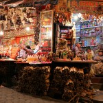
- Mercado de Hechiceria, the Witches Market, La Paz, Bolivia. August 26, 2015.
-
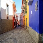
- Calle Apolinar Jaen, La Paz, Bolivia. August 26, 2015.
CITIES - SUCRE
Date || August 31, 2015
Location || Sucre, Bolivia ()
I spent longer in Sucre than initially planned, spent more time in this Bolivian city than any other location in the country. It’s an easy place to while away time. Really easy.
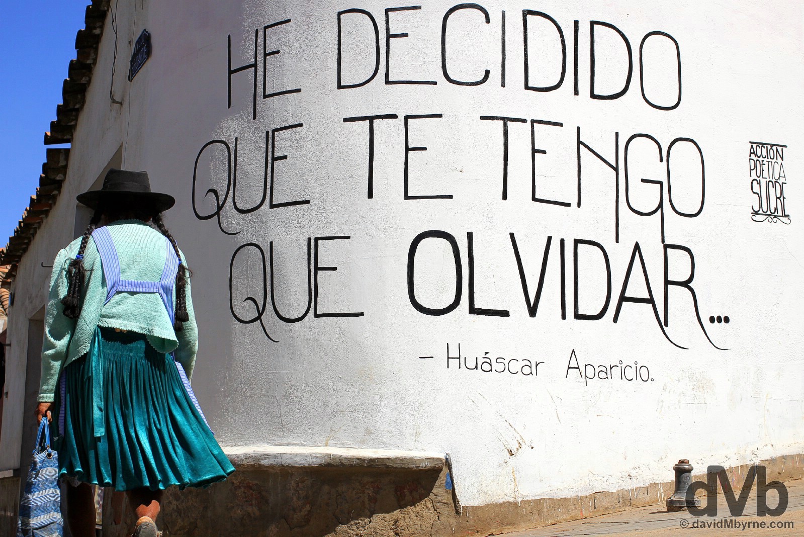
‘I have decided that I have to forget’. A quote by Bolivian folk singer and Sucre native Huascar Aparicio, who died in a car crash in 2013 at the age of 41, on the streets of Sucre, Bolivia. August 30, 2015.
The Historic City of Sucre
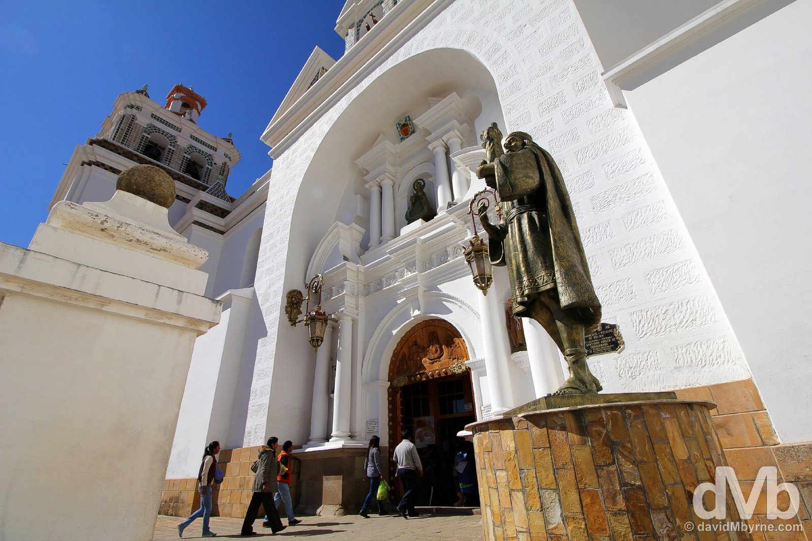
Sucre, the first capital of Bolivia & still the official capital and location for the Bolivian supreme court, was founded by the Spanish in 1538 as the capital of the Charcas, a vast region stretching from southern Peru to Argentina. Bolivian Independence from the Spanish was declared here in August 1825, and it was here, the the city’s Casa de la Libertad, that the new republic was created and named after its liberator, Simon Bolivar. Today Sucre is a university town, a small but bustling, convivial & laid-back city that is easily Bolivia’s prettiest urban centre – it boasts leafy plazas, gorgeous streetscapes and an impressive array of well-preserved, mostly whitewashed colonial-era buildings that illustrate the blending of local architectural traditions with styles imported from Europe. And if all that history and architectural eye candy isn’t enough for you there’s always the biggest collection of dinosaur footprints on the planet at Parque Cretacico (Dinosaur Park) on the city’s outskirts.
Some more pictures from my time in Sucre, easily the most photogenic city in Bolivia.
-
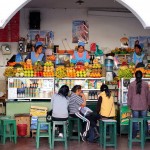
- Central Market in Sucre, Bolivia. August 28, 2015.
-
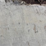
- Dinosaur footprints, part of the largest collection of preserved dinosaur footprints in the world, in Parque Cretacico/Dinosaur Park in Sucre, Bolivia. August 29, 2015.
-

- Corte Suprema de Justicia, the supreme court of Justice, in Sucre, Bolivia. August 28, 2015.
-
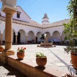
- Casa de la Libertad, Sucre, Bolivia. August 29, 2015.
-

- Parque Cretacico/Dinosaur Park in Sucre, Bolivia. August 29, 2015.
-
- Casa de la Libertad, Sucre, Bolivia. August 29, 2015.
-
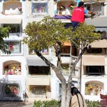
- Cementerio General in Sucre, Bolivia. August 28, 2015.
-

- A 100 bolivianos note/bill (€13) in the central courtyard of Universidad in Sucre, Bolivia. August 31, 2015.
-

- On Nicolas Ortiz in central Sucre, Boliva. August 30, 2015.
-
- Universidad, Sucre, Bolivia. August 28, 2015.
-

- Palacio de Gobierno/Chuquisaca Governorship Palace overlooking Plaza 25 de Mayo in central Sucre, Bolivia. August 29, 2015.
-
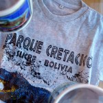
- On sale in Parque Cretacico/Dinosaur Park in Sucre, Bolivia. August 29, 2015.
-

- Plaza 25 de Mayo in central Sucre, Bolivia. August 29, 2015.
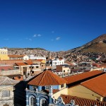
CITIES - POTOSI
Date || August 31, 2015
Location || Potosi, Bolivia ()
Today is day 9 in Bolivia. I’ve a little under a week left in the country before crossing over into Argentina. I’ve enjoyed my time here but nothing I’ve experienced in Bolivia thus far, nor anything I’m likely to experience before leaving, will top what happened today.
Potosi, The Mines & Big Deal Tours
Potosi, sitting at 4060 metres on a desolate windswept Bolivian plain, is one of the highest cities in the world (Rough Guides claims it to be the highest city in the world but Wikipedia has serious issues with that titbit of information). In the mid-sixteenth century, & in the space of only 2 decades, the city grew from nothing to the largest metropolis in the Americas, all thanks to the discovery of silver in Cerro Rico (Rich Mountain), a perfectly conical peak towering over the city. It was, and still is to this day, the richest source of silver the world has ever seen, one the Spanish milked for all its worth – millions worked & died in deplorable conditions over three centuries of mining to extract wealth that the Spanish shipped back to Europe. Today the Cerro Rico mines are still operational – although these days they mostly produce tin – and embarking on a tour of the mines is the must-do activity here in Potosi.
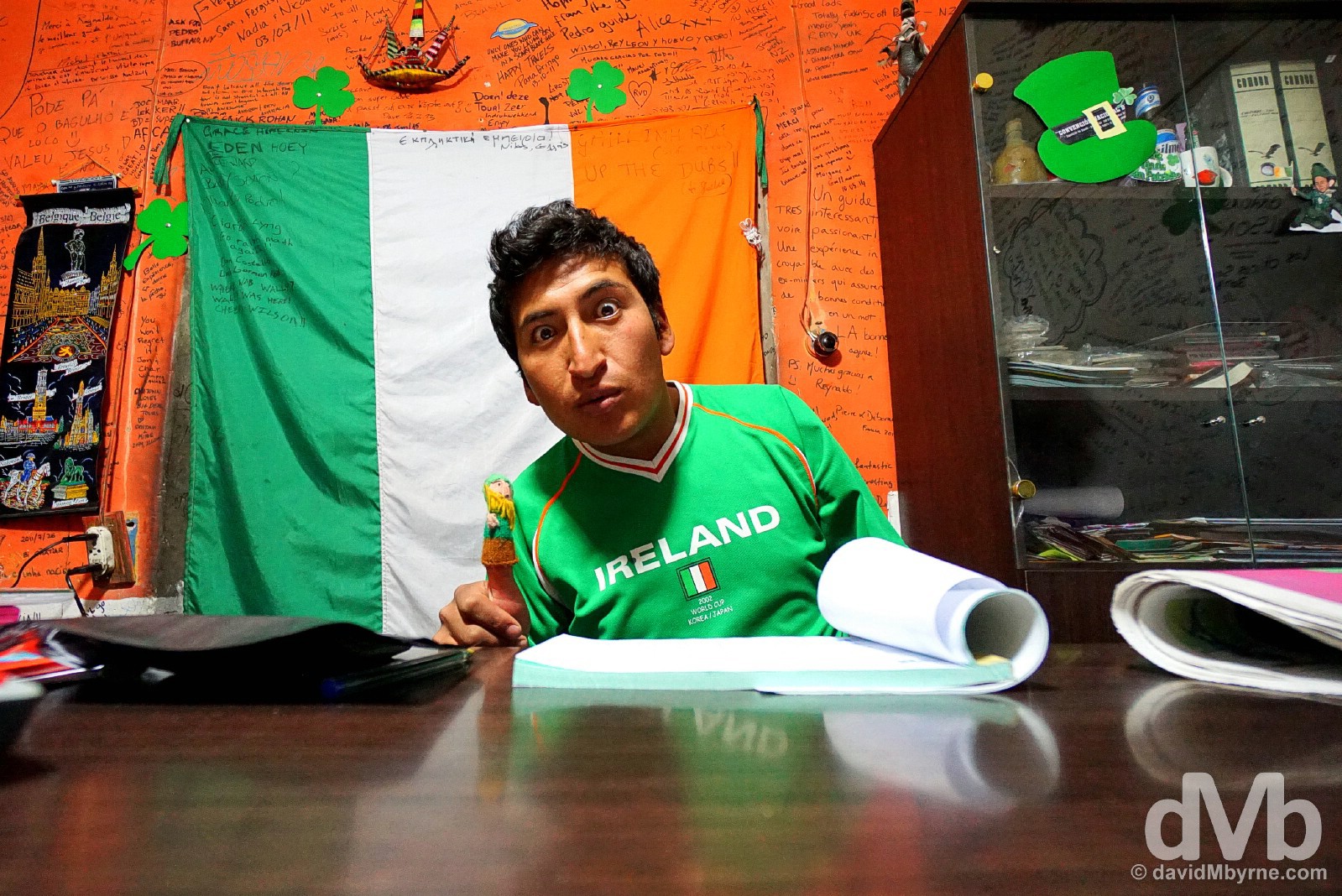
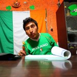
Picking a Potosi tour agency to take you into the mines is a hit & miss endeavour but when I walked into the offices of Big Deal Tours this afternoon shortly after arriving off the bus from Sucre I knew I’d found the right outfit for me. This is Pedro who was happy to both take my BOB 150 (€20) for the mine tour and explain to me why his office doubles as a grotto of Irishness – not counting the massive tricolour, Pedro’s attire or his St. Patrick finger puppet, the place is awash with Leprechaun hats, shamrocks & Guinness paraphernalia. Needless to say it was a rather bizarre find in such a remote, spit-and-sawdust town as Potosi & all the while in here as I scanned the walls surrounding me I thought someone was playing a cool practical joke on me. Seemingly Pedro relates to the Irish – according to him he likes the Irish laid-back, no-nonsense attitude to things and how we like to drink ‘just like us Bolivians.’ So there you have it. The tour tomorrow should be interesting. Nowhere near as interesting as earlier today but nice way to kick-off my 40th birthday celebrations nonetheless. Big Deal Tours, Potosi, Bolivia. August 31, 2015.
Date || September 1, 2015
Location || Potosi, Bolivia ()
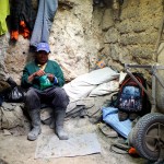
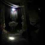
A decade ago, when davidMbyrne.com didn’t even exist, I said goodbye to my 20s & hello to my 30s at a remote section of the China-Vietnam border overlooking the fabulous Detian Falls. Today I bid adios to my 30s deep inside the dark, dusty, claustrophobic mines of the Cerro Rico here in Potosi, Bolivia, where I got a fascinating firsthand look at the hard life that is manual mineral mining. This is unrelenting hard labour in a dangerous unforgiving environment. I always feel privileged to live the life I do but seeing miners toiling for 10 hours a day for a monthly salary of some €250, well above average for Bolivia, I was reminded just how privileged I really am.
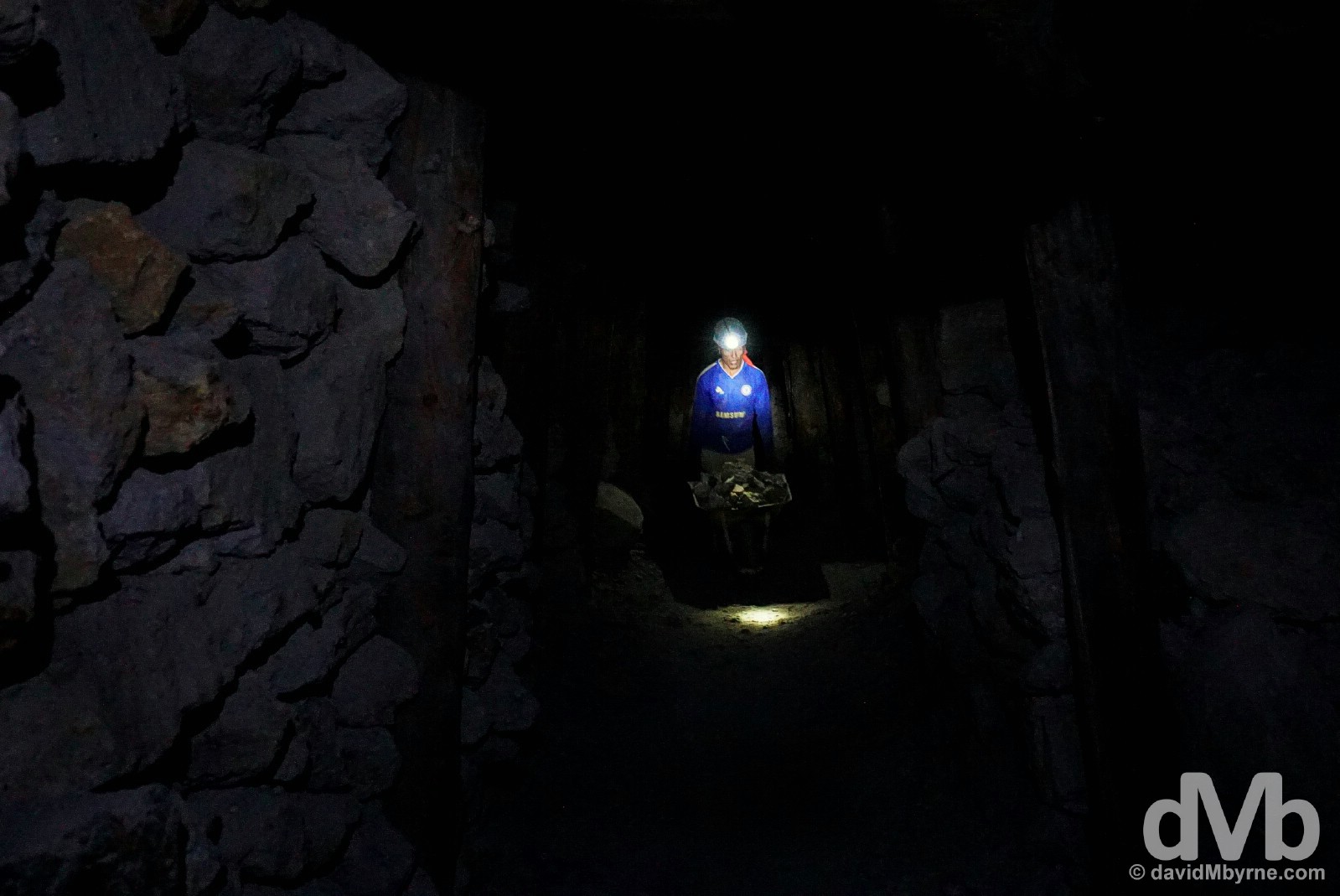
Needless to say, photography was a challenge in here with the only light provided by headlamps such as the one seen here on the floor of the mine shaft as a miner pushes a wheelbarrow of unprocessed rocks down the long tunnel to the entrance, only to repeat the process over and over again. In the deep, dark mineral mines of Cerro Rico, Potosi, Bolivia. September 1, 2015.
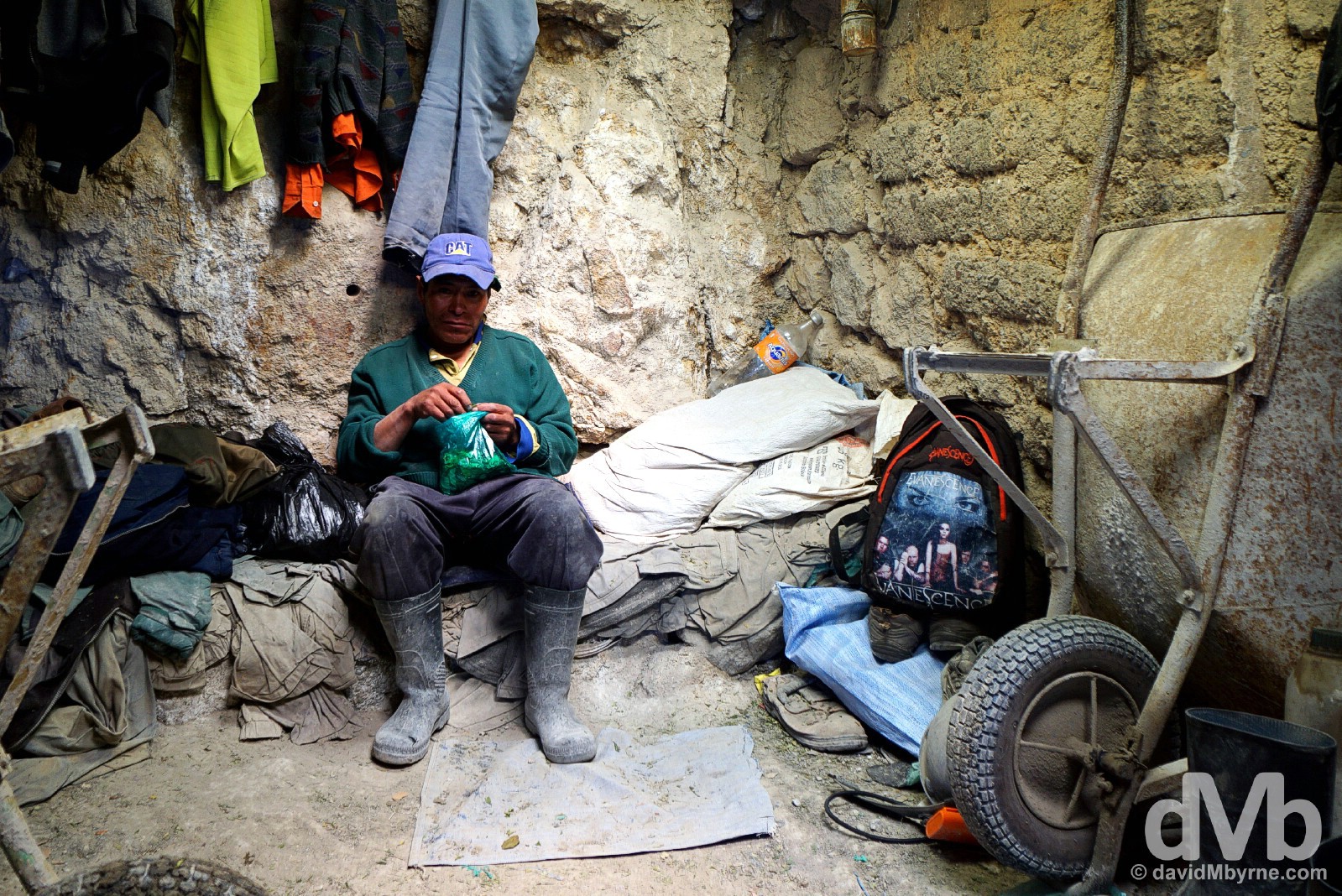
A miner with his bag of coca leaves during a break from work in the Cerro Rico Mines, Potosi, Bolivia. September 1, 2015.
A few other captures from today in Potosi.
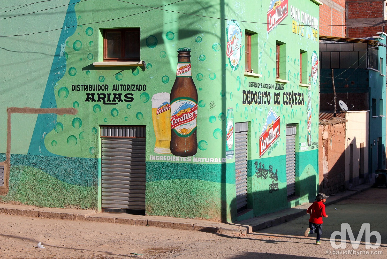
-
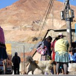
- Potosi, Bolivia. September 1, 2015.
-

- Coca leaves & cigarettes in the Miners market, Potosi, Bolivia. September 1, 2015.
-
- Miners market, Potosi, Bolivia. September 1, 2015.
-

- Twinkle twinkle. Unprocessed minerals in Potosi, Bolivia. September 1, 2015.
UYUNI & SALAR DE UYUNI
Date || September 3, 2015
Location || Uyuni, Bolivia ()
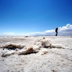
I wasn’t a fan of Uyuni. Not many are. A remote and dusty middle-of-nowhere settlement full of underwhelming and overpriced accommodation & eateries, the place seems to exist for the sole purposes of facilitating visits to the nearby Salar de Uyuni, the world’s largest salt flats & probably Bolivia’s biggest draw. If it wasn’t for the flats, and the Cementerio de Trenes (Train Cemetery) on the town’s outskirts, then avoiding Uyuni altogether would be the better option even if, like me, you’re passing through en route to the Argentine border further south, not a popular route with travellers (most who do find themselves in Uyuni are ultimately en route to/from the Chilean border to the west).
Salar de Uyuni, southern Bolivia. September 3, 2015.
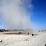
Cementerio de Trenes/Train Cemetery
Any tour to the Salar de Uyuni embarked upon from Uyuni will invariably include a visit the Cementerio de Trenes on the outskirts of the town, a graveyard for trains that seem to have chugged one last time through to their final resting place among the sand of the barren southern Bolivian landscape. An unexpected, unique & rather bizarre sight the graveyard may be but it’s one that is surprisingly photogenic.
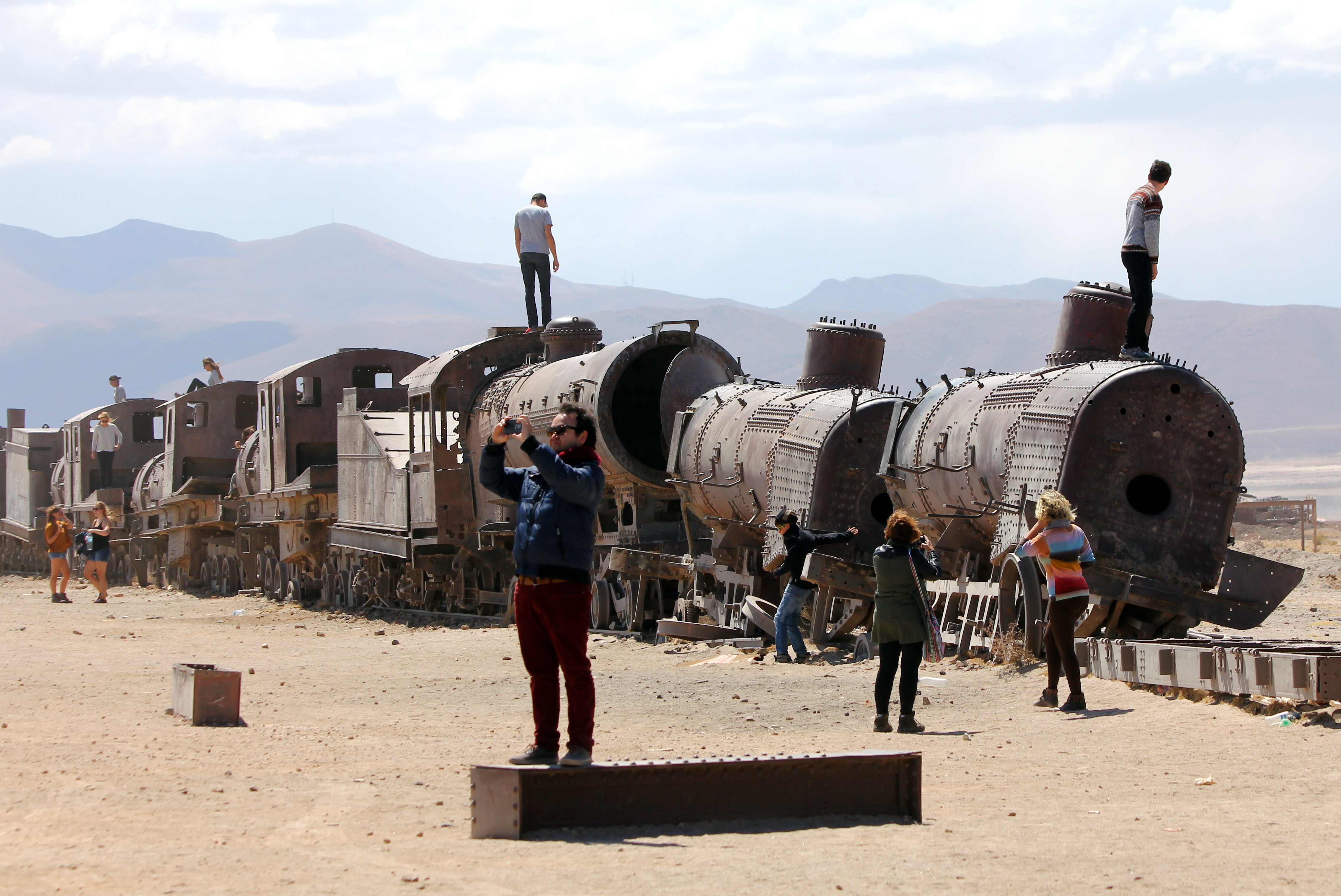
Cementerio de Trenes, the Train Cemetery, on the outskirts of Uyuni, southern Bolivia. September 3, 2015.
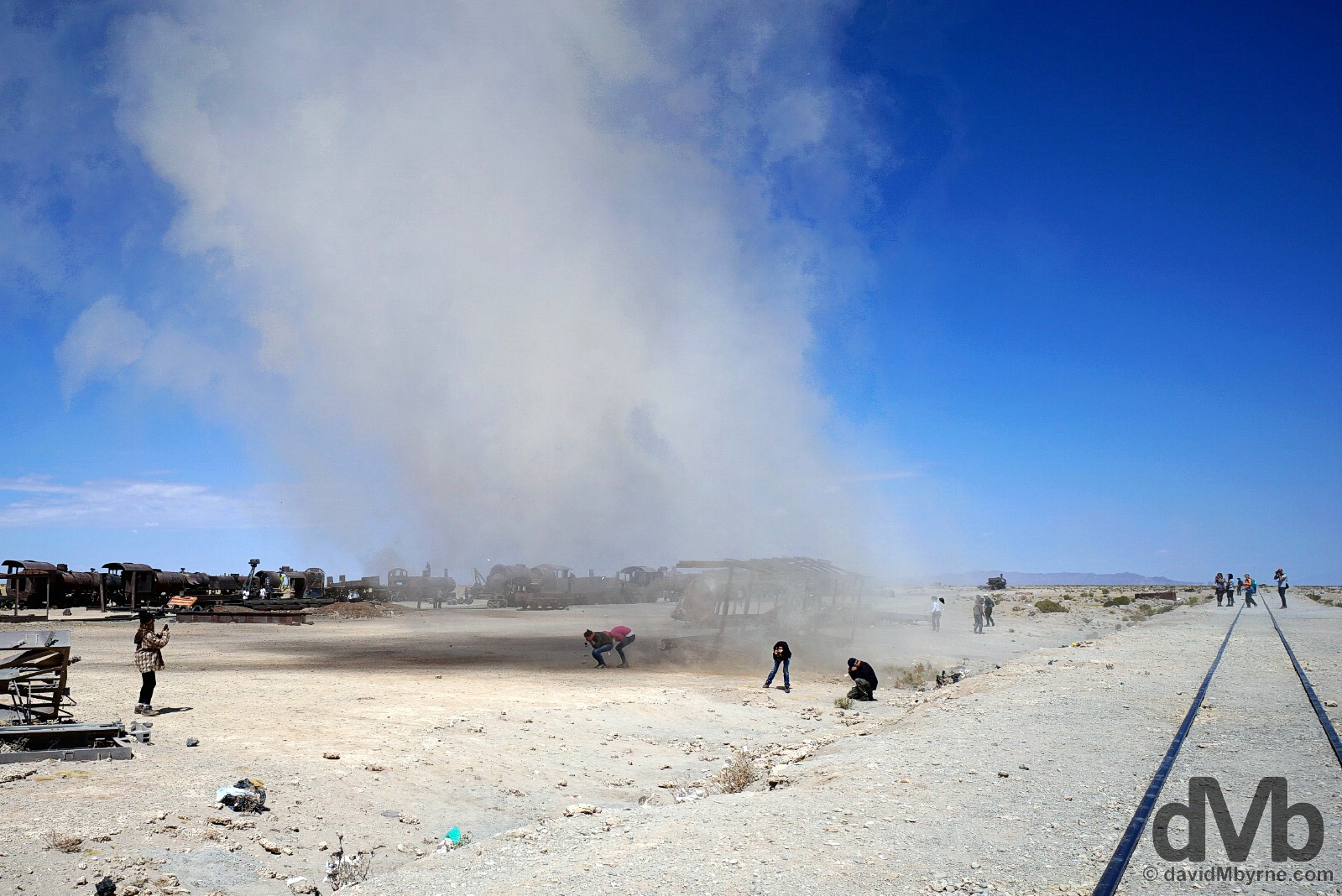
A sand twister Cementerio de Trenes, the Train Cemetery, on the outskirts of Uyuni, southern Bolivia. September 3, 2015.
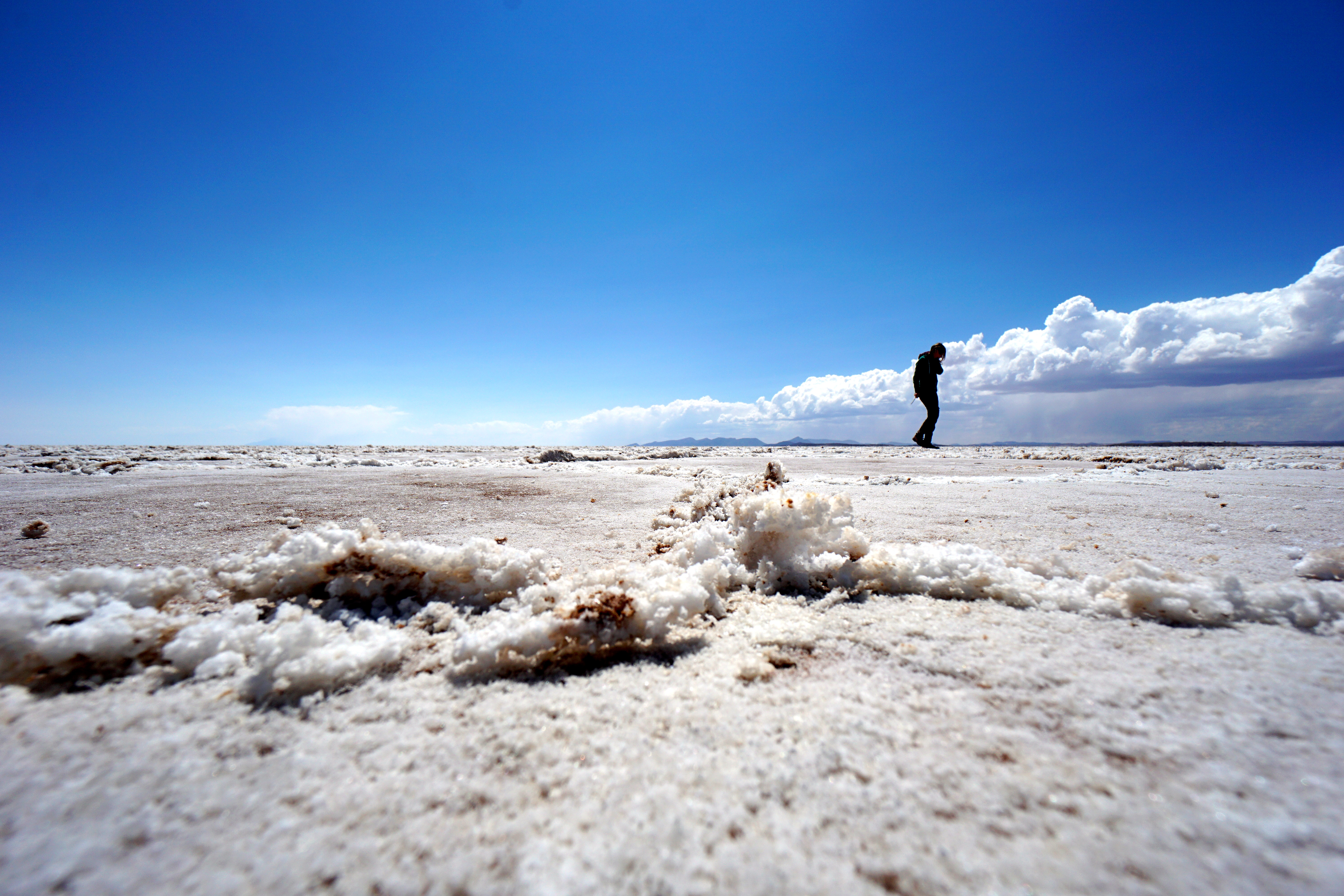
Salar de Uyuni
Sitting at an altitude of 3653 metres and covering an area of about 12,000 km², the Salar de Uyuni, the world’s largest salt flat, is a remnant of a massive prehistoric salt lake, Lago Minchin, that dried up. It’s also one of the continents must-see attractions, never mind a Bolivian one.
-
- Salar de Uyuni, southern Bolivia. September 3, 2015.
-

- Isla Incahuasi, Salar de Uyuni, southern Bolivia. September 3, 2015.
-

- Posing on the Salar de Uyuni, southern Bolivia. September 3, 2015.
-

- The Dakar Bolivia Monument, Salar de Uyuni, southern Bolivia. September 3, 2015.
-
- Salar de Uyuni, southern Bolivia. September 3, 2015.
-
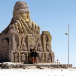
- The Dakar Bolivia Monument, Salar de Uyuni, southern Bolivia. September 3, 2015.
Bolivia || The Complete Gallery
-

- Challapampa, Isla del Sol, Lake Titicaca, Bolivia. August 24, 2015.
-
- The Catedral in Copacabana, Bolivia. August 23, 2015.
-
- On the streets of Copacabana, Bolivia. August 23, 2015.
-

- The summit of Cerro Calvario overlooking Lake Titicaca & the town of Copacabana, Bolivia. August 23, 2015.
-
- A sand twister at the Train Cemetery on the outskirts of Uyuni, southern Bolivia. September 3, 2015.
-

- La Paz, Bolivia. August 26, 2015.
-

- The Train Cemetery on the outskirts of Uyuni, southern Bolivia. September 3, 2015.
-

- Avenue 6 de Agosto, tourist central in Copacabana, Bolivia. August 24, 2015.
-
- Walking on Isla del Sol in Lake Titicaca, Bolivia. August 24, 2015.
-
- Vendors outside the Catedral in Copacabana, Bolivia. August 23, 2015.
-
- Views from Isla del Sol in Lake Titicaca, Bolivia. August 24, 2015.
-

- The town of Copacabana on the shores of Lake Titicaca as seen from the pilgrimage mountain Cerro Calvario. Copacabana, Bolivia. August 23, 2015.
-

- In the deep, dark mineral mines of Cerro Rico, Potosi, Bolivia. September 1, 2015.
-

- A girl with a llama on the path approaching the village of Yumani on Isla del Sol in Lake Titicaca, Bolivia. August 24, 2015.
-
- Inca ruins on Isla del Sol overlooking Lake Titicaca, Bolivia. August 24, 2015.
-
- Salar de Uyuni, southern Bolivia. September 3, 2015.
-
- At the port in Yumani, Isla del Sol, Lake Titicaca, Bolivia. August 24, 2015.
-
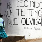
- ‘I have decided that I have to forget’. A quote by Bolivian folk singer and Sucre native Huascar Aparicio, who died in a car crash in 2013 at the age of 41, on the streets of Sucre, Bolivia. August 30, 2015.
-
- A miner during a break from work in the Cerro Rico Mines, Potosi, Bolivia. September 1, 2015.
-
- Hello Bolivia. At the Peruvian-Bolivian Kasani border crossing on the shores of Lake Titicaca. August 22, 2015.
-
- As seen from my hostel window. Avenue Felix Tejada, Copacabana, Bolivia. August 23, 2015.
-
- Late afternoon shadows on Avenue 6 de Agosto, tourist central in Copacabana, Bolivia. August 24, 2015.
-
- Ireland-loving Pedro of Big Deal Tours in Potosi, Bolivia. August 31, 2015.
-
- Shadows on Avenue Felix Tejada in Copacabana, Bolivia. August 23, 2015.
-
- In the deep, dark mineral mines of Cerro Rico, Potosi, Bolivia. September 1, 2015.