EPIC US ROAD TRIP 2016
DAYS 30-36 - KENTUCKY & THE GREAT LAKES - OHIO, KENTUCKY, INDIANA & ILLINOISImage || Cloud Gate, a.k.a The Bean, Millennium Park, Chicago, Illinois.

Epic US Road Trip 2016 – Kentucky & The Great Lakes
The home straight. The final 7 days, the final 4 states, the last 1,134 miles. Turning our backs on the mist of the Appalachians, a foray into Ohio, although all-too brief, still managed to tack on one final and unintended National Scenic Byway to the road trip total. Once we got away from the industralised banks of the region’s Ohio River, the state of Kentucky got very rural, very green and very photogenic, thereafter rarely letting up – the state, with its picture-postcard Bluegrass Country, rolling karst landscapes & unmissable subterranean delights, more than lived up to its photogenic billing. Oh and the music pilgrimage continued here too, something one might expect in a state that has a region called Bluegrass & where the music genre of the same name was born. But when all was said and done, and after a quick south-to-north we’re-only-passing-through dash through Indiana, we somewhat reluctantly rolled across the Illinois state line and into southern Chicago, 33 days after departing its northern fringes. Unexpectedly returning to the city in a different ride, between the granite-coloured Hyundai Accent hatchback we departed the city in, the same Accent that buckled under the toil of Colorado Rocky Mountain highs on day 17, and the silver Hyundai Accent saloon we brought back, we had accumulated a whopping 9,493 miles of US road-trippin’. That’s an average of 288 miles, or 463 kilometres, of daily driving over 33 days, an undertaking one might (wrongly) assume would exhaust. A final seventeen miles & three days of Windy City architecture-heavy sightseeing later and it really was The End, the end of Epic US Road Trip 2016.
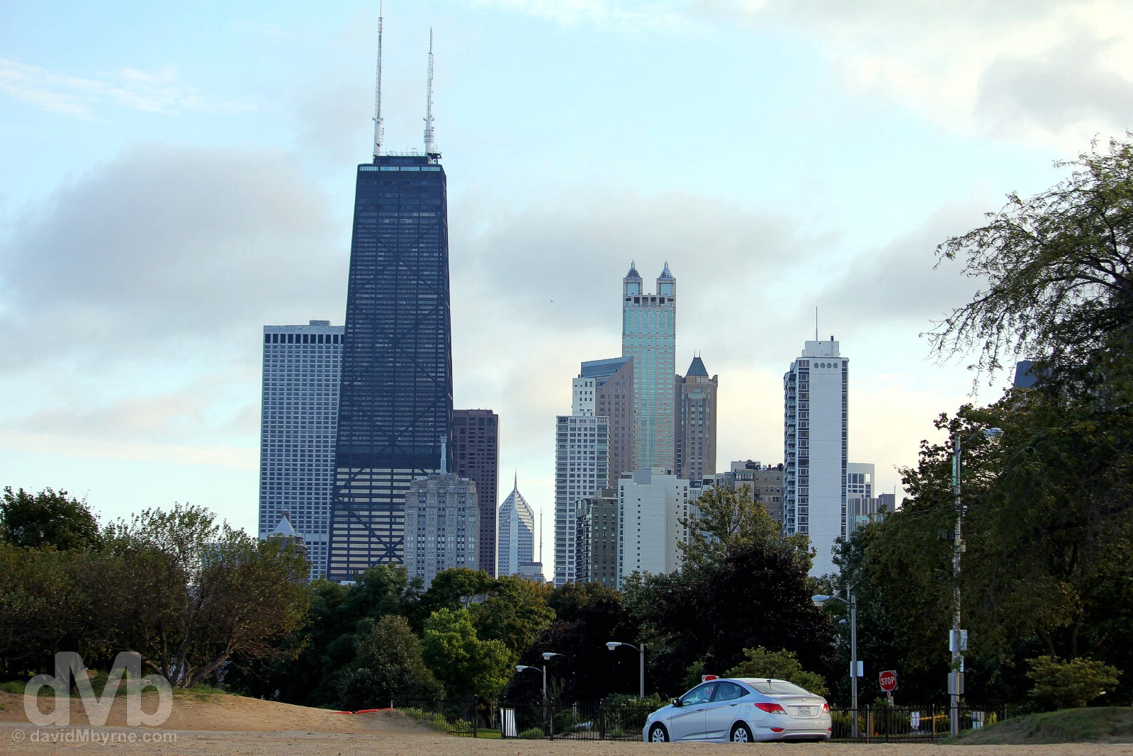
The End. Completing the 26-state, 9,493-mile loop. Arrival by the windswept southwestern shores of Lake Michigan in Chicago 33 days after departure. Chicago, Illinois. September 29, 2016.
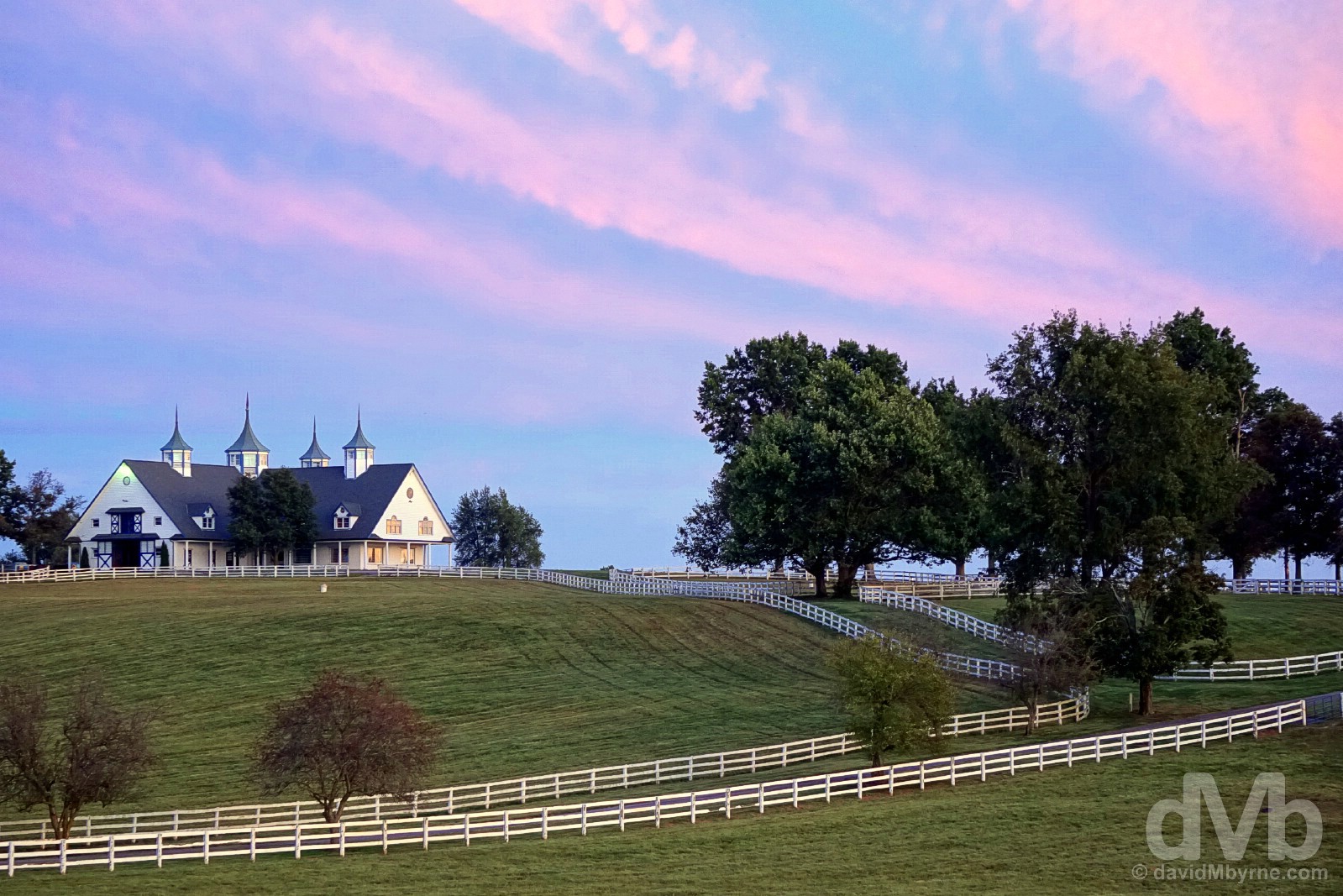
Image ||A horse in a paddock of Calumet Farm in Bluegrass Country on the outskirts of Lexington, Kentucky.
“Once a region of wild woodlands and meadows, today this pretty landscape is dotted with horse farms; Bluegrass Country alone as some 450 farms, centres of horse breeding excellence with acres of undulating lush bluegrass grassland criss-crossed by miles of brilliantly-white fencing.”
Day 30 || September 26 2016
Route || Lewisburg, West Virginia, to Lexington, Kentucky (via Chesapeake, Ohio; Cordell, Kentucky; & Sandy Hook, Kentucky)
Miles (Kilometres) Driven || 404 (650)
Posted From || Lexington, Kentucky
Today’s Highlight || Dusk over Bluegrass Country
We had a bit of ground to cover today in getting from Lewisburg, West Virginia, to Lexington, Kentucky. At its most direct it’s a 300-mile drive via Interstate 64. But where’s the fun in that? We tacked on another 100-plus miles by going our own way through the heart of rural eastern Kentucky and via the towns of Cordell & Sandy Hook, two sleepy settlements that to visit at all would require either a serious navigational oversight or a really good reason; we had the latter. This day also saw us saying a brief hello to Ohio, state number 23, driving portions of not 1, not 2, but 3 National Scenic Byways – 1 in West Virginia, 1 in Ohio & 1 in Kentucky – and being treated to the best of an evening sunset over Kentucky’s famed and oh-so photogenic Bluegrass Country, a stunningly beautiful part of the world.
Dusk at the Manchester Farm in Bluegrass Country on the outskirts of Lexington, Kentucky. September 26, 2016.
Ohio
We didn’t inconvenience ourselves too much in getting to Ohio as it’s a short detour north off Interstate 64 and across the Ohio River from West Virginia. We also didn’t spend long in the state – an hour, give or take – or see much of it; a busy & inconvenient road junction at the state line bridge crossing over to Ashland, Kentucky, meant we were even thwarted in our efforts to get a ‘Welcome To Ohio’ state picture, our first such failing of the wider road trip. 22 out of 23 up to this point is still an acceptable strike rate I guess.
State Nicknames – The Buckeye State; Birthplace of Aviation; The Heart of It All. State Motto – With god, all things are possible. Admitted To The Union – March 1 1803 (17th state). Population – 11.6 million (7th most populous state). Area – 44,825 sq miles (34th largest state). Capital – Columbus. National Parks – 1 (Cuyahoga Valley). National Scenic Byways/All-American Roads – 4/1. Famous For – The Wright Brothers; being a perennial swing state in presidential elections; Amish communities; cows; roller-coasters – the world’s greatest concentration of them can be found at Ohio’s Cedar Point Amusement Park. State Highlight – Cleveland’s Rock and Roll Hall of Fame. Ohio Titbits – Although nearly all of the waterway belongs to neighbouring Kentucky & West Virginia, Ohio is named after the region’s Ohio River which defines the state’s southern border with Kentucky; eight US presidents have had Ohio as their home state, the most of any US state; the state had the country’s very first fully professional baseball team, the 1869 Cincinnati Red Stockings, now the Cincinnati Reds.
Ohio. State #23. There’s a lot going on here on the Ohio plate, a lot to decipher. Present, of course, are the state’s three nicknames of Birthplace of Aviation (although their famous first flight happened in North Carolina in December 1903, the Wright Brothers were from the state of Ohio), The Heart of It All (presumably because Ohio’s geographical location means it links the Northeast to the Midwest, not to mention the fact that no matter where you are in the state you’re only a one-day drive of 50% of North America’s population and 70% of North America’s manufacturing capacity), & The Buckeye State (partly because many buckeye trees once covered Ohio’s hills and plains). But there’s more on here, including Light & Flight – as well as the Wright Brothers, Thomas Edison, the inventor of the microphone, the phonograph &, of course, the light bulb, was also a Buckeye. Go Ohio! Chesapeake, Ohio. September 26, 2016.
About all we actually experienced of the state of Ohio was a miserly 14-mile stretch of its river-hugging Ohio River National Scenic Byway, the ninth and penultimate National Scenic Byway of the wider road trip. Driving east to west, the 943 mile (1,518 kilometre) history-rich byway follows the course of the Ohio River across the southern border of three states: Ohio, Indiana & Illinois. No, we didn’t experience any of the charming river communities lining the river, and nor did we sample any of the rural beauty the byway supposedly meanders through en route to Cincinnati (the 14 mile stretch of the byway we sampled is rather industrial), but we did, of course, see plenty of the river itself. We’ll take that. After all, this scenic byway and anything that happened to come with it was a bonus.
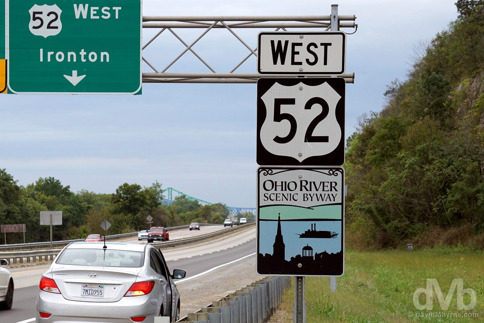
Heading west on a portion of the Ohio River National Scenic Byway/Highway 52 outside Chesapeake, Ohio. September 26, 2016.
– www.fhwa.dot.gov commenting on the Ohio River Scenic Byway
Our epic 14 mile adventure in Ohio ended when we once again drove a bridge over the Ohio River, this one bringing us into Ashland and the state of Kentucky, Epic US Road Trip state number 24.
State Nickname – The Bluegrass State. State Mottos – United we stand, divided we fall; Deo gratiam habeamus (Let us be grateful to God). Admitted To The Union – June 1792 (15th state). Population – 4.4 million (22nd most populous state). Area – 40,409 sq miles (37th largest state). Capital – Frankfort. National Parks – 1 (Mammoth Cave). National Scenic Byways/All-American Roads – 6/0. Famous For – Horses, horse farms & the Derby; bluegrass (the region, the grass & the music); bourbon; being photogenic; KFC; Abraham Lincoln (born in Hodgenville); Fort Knox; baseball bats; Muhammad Ali (born in Louisville); karst landscapes; caves; quilting patterns. State Highlight – Picture-perfect Bluegrass Country; bluegrass (the music); Mammoth Cave National Park; rural, back country drives. Kentucky Titbits – Kentucky boasts the world’s longest cave system; it also has more navigable miles of water than any other state not called Alaska; the state produces 95% of the world’s supply of bourbon whiskey, and the number of barrels of bourbon being aged in Kentucky (more than 5.7 million) far exceeds the state’s population; the name Kentucky means ‘meadow lands’ in several different Indian languages and was specifically applied to this region of the country, thereafter Europeans adopting the name to apply to the state; Harland Sanders, a Kentucky colonel, launched Kentucky Fried Chicken at his service station in North Corbin, Kentucky, in 1930. Supposedly even back then it was finger-lickin’ good!
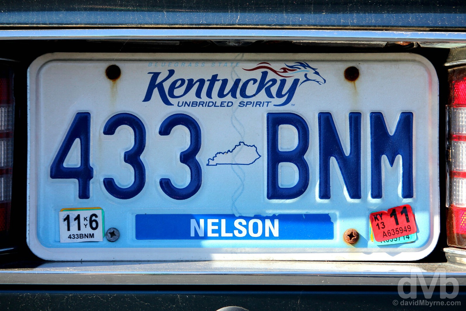
Kentucky. State #24. Unbridled Spirit. Unbridled. Horses. See what they did there? Lexington, Kentucky. September 27, 2016.
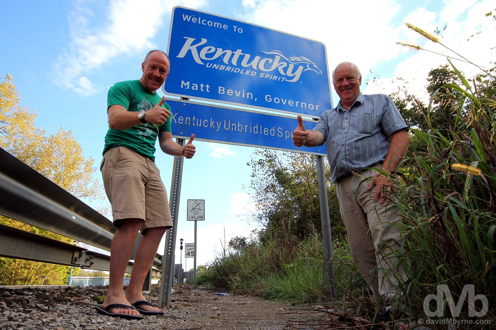
State sign #24 || We got a ‘Welcome to Kentucky’ picture in Ashland on this day, but it wasn’t a very good capture. So instead here’s one from the future, one captured when leaving Kentucky & entering the state of Indiana on day 32. At the Kentucky/Indiana state line on Indiana State Road 161 outside Owensboro, Kentucky. September 28, 2016.
Although we didn’t know it at the time, our first foray into eastern Kentucky saw us heading south on US 23 from Ashland, this stretch of asphalt making up the northern portion of the state’s 144-mile, 232-kilometre-long Country Music Highway, the tenth and final National Scenic Byway of the wider road trip.
– www.fhwa.dot.gov commenting on the Country Music Highway
Rural Kentucky is home to many a country & bluegrass music heavy-hitter, two in particular – one alive, one very much dead – of interest to us on this day. We went searching for signs of them in two Kentucky towns that you’d probably otherwise have no reason to visit. First up was Cordell, a 50-mile drive from the Ohio/Kentucky state line at Ashville. There was not a whole lot to see en route (this extreme eastern region of the state isn’t yet picture-postcard Kentucky) and as it turned out there was even less to see once we got there.
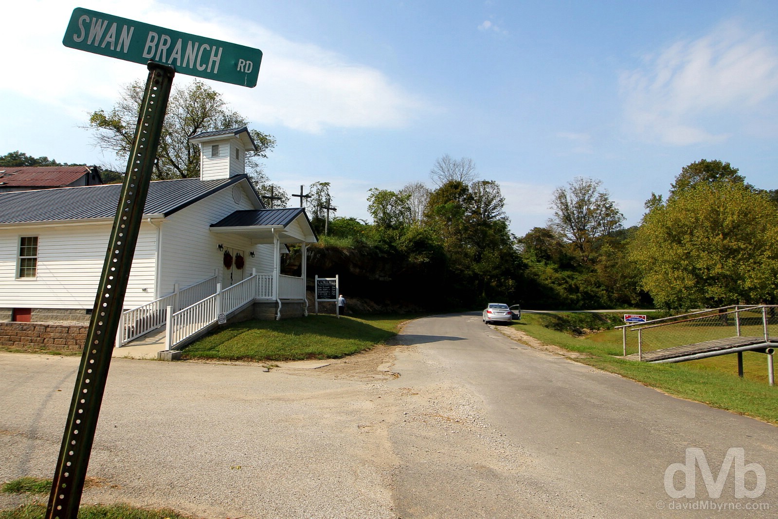
We’ve been & gone but we’re still not sure where Cordell, Kentucky, is, assuming it’s here at all (it is referenced on maps). Among the three lines of text given over to it on Wikipedia, Cordell is described as an ‘unincorporated community’ (frankly I’m surprised a Wikipedia entry on Cordell even exists). We saw no signs of life while searching for a main street, a square/plaza, anything signifying a town or a village. There was nothing. The only sign of community we found was this Free Will Baptist Church facing Bushy Creek and lining Bushy Creek Road, a road we accessed from Kentucky Route 32 and a road that seems to serve no purpose other than to take lost explorers even deeper into rural, way-off-the-beaten-track Kentucky. We were here looking for signs of local boy done good & general musical prodigy Ricky Skaggs – the aforementioned Wikipedia page does make reference to Cordell’s favourite son by informing that ‘Country singer Ricky Skaggs was born in Cordell’ – but needless to say came away empty handed. Regardless, it was a bit of an adventure. Cordell, Lawrence County, Kentucky. September 26, 2016.
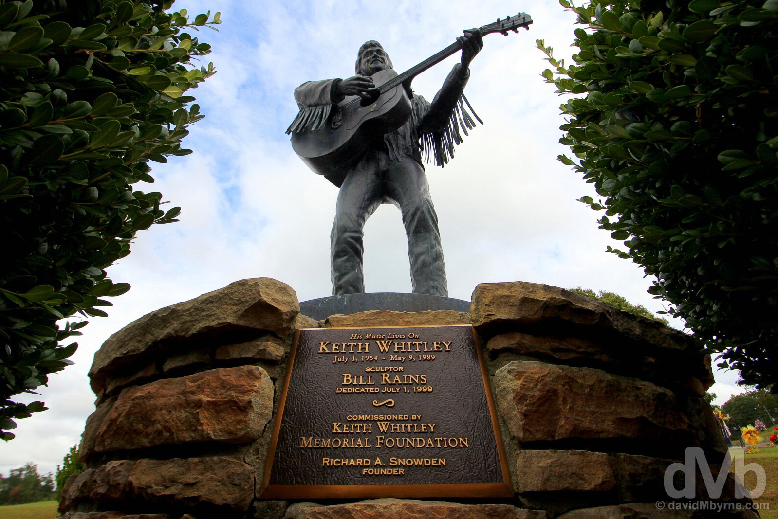
We had more success in the town of Sand Hook, a 25-mile drive via Kentucky Route 32 from Cordell. While hardly a metropolis, the town’s population of less than 1,000 still ensured there was more life here than we found in Cordell. Sandy Hook is the hometown of the late & hugely influential country music singer Keith Whitley (died of alcohol poisoning in 1989 aged 34). Although buried in Nashville, a statue of Whitley playing his guitar in the local cemetery was what we came here to see meaning we had more success in Sandy Hook than we did in Cordell before it. Sandy Hook, Elliott County, Kentucky. September 26, 2016.
Bluegrass & Horse Country
Continuing west, it’s a 130-mile drive from Sandy Hook to Lexington, the region’s largest city in the heart of the state’s northern Bluegrass Country and the so-called ‘The Horse Capital of the World’. Our partly successful forays into rural Kentucky earlier in the day meant it was approaching sunset by the time we rolled into Lexington, not a bad time of the day to brandish a camera in Kentucky’s famed horse country on the city’s outskirts.
– Alistair Cooke, British-born American journalist, television personality and broadcaster
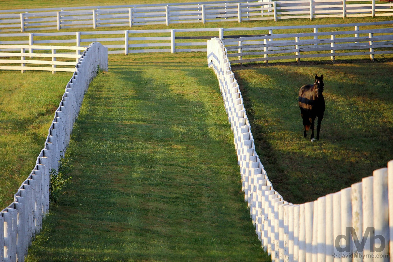
A Thoroughbred grazing in a paddock of Calumet Farm in Bluegrass Country, named as such by the Europeans after the blue flowered poa grass that they found growing here. The region’s natural limestone deposits are said to make for some good quality grazing, not to mention some picturesque landscapes. A renowned centre for breeding quality livestock stretching back to antebellum years, it’s all about horses here, especially multimillion-dollar Thoroughbred race horses; Kentucky is the leading producer of horses in the US and the number one producer of Thoroughbreds with 30% of the national foaling total, most of which originate here in Bluegrass Country. Once a region of wild woodlands and meadows, today this pretty landscape is dotted with horse farms; Bluegrass Country alone as some 450 farms, centres of horse breeding excellence with acres of undulating lush bluegrass grassland criss-crossed by miles of brilliantly-white fencing. The whole region is almost too idyllic, too picture-postcard perfect, especially when soft lighting and late evening shadows are added to the mix. Calumet Farm in Lexington, Kentucky. September 26, 2016.

Most of the Bluegrass Country horse farms are closed to the public, their work to engender the next champion racehorse conducted behind closed doors. The idyllic red and white barns of Calumet Farm are not only one of the region’s most famous centres of livestock breeding but also perhaps the most famous horse farm in the world. Closed to the public, it was established in 1924 and quickly became one of the leading stables of the mid-20th century by producing a string of fine Thoroughbred horses. This included no less than 8 winners of the Kentucky Derby (although they can’t claim a Derby winner since 1968), probably the country’s most famous race held at the Churchill Downs racetrack in Louisville every May. Seen here are two notable & especially picturesque features of horse country, they being the elaborate cupolas, clerestories and other ornamentation features of stud barn architecture, and the whitewashed wooden fencing, the latter a major expense for a horse farm; wooden fencing is estimated to cost roughly $18,000 per mile to build not including the significant maintenance costs associated with its upkeep (Calumet Farm alone boasts some 35 miles (56 kilometres) of white fencing). Traditionally painted white, some farms now paint their fencing black. While this may reduce costs it’s nowhere near as photogenic. (Double fencing, seen here, is typically used to provide separation between each stallion paddocks as the studs can become quite territorial.) I stood by the side of Versailles Road on the outskirts of Lexington peering into the farm this evening as the light slowly died. I almost couldn’t fathom how picturesque a scene it was, suspecting at the time that the pictures I was capturing would scarcely do the scene justice. I was right as they didn’t even come close. Regardless, it was a memorable end to Epic US Road Trip day 30. Late afternoon shadows at Calumet Farm in Lexington, Kentucky. September 26, 2016.
Image ||Ranger tour deep in Mammoth Cave National Park, Kentucky.
“Believed first explored by native American Indians some 4,500 years ago, to date 27 entrances have been identified & 405 miles (652 kilometres) of fascinating underground caverns & passageways of this ulterior labyrinth have been mapped (as of July 2015 with geologists estimating some 600 miles could still be undiscovered).”
Day 31 || September 27 2016
Route || Lexington to Beaver Dam, Kentucky (via Lincoln Homestead State Park & Mammoth Cave National Park)
Miles (Kilometres) Driven || 241 (388)
Posted From || Beaver Dam, Kentucky
Today’s Highlight || Mammoth Cave National Park
More of picture-postcard Bluegrass Country, the rolling karst landscapes of central Kentucky and the subterranean wonders of the world’s most extensive cave system. Above or below ground, it didn’t matter. The state of Kentucky ensured day 31 is up there as one of the most photogenic days of the wider 36-day road trip.
In a paddock in Bluegrass Country on the outskirts of Lexington, Kentucky. September 27, 2016.
Once was never going to be sufficient so we took another drive around the peaceful tree-lined equestrian nirvana of Bluegrass Country surrounding Lexington this morning, basically retracing our route of last evening. There was no sunset this morning and the lighting not quite as soft, but everything was just as photogenic, par for the course around here.
The equine industry contributes some $3 billion annually to economy of the state of Kentucky. Trappings of that wealth are never far away when exploring Bluegrass Country, polished and nicely presented houses and estates yet another picturesque feature of the gorgeous landscape. Off Van Meter Road on the outskirts of Lexington, Kentucky. September 27, 2016.
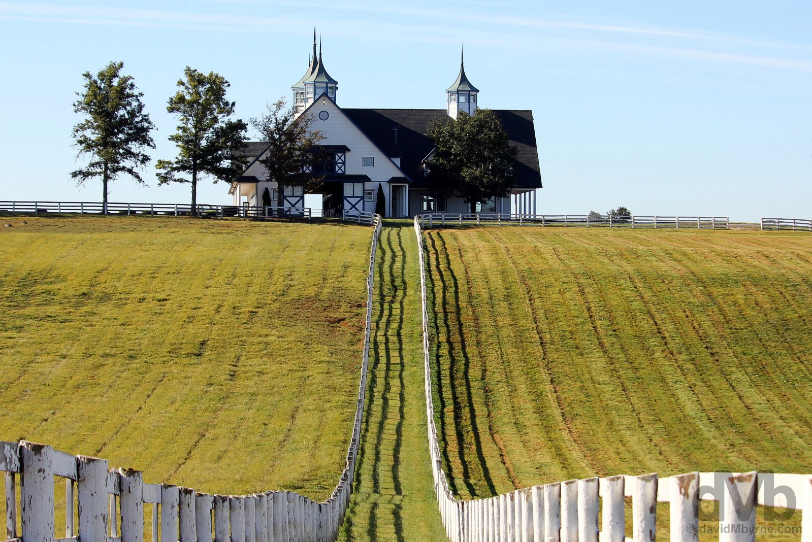
A well-known horse country landmark that is one of Bluegrass Country’s most recognisable farms, Manchester Farm is yet another commercial Thoroughbred nursery for the breeding & selling of young racehorse prospects. Located some way back off Van Meter Road, this typical horse country scene of elaborate stud barn architecture and iconic white fencing separating two expansive paddocks is one of the region’s most iconic scenes, and certainly one of its most photographed. Manchester Farm in Bluegrass Country on the outskirts of Lexington, Kentucky. September 27, 2016.
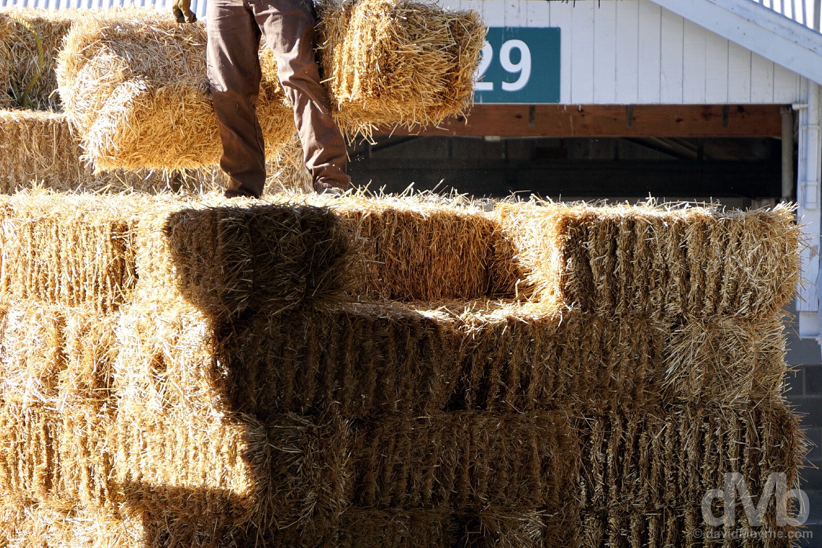
Shifting bales in the stables of Keeneland, Versailles Road, Lexington, Kentucky. September 27, 2016.
Tending to the home straight of the Keeneland Racecourse. Needless to say horse racing as well as horse breeding is well established in the countryside surrounding Lexington, racing having first started here in 1787. Today the region’s most famous track is the Keeneland Racecourse. One of 5 Thoroughbred racing tracks in the state of Kentucky, it hosts meets twice a year (in spring & fall). Founded in 1936 & both added to the National Register of Historic Places and designated a National Historic Landmark in 1986, this is more than just one of the best racetracks in the country. It’s also the world’s largest Thoroughbred auction house, and one with quite the reputation – horses sold by Keeneland, for example, won all three of the 2016 Triple Crown races, the country’s three most prestigious races for three-year-old Thoroughbred horses. And of course it – horse sales – is big business with the three yearly Keeneland auctions generating over half a billion dollars in sales. Keeneland’s September Yearling Sales, representing the sale of horses from the breeding farms to race horse owners & globally acknowledged as the leading Thoroughbred yearling auction, had just finished two days prior to us snooping around the track, the stables and the grandstand of the impressive, polished facility. All told, 2,792 yearlings were sold for a total cost of $272,890,500 over the course of the two weeks of sales. Keeneland, Versailles Road, Lexington, Kentucky. September 27, 2016.
We hadn’t planned on visiting Kentucky’s Lincoln Homestead State Park. We hadn’t even heard of it when setting out from Lexington for Mammoth Cave National Park, a 2-hour 130-mile drive southwest of Lexington and somewhere we definitely did know existed. But a sign en route highlighted the existence of the charming little park situated in the centre of the state, somewhere we took a slight detour to get to and somewhere that ably served its purpose of educating us as to the family history of one of the icons of American history.
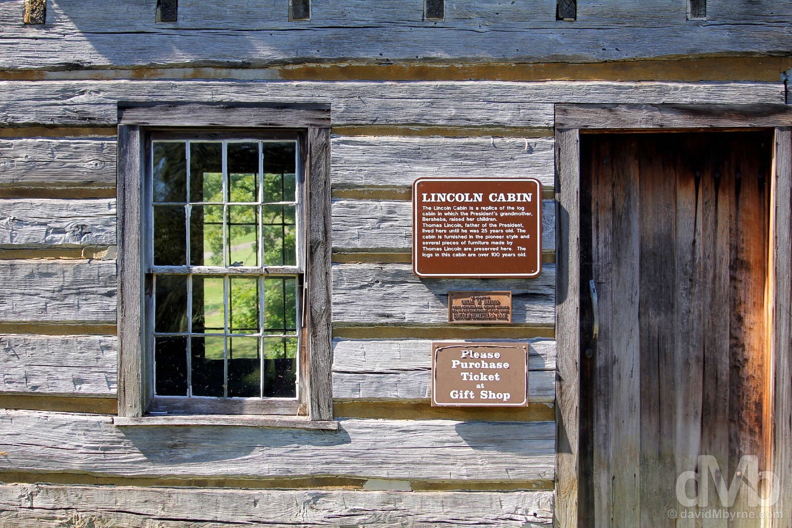
Revered countrywide, Abraham Lincoln (1809–1865), the 16th President of the US (1861-65), was born in Kentucky, although not here – he was born in 1809 in Hodgenville, Kentucky, about 40 miles west of here. The Lincoln Homestead State Park, just north of Springfield in central Kentucky and some 40 miles from Lexington, is the site where the President’s grandfather relocated to in the early 1870s (from Virginia). Today the site preserves many historic buildings including the Lincoln Cabin, seen here, a reconstruction of the cabin were Thomas Lincoln, the President’s father, lived until he was 25. An idyllic little parkland setting among the rolling karst hills of central Kentucky, the park was a pleasant & unexpected find while driving through the picturesque centre of the state. Lincoln Homestead State Park, Washington County, Kentucky. September 27, 2016.
Kentucky Karst – Above & Below
Meandering as it does through central Kentucky’s karst landscape meant the 90-mile drive from the Lincoln Homestead State Park to Mammoth Cave National Park was rather photogenic. Slow going at times but photogenic nonetheless.
Large swaths of Kentucky, meaning ‘meadow lands’ in several different Indian languages, are characterised by underlying dolostone, shale & fossiliferous limestone that were deposited layer by layer some 600 million years ago when shallow seas repeatedly came & went over what is now the US. Kentucky’s karst landscape (a limestone landscape in which water moves rapidly underground forming water erosion features like gorges, potholes, sinkholes, caves etc.) formed via underground erosion over the subsequent years – many, many subsequent years – and today is represented top side by an abundance of gently rolling hills, hills which roads follow to rather photogenic (yep, there’s that word again) effect. Yes, it’s all very pretty, especially when the sun shines. On Lincoln Park Road in Washington County, central Kentucky. September 27, 2016.
– The American Monthly Magazine (1837)
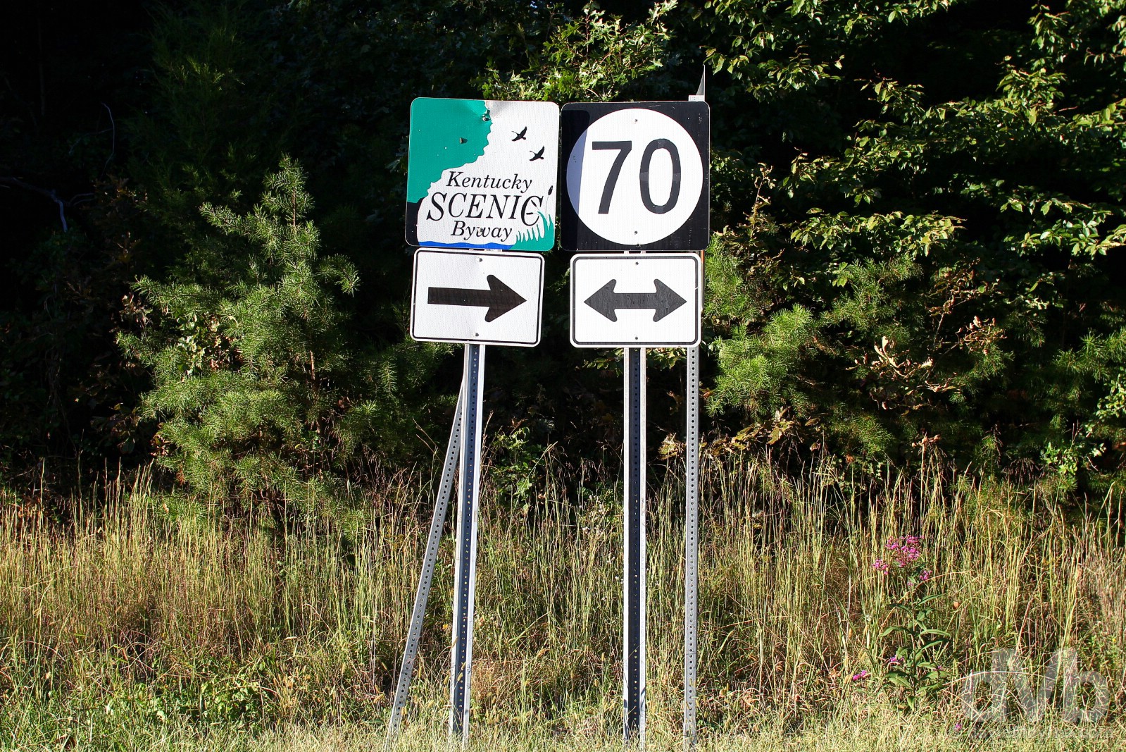
Kentucky Route 70 outside Mammoth Cave National Park, Kentucky. September 27, 2016.
Central Kentucky’s karst underbelly is not only responsible for the state’s undulating and easy-on-the-eyes landscape. It’s also to blame for the formation of the Kentucky’s most popular natural attraction, the state’s only UNESCO World Heritage-listed site (and national park) and the world’s largest network of subterranean tunnels, the fascinating & aptly-named Mammoth Cave of Mammoth Cave National Park, the 9th & last national park of our wider road trip.
Mammoth Cave National Park
Size: 52,830 acres/214 km². Founded: 1941. Annual Visitors: 2 million. In a state known for its elevated landscape in the form of the Appalachian and Cumberland mountains, it is an inverse topography — the world’s longest known cave system — that is Kentucky’s lone national park. This underground wonder, whose dimensions suit its name, is mapped at 400 miles — a length that increases with ongoing exploration. Here, midway between Louisville and Nashville, this limestone labyrinth with a colorful and contentious (land-ownership) past fascinates visitors.
– John Burroughs, naturalist, “In Mammoth Cave” (1887)
The deep history goes back 10 million years in time and 379 feet into the earth, where ancient human remains and artifacts are legally protected. The modern story includes African American history, such as the legacy of Stephen Bishop, who ventured into unexplored areas and became a guide. He is buried at the park’s Old Guides’ Cemetery. In popular culture, Mammoth has inspired a short story, an early computer game, poetry and rock-music lyrics. Today, park rangers continue to guide cave visitors through tours of varying length, style and level of physical demand — from easy to extremely strenuous. Tours include Gothic Avenue, which has historically significant passageways where 19th-century signatures are preserved. Interior temperatures average about 54 degrees. Bring a jacket or sweater and wear shoes suitable for walking. Above ground activities include hiking and fishing.
From The Washington Post – The Essential guide to all 59 U.S. national parks.
![]()
– UNESCO commenting on Mammoth Cave National Park
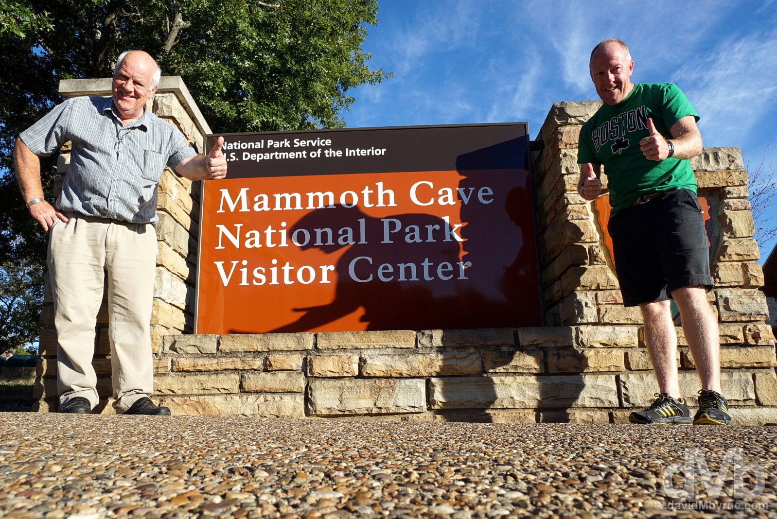
National Park #9 || Above ground. Mammoth Cave National Park, Kentucky. September 27, 2016.
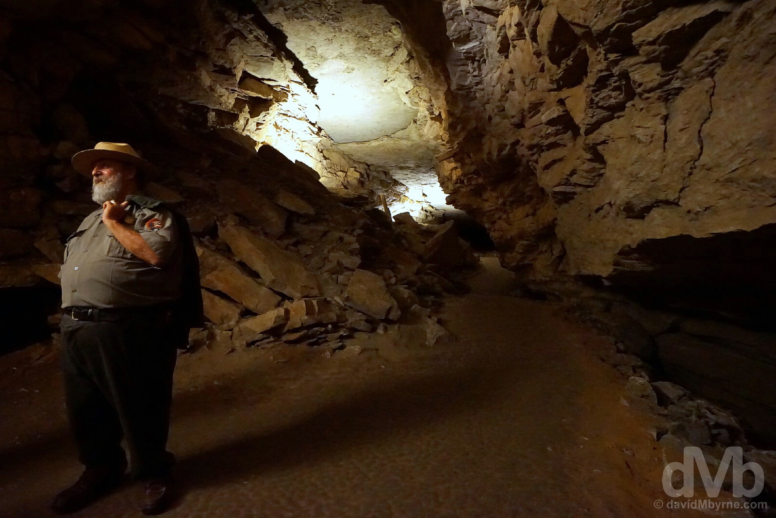
Below ground. While Kentucky is second only to neighbouring Tennessee, another karst-heavy state, in the number of caves it can boast of having, the state can at least lay claim to the world’s longest known cave system here in Mammoth Cave, designated a national park in 1941 & a UNESCO World Heritage site in 1981. Foraging deep inside part of the nation’s largest region of cavernous rocks, Mammoth Cave’s makeup also stands it apart from other subterranean networks; the system here is unique given the presence of an insoluble sandstone roof, effectively a layer of impervious sandstone that has protected the soft and soluble limestone below and allowed the extensive Mammoth Cave structure to form via many millions of years of erosion. Believed first explored by native American Indians some 4,500 years ago, to date 27 entrances have been identified & 405 miles (652 kilometres) of fascinating underground caverns & passageways of this ulterior labyrinth have been mapped (as of July 2015 with geologists estimating some 600 miles could still be undiscovered). Only a tiny percentage of those 405 miles are accessible to the public by embarking on various dark & chilly Ranger-led tours that explore, among other cave formations, canyons, fissures, vertical shafts, tubes & rotundas. Needless to say lighting down there is scarce, and absent altogether during the we’re-going-to-scare-you & you-can’t-see-your-hand-in-front-of-your-face moments when the lights are killed altogether. Of course photography is a challenge in such an environment. Plus, and dare I say it, poorly-illuminated caverns, rocks & stalactites are just not all that photogenic. Probably best then to not worry too much about getting the shot – save for this grainy, off-the-cuff picture of our US Park Ranger guide briefing us during a section of the tour then I doubt I’d have captured a blog-worthy picture down in the fascinating bowels of the cave structure at all. That said, this is still my photographic highlight of the day proving somewhat that Kentucky will please both above and below ground. Mammoth Cave National Park, Kentucky. September 27, 2016.
Image ||Bill Monroe’s Old Homeplace in the hills of Rosine, Kentucky.
“Today, our final day in The Bluegrass State, was all about bluegrass. The music. A magical day of musical pilgrimage started with a visit to the so-called Old Homeplace, the revered birthplace of that All-American musical genre in the captivating hills over Rosine…”
Day 32 || September 28 2016
Route || Beaver Dam, Kentucky, to Bloomington, Indiana (via Rosine & Owensboro, Kentucky)
Miles (Kilometres) Driven || 190 (306)
Posted From || Bloomington, Indiana
Today’s Highlight || Bill Monroe’s Old Homeplace in Rosine
Today, our final day in The Bluegrass State, was all about bluegrass. The music. A magical day of musical pilgrimage started with a visit to the so-called Old Homeplace, the revered birthplace of that All-American musical genre in the captivating hills over Rosine, before a visit to the International Bluegrass Music Museum in Owensboro on the border with Indiana. Some twenty-four hours removed from a return to the skyscrapers and fumes of cacophonic Chicago, we left the sublime serenity of the wooded hills of rural Kentucky, the last bit of rural respite we’ll get to sample on the trip. We’ll not be forgetting that for a long time.
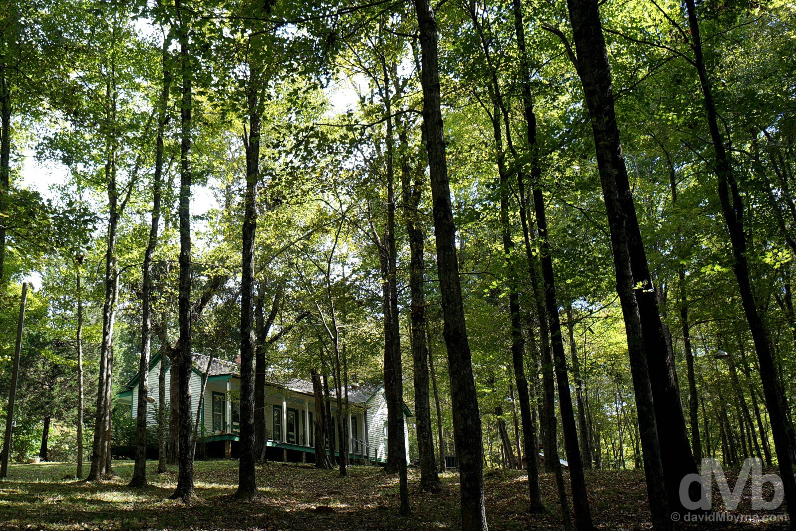
Bill Monroe’s Old Homeplace in the woods of Pigeon Ridge in the hills over Rosine, Ohio County, Kentucky. September 28, 2016.
The staging point for our assault on the bluegrass bonanza of Rosine, not to mention our overnight location for Epic US Road Trip day 32, Beaver Dam is somewhere we drove to yesterday evening after surfacing from the depths of Kentucky’s Mammoth Cave National Park some 50 miles to the southeast.
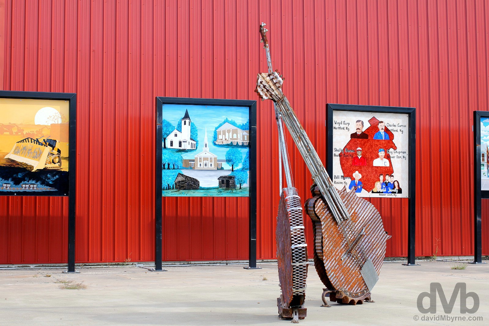
Ten miles from Rosine, Beaver Dam was named after the church – the Beaver Dam Baptist Church – that predates the town itself by some 6 decades. The small town has had some rather renowned former residents, notably jockey Shelby Barnes, southern gospel family group The Crabb Family & one Ray Chapman, the only player in MLB history to die as a result of injuries received during a game; he died in August 1920, aged 29, after being hit in the head by a pitch. I know this about Beaver Dam because all three are commemorated here in the this little space off Main Street, the centerpiece of which is a rather cool metalwork piece of a guitar & banjo. Of course the space also makes reference to nearby Rosine and its particular musical legacy as the home of Bill Monroe, a.k.a. The Father of Bluegrass. Beaver Dam, Ohio County, Kentucky. September 28, 2016.
We swung by yesterday evening when the gate to Monroe Country’s Old Homeplace in the remote, wooded hills above Rosine, Kentucky, was closed. Returning today we found it open, and we had it all to ourselves. Just the latest highlight in a 32-day-long string of highlights, this was to prove to be one of the highlight highlights.
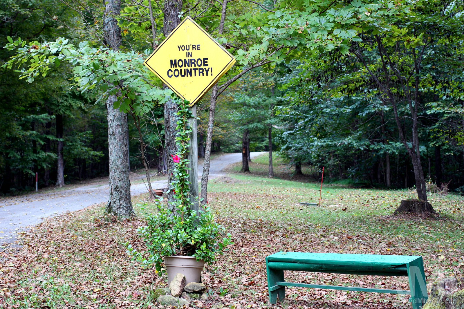
A highlights highlight. Entering Monroe Country outside Rosine, Ohio County, Kentucky. September 28, 2016.
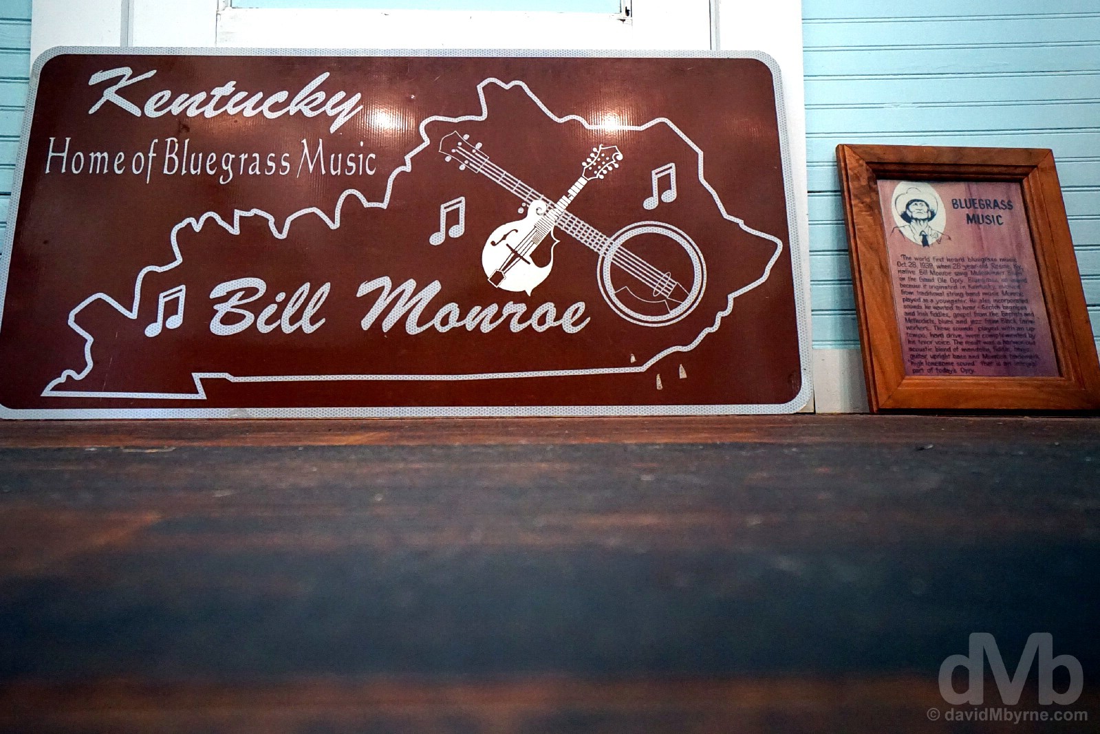
Bill Monroe & Bluegrass Music
As a singer, songwriter, bandleader, showman and instrumentalist, no individual is so closely identified with an American music style as William ‘Bill’ Smith Monroe (1911-1996), a.k.a. The Father of Bluegrass Music. For more than half a century, he shaped bluegrass with his forceful mandolin playing, his high lonesome singing, and mastery of his band, the Blue Grass Boys. In doing so, he gave older country sounds new life, gave the mandolin a new role as a lead instrument in country, pop and rock, and set standards for musicians as diverse as The Everly Brothers, Elvis Presley, George Jones and rock star Jerry Garcia.
Bluegrass Music, so called because it originated in Kentucky, the Bluegrass state, evolved from traditional string band music Monroe played as a youngster, the same music that evolved when Celts, displaced from Britain & Ireland in the 19th century, filtered into the Appalachians, mixed with the locals, & created a genre of folk mountain music. Monroe took this and ran with it, incorporating sounds he wanted to hear himself: Scottish bagpipes and Irish fiddles; gospel from the Baptists and Methodists; & blues and jazz from Black farmworkers. These sounds, played with an up-tempo hard drive, were complemented by his tenor voice, resulting in a harmonious acoustic blend of mandolin, fiddle, banjo, guitar, upright bass and Monroe’s trademark ‘high lonesome sound’ that is still today an integral part of the bluegrass sound. At Bill Monroe’s Old Homeplace on Jerusalem Ridge in the hills over Rosine, Ohio County, Kentucky. September 28, 2016.
The youngest of 8 children and of Scottish & Dutch ancestry, Bill Monroe was first recorded and broadcast on the airways of North Carolina in 1936, a duo with his brother Charlie simply called The Monroe Brothers. It was in 1939 – by then playing with his own band The Blue Grass Boys, named after his home state – that the world first heard bluegrass music when, on October 28 of that year, a 28-year-old Monroe sang ‘Mule Skinner Blues’ on the Grand Ole Opry stage in Nashville, Tennessee. Quickly elevated to a star, by 1943 he was grossing $200,000 a year from show dates. It wasn’t until the 1950s that the name ‘bluegrass’ would be adopted for the Monroe style of music, by which time other present-day icons of the genre, among them Lester Flat & Earl Scruggs, had, and as members of Monroe’s Blue Grass Boys, helped lay down some of the definitive recordings of the genre – Monroe originals including, among many others, ‘Uncle Pen’, Blue Moon of Kentucky’, ‘Jerusalem Ridge’, ‘Bluegrass Breakdown’ & the aforementioned ‘Mule Skinner Blues’ are still to this day staples in the repertoire of profession and amateur bluegrass musicians alike. Bill Monroe’s Old Homeplace on Jerusalem Ridge in the hills over Rosine, Ohio County, Kentucky. September 28, 2016.
The Old Homeplace
Brilliantly restored & presented today by The Bill Monroe Foundation, a non-profit organisation with the mission of creating a memorial to the Father of Bluegrass Music and preserving the source and heritage of the original American art form that is the Monroe style of bluegrass, Bill Monroe’s Old Homeplace is a magical attraction in a magical setting, something I imagine it would be even to non-bluegrass music fans.
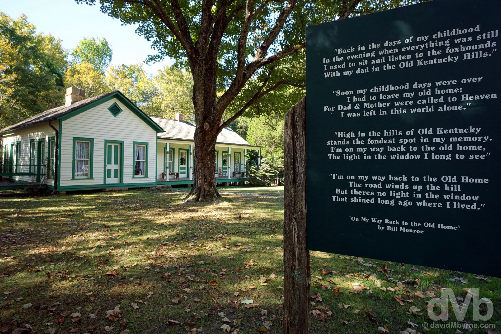
Bill Monroe’s Old Homeplace on Jerusalem Ridge in the hills over Rosine, Ohio County, Kentucky. September 28, 2016.
– Reproduced from text on display in the grounds of the Old Homeplace
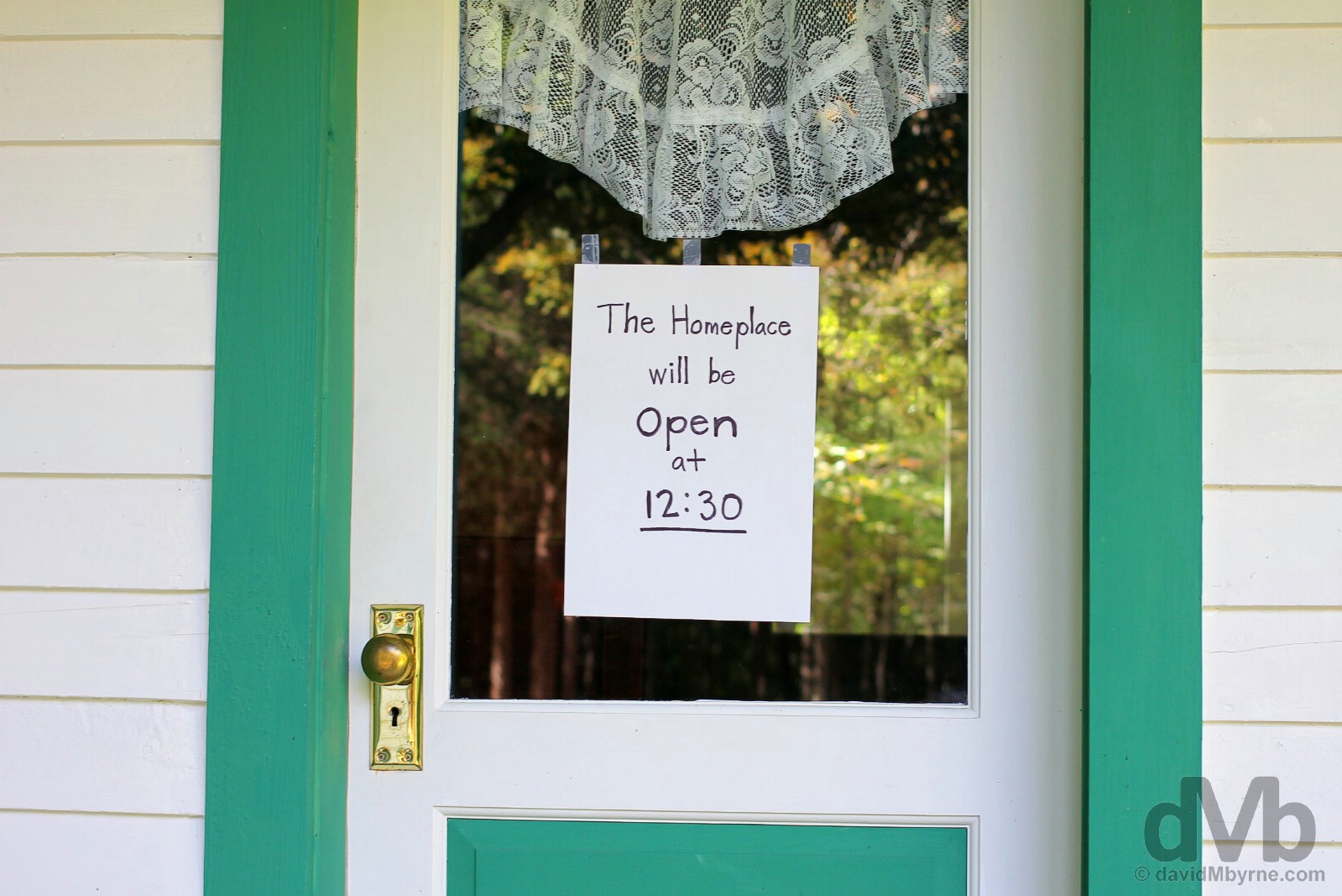
Whoops. Too early. Arriving at the Old Homeplace, something of a niche attraction (you won’t find posted opening hours, a ticket office or a gift shop here), just after 10 a.m. saw us greeted by this sign posted on the front door. We poked around the grounds, peered in the windows, and wondered if we’d manage to pass the time required. Bill Monroe’s Old Homeplace on Jerusalem Ridge in the hills over Rosine, Ohio County, Kentucky. September 28, 2016.
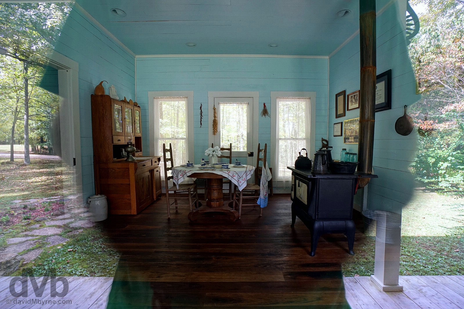
I had a lot of fun playing with reflections while photographing from the outside the interior of the restored Old Homeplace from the front & rear porches. Bill Monroe’s Old Homeplace on Jerusalem Ridge in the hills over Rosine, Kentucky. September 28, 2016.
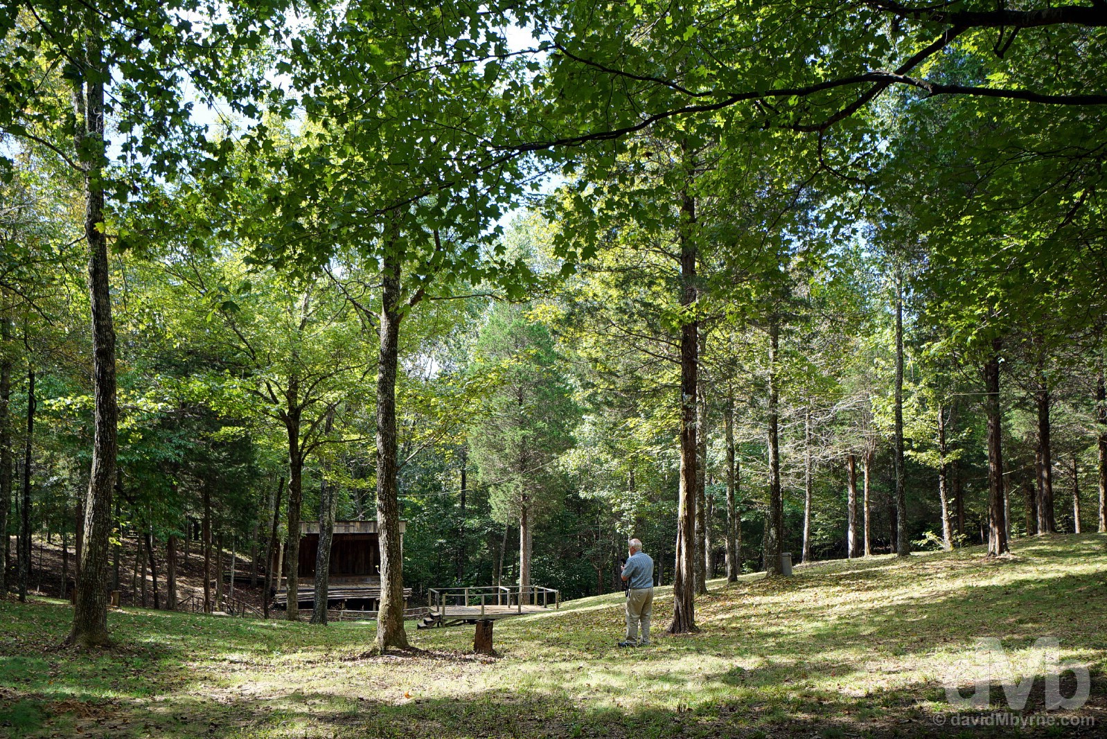
The wooded setting in the vicinity of the Old Homeplace, in the grounds of the 376-hectare (930-acre) Monroe family farm, known as Jerusalem Ridge, is magical. Its wooded slopes form a natural but somewhat unusual & unique amphitheater where The Bill Monroe Foundation placed a permanent stage, the location for the (almost) annual Jerusalem Ridge Bluegrass Celebration (there was no festival in 2016). Central to the bluegrass experience and an integral part of it today, the first multi-day bluegrass music festival was held in 1965, Bill Monroe himself launching his own annual bluegrass music festival in Bean Blossom, Indiana, in 1967, probably still today the best-know festival of them all. Dozens, maybe even hundreds, of bluegrass festivals have established themselves in various parts of the US, and especially in the eastern & Appalachian regions, but only one can claim to be based here at the birthplace of the music itself. In the wooded hills of Jerusalem Ridge behind Bill Monroe’s Old Homeplace in the hills over Rosine, Ohio County, Kentucky. September 28, 2016.
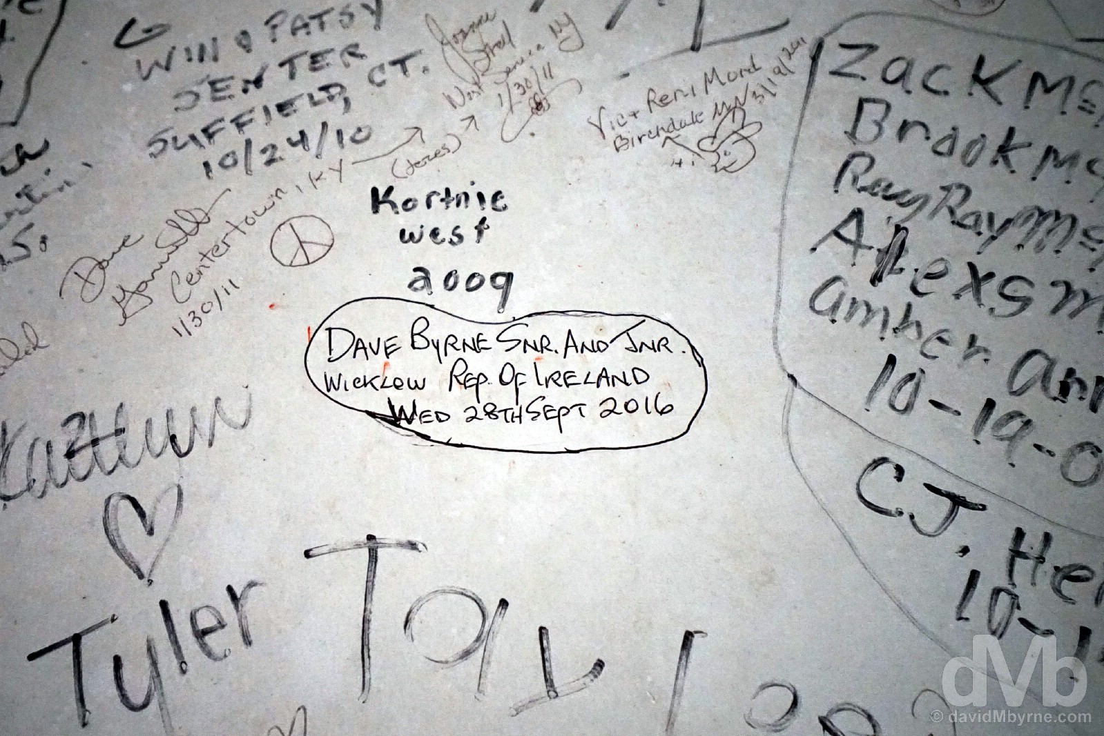
Leaving our mark. The rear of the stage gracing the Old Homeplace amphitheater is decorated with the signatures of the artists who have played here and the visitors who have visited. We made sure to leave our mark, too. As the person who introduced me to bluegrass, and who now jokes I’m more of a connoisseur of the music than he is, it was very special to be here with my Dad. Bill Monroe’s Old Homeplace on Jerusalem Ridge in the hills over Rosine, Ohio County, Kentucky. September 28, 2016.
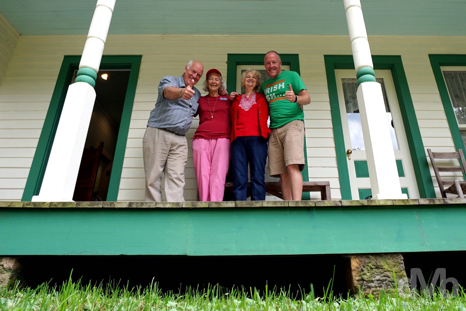
We eventually got access to the Old Homeplace when Jonell (right) showed up and gave us a tour of the restored interior, and before 12:30 to boot. Shortly thereafter Merlene (left) joined the party meaning we had not one but two sweet and hospitable tour guides who were more than happy to pose with us for a picture on the front porch. Bill Monroe’s Old Homeplace on Jerusalem Ridge in the hills over Rosine, Ohio County, Kentucky. September 28, 2016.
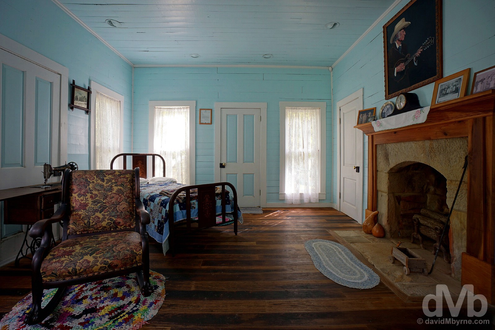
Pictures in the Old Homeplace testify to the brilliant restoration job performed to get the 5-room cabin to its present form, both inside and out; from almost ruin to this, to how it appeared in 1917, really was quite the commendable undertaking (the work was carried out by the Leatherwood Construction Company of Tennessee). Presented today as a museum to the life and time of Bill Monroe, there is no shortage of music paraphernalia, family photos, awards, honours, & information on the history of the musical genre born within these walls. We know these walls can sing & dance, but if only the walls could talk. A parting shot from a bedroom in the Old Homeplace on Jerusalem Ridge in the hills over Rosine, Ohio County, Kentucky. September 28, 2016.
Away from the hills of the Old Homeplace and in the sleepy settlement of Rosine itself (population less than 100) there is, of course, more bluegrass-related sights to see.
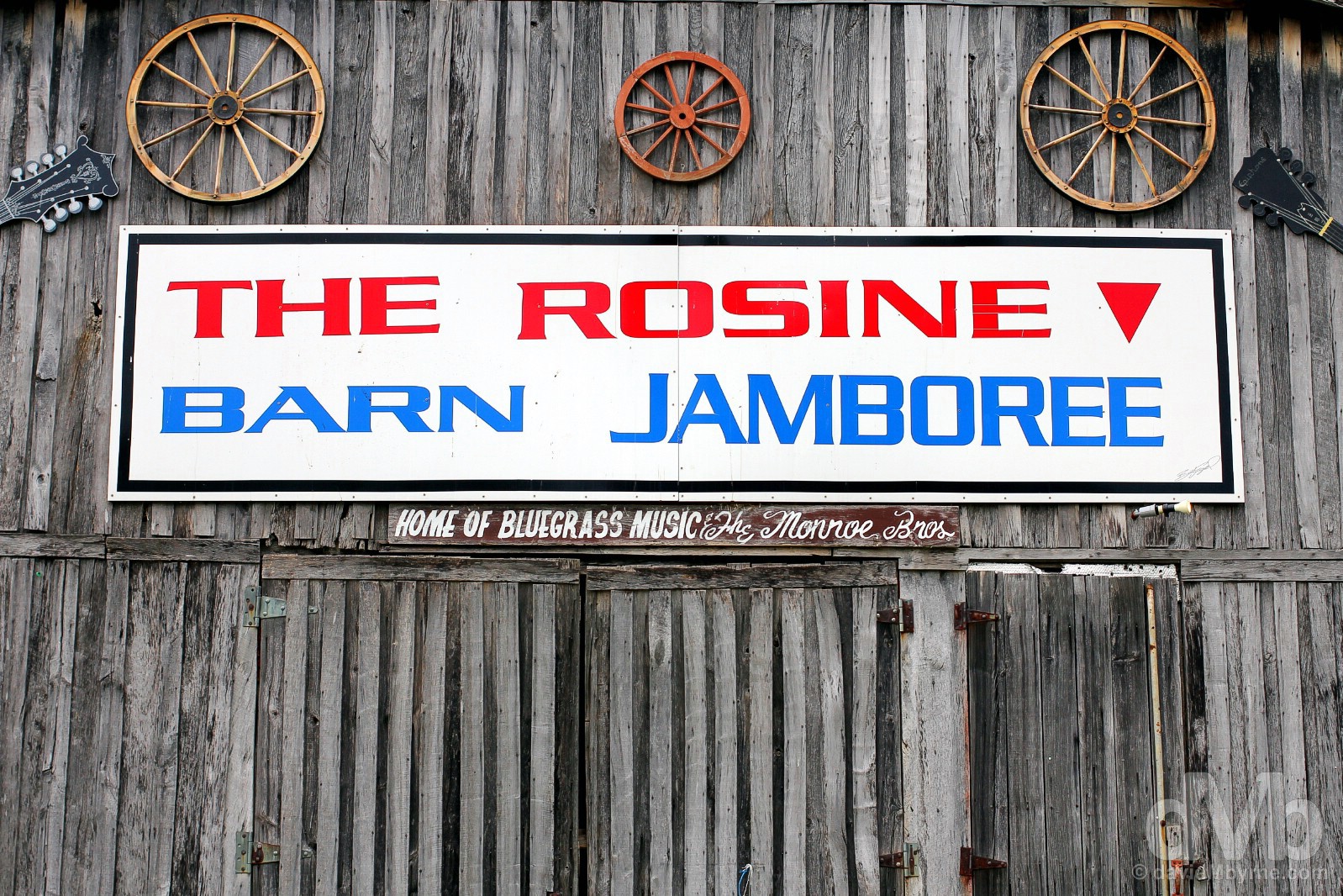
Listed on the National Register of Historic Places & selected as ‘one of the 52 Places to Visit in 2016’ by the New York Times, the Rosine Barn Jamboree is an historic rustic barn renowned for its live bluegrass, country and gospel music performances – Bill Monroe himself was a regular performer. Held every Friday evening from March through mid-December, it’s recommended to ‘bring your lawn chair for when seating gets scarce!’ Rosine, Ohio County, Kentucky. September 28, 2016.

We couldn’t leave Rosine without visiting the great man’s grave. Flanking Bill’s grave you’ll also find the last resting places of many members of the Monroe family including Birch & Charlie, Bill’s musician brothers. A little further away is the grave of Pendleton Vandiver, the famous Uncle Pen Monroe immortalised in probably his most famous recording of them all. Also interred here are 111 veterans (what’s a US cemetery with veterans?) and the first Kentuckian to receive a post humous Medal of Honor for service during World War II, PFC Wesley Phelps. Rosine Cemetery, Rosine, Ohio County, Kentucky. September 28, 2016.
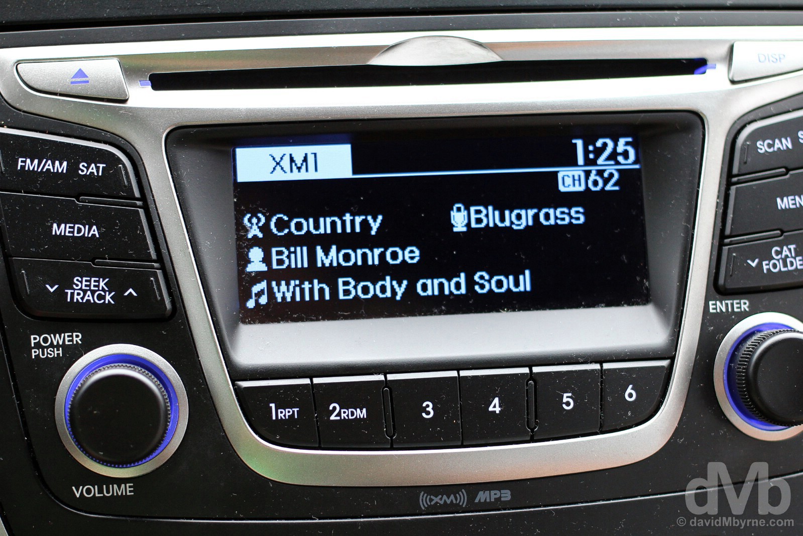
We got in the car to leave Rosine for Owensboro and wouldn’t you know it, Bill Monroe on the radio. How apt. Rosine, Ohio County, Kentucky. September 28, 2016.
Owensboro
The bluegrass bonanza wasn’t done for this day. Oh no. Less than 40 miles north of Rosine is Owensboro. Straddling the state line with neighbouring Indiana, the city is also the location for the International Bluegrass Music Museum. We left it late in the afternoon to drop by but still had time to take in all the awesome one-of-a-kind showcase of bluegrass had to offer.
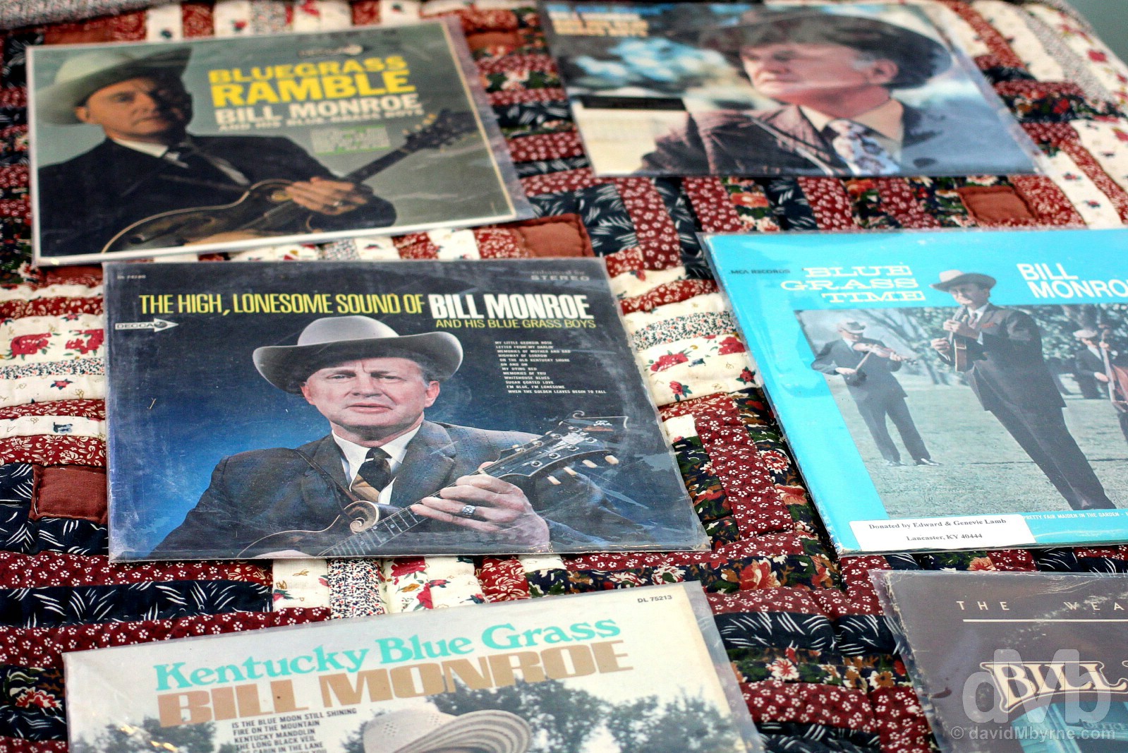
The only museum of its kind in the world, the International Bluegrass Music Museum in Owensboro is dedicated to telling the story of the history of bluegrass music, the instruments at the core of its unique sound and the gifted musicians who have brought it to life down through the years. As good as the museum is now, and it is, it’s gonna be even bigger & better come Spring 2018 when it moves a few blocks away to a new home as part of the new International Bluegrass Music Center. The International Bluegrass Music Museum in Owensboro, Kentucky. September 28, 2016.
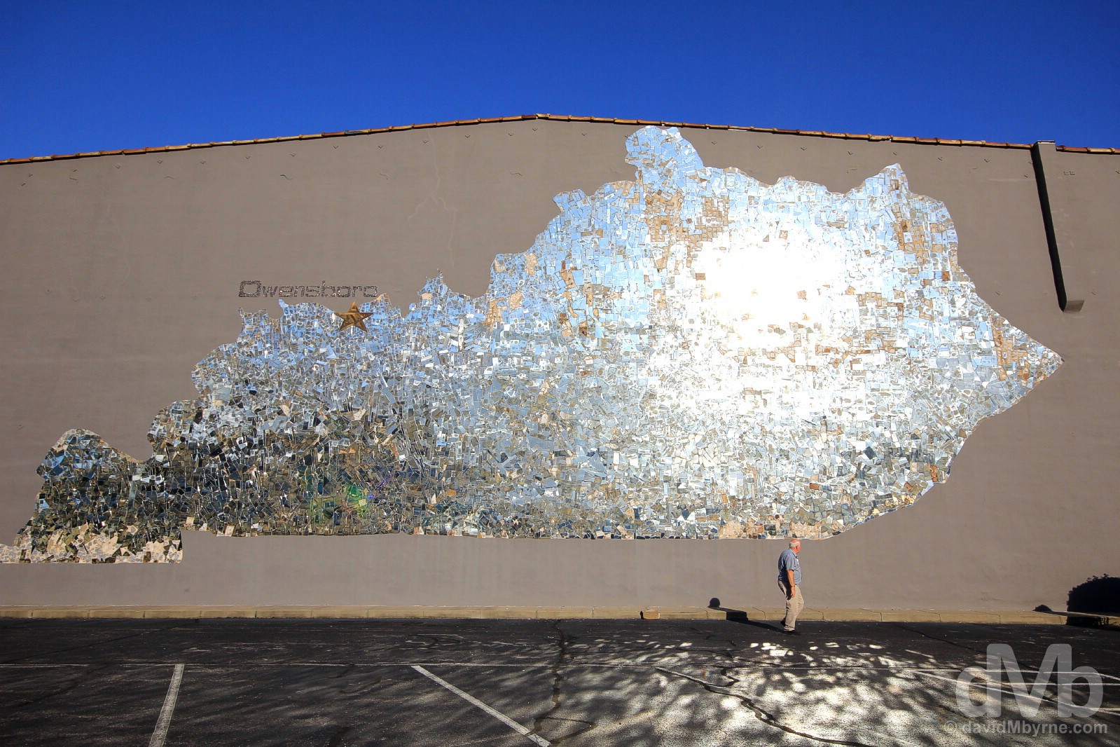
Dazzling Owensboro. Dazzling Kentucky. Kentucky was amazing, just as photogenic as I expected it to be. And even when trying to leave the state we were pulled back for yet more eye candy. This caught our attention when crossing the Owensboro Bridge over the Ohio River out of town, and out the state of Kentucky, towards the state line with Indiana necessitating an about-turn for a closer inspection. Yes, it’s a massive mirror mural of the state of Kentucky, and it’s blindingly awesome. Thank you Kentucky and see you again sometime. Owensboro, Kentucky. September 28, 2016.
A second drive over the Owensboro Bridge spanning the Ohio River and out of the state of Kentucky brought us to the state line with Indiana, the penultimate state of the road trip.
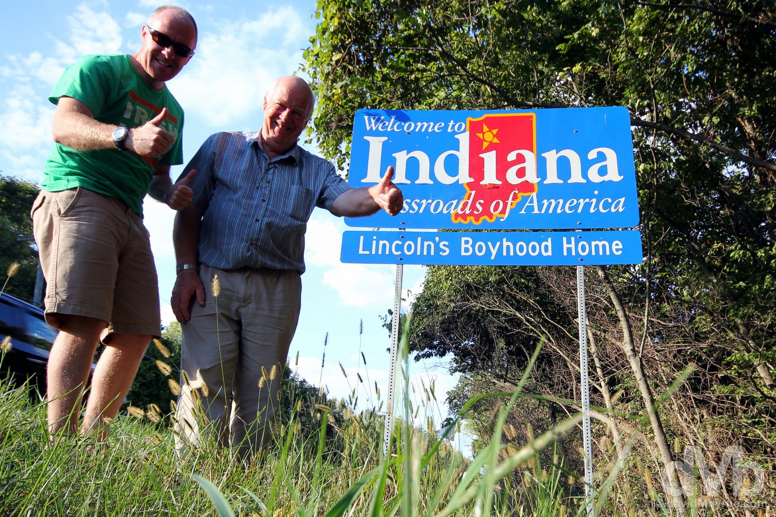
State sign #25 || Welcome to Indiana, the penultimate state. At the Indiana state line on Indiana State Road 161, southern Indiana. September 26, 2016.
State Nickname – The Hoosier State. State Motto – The Crossroads of America. Admitted To The Union – December 1816 (19th state). Population – 6.6 million (16th most populous state). Area – 36,400 sq miles (38th largest state). Capital – Indianapolis. National Parks – 0. National Scenic Byways/All-American Roads – 2/1. Famous For – The Indy 500; farmers, farmland & corn; the NCAA; . State Highlight – The architecture of Columbus. Indiana Titbits – The state’s name means “Land of the Indians”, or simply “Indian Land”; Indianans are called ‘Hoosiers’ but no one really knows why; the state has two time zones; Hoosiers like their hoops – Indiana has produced more NBA players per capita than any other state; attracting some 250,000 people every, the Indy 500 is said to be the largest single day sporting event in the world.
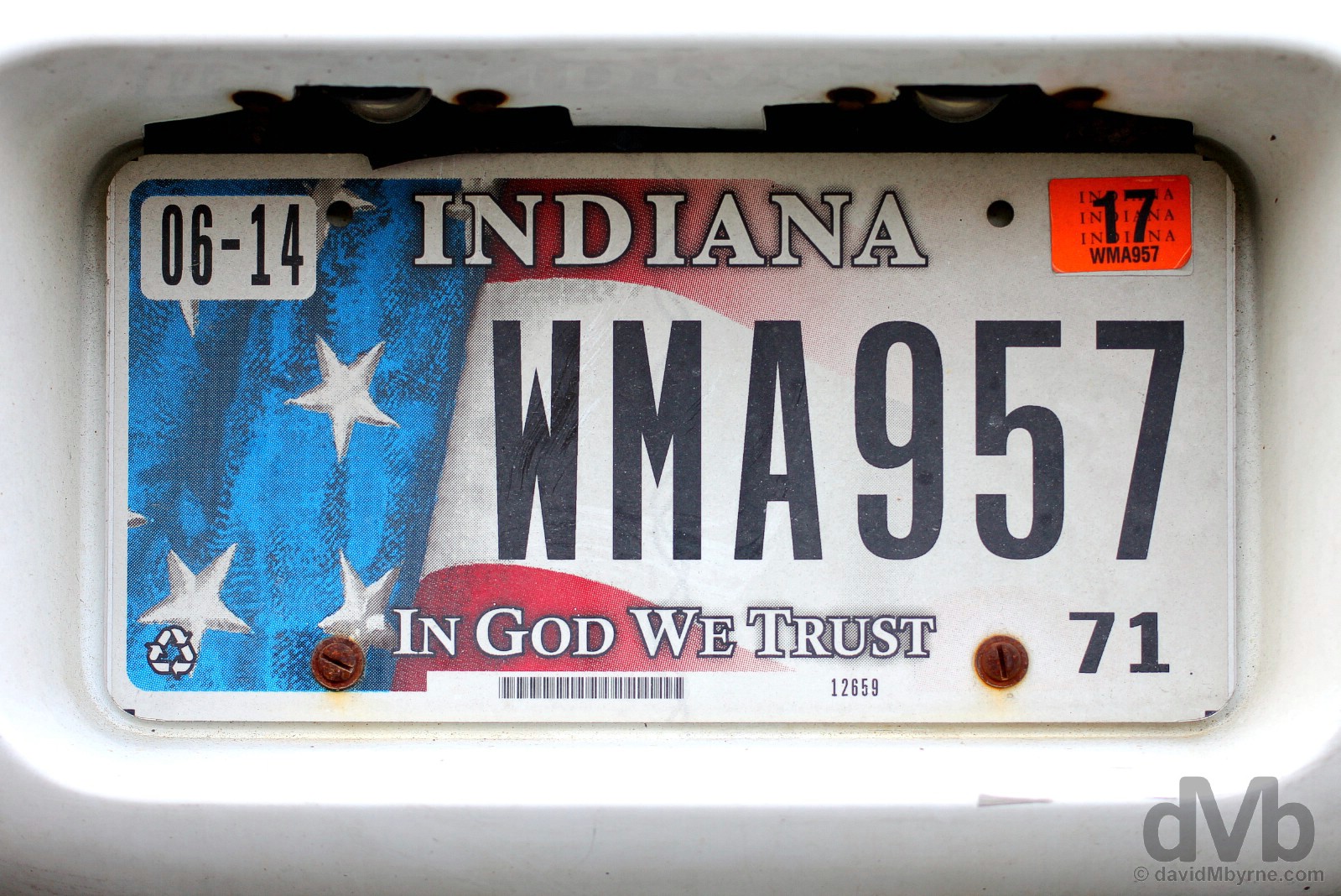
Indiana. State #25, the penultimate state. Bloomington, Indiana. September 29, 2016.
Image ||Completing the loop by the windswept shores of Lake Michigan, Chicago, Illinois.
“… we’ve three days left to get to grips with Chicago, but today, and once we’d completed the 5-hour, 300-mile drive from Bloomington, Indiana, to the Windy City via a stop at the Indianapolis Motor Speedway, signalled the end of the wider road trip, the completion of the loop. What a ride it has been.”
Day 33 || September 29 2016
Route || Bloomington, Indiana, to Chicago, Illinois (via Indianapolis, Indiana)
Miles (Kilometres) Driven || 282 (454)
Posted From || Chicago, Illinois
Today’s Highlight || Completing the loop in Chicago
Today, day 33, was the last day on the road. Yes, we’ve three days left to get to grips with Chicago, but today, and once we’d completed the 5-hour, 300-mile drive from Bloomington, Indiana, to the Windy City via a stop at the Indianapolis Motor Speedway, signalled the end of the wider road trip, the completion of the loop. What a ride it has been.
The End. Completing the 26-state, 9,493-mile loop. Arrival by the windswept shores of Lake Michigan in Chicago 33 days after departure. Chicago, Illinois. September 29, 2016.
Although we were only passing through, we wanted to see something of the state of Indiana, if only briefly. So we decided to swing by the Indianapolis Motor Speedway. Located in a suburb of Indianapolis, the state capital, it was a 60 mile drive north from our overnight location of Bloomington, or about 24 laps of what is probably the world’s most famous motor racing circuit.
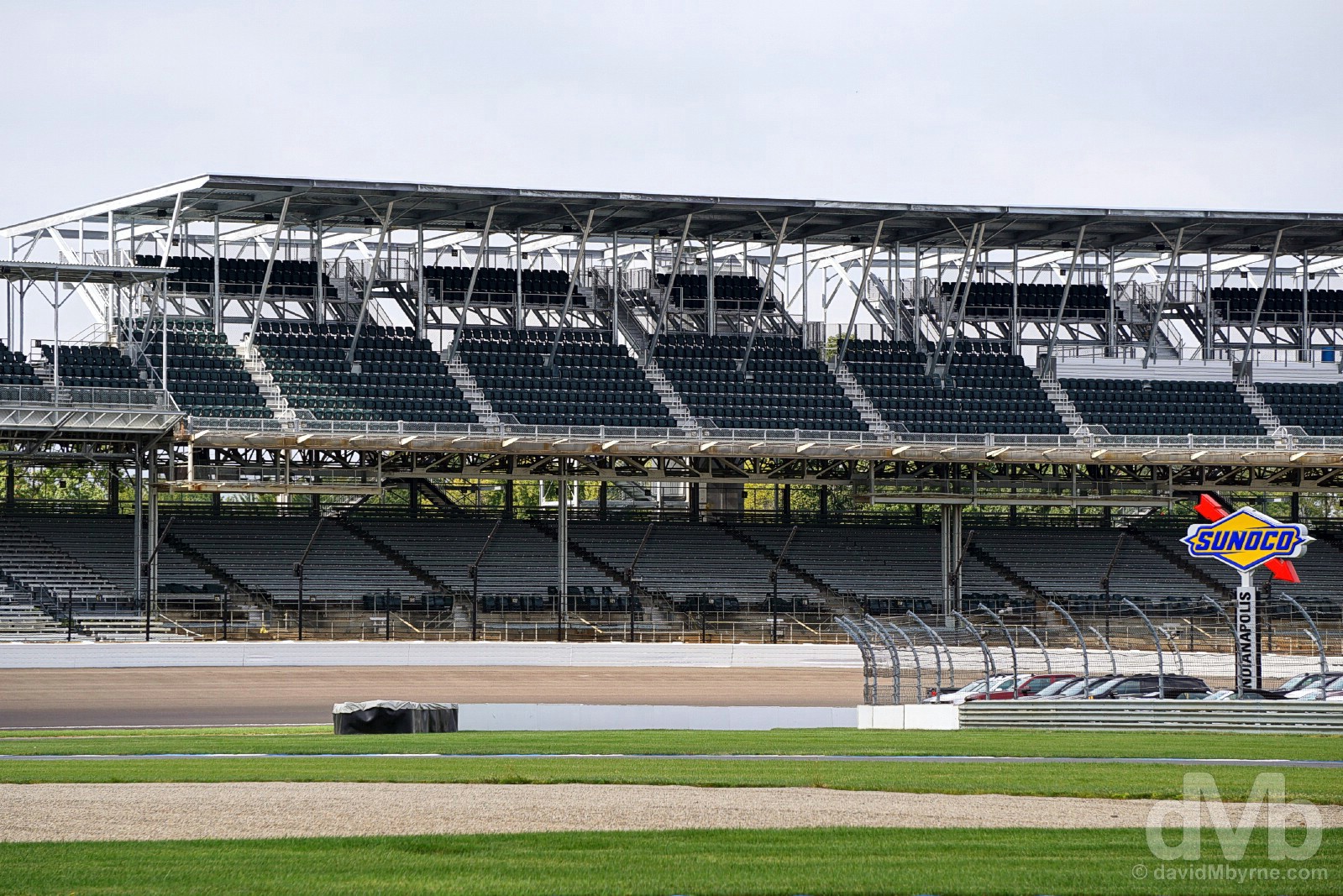
A portion of the 2.5-mile-long track and grandstands lining the Indianapolis Motor Speedway in Indianapolis, Indiana. September 29, 2016.
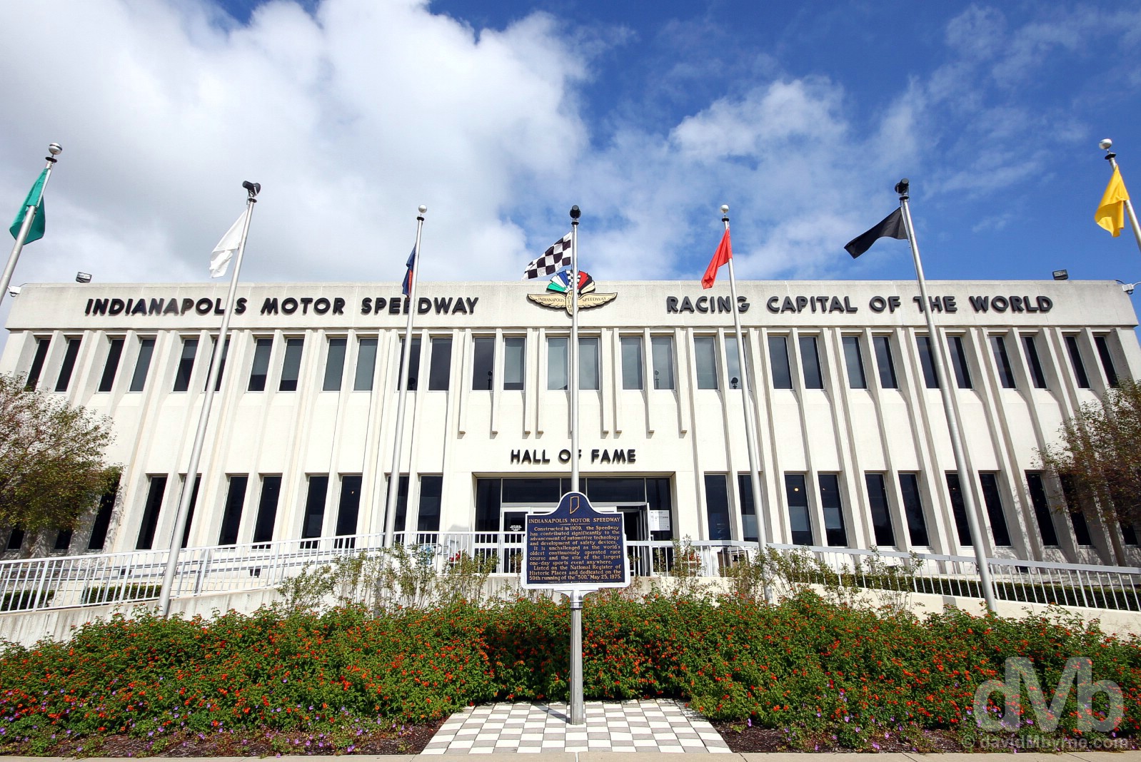
The state of Indiana has an extensive history with auto racing and it is quite proud to be home to probably the world’s most famous motor racing circuit. The Indianapolis Motor Speedway, the self-titled ‘Racing Capital of the World’, was first constructed in 1909 & has been home since 1911 to the 200-lap Indy 500, a.k.a. The Greatest Spectacle in Racing. The speedway, placed on the National Register of Historic Places in 1975 and designated a National Historic Site in 1987, is both the world’s oldest continuously operated race course and the highest-capacity sports venue in the world with a capacity to accommodate upwards of 400,000 petrol heads; the Indy 500, typically held on the last weekend in May, attracts crowds of 250,000 making it the largest single day sporting event in the world. The 2.5-mile-long nearly rectangular oval track encloses a vast space that manages to house 4 holes of an 18-hole golf course. It’s big, so big that it’s hard to get an appreciation for its scale from ground level. We saw aerial pictures of the oval for sale in the vastly overpriced gift shop of the Indianapolis Motor Speedway Museum and Hall of Fame, seen here, somewhere we snooped around for a bit after been told tours of the track itself for this particular day were not running. The Indianapolis Motor Speedway in Indianapolis, Indiana. September 29, 2016.
Bloomington To Chicago – The Indiana/Illinois State Line
We didn’t take the most direct route from Indianapolis to Chicago, a 180-mile drive north via Interstate 65, instead opting for a 300-plus-mile route via eastern Illinois. We needed to be sure of getting the last state line picture of the road trip.

State sign #26 || The final state line crossing. On the Indiana-Illinois state line, eastern Illinois, September 29, 2016.
State Nicknames – Land of Lincoln; The Prairie State. State Motto – State Sovereignty, National Union. Admitted To The Union – December 1818 (21st state). Population – 12.9 million (5th most populous state). Area – 58,000 sq miles (25th largest state). Capital – Springfield. National Parks – 0. National Scenic Byways/All-American Roads – 5/2. Famous For – Skyscrapers (first sprung in Chicago in 1885); flat farmland; Route 66 (it starts in Chicago); having an Abraham Lincoln obsession. State Highlights – Chicago. Illinois Titbits – Illinois’s largest city, Chicago, is the third largest city in the US; it’s a coal state – over 200 billion tons of coal are estimated to lie under the surface, having a total heating value greater than the estimated oil deposits in the Arabian Peninsula; the world’s first nuclear reactor was built on the University of Chicago campus; three US presidents have claimed Illinois as their political base – Abraham Lincoln (born in Kentucky), Ulysses S. Grant (born in Ohio), & Barack Obama (born in Hawaii).
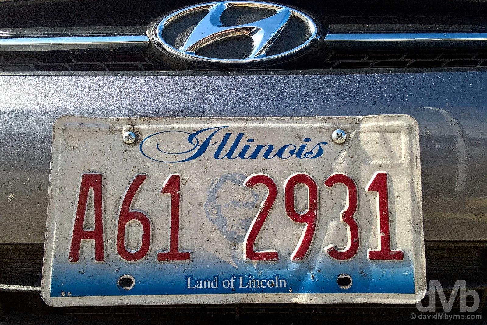
Illinois. State #26. The licence plate of the first of our two road trip steeds upon arrival in O’Hare International Airport on the first day of the road trip. Chicago, Illinois. August 28, 2016.
We arrived (back) in Chicago mid-afternoon, the city a big change of pace to the previous few days. Utilising the car for the last evening we can, we drove to the shores of Lake Michigan before calling in on Wrigleyville neighbourhood in the city’s northern suburbs, the location for fabled Wrigley Field, the home of the city’s much-loved Cubs. Lots more to come from Chicago. We’re only just starting to get to grips with the Windy City.
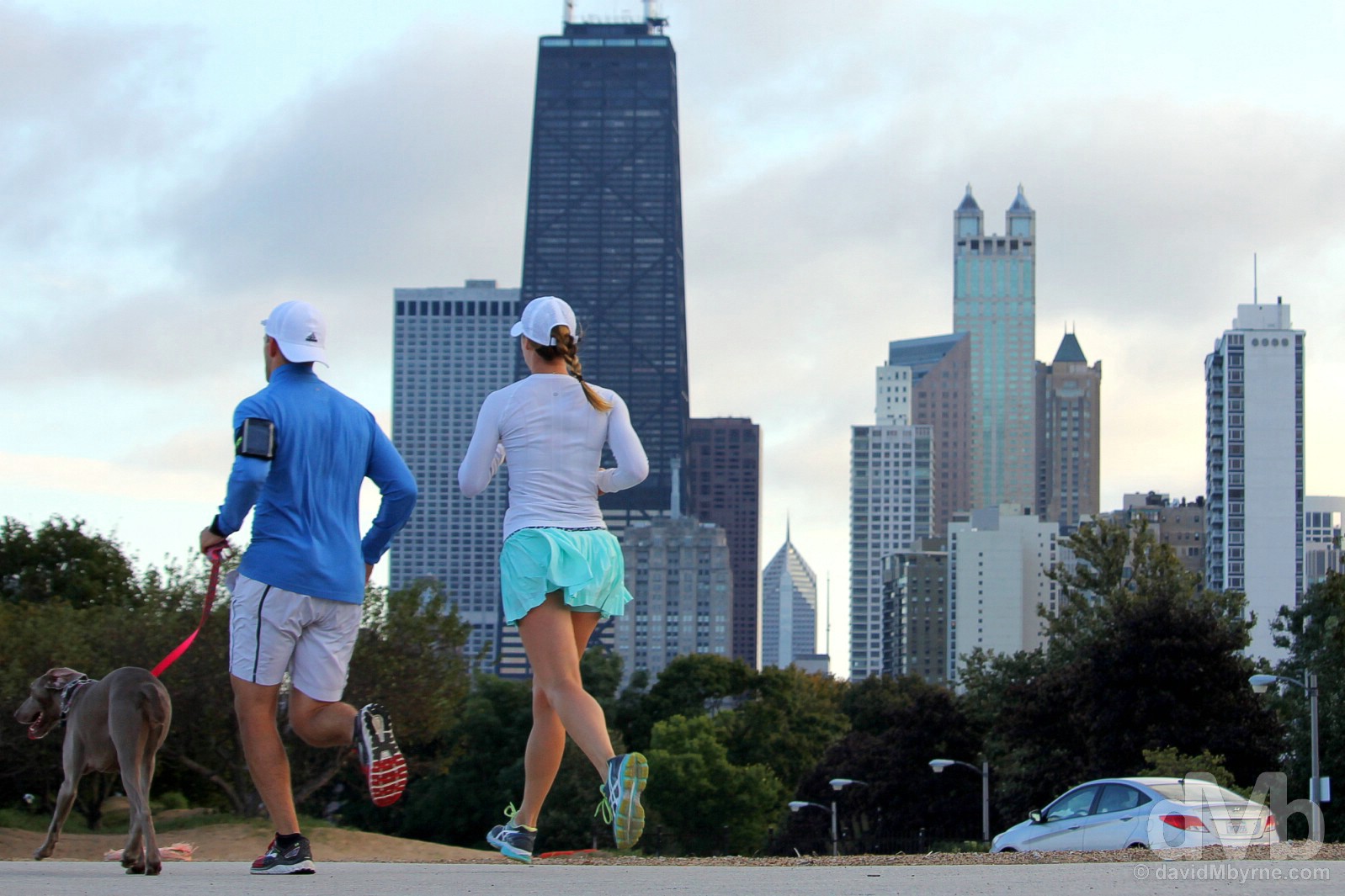
Joggers by the windswept southwestern shores of Lake Michigan in Chicago, Illinois. September 29, 2016.
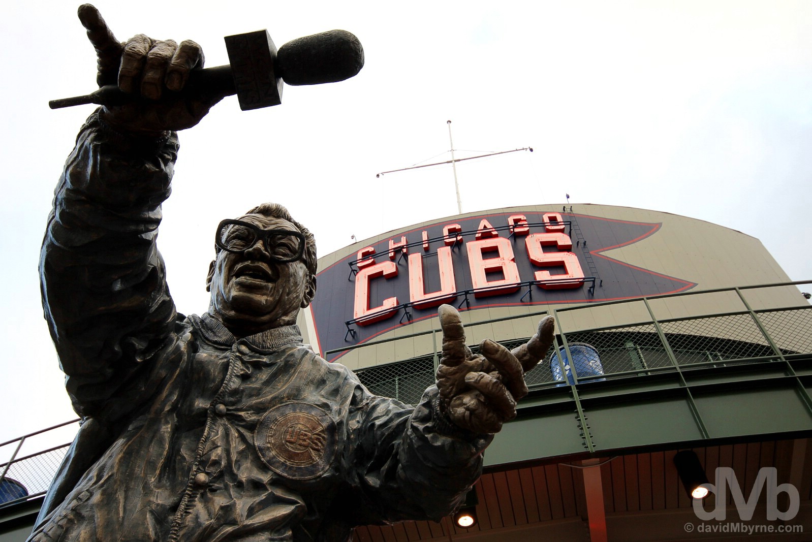
‘Let me hear ya… a one… a two… a three…’ Calling over 8,300 games during a 53-year career in broadcasting, the last 16 years of which were spent as radio announcer for the Chicago Cubs, Harry Caray is best known for his 7th-inning stretch rendition of ‘Take Me Out to the Ballgame’. Revered in Cubland, he died aged 83 in February 1998, 2 months before the start of the baseball season, this statue erected in his honour a year later in April 1999. Outside Wrigley Field, the home of the Chicago Cubs, Wrigleyville, Chicago, Illinois. September 29, 2016.
Image ||On deck. Wrigley Field, Chicago.
”As a baseball fan, a visit to Chicago’s Wrigley Field (yes, it’s named after the gum), home to the city’s beloved Cubs & one of professional sport’s most iconic theaters with a string of unique features, was at the very top of my Chicago must-see list. And by doing so earlier today I’m pretty confident that I did my bit to help break the 71-years-and-counting Curse.”
Days 34-36 || September 30 – October 2 2016
Posted From || Chicago, Illinois
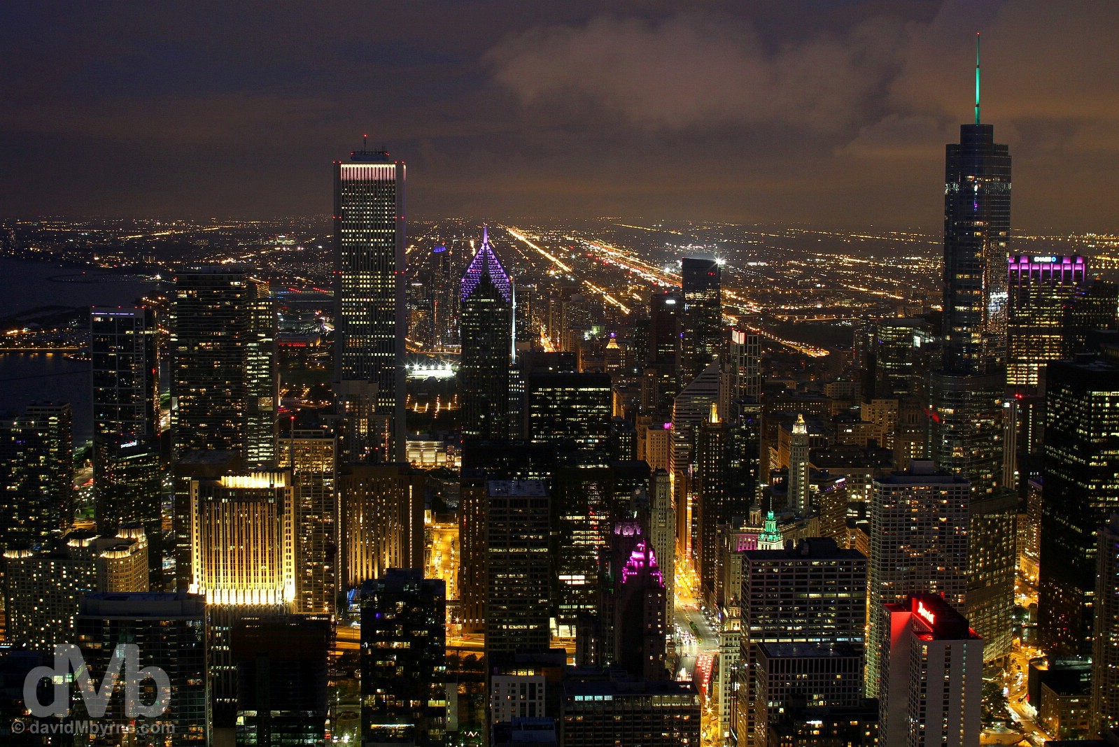
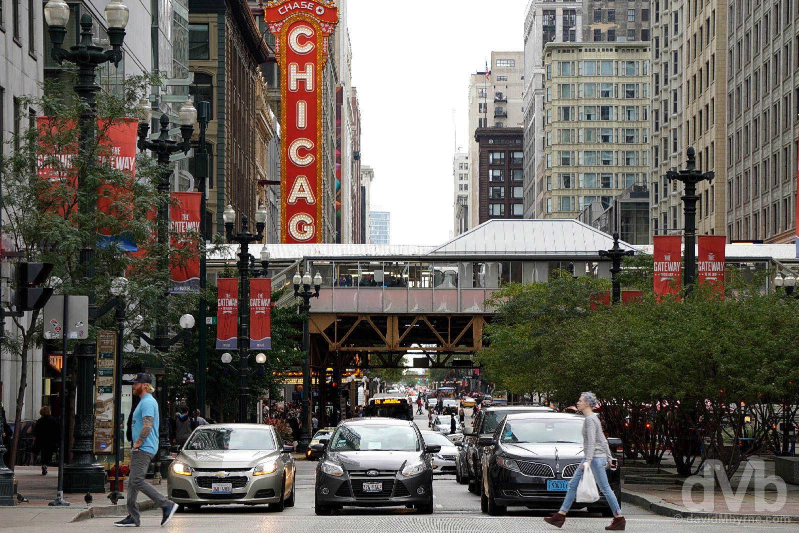
The last three days in Chicago were always going to be very different to the 33 days that preceded them. Aside from a 17-mile drive from the city to the airport to fulfill the obligation to return the hire car, we didn’t drive anywhere for the three days and we stayed in the same bed for more than 2 nights, both trip firsts. And while we’d visited sizable cities over the last 5 weeks – Minneapolis & Saint Paul, Salt Lake City & St. Louis immediately spring to mind – none can match Chicago for size, noise or variety. So yes, Chicago, the largest city in Illinois, the third-largest city in the US and a bustling Great Lakes port that extends 26 miles along the southwestern shoreline of Lake Michigan that’s something of an architectural trendsetter & that boasts one of the world’s most iconic skylines, was a very different proposition to what came before it. The infamous domain of one Al Capone in the 1920s & a city whose crime rate is substantially higher than the US average and which boasts the highest sales tax rates in the country it may be, but there’s still plenty to love about Chicago – the city was a great choice for ending (& starting) this 36-day once-in-a-lifetime gallivant around a rather hefty portion of the US.
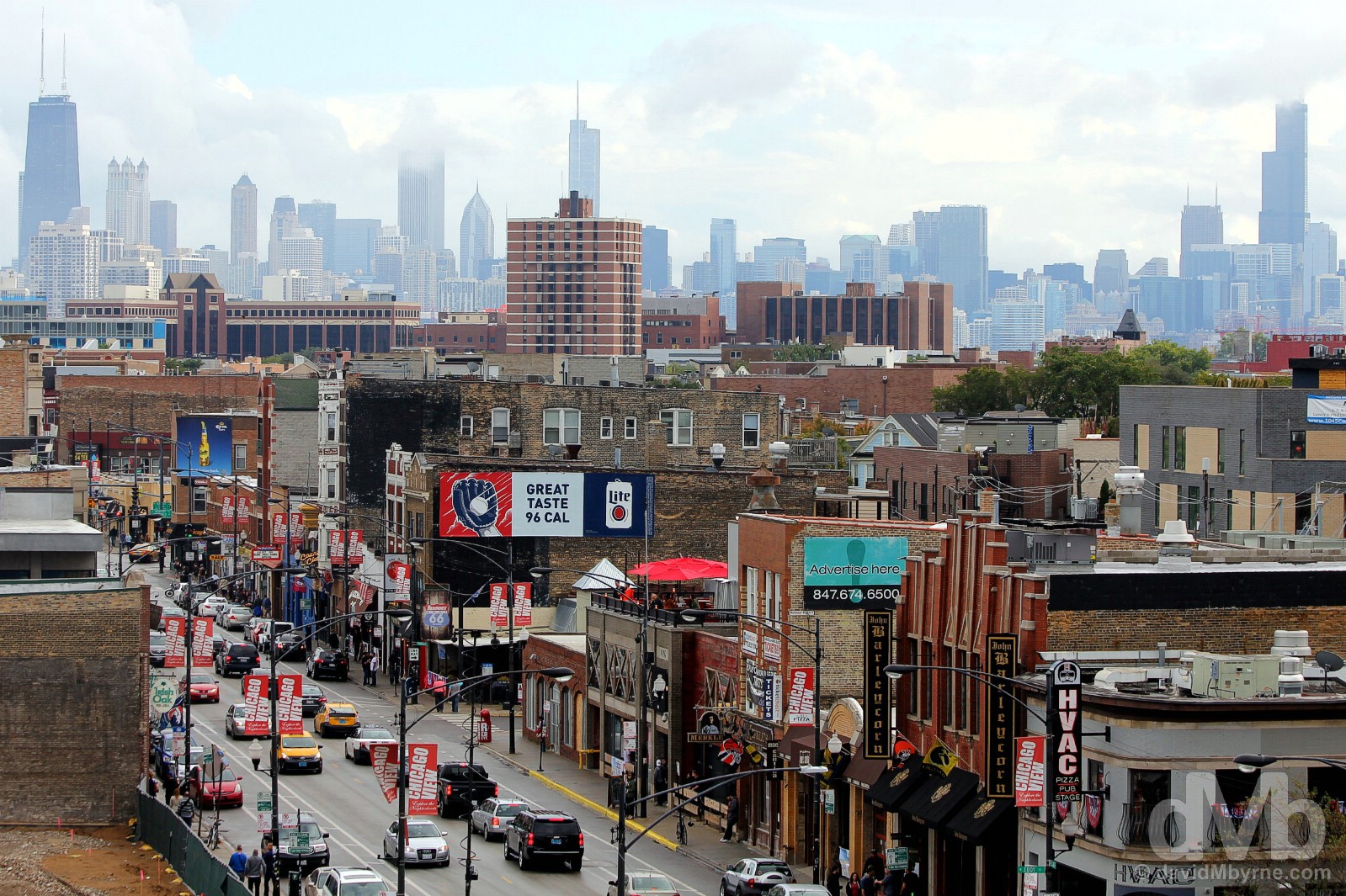
The iconic Chicago city skyline, from The John Hancock Building (left) to the Willis Tower ( right) as seen from Wrigleyville, northern Chicago, Illinois. October 1, 2016.
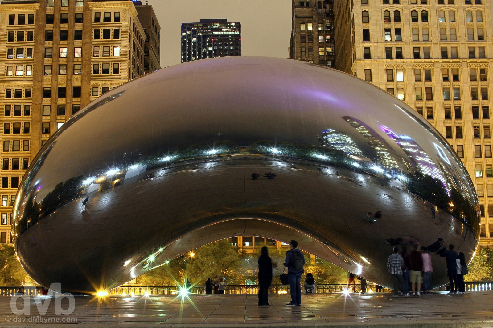
Image || The Cloud Gate, a.k.a. The Bean, Millennium Park, Chicago.
”Inspired by liquid mercury and the winner of a design competition, the 20-metre-wide by 13-metre-high, 110-ton structure is made up of 168 stainless steel plates welded together and polished to appear without any visible seams; try as you may, you won’t find any.”
Day 34 || September 30 2016
Today’s Highlight || The architecture of Downtown Chicago.
I was out on the streets of Downtown Chicago early this morning. It was before 7 a.m. and I was surprised how quite the streets of such a large city were at that time of a Friday. It was also somewhat dank and while it wasn’t raining, it was threatening to. But, and in spite of the hour and the undesirable climatic conditions, I was still feeling the same buzz I invariably get when exploring and getting acquainted with somewhere new. Chicago for me was somewhere new, a city I had wanted to visit for a long time.
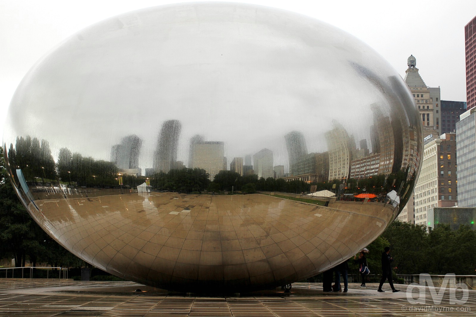
It wasn’t raining when I began my early morning amble through Downtown Chicago, but there was no letup in the rain by the time I found myself playing with reflections at the city’s iconic and very shiny Cloud Gate, more commonly known as The Bean, in the city’s Millennium Park. Chicago, Illinois. September 30, 2016.
– Jeremy Piven, American actor and producer.
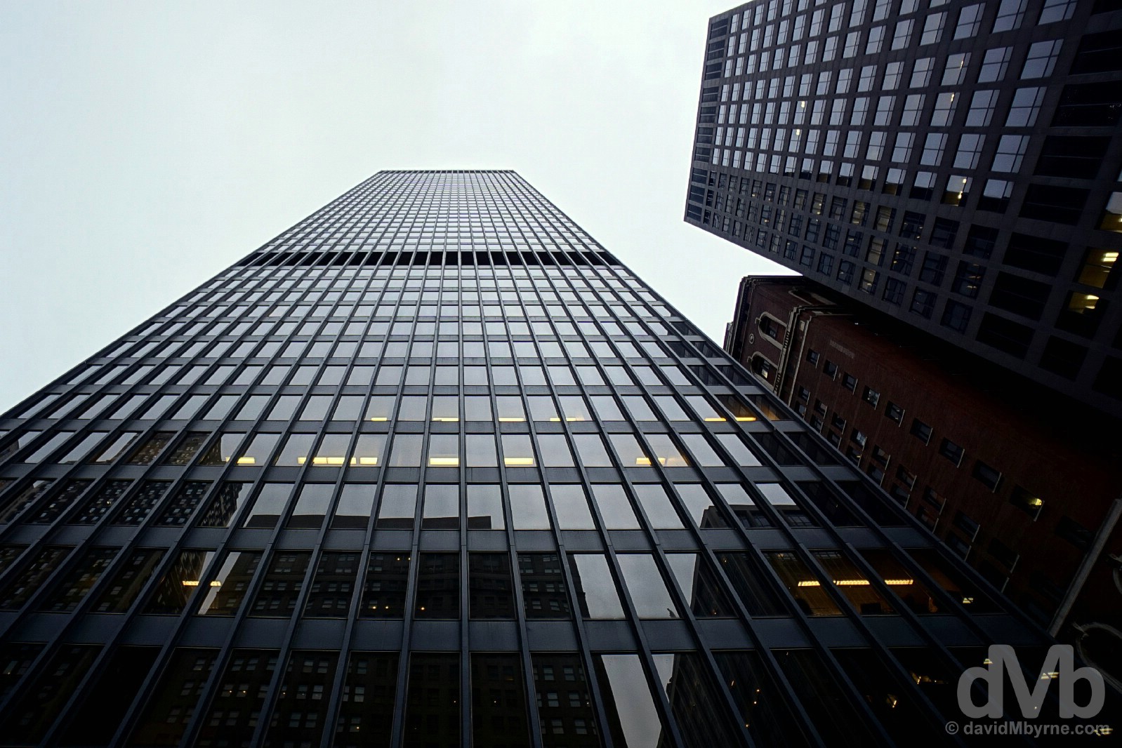
Skyscrapers in Downtown Chicago, Illinois. September 30, 2016.
Chicago & Architecture
Famous today for its architecture and its architectural diversity, everything from timeless Art Deco towers to classic super-tall skyscrapers to contemporary & elegant hotels to modern & shiny sculptures, Chicago was founded in 1833, thereafter growing rapidly from a population of around 150 to over 100,000 in less than 30 years. Devastated by a fire in October 1871, which burned the majority of buildings in the mostly wooden city, Chicago was forced to rebuild, taking the opportunity when doing so to firmly establish itself as both an architectural trendsetter & a leader in skyscraper engineering and design; the world’s very first skyscraper, a word first coined in the city, pierced the Windy City sky in 1885. While there’s plenty to do in the city that doesn’t involve tilting your neck skywards ogling at various towering architectural forms, suffice to say doing exactly that is an unavoidable consequence of any visit to the city, and it’s about all I did this morning while exploring the city’s Loop, its central downtown business district.
– The Chicago Architecture Foundation
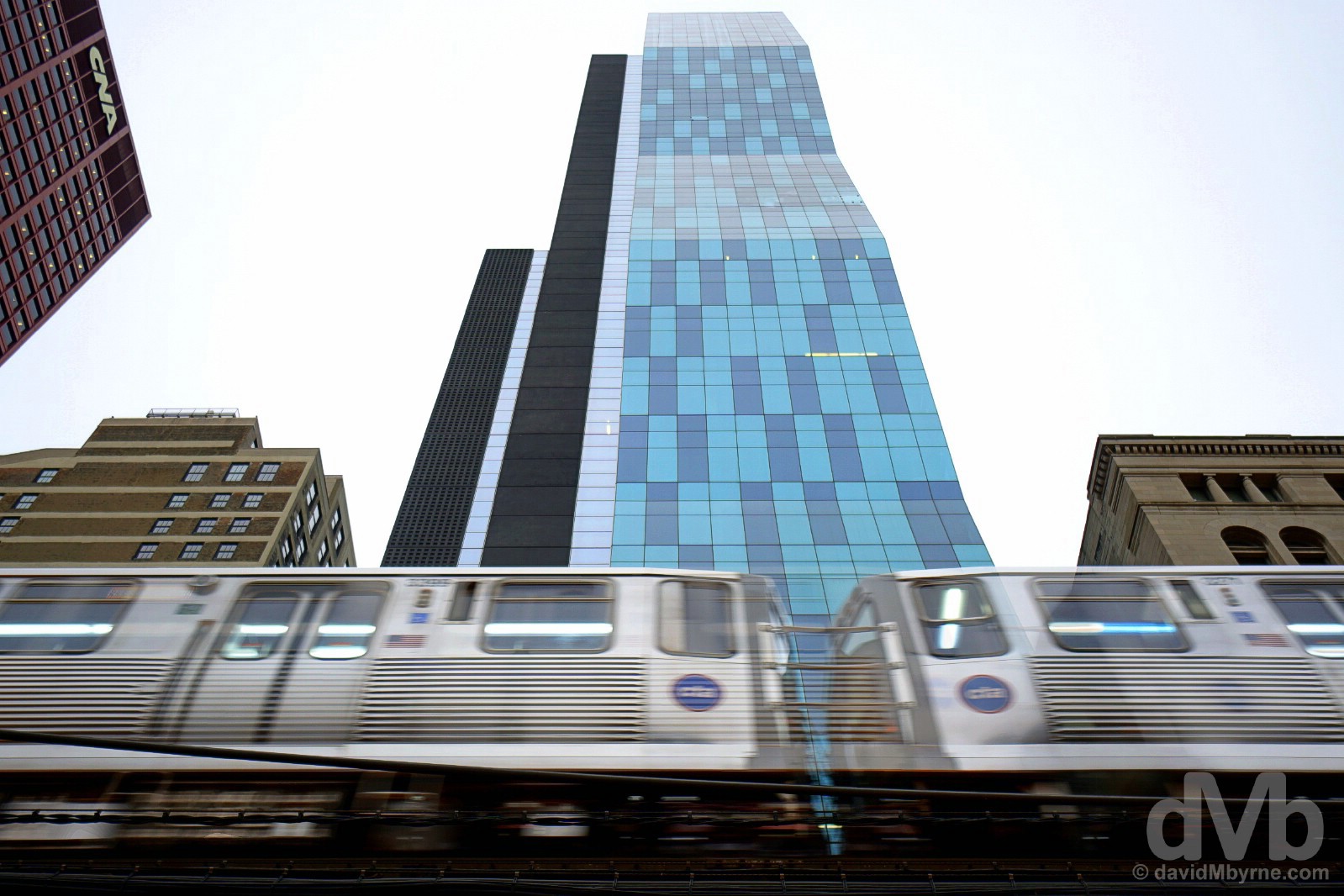
Chicago’s Downtown Loop, the financial & business nexus of the city, is a central grid of towering steel & concrete, world-class 20th-century architecture and riverside walks. It’s also a hub for CTA (Chicago Transit Authority) trains that circle, or perform a loop, on elevated tracks providing both a unique vision and soundtrack to the city. An elevated CTA train on S Wabash Avenue in Downtown Chicago, Illinois. September 30, 2016.

Chicago had an elevated railway – the ‘L’ – as far back as 1894, but the city didn’t open its first subway until 1943. The Chicago Downtown now boasts both – elevated tracks run along the streets at the foot of towering skyscrapers before eventually diving into subterranean tunnels below the Chicago River. On the elevated platform of Clark/Lake CTA Station, Downtown Chicago, Illinois. September 30, 2016.
Millennium Park
The northern part of the larger Grant Park and sandwiched between the Loop and the shores of Lake Michigan, Millennium Park is the epitome of modern Chicago, a green canvas upon which top architects, artists and engineers have been let loose, collaborating to create an outdoor modern-design gallery, a harmonious blend of public art pieces, pavilions, promenades, gardens, galleries, squares & plazas.
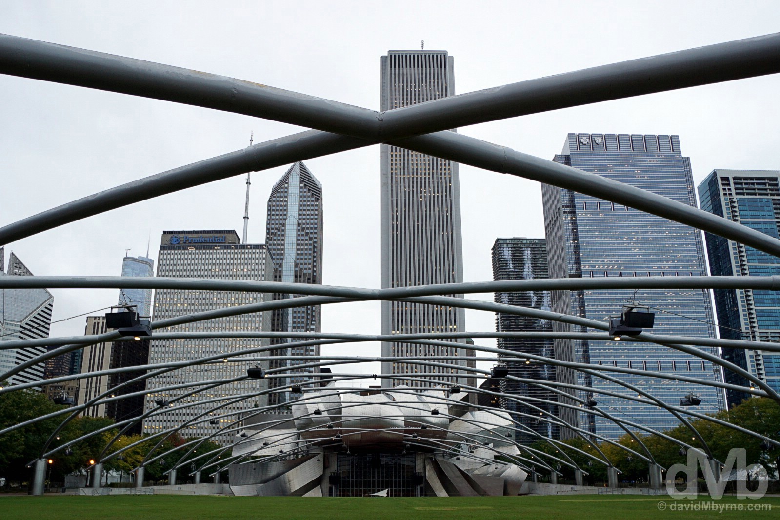
Designed by renowned Canadian architect Frank Gehry, winner of the Pritzker Prize in Architecture & National Medal of Art, Millennium Park’s centrepiece Jay Pritzker Pavilion is a massive open-air auditorium of futuristic architecture blending perfectly with the surrounding city skyline. Completed in 2004 at the end of a 5-year build, the bandshell boasts a state-of-the-art acoustic system that is suspended above the audience by means of a photogenic trellis of criss-crossing steel pipes. A fabulous location in which to brandish a wide angle lens, the pavilion can accommodate more than 11,000 people (4,000 in permanent seating and 7,000 on the lawn) and regularly plays host to free concerts and performances during the warmer summer months; the pavilion is also home to the Grant Park Symphony Orchestra & Chorus and the Grant Park Music Festival, the only remaining free outdoor classical music series in the US. Millennium Park, Chicago, Illinois. September 30, 2016.
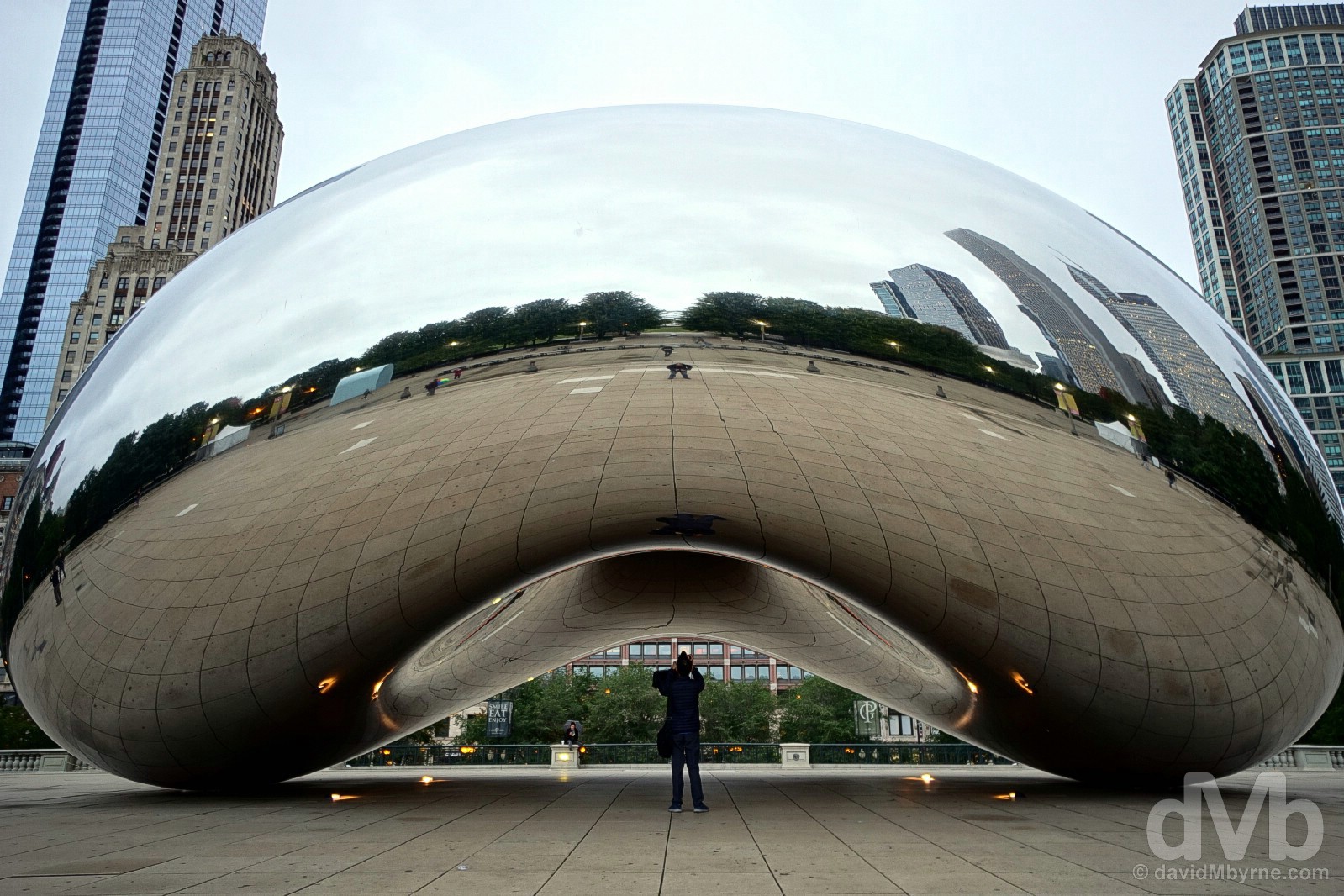
Easily Millennium Park’s biggest draw, maybe even Chicago’s biggest draw at this stage, Cloud Gate is a highly-polished stainless steel sculpture affectionately known as The Bean (and you can probably see why). Designed by world-renowned Indian-born British artist Anish Kapoor and what is his first public work installed anywhere in the US, it has become an icon of the city since its installation in 2004 (although it wasn’t officially completed until 2006), one that enthralls millions yearly. Inspired by liquid mercury and the winner of a design competition, the 20-metre-wide by 13-metre-high, 110-ton structure is made up of 168 stainless steel plates welded together and polished to appear without any visible seams; try as you may, you won’t find any. It’s an awesome sight and needless to say the photo opportunities it affords are endless. AT&T Plaza, Millennium Park, Chicago, Illinois. September 30, 2016.
Photography exploits on this day ended after dark back in Millennium Park and back in the vicinity of The Bean in AT&T Plaza. Yes, of course it also looks great at night.
Cloud Gate, a.k.a. The Bean, AT&T Plaza, Millennium Park, Chicago, Illinois. September 30, 2016.
Image || Chicago as seen from 360 Chicago, the 94th-floor observation deck of The John Hancock Building.
”We got up here with plenty of light left on this day and waited… for the twinkling lights of the city far below to come to life and to take over. From late afternoon to early evening & through dusk to nighttime darkness, it was a magical transition towards a magical outcome.”
Day 35 || October 1 2016
Today’s Highlight || Twinkling nighttime Chicago.
A return to Wrigley Field to preempt the ending of a 108-year losing streak and 71-year-old curse; a walk up the swish shopping mecca of Michigan Avenue, a.k.a the Magnificent Mile; and watching the city lights spring into life from 360 Chicago, the 94th-floor viewing deck of The John Hancock Building, one of the loftier Chicago architectural wonders. Three highlights in one day, day two in Chicago and the penultimate day of the wider trip.
Looking south at dusk. 360 Chicago, formally the John Hancock Observatory, the 94th-floor viewing deck of The John Hancock Building, North Michigan Avenue, Chicago, Illinois. October 1, 2016.
Wrigley Field – The Curse & The Friendly Confines
As a baseball fan, a visit to Chicago’s Wrigley Field (yes, it’s named after the gum), home to the city’s beloved Cubs & one of professional sport’s most iconic theaters with a string of unique features, was at the very top of my Chicago must-see list. And by doing so earlier today I’m pretty confident that I did my bit to help break the damned 71-years-and-counting Curse. (UPDATE – November 2, 2016: Well I never. It worked! The Cubs have just won the World Series, winning the deciding Game 7 against the Cleveland Indians. You’re very welcome, Chicago.)
The on deck circle in Wrigley Field, Wrigleyville, Chicago, Illinois. October 1, 2016.
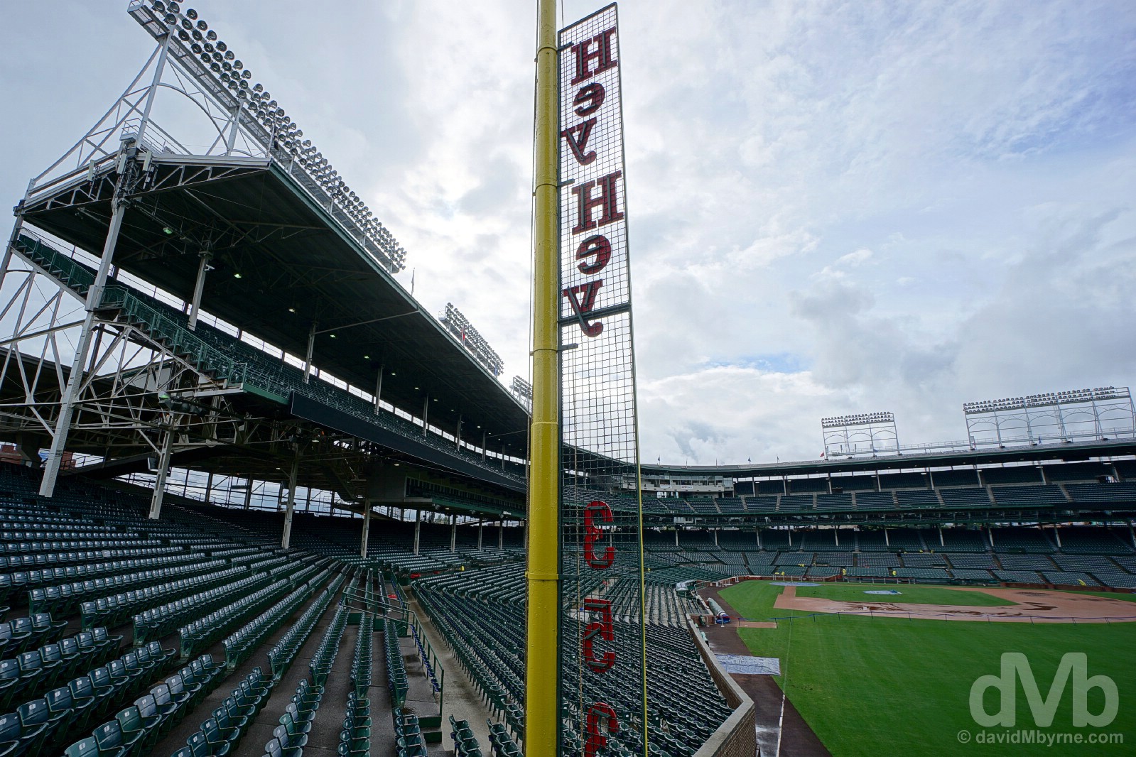
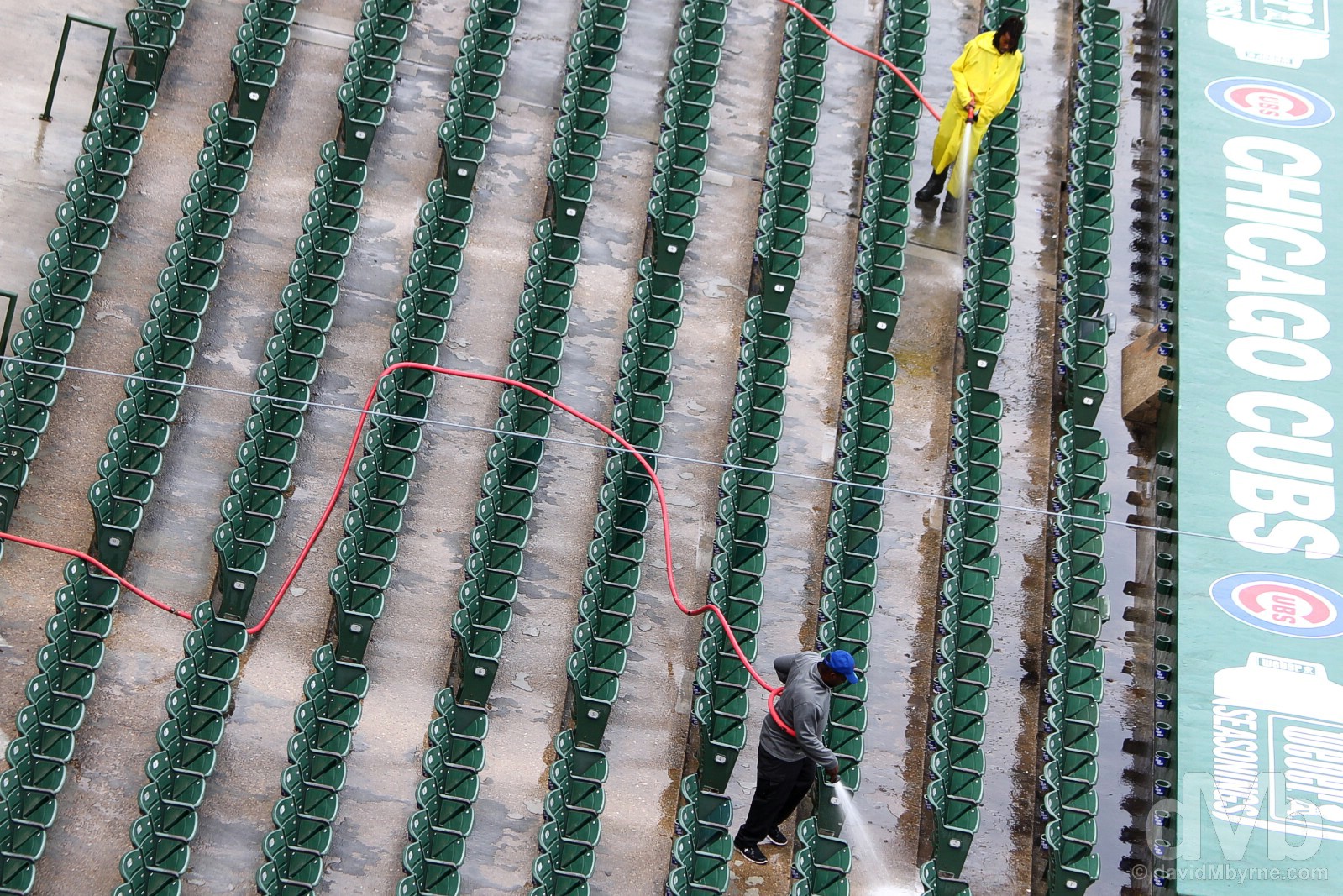
The guide conducting the tour of Wrigley Field mentioned the 71-years-and-counting curse more than once. Sentencing the team to eternal failure, it is said that The Curse of the Billy Goat was bestowed upon the city’s northside baseball team (Chicago’s southside also has a professional baseball team, The White Sox, who in this city play a distant second fiddle to the Cubs) in 1945 by a tavern owner after his flea-bitten goat was denied entry to Wrigley Field. And it’s working, the perennial hard-luck Cubs having not won the World Series now for 108 years, the longest drought, by far, of any professional sports team in the US. Wrigley Field, Wrigleyville, Chicago, Illinois. October 1, 2016.
There was an upbeat vibe in Wrigley Field on this day, the penultimate day of the last weekend of the 2016 regular season. The Cubs, the only 100-game winner in the Majors this year and who have long since wrapped up a Postseason berth by winning the National League Central Division, are out of town this weekend and Wrigley is getting ready for the fast-approaching playoffs. Could this be the year? Preparing for the upcoming 2016 Major League Baseball Postseason in Wrigley Field, Wrigleyville, Chicago, Illinois. October 1, 2016.
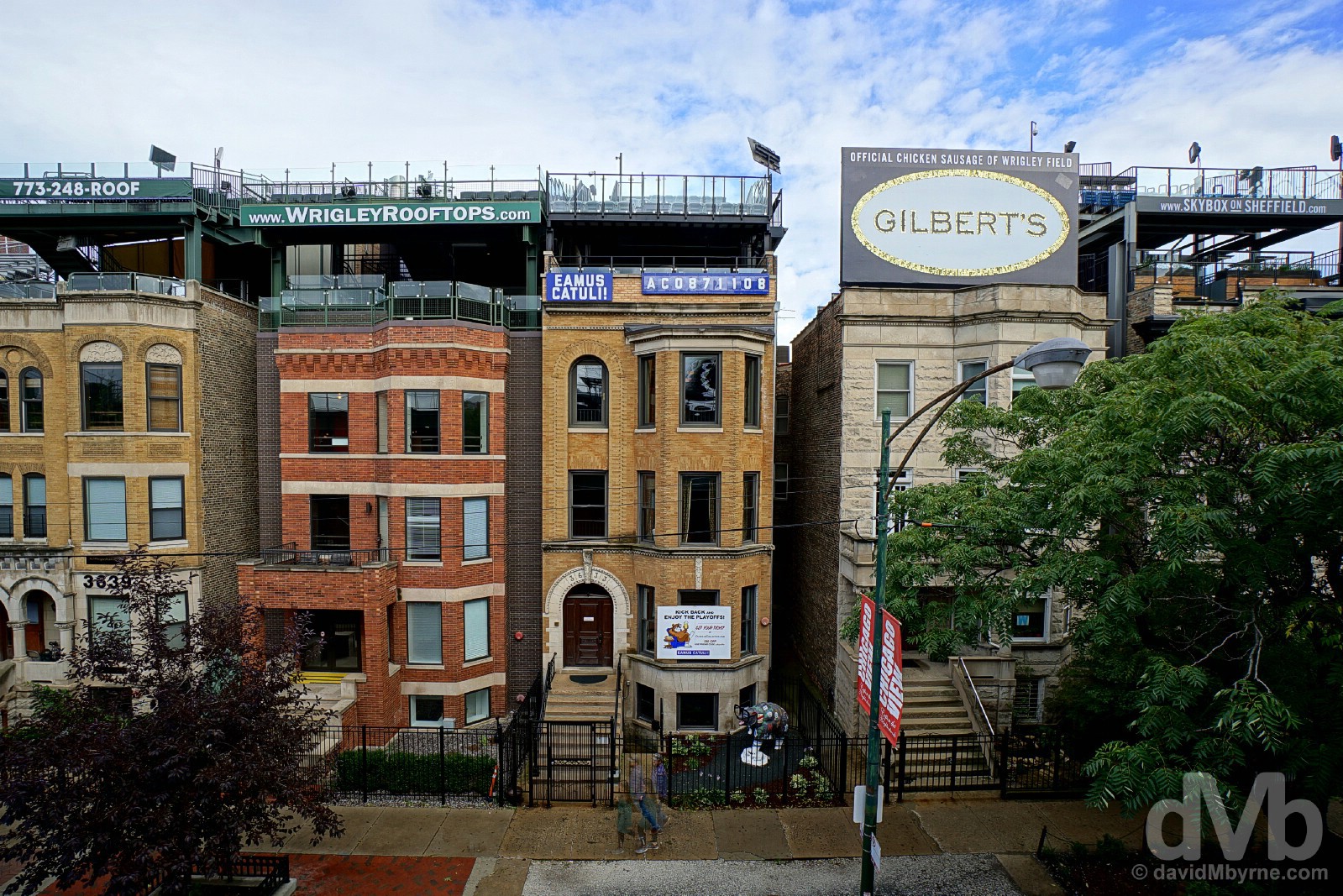
Wrigley Field, nicknamed ‘The Friendly Confines‘, dates to 1914 making it the second-oldest ballpark in the Major Leagues after Boston’s Fenway Park (opened in 1912). Regarded by many as baseball’s most charming stadium, it has a string of unique features including an ivy-covered brick outfield wall; unusual & unpredictable wind patterns blowing in off Lake Michigan; an iconic red marquee over the main entrance; and an old school, hand-turned scoreboard. Another striking feature of the ballpark is its location in a primarily residential (sports-mad) neighborhood with no parking lots and views from the rooftops behind the outfield, the so-called Wrigley Rooftops along W Waveland Avenue and, seen here, N Sheffield Avenue. Given Wrigley’s residential neighbourhood setting, the ballpark was also the last in the Majors to install floodlights to accommodate night games when it did so in 1988. Wrigley Field, Wrigleyville, Chicago, Illinois. October 1, 2016.
After touring Wrigley Field, it was time to return to Downtown Chicago in search of some epic skyline vistas, the sort Chicago is renowned for. And getting to epic elevated highs required a stroll along a mile of ground level magnificence.
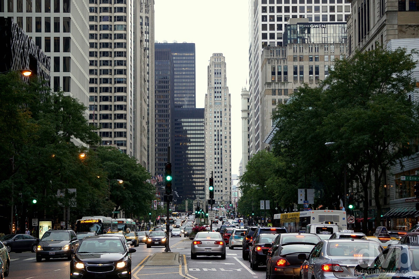
Looking south down Michigan Avenue, a.k.a. The Magnificent Mile, Chicago, Illinois. October 1, 2016.
The Magnificent Magnificent Mile
Planned as an elegant boulevard in Daniel Burnham’s 1909 Plan of Chicago and today the spine of Chicago’s most prestigious residential & shopping district with some of the country’s most expensive rental space, Michigan Avenue is probably Chicago’s most famous thoroughfare. If you’re a high-end shopper then I guess the upscale section of the avenue that has since the 1940s been dubbed the Magnificent Mile is indeed magnificent. Come to think of it, with several landmark buildings – the Wrigley Building & The John Hancock Building to name but two – towering over this particular city artery, architectural aficionados might also find reason to deem it magnificent.
Skyscrapers towering above the Magnificent Mile, Chicago, Illinois. October 1, 2016.

360 Chicago, formally the John Hancock Observatory, the 94th-floor viewing deck of The John Hancock Building, North Michigan Avenue, Chicago, Illinois. October 1, 2016.
The John Hancock Building
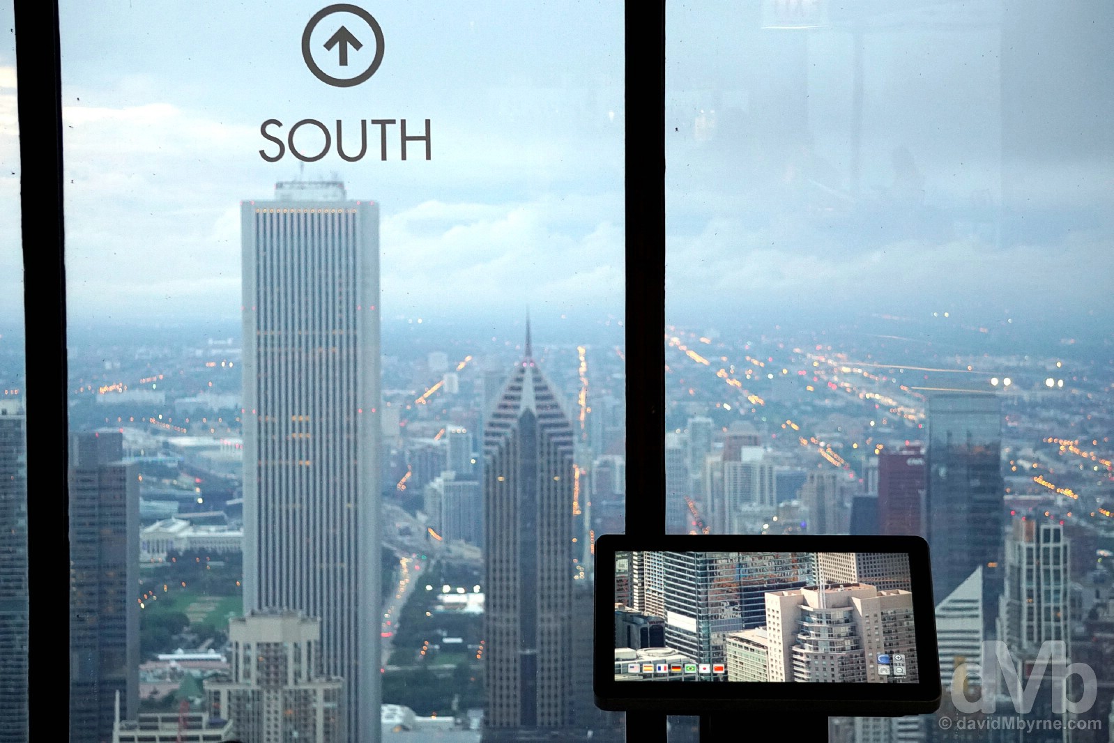
Most make a beeline for the Willis Tower, formally the Sears Tower. I get that – at 1,450 feet (442 metres), it is still the tallest building in the city, the second-tallest in the US (after the 541-metre-high One World Trade Center in New York City) and, as of October 2016, the 17th tallest building on earth. But, and although only the fourth-tallest tower in Chicago, the views from the 1,127-feet-high (344 metres) John Hancock Building on the Magnificent Mile are arguably the best on offer in the city; there’s a reason its 94th-floor viewing deck is called 360 Chicago.
The 8th-tallest building in the US, the tallest building constructed anywhere in the world during the 1960s (it was constructed between 1965 & 1969), and the first building in the world outside of New York City to rise at least 1,000 feet (305 metres), Chicago’s John Hancock Building is full of offices, condominiums & restaurants, but it does, of course, also have a 1,030-feet-high (310 metre) observation deck on the 94th floor of the 100-storey building. Given the building’s position towering over the Magnificent Mile and near the shores of Lake Michigan, the views afforded from here are arguably the best on offer in the city. We got up here with plenty of light left on this day and waited, while being schooled on the building’s history & construction via informative text & video, for the twinkling lights of the city far below to come to life and to take over. From late afternoon to early evening & through dusk to nighttime darkness, it was a magical transition towards a magical outcome. Nighttime Chicago as seen from 360 Chicago, the 94th-floor viewing deck of The John Hancock Building. Chicago, Illinois. October 1, 2016.
Coming down from the high of The John Hancock Building, I went in search of things – buildings – to photograph. I didn’t find Downtown Chicago all that photogenic after dark (it’s way too built-up with a jumble of light sources spoiling most scenes), or maybe I just didn’t try all that hard. I didn’t put all that much effort into photographing the city’s iconic Chicago Theatre, one of the buildings in Chicago that definitely needs to be photographed at night and one that deserves more effort than I expended when trying to photograph it.

Added to the National Register of Historic Places in 1979, the 4,000-seater landmark Chicago Theatre was built in 1921 as the city’s flagship movie theatre (it also plays host to live theatre performances). I didn’t catch a glimpse of its opulent (restored in the 1980s) French Baroque interior, but from the outside I was able to appreciate facets of its 7-storey-tall Baroque/Neoclassical exterior, namely the 60-foot (18-metre) wide triumphal arch with circular Tiffany stained glass window and, of course, the iconic flashing Chicago marquee. The fourth marquee to adorn the front of the theatre, it has become an unofficial emblem of the city. The Chicago Theatre on State Street, Chicago, Illinois. October 1, 2016.
Image || Sightseeing cruise on the Chicago River.
”Today, and ignoring for now the fact that it’s the last day of the 36-day trip, was just like the previous two insofar as it was all about architecture. Another final stroll around Downtown Chicago, and along the banks of the Chicago River…”
Day 36 || October 2 2016
Today’s Highlight || The architecture of Downtown Chicago (again).
Today, and ignoring for now the fact that it’s the last day of the 36-day trip, was just like the previous two insofar as it was all about architecture. Another final stroll around Downtown Chicago, and along the banks of the Chicago River, resulted in more pictures of towers. Towers of all kinds, be they of the drab concrete, shiny glass & steel or innovative & intricate kind.
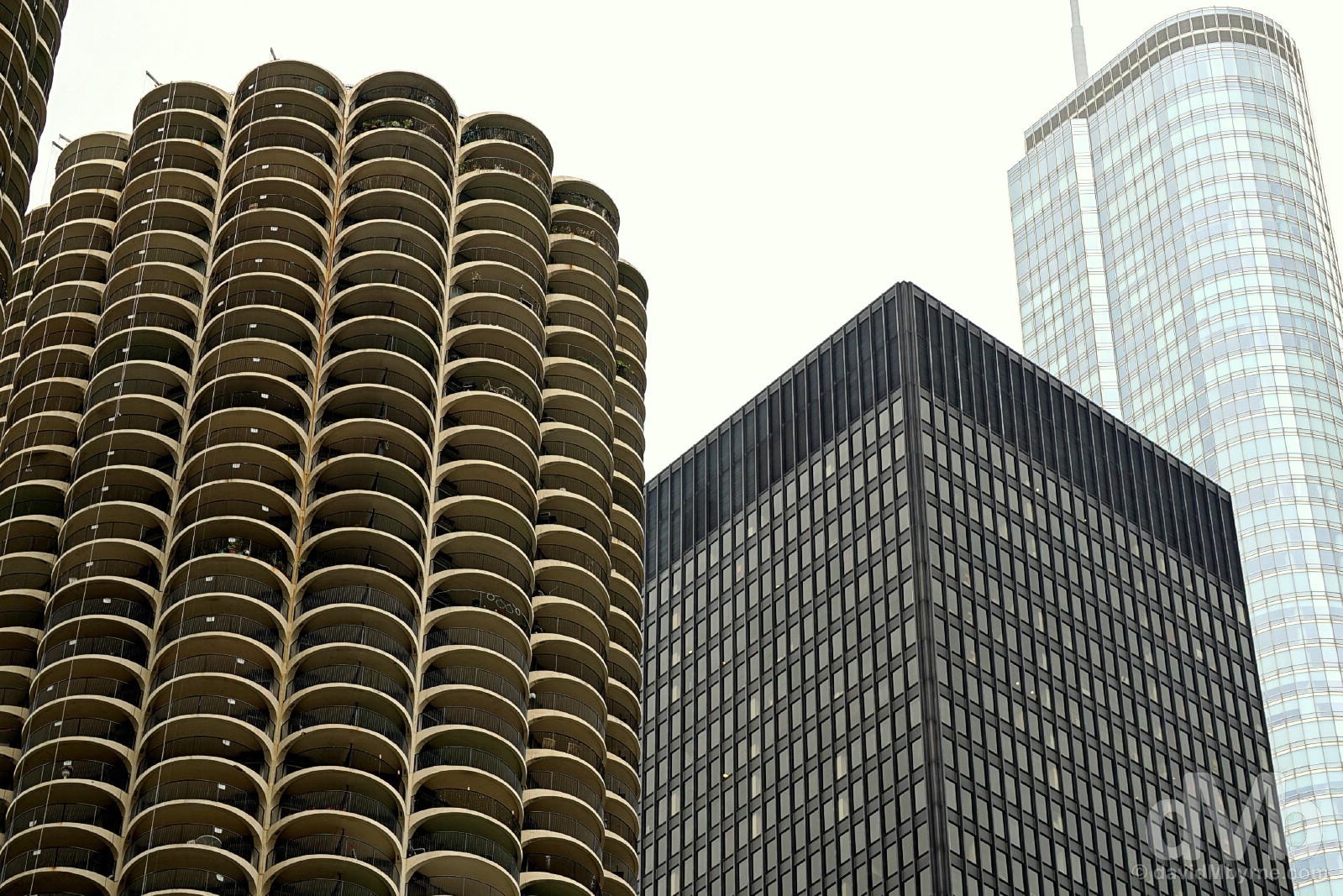
A terrific towering trio, the three neighbouring & vastly contrasting towers of (L-R) Marina City, the IBM Building/Plaza & Trump International Hotel & Tower Chicago on the northern bank of the Chicago River as seen from Wacker Drive in Downtown. The middle of the three in terms of geographical location & age, AMA Plaza, the name the building now goes by, is still, and probably always will be, known as the IBM Building/IBM Plaza – it’s not owned nor even occupied by Big Blue these days, the corporation having severed all ties with the landmark building in 2006. Completed in 1973, the black & boxy 52-storey tower, 11 storeys of which today house a high-end hotel, has several design features that are rare in an office building but understandable given its original owner occupier – these include an electrical & environmental system and increased floor strength and ceiling heights to accommodate large raised floor computing centres. Also, the tower’s so-called ‘banked’ intelligent elevator system is a model of efficiency even to this day. Declared a Chicago Landmark in February 2008 and added to the National Register of Historic Places in March 2010, it’s the newest building of the many buildings in Chicago to be included on both lists. Chicago, Illinois. October 2, 2016.
– The Chicago Architecture Foundation
Because, and even by Chicago standards, it is something of a visual architectural oddity, Marina City is probably my favourite structure in the city. Although the four-building complex, completed in 1964, was built to include an office block and an irregular, saddle-shaped theatre, it is the standout 65-storey, 587-foot (179 metre) twin circular towers – part car park, part residential apartments – that are widely recognised as a symbol of Chicago. Both the tallest residential buildings & the tallest reinforced concrete structures in the world upon completion, the innovative corncob-esque towers contain wedge-shaped apartments (450 in each tower) set around a central elevator, unique living spaces that have almost no interior right angles and all of which come with curved balconies. At river level, seen here, Marina City boasts a small (tiny, really) marina for pleasure craft, hence its name, above which is the first of the 19 floors of exposed spiral valet parking offering almost 900 parking spaces per tower, another strikingly unique feature of this unique construction. The first urban post-war high-rise residential complex in the US, Marina City was built at a time when the city centre was rapidly losing population to the suburbs, the architects envisioning a city within a city that would lure with a wide array of amenities for its residents. The project was an immediate success and became a prototype for urban living that was widely replicated and which was credited with beginning the residential renaissance of American inner cities. Marina City on the northern bank of the Chicago River as seen from across the river on Wacker Drive, Downtown Chicago, Illinois. October 2, 2016.
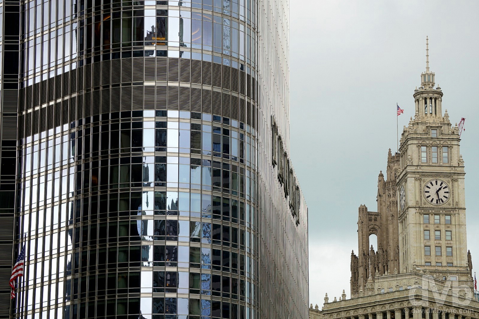
Then & Now. Old & New. The 21st-century Trump International Hotel and Tower Chicago & the Wrigley Building as seen from Wacker Drive in Downtown Chicago. A 98-storey polished stainless steel and iridescent glass tower, the Trump International Hotel and Tower Chicago is the newest addition to the fabled Chicago skyline – built on prime real estate on a riverside site previously occupied by the former Chicago Sun-Times building, it was built between 2005 & 2009 at a cost of $850 million. Rising high over the Chicago River and with commanding views of the Loop and the lakefront, the elegant, 1,388-foot-high (423 metre) tower is, as of October 2016, the 23rd tallest building in the world and the second-tallest building in Chicago after the 442-metre-tall Willis Tower (formerly the Sears Tower) – ambitions plans, maybe overly ambitious plans to make it the tallest building on earth were scaled back after the 9/11 attacks. It houses retail space, a parking garage, a spacious 5-star hotel, and luxury residential condominiums, a three-tiered riverfront park a nice perk for those who can afford to call the tower home. At the time of its construction in 1920, the Neo-Spanish Wrigley Building was the only major office building north of the Chicago River, chewing gum magnet William Wrigley Jr. choosing a commanding site at the junction of the Chicago River and Michigan Avenue as the location for the corporate headquarters. Like much of the region’s buildings, it was built as part of the city’s 1920s building boom that epitomised the prosperity of the roaring 20s fuelled by a major expansion in industry. The daring height and slender form of the white terra cotta building was a striking novelty that deftly combined Beaux Arts design with the legacy of the Chicago Commercial style. The concept of the 425-foot (130 metre) south tower – springing from a stepped block and marked by spires, parapets, pinnacles & 4 identical 6-metre-diameter clock faces – is a reference to the tower of Giralda Cathedral in Seville, Spain. Chicago, Illinois. October 2, 2016.
Taking a break from looking up by looking down… on sightseers on a Chicago River cruise from a bridge spanning the Chicago River, Chicago, Illinois. October 2, 2016.
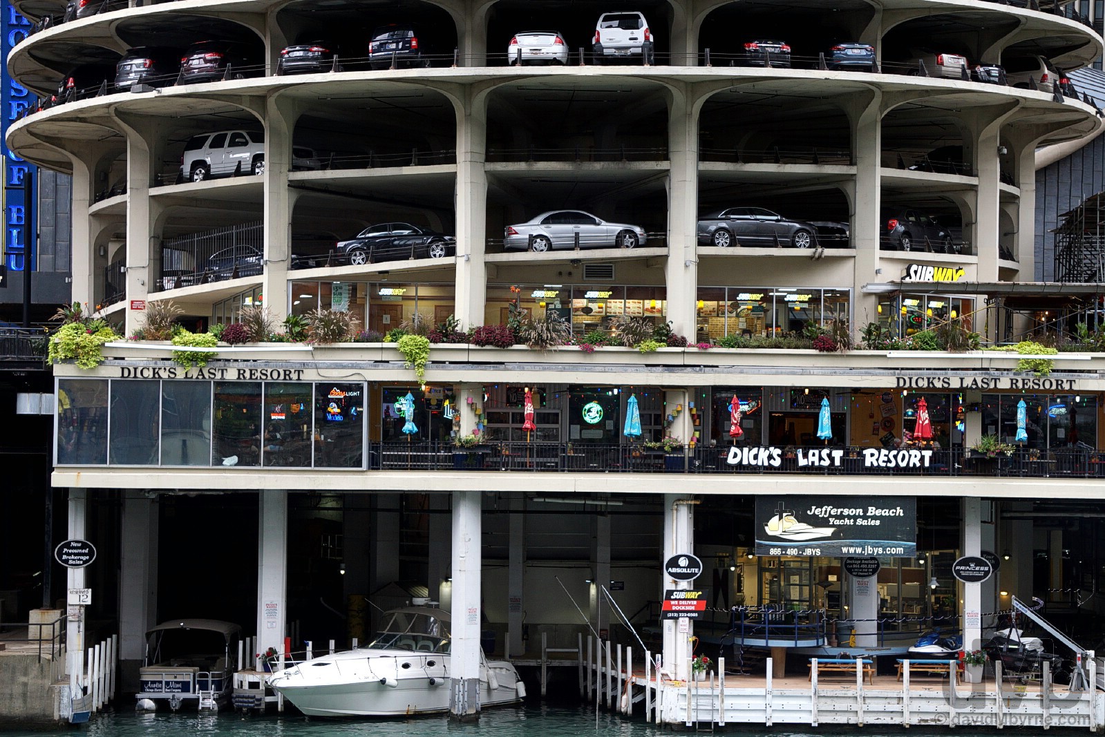
A parting shot from Chicago, and the final shot from the wider road trip. Taking a break from looking up by looking down… State Street, Chicago, Illinois. October 2, 2016.
The End!
THE UPPER MIDWEST || Wisconsin & Minnesota
DAY 01 139 miles || Chicago’s O’Hare Airport to Madison, Wisconsin
DAY 02 302 miles || Madison to Saint Paul, Minnesota (via Pewit’s Nest State Natural Area & Prescott, Wisconsin)
DAY 03 259 miles || Saint Paul to Bemidji, Minnesota (via St Cloud, Brainard & Walker, Minnesota)
THE DAKOTAS || North & South Dakota
DAY 04 458 miles || Bemidji to Bismarck, North Dakota (via Grand Forks, Lakota & Rugby, North Dakota)
DAY 05 459 miles || Bismarck to Deadwood, South Dakota (via Fort Yates, North Dakota & Badlands National Park, South Dakota)
DAY 06 167 miles || Deadwood & The Black Hills (Mount Rushmore National Memorial & Crazy Horse Memorial)
THE NORTHERN ROCKIES || Wyoming, Montana, Idaho, & Northern Utah
DAY 07 354 miles || Deadwood to Billings, Montana (via Devil’s Tower & Little Bighorn Battlefield National Monuments)
DAY 08 262 miles || Billings to West Yellowstone, Montana (via the Beartooth Highway & Yellowstone National Park)
DAY 09 227 miles || West Yellowstone to Jackson, Wyoming (via Yellowstone National Park & Grand Teton National Park)
DAY 10 280 miles || Jackson to Salt Lake City, Utah (via Alpine, Wyoming; & Montpelier, Paris, & Bear Lake, Idaho)
THE SOUTHWEST || Southern Utah, Arizona & New Mexico
DAY 11 330 miles || Salt Lake City to Panguitch, Utah (via Brian Head & Cedar Breaks National Monument)
DAY 12 273 miles || Panguitch to Page, Arizona (via Bryce Canyon National Park, & Zion National Park)
DAY 13 307 miles || Page (Horseshoe Bend) & Grand Canyon National Park (North Rim)
DAY 14 175 miles || Page to Kayenta, Arizona (via Upper Antelope Canyon, Arizona & Monument Valley, Utah)
DAY 15 252 miles || Kayenta to Durango, Colorado (via Monument Valley, Utah, the Four Corners Monument, & New Mexico)
THE ROCKIES || Colorado
DAY 16 348 miles || Durango to Leadville, Colorado (via Wolf Creek Pass & Monarch Pass)
DAY 17 299 miles || Leadville to Estes Park, Colorado (via Independence Pass, Aspen, Berthoud Pass, & Rocky Mountain National Park)
THE GREAT PLAINS || Wyoming, Nebraska, Iowa, Missouri & Arkansas
DAY 18 307 miles || Estes Park to Cheyenne, Wyoming (via Laramie, Como Bluff, Medicine Bow, & Buford, Wyoming)
DAY 19 404 miles || Cheyenne to Burwell, Nebraska (via Scotts Bluff National Monument & Carhenge, Nebraska)
DAY 20 407 miles || Burwell to Kansas City, Missouri (via Spalding, Nebraska; SW Iowa; & Omaha, Nebraska)
DAY 21 286 miles || Kansas City to St Louis, Missouri
DAY 22 322 miles || St Louis to Memphis, Tennessee (via Dyess, Arkansas)
THE SOUTH || Tennessee, Mississippi, Alabama & Georgia
DAY 23 308 miles || Memphis to Vicksburg, Mississippi (via Clarksdale, Yazoo City & Bentonia, Mississippi)
DAY 24 336 miles || Vicksburg to Prattville, Alabama (via Selma, Alabama)
DAY 25 297 miles || Prattville to Cornelia, Georgia (via Montgomery, Alabama & Stone Mountain, Georgia)
THE APPALACHIANS || Georgia, North Carolina, Virginia & West Virginia
DAY 26 261 miles || Cornelia to Asheville, North Carolina (via Helen & Brasstown Bald, Georgia & Great Smoky Mountains National Park, North Carolina)
DAY 27 200 miles || Asheville to Galax, Virginia (via the Blue Ridge Parkway)
DAY 28 004 miles || Galax, Virginia
DAY 29 354 miles || Galax to Lewisburg, West Virginia (via the Blue Ridge Parkway & Shenandoah National Park)
KENTUCKY & THE GREAT LAKES || Ohio, Kentucky, Indiana & Illinois
DAY 30 404 miles || Lewisburg to Lexington, Kentucky (via Chesapeake, Ohio; Cordell, Kentucky; & Sandy Hook, Kentucky)
DAY 31 241 miles || Lexington to Beaver Dam, Kentucky (via Lincoln Homestead State Park & Mammoth Cave National Park)
DAY 32 190 miles || Beaver Dam to Bloomington, Indiana (via Rosine & Owensboro, Kentucky)
DAY 33 282 miles || Bloomington to Chicago, Illinois (via Indianapolis, Indiana)
DAYS 34-36 017 miles || Chicago, Illinois